resistivity study at the jethro coffin houselot
TRANSCRIPT

RESISTIVITY STUDY AT THE JETHRO COFFIN HOUSELOT.
by E.A. Little, T. Lepore, R. Gumaer, J.C. Andrews, J. Pretola, J.N. Little
The Archaeology Committee
Nantucket Historical Association, Nantucket, MA 02554.
October 1985, Revised December 26, 1986


RESISTIVITY STUDY AT THE JETHRO COFFIN HOUSELOT.
The purpose of the soil resistivity measurements at the JethroCoffin Houselot was to provide data for a test of this non-destructive survey methodology. The results of a comparison betweenresistivity data and data from an archaeological survey using shoveltests and cores suggest that resistivity measurements indeed candetect buried cultural debris such as brick, china, glass and buriedwater pipes in an historic archaeological context. Additional studiesare warranted to explore further the value of this methodology forhistoric sites at Nantucket.
Resistivity studies are based on the observation that soilsconduct electricity to varying degrees (Aitken 1974:267). Majorfactors that influence soil resistance to electri,cal current are theamount of moisture present, which lowers the resistivity, and thegrain size of the soil, whereby sand and igneous or metamorphic rockshave a higher resistivity than clay. Resistance measurements maythus be affected by soil type (Appendix I), topography (Appendix II),rain during field testing, and vegetative cover. Cultural deposits,if moist as in organic middens, will lower the resistivity, and ifdry as in stone, broken brick, glass, shell, and pottery or otherdebris, will provide higher resistivity readings.
A soil resistivity survey of the backyard of the Jethro CoffinHouse (Figure 1, Figure 2, Appendix III) was conducted July 31afternoon and August 1 forenoon, 1985, under the direction of RickGumaer (Gumaer, Paynter, Weston, and DelCizzi 1984), using a UMass,Amherst, instrument built by him to the specifications of Williams(1984) (Figure 3). Volunteer assistance was provided by Tim Lepore,Clint Andrews, John Pretola, and Betty Little (Figure 4). The size ofthe project area was determined by the time the volunteers were ableto commit to it.
Soil resistance was measured for an area 20 meters by 10 meters,with readings taken at one meter intervals, on a grid of one meter byone meter squares laid out on a base line parallel to and 50 cm northof the north edge of the house (Figure. 5). Four stainless steelprobes were set approximately 25 cm into the ground, with leads tothe resistivity instrument. Each probe was spaced one meter from thenext along an east-west line of the grid. The instrument appliesvoltage between the two outer probes and measures soil resistance inohms for a volume about 1 m deep, 1 m wide and 1 m long between theinner two probes (Aitken 1974; Carr 1982:33-36). The measured valueis assigned to a point half way between the two inner probes.
Using a Compaq computer, the measured data (Figure 6) were usedfor the construction of contour surfaces showing resistance valuesgreater than 130 ohms (Figure 7a) and less than 80 ohms (Figure 7b),and an intensity plot (Figure 8). Possible complications resultingfrom a “W” shape of the probe array response (Aitken 1974:274) havenot been addressed here.
1


The data in Figures 6, 7, and 8 show,
- a large sized high restivity area between (E02,N02) and (E13,N07)which needs further exploration. It may be related to a 19th centuryshed (Appendix IV,V), or to one or more rebuilding or landscapingepisodes;
- a small high resistivity area near (E18,N03), which reflects fillplaced in the site of the Johnson excavation of 1974-76 (Jacobson etal. 1985);
- a low resistivity linear feature between (E16,NOO) and (E16,N1O)(Figure 8), which may be related to the trench for a water pipe to atoilet in the shed;
- a linear feature extending north of the northwest corner of thehouse (E04);
— a light overnight rain after data points N04 and south and beforepoints N05 and north, made no observable reduction in resistivity.
These observations and hypotheses drawn from surface resistivity andbackground studies require subsurface testing to confirm or refutethem, and to evaluate the resistivity survey method.
In June 1986, Duncan Ritchie and crew of PAL, Inc. (Ritchie1986), surveyed the Jethro Coffin backyard with 50 cm by 50 cm shoveltest pits in a 5 meter grid (Figure 9). Shovels of soil taken fromrecorded depths were sifted through a quarter inch mesh screen, andthe weight and a description of all the cultural debris,- brick,ceramic, glass, shell, bone, iron nails, mortar, slag, coal,prehistoric stone tools, etc.,- recovered in the screen, wastabulated. A two inch diameter cast iron water pipe was discovered intest pit 0-2 at a depth of about 20 cm, and a ceramic tile sewer pipewas discovered in test pit 0-3 at a depth of about 40 cm. Thesepipes are parallel to and less than 50 cm from the linear array of lowresistivity values which we had proposed reflected a trench for waterpipes to the outbuilding. A trash pit filled with a substantialamount of ceramics and other debris was uncovered in test pit F-2, inan area which had shown a very high resistivity value.
From the shovel test data, the cultural debris in the back yardhad an average lower depth of 50 cm with a range of 30-70 cm, andthus all of it would have contributed to the resistivitymeasurements. However, a shovel test pit measuring 50 cm by 50 cm by70 cm would constitute less than 20% of the volume of one cubic meterrepresented in a resistivity measurement. Thus, we should not expectthese two methods to provide identical results, especially since theresistivity in the area can vary substantially within 50 cm.
In order to study the relation between the two methods, I havegathered together in Table 1 the weight in grams of cultural debrisfrom each back yard test pit (Ritchie 1986) which coincides with aresistivity measurement, and the resistance in ohms which correspondsto each shovel test pit.
2


TABLE 1. COMPARISON OF CULTURAL DEBRIS WEIGHT AND RESISTANCE FOR 12TEST PITS IN JETHRO COFFIN HOUSE BACKYARD.. Test pit locations given inFigure 9.
Test Pit: D3: 84 gm E3: 124 gm F3: 228 gm 03: 141 gm116 ohm 90 ohm 111 ohm 87 ohm
D2: 54 gm E2: 322 gin F2: 1044 gm G2: 208 gin119 ohm 134 ohm 167 ohm 167 ohm
Dl: 14 gin El: 253 gin Fl: 195 gin 01: 541 gin87 ohm 93 ohm 70 ohm 56 ohm
These data in Table 1 are plotted in Figure 9, which shows bythe scatter of points that the resistivity of a cubic meter of soilis not closely related to the weight of cultural debris in a test pit(50 cm by 50 cm by 70 cm) within the cubic meter. Possibly thecultural material (ceramics, bone, iron, etc.) and its depthdistribution needs to be analyzed in more detail that has been donehere.
To conclude, the results of the test of the resistivitymethodology in the backyard of the Jethro Coffin House, whilelimited, are encouraging. Using resistivity measurements togetherwith shovel testpits, we have located a deposit of buried debris,buried water and sewer pipes, and the probable site of a 1975archaeological excavation. Additional resistivity measurements nearthe north fence might detect foundations of 17th through 19th centuryoutbuildings such as a “barn”, “out houses”, “Shops”, “wells”, andthe 1708 “Garden fence” (Appendices III, IV, V, VI, VII). Theprobable front door porch (Chase 1986) might also have left remainsdetectable by resistivity measurements.
Furthermore, we have identified some problems in theinterpretation of resistivity readings. In the kinds of soilsencountered at this site, sandy silts and loams and silty sands witha few pebbles, we expect variation in resistivity to reflect buriedcultural debris or features. Additional resistivity measurementsclosely coupled with subsurface testing will be required tocharacterize accurately the resistivity signal of specific buriedcultural materials and features at Nantucket.
The study reported here has been an initial step in thedevelopment of historic archaeological studies at Nantucket.Resistivity measurements offer a non-destructive method for studyingarchaeological sites. If the Nantucket Historical Association wishesto encourage further development of this technique on Nantucket, wesuggest the purchase of a resistivity meter for the Association.
3

Site #NHA-N-lO.
17’ 30”
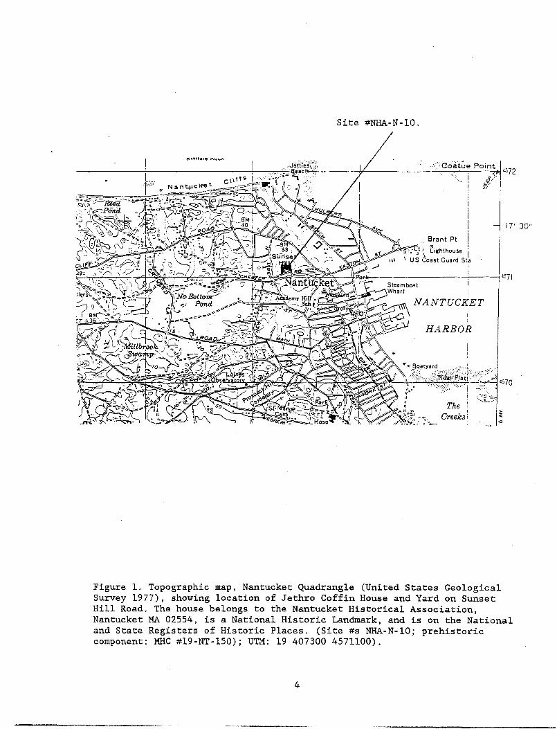
Figure 1. Topographic map, Nantucket Quadrangle (United States GeologicalSurvey 1977), showing location of Jethro Coffin House and Yard on SunsetHill Road. The house belongs to the Nantucket Historical Association,Nantucket MA 02554, is a National Historic Landmark, and is on the Nationaland State Registers of Historic Places. (Site #s NHA-N-lO; prehistoriccomponent: MHC #l9-NT-l50); UTM: 19 407300 4571100).
4


c00C
r~)
LU
Figure 2. Portion of 1985 Nantucket Assessor’s Map, scale: 50 feet to theinch, showing approximate location of the Jethro Coffin house on the NRA lot(Schofield Brothers, Inc. 1975: Map Sheet #42.4.4).
.2.SS 001 ~T0~
Jethro Coffin House
IN 105.000.
5


Figure 3. Resistivity Survey, University of Massachusetts Field School,June 1985, Northhampton, Mass., showing Resistivity Meter in use.
6
V,pr. ~


Figure 4. ResistivitySurvey at Jethro CoffinHouse, NantucketHistoricalAssociation,July 31, August 1,1985.
Looking S.Laying out gridusing a surveyor’schain marked with ameter scale.
Looking E.Clinton Andrews,Tim Lepore, RickCumaer, John PretolaTaking and RecordingResistanceMeasurements.
John Pretola movingrods and clips.
Elizabeth A. LittlePhotographer.
a,~ ~-JbuJ~_t~.at.. ~
~ ta~~a~
___ r’ -~ ______ ~/ ____
=~4r
— ‘I
/
--~ lug :1
I~Y:~4’ ~P ~ ~ ~:~~Wt~~ris~:~ ~::
- ¶1~ ~: ~7


NFence—,-
16+
12
[SHEDI TOIk~ET
Figure 5. Map of backyard of Jethro Coffin House showing one metergrid for resistivity measurements (dots show midpoints of probearrays), July 31/August 1, 1985. T. Lepore, E.A. Little, J.C.Andrews, R. Gumaer.
08w
04
o~
S
. . .. . S• • • I I I S I I S I I SSIll I II ISIS II II I SI.
II
SI
II
•I
IIIII I
IS
SS
I5.
II
II
SS
I
I
I
5
S
I
I
S
I
I
I
I
I II I I IS 5 I I I I I IS S S I I1511111 I III III I
5 5 5 I S II I I I
IIIIIIIISISSIII•55I
I I I f 5 I
I I I I S II I 5 5 5 5 5 I 5 5 5 5
I I I I I II I I I S I I IS 5 5 5 II 10141 I IpS~3I I I 1121 I S 1161 I 5
E
HOUSEimL
im
8


N 00 01 02 03 04 0510 11~~i 9c:io 89509 867 732 878 782 833 92308 825 674 1000 ioot: 1~,e ‘ loss07 1038 700 840 860 979 94006 946 823 904 618 1170 83005 1193 968 :1151 1000 1338 1341
W04 1153 1142 1231 1273 1381 144203 1214 :1108 1305 1394 1485 146602 io~.i 1000 1238 1344 1661 144001 778 922 1234 138S 1706 132000 870 863 1300 1211 1682 927S
06 07 08 09 10 118S9 1099 941 1000 1112 10201000 846 1120 boo 1101868 883 1000 1066 1171 1000893 1041 720 1243 1036 1408948 9S5 918 1025 1384 9331233 1581 11S9 1624 1874 16S71274 1378 1459 149S 1459 1351133S 1307 1063 1468 1214 14381345 13S2 lOiS 1302 1084 11841303 1076 1048 848 868 lc:9o1280 746 1030 855 703 700
12 13 14 15 16 1~9S1 489 1326 871 S35 1294869 821 1000 1000 521 1012
• 1245 878 853 1475 412 10001051 1452 174S S95 10001416 1000 1000 1266 722 10891364 1644 1039 1668 559 8831327 1162 1.000 892 804 8631338 1118 1362 817 1727 :L16t)1104 1180 9S3 940 1221 9257S0 1016 840 645 830 785584 S92 5S3 563 959 540
18 1953!3901 8731000 5801285 412looc:j 1120 E1736 4541477 13362143 23842069 13411418 11451031 12S6
Figure 6. Resistance Measurements in Ohms x 10. Jethro Coffin Yard,Nantucket Historical Association, July 31, August 1, 1985. U.Mass.Anthropology Department Instrument built by Rick Gumaer; PC-MATLAB Software(The MathWorks, Inc. 1985) by John N. Little.
9


N
N+
+ +
++
++ + +++-I-+ ÷ ~F
++ ÷+++++ -F
++++++ ± +± + + -F
÷++++ + • -F
+
Figure 7a. Resistance Values Greater than 130 ohms shown by peaks in surface,and by (+) (The MathWorks 1985). Jethro Coffin House, 1985.
Figure 7b. Resistance Values less than 80 ohms, shown by peaks in surface andby (+) (The MathWorks 1985). Jethro Coffin House, 1985.
+ +
+
+
+
±
E
w
S
N
W
N’
++
+
+
++
+
S+ ++
10


, _‘~~‘ .‘..‘,‘ ~
I.
~ :~
\ \‘
-#
Data interval: 41.2—2384 Ohms/rnU r% rA r%,17Z 22Z 277. 32Z 37Z 43Z 48Z 53Z 58Z 63Z 687. 74Z 797. 84Z 897. 947
Figure 8. Intensity plot for resistivity in ohms/meter in backyard ofJethro Coffin House (courtesy of R. D. Little). Each resistivityintensity comprises the range from its percentage (of the maximum of238.4 ohms/m) to the next higher percentage.
11


N
Fence ~
15+ ~D4 •E4 SHED •G41 TOILET
10 D3 ‘E3 SF3 sG3
Ew
05 02 •E2 sF2 .G2 •
Dl El Fl Gioç 00 1~5 10
I HOUSES imL
im
Figure 9. Five meter grid layout for survey test pits in backyard ofJethro Coffin House (Ritchie 1986).
12


200
S S
.
w II— Iw
I I,•• I
w
Cl)I
I0
0 I I I I I I I I
0 500 1000 GRAMS
Figure 10. Resistivity in ohms per meter plotted against weight ingrams of test pit cultural debris retained in a 1/4 in mesh at JethroCoffin house backyard (from Table 1). The scatter of points suggeststhat we have not yet identified the chief factors involved inresistivity values of the soil at this site.
13


APPENDICES.
I. Sunset Hill Portion of Soil Map of Nantucket (Langlois 1977: Sheet #4).
II. Sunset Hill Portion of 200 feet to the inch topographic map (SchofieldBrothers 1975).
III. Plot plan for Jethro Coffin House and land in 1840, from Deed of GeorgePaddock to George Turner (Nantucket County Deeds 40:117-118).
IV. View of Jethro Coffin House and outbuildings from the North Tower,looking northwest, late 19th century (stereograph by J. Freeman, NantucketHistorical Association Collection).
V. View of Jethro Coffin House and partial view of outbuildings lookingnorthwest, about 1863 (stereograph by J. Freeman, Nantucket HistoricalAssociation Collection).
VI. View of Jethro Coffin House, wall, and outbuilding after repairs of 1928(Nantucket Historical Association Collection).
VII. Deed for house from Jethro Coffin of Nantucket to Nathaniel Paddack ofNantucket, 1708 (NCD 3:6) transcribed by H.W. Chase (1985).
14


APPENDIX I. Soil Map of Nantucket, showing soil types at Jethro Coffin House(Sunset Hill) (Langlois 1977: Sheet #4). RfB is well drained land, wellsuited to agriculture except during drought. ME is very poorly drained landwith organic content suitable for trees. Kp is moderately well to poorlydrained, often with underlying clay, suitable for agriculture or woodyvegetation. The disadvantages of the hilltop and northerly facing slope ofthis property, exposed to the prevailing NW winter winds, and minimized solarradiation, may have been partially overcome by trees on the north which couldoffer wind protection. While the 19th century photographs show no trees,there is considerable growth of (probably native) cherry trees, etc., in1985, in the low N part of the hill. Good agricultural land on Nantucket isscarce and patchy (Langlois 1977), and this is a good patch of it. Soilmoisture was noted by the field crew especially in the NW corner of the backyard among the lilies.
15


APPENDIX II. Sunset Hill Portion of 200 feet to the inch topographic map fromAssessor’s Office, showing Coffin House on the northeast slope of Sunset Hill(Schofield Brothers 1975: Map Sheets 41,42).
16
1Ff


—I.,
I
~ppEND1X III. Jethro Coffin -
Plot plan (NantUc~t Countyi~ious~i0t 1840118 G.Padd0~ toDeeds 40:117
‘I0~
17


- • .— -
• -‘‘~:
APPENDIX IV. View of Jethro Coffin house and outbuildings from the NorthTower, looking northwest, late 19th century (stereograph by J. Freeman,Nantucket Historical Association Collections). Four outbuildings can beidentified to the north of the house. See Appendix V for three outbuildings-.The house just south of the Coffin house is the Paddock house, now gone.
18


H~d
~F-1
rt() f-.
(D~rt
0I-,.
rt(DOrt
I-’ ‘100
f-~ C~0
(fl H.
I—’
rt~H’ O~OlD
OlD
CD-0ct~)H~ ~i
‘—, 0
0~~
H’H
rtCDIII-ICD
‘-1
H• rt ‘ti(I) ~rtIlOlDI-jCD~H- ‘—j0- ~4
0~
H- H’
cD~OrtO f’f,H-Il0 rtC~,
C)CD ~ODIIlH rt 0H-CD C~OP)OCl OPtiH. 0 f-F,o ~ H’
rt~
•F-~03 0
I.A) CflCD
rt~CD~~‘1op,lirt
g~ H•
‘-~ H-CD
0
‘1CD~
Ert
- H-Hzp~
~ H’rtqq
0CDCl


To all Christian People To Whom these presents Shall ComeJethro Coffin of the Island of Nantucket in the province of theMassachusets Bay in New England yeoman Sendeth GreetingKnow ye that I the Said Jethro Coffin for and in the Considerationof the Sum of Ninety five pounds Currant money in New England tome in hand paid or sufficient Security given for the paymentthereof before the ensealing and delivery of these presentsby Nathaniell Paddack of the aforesaid Island of Nantucket weaverhave given granted bargained Sold Aliened Ratified and Confirmedand do by these presents fully Clearly and absolutely give Grantbargain sell alien rattifie and Confirm unto the Sd NathaniellPaddack his heirs and assigns for ever all that my now dwellinghouse Situate and being on the Island of Nantucket aforesd andone acre and a half of land more or less adjoyning to Sd houseand bounded as fol~ows the first bound begins at the land ofEleazer Folger Sen and runs on a west Course Just to the northwardof the Garden fence till it Comes one rod to the westward of Sdhouse from thence South to the path on the bank thence along bythe path as far Eastward as to the land of the Sd Eleazer Folgerthence along by sd land to the first bound together with the barnand all other the out houses Shops wells Easments Garden fencesand all other priveledges and appurtenances whatsoever belongingor appertaining to the Sd house and land or to any part or parcellthereof To have and to hold the Sd house and land as above boundedwith all and singular other the premisses by these presents meantmentioned or Intended to be hereby bargained and sold and everypart and parcel thereof unto him the sd Nathaniell Paddack hisheirs and assigns for ever to his and their only use benefit andbehoof for ever and I Jethro Coffin do for my Self my heirsExecutors Administraters and every of them Covenant and promiseto and with the Sd Nathaniell Paddack his heirs and assignsto warrantize and defend Sd house and land and all other thepremisses herein bargained and Sold against all persons whatsoeverClaiming any lawfull Right title or Interest of in or to the Sdhouse and land or to any of the premisses herein Mentioned orIntended to be bargained and Sold or to any part thereofIn witness whereof I the said Jethro Coffin have hereunto Set myhand and Seall the twenty first day of September in the Seventhyear of the Reign of Anne of Great Brittain &c: Queen and in theyear of our Lord one thousand seven hundred and ‘Eight
Sealed and delivered [signed] Jethro Coffinin the presence of [Signedj Mary Coffin [Seal]
[Signed] Nathanell Gardner r The above named Jethro Coffin[Signed] Eleazer Folger Jun and Mary his wife appeared before me
on the day of the date hereof andRecorded by me r acknowledged the above written
[Signed] Eleazer Folger Reg Instrument to be their act and deed
Sep 21: 1708 [Signed] William GayerJustice of ye peace
APPENDIX VII. Deed for house froni Jethro Coffin of Nantucket to NathanielPaddack of Nantucket, 1708 (NCD 3:6) transcribed by H. W. Chase (1986).
20


REFERENCES CITED.
Aitken, M.1974 Physics and Archaeology, second edition. Oxford University Press.
Carr, C.1982 Handbook on soil resistivity surveying. Center for American
Archaeology Press, Evanston.
Chase, Helen Winslow1986 Jethro Coffin House Chronology, 1686-1986. Nantucket Historical
Association, Nantucket MA 02554.
Guniaer, D.R., R. W. Paynter, D. Weston, R. DelGizzi1984 Geophysical Applications and Horizontal Site Structure in New England
Historical Sites. Paper presented at 24th annual.meeting of N.E.A.A.
Jacobson, M., J.C. Andrews, L. Hussey, E.A. Little1985 Inventory of artifact finds from the 1975-1976 archaeological
excavation at the Jethro Coffin House, Nantucket, Massachusetts. NantucketHistorical Association, Nantucket MA 02554.
Langlois, K. H., Jr.1977 Soil Survey of Nantucket County, Massachusetts. United States
Department of Agriculture, Soil Conservation Service, in cooperation withMassachusetts Agricultural Experiment Station.
NCDNantucket County Deeds, Registry of Deeds, Town and County Building,
Nantucket, Mass.
Ritchie, Duncan1986 A Preliminary Archaeological Survey of the Jethro Coffin House,
Nantucket, Massachusetts. Report No. 102-1. Public ArchaeologicalLaboratory, Inc., Providence RI.
Schofield Brothers, Inc.1975 The Town and County of Nantucket, Massachusetts. Assessor’s Office,
Town and County Building, Nantucket.
Shapiro, G.1984 A Soil Resistivity Survey of 16th Century Puerto Real, Haiti. Journal
of Field Archaeology 11:101-110.
The MathWorks, Inc.1985 PC-MATLAB. 124 Foxwood Rd., Portola Valley, CA 94025.
Weymouth, J. W.1986 Geophysical Methods of Archaeological site Surveying. In Advances in
Archaeological Method and Theory, edited by M. B. Schiffer, 9:311-395.Academic Press, Orlando.
Williams, J.M.1984 A New Resistivity Device. Journal of Field Archaeology 11:110-114.
21


