resolution number 14-107 - home / westfield, … number 14-107 resolution of the common council of...
TRANSCRIPT

Resolution 14-107
Spring Mill Station Plan
An Addendum to the Westfield-Washington Township Comprehensive Plan
RESOLUTION NUMBER 14-107
RESOLUTION OF THE COMMON COUNCIL OF THE
CITY OF WESTFIELD, INDIANA, APPROVING AN ADDENDUM TO THE
WESTFIELD-WASHINGTON TOWNSHIP COMPREHENISVE PLAN
WHEREAS, the City of Westfield, Indiana (the “City”) is a duly formed municipal
corporation within the State of Indiana, governed by its duly elected Mayor and Common
Council (“Council”); and;
WHEREAS, the Council has the duty and authority to review, amend and approve
amendments to the Comprehensive Plan adopted and certified by the Westfield Advisory Plan
Commission; and,
WHEREAS, an amendment has been approved and certified to the Council, the merits
reviewed and considered by this Council.
NOW, THEREFORE, BE IT RESOLVED BY THE COMMON COUNCIL OF
CITY OF WESTFIELD, AS FOLLOWS:
SECTION I. That the Council hereby adopts the amendments to the Westfield-
Washington Township Comprehensive Plan as evidenced by
Exhibit “A”, attached hereto and incorporated by reference herein.
SECTION II. That the Economic and Community Development Department is
ordered to amend the Comprehensive Plan to conform to these
amendments. All acts done to create and implement this
Amendment to the Comprehensive Plan are hereby ratified.
SECTION III. This Resolution shall be in full force and effect immediately.
THE REMAINDER OF THIS PAGE IS BLANK INTENTIONALLY
Resolution 14-107
Spring Mill Station Plan
An Addendum to the Westfield-Washington Township Comprehensive Plan
ALL OF WHICH IS ORDAINED/RESOLVED THIS _____DAY OF ________2014.
WESTFIELD CITY COUNCIL
Voting For Voting Against Abstain
______________________ ___________________ __________________
Jim Ake Jim Ake Jim Ake
______________________ ___________________ __________________
Steven Hoover Steven Hoover Steven Hoover
______________________ ___________________ __________________
Robert L. Horkay Robert L. Horkay Robert L. Horkay
______________________ ___________________ __________________
Charles Lehman Charles Lehman Charles Lehman
______________________ ___________________ __________________
Robert J. Smith Robert J. Smith Robert J. Smith
______________________ ___________________ __________________
Cindy L. Spoljaric Cindy L. Spoljaric Cindy L. Spoljaric
______________________ ___________________ __________________
Robert W. Stokes Robert W. Stokes Robert W. Stokes
ATTEST:
__________________________
Cindy Gossard, Clerk Treasurer

Resolution 14-107
Spring Mill Station Plan
An Addendum to the Westfield-Washington Township Comprehensive Plan
I hereby certify that RESOLUTION 14-107 was delivered to the Mayor of Westfield
on the _____ day of _____________, 2014, at ___:___ __.m.
Cindy Gossard, Clerk-Treasurer
I hereby APPROVE Resolution 14-107
this _____ day of _____________, 2014.
at ___:___ __.m.
I hereby VETO Resolution 14-107
this _____ day of _____________, 2014.
at ___:___ __.m.
J. Andrew Cook, Mayor
J. Andrew Cook, Mayor
This document prepared by:
Ryan Clark
City of Westfield
317.674.6599

Resolution 14-107
Spring Mill Station Plan
An Addendum to the Westfield-Washington Township Comprehensive Plan
EXHIBIT A: Spring Mill Station Plan

Spring MillStation Plan
An Addendum to the Westfield Washington Township Comprehensive Plan
2014

Table of Contents:
Executive Summary.............................................................................4
Chapter 1: Overview...........................................................................5
Chapter 2: Chronology of Related Events..................................6
Chapter 3: Recent Events...............................................................11
Chapter 4: Planning Area...............................................................17
Chapter 5: Identity – “Spring Mill Station”............................20
Chapter 6: Land Uses.......................................................................21
Chapter 7: Site Design And Architecture ................................25
Chapter 8: Transitions and Buffering ......................................34
Chapter 9: Access and Circulation..............................................37
Chapter 10: Public Input.................................................................38
Chapter 11: Planning Objectives And
Policy Recommendations.........................................42
Chapter 12: Going Forward............................................................44
Appendices..........................................................................................45
3
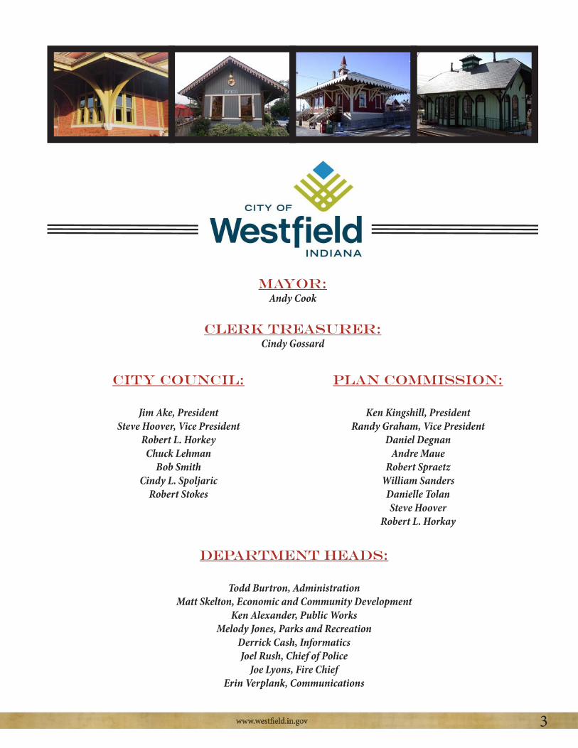
mayor:Andy Cook
Clerk Treasurer:Cindy Gossard
City Council:
Jim Ake, PresidentSteve Hoover, Vice President
Robert L. HorkeyChuck Lehman
Bob SmithCindy L. Spoljaric
Robert Stokes
Plan Commission:
Ken Kingshill, PresidentRandy Graham, Vice President
Daniel DegnanAndre Maue
Robert SpraetzWilliam Sanders
Danielle TolanSteve Hoover
Robert L. Horkay
Department Heads:
Todd Burtron, AdministrationMatt Skelton, Economic and Community Development
Ken Alexander, Public WorksMelody Jones, Parks and Recreation
Derrick Cash, InformaticsJoel Rush, Chief of Police
Joe Lyons, Fire ChiefErin Verplank, Communications

Spring Mill Station
4Spring Mill Station
Executive Summary:
This Spring Mill Station Plan (the “Plan”) is an addendum to the Westfield-Washington Township Comprehensive Plan. The Plan: (1) provides a history of past events and current activities related to the vicinity of the 161st Street and Spring Mill Road intersection (named “Spring Mill Station” in this Plan); (2) identifies the geographic area of the Spring Mill Station Study Area; and (3) sets forth several recommendations pertaining to the future development and design of private developments and public infrastructure within the Study Area that are suggested as being essential for achieving the Spring Mill Station vision described in this Plan.
The Spring Mill Station Plan process included several meetings, or charrettes, of the Spring Mill Station Study Group comprised primarily of community leaders from the various residential neighborhoods within close proximity of the Study Area. Through the process of these Study Group meetings and other input meetings with stakeholders, residents and developers, the Study Group arrived at the following policy recommendations which are discussed in further detail in this Plan:
1. Spring Mill Station Task Group: Establish the “Spring Mill Station Task Group,” which is contemplated as a neighborhood land use committee that will, among other things, review proposed zoning petitions and provide recommendations regarding such projects to City representatives. 2. Branding: Further develop the Spring Mill Station “brand” and incorporate such brand into development projects and public infrastructure projects.3. Land Uses: Develop land uses within the Study Area in a manner consistent with the concepts envisioned the Spring Mill Station Plan (e.g., a mix of complementary uses, a neighborhood “hub”).4. Architecture and Site Design: The design and quality of building architecture and site designs within the Study Area should be developed in a manner consistent with the Spring Mill Station Plan (e.g., high quality buildings, pedestrian orientation, people spaces). 5. Development Strategy: A coordinated development strategy for the Study Area should be developed (e.g., coordinated amenities, infrastructure, vehicular accesses and pedestrian trails). 6. Financial Strategy: Develop and implement a financial strategy to make desired infrastructure improvements within the Study Area.7. Economic Development: Be proactive in attracting desirable development projects and businesses within the Study Area.
The Spring Mill Station Plan recommends that this planning process be revisited periodically, ideally every year: (1) to measure progress toward accomplishing the planning objectives included in the Plan; (2) to revise or refine the planning objectives of the Plan as needed; and (3) to aid in work planning and project prioritization in order to accomplish the Spring Mill Station vision.

Spring Mill Station
5Spring Mill Station
Chapter 1: Overview
This document, the Spring Mill Station Plan (the “Spring Mill Station Plan”), is intended to be adopted as an addendum to the Westfield-Washington Township Comprehensive Plan under the IC 36-7-4-500 Series. The intent of the Spring Mill Station Plan is to clearly identify the surrounding community’s vision for the future of the area in the vicinity of 161st Street and Spring Mill Road. Residents in the surrounding neighborhoods are hopeful that this plan will encourage coordination and cooperation among the development community and the neighborhoods within the vicinity of 161st Street and Spring Mill Road to ultimately achieve the Spring Mill Station vision.
The Spring Mill Station Plan: (1) identifies important historical events which have occurred over the past ten (10) years related to the 161st Street and Spring Mill Road area; (2) inventories the relative recent events, plans, nonconforming uses, development interests, and infrastructure plans for the area; (3) identifies the geographic scope of the study area to which the recommendations of the Spring Mill Station Plan apply; (4) identifies land uses, architectural styles, transitions, buffers, and circulation preferences in Spring Mill Station area; (5) summarizes feedback received from the development community and residents about the feasibility and desirability of the various Spring Mill Station elements; and (6) sets forth policy recommendations necessary to accomplish the Spring Mill Station vision.
The process of preparing the Spring Mill Station Plan involved a series of neighborhood charrettes hosted by a group of 161st Street and Spring Mill Road area HOA leaders, City Council Committee on Ordinance Revisions members, and the Superintendent of Westfield Washington Schools. Study group members include:
The work product of the planning charrettes is included in this Spring Mill Station Plan. Each of the planning charrettes is described in much more detail within the appendices to this plan. Copies of materials discussed in the planning charrettes are also included or at least described in the appendices.

Spring Mill Station
6Spring Mill Station
Chapter 2: Chronology of Related Events
Over the past several years, the area within the vicinity of 161st Street and Spring Mill Road has experienced a significant amount of attention from the development community, residents and the City of Westfield. This section of the Spring Mill Station Plan is intended to summarize the recent historical context of this area related to land use and development.
June 23, 2003 – A change in zoning request was introduced at the Westfield-Washington Township Advisory Plan (the “APC”) Commission meeting. The request was to rezone approximately 16.8 acres of property, located at the northeast corner of 161st Street and Spring Mill Road, from SF-3 and AG-SF1 zoning classifications to the General Business zoning classification (Case No. 0306-REZ-02). The proposal, filed by Flynn and Zinkan Realty Company, LLC, was to develop a retail shopping center at this location. The proposal was forwarded to a committee for analysis against the Comprehensive Plan.
The property was not within the corporate limits of Westfield at the time, but was within Washington Township. Through a joinder agreement, the Town of Westfield was given zoning jurisdiction over all of Washington Township in the late 1970’s.
August 25, 2003 – The APC held a public hearing, where 4 people spoke in favor of the project and 17 people spoke in opposition of the project. In addition to comments made at the meeting, approximately 75 pieces of written comment were received prior to the meeting, the majority of which were in opposition of the project. The Comprehensive Plan Committee of the APC recommended that the proposal receive a negative recommendation from the full APC.
The APC voted 6-1 to send a negative recommendation of Flynn and Zinkan’s rezoning petition 0306-REZ-02 to the Westfield Town Council.
October 13, 2003 – The Westfield Town Council (the “Council”) approved Ordinance 03-28, which changed the zoning of the 16.8 acres at the northeast corner of 161st Street and Spring Mill Road to the General Business District.
Winter 2003/Spring 2004 – The events surrounding the zoning decision at the intersection of 161st Street and Spring Mill Road caused many residents to voice their opinions and concerns with Westfield decision-makers about the Flynn and Zinkan project. At the time the area around 161st Street and Spring Mill Road was an unincorporated area of the township, and therefore, the residents in the area did not have the ability to vote for the Council members. Many residents were frustrated by this situation. Discussions between residents and the City of Carmel occurred regarding the possibility of the south-central/south-western portion of Washington Township being annexed into Carmel, instead of Westfield. Carmel put plans together to annex up to 10 square miles of Washington Township, which had long been assumed to be “Westfield’s territory”. Westfield leaders met with residents and ultimately convinced them that it would be in their best interest
Spring Mill Station
7Spring Mill Station
to be annexed by Westfield instead of Carmel. A citizen group called “Citizens for Responsible Annexation” was instrumental in building support amongst the residents for incorporation into Westfield.
February 9, 2004 – Platinum Properties, LLC requested that the 24 acres located immediately north of the Flynn and Zinkan property be rezoned from SF-3 (Cluster) to Multi-Family 2 (Case No. 0312-REZ-07).
February 10, 2004 – Developer Flynn and Zinkan filed a Development Plan with the APC for a retail shopping center at the northeast corner of 161st Street and Spring Mill Road (Case No. 0402-DP-08). The shopping center was named SpringMill Commons.
March 22, 2004 – The APC was not able to obtain majority vote to either approve (3-5-1 vote) or deny (4-3-2 vote) the Development Plan for Springmill Commons. The project was continued to the April 26, 2004 APC meeting.
April 26, 2004 – Flynn and Zinkan withdrew its Development Plan item for Springmill Commons (Case No. 0402-DP-08).
June 28, 2004 – The APC voted 6-1 to send a recommendation for approval of the Platinum Properties petition 0312-REZ-07 (called “Townhomes at Countryside”) to the Council.
July 12, 2004 – The Council initiated the rezoning of the property at the northeast corner of 161st Street and Springmill Road from SF-3 (Cluster) to the MF-2 District. The Council directed the APC to hold a public hearing and send the item back to the Council with a recommendation on how to act on the case.
July 12, 2004 – The Westfield City Council approved Ordinance 04-28, changing the zoning of the area for the Townhomes at Countryside from SF-3 (Cluster) to the MF-2 District.
September 27, 2004 – The APC approved the Development Plan for the Townhomes at Countryside project (Case No. 0405-DP-24).
September 27, 2004 – The APC held a public hearing on the petition sent to them from the Council to rezone the 16.8 acres located at the northeast corner of 161st Street and Spring Mill Road back to its original SF-3 and AG-SF1 zoning classifications (Case No. 0408-REZ-07). The APC voted 5-1 to send a recommendation for approval of the petition to the Council.
September 27, 2004 – Flynn and Zinkan requested that the APC suspend its rules and make a determination on the previously-withdrawn Development Plan (Case No. 0402-DP-08). The APC did not take action on this request at the September 27, 2004 meeting. This matter was never discussed again at subsequent meetings.

Spring Mill Station
8Spring Mill Station
October 11, 2004 – Flynn and Zinkan filed a lawsuit against the Town of Westfield in Hamilton County Superior Court No. 3 (Cause No. 29D03-0410-PL-914). The lawsuit requested a judgment mandating that the Town of Westfield approve the Development Plan for Springmill Commons and issue all necessary permits for the project.
October 25, 2004 – The Council rezoned the property at the northeast corner of 161st Street and Spring Mill Road back to its original SF-3 and AG-SF1 classifications (Ordinance 04-36).
November 2, 2004 – 82 percent of Westfield voters voted to change from a Town to a City. The
August 27, 2005 – The Hamilton County Superior Court found that the Development Plan for Springmill Commons was compliant with applicable zoning regulations and ordered the Town of Westfield to approve the Development Plan (Case No. 0402-DP-08) for Springmill Commons (Cause No. 29D03-0410-PL-914).
August 31, 2005 – As ordered by the Hamilton County Superior Court, the Advisory Plan Commission approved the Development Plan for Springmill Commons (Case Nos. 0402-DP-08 and 0508-DP-32).
September 12, 2005 – The “Southwest Annexation” was approved by the Westfield Town Council (Ordinance 05-09). This was a large annexation that incorporated much of the south-central and south-western portions of Washington Township into the Town of Westfield.
November 1, 2005Commons was approved administratively (Case No. 04-02-DP-08). The minor amendment approved moving the truck dock forty feet towards the center of the store and adding a fourteen foot tall masonry wall to screen the trash dumpster and refrigeration equipment.
November 22, 2005 – A minor amendment to the building size, drive-thru location, and number of drive-thru lanes for the Chase Bank outlot building in Springmill Commons was approved administratively (Case No. 04-02-DP-08).
May 26, 2006 – A minor amendment to the building size of the Chase Bank outlot building in Springmill Commons was approved administratively (Case No. 0605-DP-12).
July 9, 2007 – Zinkan and Barker, successor to Flynn and Zinkan, requested that the 16.8 acres located at the northeast corner of 161st Street and Spring Mill Road (Springmill Commons plus the additional 2-acre parcel that was owned by Crossroads Church, and part of the original rezoning petition) be rezoned from SF-3 and AG-SF1 to General Business (Case No. 0707-REZ-02).
July 13, 2007 – Douglas Realty Group, LLC filed a request that the 20 acres located at the southwest corner of 161st Street and Spring Mill Road be rezoned from AG-SF1 to Local Business (Case

Spring Mill Station
9Spring Mill Station
meeting, in order to allow the 161st Street and Spring Mill Road Special Study to be completed.
August 1, 2007 – The City began studying the area around the intersection of 161st Street and Spring Mill Road. The study was named “161st and Spring Mill Road Special Study and Community Design Gallery Report” (the “Special Study”). The Special Study included stakeholder interviews, market analysis, capacity/demand analysis, and a community design preference survey using renderings of possible future build-out scenarios at the intersection. The Special Study also included recommendations for the area, based on information gathered at the time. The Special Study was adopted by the City Council on March 3, 2008.
August 13, 2007 – Peacock Springmill, LLC requested that the 6.9 acres located at the southeast corner of 161st Street and Spring Mill Road be rezoned from AG-SF1 to General Business (Case
meeting, in order to allow the 161st Street and Springmill Road Special Study to be completed. This
November 26, 2007 – The APC voted 6-1-1 to send a negative recommendation of Zinkan and Barker’s rezoning petition (0707-REZ-02) to the Council.
December 6, 2007 – Zinkan and Barker withdrew its rezoning request, (Case No. 0707-REZ-02).
May 12, 2008 – The Special Study was presented to the Council, and the Council adopted the Special Study under Resolution 08-12.
June 9, 2008 – CrossRoads Church at Westfield, Inc. requested that approximately 2 acres located north of the Spring Mill Road entrance to Springmill Commons (the “Church Property”) be rezoned from AF-SF1 to General Business (Case No. 0807-REZ-02). This property was part of the initial rezoning request by Flynn and Zinkan in 2003.
July 7, 2008 – Peacock Springmill, LLC withdrew its rezoning request, (Case No. 0708-REZ-03).
July 21, 2008 – The APC voted 9-0 to send a negative recommendation of Douglas Realty Group’s rezoning petition 0709-REZ-04 to the Council.
July 21, 2008 – The APC voted 9-0 to send a negative recommendation of Cross Road Church’s rezoning petition 0807-REZ-02 to the Westfield City Council. The church withdrew its petition at the APC meeting.
August 11, 2008 – The Council denied Douglas Realty Group’s rezoning petition, (Ordinance 08-43).
May 9, 2011 – M & I Bank requested that the Church Property be rezoned from AF-SF1 to General

Spring Mill Station
10Spring Mill Station
Business (Case No. 1106-REZ-02).
June 30, 2011 – M & I Bank withdrew its rezoning request, (Case No. 1106-REZ-02).
January 23, 2012 – Cross Roads Church of Westfield, Inc. requested that the Church Property be rezoned from AG-SF1 to the CrossRoads Church PUD District (Case No. 1202-PUD-01).
March 5, 2012 – The APC voted 9-0 to send a recommendation for the approval of the CrossRoads Church PUD petition (1202-PUD-01) to the Council. The PUD proposal limits the allowable uses on the site to banks and other professional office uses.
March 12, 2012 – The Council approved Ordinance 12-03, changing the zoning of the Church Property from AG-SF1 to the CrossRoads Church PUD District.
August 13, 2012 – Cooperstown Partners, LLC requested that the approximately 6.5 acres located at the southeast corner of 161st Street and Spring Mill Road be rezoned from AG-SF1 to the Springmill Corner PUD District (Case No. 1209-PUD-11).
This petition remains pending as of the writing of this plan. Several other development inquiries have been received from would-be developers regarding the status of this Spring Mill Station planning initiative by the time of this writing. This would seem to indicate a substantial amount of development interest in the Spring Mill Station area.

Spring Mill Station
11Spring Mill Station
Chapter 3: Recent Events
The City of Westfield (the “City”) is a dynamic development environment with several plans and projects (public and private) related to the Spring Mill Station Study Area under way. This section of the Spring Mill Station Plan is intended to provide a summary of recent activities that have occurred or that are in the process of occurring that affect (or will affect) the area in the vicinity of 161st Street and Spring Mill Road.
Spring Mill Road and 161st Street Engineering and Programing Study Summary
The Spring Mill Road and 161st Street Engineering and Programming Study was completed on April 30, 2013. The purpose of the study is to assess future traffic needs of the 161st Street and Spring Mill Road corridors to plan for future roadway improvements. A summary of the study follows:
Spring Mill Road Corridor: No additional lanes are identified as being needed through 2033. However, it is recommended that the roadway from 146th Street to 161st Street be updated by 2018 and continue to SR 32 by 2023 in accordance with the City’s Complete Streets Policy (Resolution 12-114). At the time the study was completed, 161st Street was classified as a secondary arterial which contemplates one hundred and twenty (120) feet of right-of-way. Since that time, the City’s Thoroughfare Plan was amended to identify 161st Street as a primary arterial which contemplates one hundred and fifty (150) feet of right-of-way (Resolution 13-115).
161st Street Corridor: It is recommended that an additional lane be added in each direction by 2028 to maintain an acceptable level of service and to implement the City’s Complete Streets Policy. A roundabout is scheduled to be constructed at Oak Ridge Road and 161st Street in the fall of 2014.
Existing Conditions of the 161st Street and Spring Mill Road Intersection: The signalized intersection northbound approach includes one through lane, a 170 feet long left turn lane, and a 100 feet long right turn lane. The westbound approach includes one through lane, a 460 feet long left turn lane and a 260 feet long right turn lane. The southbound approach includes one 310 feet long left turn lane and one shared through/right turn lane. The eastbound approach includes a 150 feet long left turn land and one shared through/right turn lane.
Springmill Commons Shopping Center – Zinkan and Barker
The northeast corner of 161st Street and Spring Mill Road, named “Springmill Commons,” was developed by a development firm named Flynn & Zinkan (now Zinkan & Barker) with a large grocery store anchor, with additional outlots and an in-line multi-tenant retail building in 2004. The property is presently zoned for single-family residential use. The existing commercial development constitutes a legally established nonconforming use on the property, resulting from certain legal

Spring Mill Station
12Spring Mill Station
proceedings requiring the City’s approval of the project. Any proposed changes to the existing development would require the site to be rezoned.
The Spring Mill Study Group has identified several issues associated with Springmill Commons that, if adequately addressed, would enhance the development:
1. Traffic Circulation and Parking: The traffic and pedestrian circulation patterns within the shopping center function at a suboptimal level with multiple points of conflict on the internal access ways and drive aisles in the development, leading to potentially dangerous interactions. The internal drive running north to south across the development causes confusion as stop signs control traffic movements along the access road but there are no restrictions on automobiles entering from the existing parking lot. There is no vehicular or pedestrian access planned in order to access the parcel (the “CrossRoads Church PUD” Ordinance 12-03) to the northwest of Springmill Commons from within Springmill Commons. This prohibits the shopping center and the CrossRoads Church PUD from operating as a coordinated integrated commercial center.
2. Sign Area: The sign standards applicable to Springmill Commons are lesser than what is permitted for a similar center under the present zoning ordinance. The sign standards applicable to the shopping center currently permit one (1) square foot of wall signage for each linear foot of tenant front facade while the present zoning ordinance permits two (2) square feet of signage for each linear foot of tenant front façade. Also, no sign shall be restricted to be less than twenty-five (25) square feet of sign area under the present zoning ordinance.
3. Landscaping: Compared to the normally applicable zoning standards, Springmill Commons is deficient on several landscaping standards. There is little or no landscaping along structures that exceed eighty (80) feet in length without corner breaks, which would not be permitted under current zoning requirements. Also, the site is deficient in the number of shade trees for a commercial development. Most notably the development lacks the normally applicable shade trees along the 161st Street road frontage. 161st Street also lacks the normally required buffer yard distance from the road right-of-way. As a result, the parking lot appears expansive in this area and there is insufficient landscaping to help break up the monotony of the parking lot. The interior parking lot also lacks shade trees in most parking lot islands as required by the zoning ordinance today. Such additional landscaping would greatly enhance the feel of the development. The overall development is also deficient in the number of shrubs required in buffer yards.
4. ROW Widths: 161st Street is classified as a primary arterial in the City’s Thoroughfare Plan which contemplates a seventy five (75) feet wide half right-of-way. Currently, 161st Street possesses a half right-of-way of approximately forty (40’) feet (which would require up to an additional thirty-five (35’) feet of right-of-way in order to comply with the recommendations of the Thoroughfare Plan).
Spring Mill Station
13Spring Mill Station
5. Architectural Standards: State Highway 32 Overlay Zone: The State Highway 32 Overlay Zone (the “32 Overlay”; WC 16.04.065) is a set of standards applicable to new developments along the State Highway 32 Corridor. The architectural standards and urban design standards included in the 32 Overlay are frequently imposed on new community development during the zoning approval process. If the Spring Mill Commons were approved today, these standards would likely apply. Compared to these standards, the strip center development does not have any building offsets for elevations that are greater than 90 feet in length. Also, the layout of the gas station would not be permitted due to location of the fuel pump canopy and the actual convenience store location under the pumps.
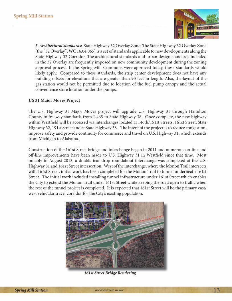
US 31 Major Moves Project
The U.S. Highway 31 Major Moves project will upgrade U.S. Highway 31 through Hamilton County to freeway standards from I-465 to State Highway 38. Once complete, the new highway within Westfield will be accessed via interchanges located at 146th/151st Streets, 161st Street, State Highway 32, 191st Street and at State Highway 38. The intent of the project is to reduce congestion, improve safety and provide continuity for commerce and travel on U.S. Highway 31, which extends from Michigan to Alabama.
Construction of the 161st Street bridge and interchange began in 2011 and numerous on-line and off-line improvements have been made to U.S. Highway 31 in Westfield since that time. Most notably in August 2013, a double tear drop roundabout interchange was completed at the U.S. Highway 31 and 161st Street intersection. West of the interchange, where the Monon Trail intersects with 161st Street, initial work has been completed for the Monon Trail to tunnel underneath 161st Street. The initial work included installing tunnel infrastructure under 161st Street which enables the City to extend the Monon Trail under 161st Street while keeping the road open to traffic when the rest of the tunnel project is completed. It is expected that 161st Street will be the primary east/west vehicular travel corridor for the City’s existing population.
161st Street Bridge Rendering

Spring Mill Station
14Spring Mill Station
Possible Intersection Improvements for 161st Street/Spring Mill Road
The City Engineer has indicated the following possible future improvements to the intersection of 161st Street and Spring Mill Road. The intersection of 161st Street and Spring Mill Road currently functions at an acceptable Level of Service (“LOS”) for current traffic levels. 161st Street and Spring Mill Road both currently function at an A or B LOS for all four approaches to the intersection. A curb on the southeast corner of the intersection was installed in 2012 to prevent continued encroachment into the corner yard from automobiles driving through the corner of the intersection. Improvements to the intersection that may occur in the future include relocating electric lines that are installed at nearly the same height as the hanging street lights, creating visibility obstructions. The street light poles themselves might be updated to a higher quality pole than those that are currently in place. Lastly, reprogramming the traffic light to meet the demands of future traffic patterns may occur.
Spring Mill Road Programming and Engineering Draft Study
Future improvements to the 161st Street and Spring Mill Road area are recommended by the United Consulting Engineers’ Spring Mill Road Programming and Engineering Study. Future improvements not included in the study may be added at a later date if needed. The study recommends that a roundabout be installed at both the intersections of 161st Street and Oak Ridge Road, as well as 156th Street and Spring Mill Road. Both roundabouts are expected to be completed by fall of 2014. It is also recommended that 161st Street be widened to include an additional lane on each side of the road to allow cycle tracks to be added to the road cross section.
Grand Park
The Grand Park Sports Campus is located approximately 2.5 miles north of the Spring Mill Station Study Area and is anticipated to generate approximately 1.5 million visitors per year. This level of tourism activity will likely generate a significant amount of consumer activity in Westfield. Spring Mill Station may experience increased demand due to its proximity to the Sports Campus. Due to

Spring Mill Station
15Spring Mill Station
the nature of how Grand Park is expected to function, extreme traffic spikes are not expected in the Study Area; however, overall traffic levels may be greater than previously expected.
The Grand Park Sports Campus may also affect the use of the southwest corner of Spring Mill Station, where approximately fourteen (14) soccer fields are currently used by the Westfield Youth Soccer Association. The Westfield Youth Soccer Association is one of the key users expected to host activities at the Sports Campus. Demand for the fields, currently owned by the Westfield-Washington School Corporation, may be reduced if the demand for fields is otherwise met at the Sports Campus.
Viking Meadows and Maple Knoll Subdivisions Permit Activity:
Located in close proximity to the Spring Mill Station study area are the subdivisions of Viking
single-family home starts in Westfield for 2013, accounting for twenty five (25%) percent of all permits. In 2012, Viking Meadows accounted for twenty five (25%) percent of all new single-family
Station had the third highest number of new single-family housing starts at thirteen (13%) percent
home starts in Westfield. These new homes located in close proximity to Spring Mill Station will likely increase the viability of and need for a neighborhood hub as contemplated in this Plan.
Townhomes at Countryside
On the northeast corner of 161st Street and Spring Mill Road and north of Springmill Commons is the Townhomes of Countryside, an owner occupied multi-family development. The development consists of nine (9) three (3) story townhome buildings with approximately forty-eight (48) units and three (3) single story buildings with nine (9) units. The development gained zoning approval in
This approval occurred after the Springmill Commons project was approved.
Nine (9) of the three (3) story townhome buildings were constructed by Ryland Homes and the single story buildings were constructed by Shoopman Homes, who acquired the remaining unimproved building pads in the project. During the recent economic downturn, owner-occupied townhome buildings struggled to remain as viable as traditional single family homes. As a result, Shoopman Homes acquired the remaining building pads and began constructing single family attached units in 2010. Nine (9) separate single story units have been constructed by Shoopman Homes since that time and nine (9) building pads remain to complete the build out of the project. As indicated by Shoopman Homes, it chose this area because of the amenities in the immediate vicinity and easy road connections to the surrounding area.

Spring Mill Station
16Spring Mill Station
Development Interest
The four corners of the 161st Street and Spring Mill intersection have seen an increased level of development interest over the past several years. Currently, one formal rezoning petition has been filed with the Advisory Planning Commission for the southeast corner of 161st Street and Spring Mill Road. The proposal would permit a variety of local business (LB) uses such as a drug stores, banks and medical offices on a seven (7) acre site. The proposed site plan illustrates four (4) structures with a drug store (approximately 15,000 square feet) on the corner of 161st and Spring Mill and three other separate buildings totaling 16,000 square feet.

Spring Mill Station
17Spring Mill Station
Chapter 4: Planning Area
The Spring Mill Station planning area consists of approximately ninety (90) acres around the four corners of the 161st Street and Spring Mill Road intersection. The area is approximately two (2) miles west of US Highway 31 and three (3) miles from downtown Westfield, also known as Grand
lots and part of an airport runway to the southeast, a vacant field and soccer fields to the southwest, and residential lots and a large wooded estate to the northwest.
Rationale:
The planning area is identified in order to prevent commercial creep down the 161st Street and Spring Mill Road. Both corridors are zoned entirely for single-family residential use and the study area itself is envisioned as the only location non-residential activity may occur in this vicinity. It is not intended that the planning area be entirely commercial. Residential uses may occupy a significant portion of the planning area. Areas outside of the planning area are envisioned to remain as single-family homes. The planning area is designed to allow adequate space for internal buffering and transitions to the surrounding neighborhoods. Specific descriptions of the planning area as well as rationale for the inclusion of each individual corner of the planning area are included below:

Spring Mill Station
18Spring Mill Station
Northwest Corner of 161st/Spring Mill Road
The northwest corner of the planning area includes approximately fourteen (14) acres of land, comprised of seven (7) parcels.
development to the west and a five (5) acre residential parcel to the north. The area includes six (6) residential homes and a vacant
through the center of the parcel. The west boundary along Maple
Rationale: The northernmost parcel with the regulated drain was
network to provide a connection to the extensive Countryside Subdivision trail network and also access to a planned roadside trail to be installed along Spring Mill Road. The connection point would also give residents access to the fifteen (15) acre Armstrong
Park located inside the Countryside subdivision. This boundary also lines up closely with the northern property line of the CrossRoads Church Planned Unit Development and the Springmill Commons shopping center located directly east of this area.
Northeast Corner of 161/Spring Mill Road
The northeast corner of the planning area includes approximately fifteen (15) acres of land comprised of five (5) parcels. This corner of the Study Area is bound by the Townhomes at Countryside to the north and the Countryside Subdivision to the east. The
anchored shopping center, which includes in-line B-shoppes, three outlots, and a gasoline fueling station. A vacant, dilapidated, single family home with a pole barn is also located
north of the gasoline fueling station. The buffer area located north of the B-shops between the townhomes of Countryside includes a large earthen mound with evergreen and deciduous landscaping. A pedestrian trail connects the shopping center with the Countryside Subdivision to the north.
Rationale: The existing and Spring Mill Commons development was included in the study area since the existing commercial center is a large component of the functional area within the vicinity of 161st Street and Spring Mill Road. A zoning nonconformity also exists for the

Spring Mill Station
19Spring Mill Station
shopping center as the development is zoned Single-Family 3. This study acknowledges this issue and suggests that this issue be appropriately addressed in order to accommodate the further development of future redevelopment of this property. The eastern common area is also included and may be desirable to provide a trail connection area from Countryside Subdivision to 161st Street.
Southeast Corner of 161/Spring Mill
The southeast corner includes approximately twenty-two (22) acres of land, comprised of eight (8) parcels. The area follows the same eastern boundary as Spring Mill Commons to the north. The area is bound by the Mulberry Farms Subdivision to the south and a residential home to the east. The area includes a church, five (5) residential homes, two vacant lots, and approximately half of a grass airport runway. A tree stand runs intermittently along the Mulberry Farms boundary.
Rationale: The intention for the eastern boundary is to create a seamless transition on both sides of 161st Street. Mulberry Farms Subdivision serves as a natural boundary to the south. The intention of the twenty-two (22) acre area would allow for residential and commercial development to include a large buffer and landscape area to provide transition between newly developed areas and adjacent development.
Southwest Corner of 161/Spring MillThe southwest corner includes approximately thirty-seven (37) acres, comprised of two parcels of land. The area is bounded by the Crosswind Commons Subdivision to the south and Shamrock Springs Elementary School to the west. Both parcels are approximately eighteen (18) acres in size. The parcel located on the immediate corner of Spring Mill Road and 161st Street is undeveloped and currently farmed. The school-owned parcel currently contains fourteen (14) soccer fields.
Rationale: The thirty-seven (37) acres of the corner were included to ensure coordinated design and transitioning with surrounding neighborhoods and the rest of the planning area should any redevelopment occur. The corner is not envisioned
to develop entirely as neighborhood commercial and would mostly likely include a large residential or medical component. If development occurs, special attention should be given to the soccer fields as an amenity for the planning area.

Spring Mill Station
20Spring Mill Station
Chapter 5: Identity– “Spring Mill Station”
The Spring Mill Station Study Group quickly determined that establishing a clear identity for the planning area is of critical importance to create the desired neighborhood hub. The area is intended to function as a “hub” of activity and social connections for the surrounding neighborhoods and the name “Spring Mill Station” was chosen to embody that concept. The hub concept envisions local residents using multiple modes of transportation to access the various amenities that are contemplated in this plan. The hub is intended to function as both a community gathering place as well as a neighborhood center to meet the local consumer needs of the community.
To create the desired identity and community hub of activity, “Spring Mill Station” was chosen as the name of this planning area for the following reasons:
and its relation to the abandoned rail lines in the area.
2. “Station” also relates to Westfield’s involvement in the Underground Railroad and the continuation of that theme west of US 31.
3. “Spring Mill” connotes a certain community pride and identify that is easily recognizable and should be retained for this neighborhood hub area.
4. The railroad identity should be translated and emphasized throughout the architecture and design of the site.
Spring Mill Station is envisioned to be a high quality development area that has a timeless feel, a place where people feel comfortable simply spending time outdoors, a place away from home and work that one can relax and play. The quality of development contemplated in this plan is intended to focus attention on aesthetic detail and reduce the generic feel of typical strip mall shopping centers. Architectural themes that possess a long lasting appeal are recommended in order to create a timeless “feel” for this area and prevent trendier architectural themes that could be outdated in a decade.
To fulfill this vision and work within the “Spring Mill Station” name, a railroad era architectural theme was chosen to be continued throughout the planning area. The theme presents an opportunity for not only railroad era architecture, but a branding of railroad style designs all throughout Spring Mill Station. Such elements can be utilized in public rights-of-way as art pieces as well as within common areas. The history of railroads in Westfield and the United States presents design opportunities that are as timeless as any architecture we have in the country. Recreating that visual effect can further the brand of this area and create the desired space that is unique from other areas.

Spring Mill Station
21Spring Mill Station
Chapter 6: Land Uses
To fulfill the vision of a neighborhood center or hub, the mix of permitted land uses is critical. The intent is to create a neighborhood center where auto and pedestrian trips are generated from a close proximity and to discourage uses that tend to generate largely auto trips from further away. The contemplated land uses for Spring Mill Station are aimed to help achieve the feel of a neighborhood center and meet the needs and desires of local residents.
Recommended land uses include eating and dining establishments, convenience retail stores, food and beverage retail stores, multi-family uses, small business offices and community facilities. All of these uses are contemplated as serving the basic needs of surrounding residential neighborhoods. Below is a list of the recommended land use categories with specific local examples identified:
A. Retail sales as envisioned by the Spring Mill Station Study Group, includes the sale or rental of common goods or services. (excluding agricultural, animal, automotive, business equipment, construction sales, gas sales, prominent drive-up orientation). Retail sales can be broken into the following groups:
1)Convenience retail sales: As envisioned by the Spring Mill Station study group this type of use includes the sale of frequent or reoccurring small personal items or services for residents located in close proximity. Typical uses include neighborhood grocery and drug stores. Examples: Pharmacy, Small Retail Establishment
2) Restaurants and Pubs: Establishments primarily engaged in sale of foods and beverages for on-premise consumption. Typical uses include restaurants, short order eating places or pubs. Examples: Restaurants –Yat’s, Kona Grill, Granite City Food and Brewery, Mitchell’s Fish Market, Keltie’s, Mama
Corollas Old Italian Restaurant, Aristocrat Pub and Restaurant, Ice Cream shop, Pizza Shop, Dunkin Donuts
Unique outdoor eating establishment

Spring Mill Station
22Spring Mill Station
3) Food and Beverage Retail Sales: Establishments primarily engaged in the sale of food and beverages for home consumption. Typical uses include groceries or delicatessens.
Examples:, Trader Joe’s, Butcher Shop, Bakery, Fresh Market
4) General Retail Sales: Sale or rental of goods and merchandise for personal or household items but different from the uses listed above. Typical uses include boutique stores, apparel stores, paint stores, hardware stores, bike shops, hobby stores and specialty
stores. Examples: Art Gallery, Design Gallery, Music Store, Florists, Pottery, Clothing Store. Big box retail stores are not contemplated uses in this area.
B. Administrative and Professional Services refer to businesses which typically provide professional, executive, management or administrative services. Typical uses include administrative offices, legal offices, accounting offices, and engineering or architecture firms.
C. Business and Personal Services includes the use categories of banks, financial services, medical services, and personal and repair services. Business and Personal services can be broken into the following groups:
1) Banks and Savings and Loan: Financial institutions providing on site retail services to individuals and businesses.
2) Finance, Insurance and Real Estate Services: Establishments primarily engaged in financial, insurance, real estate, or security brokerage services. Typical uses include banks, insurance agencies or real estate firms.
3) Medical Services: Personal health services for the prevention, diagnosis and treatment or rehabilitation services. Typical uses include clinics, medical specialty offices and
dentist’s offices.
4) Personal and Repair Services: Establishments primarily engaged in the provision of repair service to individuals and households. Typical uses include photography
studios, dry cleaners, apparel repair business or musical instrument repair business.
D. Community Facilities to provide a physical meeting space for residents to hold meetings or special events/activities. (e.g. Gazebo)
E. Assisted Living Facilities to provide housing opportunities for individuals with additional needs and assistance.
F. Multi-Family housing for apartments, townhomes, and condominiums intermixed with other approved uses and as a transition from more intense uses.

Spring Mill Station
23Spring Mill Station
G. Single Family housing as envisioned by the Spring Mill Station Study Group include village or cottage style residential development in a compact arrangement to blend in with the neighborhood hub.
Outdoor Restaurants
Banks Food & Beverage/Office
Single Family Housing Multi-Family Housing
General Retail (unique)Convenience Retail Sales
Spring Mill Station Land Use Examples:

Spring Mill Station
24Spring Mill Station
Chapter 7: Site Design & Architecture
In order to create a residential neighborhood center which blends into the surrounding single-family residential fabric of the area, specific architecture and site design concepts should be thoughtfully crafted to create the desired effect. It is envisioned that the (4) four corners of the planning area should be developed in such a manner where buildings are located up closer to the street rights-of-way on two (2) or three (3) of the four (4) hard corners of 161st Street and Spring Mill Road. It is not contemplated that building should be built right along the street rights-of-way on all four (4) corners. Buildings located along the street should range between 1.5 to 2.5 stories and promote pedestrian connectivity over vehicular access. Generous buffer areas are recommended between the edge of the developed areas of the Spring Mill Station and existing residential/institutional areas. Spring Mill Station is envisioned as including a significant residential component in addition to the various commercial uses described in this plan. It is envisioned that Spring Mill Station will be a unique and vibrant people space that features winding outdoor common areas with small parks and places for people to sit.
Village Green
A village green located near the intersection is desired by residents to provide a place to relax and socialize, and to serve as a community gathering place for the local neighborhoods. The village green is envisioned as a place including public art, outdoor seating, heavy landscaping, and mixed use buildings that front on the village green. The space is meant to be intimate and freely accessible to all while also providing a comfortable setting for restaurants or businesses to use part of the green as an amenity. Ideally the space would also include a clubhouse or community meeting room area to serve as a meeting place for the surrounding neighborhoods. The green would function to diversify the entire neighborhood center to create multiple reasons why someone might visit the area and ultimately increase impromptu interactions with others.

Spring Mill Station
25Spring Mill Station
Thematic Design: Railroad
The Spring Mill Station study group selected a railroad style architectural theme to be carried out throughout the entire Spring Mill Station Study Area. This theme should be continued throughout the architecture of the buildings, common areas, and amenities of Spring Mill Station. This theme will help to carry a consistent vision on all four corners and create a custom feel for the area. The buildings should utilize quality building materials (e.g., brick, stone, wood) and be built at a scale that is comfortable for pedestrians using the neighborhood center. The architecture should be similar to what is described below and as illustrated in the following examples:
The following is a list of encouraged architectural designs for Spring Mill Station:
Railroad Theme Architecture: Quality and Theme
1) Verge board (gingerbread style detail)2) Gable roofs (steep pitch)3) Strut detail4) Mixed colors and stacked elements5) Windows and panes6) Towers/cupolas7) Variation of architecture elements8) Arches9) Mix of brick and wood10) Window accents/fenestration11) Iron work/accents12) Undulating facades to prevent box like structures13) Inviting entrances/covered entrances to buildings14) Pedestrian scale: windows and building massing designed for pedestrians
The following is a list of encouraged features for public art in Spring Mill Station:
Public Art (Desired Features)
1) Water tower feature 2) Railroad style public furnishings (e.g., benches, pergolas, playscapes) 3) Use of red/black/rust colors 4) Use of old railroad track or steam engine as part of common area

Spring Mill Station
26Spring Mill Station
Site Design Concepts
To help illustrate the concepts and objectives set forth in the Spring Mill Station Plan, two conceptual renderings were created that would both be considered consistent with the vision set forth in this document. The purpose of the illustrations is to represent two potential build out scenarios of the entire planning area that are consistent with the Spring Mill Station vision. These two illustrations are not an either/or scenario, rather two of many possible build-out scenarios that could meet the intent of the Spring Mill Station Plan. Any two building locations or land uses shown on the conceptual plans could be placed many other ways on the sites. The renderings are presented to provide additional clarity to the concepts set forth in the Spring Mill Station plan.
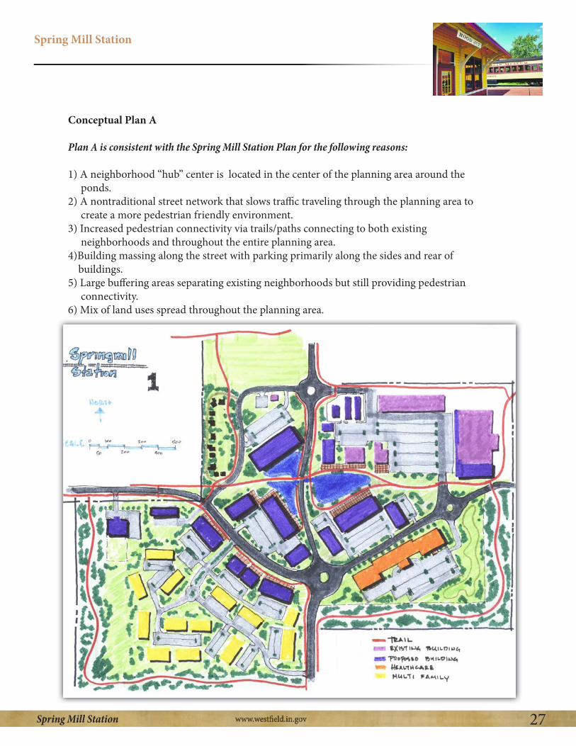
Conceptual Plan A
Conceptual Plan B
The Spring Mill Station Study Group acknowledges that Conceptual Plan A would take more time to accomplish and would require additional assistance from the City in order to acquire additional right-of-way and construct the necessary infrastructure to achieve the overall vision. It is acknowledged that Plan B would require less time and coordination from different stakeholders to achieve the goals of the Spring Mill Station vision.
Spring Mill Station
27Spring Mill Station
Conceptual Plan A
Plan A is consistent with the Spring Mill Station Plan for the following reasons:
1) A neighborhood “hub” center is located in the center of the planning area around the ponds.2) A nontraditional street network that slows traffic traveling through the planning area to create a more pedestrian friendly environment.3) Increased pedestrian connectivity via trails/paths connecting to both existing neighborhoods and throughout the entire planning area.4)Building massing along the street with parking primarily along the sides and rear of buildings.5) Large buffering areas separating existing neighborhoods but still providing pedestrian connectivity.6) Mix of land uses spread throughout the planning area.

Spring Mill Station
28Spring Mill Station
Conceptual Plan B
Plan B is consistent with the Spring Mill Station Plan for the following reasons:
1) A neighborhood “hub” area and village green is located on the southwest corner of the planning area.2) Mixed use buildings are located adjacent to the village green area with common areas on the green.3) Increased pedestrian connectivity via trails/paths connecting to both existing neighborhoods and throughout the entire planning area.4) Building massing along the street with parking primarily along the sides and rear of buildings.5) Large buffer areas separating existing neighborhoods but still providing for pedestrian connectivity between neighborhoods. 6) Mix of land uses spread throughout the planning area.

Spring Mill Station
29Spring Mill Station
The following are examples of site design elements that are encouraged to be within the Spring Mill Station:

Spring Mill Station
30Spring Mill Station
The following are examples of railroad themed architectural elements that are encouraged to be incorporated within Spring Mill Station:
Window Accent Shutters
Overhangs
Vergeboards
struts
SteepPitch(GableRoof)
Tower/Cupola

Spring Mill Station
31Spring Mill Station
Iron Detail
Mix of Brick/wood &Mixed Color elements
Window Accents
Windows and Panes
Inviting Entrances/Covered Entrances
Tower/Cupola
variation of architecturalelements

Spring Mill Station
32Spring Mill Station
The following are examples of encouraged features for public art in Spring Mill Station:
Railroad Inspired Art
Water Towers Railroad Benches
ClockTower

Spring Mill Station
33Spring Mill Station
Specific examples of site design and quality architecture to be emulated include the following:
1)Buckingham Development: Old Meridian Street Carmel - Potential for this style development on the two hard corners and smaller Broad Ripple scale buildings on other corners. Three story structures are not encouraged on hard corners of the intersection.2) Scottsdale, Arizona: Architecture and quality design that tie area together.3) Soulard in St. Louis: Residential neighborhood with many restaurants, pubs, and other businesses.4)The Hill in St. Louis: Family area feel with active people places on sidewalks.5) Breckenridge, Colorado: Walkable downtown with many shoppes and restaurants.6) Downtown Zionsville, Indiana: Smaller building massing with good internal landscaping. 7) Manchester, Vermont: Old world feel8) Bloomington, Indiana: Hodgepodge of architecture and eclectic feel. 9) Fountain Square, Indiana: Interesting mix of architecture, dining, entertainment
Massing
The buildings in Spring Mill Station should have a comfortable scale in relationship to pedestrians and should not be overwhelming.
The following is a list of encouraged massing elements:
1) Curvilinear elements2) Broken planes3) Staggered/varied styles/textures4) Trees/comfort/elements that draw people to space5) Ornamental parapets6) Three story buildings when used in context sensitive design (i.e., layered). Closer
to intersection buildings should range in size for 1.5 to 2.5 stories; however, buildings could range to 3 stories if nearer higher intensity uses and built in proportion and scale to surrounding buildings.
The following is a list of discouraged massing elements:
1) Traditional strip center style development (e.g., lack of bump out/offsets) 2) Movie set look (e.g., fake design)3) Lack of rooftop modulation

Spring Mill Station
34Spring Mill Station
Chapter 8: Transitions and Buffering
Establishing appropriate transitions and buffers is paramount to reducing the possible negative impacts of development to the surrounding residential neighborhoods. The intent of the Spring Mill Study Group is to create a clearly defined boundary for the Spring Mill Station Planning Area in order to prevent higher intensity development activity from occurring outside such area. As contemplated, large buffer areas along the perimeter of the Spring Mill Station Study Area will provide opportunities for pedestrian connectivity and create good transitions to surrounding uses. Spring Mill Station is contemplated as transitioning from the highest intensity uses in the center of the Study Area to less intense uses and building sizes toward the perimeter of the Study Area. Assisted Living facilities and multi-family uses could be appropriate transitional uses from more commercial or retail uses, but special attention should be paid to building height and orientation along perimeters of the Study Area. The Study Group strongly recommends that commercial uses not be permitted outside of the Study Area.
Connected, But Protected Design
The buffer areas around the perimeter of the Study Area are intended to protect nearby uses from the impact of more intense land uses, but also to connect the surrounding neighborhoods to Spring Mill Station. The Study Group sees such connections as being critical to accomplishing the Spring Mill Station vision – creating a “hub” of activity, land uses and social interaction. Traffic calming measures are recommended in order to ensure a safe pedestrian environment. Spring Mill Station is envisioned as being a place where pedestrians can easily access all parts of Spring Mill Station without the use of a vehicle.
The Study group recommends that there be a strong focus on landscaping installations in site designs in order to create an intimate and comfortable pedestrian feel for the area. This will help to ensure the high quality and timeless character of development the Group has envisioned for this area.
(Connected pedestrian path shielded from surrounding uses)

Spring Mill Station
35Spring Mill Station
Buffering:
The Spring Mill Station Study Group offers the following recommendation within and near to transitional buffer areas along the perimeter of the Spring Mill Station Study Area.
The following is a list of encouraged buffer standards:
1) Continuation of the “railroad theme” throughout the buffer areas.
2) Large natural buffer areas with a mix of hardscapes and mature landscaping. Brick fences with wrought iron elements are identified as desirable hardscape types. The use of long, unbroken expanses of wood fencing used as a buffer to screen from adjacent uses should be discouraged within the Study Area, unless desired by adjacent residential uses for security purposes.
3) Landscaping should be clustered in groups in order to create a natural feel instead of a regimented design. Special attention should be given to sight lines so as to visually buffer development attributes that are less slightly.
4) Evergreen trees in conjunction with deciduous trees for year round buffering should be utilized.
5) Earthen berms are encouraged to be used for buffering purposes as long as they are not regimented in appearance and they are designed so as not to prevent connectivity with surrounding neighborhoods. Undulating berms and mounds (with varying heights and widths) are preferred.
6) Native plantings should be used where appropriate.
7) Contextually sensitive design is desired. For example, berms or mounds should be designed not just to screen uses from each other, but also to enhance the pedestrian experience within transitional buffer areas. More intensive buffering should be provided nearest to more intensive uses and structures, unless such buffering would prevent a given use or building from being showcased in an aesthetically pleasing manner.
8) Special attention should be given to installing landscaping in a manner that would screen or block headlights.
9) Pedestrian pathways and/or trails should be installed within transitional buffer areas which provide connectivity within the Study Area and also to the surrounding neighborhoods.
10) Delivery trucks should not be permitted to remain idling while deliveries are being made.
11) Trash pickup should be restricted to normal waking hours.
12) Loading areas should be fully enclosed in order to shield from view and reduce noise pollution.

Spring Mill Station
36Spring Mill Station
13) Lighting should be fully shielded from encroaching into neighboring residential areas.
Site Sensitive Buffer Areas: The following areas should be designed with a heightened sensitivity to surrounding existing residential uses.
many of the existing mature trees as possible in this area so as to provide a visual and sound buffer. At least a 50’ wide buffer is recommended if the adjacent use is of lower intensity and greater buffer width is recommended for if a higher intensity use is developed.
2) The area abutting Mulberry Farms. Maintain a 150’ wide buffer area along this boundary of the Study Area.
3) The area abutting Crosswind Commons Subdivision. Maintain a considerable buffer between residential area and adjacent uses within the Study Area. The higher the intensity of the adjacent use developed, the greater the buffer that should be provided.
4) The border between Springmill Commons and Countryside. Further improvements should be installed to enhance the existing Countryside trail network to provide access around and through Springmill Commons as to provide a good connection to Armstrong Park (located a short distance
(Mix of evergreen and deciduous trees w/ wrought iron fence)
(Earthen mound w/mix of trees and hardscapes)

Spring Mill Station
37Spring Mill Station
Chapter 9: Access and Circulation:
The Spring Mill Study Group envisions Spring Mill Station to be a place accessed by multiple modes of transportation, including but not limited to bicycles, pedestrians and motorized vehicles. To slow traffic speeds in the area, a roundabout is the preferred intersection type for the 161st Street and Spring Mill Road intersection. A roundabout is desired for its aesthetic appeal with possibilities for landscaping and branding in the public right-of-way as opposed to a traditional intersection with a traffic light. The Study Group also recommends that the City consider taking other appropriate steps to reduce traffic speeds in the area in order to create a safer and more desirable environment for pedestrians to cross the main thoroughfares.
The Study Group recommends site designs within the Study Area that connect all parts of Spring Mill Station to surrounding areas by coordinated street connections and pedestrian trails. Pedestrian trails should be extended throughout buffer areas and along main thoroughfares to provide connectivity. Improvements on the parcels fronting on the hard corners of 161st Street and Spring Mill Road should be designed to create a traffic calming effect in the area. Entrances to developments within the Study Area should be designed, controlled and located in a manner so as to not create conflicting traffic movements and to provide for the orderly development and build out of the Study Area.

Spring Mill Station
38Spring Mill Station
Chapter 10: Public Input
In order to obtain feedback on the Spring Mill Station Plan, the Spring Mill Study Group met with numerous stakeholders, hosted a public open house, and met with selected developers over the course of five (5) meetings. The feedback from those groups is presented below:
1) Stakeholder Input2) Public Open House Comments3) Developer Input
1) Stakeholder Input:
Stakeholder Concerns:1. Find the balance between groups desires and marketplace realities.2. Opposed to any rerouting or recirculation of roads that will impact site lines, accessibility, parking traffic flow, and overall convenience of existing shopping center.3. Opposed to any change of the existing alignment of 161st Street and Spring Mill Road.
a. Time to obtain approval and agreements.b. Expense of relocating utilities and infrastructure, legal fees, design.
4. The cost of complying with the Spring Mill Station vision will likely increase costs for the retailer to enter the market. Retailers are now competing in a national marketplace instead of regionally. The more hurdles there are for the retailer, the less chance the retailer will enter the marketplace.5. The conceptual plans not realistic for development on southwest corner.
a. The site layout is too different from the national prototype plans. (e.g. access, convenience, efficiency, traffic/shopping patterns, behaviors, other factors)
6. The demand for “office” space is weak. There is potential for garden offices, but more of a long term prospect.7. Village Green: The park on southwest corner is a nonstarter as the most valuable land is being used for a park and is not providing an economic benefit to Westfield. 8. Concept plan A (4.1) is not workable do to extraordinary infrastructure costs of installing the illustrated infrastructure. This would appear to be impractical and unachievable.9. Concerns with Concept Plan B (4.2)
a. Construction: Clients are not interested in the construction of buildings along the street in the configuration shown.b. Parking: At least two (2) rows of parking between the building and the street is a necessity. The appearance of this parking can be mitigated by landscaping and hardscapes.c. Drive-thrus: Prohibition of drive-thrus would be problematic as heavy demand for drive thrus with the type of uses Spring Mill Station Study Group desires.
Spring Mill Station
39Spring Mill Station
Stakeholder Affirmations:1. A majority of the principles of the plan as presented by the Spring Mill Station Study Group are desirable.2. Agreement and support of the proposed areas of plan, the name of plan, the proposed development theme, the general designs illustrated, and the proposed land uses.3. Upgraded Architectural Design: National retailers are more likely to expend resources on architectural design over other aspects such as site design.4. Supportive of intensive and quality landscaping throughout planning area.5. Apartments- There is significant demand for this type of use at this location.6. Concept Plan B (4.2)
a. Buffering: Supportive of a Unified and consistent landscape plan around entire planning area.b. Connectivity: Supportive of extensive pedestrian and vehicular connectivity with provision of safe access to, from, around the development. Traffic flow is beneficial for both pedestrians and automobiles. c. Identity and Theme: Supportive of conformity with railroad federalist architecture and
the creation of marquee elements at SE corner, such as clock tower, etc.d. Architecture: Supportive of the use of variable and high quality materials.e. Road improvements: Stakeholders would consider a contribution to the roundabout construction and dedicating the required right-of-way to meet the vision of the plan.f. Community: Supportive of designing hardscape elements to promote quality public spaces.
2) Public Open House Comments:
1. Concerned about the noise that could be generated from store deliveries and trash pick-up.2. Would like to see adequate tree preservation at Mulberry Farms boundary.3. All owners should be notified of planning process before any zoning change could occur.4. Drive-thrus should be permitted in planning area due to needs of older people and parents.5. Building Height: Buildings over three (3) stories in height are too tall. 6. Safety: Pedestrian paths are shown too close to the roads. The village green could become a gathering place for teens.7. The roads should be straight streets and not curved as shown on one of the concept plans.8. Fencing should be of high quality.9. Buffer Yard: Lack of mature vegetation in buffer yards may provide insufficient protection. 10.Water/Drainage: Water retention should be designed as “rain gardens” for enhanced mitigation.11. Environmental Concerns: The surface color parking lots should be considered to reduce the heat island effect. Also building arrangement should be considered to no affect wind flow.12. Concept Plan A: This concept is too costly to construct and too time consuming.13. The CrossRoads property should not be used as gas station and a bank is an appropriate use.14. Gas Station: If a gas station use is permitted in this area, light and noise should be adequately addressed.

Spring Mill Station
40Spring Mill Station
15. Crime: Too many multi-family apartments are shown in the plans, which can lead to crime. 16. Will Grand Park affect this future intersection/development?17. Gas stations should not be allowed on any corner of the planning area.18. What type of signage will be permitted?19. What type of lighting will be permitted?20. The development of the study area could lead to increased traffic congestion of the commercial area.21. Private businesses should be encouraged over national chain businesses. 22. Minimize disruption to surrounding neighborhoods during construction.
be provided.24. Auto Oriented Traffic: Increase green space in the area in order to encourage pedestrian traffic.25. Railroad Theme: Existing businesses should also adhere to these guidelines.
3) Developer Input
1) Trail access that connects not only to the planning area, but to the overall trail network is a must.2) Must strike a balance between the cost of accomplishing the thematic design objectives without overpricing the market for rent prices. Consider allowing developers more square footage in order to meet design requirements.3) Consider adding public buildings (government buildings, etc.) throughout the planning area to increase more pedestrian traffic.4) Having multiple land owners and multiple developers will increase the difficulty of achieving the overall vision. Need to develop a coordinated development strategy for the entire study area.5) The land uses proposed are vehicular intensive. Careful consideration should be given to how you promote pedestrian connections. 6) For buildings constructed on hard corners of the intersections, you must strike a balance between the community’s objectives and the developer’s objectives by creating a unique design, but allow retailer to have a presence so community is aware of business location. The two entrance design (i.e., stores required to have public entrances on two sides, can be difficult for retailers to orient business for point-of-sale inside building.7) Building standards and hard rules for development are helpful for developers to understand what they can and cannot build.8) How the financing would be achieved for the village green and how costs would be shared is something important to work out. The park can add value for certain users in its proposed location on the intersection. The village green could also be located in an alternative manner to incorporate buffer areas and provide more of a linear park along the road.9) Consider a stronger focus on integration to the existing, surrounding land uses.10) Consider potential pedestrian bridges incorporating railroad elements for better pedestrian connectivity. Pedestrian tunnels could also be incorporated for main thoroughfares.

Spring Mill Station
41Spring Mill Station
Quality Apartment Development in planning area:
1) Density should be encouraged in the planning area, as high as 30 units per acre. 2) An apartment community of less than 200 units is not conducive due to economies of scale. 3) Heights of buildings should be limited by number of stories, not actual height, in order to encourage flexibility in design.4) Buildings should be allowed to be constructed on the street and have on-street parking. Parking should be hidden and out of sight as much as possible.5) Building location should encourage informal human interaction and allow for pocket park development.6) Pedestrian walkways should provide easy and safe access to other areas within the overall plan.
Concept A
1) Lacks a sense of arrival when driving through the planning area.2) Visibility is poor on the intersections when inside the planning area.3) Design is suitable for achieving many of the quality apartment design objectives. 4) Street layout allows for safer pedestrian access which will in turn help all businesses in planning area.5) Cost of the street network would be too great for any one developer and would require additional development support from a funding source like Tax Increment Financing.
Concept B
1) Establishes a sense of arrival when driving through planning area. 2) The village green on the corner creates a non-traditional intersection that is unique.3) Retailers will react better to this design concept over design Concept A.4) More roundabouts could be incorporated to slow traffic thru planning area and also add more public space.5) Additional flexibility should be considered for buffer areas. Surrounding land uses should dictate buffer distance. There could be a benefit for a reduced buffer distance to the sports fields on west side of planning area. 6) The preliminary layout of the apartment buildings is not a very creative design for achieving the critical mass of apartments that is desirable.

Spring Mill Station
42Spring Mill Station
Chapter 11: Planning objectives and Policy Recommendations
The Spring Mill Station Study Group has identified the following planning objectives which, if accomplished, would advance the realization of the vision established in this plan.
1) Spring Mill Station Task Group: The Study Group recommends the establishment of the “Spring Mill Station Task Group.” This group of community members (contemplated as initially consisting of the Spring Mill Station Study Group citizen members) would function in a manner
following activities: (a) it would review zoning petitions for potential development within the Spring Mill Station Study Area to determine consistency with the Spring Mill Station vision; (b)it would collaborate with would-be developers of projects in the Study Area in order to ensure consistency with the Spring Mill Station visions; (c) it would provide recommendations to the Westfield Advisory Plan Commission and City Council members regarding zoning petitions in the Study Area; (d) it would collaborate with City representatives in order to guide decisions related to public infrastructure improvements in the Study Area; and (e) it would engage in periodic planning activities and analysis in order to keep this Spring Mill Station Plan current and further the accomplishment of the planning objectives set forth herein.
2) Branding: The Study Group recommends further development of the Spring Mill Station “brand.” Once further developed, this brand should be incorporated into the various private development projects and public infrastructure projects envisioned within the Spring Mill Station Study Area.
3) Land Uses: The Study Group recommends that land uses within the Study Area be developed in a manner consistent with the concepts envisioned this Plan. As contemplated, the Spring Mill Station Task Group will actively work with would-be developers to ensure that this occurs prior to making its recommendation to the Westfield Advisory Plan Commission and City Council members on zoning petitions.
4) Architecture and Site Design: The Study Group recommends that the design and quality of building architecture and site designs within the Study Area be developed in a manner consistent with the concepts envisioned in this Plan. As contemplated, the Spring Mill Station Task Group will actively work with would-be developers to ensure that this occurs prior to making its recommendation to the Westfield Advisory Plan Commission and City Council members on zoning petitions.

Spring Mill Station
43Spring Mill Station
5) Development Strategy: The Study Group recommends that a coordinated strategy for development (and in some cases redevelopment) be developed for the Study Area. Specifically, the Group is concerned about the effect of ad-hoc, uncoordinated private developments occurring within the Study Area. In a perfect world, the Group believes that it would be desirable for the entire Study Area to be developed by a single developer. This would likely ensure coordination of vehicular connectivity, pedestrian connectivity, water detention facilities, open spaces, thematic architecture and site design. The Group acknowledges, however, that it is probably unrealistic to expect a single developer to develop the entire Study Area. With that in mind, the Group recommends that measures be taken to ensure this level of coordination among different (and possibly competing) developments within the Study Area. As contemplated, the Spring Mill Station Task Group will actively work with would-be developers and City officials to ensure that this occurs prior to making its recommendation to the Westfield Advisory Plan Commission and City Council members on zoning petitions. The Study Group also recommends that the City explore other possible ways to encourage or compel coordination of development within the Study Area.
6) Financial Strategy: The Study Group recommends that a financial strategy be developed and implemented that would advance the City’s efforts to make infrastructure improvements within the Study Area consistent with the concepts envisioned in this Plan. The group suggested that the City explore the possibility of establishing an Economic Development Area for the Study Area that would provide the option of using Tax Increment Financing for making desired infrastructure improvements. The Study Group also recommends that the City explore other financial sources or mechanisms for making such improvements that may be available (or may become available) to the City.
7) Economic Development: The Study Group recommends that the City and the Study Group work together to be proactive in attracting quality development within the Study Area and also to attract the specific businesses and services desired by the Spring Mill Station Task Group. Rather than wait for would-be development projects to come forth on their own, the Group expressed a desire to proactively reach out to desirable developers and businesses to educate them and attract them to Spring Mill Station.

Spring Mill Station
44Spring Mill Station
Chapter 12: Going Forward
The Spring Mill Station Plan recommends that this planning document be revisited periodically. Ideally this activity would occur annually. This periodic exercise is recommended to include the following elements:
1) Measuring Progress: The Spring Mill Station Task Group should periodically review the progress made toward accomplishing the planning objectives identified in Chapter 11 of this Spring Mill Station Plan.
2) Important Factors: The Group should document any events or factors which have inhibited or facilitated progress toward accomplishing the planning objectives stated in this Plan.
3) Validation of Existing Objectives: Each planning objective stated in this plan should be reviewed by the Group in order to determine if it is still a priority in order to accomplish the Spring Mill Station vision.
4) Revising Planning Objectives: The Group should identify any new or refined planning objectives not previously listed in the Spring Mill Station Plan and determine if it is desirable to add such items to the list of planning objectives stated in the Plan. To the extent that any of the previously identified planning objectives are completed or substantially accomplished, the Group may choose to remove such items from the list of planning objectives stated in the Plan.
5) Prepare Addendum: A summary document, a Spring Mill Station Plan Addendum (the “Addendum”), should be prepared which explains the process and details outlined above.
It is recommended that the Addendum be adopted in accordance with the process for a comprehensive plan amendment as contemplated in the 500 Series of Ind. Code 36-7-4.
If completed in a timely manner, this document is easily useable for the purpose of guiding annual work planning and budgeting for City departments and the various stakeholder organizations working to accomplish the Spring Mill Station vision. The Spring Mill Station Plan, as amended, is designed and intended to act as a living, breathing document which chronicles the Westfield community’s Spring Mill Station accomplishments, charts a course through the often complicated process of placemaking, and acknowledges and coordinates the efforts and energies of the stakeholders actively working to make the Spring Mill Station vision a reality. By engaging in this planning dialogue on a regular, recurring basis, the community will be well-positioned to reach its goal of creating the vibrant neighborhood “hub” envisioned in the Plan.

Spring Mill Station
45Spring Mill Station
Appendices
Appendix A – Charrette 1: Orientation and IntroductionAppendix B – Charrette 2: Planning Area and Land Use Appendix C – Charrette 3: Architecture and Urban DesignAppendix D – Charrette 4: Transitions and Vehicular AccessAppendix E – Charrette 5: Rail Road Era Architecture and DesignAppendix F – Charrette 6: Stakeholder Meeting FeedbackAppendix G – Charrette 7: Public Open HouseAppendix H – Charrette 8: Developer Input Meeting

Spring Mill Station
46Spring Mill Station
Appendix A – Charrette 1: Orientation and Introduction
161st/Spring Mill PlanCharrette #1 Summary
The meeting began with an introduction by the participants including where they reside in Westfield and why they are interested in developing a plan for the 161st and Spring Mill area. The format for the future meeting and the topics to be discussed was then explained.
A summary of the history of the 161st Street and Spring Mill Road intersection was handed out to the participants. Participants were encouraged to read through summary and provide any events they felt was absent from the document for future meetings. Participants explained why they felt the plan was important for the community moving forward.
that could be similar to the final work product for 161st/Spring Mill corner.
The group then discussed the geographic area which should be the subject of the 161st/Spring Mill Plan. Maps were distributed of the general area and the group drew boundaries for the plan. A consensus was then reached for the boundary of the study area.
Homework was passed out to the group to identify a name for the study area and list potential land uses that would be desirable for the area.
Spring Mill Station
47Spring Mill Station
161st & Spring Mill PlanCharrette #2 Homework Handout – Study Area & Land Use
(6:30 PM – 8:30 PM)
1. Study Area:a. Please spend some time thinking about your neighborhood and your local community in the vicinity of the 161st Street and Spring Mill Road intersection.b. Review the aerial photographs distributed to the group showing this geographic area.c. Ultimately the group should agree on the geographic area it will be discussing over the next several weeks.d. Please draw a lines on at least one of the aerial photographs showing what you believe should be the limits of the study area.
the rationale behind it.
2. Develop Name/Identity (if desired):a. Is it important to you that the area in the vicinity of the 161st Street and Spring Mill Road intersection have an independent name or identity? Or, are the various names of the developments within the vicinity of this area adequate to establish the level of neighborhood/community identity you desire/prefer?
ownership history in the area to provide the group with interesting/important historical names relevant to the area. The group is free to determine the extent to which any of this information may be helpful (if any is desired at all) in arriving at a name.c. Do you have any name ideas for the vicinity (if a name is desired)?d. Do you have any other ideas or resources that might assist in arriving at a name (if one is desired)?
Land Uses:
e. It is fine if you do not wish to see any change at all in the study area. This is certainly an option. If this is your mindset, please do not respond to the following questions.f. If you could have any new land uses located within the study area, what would they be? Why?g. Are there any existing land uses present in the vicinity that you wish were not present? Why?h. Have you visited an area that you wish could be replicated in the study area? What is it? Where is it? Why? Please provide pictures if reasonably possible.i. Specifically, what new stores, restaurants, services, etc. do you wish were located in the study area (that are not already present). Why? It is fine to use actual store names, but not necessary. Please provide pictures if reasonably possible.

Spring Mill Station
48Spring Mill Station
If possible, please provide any feedback pertaining to Item #3 (Land Uses) to Ryan Clark (rclark@
best we can to incorporate for the group’s discussion.
Thanks and please let us know if you have any questions or need any clarification.
¯Planning Area Boundary(Consensus Map Area choosen)

Spring Mill Station
49Spring Mill Station
Appendix B: - Charrette 2: Planning Area and Land Use161st/Spring Mill PlanCharrette #2 Summary
The meeting began by reviewing the study area boundary identified by the participants at the first charrette. The meeting area was confirmed by group with the addition of adding pedestrian
subdivision. The group then reviewed the homework exercise from Charrette #1 that asked group to identify a name/identify for the agreed upon study area as well as land uses that group felt were appropriate in that area should they desire the area to redevelop.
The group identified several names for the study area including Spring Mill Station, Mill Point, Four Points at the Mill, Spring Mill Acres, Trails at Spring Mill, and Water Tower Place. Spring Mill Station was chosen as the working name for the following reasons:
1.The group acknowledged the “Station” part of the name played well with the existing “Grand
2. Makes references to the history of the underground railroad in the area.3.The name “Station” also functions like a meeting place and hub to which the group envisions this area becoming. 4. The group agreed that the name “Spring Mill” has a certain aura and pride for the area that is easily recognizable and should not be excluded from the name.5. The area could be easily branded with references to the railroad.
The group then broadly discussed land uses they feel would be appropriate in the study area, what uses are missing from the current development, what specific places they would like to emulate, and what uses they would not like to see in the area.
Uses:
1. The groups discussed the Buckingham mixed use development in Carmel along old Meridian St. and the desire for some level of mixed use development that fronts on the street.
a. The group indicated development on the street of all four corners was not desired, however, two corners would be more palatable. 2. Uses
a. The group desired more upscale restaurants that were local or homegrown, family orientated, and had a funky or electric feel.
Corolas, The Aristocrat)b. Ice Creamc. Bakeryd. Florist

Spring Mill Station
50Spring Mill Station
e. Medical Specialtyi. Eye doctor, dentist, pediatrician, etc.f. Apartments with first floor retail were agreed as being a desirable use.
i. The group wants to see higher quality architecture, comparable or better in quality to surrounding area. (example. Illinois and 56th St.)
g. Insuranceh. Assisted Livingi. Art Gallery j. Clothing Storek. Design Galleryl. Pizzai. The group identified a strong need for a good sit down pizza restaurant in the area.m. Dunkin Donuts or similar n. Pilateso. Music storep. Floristsq. Beauty salonr. Potterys. Rentable space for hostingt. Butcher shop
v. GNC or supplement storew. Upstairs officex. Tae kwon do or similar karate venues y. Churchz. Walk-in movie theatre
The group then discussed the neighborhood hub concept and what size the area should be to accom-plish this feel.
1. The group agreed Village Park Plaza along US 31 and 146th Street is too large and intense for this area.2. The ability to sit on one corner of the intersection and see someone you know on the other corner.3. The group agrees the area cannot be wall to wall commercial and residential aspects will have to be part of the plan. Assisted living facilities could also be appropriate. 4. The group envisions the area to be a unique and vibrant people space that features winding outdoor common areas with small parks and places for people to sit. 5. The group gave the examples of West Clay, downtown Noblesville, and Broad ripple for offering a destination of shops, sustained property values, and mature growth that could be desirable in this area.

Spring Mill Station
51Spring Mill Station
The group then discussed corner development examples they feel aspects of which could work well in the area:
1) The Buckingham development in Carmel on two corners and then smaller development similar to Broad Ripple on the other corners.2) Scottsdale, Arizona
a)Architecture and quality design that tie area together. 3) Soulard in St. Louis4) The Hill in St. Louis
a)Family area feel with active people spaces on sidewalks. 5) Breckenridge, Colorado6) Zionsville, Indiana
a)Smaller building massing and good internal landscaping7) Manchester, Vermont
a)Old world feel8) Bloomington, Indiana
a)Hodgepodge of architecture 9) Fountain Square, Indiana
a)The group likes the notable character of the area and with its interesting mix of architecture, dining, and entertainment.
Existing preferred uses in Study Area:
The group then discussed the uses at the existing shopping center that like:1) Bank2) Chinese restaurant 3) Liquor store4) The Mill
6) Mexican restaurant (ability to sit outside)7) Starbucks (ability to sit outside)8) The convenience of having these close to homes, not the uses themselves9) Gas Station
What about the center do you not like?
The group agreed that that they do not like strip development, the elevations of the strip center, and the vehicle focused nature of the center. Specific examples are below:
1) The group agreed the traffic flow in and around the development was subpar.2) The aesthetic appeal of the center is poor.3) Parking lot design and landscaping is poor.4) No landscape buffer on south side of development between the street.
Spring Mill Station
52Spring Mill Station
5) An overall lack of creativity in the design.
161st & Spring Mill PlanProposed Discussion Outline & Meeting Schedule
a. Identifying the Planning Area – Review Resultsb. Naming the Planning Area/Community Identity
i. Interested in naming corner?ii. Ideasiii. Selection
c. Identify/Discuss Desired Land Usesiv. Is change desired?v. Places you would like to replicate?vi. Existing uses you like/don’t like?

Spring Mill Station
53Spring Mill Station
Appendix C - Charrette 3: Architecture and Urban Design
161st/Spring Mill PlanCharrette #3 SummaryAugust 7, 2013
The meeting began with the group discussing the history of Spring Mill Road and whether any notable historical events took place on the corner of 161st Street and Spring Mill Road. The group decided to stick with the working name of “Spring Mill Station”, as it represented both a historical
maintaining the aura that Spring Mill road induces in the area.
The group then reviewed three separate handouts images of buildings pertaining to 1) massing 2) building setbacks and orientation and 3) architecture and building materials. The images were chosen from pictures submitted by group members as well images submitted by staff as a way for the group to review and discuss what they liked and disliked pertaining to the three topics. In summary, the group preferred a building massing that was staggered with broken planes and curvilinear elements had many architectural elements, and included dormers and ornamental parapets. The group decided a three story building would be too tall on the hard corners of the intersection but could possibly be blended well into the entire development. The group did want to create a typical strip mall style development.
Building setbacks and orientation were reviewed and the group discussed liking buildings designed with landscaping that doubled as protection from the street and to create a comfortable pedestrian environment. The setbacks should be large enough to have hardscape and landscape elements to create that environment.
Lastly, architecture was reviewed and the group preferred residential compatible design that focused on each building having its own architectural identify and high mix of materials. The buildings should include numerous arches and angles, as well as window fenestration, and high quality design. The group was supportive a consistent theme through the whole study area (i.e. Railroad) could provide for a coordinated design.
1) Building Massinga) review imagesb) Discussi. The group discussed the following elements as being desirable relating to massing:
a. Intersection of 126th and Gray b. Architectural Detail c. Iron work/accents d. Curvilinear elements

Spring Mill Station
54Spring Mill Station
e. Broken planes f. Staggered/varied styles/textures g. The Library- use of timeless architecture, elements to draw people in
h. Dormers i. Use of ornamental parapets j. Trees/comfort/draw people to space k. Entrance features/signs
ii. The group discussed the following elements as being undesirable relating to massing:
a. Strip Center development b. Movie set look (fake) c. Limited amount of flat rooftops
2) Building Setbacks and Orientationa) review imagesb) Discuss
1. Positive elements relating to massing: a. hardscape and landscape elements important b. design for protection of pedestrian space using landscaping to create a
comfortable feeling c. Three story buildings could be appropriate in some areas but would most likely be too tall on hard corners of the intersection (context sensitive).
3) Architecture and Building Materialsa) review imagesb) Discuss
1) Positive elements relating to architecture and building materials 1. Heavy use of arches and angles 2. Unusual architecture that is not simply a box design 3. Need a heavy mix of materials 4. EIFS can be used as an accent material 5. Dormers to match residential character 6. Covered entrances to buildings 7. Use of window fenestration 8. Residential compatible design to blend into surrounding area 9. Use of wrought iron in building design 10. Each building to have own identity
4) The group discussed and agreed upon the idea of having a thematic consistency for the whole
upon favorably. The group was tasked with looking more into this concept and what elements could be incorporated.

Spring Mill Station
55Spring Mill Station
5) Lastly, the group was asked what does connected and protected mean to them? The general them was connected was being able to get from all surrounding neighborhoods and across the development in all modes of transit, while protected meant achieving that access in relative safety.
Spring Mill Station PlanCharrette 3 Discussion Outline – Architecture & Urban DesignAugust 7, 2013(6:30 PM – 8:30 PM)
1. Building Massing: (HANDOUT #1)a. Review Images b. Discuss2. Building Setbacks & Orientation: (HANDOUT #2)a. Review Imagesb. Discuss3. Architecture & Building Materials: (HANDOUT #3)a. Review Imagesb. Discuss4. Service Area: Confirm/Discuss5. Connectivity: Connected/Protected
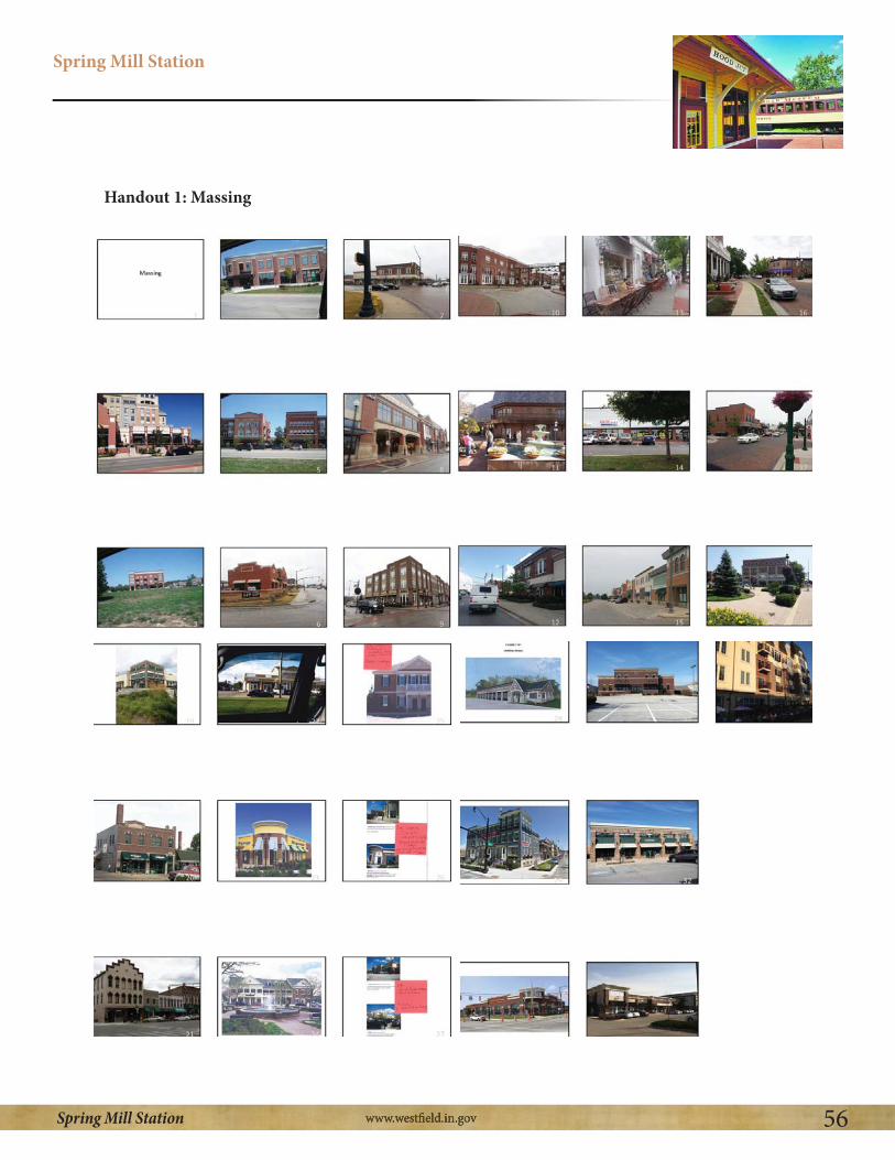
Spring Mill Station
56Spring Mill Station
Handout 1: Massing

Spring Mill Station
57Spring Mill Station
Handout 2: Setbacks

Spring Mill Station
58Spring Mill Station
Handout 3: Architecture

Spring Mill Station
59Spring Mill Station
Appendix D – Charrette 4: Transitions and Vehicular Access
161st/Spring Mill PlanCharrette #4 SummaryAugust 14, 2013
The meeting began with a review of the connected vs. protected discussion regarding alternative access to the study area that was also safe. The group agreed protection was relating to preserving property values and traffic calming measures to ensure pedestrian safety and connection dealt with both getting to and from the site as well social connections that occur once on site.
Buffering/Transition Areas
The group then discussed buffering and transition methods in the study area and were handed an exhibit of aerial images depicting various Hamilton County developments for the purpose of commenting on preferences and dislikes. The group first identified three areas within the study boundary that would require special attention on buffering and transition. The first area was the
The group was interested in maintaining the existing tree line and keeping a 50 foot buffer in that location to aid as a sound and visual barrier. The next area was the Mulberry Farms homes that bordered the airport strip in the south east quadrant. The group was interested in maintaining a 150 foot buffer from those homes. Lastly, the area bordering Crosswinds Commons residential subdivision on the southwest quadrant was identified as a sensitive area.
Buffer Preferences/Concerns
After reviewing the aerial image exhibit, the group identified buffer preferences to prevent commercial creep in the study area. The group focused on a context sensitive design for the buffer areas meaning different areas could be more or less intense than others. The group agreed that along a residential area a solid fence as a buffer could serve well for security reason. However, a solid fence would not be appropriate when an existing residential area abuts a new residential area. The group preferred buffers that would minimize noise, provide visual screen, serve a year round function, use native landscaping when possible, and lastly have a taller buffer when abutting taller buildings. The group was concerned about flat, unbroken, monotonous fences that tend look poorly.
Site Plan Renderings
The group then reviewed several artist renderings of what the proposed development could look like based on the input from the three previous charratte meetings. The rendering were not detail oriented and intended to serve as a basis of discussion for which concepts the group liked and disliked

Spring Mill Station
60Spring Mill Station
as well as variations in road network layout. The group reviewed a connectivity plan and reaffirmed the preference for a high level of trail connections to the site from surrounding neighborhoods. The group also expressed an interest in an alternative road network that includes a roundabout configuration located further south than the existing intersection and creating four new corners at 161st and Spring Mill. Lastly, the group reaffirmed the preference for a “village green” style park amenity with common areas and buildings front on the park and wanted to see how this design could work on other corners.
1) Transitions/Bufferinga. Connected vs protected
i. The group discussed the concept of protected vs connected and agreed upon the following:
1. Protected:a. Preserve property value
b. Traffic calming (bending roads etc)2. Connected:
a. Social connectivity in the study area b. Pedestrian connectivity in the study area
b. Blending/Transition
ii. The group discussed the following areas as being more sensitive to buffer design:
a. Preservation of trees along boundary to serve as visual and sound barrier, 50’ buffer preferred (including trees) 2. Mulberry Farms (SE quadrant residential boundary) a. Maintaining a 150’ buffer between residential area potential com
mercial area to north. 3. Crosswind Common Subdivision (SW quadrant-residential boundary) a. Maintaining a considerable buffer between residential area and
potential commercial area.
iii. The group discussed the following items as being preferences for buffer areas:
1. Elevation changes 2. Minimizing sound impacts 3. Creating visual screen 4. Combination of evergreen and shade trees 5. Year round function 6. Strong growth rate for landscaping (trees) 7. Taller buildings require taller buffer blocks 8. Native plantings where appropriate. 9. Context sensitive design (berms that have pedestrian connectivity thru

Spring Mill Station
61Spring Mill Station
them)
iv. The group had the following concerns for buffer areas: 1. Fences that are long, unbroken, and lacking character a. Fences of this style could be ok when serving as security bound ary along a residential area
v. The group discussed keeping the “Spring Mill Station” railroad theme even throughout the buffer transition areas when appropriate. The group agreed that thematic areas tended to develop with more mature and higher quality landscaping and hardscaping than non-themed area.
c. Site Plan Rendering
i.The group reviewed four conceptual renderings of the study area based on input from the previous charrettes. 1. The group preferred an exhibit showing an alternative road layout that installed a roundabout off center from existing intersection creating four
new corners. a. The following reasons were identified as why this approach was
preferred:i. Natural traffic calming
ii. Develop all corners to build how group would prefer iii. Simplifies amount of landowners involved 2. The group also preferred a design showing “slip lane” parking off Spring Mill Road and 161st that fronted onto a village green concept. The group asked to see more variations of this design on other corners. 3. The group also preferred a connectivity plan that showed trails along all roads and buffer areas and included connectivity to surrounding neighbor
hoods.

Spring Mill Station
62Spring Mill Station
Spring Mill Station PlanCharrette 4 Discussion Outline – Transitions & Vehicular AccessAugust 14, 2013(6:30 PM – 8:30 PM)
1. Transitions/Buffering: a. Connected and Protected: Review & Discussion [HANDOUT #1] b. Connecting: Review and Confirmation of Strategy
c. Protecting:i. Blending/Transitioningii. Buffering/Preventing Commercial Creepiii. Transition Methods [HANDOUT #2]
1. Distance/Space2. Improvements
a. Landscapingb. Mounds/Bermsc. Hardscapes/Walls/Fences
3. Adjacent Buildings/Design/Scale/Architecture2. Vehicular Access/Circulation:a. Quick Reviewb.Review Exhibits
i. Preliminary Draft Design [HANDOUT #3]ii. Connectivity Plan [HANDOUT #4]iii. Alternative Road Configuration [HANDOUT #5]iv. Village Green Concept [HANDOUT #6]c. Discuss Preferences/Observations
Protected vs Connected Discussion
Ability to walk to commercial areasCan I get there safely Synergy across the different developmentsPreservation of existing mature tree in the areaPedestrian path networkWell planned transitions between commercial and residential areas Foot and bike connectivity

Spring Mill Station
63Spring Mill Station
Appendix E – Charrette 5: Rail Road Era Architecture and Design
161st/Spring Mill PlanCharrette #5 Rail Road Era Architecture and DesignSeptember 25, 2013
The meeting began with a review of the first draft of the Spring Mill Station Plan prepared by staff. The draft was a text only version of the document and an attempt to capture the essence of the key points, ideas, and concepts of the first four planning charrettes. The group reviewed document commenting on various concepts and points that needed to be expanded or clarified upon going forward.
Next the group discussed how they would like to incorporate the railroad design concepts into the common area, public right-of-way, as well as building design and architecture. The group was given a handout of images broken into three categories being: 1) Railroad Public Art 2) Railroad Theme Architecture (elements and ornamentation) 3) Architecture Quality and Form
The group agreed nearly all the images should be included in the Spring Mill Station plan as examples of the type and quality of development they would like to see in the area. For each of the three categories, the following elements were identified as being desired in the study area:
Public Art (Desired Features)1) Images did good job encapsulating desire and intent of public art2) Water tower feature 3) Railroad style public furnishings (i.e., benches, pergolas, playscapes) 4) Use of red/black/rust colors 5) Use of old railroad track or steam engine as part of common area
Railroad Theme Architecture1) Verge board (gingerbread style detail)2) Gables roofs (steep pitch)3) Strut detail4) Mixed colors and stacked elements5) Windows and panes6) Towers/cupolas7) Different architecture elements8) Arches9) Mix of brick and wood10) Window accents

Spring Mill Station
64Spring Mill Station
Architecture Quality and Theme1) See pictures included in Architecture section for Railroad era design
The group then discussed the process for going forward with the plan in regards to modifications, meeting with developers, and holding a public hearing. The group decided there should be an open house for the community to discuss the plan and receive feedback. The group also decided to meet with interested developers in the future to judge feedback and make adjustments as necessary. Lastly, the group reviewed two new site plan concepts that were prepared for the group based off previous input. Going forward, the group would like to show these potential plans at the open house and with developers to judge feedback and identify preferences for the layouts. Both designs stress the importance of interconnectivity from a bike standpoint and pedestrian standpoint and address buffer concerns around the entire Spring Mill Station Planning Area.
Spring Mill Station meeting
Ability to walk to commercial areas Can I get there safely Synergy across the different developments Preservation of existing mature tree in the areaPedestrian path network Well planned transitions between commercial and
residential areas Foot and bike connectivity

Spring Mill Station
65Spring Mill Station
Handout # 2 Transition Methods

Spring Mill Station
66Spring Mill Station

Spring Mill Station
67Spring Mill Station
Handout # 3 Preliminary Draft Design
Handout #4 Connectivity Plan

Spring Mill Station
68Spring Mill Station
Handout #5 Alternative Road Configuration
Handout #6 Village Green Concept

Spring Mill Station
69Spring Mill Station
Appendix E - Charrette 5: Rail Road Era Architecture and Design
161st/Spring Mill PlanCharrette #5 SummarySeptember 25, 2013
The meeting began with a review of the first draft of the Spring Mill Station Plan prepared by staff. The draft was a text only version of the document and an attempt to capture the essence of the key points, ideas, and concepts of the first four planning charrettes. The group reviewed document commenting on various concepts and points that needed to be expanded or clarified upon going forward.
Next the group discussed how they would like to incorporate the railroad design concepts into the common area, public right-of-way, as well as building design and architecture. The group was given a handout of images broken into three categories being: 1) Railroad Public Art 2) Railroad Theme Architecture (elements and ornamentation) 3) Architecture Quality and Form
The group agreed nearly all the images should be included in the Spring Mill Station plan as examples of the type and quality of development they would like to see in the area. For each of the three categories, the following elements were identified as being desired in the study area:
Public Art (Desired Features)
1) Images did good job encapsulating desire and intent of public art2) Water tower feature 3) Railroad style public furnishings (i.e., benches, pergolas, playscapes) 4) Use of red/black/rust colors 5) Use of old railroad track or steam engine as part of common area
Railroad Theme Architecture
1) Verge board (gingerbread style detail)2) Gables roofs (steep pitch)3) Strut detail4) Mixed colors and stacked elements5) Windows and panes6) Towers/cupolas7) Different architecture elements8) Arches9) Mix of brick and wood10)Window accents

Spring Mill Station
70Spring Mill Station
Architecture Quality and Theme
1) See pictures included in Architecture section for Railroad era design
The group then discussed the process for going forward with the plan in regards to modifications, meeting with developers, and holding a public hearing. The group decided there should be an open house for the community to discuss the plan and receive feedback. The group also decided to meet with interested developers in the future to judge feedback and make adjustments as necessary. Lastly, the group reviewed two new site plan concepts that were prepared for the group based off previous input. Going forward, the group would like to show these potential plans at the open house and with developers to judge feedback and identify preferences for the layouts. Both designs stress the importance of interconnectivity from a bike standpoint and pedestrian standpoint and address buffer concerns around the entire Spring Mill Station Planning Area.
Charrette #5 Discussion Outline – Draft #1 ReviewSeptember 25, 2013(6:30 PM – 8:30 PM)
1.Review Spring Mill Station Plan Text1) Executive Summary2) Overview3) Chronology of Related Events4) Recent Events5) Planning Area6) Identity – “Spring Mill Station7) Land Uses8) Architecture and Site Design
i. Discuss Railroad theme Pictures for Public Art, theme example (elements and ornamentation), arch quality and form (HANDOUT #1)
9) Transitions and Buffering10)Access and Circulation 11)Stakeholder Feedback12)Policy Recommendations13) Going Forward14) Appendices
2. Review Spring Mill Station Concept Plan(a) Plan A (HANDOUT #2)(b) Plan B (HANDOUT #3)
3. Strategy Regarding Development Input4. Strategy Regarding Community Input 5. Process/ Timing

Spring Mill Station
71Spring Mill Station
Railroad Public Art
1 2 3 4
5 6 7 8
9 10 11 12
Railroad Theme examples (elements and ornamentation)
13 14 15 16
Handout #1 Rail Road Era public art, thematic examples and architecture quaility and form

Spring Mill Station
72Spring Mill Station
17 18 19 20
21 22
Architecture Quality and Form
by Windows User
23 24
25 26 27 28
29 30

Spring Mill Station
73Spring Mill Station
Handout #2 Spring Mill Station Concept Plan A

Spring Mill Station
74Spring Mill Station
Handout #3 Spring Mill Station Concept Plan B

Spring Mill Station
75Spring Mill Station
Appendix F - Charrette 6: Stakeholder Meeting Feeback
161st/Spring Mill PlanCharrette #6 Stakeholder Meeting Feedback
Stakeholder Concerns:1. Find the balance between groups desires/marketplace realities2. Opposed to any rerouting or recirculation of roads that will impact site lines, accessibility, parking traffic flow, and overall convenience of existing shopping center3. Opposed to any change of the existing 161st and Spring Mill Road
a. Time to obtain approval and agreementsb. Expense of relocating utilities and infrastructure, legal fees, design
4. Cost of reaching Spring Mill Station vision increase costs for the retailer to enter the market
a. Now competing on national marketplace not regional dollars, more hurdles equals less likely to enter marketplace
5. Both conceptual plans not realistic for development on SW corner. a. Too different national retailers prototype plan (ex. access, convenience, efficiency, traffic/shopping patterns, behaviors, other factors)
6. Demand for “office” is weak (potential for garden offices, but more long term prospect)7. Village Green: Park on SW corner is non starter; most valuable land used for a park, not a benefit to Westfied (economic opportunity/value) 8. Concept plan 1 (4.1) is not workable do to extraordinary infrastructure costs (question practicality, achievability)9. Concerns with Concept Plan 4.2
a. Construction: Clients not interested in the construction of buildings along the street (massing on street)b. Parking: 2 rows of parking between building is necessity (can be mitigated by landscaping and hardscapes)c. Drive-thrus: Prohibition would be problematic as heavy demand for the type of uses SS desires
Stakeholder Affirmations:1. Majority of the principles of the plan2.Agreement and support of proposed areas of plan, name of plan, theme, and general design, uses3. Upgraded architectural design: National retailers likely to stretch in this aspect vs others.4. Landscaping

Spring Mill Station
76Spring Mill Station
5. Apartments- Demand for this type of use at this location6. Concept Plan (4.2)
a. Buffering: unified and consistent landscape planb. Connectivity: extensive connectivity with provision of safe access to, from, around the development. Traffic flow beneficial to pedestrian and automobiles c. Identity and Theme: Conformity to railroad federalist arch; creation of marquee elements at SE corner, such as clock towerd. Architecture: Use of variable and high quality materialse. Road improvements: Contribution to roundabout construction and required ROWf. Community: Design of hardscape elements to promote public space

Spring Mill Station
77Spring Mill Station
Appendix G – Charrette 7: Public Open House
161st/Spring Mill PlanCharrette #7 Public Open HouseDecember 11, 2014
A public open house was held for the community to review and provide comment regarding the Spring Mill Station Study Groups work to date. Over 100 individuals attended the open house and provided comment as summarized below. The attendees were presented with two (2) handouts:
1) HANDOUT #1 (Spring Mill Station Display Boards)2) HANDOUT #2 (Spring Mill Station Narrative Description)
Public Open House Comments:
Community Residents Affirmations:1. Whole Spring Mill Station concept and holistic planning 2. Concept Plan A (4.1)- Nice town center feel, roundabouts, unique feel, different character to area, relaxed and people friendly3. Spring Mill Station “theme” and “architecture” 4. Pedestrian connectivity 5. Buffer areas 6. Prefer conceptual plan B (4.2)7. Railroad thematic architecture 8. Hardware store9. Interconnected planned areas with trails, natural boundaries 10. Walgreens has shown in other cities they will commit to arch change
Community Residents Concerns:1. Noise: trash pickup/delivery2. Tree preservation at Mulberry Farms3. All owners should be notified of planning process4. Drive thrus- should be permitted due to needs of older people and parents5. Building Height - 3 stories too tall for area6. Safety: Pedestrian paths to close to roads; village green could be gathering place for teens7. Straight streets, not curved streets8. Fencing 9. Buffer Yard- lack of mature vegetation10.Water/drainage- water retention should be “rain gardens” for mitigation11. Environmental concerns-water retention “rain gardens”, surface color parking lots (temp), building arrangement (wind flow)12. Concept A- too costly and time consuming13. CrossRoads property- should not be used as gas station (bank appropriate use)14. Gas station: concerns of lights, noise15. Crime: reduce number of multi-family apartments
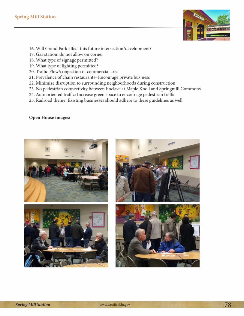
Spring Mill Station
78Spring Mill Station
16. Will Grand Park affect this future intersection/development?17. Gas station: do not allow on corner18. What type of signage permitted?19. What type of lighting permitted?20. Traffic Flow/congestion of commercial area21. Prevalence of chain restaurants- Encourage private business 22. Minimize disruption to surrounding neighborhoods during construction
24. Auto oriented traffic: Increase green space to encourage pedestrian traffic25. Railroad theme: Existing businesses should adhere to these guidelines as well
Open House images:

Spring Mill Station
79Spring Mill Station
Handout #1 Spring Mill Station Display Boards
“Spring Mill Station”
Planning Area & Identity 1.2
Desire for:
A
B
CD
Neighborhood Hub
Neighborhood Branding
Thematic/Consistent Design
Build off City Planning Initiatives
Railroad styleCanopy
VillageGreen
Railroad InspiredArchitecture
SPRING MILL
STATION
SPRING MILL
STATION
“ ”

Spring Mill Station
80Spring Mill Station
Land Use & Urban Design 2.1
Land Use
SPRING MILL
STATION
Outdoor Restaurants
Banks Food & Beverage/Office
Single Family Housing Multi-Family Housing
General Retail (unique)Convenience Retail Sales
Neighborhood Retail Sales
Restaurants
Food and Beverage Retail Sales
General Retail Sales
Administrative and Professional Services
Financial, Medical, & Personal Services
Multi-Family housing
Assisted Living Facilities
Single Family Housing
(Pharmacy, Neighborhood Grocery, Drug Store)
(Restaurants (focus on original & unique), Ice Cream Shops, Pizza Shops)
(Groceries or Delicatessens)
(Professional, Executive, Management or Administrative Services)
(Boutique Stores, Apparel Stores, hardware Stores, Specialty Stores)
(Banks, Insurance Offices, Medical and Dentist Offices)
(Apartments, Condos)
Land Use & Urban Design 2.2
Urban Design
Context Sensitive Design
Neighborhood Hub Concept (Impromptu Interactions)
Village Green
Mixed-Use Buildings Surrounding Village Green
Building Massing Along Street
Heightened Pedestrian Connectivity
Quality Design With Public Amenities
Large Buffer Areas with Pedestrian Connectivity
Thematic Design and Consistent Architecture
Village Green w/ Mixed Use Massing on Street
Pedestrian ConnectivityPublic Amenities
Context Sensitive Design Quality Design
SPRING MILL
STATION

Spring Mill Station
81Spring Mill Station
Thematic Architecture 3SPRING MILL
STATION
Conceptual Plans 4.1
Conceptual Plan “A”
SPRING MILL
STATION
Enclave at Maple Knoll
Mulberry Farms
Countryside
Crosswind Commons

Spring Mill Station
82Spring Mill Station
Conceptual Plans
Conceptual Plan “B”
4.2SPRING MILL
STATION
Enclave at Maple Knoll
Mulberry Farms
Countryside
Crosswind Commons
Connectivity and Buffering 4.3SPRING MILL
STATION
Enclave at Maple Knoll
Mulberry Farms
Countryside
Crosswind Commons
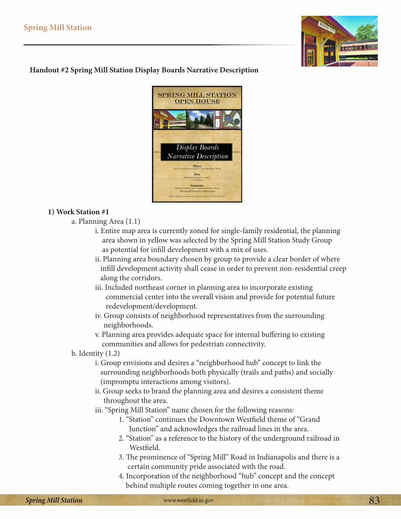
Spring Mill Station
83Spring Mill Station
1) Work Station #1a. Planning Area (1.1)
i. Entire map area is currently zoned for single-family residential, the planning area shown in yellow was selected by the Spring Mill Station Study Group as potential for infill development with a mix of uses. ii. Planning area boundary chosen by group to provide a clear border of where infill development activity shall cease in order to prevent non-residential creep
along the corridors. iii. Included northeast corner in planning area to incorporate existing commercial center into the overall vision and provide for potential future redevelopment/development. iv. Group consists of neighborhood representatives from the surrounding
neighborhoods. v. Planning area provides adequate space for internal buffering to existing
communities and allows for pedestrian connectivity.b. Identity (1.2)
i. Group envisions and desires a “neighborhood hub” concept to link the surrounding neighborhoods both physically (trails and paths) and socially (impromptu interactions among visitors). ii. Group seeks to brand the planning area and desires a consistent theme
throughout the area. iii. “Spring Mill Station” name chosen for the following reasons: 1. “Station” continues the Downtown Westfield theme of “Grand
2. “Station” as a reference to the history of the underground railroad in Westfield. 3. The prominence of “Spring Mill” Road in Indianapolis and there is a certain community pride associated with the road. 4. Incorporation of the neighborhood “hub” concept and the concept behind multiple routes coming together in one area.
Handout #2 Spring Mill Station Display Boards Narrative Description
Spring Mill StationOpen House
Display Boards Narrative Description
Where:
Date:
Comments:

Spring Mill Station
84Spring Mill Station
2) Work Station #2
a. Land Use (2.1) i. Planning area envisioned to serve the needs of the local community (not a regional draw) and reduce the need to travel across the community fulfill basic
needs.ii. Heavy preference for additional restaurants and outdoor eating areas.iii. Heavy preference for “unique” style of stores/restaurants in the planning area.iv. Desired uses:
1. Neighborhood Retail Sales: (for example: neighborhood grocery and drug store, restaurants, groceries/delicatessens, hardware stores, bikes shops, hobby shops) 2. Administrative and Professional Services: (for example: legal offices,
engineering offices, architects office)3. Business Services: (for example: local bank branch, finance and real estate office, medical office)4. Personal Services: (for example: photography studio, dry cleaner) 5. Desire for community meeting facility as most of the surrounding neighborhoods do
not have a facility of their own. 6. Multi-Family Living: Multi-Family could be incorporated in a context sensitive
manner throughout the site (2-3 stories)7. Assisted Living: (same as multi-family)8. Single-Family Housing: Appropriate where supported by marketplace
b.Urban Design (2.2)i. Context Sensitive Design: Design buildings in accordance with and of similar scale to buildings and neighborhoods in surrounding area in order to blend into the existing
environment.ii. Neighborhood “Hub” Concept: A high activity area located in the heart of Spring Mill Station that is well connected to surrounding neighborhoods, by pedestrian paths to allow for impromptu interactions between residents, featuring public
amenities to enhance the area.iii. Village Green: An amenity filled park built into the development that would be a comfortable place for visitors to congregate/relax/play, etc. The area is envisioned to be heavily landscaped and feature public art components. iv. Mixed Use on Village Green: Buildings fronting on the village green to activate the green space and enable restaurants to have outdoor seating/patio space integrated into
the overall design.v. Building Massing on the street: The intersection of 161st Street and Spring Mill Road is envisioned to have buildings constructed along the right-of-way of the street and not to have a typical auto oriented design of a sparsely landscaped parking lot in front of the building. A small single lane of parking (slip lane) could be integrated in front of the buildings with landscaping (similar to Clay Terrace). The buildings

Spring Mill Station
85Spring Mill Station
are envisioned to be no taller than 1.5 to 2 stories on the corner of the intersection. vi. Heightened Pedestrian Connectivity: Strong emphasis on providing pedestrian connectivity though trails both throughout the planning area and also connecting to the existing residential neighborhoods that surround Spring Mill Station. vii. Large Buffer Areas: Providing large buffer areas to protect surrounding
neighborhoods from potential negative impacts of noise, light, traffic, smell, etc. from the use of tree plantings, berms, and length of open space.viii. Thematic Design: Use components of railroad era design across the entire planning
area.
3) Work Station #3
a. Thematic Railroad Era Architecture (2)i. Spring Mill Station: Building off the railroad inspired name and applying a thematic railroad era design across the entire planning area to provide a consistent and timeless feel and to eliminate typical franchise architecture. Also provides for coordinated development instead of different themes for each individual project that is brought forward. ii. Architectural Elements: Incorporate elements of railroad era architecture such as verge boards, gabled roofs, struts, use of colors, window fenestration, windows and panels, towers/cupolas, undulating facades, and built to a pedestrian scale. The architectural elements allow for easy way to make this area distinct from typical
commercial/residential developments. iii. Public Art: Provides another methods to apply consistent design across the planning
area with rail inspired public art that can be used as an amenity. Examples include bench covers and bike racks, water towers, murals, clock towers, and other sculptures related to railroads.
4) Conceptual Plansa. Overview
i. Both conceptual plans are consistent with the vision of “Spring Mill Station” and incorporate a heavy reliance on pedestrian connectivity paths, large
buffering areas from existing neighborhoods, the neighborhood “hub” concept and village greens. ii. Each conceptual plan represents ONE possible build out scenario showing how this area could potentially develop in the future. There are possibly an unlimited number of build out scenarios which, if created, would accomplish
the Spring Mill Station vision. b. Conceptual Plan “A” (4.1)
i. Incorporates a rerouting of 161st Street and Spring Mill Road that shows the neighborhood “hub” in center of the planning area.
c. Conceptual Plan “B” (4.2) i. Incorporates a more traditional street layout and roundabout with the village

Spring Mill Station
86Spring Mill Station
green concept on the southwest corner of the planning area. The plan also depicts buildings being constructed close to the right-of-way with a slip lane of parking. d. Buffering and Connectivity (4.3)
i. Highlights pedestrian paths and buffer areas with image depictions of what those areas could look like. ii. Highlights some basic concepts incorporated into both plans.

Spring Mill Station
87Spring Mill Station
Appendix H– Charrette 8: Developer Feedback
161st/Spring Mill PlanCharrette #8 Developer Feedback
The Spring Mill Station Group met with several developers who were not current stakeholders in the study area in order to garner feedback regarding the Spring Mill Station Plan. The developers were given the Spring Mill Station display board handout and narrative description handout (found in Appendix G) from the public open house to review prior to the meeting. Listed below is a summary of the key concepts the Spring Mill Station group received from the developers:
Key Points:
1) Trail access that connects not only to the planning area, but to the overall trail network is a must.
2) Strike a balance between the cost of reaching the thematic design concepts without overpricing the market for rental prices. Consider allowing developers more square footage in order to meet design requirements.
3) Consider adding public buildings (government buildings, etc.) throughout the planning area to increase more pedestrian traffic.
4) Having multiple land owners increase difficulty of achieving overall vision.5) The land uses proposed are vehicular intensive, careful consideration should be given to how
promote pedestrian connections. 6) For buildings constructed on hard corners of intersection, strike a balance between community
and developer objectives by creating an untypical design, but allow retailer to have a presence so community is aware of business location.
a. Two entrance design can be difficult for retailers to orient business for point-of- sale inside building.7) Building standards and hard rules for development are helpful for developers to understand
what they can/cannot build.8) How the financing would be achieved for the village green and how costs would be shared is
something important to consider. The park can add value for certain users in its proposed location on the intersection.
a. The village green could also be located in an alternative manner to incorporate buffer areas and provide more of linear park along the road.9) Stronger focus on integration to the existing, surrounding land uses.10) Potential pedestrian bridge incorporating railroad elements for better pedestrian connectivity.
Pedestrian tunnels could also be incorporated for main thoroughfares.
Quality Apartment Development in planning area:

Spring Mill Station
88Spring Mill Station
1) Density should be encouraged in the planning area, as high as 30 units per acre. 2) An apartment community of less than 200 units is not conducive due to economies of scale. 3) Heights of buildings should be limited by number of stories, not actual height, in order to
encourage flexibility in design.4) Buildings should be allowed to be constructed on the street and have on-street parking. Parking
should be hidden and out of sight as much as possible.5) Building location should encourage informal human interaction and allow for pocket park
development.6) Pedestrian walkways should provide easy and safe access to other areas within the overall plan.
Concept A
1) Lacks a sense of arrival when driving through the planning area.2) Visibility is poor on the intersections when inside the planning area.3) Design is suitable for achieving many of the quality apartment design objectives. 4) Street layout allows for safer pedestrian access which will in turn help all businesses in planning
area.5) Cost of the street network would be too great for any one developer and would require
additional development support from a funding source like Tax Increment Financing.
Concept B
1) Established a sense of arrival when driving through planning area. 2) The village green on the corner creates a non-traditional intersection that is unique.3) Retailers will react better to this design concept over design concept A.4) More roundabouts could be incorporated to slow traffic thru planning area and also add more
public space.5)Additional flexibility should be considered for buffer areas. Surrounding land uses should dictate
buffer distance. Could be a benefit for a reduced buffer distance to the baseball fields on west side of planning area.
6) The preliminary layout of the apartment buildings are not very conducive for creative design or for achieving the critical mass of apartments that is desirable.