role of space geodesy in geoss timothy h. dixon university of miami/rsmas and center for...
TRANSCRIPT
Role of Space GeodesyIn GEOSS
Timothy H. Dixon
University of Miami/RSMASand
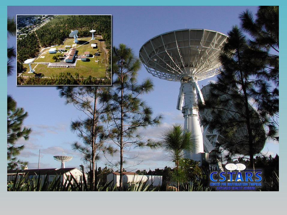
Center for Southeastern Advanced Remote Sensing(CSTARS)
Contributions from:
Jean Dickey (JPL) Jeff Freymueller (University of Alaska) Kristine Larsen (University of Colorado) Falk Amelung, Shimon Wdowinski, and Noel
Gourmelen (University of Miami)
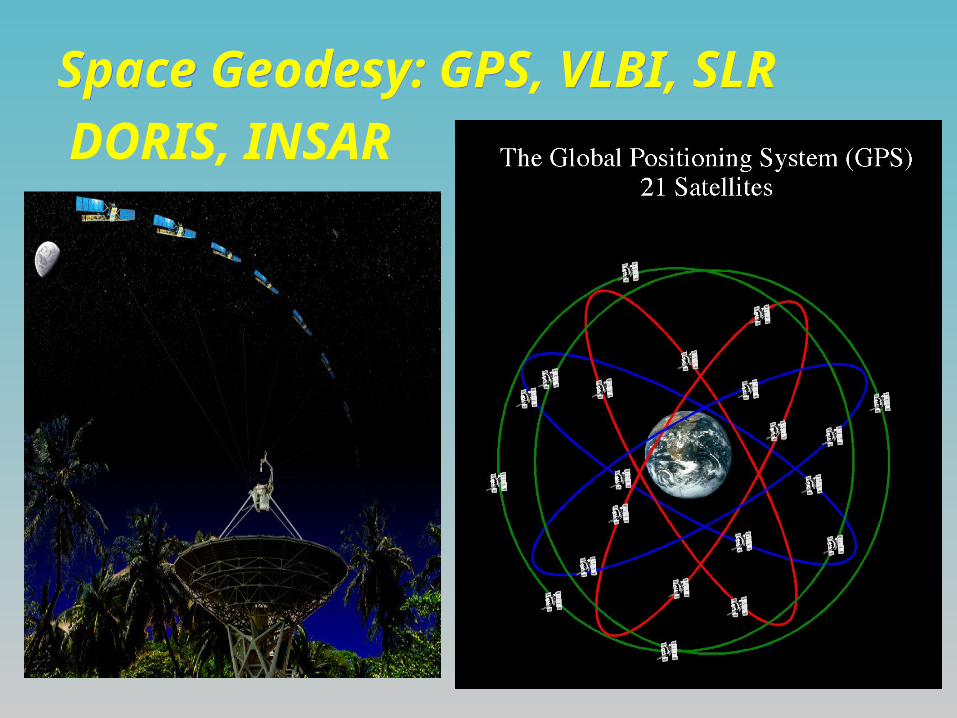
Space Geodesy: GPS, VLBI, SLR Space Geodesy: GPS, VLBI, SLR
DORIS, INSAR
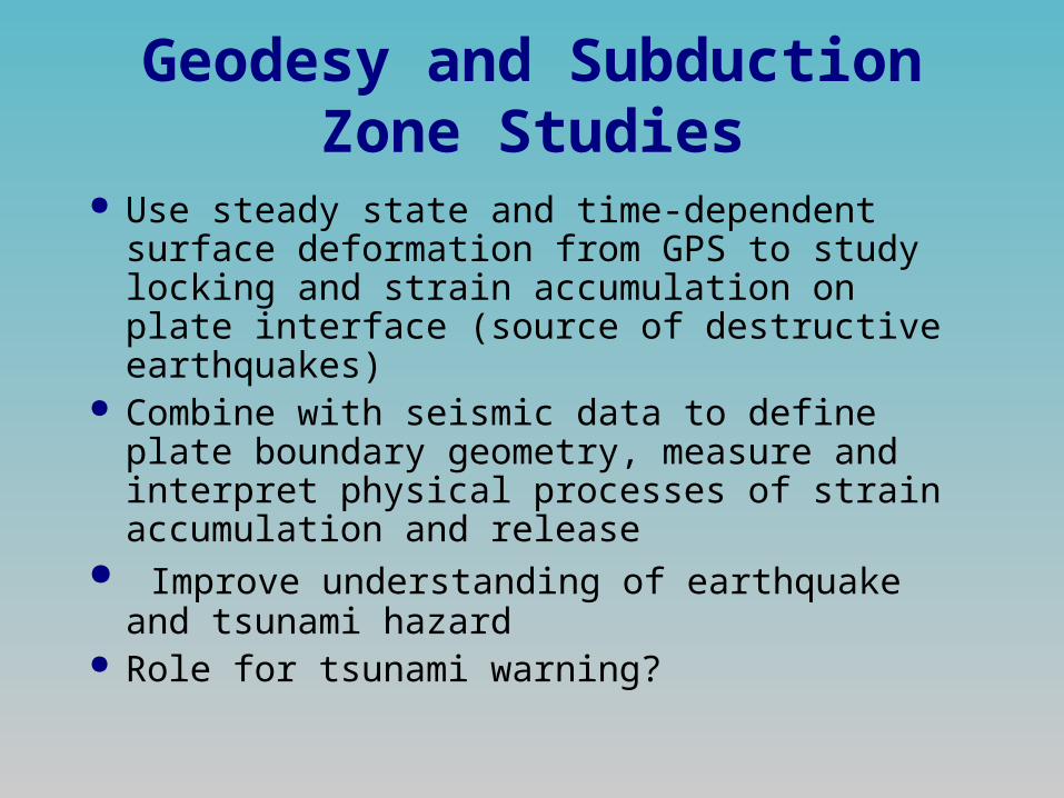
Geodesy and Subduction Zone Studies
Use steady state and time-dependent surface deformation from GPS to study locking and strain accumulation on plate interface (source of destructive earthquakes)
Combine with seismic data to define plate boundary geometry, measure and interpret physical processes of strain accumulation and release
Improve understanding of earthquake and tsunami hazard
Role for tsunami warning?
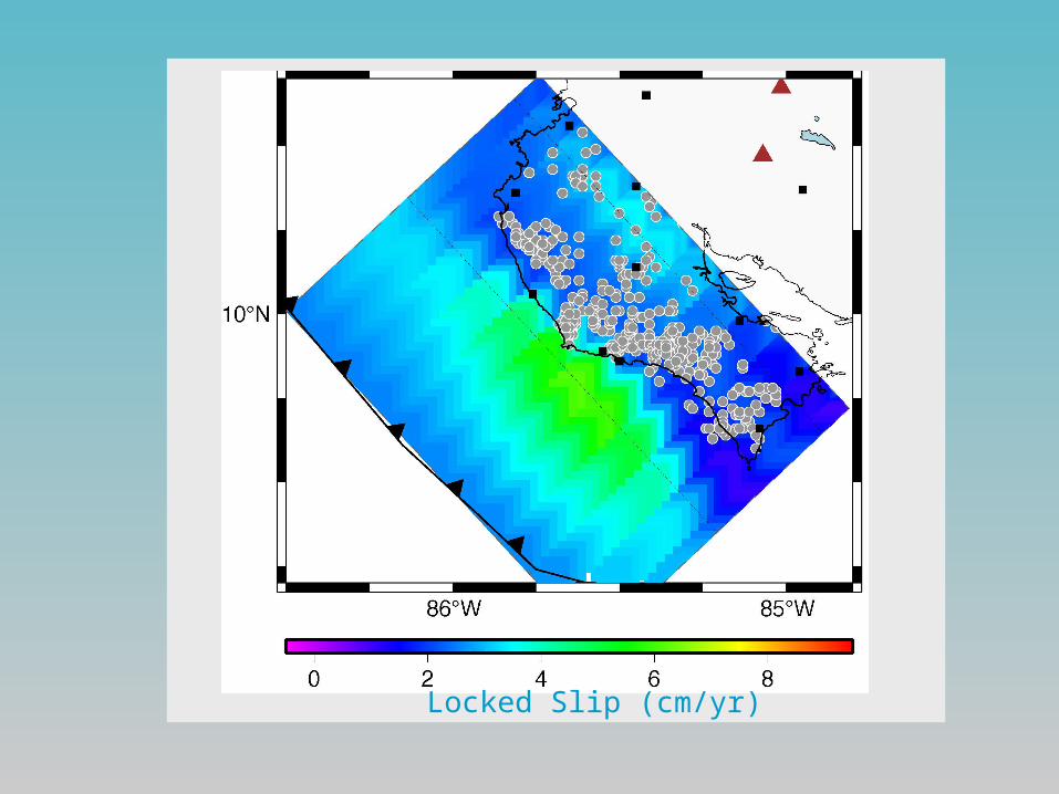
Locked Slip (cm/yr)

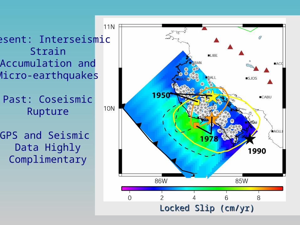
Plate Interface Locking vs Microearthquakes
LL
Locked Slip (cm/yr)Locked Slip (cm/yr)
Present: InterseismicStrain
Accumulation andMicro-earthquakes
Past: CoseismicRupture
GPS and Seismic Data Highly
Complimentary

Role for GPS in Seismic/Tsunami Hazard?
Pre-seismic strain transients are rare or non-existent
Present strain accumulation rate can be related to size and timing of future strain release (earthquake)
Possible GPS role in tsunami warning, via accurate, rapid earthquake magnitude estimation

GPS Can Measure Magnitude… within minutes
Final Static Displacement
F. Kimata, Nagoya University
Rapid, accurate magnitude estimation is difficult for largest earthquakes
High precision GPS receivers measure displacement, very sensitive to earthquake magnitude
Can estimate magnitude from only a few sites
But need to have data from sites near the earthquake in real-time, hypocenter (from short period data) and a system for real-time analysis.
Will require a real-time subduction zone network

Other Applications of High-rate GPS
GPS is sensitive to displacement rather than acceleration.
GPS can measure dynamic response of Earth’s surface to earthquakes, landslides and volcanic eruptions
GPS does not saturate for large signals, can augment strong motion networks
Can be done in real-time

2002 November 3 Denali Earthquake
Eberhart-Phillips et al., 2003
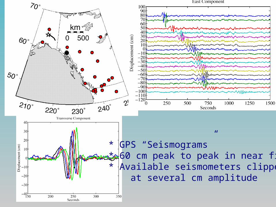
* GPS “Seismograms”* 60 cm peak to peak in near field* Available seismometers clipped at several cm amplitude
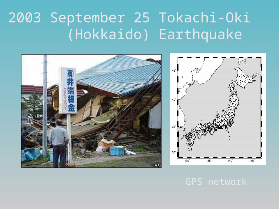
2003 September 25 Tokachi-Oki (Hokkaido) Earthquake
GPS network

Acceleration vs. Displacement
Seismic rupture model from GPS data (Miyazaki et al., 2004)
Miyazaki et al., 2004
QuickTime™ and aGIF decompressor
are needed to see this picture.

Geodesy and Volcano Hazard Assessment
Most volcanoes undergo inflation days to months prior to eruption
Hazard Mitigation Strategy: monitor surface deformation for long term eruption precursors
Quantify Pressure build-up; is it dangerous yet? Challenges: data quality, data density (time/space),
data “latency” (how fast to the lab?) Role for near-real time GPS and INSAR
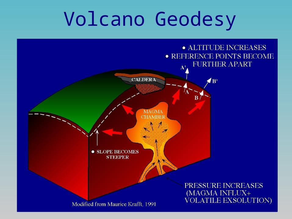
Volcano Geodesy

Vertical Component (N-S)


InSAR Challenges
Most SAR data are C-band (6 cm wavelength) which decorrelates rapidly
L-band (24 cm wavelength) is better for most terrestrial applications involving change detection via interferometry
Most SAR systems are commercial, or otherwise have restricted data availability
Most SAR systems have no or limited DDL capability, hence no or limited real time capability
Synergetic Applications Relevant to GEOSS
INSAR can be used to measure water levels in vegetated wetlands, soil moisture, and biomass
GPS can measure atmospheric water content GPS and INSAR requires terrestrial reference
frame definition and maintenance (SLR, VLBI, DORIS); this “behind the scenes” effort yields important global geophysical data
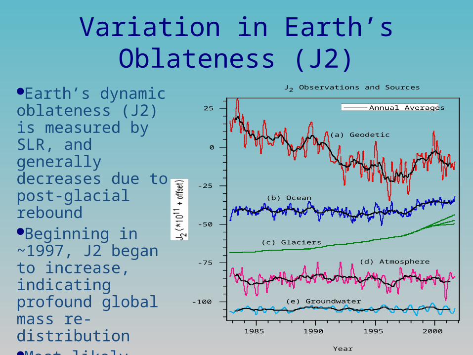
Variation in Earth’s Oblateness (J2)
1985 1990 1995 2000
-100
-75
-50
-25
0
25
Year
J 2 Observations and Sources
(a) Geodetic
(b) Ocean
(c) Glaciers
(d) Atmosphere
(e) Groundwater
Annual Averages
Earth’s dynamic oblateness (J2) is measured by SLR, and generally decreases due to post-glacial reboundBeginning in ~1997, J2 began to increase, indicating profound global mass re-distributionMost likely cause is melting of sub-polar alpine glaciers (Dickey et al., 2003)

Conclusions Space geodetic data are useful for monitoring
dynamic solid earth effects associated with climate change, earthquake and volcano processes
Space geodetic data may augment warning systems for volcanic eruption (GPS+INSAR) and tsunami (GPS) if available in real-time
For GPS, lack of dense coverage in subduction zones is a problem
For INSAR, cost and rapid availability of data is a problem (needs to be like GSN/FDSN!)