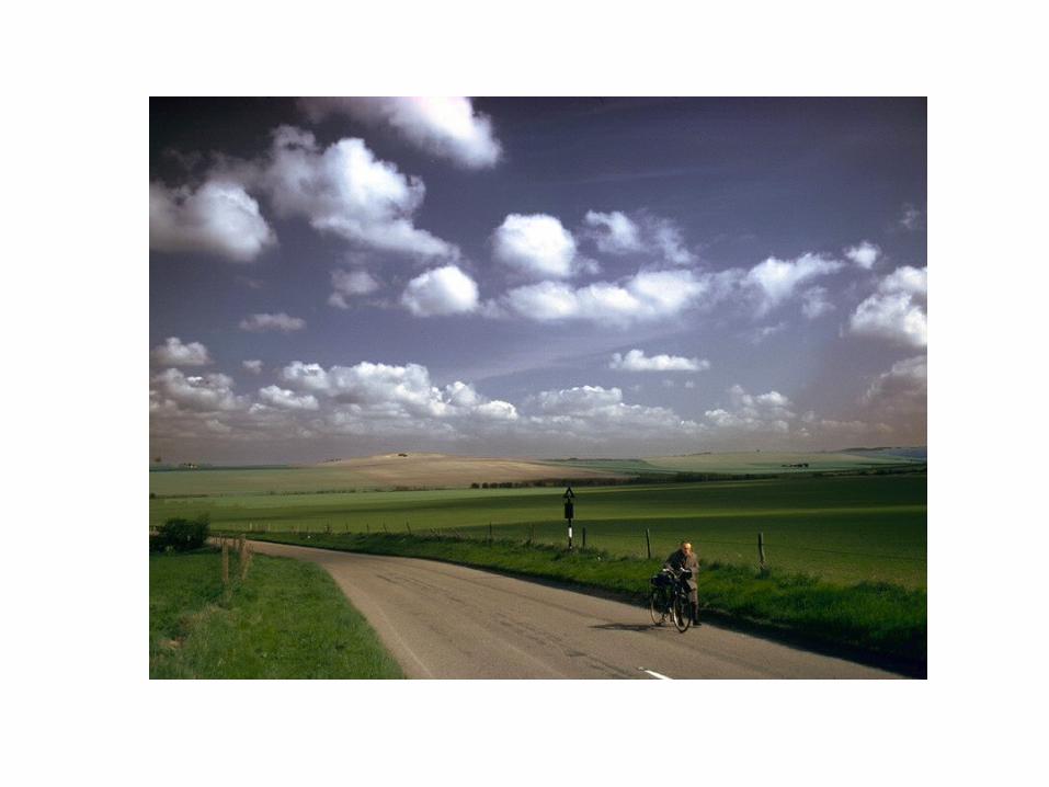
roll or arcus cloud squall lines
Post on 22-Dec-2015
232 views
TRANSCRIPT


Roll or Arcus Cloud


Squall Lines


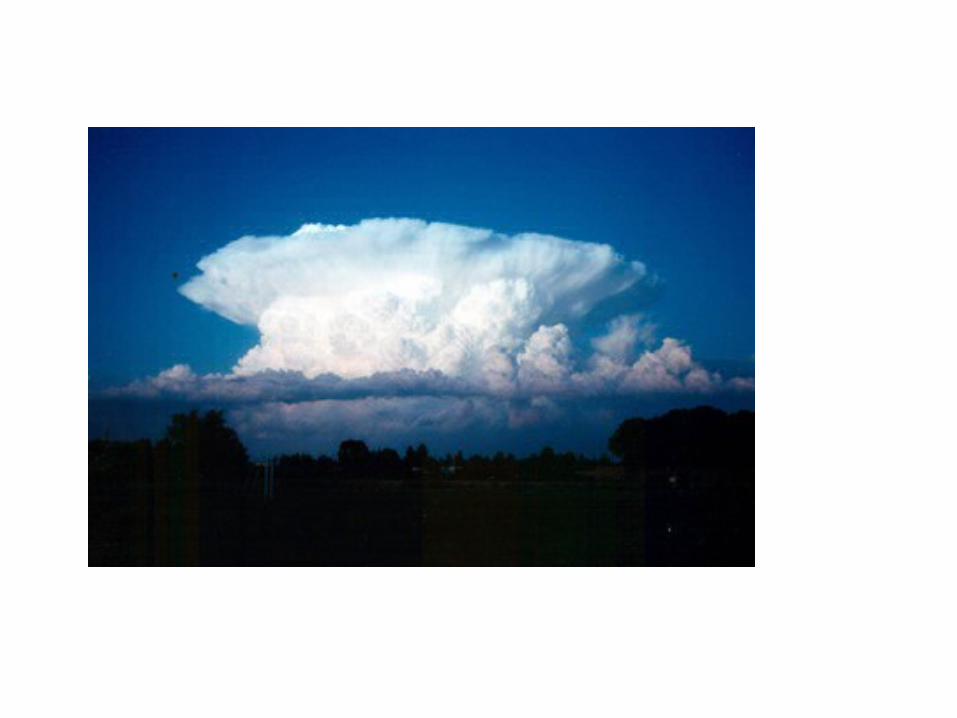
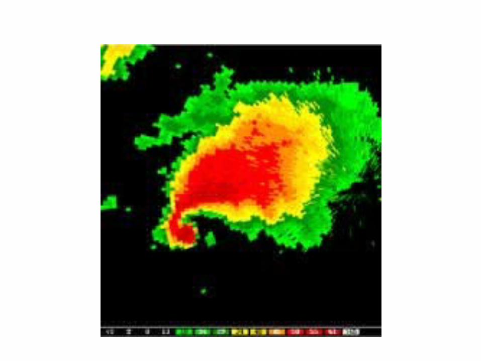
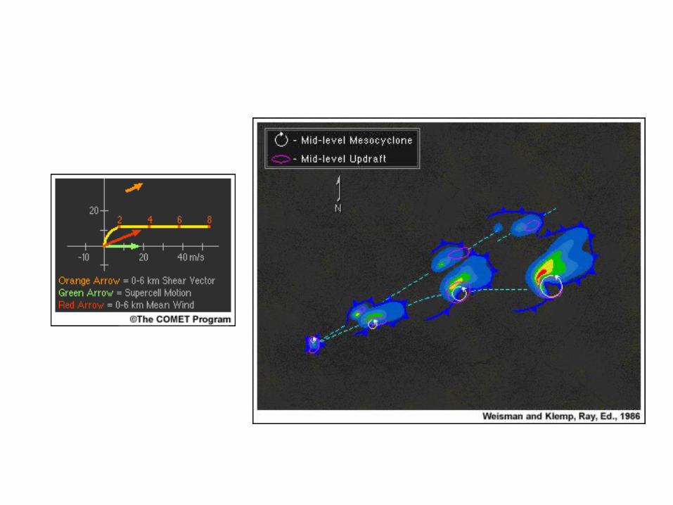
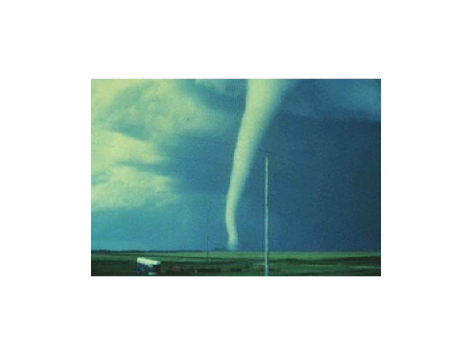
Supercell Thunderstorms


Bow Echos


High Resolution Numerical Prediction of Convection

Explicit Convective Prediction
• Requires high resolution (4km or less grid spacing)
• Requires high-resolution analysis of current situation, using radar, surface observations and all other assets.
• NCAR (WRF model) and CAPS (Oklahoma, ARPS model) are two leading efforts.

Bow Echo and Mesoscale Convective Vortex Experiment (BAMEX)Using the WRF Model
Goal: Study the lifecycles of mesoscale convective vortices and bow echoes in and around the St. Louis MO area
10 km WRF forecast domain4 km WRF forecast domain
Field program conducted 20 May – 6 July 2003

Real-time WRF 4 km BAMEX Forecast
Composite NEXRAD RadarReflectivity forecast
Initialized 00 UTC 9 June 03

Real-time WRF 4 km BAMEX Forecast
Composite NEXRAD Radar
4 km BAMEX forecast 36 h Reflectivity
4 km BAMEX forecast 12 h Reflectivity
Valid 6/10/03 12Z

27h WRF BAMEX Forecast
Valid 6/10/03 03Z
4 km Max Reflectivity 10 km Max Reflectivity

30h WRF BAMEX Forecast
Valid 6/10/03 06Z
4 km Max Reflectivity 10 km Max Reflectivity

Real-time WRF 4 km BAMEX Forecast
Initialized 00 UTC 10 June 03
Reflectivity forecast Composite NEXRAD Radar

Real-time 12 h WRF Reflectivity Forecast
Composite NEXRAD Radar
4 km BAMEX forecast
Valid 6/10/03 12Z
10 km BAMEX forecast
22 km CONUS forecast

Composite NEXRAD RadarReflectivity forecast
Real-time WRF 4 km BAMEX Forecast
Initialized 00 UTC 30 May 03

Real-time WRF 4 km BAMEX Forecast
Composite NEXRAD Radar23 h Reflectivity Forecast
Line ofSupercells
Valid 5/30/03 23Z
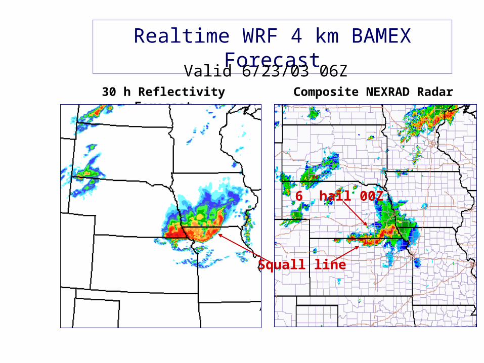
Realtime WRF 4 km BAMEX Forecast
Composite NEXRAD Radar30 h Reflectivity Forecast
Squall line
6” hail 00Z
Valid 6/23/03 06Z

Real-time WRF 4 km BAMEX Forecast
Initialized 00 UTC 11 June 03
Reflectivity forecast Composite NEXRAD Radar

Realtime WRF 4 km BAMEX Forecast
Composite NEXRAD Radar30 h Reflectivity Forecast
Missed
Valid 6/12/03 06Z

Real-time WRF 4 km BAMEX Forecast
Initialized 00 UTC 24 May 03
Reflectivity forecast Composite NEXRAD Radar

Realtime WRF 4 km BAMEX Forecast
Composite NEXRAD RadarReflectivity Forecast
12 h
24 h
Squall line
Persists Dissipates
Initialized 5/24/03 00Z

Preliminary BAMEX Forecast Verification
(Done, Davis, and Weisman)
Mode for corresponding convective systems
For Convective Mode 2 or 3
Cases Observed
Yes No
CasesPredicted
61 25
16 21
Yes
No
Probability of detection (POD) = 79%
False alarm rate (FAR) = 29%

A High-Resolution Modeling Study of the 24 May 2002 Dryline Case during IHOP
(Xue and Martin 2006a,b MWR)
Goal: Understand exactly
WHEN, WHERE, HOW convection is initiated
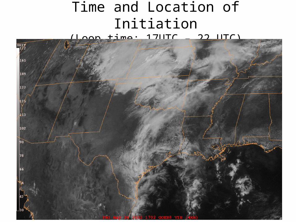
Time and Location of Initiation(Loop time: 17UTC – 22 UTC)

Surface analysis
+ satellite images
From Wakimoto et al.(2006 MWR).
1900 2000
22002100

18 UTC May 24, 2002 I.C.3 km / 1km grid

Model Configurations
• ARPS model with full physics, including ice microphysics + soil model + PBL and TKE-SGS turbulence
1200 UTC 1800 UTC 0006 UTC
1km3km
CI ~ 2000UTC
0000 UTC
ADAS ADAS
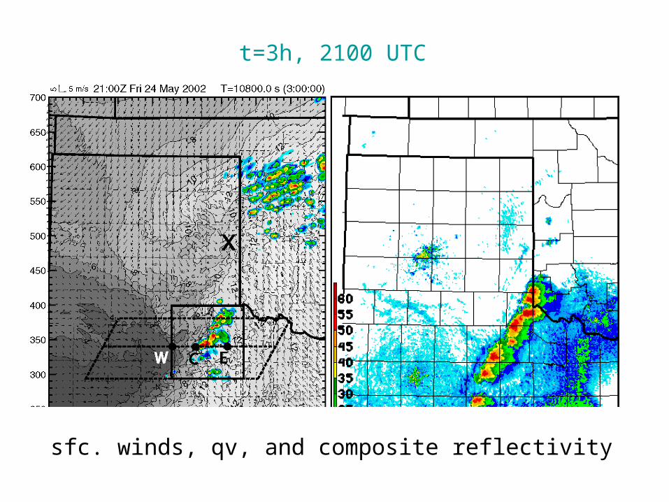
t=3h, 2100 UTC
sfc. winds, qv, and composite reflectivity

t=4h, 2200 UTC
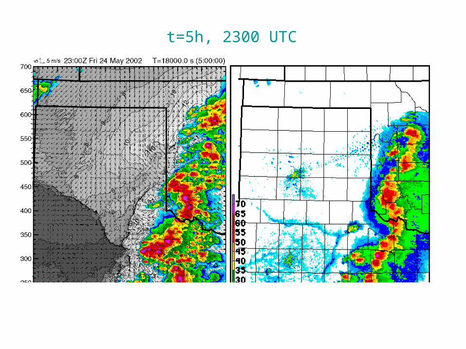
t=5h, 2300 UTC

t=3h, 2100 UTC

t=2h t=2h 15min t=2h 30min t=2h 45min
A A A
B BB
C C
C
B
A
2000 UTC 2015 UTC 2030 UTC 2045 UTC