scenario room project to support eia in...
TRANSCRIPT

SCENARIO ROOM PROJECT TO SUPPORT EIA IN SAO PAULO STATE - BRAZIL
ROMITELLI, M.S.
SILVA, R.F.
TRAVALINI, V.
Directorate of Environmental Impact Assessment
CETESB - Environmental Agency of São Paulo State - Brazil
April/2015
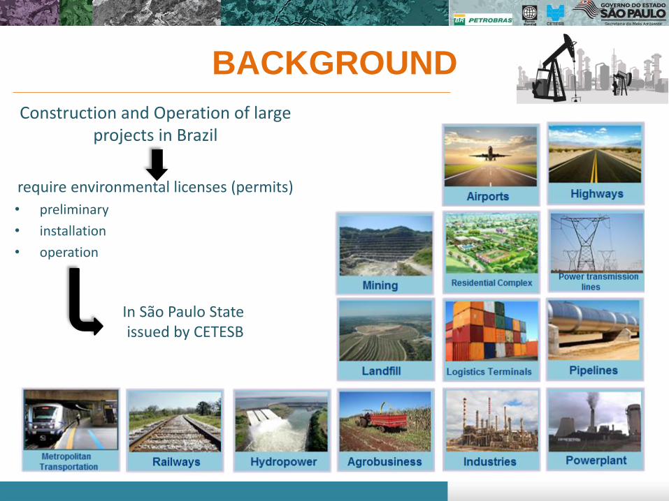
BACKGROUND
Construction and Operation of large projects in Brazil
require environmental licenses (permits)
• preliminary
• installation
• operation
In São Paulo State issued by CETESB
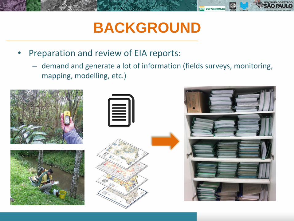
BACKGROUND
• Preparation and review of EIA reports: – demand and generate a lot of information (fields surveys, monitoring,
mapping, modelling, etc.)
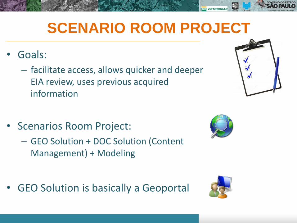
SCENARIO ROOM PROJECT
• Goals:
– facilitate access, allows quicker and deeper EIA review, uses previous acquired information
• Scenarios Room Project:
– GEO Solution + DOC Solution (Content Management) + Modeling
• GEO Solution is basically a Geoportal

GEOPORTAL
Toolbar • Projects search and comparison • Measurements (distance, area) • Drawing/sketch • Buffer • Terrain profile • Legend • Printing layout
Basemaps • Relief • Street basemap • Satellite Images • Digital Ortophotos (EMPLASA)
Layers Menu • Projects • Monitoring data (future) • External layers • My Project • Upload (shapefile, kmz)

DATAGEO

GEOPORTAL
Toolbar • Projects search and comparison • Measurements (distance, area) • Drawing/sketch • Buffer • Terrain profile • Legend • Printing layout
Basemaps • Relief • Street basemap • Satellite Images • Digital Ortophotos (EMPLASA)
Layers Menu • Projects • Monitoring data (future) • External layers • My Project • Upload (shapefile, kmz)

MY PROJECT
Environmental assessment of a new project
• New project proposal
(draw or upload)

MY PROJECT
Environmental assessment of a new project
• New project proposal
• Waterways
(draw or upload)
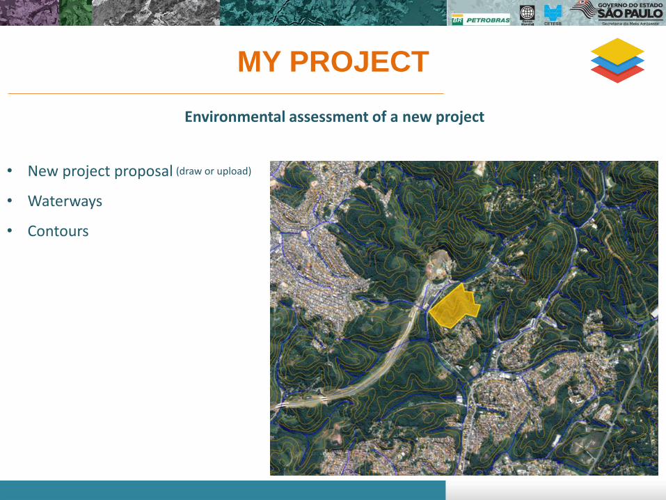
MY PROJECT
Environmental assessment of a new project
• New project proposal
• Waterways
• Contours
(draw or upload)

MY PROJECT
Environmental assessment of a new project
• New project proposal
• Waterways
• Contours
• Forestry
(draw or upload)
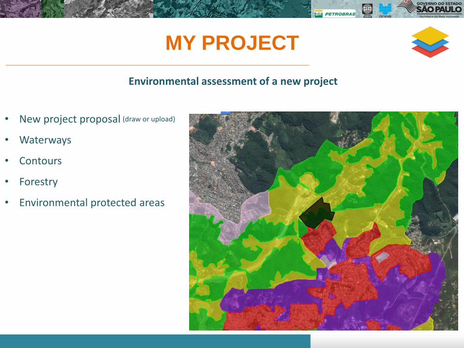
MY PROJECT
Environmental assessment of a new project
• New project proposal
• Waterways
• Contours
• Forestry
• Environmental protected areas
(draw or upload)

MY PROJECT
Environmental assessment of a new project
• New project proposal
• Waterways
• Contours
• Forestry
• Environmental protected areas
• Other projects on surroundings
(draw or upload)
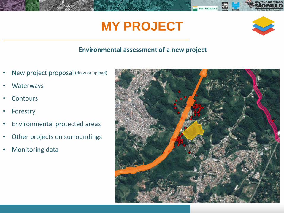
MY PROJECT
Environmental assessment of a new project
• New project proposal
• Waterways
• Contours
• Forestry
• Environmental protected areas
• Other projects on surroundings
• Monitoring data
(draw or upload)
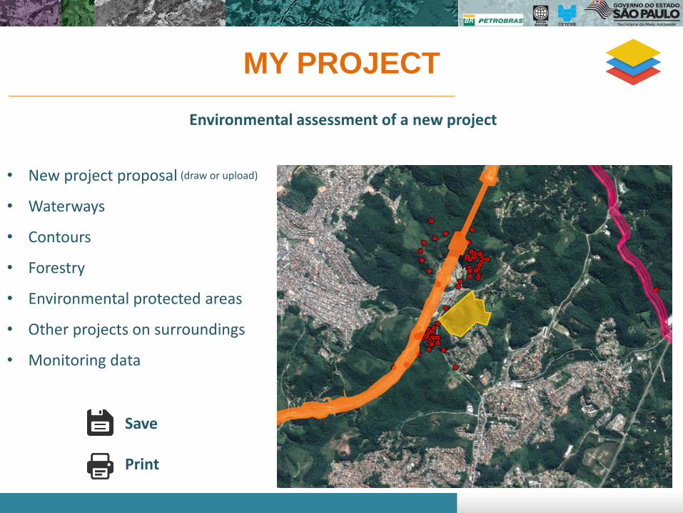
MY PROJECT
Environmental assessment of a new project
• New project proposal
• Waterways
• Contours
• Forestry
• Environmental protected areas
• Other projects on surroundings
• Monitoring data
Save
(draw or upload)

PROJECTS DATA Management information
Projects features
Environmental indicators
Project type: Highway Process ID: 00098/2011 Proposition: New project Municipalities: Caraguatatuba, São Sebastião
Compare projects Export CSV
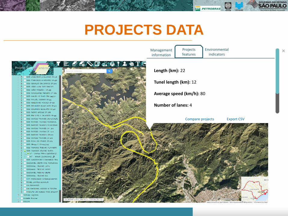
PROJECTS DATA Projects features
Environmental indicators
Length (km): 22 Tunel length (km): 12 Average speed (km/h): 80 Number of lanes: 4
Management information
Compare projects Export CSV

PROJECTS DATA Projects features
Environmental indicators
Construction period (months): 36
Earthmoving (m3): 13.079.590
Vegetation clearing (ha): 18,97
Construction labor: 2.120
Environmental protected areas: 2
Compare projects Export CSV
Management information

PROJECTS DATA Projects features
Environmental indicators
Construction period (months): 36
Earthmoving (m3): 13.079.590
Vegetation clearing (ha): 18,97
Construction labor: 2.120
Environmental protected areas: 2
Compare projects Export CSV
Management information
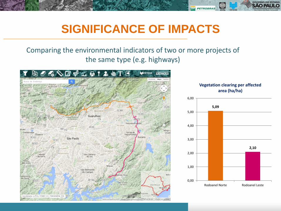
SIGNIFICANCE OF IMPACTS
Comparing the environmental indicators of two or more projects of the same type (e.g. highways)
5,09
2,10
0,00
1,00
2,00
3,00
4,00
5,00
6,00
Rodoanel Norte Rodoanel Leste
Vegetation clearing per affected area (ha/ha)

EFFECTIVENESS OF THE ENVIRONMENTAL LICENSING
Comparing the environmental indicators of the same project, but throughout the various licensing stages (study, preliminary, installation, and operation
licenses).
352
74 14
0
100
200
300
400
EIA Report Preliminarylicensing
Installatoinlicensing
Affected properties
23,5
14,2 15,6
0
5
10
15
20
25
EIA Report Preliminarylicensing
Installatoinlicensing
Vegetation Clearing (ha)
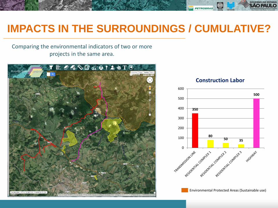
IMPACTS IN THE SURROUNDINGS / CUMULATIVE?
Environmental Protected Areas (Sustainable use)
Comparing the environmental indicators of two or more projects in the same area.
350
80 50 35
500
0
100
200
300
400
500
600
Construction Labor

• Feeding the Geoportal in an automatic way;
• Increasing interactions with other institutions licensing Systems;
• Developing more sophisticated environmental analysis tools;
• Using Content Management Solution to improve the Project.
FUTURE DEVELOPMENTS