schematic analysis of the green areas in al hillah city
TRANSCRIPT
Civil and Environmental Research www.iiste.org
ISSN 2224-5790 (Paper) ISSN 2225-0514 (Online)
Vol.3, No.12, 2013
146
Schematic Analysis of the Green Areas in Al-Hillah City Kareem Kadhim Hammadi
College of Environment, Alqassim Green University, Al-Hillah, Babil Province, Iraq *E-mail [email protected]
Abstract: The increase in the civilization levels led to increasing interest of the public gardens and green areas and making the appropriate efforts to protect them from the urban extension and to provide human revival places. This research showed the importance of urban planning in land use, especially for the entertainment purposes to ensure the availability of a healthy environment to the city population. The research is a field study of the green areas in Al-Hillah City, their distribution within the city, green area per capita, and showing the deficiency in it, the problems facing the green areas lasting in the city. It is rounded off with the conclusions and recommendations. The research problem is that the disconcerted urban growth produced negative effects in different dimensions; one of them was the negative environmental dimension. In fact this growth affected distribution of the green areas inside the cities and the surrounding green areas. So the research hypothesis is that Al-Hillah city needs a schematic environmental processing to increase the city environmental function proficiency through increasing the green areas which achieves the environmental and the health requirements for its population. The research method includes collecting data, analyzing them, and specifying the most important environmental axis required for the city urban pattern and privacy. Keywords: Green Areas, Al-Hillah, SWOT Introduction: Interest in the green areas is an indicator for the interest of the environment in the urban medium; moreover, it became the fulcrum of every urban plan. Global standards were made for this issue. The urban environmental deterioration is one of the major problems that mankind faces, especially in the current time, and its daily increase. Maintaining man’s health and cleanness had started facing new problems by the bad effect of spread of new technologies on man’s environment, which caused the man to use a lot of materials which he wasn’t familiar with their types or sizes and parentages, but he is compelled to use it nowadays because of the increasing economic, productive, and scientific activities by space and density daily. So, the necessity and importance of green areas and openings inside the urban environment have been noticed to increase man’s energy, health, and physical and psychological capabilities. 1. 1. Entertainment activity types: Recreation activities are different; what is important to us are the spatial differences which is the recognition between two forms of recreation activities, one of them necessarily requires a spatial base outside of the house to carry out, and the other doesn’t require that spatial or external requirement (Alqattan, 1980: 1). Entertainment activities consists of many types, the following types are prominent: public parks, children playgrounds, young courts, sport courts, clubs, zoos, cinemas, cabarets, theaters, and youth centers, more over the historical, archeological locations, urban centers, libraries, and the menu continues to the natural phenomenon such as beaches, coasts, lakes, riversides, forests, mountain verdant valleys. Some services are connected with this menu such as hotels, cafés, restaurants, bars, casinos, etc. (Abbas, 1977: 150-194). The researcher believes that some external entertainment activities are available in Al-Hillah City, but they are incapable to meet the increasing requirements for them because they are disregarded, or they weren’t constructed proportionally with the population densities of parts of city, so they need development and reorganization to be fit with the changes in the city structure. 1. 2. Definition of the research topic: Green areas are spaces inside a population aggregation, urban area, or geographic region generally covered by planetary or natural cover. They constitute an important part of land use for the entertainment purposes in cities, or on its primary status (forests, farms, farming areas, woods, lakes, etc.).Green areas are usually classified as in Table 1:
Civil and Environmental Research www.iiste.org
ISSN 2224-5790 (Paper) ISSN 2225-0514 (Online)
Vol.3, No.12, 2013
147
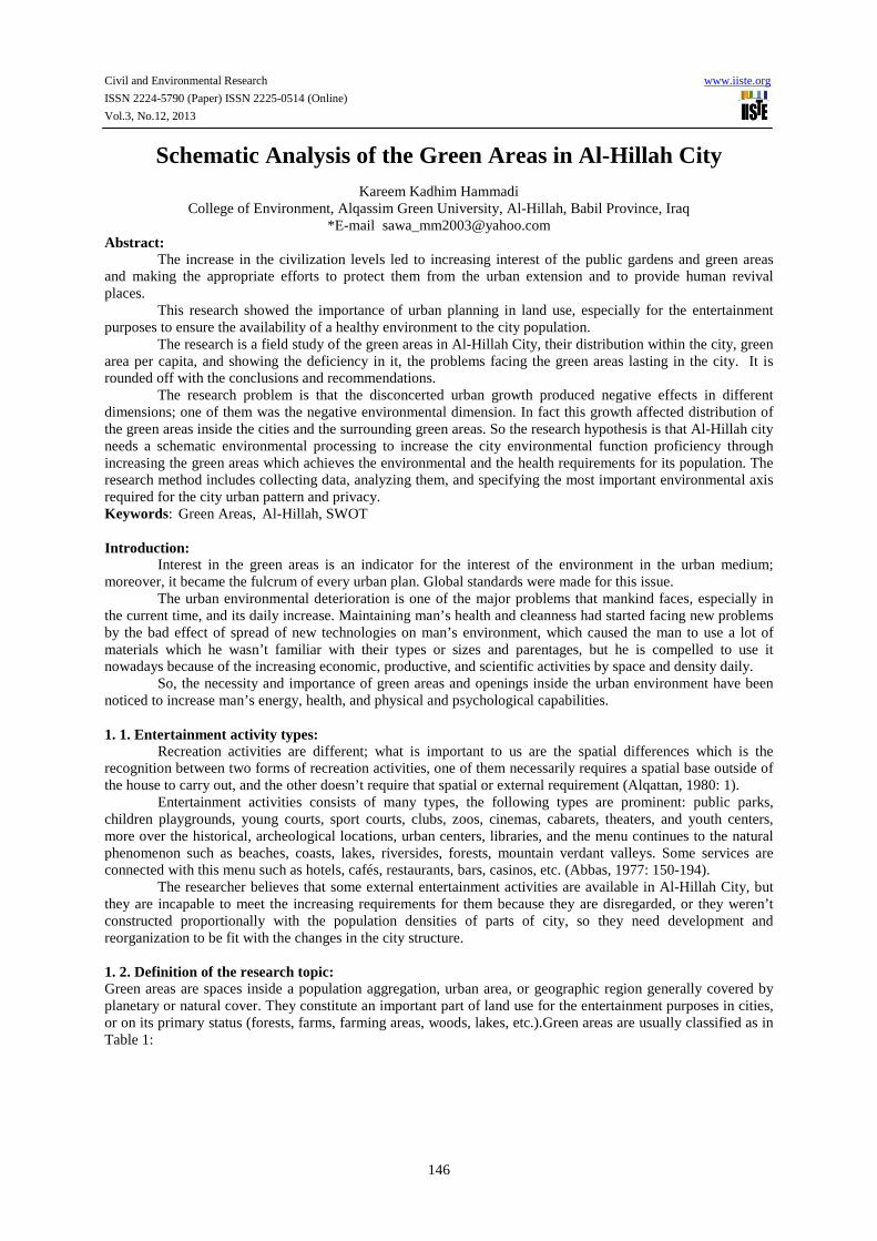
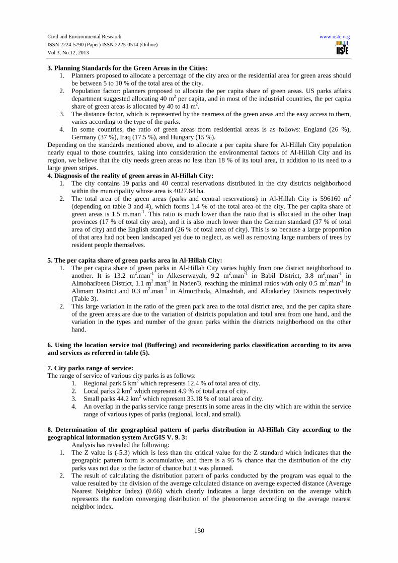
Pic. 1. Median straps (central reservation).
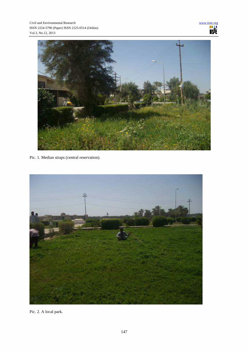
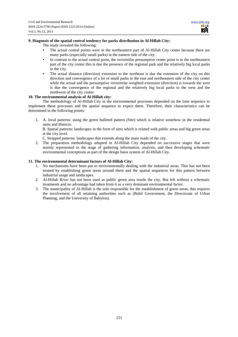
Pic. 2. A local park.
Civil and Environmental Research www.iiste.org
ISSN 2224-5790 (Paper) ISSN 2225-0514 (Online)
Vol.3, No.12, 2013
148
2. 1. The environmental status of Al-Hillah City: The city area is about 4027.64 ha. and the city population is 394992 in the year 2010 (Babil Statistics Directorate) with a population density of 63.71 person/ha-1. The population densities differ in the old parts of the city with the traditional pattern of residence since the rate is about 998 person/ha-1 in Alwardyah area, while it is 81 person.ha-1 in the modern pattern of residence in Babil District. The city is divided into two parts, the western part which contains 49 districts, and the eastern part which contain 11 districts (Babil Statistics Directorate). Location is one of the most effective environmental factors in the shape, properties, and capabilities of any city. Al-Hillah city is located at both sides of Al-Hillah River (Shat Al-Hillah) which is derived from Euphrates in crossover of (44˚15ˊ east) longitude and (32˚17ˊ) latitude. Because of that location, Babil Province climate is extreme. Weather temperature is very high in summer and very low in winter. As for spring and autumn, the temperature is a moderate during these transitional short seasons. The atmospheric pressure usually decreases in winter. The prevailing wind direction is northwest; with scarce rainfalls (50-100 ml) and the rainfall levels vary from one year to another (Abdulkareem, 1996). The location of Al-Hillah City within the semi-aired region and its continental location have led to the following:
• The city was subject for the dust and cairn storms in summer and winter. • The drought repetition phenomenon usually occurs in the city and the surrounding areas. • The city and the surrounding areas are subject for desertification phenomenon.
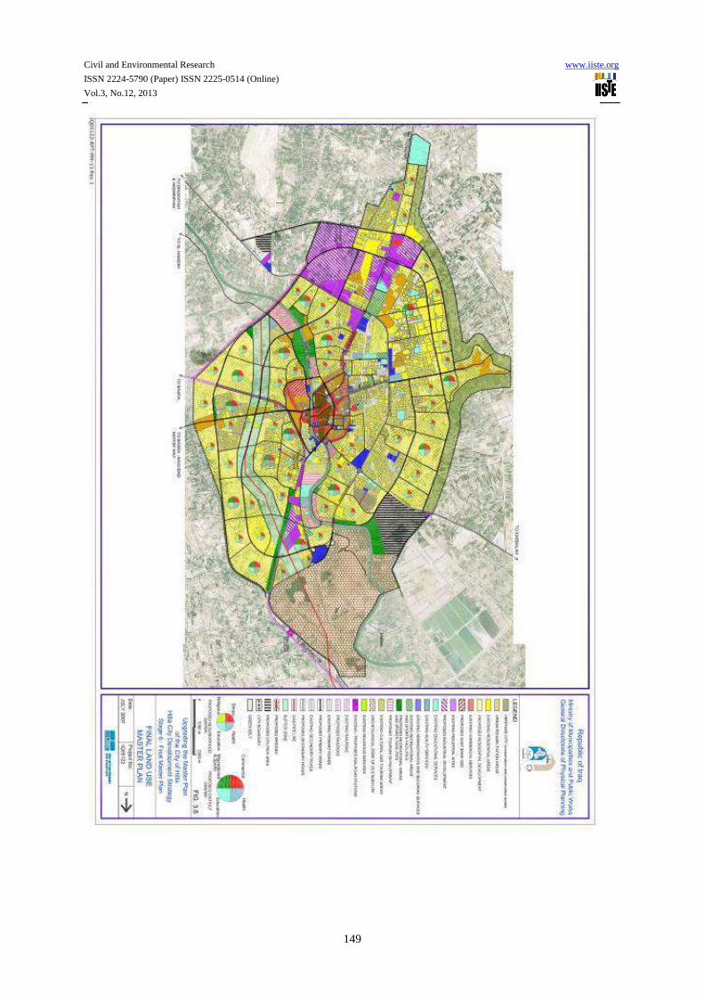
2. 2. Land uses in Al-Hillah City: The area of Al-Hillah City was (4027.64 ha) in 2008, while it was (2500 ha) in 1985 (Tarek, 2008). This shoes the increase in the spatial size of the city because of the increasing requests on residence units and public services areas. It is shown in the basic design map of Al-Hillah City 2008 that the housing use took the higher rate of the land use (44.29 %) with a (1783.8 ha) housing land use, the commercial use was (2.49 %) with a (100.11 ha) of commercial land use, industrial land use was (242.6 ha), green and cultivated areas land use were (351.11 ha) with a percentage of (8.7 %) within the municipal borders in the basic design. The area specified for services was (healthcare 25.11 ha, educational 49.17 ha, religious, administrative, entertainment 382.4 ha, public services 116 ha, and transportations 471.56 ha) as shown in Table 2. The numbers represent the actual executed uses of the land (Tarek, 2008). ) .
Civil and Environmental Research www.iiste.org
ISSN 2224-5790 (Paper) ISSN 2225-0514 (Online)
Vol.3, No.12, 2013
149
Civil and Environmental Research www.iiste.org
ISSN 2224-5790 (Paper) ISSN 2225-0514 (Online)
Vol.3, No.12, 2013
150
3. Planning Standards for the Green Areas in the Cities: 1. Planners proposed to allocate a percentage of the city area or the residential area for green areas should
be between 5 to 10 % of the total area of the city. 2. Population factor: planners proposed to allocate the per capita share of green areas. US parks affairs
department suggested allocating 40 m2 per capita, and in most of the industrial countries, the per capita share of green areas is allocated by 40 to 41 m2.
3. The distance factor, which is represented by the nearness of the green areas and the easy access to them, varies according to the type of the parks.
4. In some countries, the ratio of green areas from residential areas is as follows: England (26 %), Germany (37 %), Iraq (17.5 %), and Hungary (15 %).
Depending on the standards mentioned above, and to allocate a per capita share for Al-Hillah City population nearly equal to those countries, taking into consideration the environmental factors of Al-Hillah City and its region, we believe that the city needs green areas no less than 18 % of its total area, in addition to its need to a large green stripes. 4. Diagnosis of the reality of green areas in Al-Hillah City:
1. The city contains 19 parks and 40 central reservations distributed in the city districts neighborhood within the municipality whose area is 4027.64 ha.
2. The total area of the green areas (parks and central reservations) in Al-Hillah City is 596160 m2 (depending on table 3 and 4), which forms 1.4 % of the total area of the city. The per capita share of green areas is 1.5 m.man-1. This ratio is much lower than the ratio that is allocated in the other Iraqi provinces (17 % of total city area), and it is also much lower than the German standard (37 % of total area of city) and the English standard (26 % of total area of city). This is so because a large proportion of that area had not been landscaped yet due to neglect, as well as removing large numbers of trees by resident people themselves.
5. The per capita share of green parks area in Al-Hillah City:
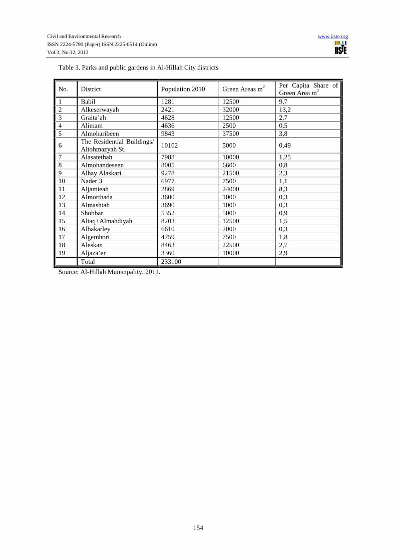
1. The per capita share of green parks in Al-Hillah City varies highly from one district neighborhood to another. It is 13.2 m2.man-1 in Alkeserwayah, 9.2 m2.man-1 in Babil District, 3.8 m2.man-1 in Almoharibeen District, 1.1 m2.man-1 in Nader/3, reaching the minimal ratios with only 0.5 m2.man-1 in Alimam District and 0.3 m2.man-1 in Almorthada, Almashtah, and Albakarley Districts respectively (Table 3).
2. This large variation in the ratio of the green park area to the total district area, and the per capita share of the green areas are due to the variation of districts population and total area from one hand, and the variation in the types and number of the green parks within the districts neighborhood on the other hand.
6. Using the location service tool (Buffering) and reconsidering parks classification according to its area and services as referred in table (5). 7. City parks range of service: The range of service of various city parks is as follows:
1. Regional park 5 km2 which represents 12.4 % of total area of city. 2. Local parks 2 km2 which represent 4.9 % of total area of city. 3. Small parks 44.2 km2 which represent 33.18 % of total area of city. 4. An overlap in the parks service range presents in some areas in the city which are within the service
range of various types of parks (regional, local, and small). 8. Determination of the geographical pattern of parks distribution in Al-Hillah City according to the geographical information system ArcGIS V. 9. 3: Analysis has revealed the following:
1. The Z value is (-5.3) which is less than the critical value for the Z standard which indicates that the geographic pattern form is accumulative, and there is a 95 % chance that the distribution of the city parks was not due to the factor of chance but it was planned.
2. The result of calculating the distribution pattern of parks conducted by the program was equal to the value resulted by the division of the average calculated distance on average expected distance (Average Nearest Neighbor Index) (0.66) which clearly indicates a large deviation on the average which represents the random converging distribution of the phenomenon according to the average nearest neighbor index.
Civil and Environmental Research www.iiste.org
ISSN 2224-5790 (Paper) ISSN 2225-0514 (Online)
Vol.3, No.12, 2013
151
9. Diagnosis of the spatial central tendency for parks distribution in Al-Hillah City: The study revealed the following:
• The actual central points were in the northeastern part of Al-Hillah City center because there are many parks (especially small parks) in the eastern side of the city.
• In contrast to the actual central point, the verisimilar presumptive center point is in the northeastern part of the city center this is due the presence of the regional park and the relatively big local parks in the city.
• The actual distance (direction) extension to the northeast is due the extension of the city on this direction and convergence of a lot of small parks to the east and northeastern side of the city center while the actual and the presumptive verisimilar weighted extension (direction) is towards the west is due the convergence of the regional and the relatively big local parks to the west and the northwest of the city center.
10. The environmental analysis of Al-Hillah city: The methodology of Al-Hillah City in the environmental processes depended on the time sequence to implement these processes and the spatial sequence to expect them. Therefore, their characteristics can be determined in the following points:
1. A. local patterns: using the green bulleted pattern (Site) which is relative somehow in the residential units and districts. B. Spatial patterns: landscapes in the form of sites which is related with public areas and big green areas at the city level. C. Stripped patterns: landscapes that extends along the main roads of the city.
2. The preparation methodology adopted in Al-Hillah City depended on successive stages that were mainly represented in the stage of gathering information, analysis, and then developing schematic environmental conceptions as part of the design basis system of Al-Hillah City.
11. The environmental determinant factors of Al-Hillah City:
1. No mechanisms have been put to environmentally dealing with the industrial areas. This has not been treated by establishing green areas around them and the spatial sequences for this pattern between industrial usage and landscapes.
2. Al-Hillah River has not been used as public green area inside the city. But left without a schematic treatments and no advantage had taken from it as a very dominant environmental factor.
3. The municipality of Al-Hillah is the sole responsible for the establishment of green areas; this requires the involvement of all retaining authorities such as (Babil Government, the Directorate of Urban Planning, and the University of Babylon).
Civil and Environmental Research www.iiste.org
ISSN 2224-5790 (Paper) ISSN 2225-0514 (Online)
Vol.3, No.12, 2013
152
12. Strengths, weaknesses, opportunities, and threats of environment and green areas in Al-Hillah City (SWOT Analysis):
Strengths Weaknesses 1. A city-level environmental information base
is available. 2. Requiring environmental impact studies in
the granting of environmental approvals for developmental projects.
3. Environmental awareness seminars for various segments of society are presented in the city.
4. Conduction of a periodic monitoring of the various activities in the city.
5. The existence of proposals by the residents of the city on the development of the municipality's work on the development of green areas (personal interviews for the researcher).
6. Babylon Directorate of Agriculture has started to develop studies on the economic feasibility of the establishment of forestry and horticulture projects to increase green areas, in order to combat desertification associated with the cultivation of high oil content olive trees, the cultivated area is estimated at twenty five hectares.
1. The lack of equipment and devices to maintaining the gardens and parks.
2. The lack of training and qualifying sessions. 3. The lack in the number of the service and
maintenance workers of green areas. 4. The lack of the environmental awareness of
institutional and public sectors. 5. Weakness in the mechanisms of coordination
and joint work with the local government departments and civil society organizations.
6. The absence of the role of civil society organizations in the field of awareness of citizens.
7. The area of green areas and open spaces located in residential districts serving its population forms (76.426 ha) of Al-Hillah City total area (5243 ha) for 2011 which represents (1.4 %). As the average per capita share of green areas is (1.5 m2.person-1). This ratio is much lower than Iraqi cities ratio which is (17 %) of total area of the city.
Opportunities Threats 1. The partnership between Al-Hillah
Municipality and Babil Environment Directorate in conducting studies about green areas in the city.
2. Consulting experts from the University of Babylon to aid the environmental efforts.
3. There is a console for environmental cooperation at the province level which holds regular meetings.
4. There is an intension to include environmental issues in the priorities of updating the basic schema of the city.
1. Many of the city districts affected by environmental problems through the lack of green areas and the lack of the necessary resources to set them up.
2. Non-activation of legislations concerning the urban environment.
3. The poor coordination in environmental work among the partners of the environment.
4. Al-Hillah City had been a subject of a significant horizontally expansion, and the municipality had to make doubled efforts to improve the service provided to the citizens.
5. The environmental climatic conditions of Al-Hillah City, the big growth in population, and the increase in the polluting activities entail larger green areas.
13. Conclusions and recommendations: 13. 1: Conclusions:
1. The geographical distribution of green areas (parks) is poorly distributed and most of them are concentrated in specific areas of the city and located mostly in old districts. The large districts lack such parks.
2. The climatic environmental conditions of Al-Hillah City; the significant growth in population; and the increase in the polluting activities necessitate that the city needs larger green areas.
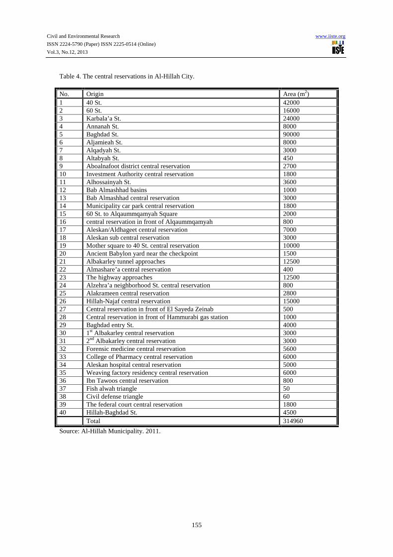
3. Green areas are represented in parks and central reservations. The area of small parks was 233100 and the area of central reservations is 314960 forming a ratio of 1.5 % of the total area of city which is a small ratio of the city.
4. There is a large variation in the rate of per capita share of parks area among the districts of the city.
Civil and Environmental Research www.iiste.org
ISSN 2224-5790 (Paper) ISSN 2225-0514 (Online)
Vol.3, No.12, 2013
153
5. Vast areas of the city (60 %) are located mostly on districts along 60 St. out of the service range of all the city parks.
6. The geographical pattern of the city parks distribution is the accumulative pattern. 13.2: Recommendations:
1. Increasing the green areas in the city to at least 20 % of the total area of the city. 2. Constructing new regional and public parks that commensurate with the area of the city and the size of
its population. 3. Increasing the central reservations area to include all main and secondary roads in the city that
commensurate with the big numbers of the cars and traffic on these streets. 4. Constructing green stripes around the city.
References:
- Holley, M., translator: Esam Abdullatif. (1979). Man and environment, the small encyclopedia, issue: 39, Alhurriah publishing. Baghdad. Iraq.
- Abbas, A. (1977). Geography of Cities. Asa’ad printing house. - Alqattan, M. (1980). City Land Uses for Entertainment Purposes- Cases and Recommendations. The 6th
Conference of The Arabic Cities Organization. Aldoha. Qatar. 1-4 March, 1980. - Salman, M. T. (2008). Evaluating Expansion Axis for Al-Hillah City Using Remote Sensing
Technologies and GIS. The area of the study is Al-Hillah City. The High Institute for Urban and Regional Planning. University of Baghdad. M.Sc. thesis. Baghdad. Iraq.
- Ahmed, S. A. (1996). Effect of Residential and Social Facts on the Spatial Contrast of the Residential Function in Baghdad Province. Faculty of Arts. University of Baghdad. M.Sc. thesis. Baghdad. Iraq.
- Babil Statistics Directorate. - Al-Hillah Municipality.
Table 1. Classification of green areas
1 big parks their total area is not less than (50000 m2).
2 small parks their total area is not more than (50000 m2).
3 central reservations median green stripes in the mid of main roads.
Table 2. Land use of Al-Hillah City
Land use Area(ha) Per cent
Housing 1783.87 44.29%
Industrial 242.56 6.02%
Commercial 100.11 2.49%
Services
Educational 49.17 1.22%
Healthcare 25.11 0.62% Religious, cultural, and Entertainment 382.84 9.51% Administrative Buildings 116.06 2.88%
Green, cultivated areas 351.11 8,7%
Transportations 471.56 11.71%
Openings 15.19 0.38%
Total 4027.64 100%
Salman, M. T. (2008). Evaluating Expansion Axis for Al-Hillah City Using Remote Sensing Technologies and GIS. The area of the study is Al-Hillah City. The High Institute for Urban and Regional Planning. University of Baghdad. M.Sc. thesis. Baghdad. Iraq
Civil and Environmental Research www.iiste.org
ISSN 2224-5790 (Paper) ISSN 2225-0514 (Online)
Vol.3, No.12, 2013
154
Table 3. Parks and public gardens in Al-Hillah City districts
No. District Population 2010 Green Areas m2 Per Capita Share of Green Area m2
1 Babil 1281 12500 9,7 2 Alkeserwayah 2421 32000 13,2 3 Graita’ah 4628 12500 2,7 4 Alimam 4636 2500 0,5 5 Almoharibeen 9843 37500 3,8
6 The Residential Buildings/ Altohmazyah St.
10102 5000 0,49
7 Alasatethah 7988 10000 1,25 8 Almohandeseen 8005 6600 0,8 9 Alhay Alaskari 9278 21500 2,3 10 Nader 3 6977 7500 1,1 11 Aljamieah 2869 24000 8,3 12 Almorthada 3600 1000 0,3 13 Almashtah 3690 1000 0,3 14 Shobbar 5352 5000 0,9 15 Altaq+Almahdiyah 8203 12500 1,5 16 Albakarley 6610 2000 0,3 17 Algemhori 4759 7500 1,8 18 Aleskan 8463 22500 2,7 19 Aljaza’er 3360 10000 2,9 Total 233100
Source: Al-Hillah Municipality. 2011.
Civil and Environmental Research www.iiste.org
ISSN 2224-5790 (Paper) ISSN 2225-0514 (Online)
Vol.3, No.12, 2013
155
Table 4. The central reservations in Al-Hillah City.
No. Origin Area (m2) 1 40 St. 42000 2 60 St. 16000 3 Karbala’a St. 24000 4 Annanah St. 8000 5 Baghdad St. 90000 6 Aljamieah St. 8000 7 Alqadyah St. 3000 8 Altabyah St. 450 9 Aboalnafoot district central reservation 2700 10 Investment Authority central reservation 1800 11 Alhossainyah St. 3600 12 Bab Almashhad basins 1000 13 Bab Almashhad central reservation 3000 14 Municipality car park central reservation 1800 15 60 St. to Alqaummqamyah Square 2000 16 central reservation in front of Alqaummqamyah 800 17 Aleskan/Aldhageet central reservation 7000 18 Aleskan sub central reservation 3000 19 Mother square to 40 St. central reservation 10000 20 Ancient Babylon yard near the checkpoint 1500 21 Albakarley tunnel approaches 12500 22 Almashare’a central reservation 400 23 The highway approaches 12500 24 Alzehra’a neighborhood St. central reservation 800 25 Alakrameen central reservation 2800 26 Hillah-Najaf central reservation 15000 27 Central reservation in front of El Sayeda Zeinab 500 28 Central reservation in front of Hammurabi gas station 1000 29 Baghdad entry St. 4000 30 1st Albakarley central reservation 3000 31 2nd Albakarley central reservation 3000 32 Forensic medicine central reservation 5600 33 College of Pharmacy central reservation 6000 34 Aleskan hospital central reservation 5000 35 Weaving factory residency central reservation 6000 36 Ibn Tawoos central reservation 800 37 Fish alwah triangle 50 38 Civil defense triangle 60 39 The federal court central reservation 1800 40 Hillah-Baghdad St. 4500 Total 314960
Source: Al-Hillah Municipality. 2011.

Civil and Environmental Research www.iiste.org
ISSN 2224-5790 (Paper) ISSN 2225-0514 (Online)
Vol.3, No.12, 2013
156
Table 5. Green area classification depending on area and service range factors
Type of green area Area (ha) Diameter of service range Small local park less than 2 less than 0.10 Local park 2 to 20 0.10 to 0.30 Public park 20 to 60 0.30 to 0.8 Regional park More than 60 More than 0.8
This academic article was published by The International Institute for Science,
Technology and Education (IISTE). The IISTE is a pioneer in the Open Access
Publishing service based in the U.S. and Europe. The aim of the institute is
Accelerating Global Knowledge Sharing.
More information about the publisher can be found in the IISTE’s homepage:
http://www.iiste.org
CALL FOR JOURNAL PAPERS
The IISTE is currently hosting more than 30 peer-reviewed academic journals and
collaborating with academic institutions around the world. There’s no deadline for
submission. Prospective authors of IISTE journals can find the submission
instruction on the following page: http://www.iiste.org/journals/ The IISTE
editorial team promises to the review and publish all the qualified submissions in a
fast manner. All the journals articles are available online to the readers all over the
world without financial, legal, or technical barriers other than those inseparable from
gaining access to the internet itself. Printed version of the journals is also available
upon request of readers and authors.
MORE RESOURCES
Book publication information: http://www.iiste.org/book/
Recent conferences: http://www.iiste.org/conference/
IISTE Knowledge Sharing Partners
EBSCO, Index Copernicus, Ulrich's Periodicals Directory, JournalTOCS, PKP Open
Archives Harvester, Bielefeld Academic Search Engine, Elektronische
Zeitschriftenbibliothek EZB, Open J-Gate, OCLC WorldCat, Universe Digtial
Library , NewJour, Google Scholar