segment assessment report - tahoe rim trailreport summary this report is a compilation of...
TRANSCRIPT
20
17
SEGMENT ASSESSMENT
REPORT
SEGMENT 4:
SPOONER SUMMIT TO KINGSBURY NORTH

2
REPORT SUMMARY
This report is a compilation of information collected on the Tahoe Rim Trail during assessments performed throughout the 2017 field season. The purpose of this report is to disseminate and record information on existing conditions and to use that information to plan improvements and modifications to trail assets and facilities. In addition, this report can help guide planning for future volunteer trail work days to address deficiencies large and small.
For more information please contact Chris Binder, Director of Trail Operations, Tahoe Rim Trail Association at 775.298.4494 or [email protected].
0
TRAIL DEFICIENCIES
SIGN ISSUES
CAMPNG IMPACTS
01
TABLE OF CONTENTS
ASSESSMENT OVERVIEW 1
RESULTS AND RECOMMENDATIONS 3
02
03 NEXT STEPS 16
ASSESSMENT PROCESS & GOALS
2017 FORMAL ASSESSMENT LOCATIONS
ASSESSMENT PROJECTIONS 2018 - 2020
1
01
ASSESSMENT OVERVIEW
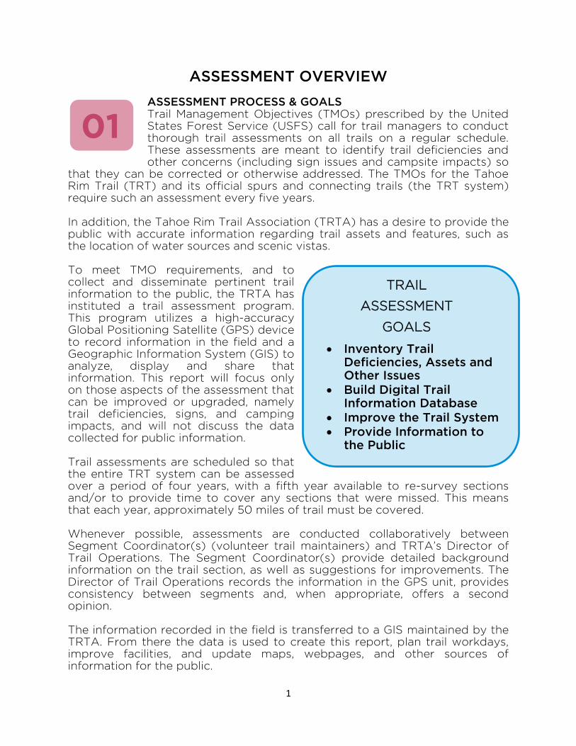
ASSESSMENT PROCESS & GOALS Trail Management Objectives (TMOs) prescribed by the United States Forest Service (USFS) call for trail managers to conduct thorough trail assessments on all trails on a regular schedule. These assessments are meant to identify trail deficiencies and other concerns (including sign issues and campsite impacts) so
that they can be corrected or otherwise addressed. The TMOs for the Tahoe Rim Trail (TRT) and its official spurs and connecting trails (the TRT system) require such an assessment every five years. In addition, the Tahoe Rim Trail Association (TRTA) has a desire to provide the public with accurate information regarding trail assets and features, such as the location of water sources and scenic vistas. To meet TMO requirements, and to collect and disseminate pertinent trail information to the public, the TRTA has instituted a trail assessment program. This program utilizes a high-accuracy Global Positioning Satellite (GPS) device to record information in the field and a Geographic Information System (GIS) to analyze, display and share that information. This report will focus only on those aspects of the assessment that can be improved or upgraded, namely trail deficiencies, signs, and camping impacts, and will not discuss the data collected for public information. Trail assessments are scheduled so that the entire TRT system can be assessed over a period of four years, with a fifth year available to re-survey sections and/or to provide time to cover any sections that were missed. This means that each year, approximately 50 miles of trail must be covered. Whenever possible, assessments are conducted collaboratively between Segment Coordinator(s) (volunteer trail maintainers) and TRTA’s Director of Trail Operations. The Segment Coordinator(s) provide detailed background information on the trail section, as well as suggestions for improvements. The Director of Trail Operations records the information in the GPS unit, provides consistency between segments and, when appropriate, offers a second opinion. The information recorded in the field is transferred to a GIS maintained by the TRTA. From there the data is used to create this report, plan trail workdays, improve facilities, and update maps, webpages, and other sources of information for the public.
TRAIL
ASSESSMENT
GOALS
Inventory Trail Deficiencies, Assets and Other Issues
Build Digital Trail Information Database
Improve the Trail System
Provide Information to the Public
2
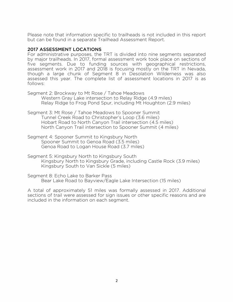
Please note that information specific to trailheads is not included in this report but can be found in a separate Trailhead Assessment Report. 2017 ASSESSMENT LOCATIONS For administrative purposes, the TRT is divided into nine segments separated by major trailheads. In 2017, formal assessment work took place on sections of five segments. Due to funding sources with geographical restrictions, assessment work in 2017 and 2018 is focusing mostly on the TRT in Nevada, though a large chunk of Segment 8 in Desolation Wilderness was also assessed this year. The complete list of assessment locations in 2017 is as follows: Segment 2: Brockway to Mt Rose / Tahoe Meadows Western Gray Lake intersection to Relay Ridge (4.9 miles) Relay Ridge to Frog Pond Spur, including Mt Houghton (2.9 miles) Segment 3: Mt Rose / Tahoe Meadows to Spooner Summit Tunnel Creek Road to Christopher’s Loop (3.6 miles) Hobart Road to North Canyon Trail intersection (4.5 miles)
North Canyon Trail intersection to Spooner Summit (4 miles)
Segment 4: Spooner Summit to Kingsbury North Spooner Summit to Genoa Road (3.5 miles) Genoa Road to Logan House Road (3.7 miles) Segment 5: Kingsbury North to Kingsbury South Kingsbury North to Kingsbury Grade, including Castle Rock (3.9 miles) Kingsbury South to Van Sickle (5 miles) Segment 8: Echo Lake to Barker Pass Bear Lake Road to Bayview/Eagle Lake Intersection (15 miles) A total of approximately 51 miles was formally assessed in 2017. Additional sections of trail were assessed for sign issues or other specific reasons and are included in the information on each segment.

3
RESULTS AND RECOMMENDATIONS
SEGMENT 4: SPOONER SUMMIT TO KINGSBURY NORTH The trail formally assessed in Segment 4 is generally in excellent condition, though several vista spurs need to be formalized, two areas require brushing and a few turns could stand to be rebuilt. Motorcycle activity in this area has increased in recent years, so
installing a gate in one location to prevent motorized access is recommended. An Eagle Scout project scheduled for 2018 will address deficiency 41708.
TRAIL DEFICIENCIES
Several of the deficiencies recorded were addressed during the 2017 field season. Eleven low- and moderate-priority deficiencies remain, all of which could be undertaken by small groups and are not major undertakings. A few concerted work days would bring this trail section up to standard.
Deficiency 41701 Type: Failing Strucutre Description: Failing Turn Priority: Low Distance to Water: 100+ Feet Special Equipment: None Estimated Hours: 35 Notes: Rebuild Turn Deficiency 41702 Type: Too Narrow/Overgrown Description: Vista trail is
overgrown/braided Priority: Low Distance to Water: 100+ Feet Special Equipment: None Estimated Hours: 8 Notes: Formalize vista trail
02
4
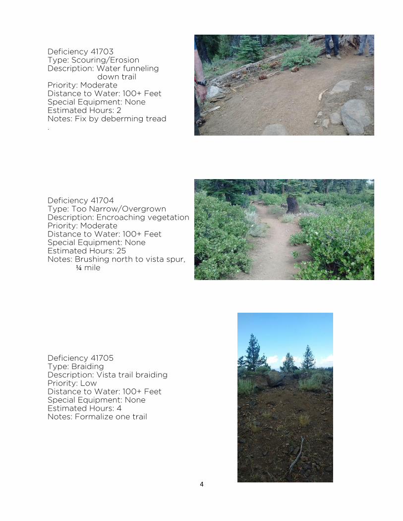
Deficiency 41703 Type: Scouring/Erosion Description: Water funneling
down trail Priority: Moderate Distance to Water: 100+ Feet Special Equipment: None Estimated Hours: 2 Notes: Fix by deberming tread .
Deficiency 41704 Type: Too Narrow/Overgrown Description: Encroaching vegetation Priority: Moderate Distance to Water: 100+ Feet Special Equipment: None Estimated Hours: 25 Notes: Brushing north to vista spur,
¼ mile
Deficiency 41705 Type: Braiding Description: Vista trail braiding Priority: Low Distance to Water: 100+ Feet Special Equipment: None Estimated Hours: 4 Notes: Formalize one trail
5
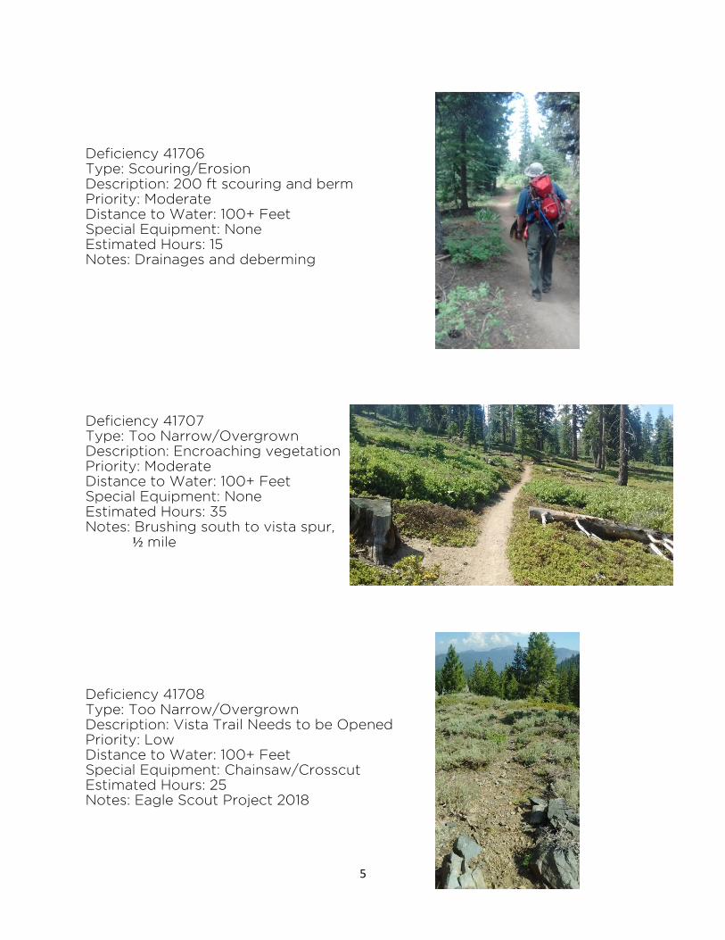
Deficiency 41706 Type: Scouring/Erosion Description: 200 ft scouring and berm Priority: Moderate Distance to Water: 100+ Feet Special Equipment: None Estimated Hours: 15 Notes: Drainages and deberming
Deficiency 41707 Type: Too Narrow/Overgrown Description: Encroaching vegetation Priority: Moderate Distance to Water: 100+ Feet Special Equipment: None Estimated Hours: 35 Notes: Brushing south to vista spur,
½ mile
Deficiency 41708 Type: Too Narrow/Overgrown Description: Vista Trail Needs to be Opened Priority: Low Distance to Water: 100+ Feet Special Equipment: Chainsaw/Crosscut Estimated Hours: 25 Notes: Eagle Scout Project 2018

6
Deficiency 41709 Type: Other Description: Motorcycle Access Point Priority: Moderate Distance to Water: 100+ Feet Special Equipment: Lots! Estimated Hours: ? Notes: Install gate at end of road Deficiency 41710 Type: Too Narrow/Overgrown Description: Encroaching Vegetation Priority: Moderate Distance to Water: 100+ Feet Special Equipment: None Estimated Hours: 25 Notes: Brushing north for ½ mile
Deficiency 41711 Type: Failing Structure Description: Turn Failing Priority: Low Distance to Water: 100+ Feet Special Equipment: None Estimated Hours: 15 Notes: Rebuild turn

7
SIGN ISSUES
Location: Spooner South TH Action: Replace faded CM, put up use regulations Location: Vista Trail North of Genoa Peak Rd Action: Install 4x6 post, vista marker, arrow NO PHOTO Location: North of Genoa Peak Rd Crossing Action: Replace CM, add use regulations Location: South of Genoa Peak Rd Crossing Action: Replace CM, add use regulations

8
Location: North of Logan House Rd Crossing Action: Add 6x6 with CM and use regulations. Remove Carsonite post. Location: South of Logan House Rd Crossing NO PHOTO Action: Add 6x6 with CM and use regulations

9
CAMPING IMPACTS
Six sites were discovered where obvious camping impacts had occurred, including one at South Camp Peak that is used by the TRTA Guided Thruhikes.. Most sites are too close to the trail to be recommended, but some sites are not developed enough or are too easily accessible by vehicle to recommend restoration. Two sites are recommended for restoration: D1701 and D17013
Campsite D1701 Location Type: Not Recommended, Too Close to Trail In Guthook App: Yes Approximate Area: 200 sq ft Approximate Barren Core: 50-300 sq ft Vegetative Ground Cover: 6-25% Vegetation Change: 26-50% Soil Exposure: 51-75% Soil Exposure Change: 51-75% Campsite Durability: Not Durable, Not Fragile Cleanliness: Charcoal and Litter Trail Visibility: Partially Visible Social Trails: Two Tree Damage: One or Two Root Exposure: None Other Sites Visible: None Development: Moderate Fire Rings, Development Proximity to Water: 100+ ft Recovery Potential: Would Require Moderate Restoration Effort Recovery Recommended: YES Condition Class: 3-Heavy Impact
10
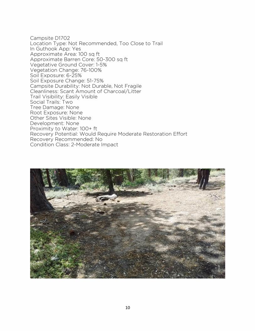
Campsite D1702 Location Type: Not Recommended, Too Close to Trail In Guthook App: Yes Approximate Area: 100 sq ft Approximate Barren Core: 50-300 sq ft Vegetative Ground Cover: 1-5% Vegetation Change: 76-100% Soil Exposure: 6-25% Soil Exposure Change: 51-75% Campsite Durability: Not Durable, Not Fragile Cleanliness: Scant Amount of Charcoal/Litter Trail Visibility: Easily Visible Social Trails: Two Tree Damage: None Root Exposure: None Other Sites Visible: None Development: None Proximity to Water: 100+ ft Recovery Potential: Would Require Moderate Restoration Effort Recovery Recommended: No Condition Class: 2-Moderate Impact

11
Campsite D1703 Location Type: Not Recommended, Too Close to Trail In Guthook App: No Approximate Area: 150 sq ft Approximate Barren Core: 50-300 sq ft Vegetative Ground Cover: 0% Vegetation Change: 76-100% Soil Exposure: 51-75% Soil Exposure Change: 76-100% Campsite Durability: Durable Cleanliness: Charcoal or Litter Trail Visibility: Truly Obtrusive Social Trails: None Tree Damage: None Root Exposure: None Other Sites Visible: None Development: Minimal Fire Ring, Moderate Development Proximity to Water: 100+ ft Recovery Potential: Would Require Moderate Restoration Effort Recovery Recommended: YES Condition Class: 2-Moderate Impact

12
Campsite D1704 Location Type: Not Recommended, Too Close to Trail In Guthook App: Yes Approximate Area: 200 sq ft Approximate Barren Core: 50-300 sq ft Vegetative Ground Cover: 1-5% Vegetation Change: 51-75% Soil Exposure: 6-25% Soil Exposure Change: 76-100% Campsite Durability: Not Durable, Not Fragile Cleanliness: Scant Essentially Spotless Trail Visibility: Easily Visible Social Trails: One Tree Damage: None Root Exposure: None Other Sites Visible: None Development: None Proximity to Water: 100+ ft Recovery Potential: Would Require Moderate Restoration Effort Recovery Recommended: No Condition Class: 2-Moderate Impact

13
Campsite D1705 Location Type: Not Recommended, Too Close to Trail In Guthook App: Yes Approximate Area: 100 sq ft Approximate Barren Core: 50-300 sq ft Vegetative Ground Cover: 0% Vegetation Change: 76-100% Soil Exposure: 76-100% Soil Exposure Change: 76-100% Campsite Durability: Durable Cleanliness: Essentially Spotless Trail Visibility: Partially Visible Social Trails: One Tree Damage: None Root Exposure: None Other Sites Visible: None Development: None Proximity to Water: 100+ ft Recovery Potential: Would Require Moderate Restoration Effort Recovery Recommended: No, Accessible by vehicle so restoration is not likely to succeed. Condition Class: 3-Heavy Impact

14
Campsite D1706 Location Type: Permitted In Guthook App: Yes Approximate Area: 1000 sq ft Approximate Barren Core: 300+ sq ft Vegetative Ground Cover: 76-100% Vegetation Change: 6-25% Soil Exposure: 6-25% Soil Exposure Change: 51-75% Campsite Durability: Not Durable, Not Fragile Cleanliness: Scant Amount of Charcoal/Litter Trail Visibility: Partially Visible Social Trails: Two Tree Damage: None Root Exposure: None Other Sites Visible: None Development: Unobtrusive Windbreaks/Seats Proximity to Water: 100+ ft Recovery Potential: Would Require Moderate Restoration Effort Recovery Recommended: No Condition Class: 2-Moderate Impact
NO PHOTO

41709
41710
41711
41701
4170241703
41705
41706
41707
41708
D1701
D1702
D1703D1704
D1705
D1706
41704
Trail Assessment
0 0.650.325Miles ¸
LEGEND
Deficiency
Assessed Trail
TRT NotAssessed
Segment 4:Spooner Summit
to Kingsbury North
Campsite
AREA OF DETAIL
15
16
NEXT STEPS
ASSESSMENT PROJECTIONS 2018-2020 Approximately 7.2 miles were formally assessed on Segment 4 in 2017, which is a majority of this 11.9 mile segment. The schedule for future formal assessments is as follows:
August 2018
Logan House Road to Kingsbury North Connector (4.7 miles)
03