selami̇ kesler afyonreswinter2015_selamikesler
DESCRIPTION
afyon_kış_okuluTRANSCRIPT
Asst.Prof. Dr. Selami KESLER Pamukkale University
Faculty of Engineering Department of Electrical & Electronics Engineering Director of Power Systems App.& Research Center
Denizli /TURKEY
A Low Cost Shading Analyzer and Site Evaluator Design to Determine Optimal Installation Area for PV Power Systems
& A Review on the Other Exsisting Tools
Fotovoltaik güç sistemleri için en uygun kurulum alanını belirlemek üzere düşük maliyetli bir gölge analizörü ve site değerlendirici tasarımı
& Diğer mevcut araçlar üzerine bir inceleme

outline
• Introduction
• Review on shading analyzers and site evaluators
• Shading analysis tools and Classification
• A new tool designed by the researcher in PAU
• Fundamentals and details of this tool
• Implementation board
• Application and results
• Evaluation software
• Discussion and conclusion
2

introduction
• Shading analyzer tools are necessary for selecting the most suitable installation site to sustain enough solar power. Besides, in order to analyze shading effects on productivity of the solar power system, changes in solar data throughout the year must be evaluated along with the identification of the obstructions surrounding the installation site.
• In this presentation, the shading analysis and site evaluator tools used commonly are introduced briefly.
• Afterwards, a new and different device developed in Pamukkale Univ. Labs. for this purpose is explained. Experimental studies were performed in Denizli, obtained results and evaluation of the device are discussed.
3

A brief review on selected tools for shading analysis
• Solar path finders and site evaluators
• Horizon catchers and Real-time sunlight observers
• Trackers and special softwares for mobile phones
AND
• a new tool designed by the researcher in Pamukkale University
4
Shading analysis tools
5
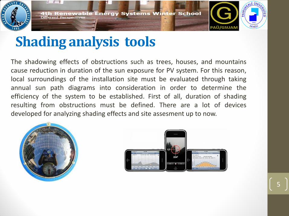
The shadowing effects of obstructions such as trees, houses, and mountains cause reduction in duration of the sun exposure for PV system. For this reason, local surroundings of the installation site must be evaluated through taking annual sun path diagrams into consideration in order to determine the efficiency of the system to be established. First of all, duration of shading resulting from obstructions must be defined. There are a lot of devices developed for analyzing shading effects and site assesment up to now.
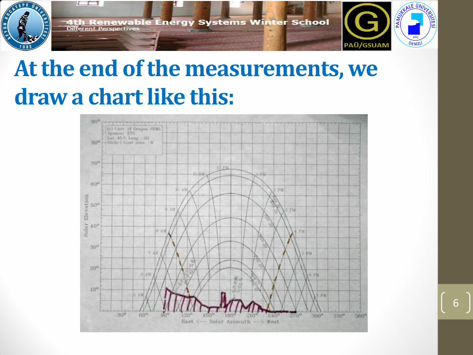
At the end of the measurements, we draw a chart like this:
6
Classification • Tools with only hardware unit:
In the systems using only hardware equipment, yearly shading graph is drawn over the yearly sunlight chart for the local area. Afterwards, all of the obtained data can be evaluated by special software, which is called a solar path finder.
• Tools with only software unit:
Data on surroundings recorded beforehand by the users are needed in the systems with only software unit. In addition, yearly sunlight database is maintained by another ancillary program like Google Earth. Some examples of these systems are Amethyst, Sombrero, and SUNDI.
• Tools with software and hardware unit:
The shading analyzers using software and hardware units use real-time data. The data on the surroundings can be transferred into a computer via an interface and combined with a software. Sun Eye is an example of these devices.
7
Solar path finders & Site Evaluators
8
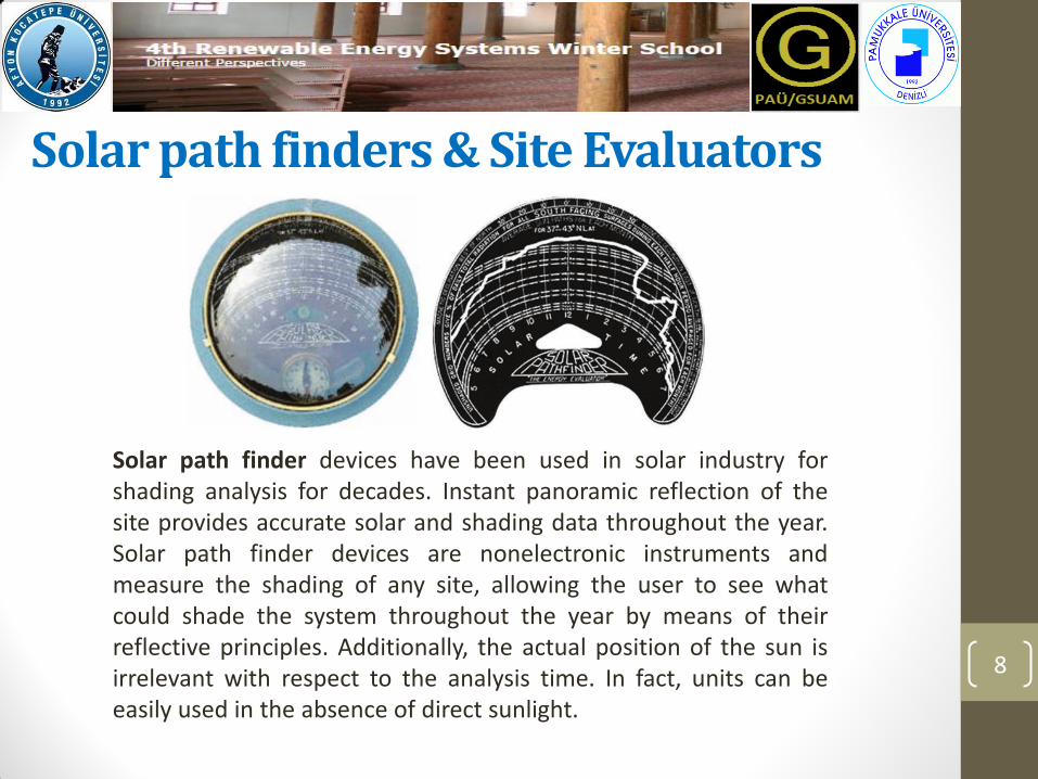
Solar path finder devices have been used in solar industry for shading analysis for decades. Instant panoramic reflection of the site provides accurate solar and shading data throughout the year. Solar path finder devices are nonelectronic instruments and measure the shading of any site, allowing the user to see what could shade the system throughout the year by means of their reflective principles. Additionally, the actual position of the sun is irrelevant with respect to the analysis time. In fact, units can be easily used in the absence of direct sunlight.
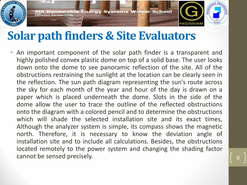
Solar path finders & Site Evaluators • An important component of the solar path finder is a transparent and
highly polished convex plastic dome on top of a solid base. The user looks down onto the dome to see panoramic reflection of the site. All of the obstructions restraining the sunlight at the location can be clearly seen in the reflection. The sun path diagram representing the sun’s route across the sky for each month of the year and hour of the day is drawn on a paper which is placed underneath the dome. Slots in the side of the dome allow the user to trace the outline of the reflected obstructions onto the diagram with a colored pencil and to determine the obstructions which will shade the selected installation site and its exact times, Although the analyzer system is simple, its compass shows the magnetic north. Therefore, it is necessary to know the deviation angle of installation site and to include all calculations. Besides, the obstructions located remotely to the power system and changing the shading factor cannot be sensed precisely. 9
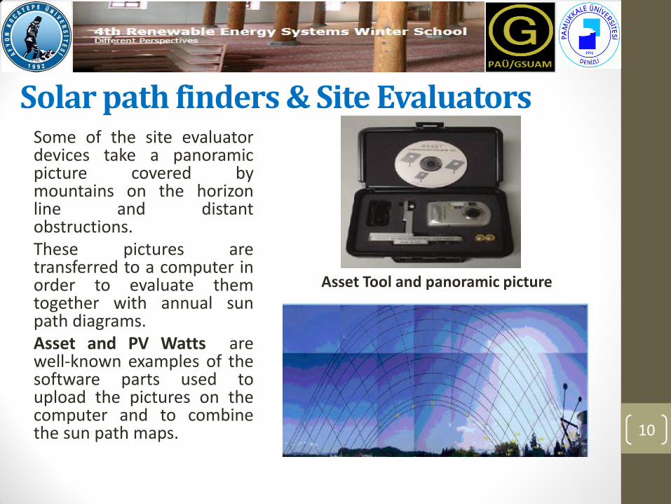
Solar path finders & Site Evaluators Some of the site evaluator devices take a panoramic picture covered by mountains on the horizon line and distant obstructions. These pictures are transferred to a computer in order to evaluate them together with annual sun path diagrams. Asset and PV Watts are well-known examples of the software parts used to upload the pictures on the computer and to combine the sun path maps. 10
Asset Tool and panoramic picture
Horizon catchers and Real-time sunlight observers
11
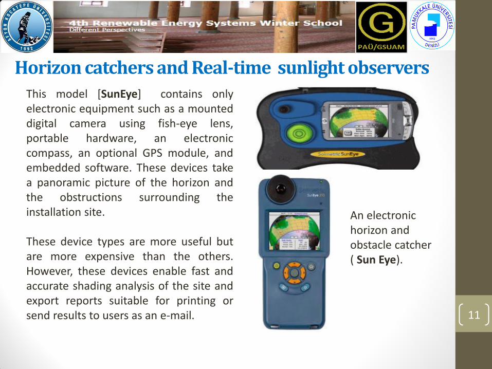
An electronic horizon and obstacle catcher ( Sun Eye).
This model [SunEye] contains only electronic equipment such as a mounted digital camera using fish-eye lens, portable hardware, an electronic compass, an optional GPS module, and embedded software. These devices take a panoramic picture of the horizon and the obstructions surrounding the installation site. These device types are more useful but are more expensive than the others. However, these devices enable fast and accurate shading analysis of the site and export reports suitable for printing or send results to users as an e-mail.
Horizon catchers and Real-time sunlight observers
12
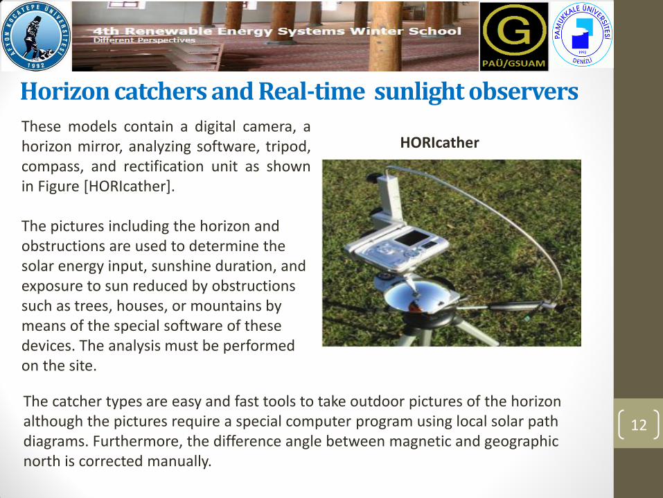
These models contain a digital camera, a horizon mirror, analyzing software, tripod, compass, and rectification unit as shown in Figure [HORIcather]. The pictures including the horizon and obstructions are used to determine the solar energy input, sunshine duration, and exposure to sun reduced by obstructions such as trees, houses, or mountains by means of the special software of these devices. The analysis must be performed on the site.
HORIcather
The catcher types are easy and fast tools to take outdoor pictures of the horizon although the pictures require a special computer program using local solar path diagrams. Furthermore, the difference angle between magnetic and geographic north is corrected manually.

Trackers and special software for mobile phones
13
This application includes a large database of PV panels and inverters which makes the system configuration easier for the users . However, this system which can evaluate real estate is only suitable for iPhone and Android operating Systems, as shown in Figure.
A typical skyline scanning via iPhone
It is the special application integrating solar energy calculation and shading analysis. In addition, it can be simplified in order to trace the outline of local skyline, to produce a trace of obstruction elevation angle for each degree of heading, and to display this along with trajectory of the sun. However, the users must set the tilt and position of the solar array.
Trackers and special software for mobile phones
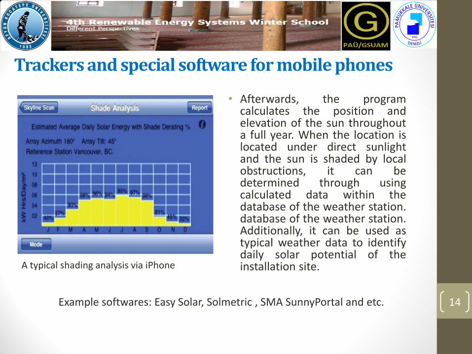
• Afterwards, the program calculates the position and elevation of the sun throughout a full year. When the location is located under direct sunlight and the sun is shaded by local obstructions, it can be determined through using calculated data within the database of the weather station. database of the weather station. Additionally, it can be used as typical weather data to identify daily solar potential of the installation site.
14
A typical shading analysis via iPhone
Example softwares: Easy Solar, Solmetric , SMA SunnyPortal and etc.
A new tool designed by PAU
15

A new tool designed by PAU
16
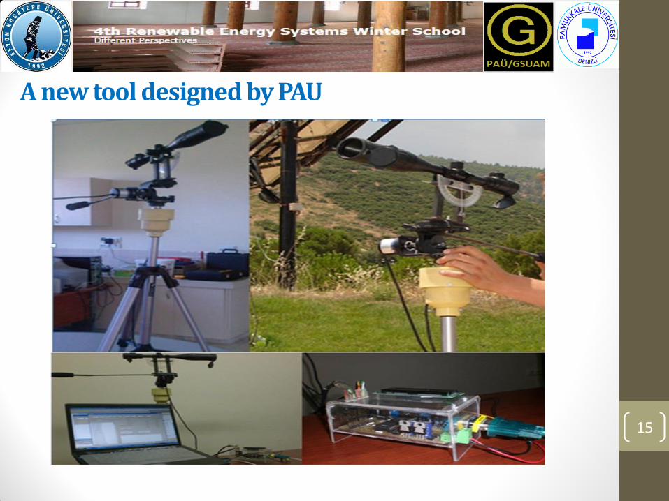
This model consists of a mini telescope, a protractor, a plump, a microcontroller, two-stepper motor or encoder and a tripod. Besides, a basic computer is needed for evaluating recorded data on a sunpath diagram.
Fundamentals of the proposed system
17
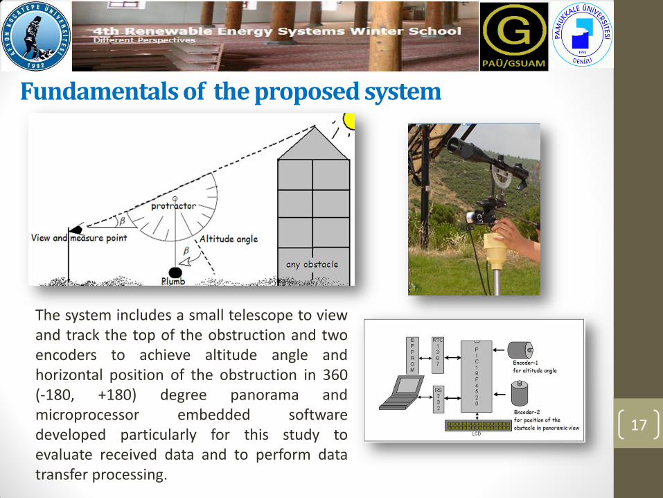
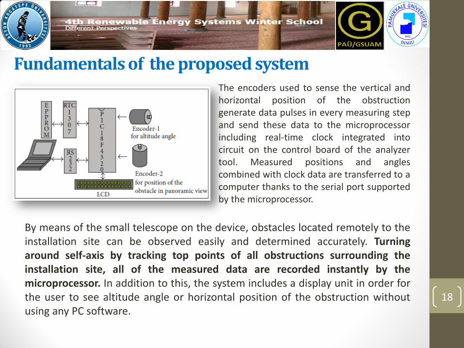
The system includes a small telescope to view and track the top of the obstruction and two encoders to achieve altitude angle and horizontal position of the obstruction in 360 (-180, +180) degree panorama and microprocessor embedded software developed particularly for this study to evaluate received data and to perform data transfer processing.
Fundamentals of the proposed system
18
By means of the small telescope on the device, obstacles located remotely to the installation site can be observed easily and determined accurately. Turning around self-axis by tracking top points of all obstructions surrounding the installation site, all of the measured data are recorded instantly by the microprocessor. In addition to this, the system includes a display unit in order for the user to see altitude angle or horizontal position of the obstruction without using any PC software.
The encoders used to sense the vertical and horizontal position of the obstruction generate data pulses in every measuring step and send these data to the microprocessor including real-time clock integrated into circuit on the control board of the analyzer tool. Measured positions and angles combined with clock data are transferred to a computer thanks to the serial port supported by the microprocessor.

Determining geographic north
19
In order to determine geographic north, the angle of the sun on horizontal axis inaccordance with the data received by a real-time clock (RTC) is calculated by the system after the user enters latitude and longitude values of the local site to the system. Afterwards, the lens of the telescope is directed to the sun and focuses on it and the position of the sun is recorded at that moment. When the angle seen on the display is equal to zero, the geographic north is determined with respect to the sun. The other method to find geographic north in this system is to determine the magnetic north and to adjust the local rectification angle for the site which has been placed in the processor beforehand. In addition, the implemented system can be used with any evaluation software (like SUNDI, etc.) easily without encountering any problems.

Determining the Sun Paths for the Software
20
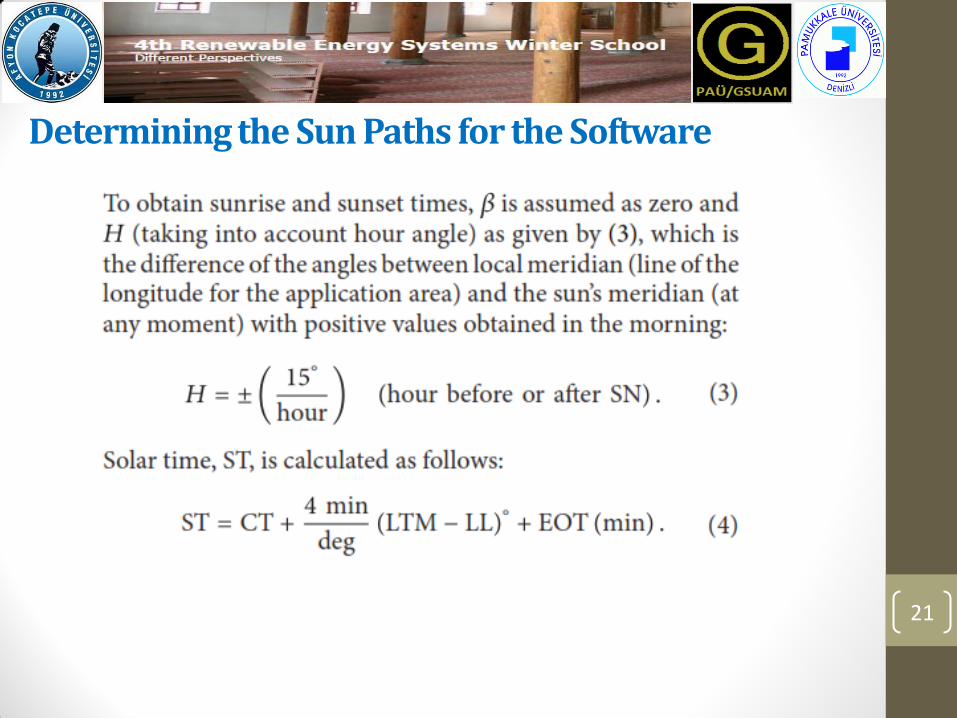
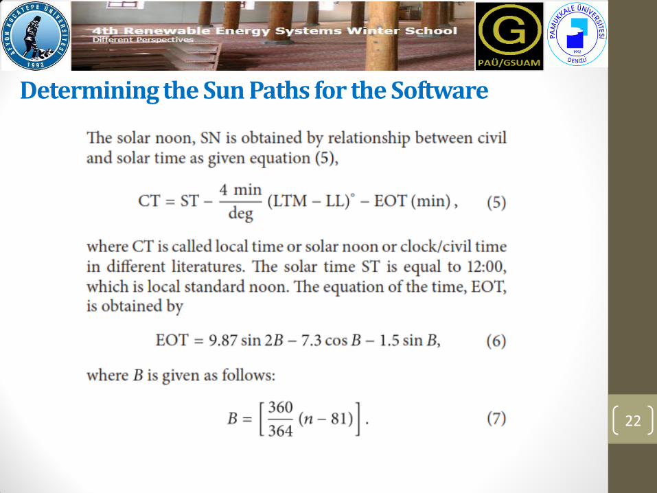
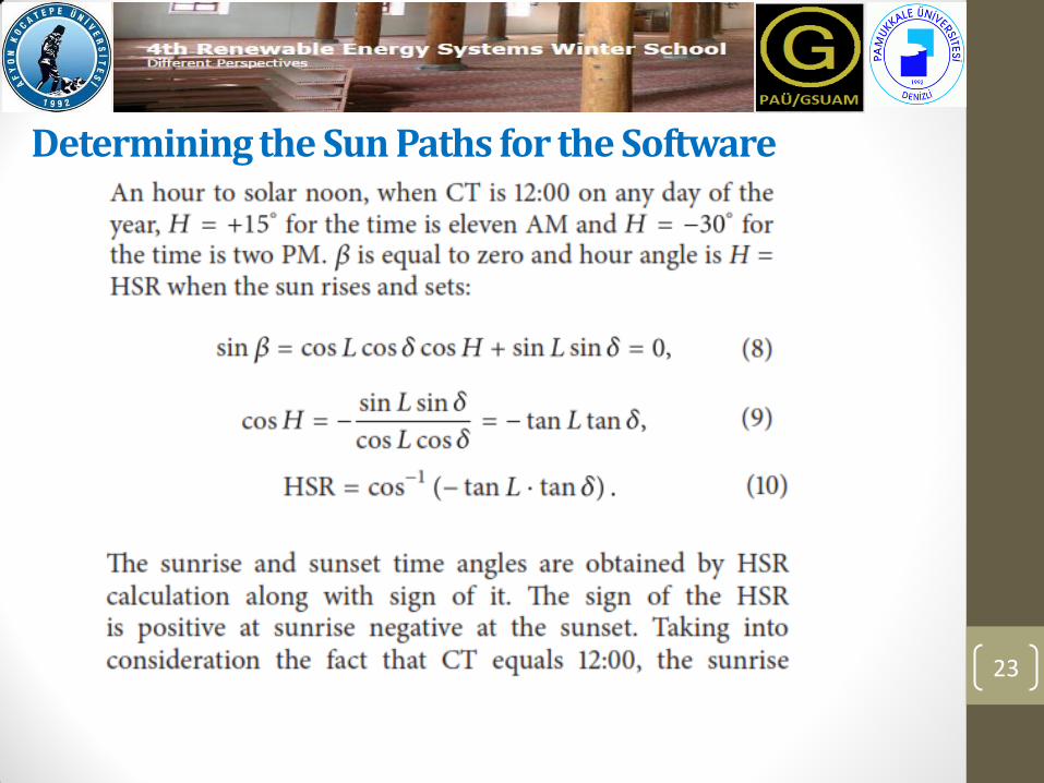
Firstly, the declination angle of the world turning on the trajectory around the sun is between +23.45 and -23.45 degrees. This angle changes at an interval of very small degrees from year to year. However, the declination angle, 𝛿, can be calculated as below:
The position of the sun at any time of the day is expressed by its altitude angle 𝛽 and azimuth angle 𝜑𝑠:
Determining the Sun Paths for the Software
21
22
Determining the Sun Paths for the Software
23
Determining the Sun Paths for the Software
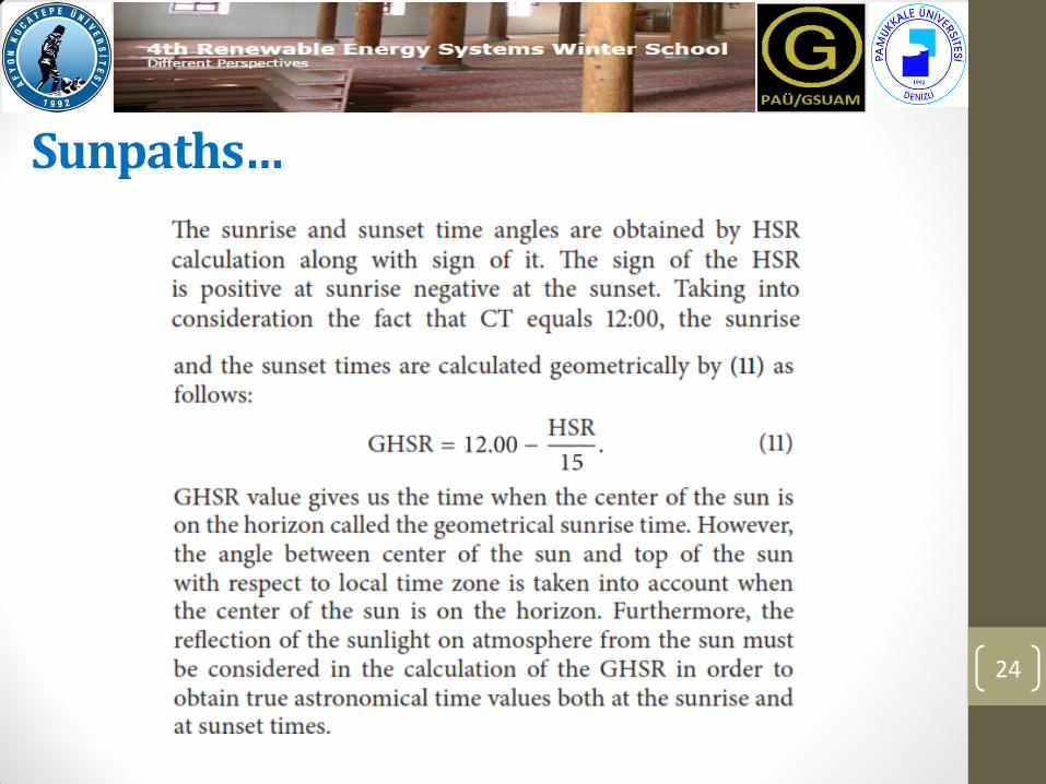
Sunpaths…
24
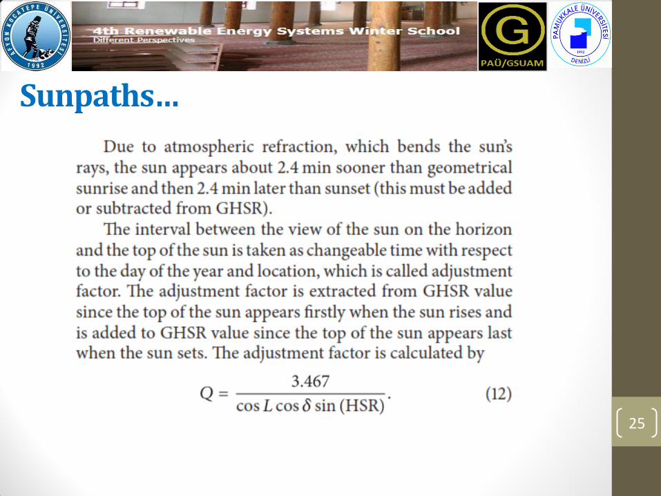
Sunpaths…
25

Implementation…..
26

Application
27
Yassihoyuk County of Denizli in Turkey is selected as a pilot area for solar power installation site and for testing the proposed system. The picture shown in Figure was taken at 19:30 on May 26, 2013. The sun sets over the horizon of 292 degrees at the mentioned time.

Results
28
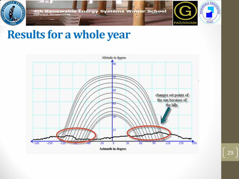
Results for a whole year
29

Evaluation sotfware for this tool
30
As the data recorded for any installation site by means of the implemented system can be evaluated by any Office program, evaluation and monitoring software based on Microsoft Visual C# platform is developed in order to estimate the effect of the shadows on the power system efficiency. The harvesting values of the sunlight with or without shadow can be estimated and displayed on a computer thanks to this interface program. Besides, the user can access local latitude and longitude data, the south angle and tilt angle of the PV panels. Some previews of the interface program developed for this study are shown in next slides.

Evaluation sotfware for this tool
31 A screenshot from evaluation software for instant

Evaluation software for this tool
32 A screenshot from evaluation software for awhole year
Discussion and Conlusion
33

Nomenclature
34

References
35

Thank you so much for your attention and patience…..
Presented by Asst.Prof. Dr. Selami KESLER
Pamukkale University
36
This study was newly published in International Journal of Photoenergy Volume 2015, Article ID 126373, 9 pages http://dx.doi.org/10.1155/2015/126373
Authors: S. Kesler, S. Kıvrak, H. Gürleyen, F. Dinçer