sendai framework disaster risk reduction 13-2015-10 - copie
TRANSCRIPT
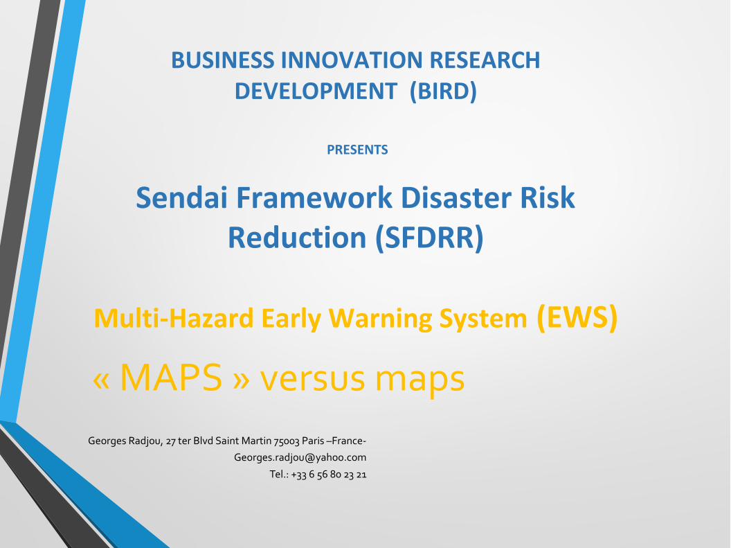
« MAPS » versus mapsGeorges Radjou, 27 ter Blvd Saint Martin 75003 Paris –France-
Tel.: +33 6 56 80 23 21
BUSINESS INNOVATION RESEARCH DEVELOPMENT (BIRD)
PRESENTS
Sendai Framework Disaster Risk Reduction (SFDRR)
Multi-Hazard Early Warning System (EWS)

I- Organization should implement more EWS, more risk information and People able to assess by 2030.DEVELOPMENT OF THE SENDAI FRAMEWORK “WORD INTO ACTION”IMPLEMENTATION GUIDE FOR SENDAI FRAMEWORK TARGET 7SUBSTANTIALLY INCREASE THE AVAILABILITY AND ACCESS TO MULTIHAZARD AND EARLY WARNING SYSTEM AND DISASTER RISK INFORMATIONASSESSMENT TO THE PEOPLE BY 2030.
DEVELOPMENT
SUBSTANTIALLYINCREASE
MHEWS
Assessment
People
2030
AVAILABILITYACCESS
Disaster Information
Source: author
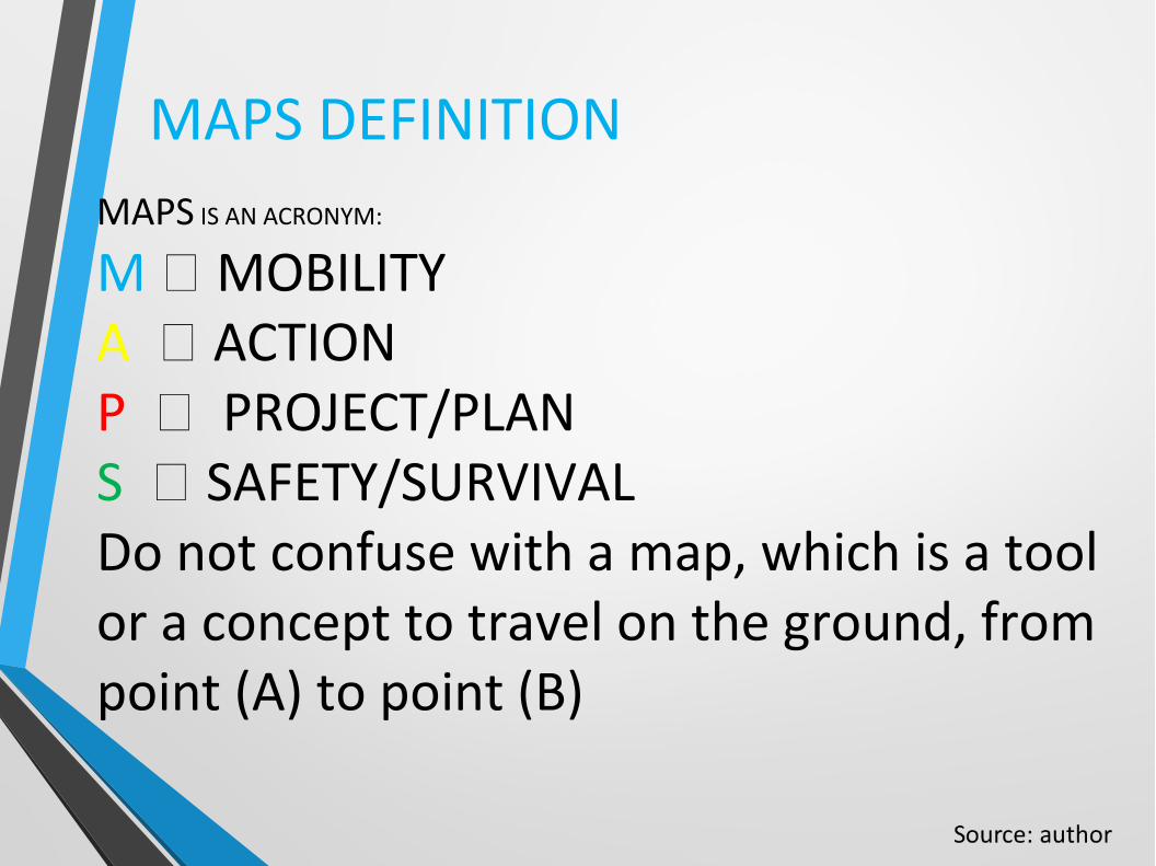
MAPS DEFINITIONMAPS IS AN ACRONYM:
M MOBILITYA ACTION P PROJECT/PLANS SAFETY/SURVIVALDo not confuse with a map, which is a tool or a concept to travel on the ground, from point (A) to point (B)
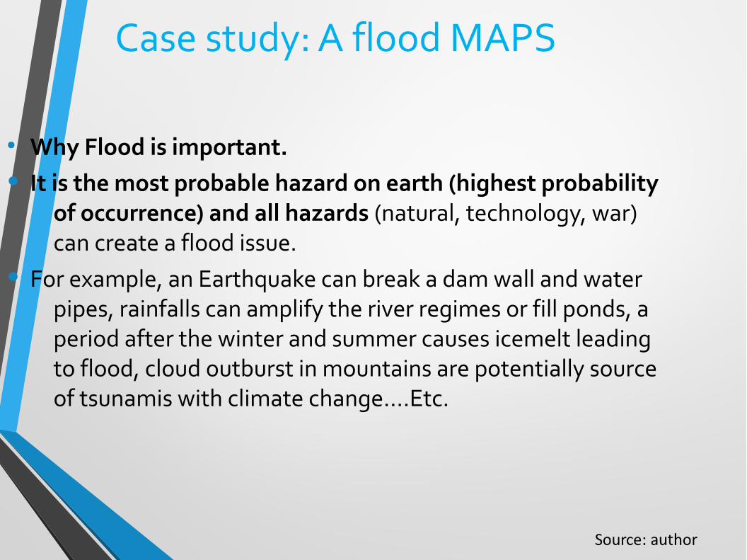
Case study: A flood MAPS
● Why Flood is important.
• It is the most probable hazard on earth (highest probability of occurrence) and all hazards (natural, technology, war) can create a flood issue.
• For example, an Earthquake can break a dam wall and water pipes, rainfalls can amplify the river regimes or fill ponds, a period after the winter and summer causes icemelt leading to flood, cloud outburst in mountains are potentially source of tsunamis with climate change….Etc.
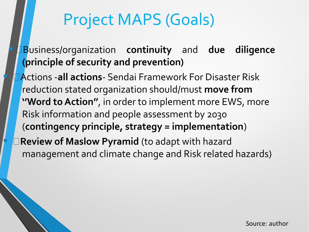
Project MAPS (Goals)
•Business/organization continuity and due diligence (principle of security and prevention)
• Actions -all actions- Sendai Framework For Disaster Risk reduction stated organization should/must move from ‘’Word to Action’’, in order to implement more EWS, more Risk information and people assessment by 2030 (contingency principle, strategy = implementation)
• Review of Maslow Pyramid (to adapt with hazard management and climate change and Risk related hazards)

Principle of the MAPS (How it is working basically). A citizen action: ensure you know what to make, before during and after these catastrophic events. There are a limited number of actions. These need to be known and compared with what the village or city is offering as a response to risk, and taking appropriate and practical actions now. In such a way, at risk (flood) predicted arrival time you are prepared. It could be an individual or a collective action.
Source: author
The MAPs method will show, what are the possibilities (at specific places and times) to ensure a safer future, while building on the past in instant (at condition you are prepared). In such a way, you can always find the best answer (to a catastrophic event). MAPS performance: Needs to adapt the general MAPS to your local geographic and human contexts, to find a new or alternative road maps (SFDRRs) from a risk to a mean of Disaster Risk Reduction), which is your own safety first, based on the preparedness and the evacuation.MAPS should be correlated with the local maps (Michelin, underground, books,…) before the risk occurs, and check for the reviews of the map (and MAPS)
Source: author
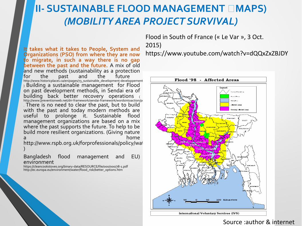
II- SUSTAINABLE FLOOD MANAGEMENT MAPS)(MOBILITY AREA PROJECT SURVIVAL)
It takes what it takes to People, System and Organizations (PSO) from where they are now to migrate, in such a way there is no gap between the past and the future. A mix of old and new methods (sustainability as a protection for the past and the future http://www.historicplaces.ca/en/pages/73_sustainable_development-developpement_durable.aspx) Building a sustainable management for Flood on past development methods, in Sendai era of building back better recovery operations (http://www.preventionweb.net/drr-framework/sendai-framework/wordsintoaction/preparedness-to-build-back-better_priority-4. There is no need to clear the past, but to build with the past and today modern methods are useful to prolonge it. Sustainable flood management organizations are based on a mix where the past supports the future. To help to be build more resilient organizations. (Giving nature a home http://www.rspb.org.uk/forprofessionals/policy/water/policyissues/floodmanagement.aspx)Bangladesh flood management and EU) environment https://cleancookstoves.org/binary-data/RESOURCE/file/000/000/78-1.pdfhttp://ec.europa.eu/environment/water/flood_risk/better_options.htm
Flood in South of France (« Le Var », 3 Oct. 2015)https://www.youtube.com/watch?v=dQQxZxZBJDY
Source :author & internet
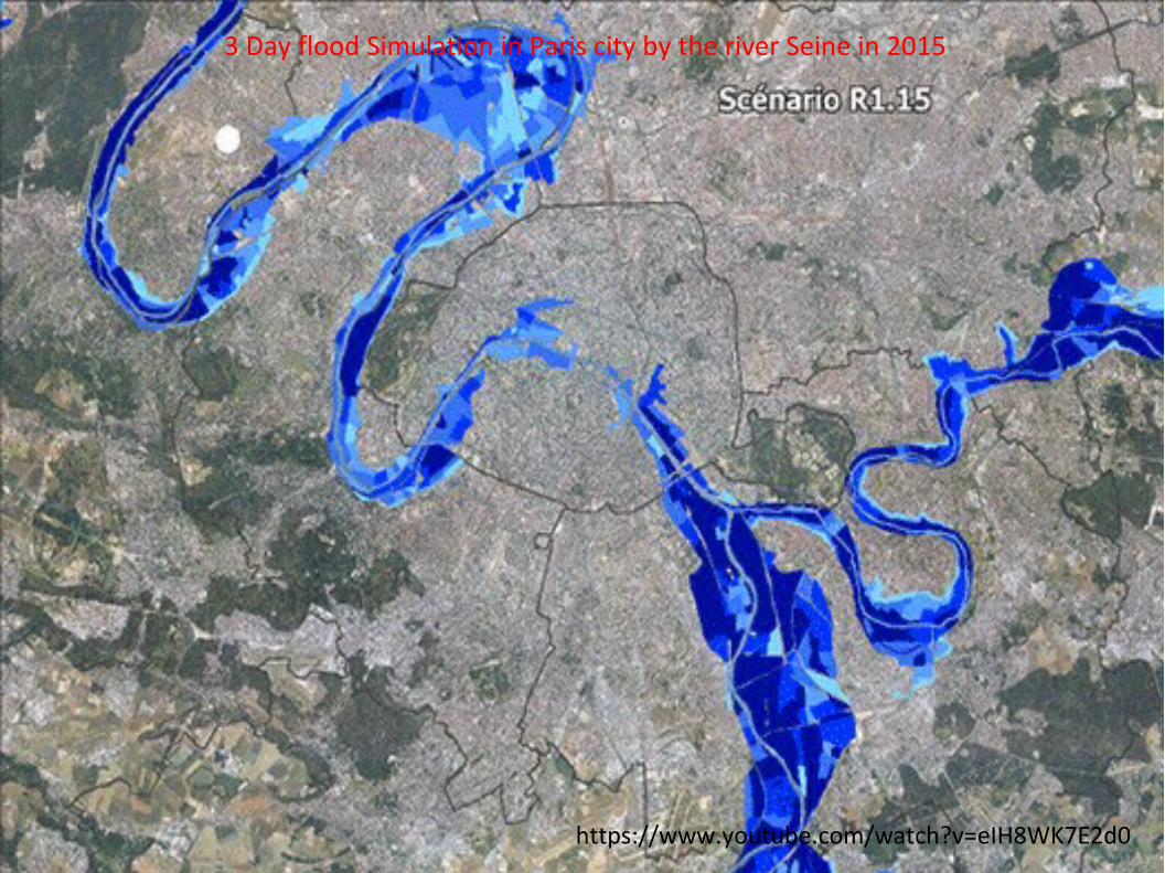
3 Day flood Simulation in Paris city by the river Seine in 2015
https://www.youtube.com/watch?v=eIH8WK7E2d0
Artificial lake
(Ls)
(Li)
W
L
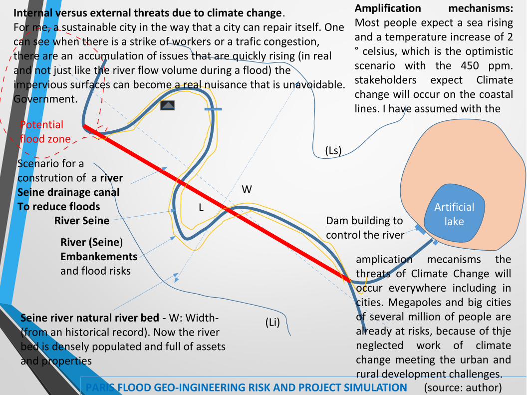
PARIS FLOOD GEO-INGINEERING RISK AND PROJECT SIMULATION (source: author)
Amplification mechanisms: Most people expect a sea rising and a temperature increase of 2 ° celsius, which is the optimistic scenario with the 450 ppm. stakeholders expect Climate change will occur on the coastal lines. I have assumed with the
Internal versus external threats due to climate change. For me, a sustainable city in the way that a city can repair itself. One can see when there is a strike of workers or a trafic congestion, there are an accumulation of issues that are quickly rising (in real and not just like the river flow volume during a flood) the impervious surfaces can become a real nuisance that is unavoidable. Government.
Seine river natural river bed - W: Width- (from an historical record). Now the river bed is densely populated and full of assets and properties
River (Seine) Embankements and flood risks
River Seine
amplication mecanisms the threats of Climate Change will occur everywhere including in cities. Megapoles and big cities of several million of people are already at risks, because of thje neglected work of climate change meeting the urban and rural development challenges.
Dam building to control the river
Scenario for a constrution of a riverSeine drainage canalTo reduce floods
Potential flood zone
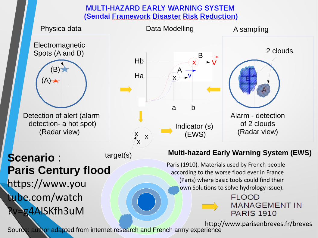
(Radar view)
ElectromagneticSpots (A and B)
Detection of alert (alarm detection- a hot spot)
Physica data Data Modelling
a
Ha
Hb x
b
V
x
2 clouds
(B)
(A)A
BA
v
B
Alarm - detectionof 2 clouds
(Radar view)
A sampling
Multi-hazard Early Warning System (EWS)
xx x
Indicator (s) (EWS)
target(s)Scenario : Paris Century floodhttps://www.youtube.com/watch?v=g4AlSKfh3uM
Source: author adapted from internet research and French army experience
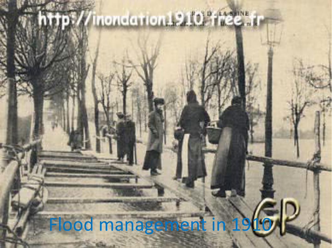
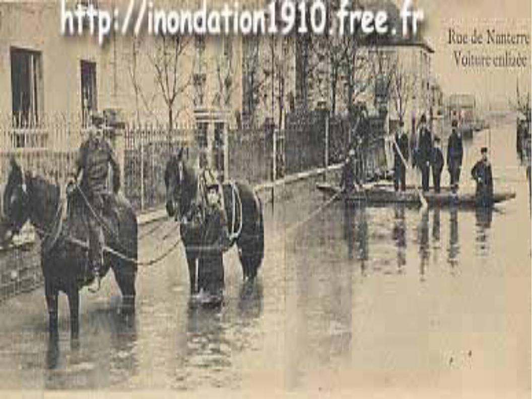
Paris (1910). Materials used by French people according to the worse flood ever in France
(Paris) where basic tools could find their own Solutions to solve hydrology issue).
http://www.parisenbreves.fr/breves
IMPACTS OF CLIMATE CHANGE AND FLOOD IN 21RST CENTURY AND BEYOND
1910: THE CENTURY FLOOD WAS AN ATTRACTIVE STORY FROM THE MEDIA AND POSTCARDS.I LIKE ANY FLOODS IT DISRUPTED THE FRENCH NATIONAL ECONOMY FOR A NUMBER OF MONTHS (GROSS DOMESTIC PRODUCT (GDP) FELT DURING THE RECOVERY. HOWEVER IT WAS NOT A DISASTER (ONLY 1 PERSON LOST THE LIFE, WITH 200,000 DISPLACED PEOPLE AND 1 BILLION EUROS LOST. ONE CAN SAY, IT WAS A VIRTUAL EVENT AT THE SIZE OF 1910 ECONOMY OF SCALE. HOW WOULD IT BE TODAY?
TODAY (21ST), ANY MEGA EVENTS OF SUCH MAGNITUDE (CENTURY FLOOD) IS LIKE TO COST AND KILL A GREAT NUMBER OF PEOPLE (DUE TO THE UNKNOWNS, PEOPLE, TECHNOLOGIES, ASSETS. WHAT HAS HAPPENED IN JAPAN CAN HAPPEN IN ALL MODERN AND DEVELOPPED CITIES, WHERE IS IT LESS EXPECTED: BRIDGES, BUILDING, FACTORIES, CITY POLLUTIONS, TRAFICS, BOATS OR HOUSES DESTROYED…

THEREFORE, « MAPS » IS A SECURE PROJECT AIMING AT HARMONY WITH NATURE, AND A SUSTAINABILITY BUILT ON OLD DEVELOPTMENT STRUCTURE, AVOIDING TO REMOVE THE OLD KNOWLEDGE AND INDUSTRY THAT CAN SUPPORT NEW ONES.ALSO, CREATING INDUSTRIES AND INFRASTRUCTURES THAT CAN SUSTAIN ITSELF, WITHOUT THE NEED FOR ORGANIZATIONS TO ENSURE MAINTENANCE. THE FORCE OF NATURE IS IN OWN HEALING POWER. IN SUCH A WAY, STAKEHOLDERS SHOULD TAKE NATURE AS AN ALLY AND NOT AN ENEMY (AS IT IS IN OLD ENGINEERING PARADIGM). (BUILDING MIMETIC ORGANIZATIONS THAT CAN REFLECT THE SCIENCE OF BIOLOGY AND ENVIRONMENT AND PUTTING MORE ABSTRACT AND GARNISHING ON PHYSICAL SCIENCE OF MATH MODELS.(POSSIBLY, A BEST PRACTICE IS TO USE OR BUILD ON OLD (AS WE CAN SEEN IN FLOOD IN 1910, VERY FEW ASSETS AND TOOLS WHERE EFFECTIVE AT REDUCING LOSSES OF LIVES, BUT TODAY A CATASTROPHIC EVENT WOULD COST MORE IN ALL ASPECTS (PEOPLE, SYSTEM, ORGANIZATION)
IMPACTS OF CLIMATE CHANGE AND FLOOD IN 21RST CENTURY AND BEYOND
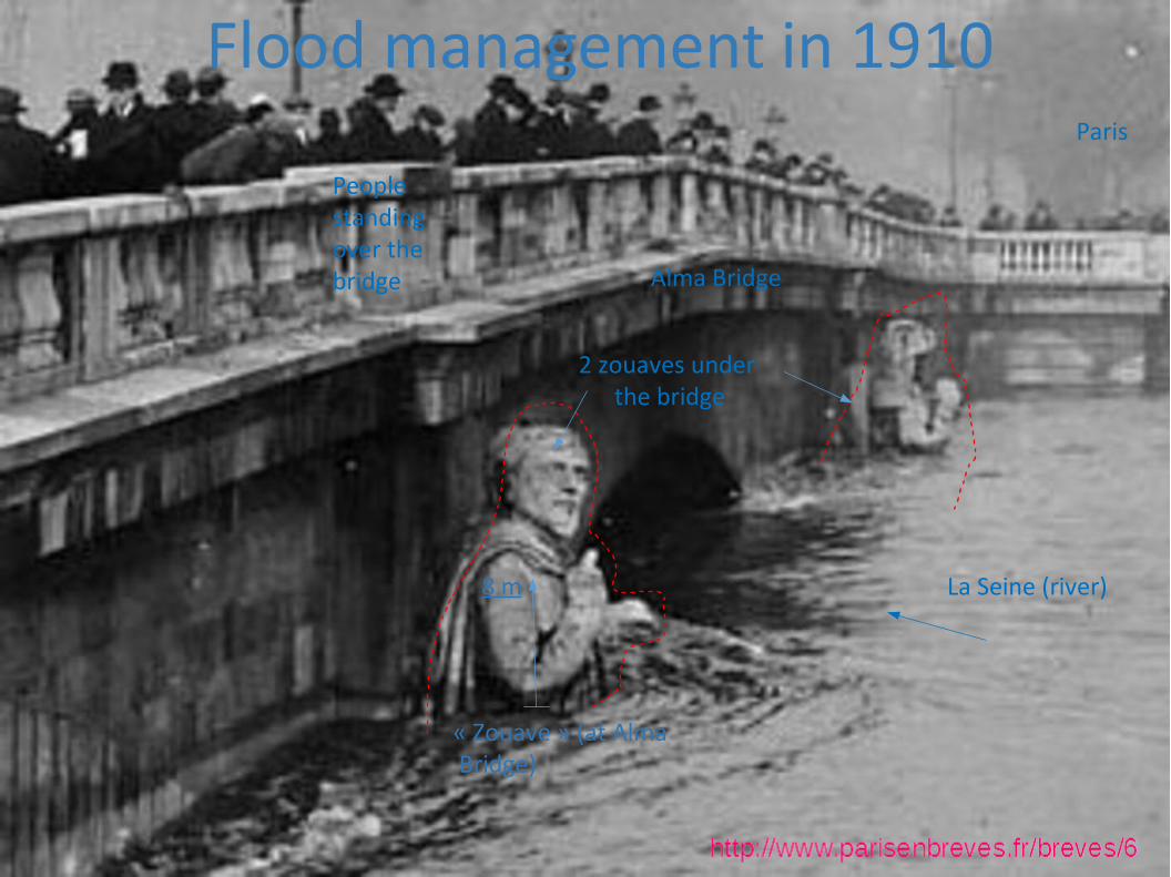
8 m
« Zouave » (at Alma Bridge)
Alma Bridge
People standing over the bridge
La Seine (river)
Paris
2 zouaves under the bridge
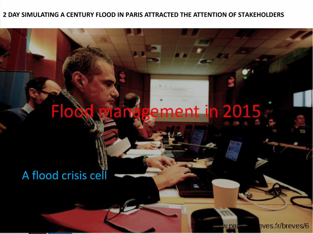
A flood crisis cell
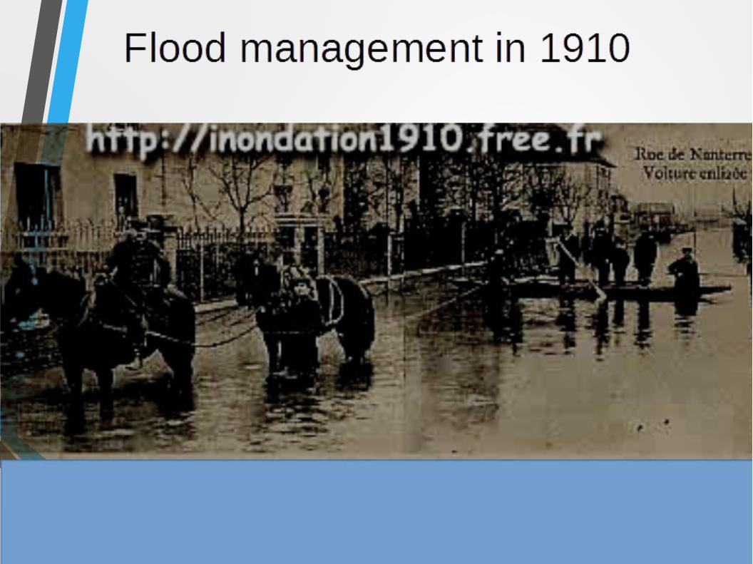
2 DAY SIMULATING A CENTURY FLOOD IN PARIS ATTRACTED THE ATTENTION OF STAKEHOLDERS

River flood - Seine close to Alma bridge with 2 zouaves…-
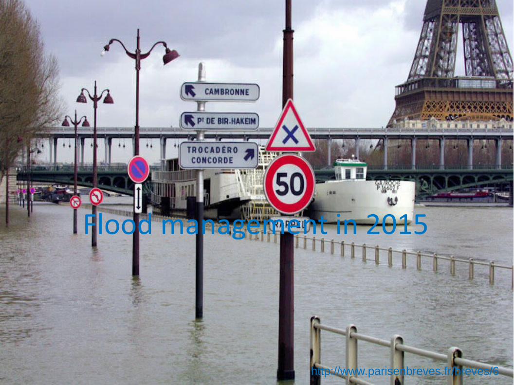
http://www.parisenbreves.fr/breves/6
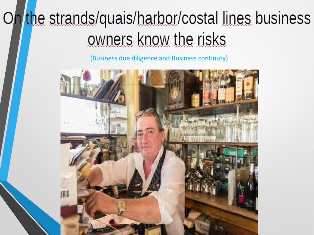
(Business due diligence and Business continuty)
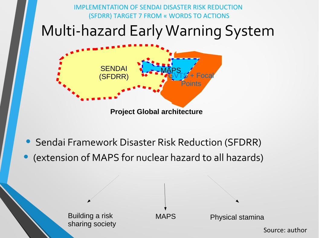
Multi-hazard Early Warning System
• Sendai Framework Disaster Risk Reduction (SFDRR)
• (extension of MAPS for nuclear hazard to all hazards)
Building a risksharing society
MAPS Physical stamina
SENDAI(SFDRR)
MAPSGVTS + Focal
Points
Project Global architecture
IMPLEMENTATION OF SENDAI DISASTER RISK REDUCTION (SFDRR) TARGET 7 FROM « WORDS TO ACTIONS
Source: author

Project concept
Risk sharing society
MAPS
Physicalstamina
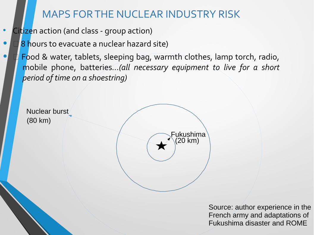
MAPS FOR THE NUCLEAR INDUSTRY RISK● Citizen action (and class - group action)
• 8 hours to evacuate a nuclear hazard site)
• Food & water, tablets, sleeping bag, warmth clothes, lamp torch, radio, mobile phone, batteries...(all necessary equipment to live for a short period of time on a shoestring)
Fukushima
Nuclear burst
(20 km)
(80 km)
Source: author experience in the French army and adaptations of Fukushima disaster and ROME
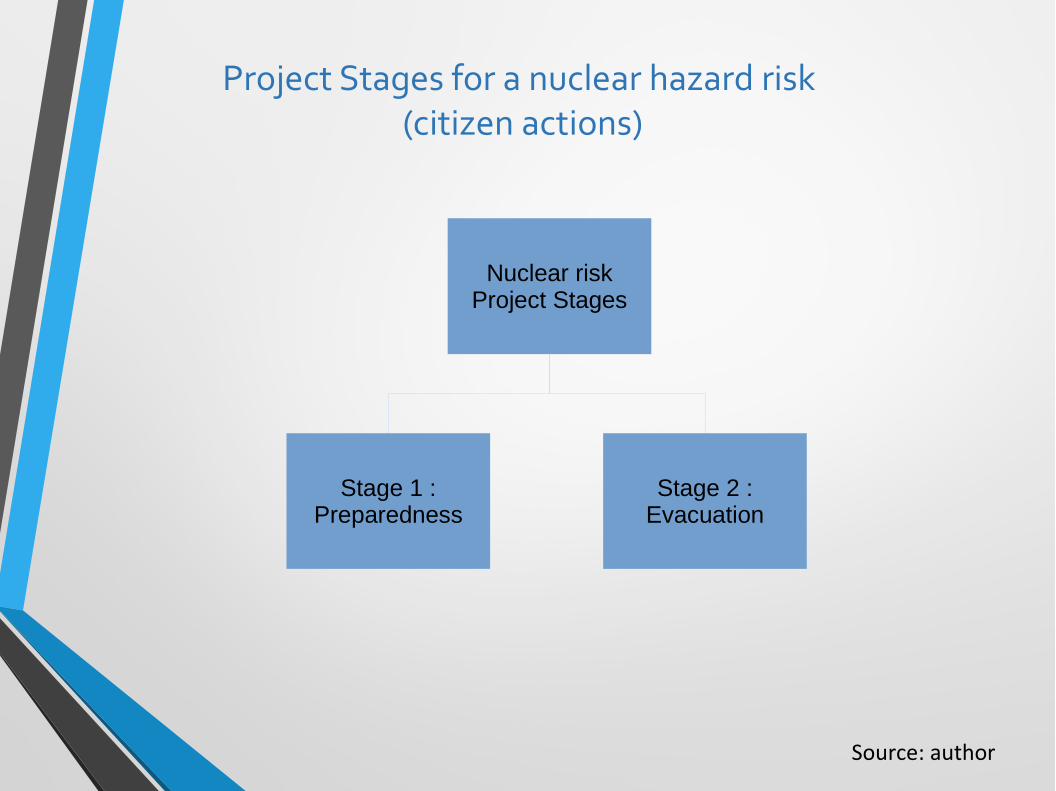
Project Stages for a nuclear hazard risk (citizen actions)
Nuclear riskProject Stages
Stage 2 :Evacuation
Stage 1 :Preparedness
Source: author

Generalized MAPS for all hazards(Natural, technology, War)
Based on an identical thinking than a MAPS for nuclear emergency evacuation, but this time for all risks :
●
● Flood● Tsunami● Earthquake● Hurricane,● Volcano eruption● Landslide● Ebola
● ….

MAPS DESCRIPTION An arrow ( ) is a vectorial representation of the risk encountered in order to evacuate in a direction of the safety point
Hazard (Threat, risk, danger...) Safety Point (*) (for the survival over time)
Fukushima swimming pool number X is realising nuclear waste (radioactive leaks)...
Japan countryside (city, rural areas) Between 20 km and 40 km (km: kilometers)
Nuclear burst...(without the wind and the heat) which supposes people where able to protect from the nuclear wind, and light/heat...)
20 km
80 kmNuclear Shelter (built or sponta-neous location)
Name of the place to go
Priority given on Action : Transport (foot, bicycle, car...) in case of Emergency evacuation
(*) dry feet, elevated features (natural or artificial, shelter…
Variable: distance
Source author with an adaptation of ROME
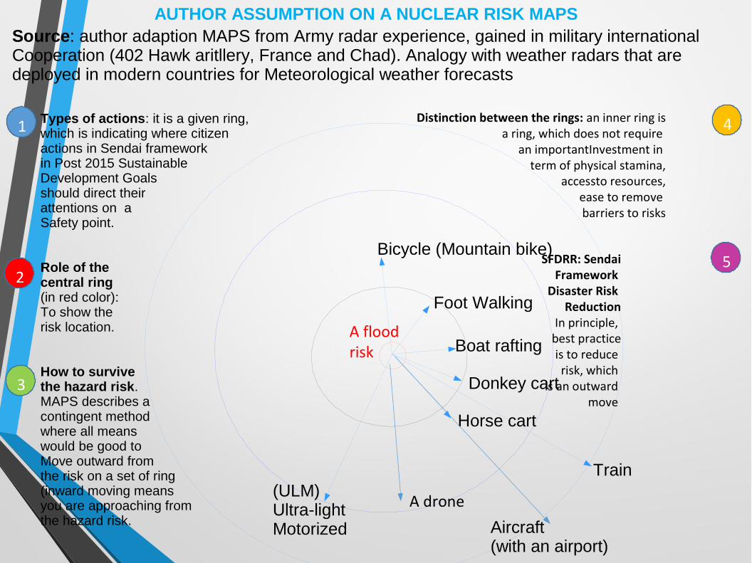
Source: author adaption MAPS from Army radar experience, gained in military international Cooperation (402 Hawk aritllery, France and Chad). Analogy with weather radars that are deployed in modern countries for Meteorological weather forecasts
AUTHOR ASSUMPTION ON A NUCLEAR RISK MAPS
Types of actions: it is a given ring, which is indicating where citizen actions in Sendai frameworkin Post 2015 Sustainable Development Goals should direct their attentions on a Safety point.
Role of the central ring (in red color): To show the risk location.
How to survive the hazard risk. MAPS describes a contingent methodwhere all means would be good to Move outward from the risk on a set of ring(inward moving means you are approaching from the hazard risk.
Foot Walking
Bicycle (Mountain bike)
Train
Aircraft (with an airport)
Boat rafting
Donkey cart
Horse cart
(ULM) Ultra-light Motorized
A flood risk
Distinction between the rings: an inner ring is a ring, which does not require
an importantInvestment in term of physical stamina,
accessto resources, ease to remove barriers to risks
SFDRR: SendaiFramework
Disaster Risk Reduction
In principle, best practice is to reduce
risk, which is an outward
move
A drone
1
2
3
4
5

CRITICAL MAPS (WORSE CASE SCENARIO)
● Citizen action (and class - group action)
• 8 hours to evacuate a nuclear hazard site) Food & water, tablets, sleeping bag, warmth clothes, lamp torch, radio, mobile phone, batteries...(all necessary equipment to live for a short period of time on a shoestring)
Source: author experience in the French army and adaptations of Fukushima disaster and ROME
HAZARD
Radar MAPS: A vulnerable person in such a risk situation where there is no road mapto exit from the hazard zone to a safety point (assembly point, when the elevated surface is flat and large) can gonowhere
For example, once, I was a skipper on
boat in the Red sea. There was a
important storm, and the sea
force was important as
the wind too. The capitan
asked me to help him managing the
boat close to ashelter near Saudia
Arabia coast, afterwe had broken several
parts of the boats
USING MAPS
One should find the same elements of a nuclear MAPS (distance, type of hazards, where to go...). It is a global tool. In any hazard management
projects, there will be a higher number of variable (comparatively to a nuclear MAPS).
Also, it is an indication on how far/close are the solutions to reduce inherent hazard risks.
MAPS project is a one thinking model wth a precise description for actions (reaction, anticipation, proaction, thinking, breakthrough projects, adaptation…
When a hazard is predicted. MAPS is a decision making for hazard management.
Inventory of actions
• General actions (given by the theory of hazard management)
• In principle, a same set of hazards (natural, technology and war) are impacting on various systems: transports, healthcare, housing, food and water supply, tele-communication, displacements.
● Your personal research could show best appropriate actions during the preparedness. And, how to be ready for the « D » day
Source: hazard management theory
Inventory of actions
● Specific actions (given by a risk sharing society and people knowledge) of the natural and built environment - or a database, in case of volumes of risk information) helping to navigate between all features of the risk and human geogrphy (infrastructures, hazard, vulnerability, barriers) enabling project to proceed, in real time with ICT Information Communication Technologies (ICTs) i.e. a smartphone, internet, uses of risk software, Apps...Aslso, animal behavior (horse, birds), owners safety tools (boats, transport systems…)
Source: author

War...too (when the water infrastructures are the targets of rockets or missiles…So, I assumed it should have a central role, in priority to all other risks.(I think it is why MAPS is important, because too often, there is no priority on water survival, which I assumed is a mis-management of emergency and risk contexts
CONSTRUCTION OF A RISK MAPS(for risk variability and ambiguity)Not completed-at this stage- as there is an infinite landscape of adaptations between risk and organisations coping with obstacles. Up to the stakeholders to make a proper inventory able to describe how sustainable is there organization in link with the built or natural environments. In such a way, survival, business continuity and due diligence helps to fulfil the requirement of Sendai framework for Disaster Risk Reduction.
CONCLUSION :
MAPS method is original as a risk sharing society organization, and the solo method to reduce in a sustained sustainable manner disaster risk reduction. By reducing gaps between MAPS and maps, you can ensure Sendai 2015 UNISDR Framework for Disaster Risk Reduction (SFDRR) in the next 15 years (by 2030) with a substantial increase of Mulit-hazard Early Warning Systems (MHEWS) and an increase Risk information and assessment to people by 2030.Various monitors and reviews on ar egular basis could ensure the quality assurance for high output management.
Source: author

Questions answered
1- Risk sharing society:
It is a risk sharing society MAPS, because people best know what are good for them. They know best what local risks in their regions and how they can cope by traveling a distance with an appropirate mean. (People displacement).
For example, if there is no train or no road. Instead a river is flowing in the city and such a risk…It is much likely to use a boat or to walk. In such a way the convenient transport is a boat (raft), walking on foot, riding a
2- Indicators for similarities between risks or level of difficulties according to the risk location (village, city, country). It is related to people vulnerability (old, women, children…). The higher the vulnerability and the less likely risk sharing society. Unless it is organized by the state government
3- Others...
REFERENCES
1- Sendai Framework Disaster Risk Reduction (2015-2030), target 72- Répertoire Opérationnel Métier Emplois (ROME), ANPEWorld Meteorological Organization (WMO), uses of weather radars3- An hazard management theory4- Integrated Flood Resource Management 5- 402 Hawk artillery Regiment6- Author various expereince of using radars and positionning instruments (GPS…)
Thank you
Georges Radjou« BIRD »