shoreline restoration planning
TRANSCRIPT
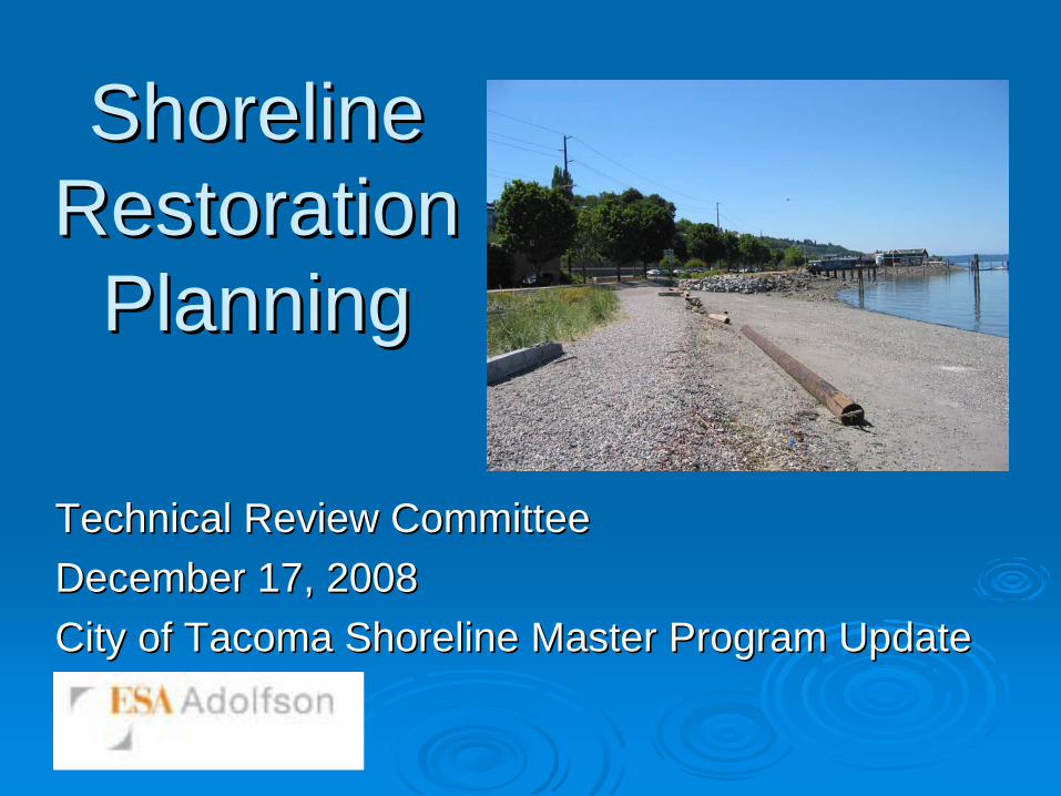
Shoreline Shoreline Restoration Restoration
PlanningPlanning
Technical Review Committee Technical Review Committee December 17, 2008December 17, 2008City of Tacoma Shoreline Master Program UpdateCity of Tacoma Shoreline Master Program Update
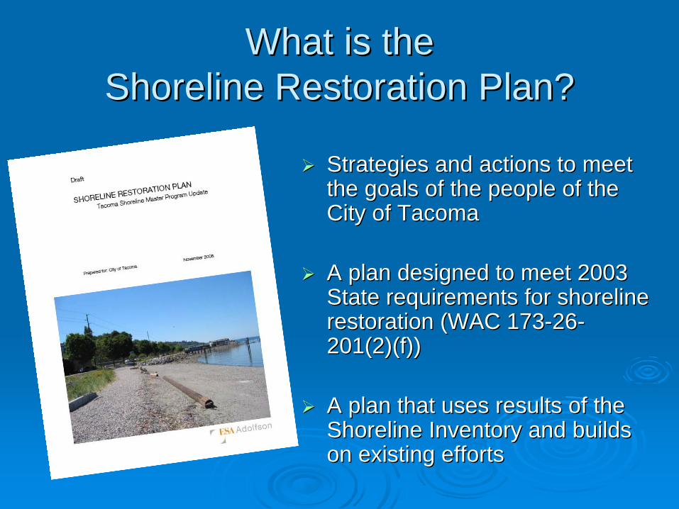
What is the What is the Shoreline Restoration Plan? Shoreline Restoration Plan?
Strategies and actions to meet Strategies and actions to meet the goals of the people of the the goals of the people of the City of TacomaCity of Tacoma
A plan designed to meet 2003 A plan designed to meet 2003 State requirements for shoreline State requirements for shoreline restoration (WAC 173restoration (WAC 173--2626--201(2)(f))201(2)(f))
A plan that uses results of the A plan that uses results of the Shoreline Inventory and builds Shoreline Inventory and builds on existing effortson existing efforts
Overview of State RequirementsOverview of State RequirementsEstablish overall restoration goals and Establish overall restoration goals and prioritiesprioritiesIdentify existing projects and programs which Identify existing projects and programs which contribute to restoration contribute to restoration Identify additional projects, programs and Identify additional projects, programs and funding neededfunding neededIdentify meaningful strategies, timelines and Identify meaningful strategies, timelines and benchmarks for implementationbenchmarks for implementation
See See http://www.ecy.wa.gov/programs/sea/sma/index.htmlhttp://www.ecy.wa.gov/programs/sea/sma/index.html for for more information about the 2003 Shoreline Management more information about the 2003 Shoreline Management GuidelinesGuidelines
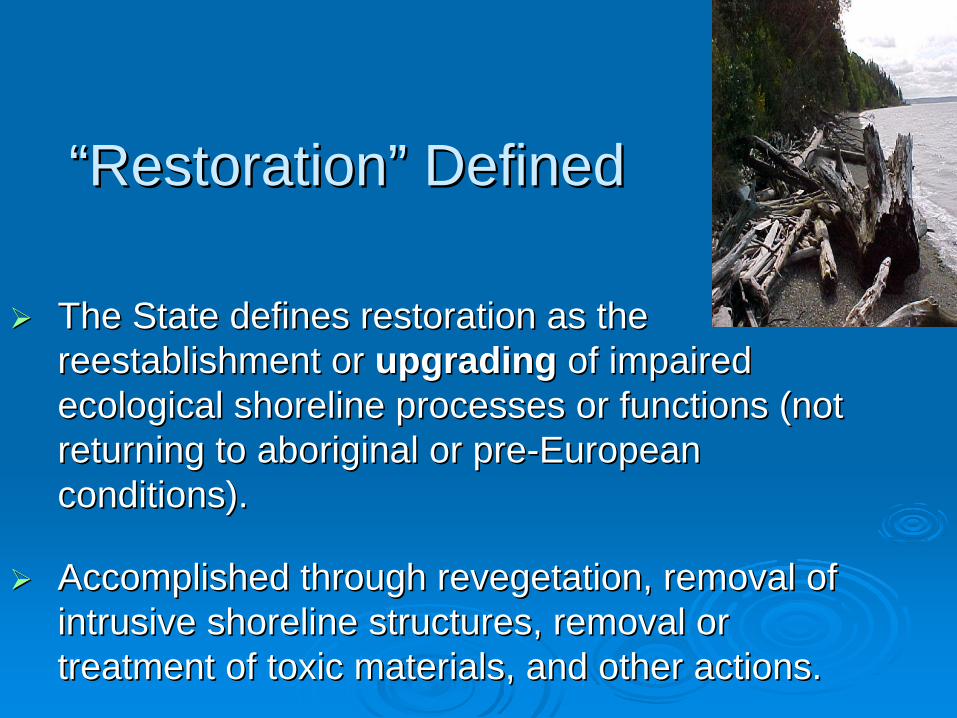
““RestorationRestoration”” DefinedDefined
The State defines restoration as the The State defines restoration as the reestablishment or reestablishment or upgradingupgrading of impaired of impaired ecological shoreline processes or functions (not ecological shoreline processes or functions (not returning to aboriginal or prereturning to aboriginal or pre--European European conditions). conditions).
Accomplished through Accomplished through revegetationrevegetation, removal of , removal of intrusive shoreline structures, removal or intrusive shoreline structures, removal or treatment of toxic materials, and other actions. treatment of toxic materials, and other actions.
Key Challenges to RestorationKey Challenges to Restoration in Urban Areasin Urban Areas
Multiple effects on shoreline from Multiple effects on shoreline from greater watershed that are outside of greater watershed that are outside of local controllocal controlLimited sites available for restorationLimited sites available for restorationFragmented habitatFragmented habitatHigh costs (land acquisition, amount High costs (land acquisition, amount of work required)of work required)Competing needs for shoreline Competing needs for shoreline resources resources
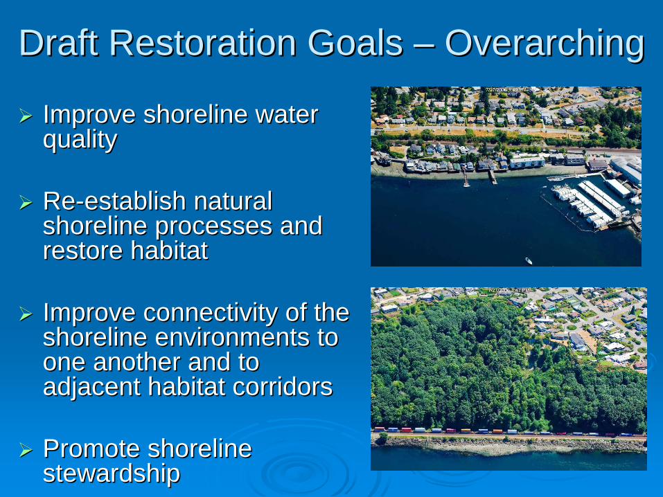
Draft Restoration Goals Draft Restoration Goals –– OverarchingOverarching
Improve shoreline water Improve shoreline water qualityquality
ReRe--establish natural establish natural shoreline processes and shoreline processes and restore habitatrestore habitat
Improve connectivity of the Improve connectivity of the shoreline environments to shoreline environments to one another and to one another and to adjacent habitat corridors adjacent habitat corridors
Promote shoreline Promote shoreline stewardshipstewardship
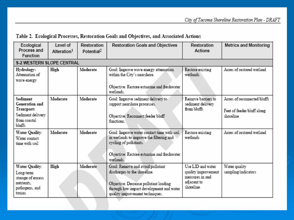
Draft Restoration Goals Draft Restoration Goals –– Specific to Shoreline ProcessesSpecific to Shoreline Processes
Goals and objectives build on Goals and objectives build on Comprehensive Comprehensive PlanPlan and and Open Space Habitat and RestorationOpen Space Habitat and Restorationgoals.goals.
Goals specifically address the altered shoreline Goals specifically address the altered shoreline processes and functions identified in the processes and functions identified in the Shoreline Inventory and Characterization.Shoreline Inventory and Characterization.
Objectives identify specific measurable actions Objectives identify specific measurable actions that can be taken to achieve the stated goals. that can be taken to achieve the stated goals.
Restoration OpportunitiesRestoration OpportunitiesShoreline Inventory and Characterization Shoreline Inventory and Characterization identified opportunitiesidentified opportunities
Draft Restoration Plan expands on the Inventory, Draft Restoration Plan expands on the Inventory, identifying specific restoration actions identifying specific restoration actions associated with:associated with:
types and levels of shoreline alterationstypes and levels of shoreline alterationspotential for restoration within each shoreline districtpotential for restoration within each shoreline districtspecific goals and objectives specific goals and objectives
Draft Plan suggests metrics for monitoring and Draft Plan suggests metrics for monitoring and measuring success measuring success
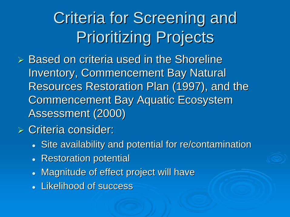
Criteria for Screening and Criteria for Screening and Prioritizing ProjectsPrioritizing Projects
Based on criteria used in the Shoreline Based on criteria used in the Shoreline Inventory, Commencement Bay Natural Inventory, Commencement Bay Natural Resources Restoration Plan (1997), and the Resources Restoration Plan (1997), and the Commencement Bay Aquatic Ecosystem Commencement Bay Aquatic Ecosystem Assessment (2000)Assessment (2000)Criteria consider:Criteria consider:
Site availability and potential for re/contaminationSite availability and potential for re/contaminationRestoration potentialRestoration potentialMagnitude of effect project will haveMagnitude of effect project will haveLikelihood of successLikelihood of success
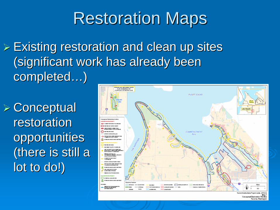
Restoration MapsRestoration MapsExisting restoration and clean up sites Existing restoration and clean up sites (significant work has already been (significant work has already been completedcompleted……))
Conceptual Conceptual restoration restoration opportunities opportunities (there is still a (there is still a lot to do!)lot to do!)
Next stepsNext steps……
Incorporate Ecology, technical committee Incorporate Ecology, technical committee and public commentsand public comments
Refine Draft Restoration Plan considering Refine Draft Restoration Plan considering conflicting uses (Public Access Plan, conflicting uses (Public Access Plan, shoreline use)shoreline use)
Identify timelines and benchmarks for Identify timelines and benchmarks for implementationimplementation

City of Tacoma Thea Foss Waterway Design and
Development Plan
Public Access ReportDecember 17, 2008
Thea Foss Waterway Public Access Report – December 17, 2008
TOPICS TO BE DISCUSSED
• City Of Tacoma Planning Documents
• Existing Public Access Along The Thea Foss Waterway
• Proposed Public Access Projects Or Improvements
• Future Opportunities For Public Access
• Use Conflict Analysis
Thea Foss Waterway Public Access Report – December 17, 2008
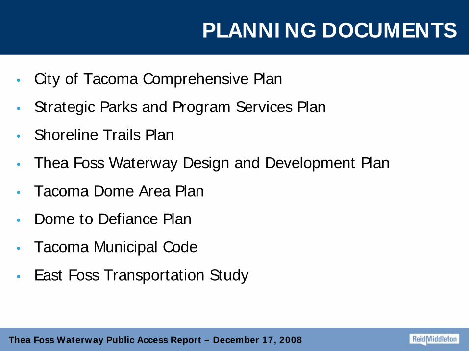
PLANNING DOCUMENTS
• City of Tacoma Comprehensive Plan
• Strategic Parks and Program Services Plan
• Shoreline Trails Plan
• Thea Foss Waterway Design and Development Plan
• Tacoma Dome Area Plan
• Dome to Defiance Plan
• Tacoma Municipal Code
• East Foss Transportation Study
Thea Foss Waterway Public Access Report – December 17, 2008
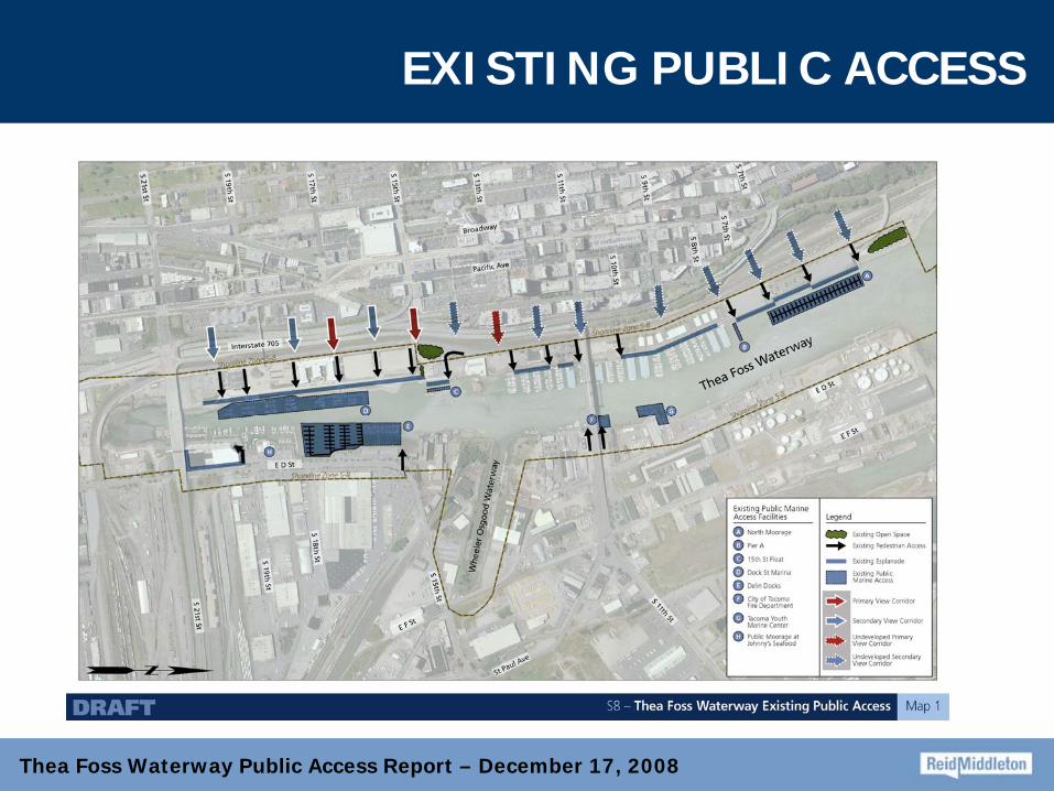
EXISTING PUBLIC ACCESS
Thea Foss Waterway Public Access Report – December 17, 2008
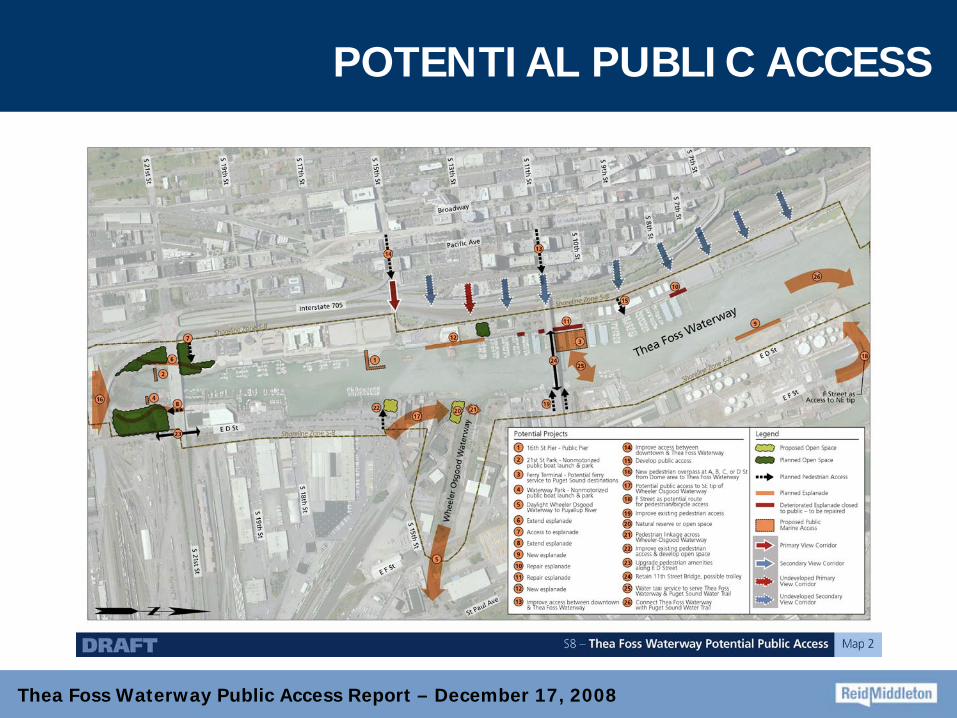
POTENTIAL PUBLIC ACCESS
Thea Foss Waterway Public Access Report – December 17, 2008
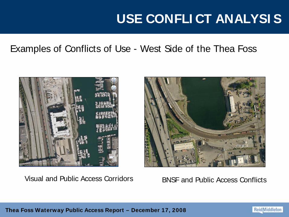
USE CONFLICT ANALYSIS
Examples of Conflicts of Use - West Side of the Thea Foss
Visual and Public Access Corridors BNSF and Public Access Conflicts
Thea Foss Waterway Public Access Report – December 17, 2008
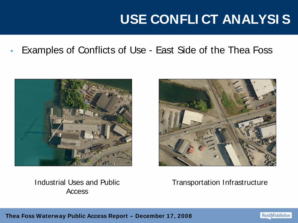
USE CONFLICT ANALYSIS
• Examples of Conflicts of Use - East Side of the Thea Foss
Transportation InfrastructureIndustrial Uses and Public Access
Thea Foss Waterway Public Access Report – December 17, 2008
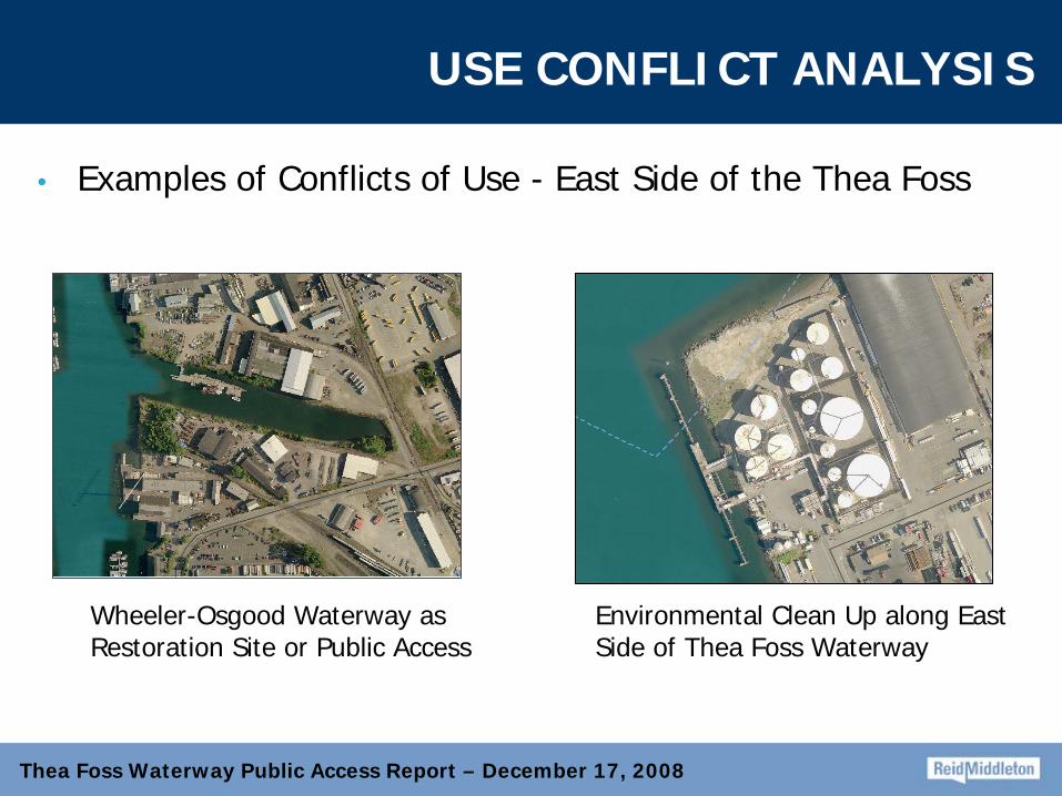
USE CONFLICT ANALYSIS
• Examples of Conflicts of Use - East Side of the Thea Foss
Wheeler-Osgood Waterway as Restoration Site or Public Access
Environmental Clean Up along East Side of Thea Foss Waterway

Thea Foss Waterway Public Access Report – December 17, 2008
USE CONFLICT ANALYSIS
• Example of Public Access and Industrial Land
Boston - Walk the Waterfront
City of Tacoma Thea Foss Waterway Design and
Development Plan
Public Access ReportDecember 17, 2008
1
Waterfront Lands Analysis 2008
By: BST AssociatesFor: City of Tacoma
2
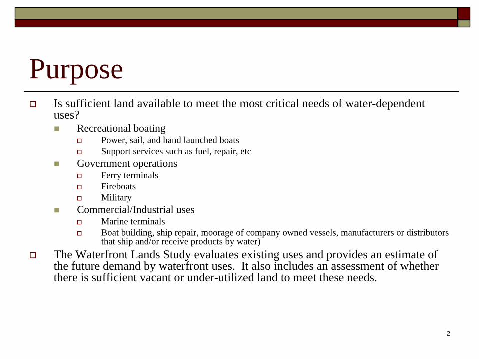
PurposeIs sufficient land available to meet the most critical needs of water-dependent uses?
Recreational boatingPower, sail, and hand launched boatsSupport services such as fuel, repair, etc
Government operationsFerry terminalsFireboatsMilitary
Commercial/Industrial usesMarine terminalsBoat building, ship repair, moorage of company owned vessels, manufacturers or distributors that ship and/or receive products by water)
The Waterfront Lands Study evaluates existing uses and provides an estimate of the future demand by waterfront uses. It also includes an assessment of whether there is sufficient vacant or under-utilized land to meet these needs.
3
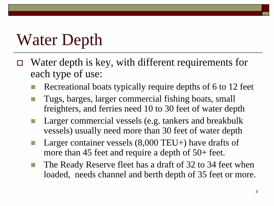
Water DepthWater depth is key, with different requirements for each type of use:
Recreational boats typically require depths of 6 to 12 feetTugs, barges, larger commercial fishing boats, small freighters, and ferries need 10 to 30 feet of water depthLarger commercial vessels (e.g. tankers and breakbulk vessels) usually need more than 30 feet of water depthLarger container vessels (8,000 TEU+) have drafts of more than 45 feet and require a depth of 50+ feet. The Ready Reserve fleet has a draft of 32 to 34 feet when loaded, needs channel and berth depth of 35 feet or more.
4
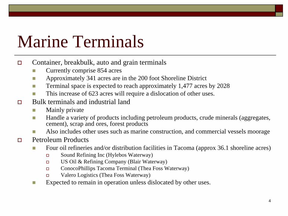
Marine TerminalsContainer, breakbulk, auto and grain terminals
Currently comprise 854 acresApproximately 341 acres are in the 200 foot Shoreline DistrictTerminal space is expected to reach approximately 1,477 acres by 2028This increase of 623 acres will require a dislocation of other uses.
Bulk terminals and industrial landMainly privateHandle a variety of products including petroleum products, crude minerals (aggregates, cement), scrap and ores, forest productsAlso includes other uses such as marine construction, and commercial vessels moorage
Petroleum ProductsFour oil refineries and/or distribution facilities in Tacoma (approx 36.1 shoreline acres)
Sound Refining Inc (Hylebos Waterway)US Oil & Refining Company (Blair Waterway)ConocoPhillips Tacoma Terminal (Thea Foss Waterway)Valero Logistics (Thea Foss Waterway)
Expected to remain in operation unless dislocated by other uses.
5
Marine Terminals (continued)
Crude MineralsFour terminals receive and/or ship crude minerals (approx. 12.2 shoreline acres)
Glacier Northwest receives local sand and gravel as an input to cement manufactureGraymont Lime receives limestone from British Columbia as an input to lime productsG-P Gypsum receives gypsum from Mexico for wallboard manufactureWalrath Trucking moves aggregates
These firms will remain in their present locations through the end of the study period or be moved to an alternative site if dislocated by terminal development or another water-dependent use.
Scrap & Ores (21.7 shoreline acres)Schnitzer Steel ships and receives through its marine terminalCalbag Metals, which does not ship or receive by waterExpected to remain in their present locations
Forest Products (approximately 144.8 shoreline acres)Manke Lumber - ships/receives by water Simpson Tacoma - ships/receives by water Buffelen Woodworking - not water dependentThere has already been a significant shrinkage in the acreage, but BST Associates projects that the remaining firms will likely stay at their present locations.
6
Moorage & Related SectorsCommercial Vessel Moorage
Crowley Maritime Corporation services the US Ready Reserve Fleet along Ruston Way at Sperry DockAmerican Construction moors company owned construction equipment on the HylebosFoss and Crowley have moorage for company owned tugs and bargesTrident Seafood moors fishing vessels and the US Army moors vessels at the end of the Blair Hylebos peninsulaAdditional moorage could be provided in the Hylebos from the Weyerhaeuser log dock past the Arkema property. However, water depth is limited in this area to 25 to 30 feet
7
Moorage & Related Sectors (continued)
Boat Builders and Shipyards (approximately 14.6 shoreline acres)
Nordlund Boat, Modutech, Metalcraft Marine, Aleutian Yachts and Northcoast Yachts manufacture recreational boatsMartinac Shipyard and Marine Industries Northwest build and repair commercial vessels.Current economic conditions are hurting vessels sales, driving some firms out of businessMetalcraft Marine, Aleutian Yachts and Northcoast Yachts will bedislocated by the Port of Tacoma YTTI Terminal
Metalcraft Marine will likely consolidate to its headquarters in CaliforniaPort is working with the others to relocate to the East Thea Foss Waterway.
BST Associates projects that 10 to 20 acres may be required to meet the needs of this sector by the year 2028. A portion of this demand can be accommodated at the Wattles property on the East Thea Foss.
8
Moorage & Related Sectors (continued)
MarinasTacoma has recently undergone resurgence in redevelopment of itsmarinas with some new marinas developed and others rebuilt
Tacoma has approximately sixteen moorage facilities (for permanent and transient moorageThese marinas are well utilized, with a 96% occupancy rateThere is a need for additional transient and permanent wet moorage facilities
Replacement of mooring buoys along Ruston WayImproved facilities for hand launched and trailerable boats (up to 26 feet long)
Preserve and enhance upland support activities such as repair, retail and other services
Repair and retail services are provided by Commencement Bay Marine Services, Modutech, J&G Marine, Day Island Boatworks and Hyland Marine among others.
9
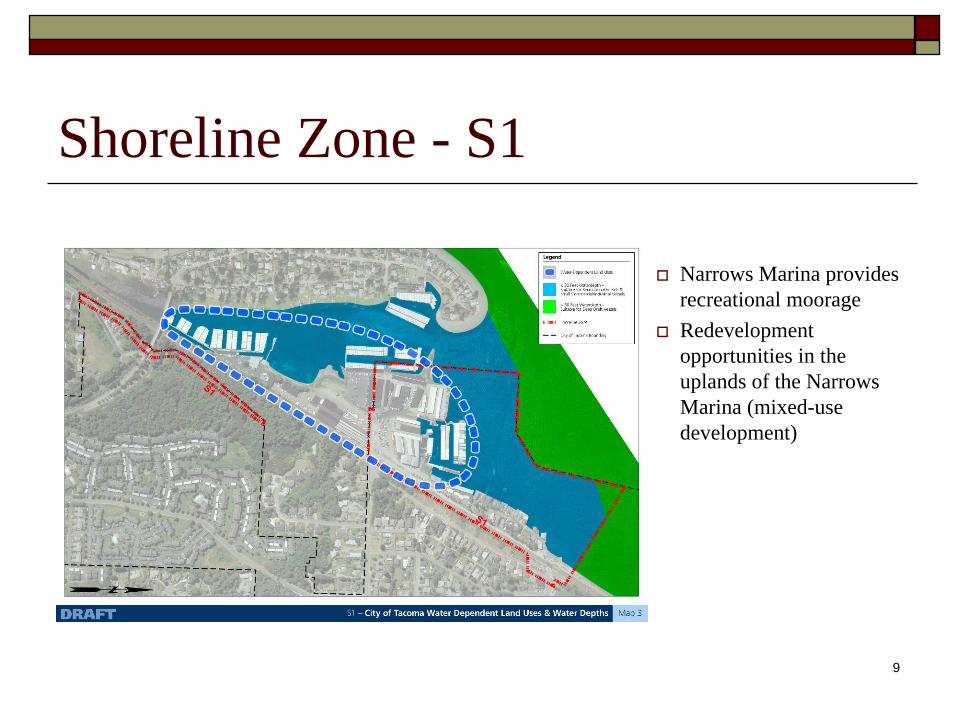
Shoreline Zone - S1
Narrows Marina provides recreational moorageRedevelopment opportunities in the uplands of the Narrows Marina (mixed-use development)
10
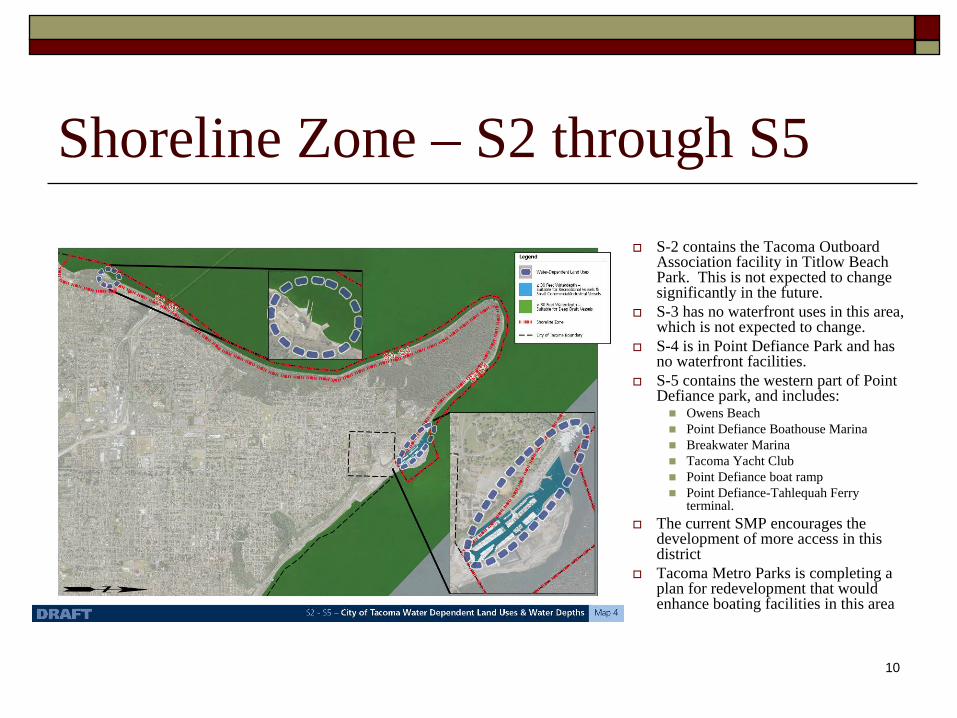
Shoreline Zone – S2 through S5S-2 contains the Tacoma Outboard Association facility in Titlow Beach Park. This is not expected to change significantly in the future.S-3 has no waterfront uses in this area, which is not expected to change. S-4 is in Point Defiance Park and has no waterfront facilities.S-5 contains the western part of Point Defiance park, and includes:
Owens BeachPoint Defiance Boathouse MarinaBreakwater MarinaTacoma Yacht ClubPoint Defiance boat rampPoint Defiance-Tahlequah Ferry terminal.
The current SMP encourages the development of more access in this districtTacoma Metro Parks is completing a plan for redevelopment that would enhance boating facilities in this area
11
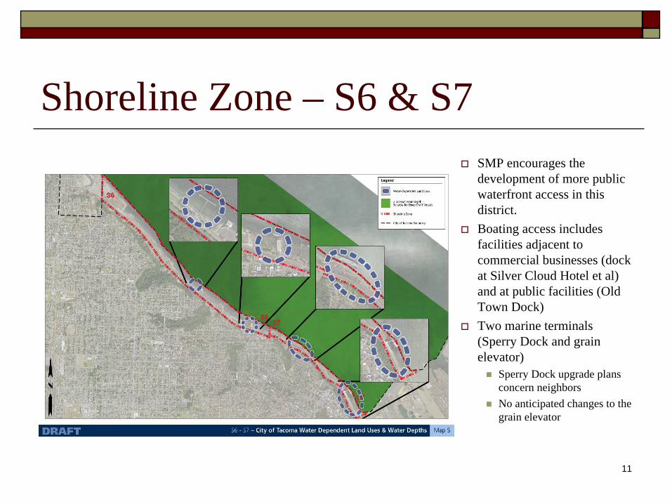
Shoreline Zone – S6 & S7SMP encourages the development of more public waterfront access in this district.Boating access includes facilities adjacent to commercial businesses (dock at Silver Cloud Hotel et al) and at public facilities (Old Town Dock)Two marine terminals (Sperry Dock and grain elevator)
Sperry Dock upgrade plans concern neighborsNo anticipated changes to the grain elevator
12
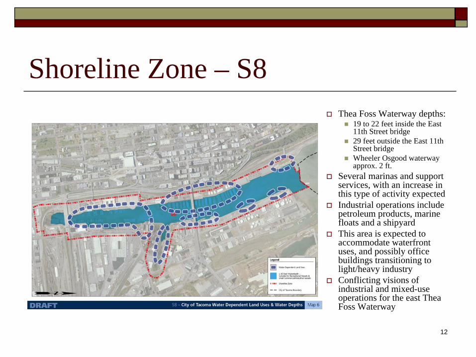
Shoreline Zone – S8Thea Foss Waterway depths:
19 to 22 feet inside the East 11th Street bridge29 feet outside the East 11th Street bridgeWheeler Osgood waterway approx. 2 ft.
Several marinas and support services, with an increase in this type of activity expectedIndustrial operations include petroleum products, marine floats and a shipyardThis area is expected to accommodate waterfront uses, and possibly office buildings transitioning to light/heavy industryConflicting visions of industrial and mixed-use operations for the east Thea Foss Waterway
13
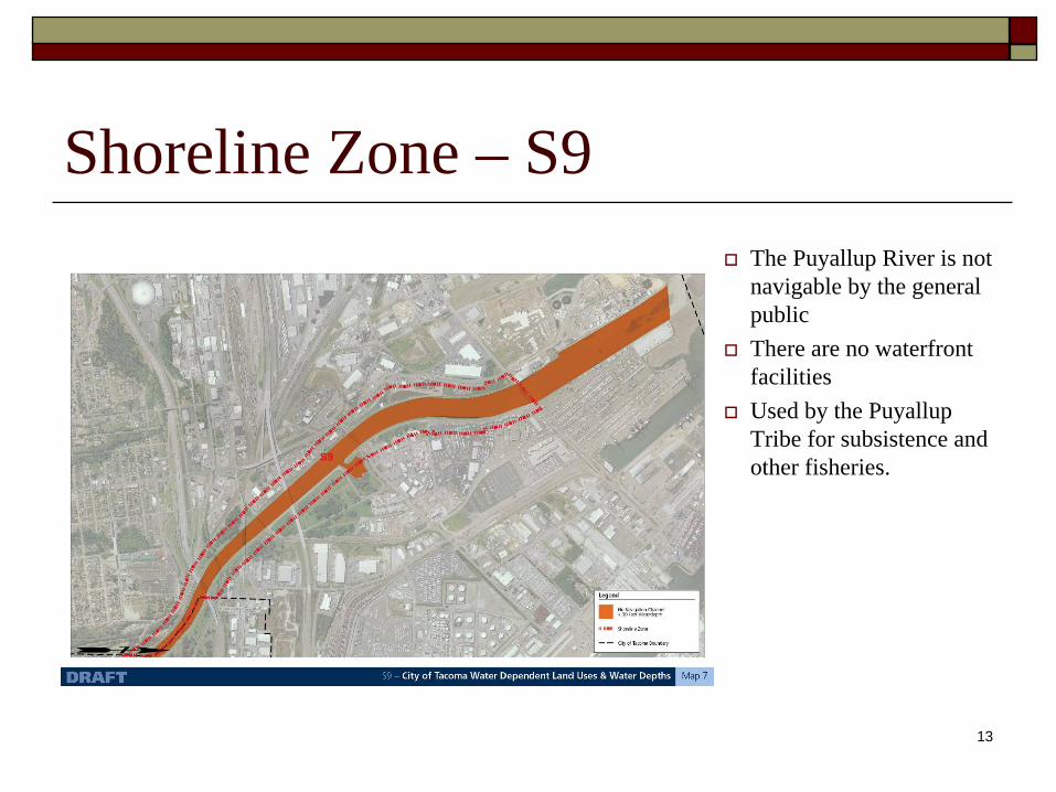
Shoreline Zone – S9The Puyallup River is not navigable by the general publicThere are no waterfront facilitiesUsed by the Puyallup Tribe for subsistence and other fisheries.
14
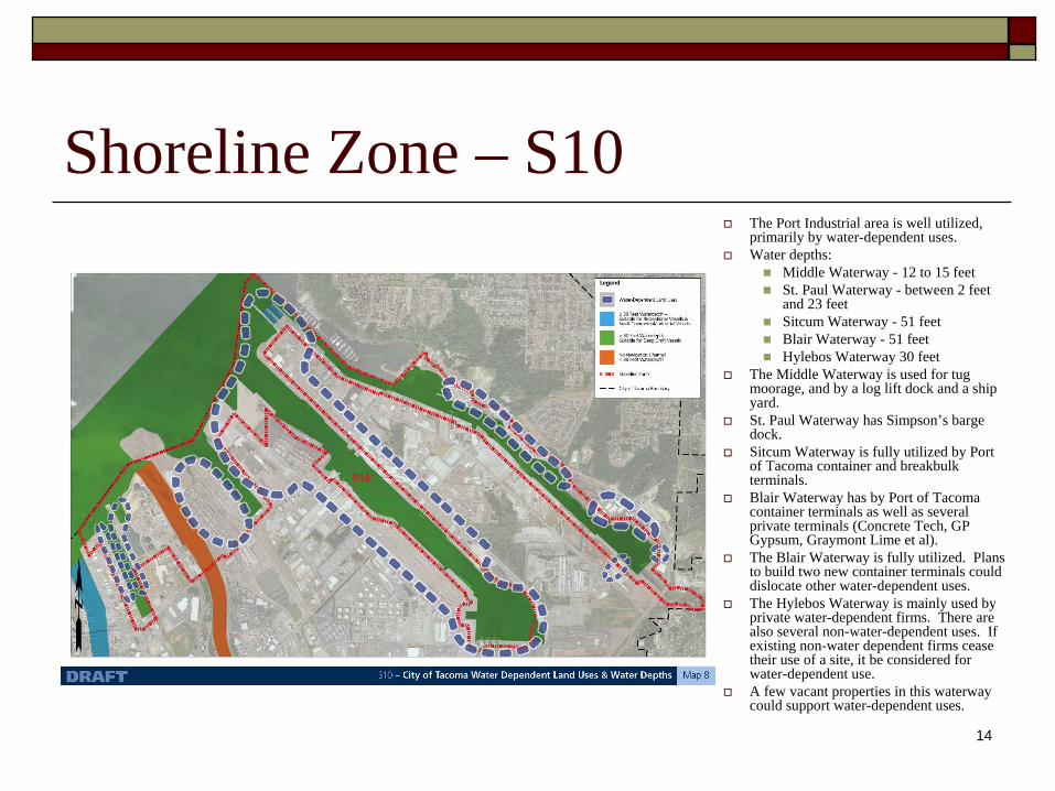
Shoreline Zone – S10The Port Industrial area is well utilized, primarily by water-dependent uses.Water depths:
Middle Waterway - 12 to 15 feetSt. Paul Waterway - between 2 feet and 23 feetSitcum Waterway - 51 feetBlair Waterway - 51 feetHylebos Waterway 30 feet
The Middle Waterway is used for tug moorage, and by a log lift dock and a ship yard.St. Paul Waterway has Simpson’s barge dock.Sitcum Waterway is fully utilized by Port of Tacoma container and breakbulk terminals. Blair Waterway has by Port of Tacoma container terminals as well as several private terminals (Concrete Tech, GP Gypsum, Graymont Lime et al).The Blair Waterway is fully utilized. Plans to build two new container terminals could dislocate other water-dependent uses.The Hylebos Waterway is mainly used by private water-dependent firms. There are also several non-water-dependent uses. If existing non-water dependent firms cease their use of a site, it be considered for water-dependent use. A few vacant properties in this waterway could support water-dependent uses.
15
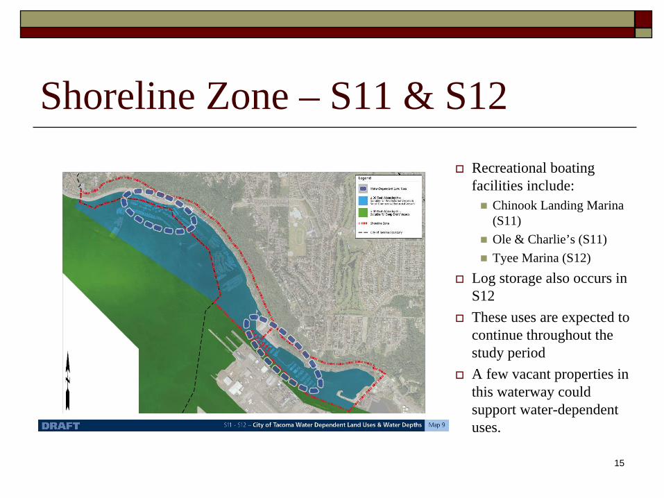
Shoreline Zone – S11 & S12Recreational boating facilities include:
Chinook Landing Marina (S11)Ole & Charlie’s (S11)Tyee Marina (S12)
Log storage also occurs in S12These uses are expected to continue throughout the study periodA few vacant properties in this waterway could support water-dependent uses.