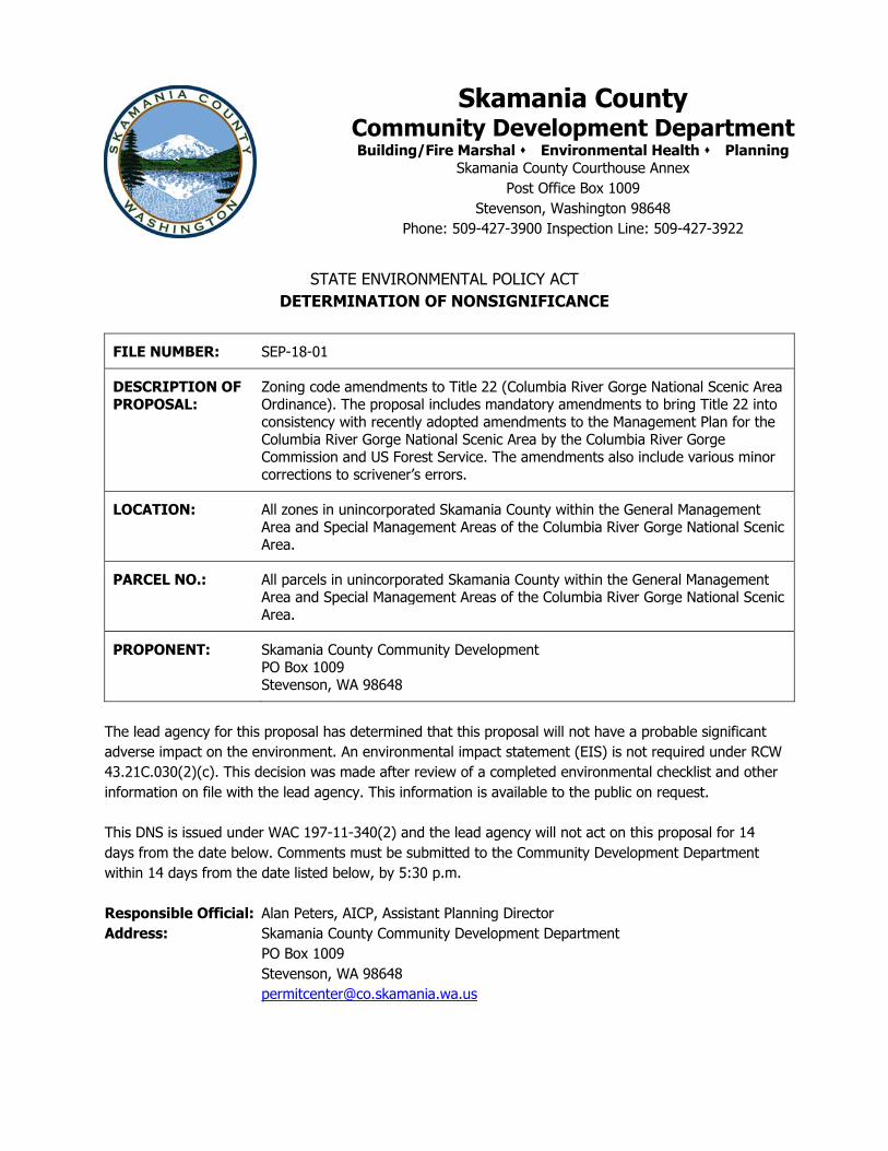
skamania county n+ community development … skamania county community development po box 1009...
TRANSCRIPT
n+
STATE ENVIRONMENTAL POLICY ACT
DETERMINATION OF NONSIGNIFICANCE
FILE NUMBER: SEP-18-01
DESCRIPTION OF PROPOSAL:
Zoning code amendments to Title 22 (Columbia River Gorge National Scenic Area Ordinance). The proposal includes mandatory amendments to bring Title 22 into consistency with recently adopted amendments to the Management Plan for the Columbia River Gorge National Scenic Area by the Columbia River Gorge Commission and US Forest Service. The amendments also include various minor corrections to scrivener’s errors.
LOCATION: All zones in unincorporated Skamania County within the General Management Area and Special Management Areas of the Columbia River Gorge National Scenic Area.
PARCEL NO.: All parcels in unincorporated Skamania County within the General Management Area and Special Management Areas of the Columbia River Gorge National Scenic Area.
PROPONENT: Skamania County Community Development PO Box 1009 Stevenson, WA 98648
The lead agency for this proposal has determined that this proposal will not have a probable significant adverse impact on the environment. An environmental impact statement (EIS) is not required under RCW 43.21C.030(2)(c). This decision was made after review of a completed environmental checklist and other information on file with the lead agency. This information is available to the public on request. This DNS is issued under WAC 197-11-340(2) and the lead agency will not act on this proposal for 14 days from the date below. Comments must be submitted to the Community Development Department within 14 days from the date listed below, by 5:30 p.m. Responsible Official: Alan Peters, AICP, Assistant Planning Director Address: Skamania County Community Development Department PO Box 1009 Stevenson, WA 98648 [email protected]
Skamania County Community Development Department Building/Fire Marshal Environmental Health Planning
Skamania County Courthouse Annex Post Office Box 1009
Stevenson, Washington 98648 Phone: 509-427-3900 Inspection Line: 509-427-3922

February 14, 2018 ______________________________ Date Alan Peters, AICP Assistant Planning Director APPEALS: There shall be no administrative appeals of environmental threshold determinations. Failure to comment on this Notice of Intent shall be determined to deny a party standing to appeal the final determination with the underlying government action to a court of competent jurisdiction.
SEPA Environmental checklist (WAC 197-11-960) July 2016 Page 1 of 12
SEPA ENVIRONMENTAL CHECKLIST
Purpose of checklist: Governmental agencies use this checklist to help determine whether the environmental impacts of your proposal are significant. This information is also helpful to determine if available avoidance, minimization or compensatory mitigation measures will address the probable significant impacts or if an environmental impact statement will be prepared to further analyze the proposal. Instructions for applicants: This environmental checklist asks you to describe some basic information about your proposal. Please answer each question accurately and carefully, to the best of your knowledge. You may need to consult with an agency specialist or private consultant for some questions. You may use “not applicable” or "does not apply" only when you can explain why it does not apply and not when the answer is unknown. You may also attach or incorporate by reference additional studies reports. Complete and accurate answers to these questions often avoid delays with the SEPA process as well as later in the decision-making process. The checklist questions apply to all parts of your proposal, even if you plan to do them over a period of time or on different parcels of land. Attach any additional information that will help describe your proposal or its environmental effects. The agency to which you submit this checklist may ask you to explain your answers or provide additional information reasonably related to determining if there may be significant adverse impact. Instructions for Lead Agencies: Please adjust the format of this template as needed. Additional information may be necessary to evaluate the existing environment, all interrelated aspects of the proposal and an analysis of adverse impacts. The checklist is considered the first but not necessarily the only source of information needed to make an adequate threshold determination. Once a threshold determination is made, the lead agency is responsible for the completeness and accuracy of the checklist and other supporting documents. Use of checklist for nonproject proposals: For nonproject proposals (such as ordinances, regulations, plans and programs), complete the applicable parts of sections A and B plus the SUPPLEMENTAL SHEET FOR NONPROJECT ACTIONS (part D). Please completely answer all questions that apply and note that the words "project," "applicant," and "property or site" should be read as "proposal," "proponent," and "affected geographic area," respectively. The lead agency may exclude (for non-projects) questions in Part B - Environmental Elements –that do not contribute meaningfully to the analysis of the proposal.
A. Background
1. Name of proposed project, if applicable: Zoning Code Amendments to Title 22 (Columbia River Gorge National Scenic Area Ordinance) 2. Name of applicant: Skamania County, Andrew Lembrick
3. Address and phone number of applicant and contact person: Skamania County
Community Development, 170 NW Vancouver Ave, Stevenson, WA 98648, 509-427-3900

SEPA Environmental checklist (WAC 197-11-960) July 2016 Page 2 of 12
4. Date checklist prepared: 2/6/2018 5. Agency requesting checklist: Skamania County 6. Proposed timing or schedule (including phasing, if applicable): Public Hearings before the Planning Commission and Board of County Commissioners March/April 2018. 7. Do you have any plans for future additions, expansion, or further activity related to or connected with this proposal? If yes, explain. No
8. List any environmental information you know about that has been prepared, or will be
prepared, directly related to this proposal. None
9. Do you know whether applications are pending for governmental approvals of other proposals directly affecting the property covered by your proposal? If yes, explain. None 10. List any government approvals or permits that will be needed for your proposal, if known. The proposal requires review by the Planning Commission and approval by the Board of County Commissioners. The Columbia River Gorge Commission must approve amendments affecting the General Management Area and the US Secretary of Agriculture must approved amendments affecting the Special Management Area. 11. Give brief, complete description of your proposal, including the proposed uses and the size of the project and site. There are several questions later in this checklist that ask you to describe certain aspects of your proposal. You do not need to repeat those answers on this page. (Lead agencies may modify this form to include additional specific information on project description.) The proposed zoning code amendments include mandatory amendments to bring Title 22 into consistency with recently adopted amendments to the Management Plan for the Columbia River Gorge National Scenic Area by the Columbia River Gorge Commission and US Forest Service. The amendments also include various minor corrections to scrivener’s errors.
- Adds definition of “adversely affect or adversely affecting”.
- Adds definition of “air”.
- Adds language to ensure no adverse effect to water resources.
- Adds language to ensure no adverse effect to sensitive wildlife areas or sites.
- Adds language to ensure no adverse effect to sensitive plants.
- Adds language codifying existing practice of requiring a reconnaissance survey if
any element of any land use application requires one.
- Adds new provision allowing that a reconnaissance survey be conducted even if
the proposed use is exempt.
- Corrects typo: “affects” to “effects” under definition of “best management
practices”.
- Corrects typo: “no” to “not” under definition of “livestock feedlot”.
- Adds missing word “and” to definition of “winery”.

SEPA Environmental checklist (WAC 197-11-960) July 2016 Page 3 of 12
- Corrects incorrect code reference.
- Corrects field survey requirement for sensitive plants, not wildlife areas under
“Sensitive Plant Protection” section. - Corrects numbering.
12. Location of the proposal. Give sufficient information for a person to understand the precise location of your proposed project, including a street address, if any, and section, township, and range, if known. If a proposal would occur over a range of area, provide the range or boundaries of the site(s). Provide a legal description, site plan, vicinity map, and topographic map, if reasonably available. While you should submit any plans required by the agency, you are not required to duplicate maps or detailed plans submitted with any permit applications related to this checklist. All zones in unincorporated Skamania County within the General Management Area and Special Management Areas of the Columbia River Gorge National Scenic Area. B. ENVIRONMENTAL ELEMENTS 1. Earth a. General description of the site: N/A. This is a County-wide non-project action. (circle one): Flat, rolling, hilly, steep slopes, mountainous, other _____________ b. What is the steepest slope on the site (approximate percent slope)? N/A. This is a County-wide non-project action. c. What general types of soils are found on the site (for example, clay, sand, gravel, peat,
muck)? If you know the classification of agricultural soils, specify them and note any agricultural land of long-term commercial significance and whether the proposal results in removing any of these soils. N/A. This is a County-wide non-project action.
d. Are there surface indications or history of unstable soils in the immediate vicinity? If so,
describe. N/A. This is a County-wide non-project action. e. Describe the purpose, type, total area, and approximate quantities and total affected area of
any filling, excavation, and grading proposed. Indicate source of fill. N/A. This is a County-wide non-project action.
f. Could erosion occur as a result of clearing, construction, or use? If so, generally describe.
N/A. This is a County-wide non-project action. g. About what percent of the site will be covered with impervious surfaces after project
construction (for example, asphalt or buildings)? N/A. This is a County-wide non-project action.
h. Proposed measures to reduce or control erosion, or other impacts to the earth, if any:
N/A. This is a County-wide non-project action. 2. Air

SEPA Environmental checklist (WAC 197-11-960) July 2016 Page 4 of 12
a. What types of emissions to the air would result from the proposal during construction, operation, and maintenance when the project is completed? If any, generally describe and give approximate quantities if known. N/A. This is a County-wide non-project action.
b. Are there any off-site sources of emissions or odor that may affect your proposal? If so,
generally describe. N/A. This is a County-wide non-project action. c. Proposed measures to reduce or control emissions or other impacts to air, if any: N/A. This
is a County-wide non-project action. 3. Water a. Surface Water:
1) Is there any surface water body on or in the immediate vicinity of the site (including year-round and seasonal streams, saltwater, lakes, ponds, wetlands)? If yes, describe type and provide names. If appropriate, state what stream or river it flows into.
N/A. This is a County-wide non-project action.
2) Will the project require any work over, in, or adjacent to (within 200 feet) the described waters? If yes, please describe and attach available plans. N/A. This is a County-wide non-project action.
3) Estimate the amount of fill and dredge material that would be placed in or removed
from surface water or wetlands and indicate the area of the site that would be affected. Indicate the source of fill material. N/A. This is a County-wide non-project action.
4) Will the proposal require surface water withdrawals or diversions? Give general
description, purpose, and approximate quantities if known. N/A. This is a County-wide non-project action.
5) Does the proposal lie within a 100-year floodplain? If so, note location on the site plan. N/A. This is a County-wide non-project action.
6) Does the proposal involve any discharges of waste materials to surface waters? If so,
describe the type of waste and anticipated volume of discharge. N/A. This is a County-wide non-project action.
b. Ground Water: 1) Will groundwater be withdrawn from a well for drinking water or other purposes? If so, give a
general description of the well, proposed uses and approximate quantities withdrawn from the well. Will water be discharged to groundwater? Give general description, purpose, and approximate quantities if known. N/A. This is a County-wide non-project action.
2) Describe waste material that will be discharged into the ground from septic tanks or
other sources, if any (for example: Domestic sewage; industrial, containing the following chemicals. . . ; agricultural; etc.). Describe the general size of the system, the number of such systems, the number of houses to be served (if applicable), or the number of animals or humans the system(s) are expected to serve. N/A. This is a County-wide non-project action.

SEPA Environmental checklist (WAC 197-11-960) July 2016 Page 5 of 12
c. Water runoff (including stormwater): 1) Describe the source of runoff (including storm water) and method of collection
and disposal, if any (include quantities, if known). Where will this water flow? Will this water flow into other waters? If so, describe. N/A. This is a County-wide non-project action.
2) Could waste materials enter ground or surface waters? If so, generally describe. N/A. This is a County-wide non-project action.
3) Does the proposal alter or otherwise affect drainage patterns in the vicinity of the site? If so, describe. N/A. This is a County-wide non-project action.
d. Proposed measures to reduce or control surface, ground, and runoff water, and drainage
pattern impacts, if any: N/A. This is a County-wide non-project action. 4. Plants a. Check the types of vegetation found on the site: N/A. This is a County-wide non-project
action.
____deciduous tree: alder, maple, aspen, other ____evergreen tree: fir, cedar, pine, other ____shrubs ____grass ____pasture ____crop or grain ____ Orchards, vineyards or other permanent crops. ____ wet soil plants: cattail, buttercup, bullrush, skunk cabbage, other ____water plants: water lily, eelgrass, milfoil, other ____other types of vegetation
b. What kind and amount of vegetation will be removed or altered? N/A. This is a County-wide
non-project action. c. List threatened and endangered species known to be on or near the site. N/A. This is a
County-wide non-project action. d. Proposed landscaping, use of native plants, or other measures to preserve or enhance
vegetation on the site, if any: N/A. This is a County-wide non-project action. e. List all noxious weeds and invasive species known to be on or near the site. N/A. This is a
County-wide non-project action. 5. Animals a. List any birds and other animals which have been observed on or near the site or are known
to be on or near the site. N/A. This is a County-wide non-project action.
Examples include: birds: hawk, heron, eagle, songbirds, other:

SEPA Environmental checklist (WAC 197-11-960) July 2016 Page 6 of 12
mammals: deer, bear, elk, beaver, other: fish: bass, salmon, trout, herring, shellfish, other ________ b. List any threatened and endangered species known to be on or near the site. N/A. This is a
County-wide non-project action. c. Is the site part of a migration route? If so, explain. N/A. This is a County-wide non-project
action. d. Proposed measures to preserve or enhance wildlife, if any: N/A. This is a County-wide non-
project action. e. List any invasive animal species known to be on or near the site. N/A. This is a County-wide
non-project action. 6. Energy and Natural Resources a. What kinds of energy (electric, natural gas, oil, wood stove, solar) will be used to meet
the completed project's energy needs? Describe whether it will be used for heating, manufacturing, etc. N/A. This is a County-wide non-project action.
b. Would your project affect the potential use of solar energy by adjacent properties?
If so, generally describe. N/A. This is a County-wide non-project action. c. What kinds of energy conservation features are included in the plans of this proposal?
List other proposed measures to reduce or control energy impacts, if any: N/A. This is a County-wide non-project action.
7. Environmental Health a. Are there any environmental health hazards, including exposure to toxic chemicals, risk
of fire and explosion, spill, or hazardous waste, that could occur as a result of this proposal? If so, describe. N/A. This is a County-wide non-project action. 1) Describe any known or possible contamination at the site from present or past uses.
N/A. This is a County-wide non-project action.
2) Describe existing hazardous chemicals/conditions that might affect project development
and design. This includes underground hazardous liquid and gas transmission pipelines located within the project area and in the vicinity. N/A. This is a County-wide non-project action.
3) Describe any toxic or hazardous chemicals that might be stored, used, or produced during the project's development or construction, or at any time during the operating life of the project. N/A. This is a County-wide non-project action.
4) Describe special emergency services that might be required. N/A. This is a County-wide non-project action.
5) Proposed measures to reduce or control environmental health hazards, if any: N/A. This is a County-wide non-project action.

SEPA Environmental checklist (WAC 197-11-960) July 2016 Page 7 of 12
b. Noise
1) What types of noise exist in the area which may affect your project (for example: traffic, equipment, operation, other)? N/A. This is a County-wide non-project action.
2) What types and levels of noise would be created by or associated with the project on a short-term or a long-term basis (for example: traffic, construction, operation, other)? Indi- cate what hours noise would come from the site. N/A. This is a County-wide non-project action.
3) Proposed measures to reduce or control noise impacts, if any: N/A. This is a County-
wide non-project action. 8. Land and Shoreline Use a. What is the current use of the site and adjacent properties? Will the proposal affect current
land uses on nearby or adjacent properties? If so, describe. N/A. This is a County-wide non-project action.
b. Has the project site been used as working farmlands or working forest lands? If so, describe.
How much agricultural or forest land of long-term commercial significance will be converted to other uses as a result of the proposal, if any? If resource lands have not been designated, how many acres in farmland or forest land tax status will be converted to nonfarm or nonforest use? N/A. This is a County-wide non-project action.
1) Will the proposal affect or be affected by surrounding working farm or forest land normal
business operations, such as oversize equipment access, the application of pesticides, tilling, and harvesting? If so, how: N/A. This is a County-wide non-project action.
c. Describe any structures on the site. N/A. This is a County-wide non-project action. d. Will any structures be demolished? If so, what? N/A. This is a County-wide non-project
action. e. What is the current zoning classification of the site? All zones in unincorporated Skamania County within the General Management Area and Special Management Area of the Columbia River Gorge National Scenic Area. f. What is the current comprehensive plan designation of the site? All land use designations in unincorporated Skamania County within the General Management Area and Special Management Area of the Columbia River Gorge National Scenic Area. g. If applicable, what is the current shoreline master program designation of the site? N/A. This is a County-wide non-project action. h. Has any part of the site been classified as a critical area by the city or county? If so, specify. N/A. This is a County-wide non-project action.
i. Approximately how many people would reside or work in the completed project? N/A. This is a County-wide non-project action.

SEPA Environmental checklist (WAC 197-11-960) July 2016 Page 8 of 12
j. Approximately how many people would the completed project displace? N/A. This is a County-wide non-project action.
k. Proposed measures to avoid or reduce displacement impacts, if any: N/A. This is a County-wide non-project action. L. Proposed measures to ensure the proposal is compatible with existing and projected land
uses and plans, if any: N/A. This is a County-wide non-project action. m. Proposed measures to reduce or control impacts to agricultural and forest lands of long-term commercial significance, if any: N/A. This is a County-wide non-project action. 9. Housing a. Approximately how many units would be provided, if any? Indicate whether high, mid- dle, or low-income housing. N/A. This is a County-wide non-project action. b. Approximately how many units, if any, would be eliminated? Indicate whether high, middle, or low-income housing. N/A. This is a County-wide non-project action. c. Proposed measures to reduce or control housing impacts, if any: N/A. This is a County-wide non-project action. 10. Aesthetics a. What is the tallest height of any proposed structure(s), not including antennas; what is the principal exterior building material(s) proposed? N/A. This is a County-wide non-project action. b. What views in the immediate vicinity would be altered or obstructed? N/A. This is a County-
wide non-project action. c. Proposed measures to reduce or control aesthetic impacts, if any: N/A. This is a County-wide non-project action.
11. Light and Glare a. What type of light or glare will the proposal produce? What time of day would it mainly
occur? N/A. This is a County-wide non-project action. b. Could light or glare from the finished project be a safety hazard or interfere with views? N/A.
This is a County-wide non-project action. c. What existing off-site sources of light or glare may affect your proposal? N/A. This is a
County-wide non-project action. d. Proposed measures to reduce or control light and glare impacts, if any: N/A. This is a
County-wide non-project action.

SEPA Environmental checklist (WAC 197-11-960) July 2016 Page 9 of 12
12. Recreation a. What designated and informal recreational opportunities are in the immediate vicinity? N/A.
This is a County-wide non-project action. b. Would the proposed project displace any existing recreational uses? If so, describe. N/A.
This is a County-wide non-project action. c. Proposed measures to reduce or control impacts on recreation, including recreation
opportunities to be provided by the project or applicant, if any: N/A. This is a County-wide non-project action.
13. Historic and cultural preservation a. Are there any buildings, structures, or sites, located on or near the site that are over 45 years
old listed in or eligible for listing in national, state, or local preservation registers ? If so, specifically describe. N/A. This is a County-wide non-project action.
b. Are there any landmarks, features, or other evidence of Indian or historic use or occupation?
This may include human burials or old cemeteries. Are there any material evidence, artifacts, or areas of cultural importance on or near the site? Please list any professional studies conducted at the site to identify such resources. N/A. This is a County-wide non-project action.
c. Describe the methods used to assess the potential impacts to cultural and historic resources
on or near the project site. Examples include consultation with tribes and the department of archeology and historic preservation, archaeological surveys, historic maps, GIS data, etc. N/A. This is a County-wide non-project action.
d. Proposed measures to avoid, minimize, or compensate for loss, changes to, and disturbance
to resources. Please include plans for the above and any permits that may be required. N/A. This is a County-wide non-project action.
14. Transportation a. Identify public streets and highways serving the site or affected geographic area and
describe proposed access to the existing street system. Show on site plans, if any. This is a County-wide non-project action. Most properties are accessed by County or State roads or private roads connecting to County or State Roads.
b. Is the site or affected geographic area currently served by public transit? If so, generally
describe. If not, what is the approximate distance to the nearest transit stop? This is a County-wide non-project action. Skamania County Public Transit provides transportation between Vancouver and Carson.
c. How many additional parking spaces would the completed project or non-project proposal
have? How many would the project or proposal eliminate? N/A. This is a County-wide non-project action.


SEPA Environmental checklist (WAC 197-11-960) July 2016 Page 11 of 12
D. supplemental sheet for nonproject actions (IT IS NOT NECESSARY to use this sheet for project actions) Because these questions are very general, it may be helpful to read them in conjunction
with the list of the elements of the environment. When answering these questions, be aware of the extent the proposal, or the types of
activities likely to result from the proposal, would affect the item at a greater intensity or at a faster rate than if the proposal were not implemented. Respond briefly and in general terms.
1. How would the proposal be likely to increase discharge to water; emissions to air; pro-
duction, storage, or release of toxic or hazardous substances; or production of noise? The proposed text changes are not likely to increase any of the above impacts. The text changes provide greater resource protection.
Proposed measures to avoid or reduce such increases are: N/A. 2. How would the proposal be likely to affect plants, animals, fish, or marine life?
The proposed text changes are not likely to affect the above resources. The text changes provide greater resource protection.
Proposed measures to protect or conserve plants, animals, fish, or marine life are: N/A. 3. How would the proposal be likely to deplete energy or natural resources?
The proposed text changes are not likely to deplete the above resources. The text changes provide greater resource protection.
Proposed measures to protect or conserve energy and natural resources are: N/A.
4. How would the proposal be likely to use or affect environmentally sensitive areas or
areas designated (or eligible or under study) for governmental protection; such as parks, wilderness, wild and scenic rivers, threatened or endangered species habitat, historic or cultural sites, wetlands, floodplains, or prime farmlands?
The proposed text changes are not likely to use or affect the above areas. The text changes provide greater protection to such areas.
Proposed measures to protect such resources or to avoid or reduce impacts are: N/A.

SEPA Environmental checklist (WAC 197-11-960) July 2016 Page 12 of 12
5. How would the proposal be likely to affect land and shoreline use, including whether it would allow or encourage land or shoreline uses incompatible with existing plans? The proposal does not affect land uses or the SMP. It provides greater protection to critical areas including shorelines.
Proposed measures to avoid or reduce shoreline and land use impacts are: None.
6. How would the proposal be likely to increase demands on transportation or public
services and utilities? The proposed text changes are not likely to increase transportation demands.
Proposed measures to reduce or respond to such demand(s) are:
None.
7. Identify, if possible, whether the proposal may conflict with local, state, or federal laws or
requirements for the protection of the environment. The proposal will not conflict with any such laws or requirements.

Summary of SCC Title 22 Amendments Required Changes Pg. 6 – Adds definition of “adversely affect or adversely affecting”. Pg. 7 – Adds definition of “air”. Pg. 143 – Adds language to ensure no adverse effect to water resources. Pg. 150 – Adds language to ensure no adverse effect to sensitive wildlife areas or sites. Pg. 153 – Adds language to ensure no adverse effect to sensitive plants. Pg. 156 – Adds language codifying existing practice of requiring a reconnaissance survey if any element of any land use application requires one. Pg. 158 – Adds new provision allowing that a reconnaissance survey be conducted even if the proposed use is exempt. Pg. 182 – Adds language to ensure no adverse effect to water resources (SMA). Pg. 186 – Adds language to ensure no adverse effect to sensitive wildlife areas or sites or sensitive plants (SMA). Minor Related Changes Renumbering throughout text to accommodate new insertions. Minor Corrections (unrelated to required changes) Pg. 7 – Corrects typo: “affects” to “effects” under definition of “best management practices”. Pg. 15 – Corrects typo: “no” to “not” under definition of “livestock feedlot”. Pg. 26 – Adds missing word “and” to definition of “winery”. Pg. 102 – Corrects incorrect code reference. Pg. 153 – Corrects field survey requirement for sensitive plants, not wildlife areas under “Sensitive Plant Protection” section. Pg. 187 – Corrects numbering.
22.04 Definitions 6
CHAPTER 22.04 DEFINITIONS
22.04.010 DEFINITIONS A THROUGH Z .................................................................6
22.04.010 DEFINITIONS A THROUGH Z
Wherever they appear in this chapter, the following terms shall have the following meanings:
-A-
1. ACCEPTED AGRICULTURAL PRACTICE means a mode of operation that is
common to farms or ranches of similar nature, necessary for the operation of such
farms or ranches to obtain a profit in money and customarily utilized in conjunction
with agricultural use.
2. ACCESSORY STRUCTURE/BUILDING means a structure or detached building
whose use is incidental and subordinate to that of the main use of the property, and
that is located on the same parcel as the main building or use. The term “detached”
means that the main building and accessory building do not share a common wall.
An accessory building connected to the main building by a breezeway is a detached
building.
3. ACTIVE WILDLIFE SITE means a wildlife site that has been used within the
past five years by a sensitive wildlife species.
4. ADDITION means an extension or increase in the area or height of an existing
building.
5. ADMINISTRATOR means the Director of the Skamania County Department of
Planning and Community Development or a designee who has authority over a
proposed project review.
6. ADVERSELY AFFECT OR ADVERSELY AFFECTING means a reasonable
likelihood of more than moderate adverse consequence for the scenic, cultural,
recreation or natural resources of the scenic area, the determination of which is
based on:
a. The context of a proposed action;
b. The intensity of a proposed action, including the magnitude and duration of an
impact and the likelihood of its occurrence;
c. The relationship between a proposed action and other similar actions which are
individually insignificant but which may have cumulatively significant impacts;
and
d. Proved mitigation measures which the proponent of an action will implement as
part of the proposal to reduce otherwise significant effects to an insignificant
level.
6.7. AGRICULTURAL SPECIALIST (SMA) means a person such as a county
extension agent with a demonstrated knowledge of farming operations, and a
demonstrated ability to interpret and recommend methods to implement regulations
pertaining to agriculture. Such abilities are usually obtained through a combination
of higher education and experience.
7.8. AGRICULTURAL STRUCTURE/BUILDING means a structure or building
located on a farm or ranch and used in the operation for the storage, repair and
22.04 Definitions 7
maintenance of farm equipment, and supplies or the raising and/or storage of crops
and livestock. These include, but are not limited to: barns, silos, workshops,
equipment sheds, greenhouses, wind machines (orchards), processing facilities,
storage bins and structures.
8.9. AGRICULTURAL USE means the current employment of land for the primary
purpose of obtaining a profit in money by raising, harvesting and selling of crops;
or by the feeding, breeding, management and sale of, or production of, livestock,
poultry, fur-bearing animals or honeybees; or for dairying and the sale of dairy
products; or any other agricultural or horticultural use, including Christmas trees.
Current employment does not include livestock feed lots. Current employment of
land for agricultural use includes:
a. The operation or use of farmland subject to any agriculture-related government
program;
b. Land lying fallow for one (1) year as a normal and regular requirement of good
agricultural husbandry;
c. Land planted in orchards or other perennial prior to maturity; and
d. Land under buildings supporting accepted agricultural practices.
10. AIR means the mixture of gases comprising the Earth’s atmosphere.
9.11. ANADROMOUS FISH means species of fish that migrate upstream to freshwater
after spending part of their life in the ocean.
10.12. ANAEROBIC means a condition in which molecular oxygen is absent (or
effectively so) from the environment.
11.13. AQUACULTURE means the cultivation, maintenance and harvesting of aquatic
species.
12.14. AQUATIC AREA means the water area of a stream, pond or lake, measured at
the ordinary high water mark.
13.15. ARCHIVAL RESEARCH means research in primary documents that is likely to
yield information regarding human occupation of the area in question, including but
not limited to deed, census, cartographic and judicial records.
-B-
14.16. BED AND BREAKFAST INN means an establishment located in a structure
designed as a single-family dwelling where more than two rooms but fewer than six
rooms are rented on a daily basis. Bed and breakfast inns are clearly incidental to
the use of a structure as a single-family dwelling and are owner occupied and
operated. Bed and breakfast inns operate as transient accommodation, not as
rooming or boarding houses.
15.17. BEST MANAGEMENT PRACTICES means conservation techniques and
management measures that:
a. Control soil loss and reduce water quality degradation caused by nutrients,
animal waste, toxins, and sediment;
b. Minimize adverse affects effects to groundwater and surface-water flow and
circulation patterns; and
c. Maintain the chemical, biological, and physical characteristics of wetlands,
ponds, streams and riparian areas.
22.04 Definitions 8
16.18. BIODIVERSITY (SMA) means a diversity of biological organisms at the
genetic, species, ecosystem and landscape levels.
17.19. BOAT LANDING means a cleared area or developed structure used to facilitate
launching or retrieving watercraft.
18.20. BUFFER or BUFFER ZONE means an area adjacent to a water resource or
other sensitive area that is established and managed to protect sensitive natural
resources from human disturbance. In instances that involve a wetland, stream or
pond, the buffer zone includes all or a portion of the riparian area.
19.21. BUILDING means any structure used or intended for supporting or sheltering
any use or occupancy. Buildings have a roof supported by columns or walls. They
include, but are not limited to, dwellings, garages, barns, sheds and shop buildings.
-C-
20.22. CAMPSITE means a single camping unit that usually consists of a cleared, level
area for a tent and may include a parking spur, fire ring, table and other amenities.
21.23. CAPABILITY means the ability of land to produce forest or agricultural
products due to characteristics of the land itself, such as soil, slope, exposure or
other natural factors.
22.24. CANOPY CLOSURE (SMA) means for forest practices, the percentage
measuring the degree to which one layer of a tree canopy blocks sunlight or
obscures the sky as measured from below.
23.25. CASCADIAN ARCHITECTURE (SMA) means an architectural style using
native rock work, large timber and steeply pitched roofs in a rustic manner.
24.26. CATASTROPHIC SITUATIONS (SMA) means forces such as fire, insect and
disease infestations, and earth movements.
25.27. CHILD CARE CENTER means a facility providing day care to three or more
children, but not including:
a. The provision of care that is primarily educational unless provided to a
preschool child for more than four hours a day;
b. The provision of care that is primarily supervised training in a specific subject,
including but not limited to dancing, gymnastics, drama, music or religion;
c. Provision of short term care primarily an incident of group athletic or social
activities.
d. The provision of day care in the provider's home in the family living quarters
for less than thirteen (13) children.
26.28. COLUMBIA RIVER GORGE NATIONAL SCENIC AREA GRAPHIC
SIGNING SYSTEM means sign design standards developed for the Scenic Area
for public signs in and adjacent to public road rights-of-way.
27.29. COMMERCIAL DEVELOPMENT/USE means any facility or use of land or
water whose function is primarily retail buying or selling of goods or services or
both. This does not include fruit or produce stands.
28.30. COMMERCIAL FOREST PRODUCTS includes timber for lumber, pulp, and
fire wood for commercial proposes.
29.31. COMMERCIAL RECREATION means any private (non-governmental)
recreational activity or facility on privately owned land, excluding non-profit

22.04 Definitions 9
facilities. This does not include operation of a public recreation facility by a private
vendor.
30.32. COMMUNITY FACILITY means basic utilities and services necessary to
support public service needs, including, but not limited to water and power utilities,
sanitation facilities, public micro-wave stations and communication facilities,
schools, road and highways. This does not include sanitary landfills.
31.33. CONSULTING PARTIES (cultural resources) means organizations or
individuals who submit substantive written comments to the Planning Agency in a
timely manner because they are concerned with the effects of a proposed use on
cultural resources.
32.34. CONTIGUOUS LAND means parcels or other lands that are under the same
ownership and have a common boundary, regardless of whether or not portions of
the parcels have separate tax not numbers, lie in different counties, lie in different
sections or government lots, lie in different land use or zoning designations or are
separated by public or private roads. Contiguous land does not include parcels
which meet only at a single point.
33.35. COUNTY means Skamania County, its officials, agents, representatives,
commissions and boards, and whichever of them has made a determination or
performed a governmental action affecting a proposed use or development
regulated under this Title.
34.36. CREATED OPENING (SMA) means a created forest opening with less than
forty percent (40 %) average canopy closure of overstory trees and less than sixty
percent (60 %) average canopy closure of understory trees averaging less than five
(5) inches diameter at breast height for coniferous forests and less than twenty-five
percent (25 %) total canopy cover for oak woodlands. This definition does not
include agricultural fields.
35.37. CREATION OF WETLANDS means a human activity that converts an upland
into a wetland. This definition presumes that the area to be converted has not been
a wetland in recent times (100 to 200 years).
36.38. CULTIVATION means any activity that prepares land for raising crops by
turning, breaking, or loosening the soil. Cultivation includes plowing, harrowing,
leveling, and tilling.
37.39. CULTURAL RESOURCE means evidence of human occupation or activity that
is important in the history, architecture, archaeology or culture of a community or
region. Cultural resources include, but are not limited to, the following:
i. ARCHAEOLOGICAL RESOURCES. Physical evidence or ruins of
human occupation or activity that are located on or below the surface of the
ground and are at least fifty (50) years old. Archaeological resources
include, but are not limited to, the remains of houses, villages, camp and
fishing sites and cave shelters, rock art such as petroglyphs and pictographs,
artifacts such as arrowheads, utensils, tools, fragments of tools and utensils,
obsidian flakes or other material byproducts from tool and utensil-making
activities; and graves, human remains and associated artifacts.
ii. HISTORIC BUILDINGS AND STRUCTURES. Standing or above-
ground buildings and structures that are at least fifty (50) years old,
including, but not limited to, log cabins, barns, canals, flumes, pipelines,
highways and tunnels.

22.04 Definitions 10
iii. TRADITIONAL CULTURAL PROPERTIES. Locations, buildings,
structures and objects that are associated with cultural beliefs, customs or
practices of a living community that are rooted in that community's history
and are important in maintaining the continuing cultural identity of the
community. Traditional cultural properties include, but are not limited to,
sites associated with traditional beliefs of a Native American group about its
origins or its cultural history; a location where a community has traditionally
carried out artistic or other cultural practices important in maintaining its
historical identity; and a location where Native American religious
practitioners have historically gone, and go today, to perform ceremonial
activities. Objects may include petroglyphs, pictographs, rock cairns or
other rock structures, trees and rock outcrops.
38.40. CUMULATIVE EFFECTS means the combined effects of two (2) or more
activities. The effects may be related to the number of individual activities, or to the
number of repeated activities on the same piece of ground. Cumulative effects can
result from individually minor but collectively significant actions taking place over
a period of time.
39.41. CUT means an area where soil or earth is excavated or removed in
conjunction with development activities.
-D-
40.42. DEDICATED SITE means an area actively devoted to the current use, as
delineated on the site plan.
41.43. DEER AND ELK WINTER RANGE means areas normally used, or
capable of being used, by deer and elk from December through April.
42.44. DEPARTMENT means the Skamania County Department of Planning and
Community Development.
43.45. DESTRUCTION OF WETLANDS means a human activity which results in
the loss of a wetland or any of its component parts, including filling, draining, or
other activity having an adverse effect on the sustainable functioning of the
wetland.
44.46. DEVELOPED RECREATION means recreational opportunities
characterized by high-density use on specific sites and requiring facilities
installation. Density of use, amount of site development, and type of recreation site
can vary widely across the spectrum of recreation activities.
45.47. DEVELOPED ROAD PRISM (SMA) means the area of the ground
associated with a particular road and containing the road surface, ditch, shoulder,
retaining walls, or other developed features. Does not include the natural appearing
portions of cut and fill slopes.
46.48. DEVELOPMENT means any land division or structure, including but not
limited to new construction of buildings and structures, and mining, dredging,
filling, grading, paving and excavation.
47.49. DIAMETER AT BREAST HEIGHT (dbh) means the diameter of a tree as
measured at breast height.
48.50. DUPLEX means a building containing two (2) dwelling units and designed
for occupancy by two families.

22.04 Definitions 11
49.51. DWELLING, single-family means a detached building containing one
dwelling unit and designed for occupancy by one family only.
50.52. DWELLING UNIT means a single unit designed for occupancy by one
family and having not more than one cooking area or kitchen.
-E-
51.53. EARTH MATERIALS means any rock, natural soil or any combination
thereof. Earth materials do not include non-earth or processed materials, including,
but not limited to, construction debris (e.g., concrete, asphalt, wood), organic waste
(e.g., cull fruit, food waste) and industrial byproducts (e.g., slag, wood waste).
52.54. EFFECT ON TREATY RIGHTS means to bring about a change in, to
influence, to modify, or to have a consequence to Indian treaty or treaty-related
rights in the Treaties of 1855 with the Nez Perce, Umatilla, Warm Springs and
Yakima tribes executed between the individual Indian tribes and the Congress of
the United States and as adjudicated by the federal courts.
53.55. EMERGENCY/DISASTER means a sudden unexpected occurrence, either
the result of human or natural forces, necessitating immediate action to prevent or
mitigate significant loss or damage to life, health, property, essential public
services, or the environment.
54.56. EMERGENCY/DISASTER RESPONSE means actions involving any
development (such as new structures, grading, or excavation) or vegetation removal
that must be taken immediately in response to an emergency/disaster event (as
defined above). Emergency/disaster response actions not involving any structural
development or ground-disturbance (such as use of emergency transport vehicles,
communications activities or traffic control measures) are not included in this
definition and are not affected by these provisions.
55.57. ENDEMIC means plant and animal species that are found only in the vicinity
of the Columbia River Gorge area.
56.58. ENHANCEMENT (natural resources) means a human activity that
increases one or more functions of an existing sensitive watercourse or other area.
Enhancement is generally limited to a sensitive watercourse or area that is
degraded. Enhancing an area that is in good or excellent condition may reduce
biological diversity and eliminate other natural functions and may not be desirable.
57.59. EPHEMERAL STREAMS (SMA) means stream that contain flowing water
only during, and for a short duration after, precipitation events.
58.60. ETHNOGRAPHY means the descriptive and analytic study of the culture of
particular groups. An ethnographer seeks to understand a group through interviews
with its members and often through living in and observing the group.
59.61. EXISTING USE OR STRUCTURE means any use or structure that was
legally established.
60.62. EXPLORATION, DEVELOPMENT (EXTRACTION AND
EXCAVATION) means all or any part of the process of surface, underground or
submerged mining of mineral resources, including all exploration, regardless of
area disturbed or volume mined.
-F-
22.04 Definitions 12
61.63. FILL means the placement, deposition or stockpiling of sand, sediment or
other earth materials to create new uplands or to create an elevation above the
existing surface.
62.64. FINISHED GRADE means the final elevation of the ground level of a
property after construction is completed.
63.65. FIRE BREAK means a break in ground cover fuels adjacent to and
surrounding buildings.
64.66. FOOTPRINT means the area that falls directly beneath and shares the same
perimeter as a structure.
65.67. FORBS means broad-leaved herbs, in contrast to ferns, fern allies and grasses
and grasslike plants.
66.68. FOREGROUND (SMA) means one-half (½) mile on either side of a traveled
road or trail.
67.69. FOREST HEALTH (SMA) means a measure of the robustness of forest
ecosystems. Forests are deemed healthy when they have capacity across the
landscape for renewal, for the maintenance of wildlife habitats, for recovery from a
wide range of disturbances, and for retention of their resilience.
68.70. FOREST PRACTICE (SMA) means any activity conducted on or directly
pertaining to forested land and relating to forest ecosystem management including
but not limited to growing, thinning, or removing live or dead forest tree or shrub
species, road and trail construction, reforestation, fertilizing, brush control,
prevention of wildfire, and suppression of diseases and insects. The removal of
hazardous trees is excluded. Uses that include establishment, management or
harvest of Christmas trees, nursery stock, or fiber producing tree species requiring
intensive cultivation (irrigation, fertilization, etc.) and a harvest rotation of twelve
(12) years or less are considered agricultural uses.
69.71. FOREST PRACTICES (GMA) means those activities related to the growing
and harvesting of forest tree species as defined in the Washington State Forest
Practices Act.
70.72. FOREST PRODUCTS means commodities produced from a forest, including,
but not limited to, timber products, boughs, mushrooms, pine cones, and
huckleberries.
71.73. FOREST SERVICE means the United States Forest Service, Columbia River
Gorge National Scenic Area Office.
72.74. FOREST STAND STRUCTURE (SMA) means the number, types and spacing
of tree species, tree sizes, and canopy layers contained in a stand of trees.
73.75. FOREST USE means growing, propagation and harvesting of forest tree species
and other forest products.
74.76. FULLY SCREENED means a description of the relative visibility of a structure
where that structure is not visible as viewed from a specified vantage point,
generally a key viewing area.
-G-
75.77. GORGE COMMISSION means the Columbia River Gorge Commission.

22.04 Definitions 13
76.78. GRADING means any excavating or filling of earth materials or any combination
thereof, including the land in its excavated or filled condition.
-H-
77.79. HAZARD TREE (SMA) means a tree with a structural defect that will
predictably result in whole or partial failure within one-and-a-half (1½) tree lengths
of a road or maintained development. A defective tree is hazardous only when its
failure could result in danger to people or damage to structures, vehicles, or other
property.
78.80. HEIGHT OF BUILDING means the greatest vertical distance between the point
of lowest finished grade adjoining any exterior wall of a building and the highest
point of the roof, such as the highest coping or parapet of a flat roof, the highest
deck line of a mansard roof, or the highest ridge of a hip, gable, gambrel, shed or
other pitched roof.
79.81. HEARING EXAMINER is an appointed official vested with the duties
established by Skamania County Ordinance Number 2006-16.
80.82. HERBACEOUS means a plant with no persistent woody stem above the ground,
with characteristics of an herb.
81.83. HERBS means nonwoody (herbaceous) plants, including grasses and grasslike
plants, forbs, ferns, fern allies, and nonwoody vines. Seedlings of woody plants
that are less than three feet tall are considered part of the herbaceous layer.
82.84. HISTORIC SURVEY means actions that document the form, style, integrity and
physical condition of historic buildings and structures. Historic surveys may
include archival research, architectural drawings and photographs.
83.85. HORSES, BOARDING OF (GMA) means the stabling, feeding and grooming,
or the use of stalls for and the care of horses not belonging to the owner of the
property, and related facilities, such as training arenas, corrals, and exercise tracks.
These facilities are either operated for a fee or by a nonprofit organization.
84.86. HYDRIC SOIL means a soil that is saturated, flooded or ponded long enough
during the growing season to develop anaerobic conditions in the upper part.
-I-
85.87. IN-LIEU SITES means sites acquired by the Army Corps of Engineers and
transferred to the Bureau of Indian Affairs for treaty fishing, in lieu of those usual
and accustomed fishing areas lost by inundation from reservoir construction. These
sites were acquired under the provisions of Public Law 14 and Public Law 100-581,
Section 401. Additional in-lieu sites will be provided for.
86.88. INDIAN TRIBAL GOVERNMENT means the governing bodies of the Nez
Perce Tribe (Nez Perce Tribal Executive Committee), the Confederated Tribes of
the Umatilla Indian Reservation (Board of Trustees), the Confederated Tribes of the
Warm Springs Reservation of Oregon (Tribal Council) and the Confederated Tribes
and Bands of the Yakama Indian Nation (Tribal Council).
87.89. INDIAN TRIBES means the Nez Perce Tribe, the Confederated Tribes and
Bands of the Yakama Indian Nation, the Confederated Tribes of the Warm Springs

22.04 Definitions 14
Reservation of Oregon and the Confederated Tribes of the Umatilla Indian
Reservation.
88.90. INDUSTRIAL USES means any use of land or water primarily involved in:
a. Assembly or manufacture of goods or products;
b. Processing or reprocessing of raw materials, processing of recyclable materials
or agricultural products not produced within a constituent farm unit;
c. Storage or warehousing, handling or distribution of manufactured goods or
products, raw materials, agricultural products, forest products or recyclable
materials for purposes other than retail sale and service; or
d. Production of electric power for commercial purposes.
89.91. INTERPRETATIVE DISPLAYS means signs and structures that provide for
the convenience, education and enjoyment of visitors, helping visitors understand
and appreciate natural and cultural resources and their relationship to them.
-K-
90.92. KEY COMPONENTS means the attributes that are essential to maintain the
long-term use and productivity of a wildlife site. The key components vary by
species and wildlife site. Examples include fledgling and perching trees, watering
sites and foraging habitat.
91.93. KEY VIEWING AREAS means those portions of important public roads, parks,
or other vantage points within the Scenic Area from which the public views Scenic
Area landscapes. These Key Viewing Areas (KVAs) are as follows:
a. In General and Special Management Areas:
i. Historic Columbia River Highway
ii. Crown Point
iii. Interstate 84, including rest stops
iv. Multnomah Falls
v. Washington State Route 14
vi. Beacon Rock
vii. Panorama Point Park
viii. Cape Horn
ix. Dog Mountain Trail
x. Cook-Underwood Road
xi. Rowena Plateau and Nature Conservancy Viewpoint
xii. Portland's Women's Forum State Park
xiii. Bridal Veil State Park
xiv. Larch Mountain
xv. Rooster Rock State Park
xvi. Bonneville Dam Visitor Center
xvii. Columbia River
xviii. Washington State Route 141
xix. Washington State Route 142
xx. Oregon Highway 35
xxi. Sandy River
xxii. Pacific Crest Trail
b. In Special Management Areas only:

22.04 Definitions 15
i. Old Washington State Route 14 (County Road 1230)
ii. Wyeth Bench Road
iii. Larch Mountain Road
iv. Sherrard Point on Larch Mountain
-L-
92.94. LAND DIVISION means the division or redivision of contiguous land(s) into
tracts, parcels, sites or divisions, regardless of the proposed parcel or tract size or
use. A land division includes, but is not limited to short subdivision, and
subdivisions and division by deed.
93.95. LANDSCAPE SETTING means the combination of land use, landforms and
vegetation patterns which distinguish an area in appearance and character from
other portions of the Scenic Area.
94.96. LEGALLY ESTABLISHED means:
a. The landowner or developer obtained applicable land use and building permits
and complied with land use regulations and other laws that were in effect at the
time the use or structure was established, or that were in effect at the time the
landowner or developer corrected an improperly established use or structure;
b. The use or structure was initially operated or constructed according to those
applicable permits, land use regulations and other laws, or has been operated or
constructed according to permits obtained to correct an improperly established
use or structure; and
c. Any changes to the original use or structure must comply with all applicable
permit requirements, land use regulations and other laws that were in effect at
the time the change was established.
95.97. LIVESTOCK FEEDLOT means stockyards and commercial livestock finishing
yards for cattle, sheep, swine and fur bearers. Feedlots do nonot include winter
pasture or winter hay-feeding grounds.
96.98. LOT LINE ADJUSTMENTS means the relocation of one or more common
boundary lines between two contiguous parcels that does not create additional
parcels.
-M-
97.99. MAINTENANCE means the ordinary upkeep or preservation of a serviceable
structure affected by wear or natural elements. Maintenance does not change the
original size, scope, configuration or design of a structure. Maintenance includes,
but is not limited to, painting and refinishing, regrouting masonry, patching roofs,
grading gravel roads and road shoulders, cleaning and armoring ditches and
culverts, filling potholes, controlling vegetation within rights-of-way, removing
trees and other roadside hazards within rights-of-way, and testing and treating
utility poles.
98.100. MANAGEMENT PLAN means the comprehensive management plan
adopted by the Gorge Commission on October 15, 1991, and any adopted revisions.

22.04 Definitions 16
99.101. MINERALS includes soil, coal, clay, stone, sand gravel, metallic ore, oil
and gases and any other material or substance excavated for commercial, industrial
or construction use.
100.102. MITIGATION means the use of any or all of the following actions:
a. Avoiding the impact altogether by not taking a certain action or parts of an
action;
b. Minimizing impacts by limiting the degree or magnitude of the action and its
implementation;
c. Rectifying the impact by repairing, rehabilitating or restoring the affected
environment; or
d. Reducing or eliminating the impact over time by preservation and maintenance
operations during the life of the action.
101.103. MOSAIC (SMA) means the dispersal of overstory and understory leave
trees in irregularly spaced clumps of varying sizes throughout an irregularly shaped
created forest opening.
102.104. MULTI-FAMILY DWELLING means a dwelling constructed or
modified into two (2) or more single-family dwelling units.
-N-
103.105. NATIVE SPECIES means species that naturally inhabit an area.
104.106. NATIVE VEGETATION means plant species which are indigenous to
the area in question.
105.107. NATURAL GRADE means the undisturbed elevation of the ground level
of a property before any excavation or construction operations.
106.108. NATURAL RESOURCE-BASED RECREATION (SMA) means
recreation activities, uses or facilities that essentially depend on the unique natural,
scenic, or cultural resources found within the Scenic Area. Campgrounds, trails,
boating and windsurfing facilities, swimming beaches, picnic sites, viewpoints,
interpretive parks, and similar outdoor recreation facilities are considered resource-
based; whereas golf courses, tennis courts, and rental cabins are not.
107.109. NATURAL RESOURCE SPECIALIST means a person with
professional qualifications, including an academic degree or sufficient professional
experience, in the subject matter the specialist is being asked to analyze or evaluate.
108.110. NATURAL RESOURCES means naturally occurring features including
land, water, air, plants, animals, fish, plant and animal habitat and scenery.
109.111. NON-PROFIT ORGANIZATION means an organization whose non-
profit status has been approved by the U.S. Internal Revenue Service.
110.112. NOT VISUALLY EVIDENT (SMA) means a visual quality standard
that provides for development or uses that are not visually noticeable to the casual
visitor. Developments or uses shall only repeat form, line, color, and texture that
are frequently found in the natural landscape, while changes in their qualities of
size, amount, intensity, direction, pattern, etc., shall not be noticeable.
-O-

22.04 Definitions 17
111.113. OLD GROWTH (SMA) means a forest stand usually at least 180-220
years old with moderate to high canopy closure; a multi-layered, multi-species
canopy dominated by large overstory trees; high incidence of large trees, some with
broken tops and other indications of old and decaying wood (decadence); numerous
large snags, and heavy accumulations of wood, including large logs on the ground.
112.114. OPEN SPACE means unimproved lands not designated as agricultural
lands or forest lands and designated as open space under the Management Plan.
Open spaces include:
a. Scenic, cultural and historic areas;
b. Fish and wildlife habitat;
c. Lands which support plant species that are endemic to the Scenic Area or which
are listed as rare, threatened or endangered species pursuant to state or federal
Endangered Species Acts;
d. Ecologically and scientifically significant natural areas;
e. Outstanding scenic views and sites;
f. Water resource zones;
g. Archaeological sites, Indian burial grounds and village sites, historic trails and
roads and other areas which are culturally or historically significant;
h. Potential and existing recreation resources; and
i. Federal and state wild, scenic and recreation waterways.
113.115. OPERATIONAL (SMA) means for a new agricultural use, an
agricultural use shall be deemed operational when the improvements and
investments described in the Stewardship Plan are in place on the parcel.
114.116. ORDINARY HIGH WATER MARK means the mark on all streams,
ponds and lakes that will be found by examining the bed and banks and ascertaining
where the presence and action of waters are so common and usual, and so long
continued in all ordinary years, as to mark upon the soil a vegetative character
distinct from that of the abutting upland. In any area where the ordinary high water
mark cannot be found, the line of mean high water shall substitute.
115.117. OTHER RELATED MAJOR STRUCTURE (SMA) means a structure
related to a dwelling on a parcel in the SMA that is less than forty (40) acres in size,
which is not incidental and subordinate to the main use of the property. A building
or structure that satisfies the definition of ACCESSORY BUILDING is not an
OTHER RELATED MAJOR STRUCTURE or a MAJOR DEVELOPMENT
ACTION.
116.118. OVERSTORY (SMA) means for forest practices, the tall or mature trees
that rise above the shorter or immature understory trees.
-P-
117.119. PARCEL means:
a. Any unit of land legally created by a short plat or subdivision, and that was
legally recognized under all state laws and local ordinances in effect on
November 17, 1986. A unit of land that is eligible for consolidation as provided
in the Management Plan shall not be considered a parcel.
b. Any unit of land legally created and separately described by deed, sales
contract, record of survey prior to November 17, 1986, if the unit of land

22.04 Definitions 18
complied with all planning, zoning and land division ordinances or regulations
applicable at the time of creation and up through November 16, 1986.
c. A unit of land legally created and separately described by deed or sales contract,
after November 17, 1986 if the unit created was approved under the Final
Interim Provisions or a land use ordinance consistent with the Management
Plan, or by the Forest Service Office prior to the Final Interim Provisions.
d. A unit of land shall not be considered a separate parcel simply because the
subject tract of land:
i. Is a unit of land created solely to establish a separate tax account;
ii. Lies in different counties;
iii. Lies in different sections or government lots;
iv. Lies in different land use zones or management area classes; or
v. Is bisected by a public or private road or a railroad.
118.120. PARTY/PARTIES OF RECORD means all persons, agencies or
organizations who have submitted written comments in response to notice of
application; within the time line set out in this Title, is the applicant, or is the
property owner.
119.121. PERSON means an individual, partnership, corporation, association,
organization, cooperative, public or municipal corporation, or any agency of a state,
tribal, federal or local governmental unit, however designated.
120.122. PRACTICABLE means able to be done, considering technology and
cost.
121.123. PRACTICABLE ALTERNATIVE means that an alternative to locating
the activity or development within a water resource zone or other sensitive area
exists, including that an alternative site for a proposed project is available, upon
which the project may be developed, after taking into consideration cost,
technology, logistics and overall project purposes. A practicable alternative does
not exist if a project applicant satisfactorily demonstrates that:
a. The basic purpose of the use reasonably cannot be accomplished using one or
more other sites in the vicinity that would avoid or result in less adverse effects
on water resources or other sensitive area;
b. The basic purpose of the use reasonably cannot be accomplished by reducing its
size, scope, configuration or density as proposed, or by changing the design of
the use in a way that would avoid or result in less adverse effects on water
resources or other sensitive area; and
c. Reasonable attempts were made to remove or accommodate constraints that
caused a project applicant to reject alternatives to the use as proposed. Such
constraints include inadequate infrastructure, parcel size and land use
designations. If a land use designation or recreation intensity class is a
constraint, an applicant must request a management plan amendment to
demonstrate that practicable alternatives do not exist.
122.124. PRE-EXISTING means existing prior to October 15, 1991, the date of
adoption of the Columbia River Gorge National Scenic Area Management Plan.
123.125. PREVIOUSLY DISTURBED means an area of land where the natural
surface has been graded, excavated, paved and/or graveled.
124.126. PRODUCTION OF MINERAL RESOURCES means the use of
portable crushing, onsite stockpiling, washing, milling, screening or sorting

22.04 Definitions 19
equipment or other similar methods of initial treatment of a mineral resource to
transport to another site for use or further processing. Secondary processing
facilities and activities, such as concrete or asphalt batch plants are considered
industrial uses.
125.127. PROJECT AREA means the geographic area or areas within which new
development and uses may cause changes in the character or use of cultural
resources, if any such resources exist.
126.128. PUBLIC USE FACILITY means recreation development(s) which meet
the definition of "recreation facility" and are open for use by the general public.
Private clubs and other facilities limited to members or otherwise restricted in
availability shall not be considered public use facilities.
-R-
127.129. RARE PLANT SPECIES is used in the generic sense to refer to various
categories of sensitive plants cited in federal and state programs.
128.130. RECONNAISSANCE SURVEY means actions conducted to determine
if archaeological resources are present in an area that would be affected by a
proposed use. Reconnaissance surveys may include archival research, surface
surveys, subsurface testing and ethnographic research.
129.131. RECREATION FACILITY means a cluster or grouping of recreational
developments or improvements located in relatively close proximity to one another,
and which are not separated in distance by more than one-quarter mile of land not
containing any such developments or improvements, except for roads and/or
pathways.
130.132. RECREATION OPPORTUNITY SPECTRUM (ROS) means a method
of classifying areas in relation to the types of recreation opportunities and
experiences they provide or for which they are appropriate. The spectrum ranges
from primitive (wilderness areas) to urban (highly modified areas).
a. Primitive. Remote, inaccessible areas with a high degree of solitude and with
resources essentially unmodified.
b. Semi-primitive. Areas accessible only by primitive transportation routes, with
low to moderately infrequent human encounters and with only subtle
modifications to the natural setting.
c. Roaded Natural. Roaded areas with moderately frequent human encounters
and with resource modifications evident.
d. Rural. Roaded areas with moderate to highly frequent human encounters and
with the natural setting dominated by cultural modifications.
e. Suburban. Areas representing the rural-urban interface, with urban-like roads,
structures, highly frequent human encounters, and dominant resource
modifications encroaching into the rural landscape.
f. Urban. Highly accessible, roaded areas dominated by human encounters and
human-related structures.
131.133. RECREATION RESOURCES means areas and facilities that provide
recreation opportunities and experiences. Recreation resources include
semiprimitive areas with few facilities and developed sites.

22.04 Definitions 20
132.134. RECREATIONAL OR CAMPING VEHICLE means a vacation trailer,
camper, self-propelled vehicle or structure equipped with wheels for highway use
that is intended for recreational purposes, but not for residential purposes, and is
equipped with plumbing, sink or toilet. A camping or recreational vehicle shall be
considered a dwelling unit if it is connected to a sewer system (including septic
tank), water and electrical lines or is occupied on the same parcel for more than
sixty (60) days in any consecutive twelve (12) month period.
133.135. REGULARLY MAINTAINED means an area of land that has been
previously disturbed and where periodic actions have been taken to:
a. Keep the area clear of vegetation (e.g., shoulders, utility yards);
b. Limit the height and type of vegetation (e.g., utility rights-of-way); and/or
c. Establish and retain non-native vegetation (e.g., landscaped medians, rest area
grounds).
134.136. REHABILITATION means a human activity that returns a wetland,
stream, buffer or other sensitive area that was disturbed during construction of a
permitted use to its natural or pre-construction condition.
135.137. REMNANT OLD FOREST (SMA) means large trees in the overstory
that are well into the mature growth state (older than 180 years).
136.138. REPAIR means replacement or reconstruction of a part of a serviceable
structure after damage, decay or wear. A repair returns a structure to its original and
previously authorized and undamaged condition. It does not change the original
size, scope, configuration or design of a structure, nor does it excavate beyond the
depth of the original structure. Repair includes, but is not limited to, re-roofing a
building, replacing damaged guardrails, reconstructing a rotten deck or porch,
replacing a broken window or door, replacing a utility pole and associated anchors,
replacing a section of broken water or sewer line, replacing a damaged or defective
utility line, reconstructing a portion of a building damaged by fire or a natural
event, and replacing railroad ties or rails.
137.139. RESOURCE-BASED RECREATION means those recreation uses
which are essentially dependent upon the natural, scenic or cultural resources of the
Scenic Area and which do not adversely affect those resources upon which they
depend.
138.140. RESTORATION means a human activity that converts an area that was
formerly a wetland back into a wetland. This definition presumes that the area to be
restored no longer qualifies as a wetland because of past activities, alterations, or
catastrophic events.
139.141. REVIEW USES mean proposed uses and developments that must be
reviewed by the County to determine if the uses comply with the regulations of this
Title (ie. An application must be submitted for review).
140.142. RIPARIAN AREA means an area immediately adjacent to streams,
ponds, lakes and wetlands that directly contributes to the water quality and habitat
components of the water body. This may include areas that have high water tables
and soils and vegetation that exhibit characteristics of wetness, as well as upland
areas immediately adjacent to the water body that directly contribute shade,
nutrients, cover or debris or that directly enhance water quality within the water
body.

22.04 Definitions 21
141.143. ROAD means the entire right-of-way of any public or private way that
provides ingress to or egress from property by means of vehicles or other means or
that provides travel between places by means of vehicles. "Road" includes, but is
not limited to:
a. Ways described as streets, highways, throughways, or alleys;
b. Road-related structures that are in the right-of-way such as tunnels, culverts, or
similar structures; and
c. Structures that provide for continuity of the right-of-way such as bridges.
-S-
142.144. SCENIC AREA means the Columbia River Gorge National Scenic Area.
143.145. SCENIC TRAVEL CORRIDOR means those portions of Interstate 84,
the Historic Columbia River Highway, Oregon Highway 35, and Washington State
Routes 14, 141 and 142, located in the Scenic Area and specifically designated to
be managed as scenic and recreational travel routes.
144.146. SENSITIVE PLANT SPECIES
a. In General and Special Management Areas, means plant species that are:
i. Endemic to the Columbia River Gorge and vicinity;
ii. Listed as endangered or threatened pursuant to federal or state
endangered species acts; or
iii. Listed as endangered, threatened or sensitive by the Washington Natural
Heritage Program.
b. In Special Management Areas only, also includes plant species recognized by
the Regional Forester as needing special management to prevent them from
being placed on federal or state endangered species lists.
145.147. SENSITIVE WILDLIFE AREAS means the following areas:
a. Bald eagle habitat;
b. Deer and elk winter range;
c. Elk habitat;
d. Mountain goat habitat;
e. Peregrine falcon habitat;
f. Pika colony area;
g. Pileated woodpecker habitat;
h. Pine marten habitat
i. Shallow water fish habitat (Columbia River)
j. Special streams
k. Special habitat area
l. Spotted owl habitat
m. Sturgeon spawning area
n. Tributary fish habitat
o. Turkey habitat
p. Waterfowl area
q. Western pond turtle habitat
146.148. SENSITIVE WILDLIFE SITES means sites that are used by sensitive
wildlife species.
147.149. SENSITIVE WILDLIFE SPECIES means animal species that are:

22.04 Definitions 22
a. Listed as endangered or threatened pursuant to federal or state endangered
species acts;
b. Listed as endangered, threatened, sensitive or candidate by the Washington
Wildlife Commission; or
c. Considered to be of special interest to the public, limited to great blue heron,
osprey, mountain goat, golden eagle and prairie falcon.
d. In the SMA, sensitive wildlife species also include animal species recognized
by the Regional Forester as needing special management to prevent them from
being placed on federal or state endangered species lists.
148.150. SERVICE STATION means a business operated for the purpose of
retailing and delivering motor vehicle fuel into the fuel tanks of motor vehicles.
149.151. SERVICEABLE means presently useable.
150.152. SHALL means action is mandatory.
151.153. SHOULD means action is encouraged.
152.154. SHRUB means a woody plant usually greater than three feet but less than
twenty (20) feet tall that generally exhibits several erect, spreading or prostrate
stems and has a bushy appearance. For this Title, seedlings of woody plants that are
less than three (3) feet tall shall be considered part of the herbaceous layer.
153.155. SIGN means any placard, poster, billboard, advertising structure or
inscribed surface, pattern or artificial lighting, pictorial or symbolic ornament,
emblematic structure, banner, fluttering apparatus, statue, model, ornamental figure
or other visually communicative or expressive device that is visible from an out-of-
doors position and is used to advertise to call the public's attention to any public,
business, commercial, industrial, recreational or other activity, object for sale or
lease, person or place, or to bear any kind of message. It includes any surface on
which a name, text, device, signal, ornament, logotype or advertising matter is made
visible. The meaning of "sign" shall also include any sign currently in disuse, but
still visible from an out-of-doors position, and any frame or support structure
erected specifically to bear or uphold a sign.
154.156. SIGNIFICANT CULTURAL RESOURCE (SMA) means a cultural
resource that is included in, or eligible for inclusion in, the National Register of
Historic Places. The criteria for evaluating the eligibility of properties for the
National Register of Historic Places appear in "National Register Criteria for
Evaluation" [36 CFR 60].
155.157. SKYLINE means the line that represents the place at which a landform,
such as a cliff, bluff or ridge, meets the sky, as viewed from a specified vantage
point, only a key viewing area. In areas with thick, unbroken tree cover, the skyline
is generally formed by the top of the vegetative canopy. In treeless areas or areas
with more open tree cover, the skyline is generally formed by the surface of the
ground.
156.158. SOIL CAPABILITY CLASS means a classification system developed
by the U.S. Department of Agriculture Soil Conservation Service to group soils as
to their capability for agricultural use.
157.159. SPECIAL HABITAT AREA means wetlands, mudflats, shallow water
and riparian vegetation that have high values for waterfowl, shorebirds, raptors,
songbirds, upland game and reptiles.
22.04 Definitions 23
158.160. SPECIAL STREAM means streams that are primary water supplies for
fish hatcheries and rearing ponds.
159.161. STAND means a group of trees possessing uniformity in regard to type,
age, vigor or size.
160.162. STORY means a single floor level of a structure as defined by the local
building code and is typically no more than ten (10) feet in height.
161.163. STREAM means an area where surface water produces a defined channel
or bed, including bedrock channels, gravel beds, sand and silt beds, springs, and
defined-channel swales. The channel or bed does not have to contain water year-
round. This definition is not meant to include irrigation ditches, canals, storm or
surface-water runoff structures or other artificial watercourses, unless they are used
to convey streams naturally occurring prior to construction in such water-courses.
a. PERENNIAL STREAM means a stream that flows year-round during years of
normal precipitation.
b. INTERMITTENT STREAM means a stream that flows only part of the year,
or seasonally, during years of normal precipitation.
c. EPHEMERAL STREAMS (SMA) means any streams that contain flowing
water only during, and for a short duration after, precipitation events.
162.164. STRUCTURE means that which is built or constructed, an edifice or
building of any kind, or any piece of work artificially built up or composed of parts
joined together in some definite manner. This includes, but is not limited to
buildings, walls, fences, roads, parking lots, signs and additions/alterations to
structures.
163.165. SUBMIT means to deliver a document (e.g., land use application, written
comment) to the Administrator’s office by personal delivery, commercial delivery,
mail, fax, or E-mail. When a document must be submitted within a specified
period, it must arrive at the Administrator’s office by the close of business on the
last day of the specified period.
164.166. SUBSURFACE TESTING means any procedure that removes material
from beneath the ground surface for the purpose of identifying cultural resources,
such as shovel tests, post-hole digger tests and auger borings.
165.167. SUITABILITY means the appropriateness of land for production of
agricultural or forest products or for recreation, considering its capability for
production, surrounding uses and features associated with development,
compatibility with scenic, cultural, natural and recreation resources, compatibility
among uses, and other factors, such as roads, powerlines, dwellings and size of
ownership.
-T-
166.168. THINNING (SMA) means a forest practice intended to create favorable
conditions for the continued growth of trees within an existing stand of trees. A
thinning becomes a forest opening in coniferous forests when the average canopy
closure of the overstory layer is zero or less than forty percent (40%) and the
understory layer is less than sixty percent (60%) average canopy closure of trees
averaging less than five (5) inches diameter at breast height. A thinning becomes a

22.04 Definitions 24
forest opening in oak woodlands when the total average canopy closure is less than
twenty-five percent (25%).
167.169. TOTAL CANOPY CLOSURE (SMA) means for forest practices, the
percentage measuring the degree to which all layers of the tree canopy combine
together to block sunlight or obscure the sky as measured from below.
168.170. TRAVELERS ACCOMMODATIONS means any establishment having
rooms rented or kept for rent on a daily or weekly basis to travelers or transients for
a charge or fee paid or to be paid for rental use or use of facilities.
169.171. TREATMENT (SMA) means for forest practices, a site-specific
operation that carries out the forest management objectives for an area.
170.172. TREATY RIGHTS means rights reserved by the Indian tribes through
the Treaties of 1855. These include the right of fishing at all usual and accustomed
places, as well as the privilege of pasturing livestock and hunting and gathering on
open and unclaimed lands in common with the citizens of the states.
171.173. TRIBUTARY FISH HABITAT means streams that are used by
anadromous or resident fish for spawning, rearing and/or migration.
-U-
172.174. UNDERSTORY (SMA) means for forest practices, the shorter or
immature trees below the tall or mature overstory trees.
173.175. UNDERTAKING means any project, activity, program or development
or change in land use that can result in changes in the character or use of a cultural
resource, if any such cultural resources are located in the area of potential effects.
For federal undertakings, the project, activity, or program must be under the direct
or indirect jurisdiction of a federal agency or licensed or assisted by a federal
agency. Undertakings include new and continuing projects, activities or programs
and any of their elements [36 CFR 800.16(y)].
174.176. UNIMPROVED LANDS means lands that generally do not have
developments such as buildings or structures.
175.177. UPLAND means any area that does not qualify as a wetland because the
associated hydrologic regime is not sufficiently wet to elicit development of
vegetation, soils and/or hydrologic characteristics associated with wetlands.
176.178. USES ALLOWED OUTRIGHT means new uses and developments that
may occur without being reviewed by the County to determine if the use is
consistent with this Title.
177.179. UTILITY FACILITY means any structure which provides for the
transmission or distribution of water, sewer, stormwater, fuel, electricity or
communications.
-V-
178.180. VESTED RIGHTS mean the right to develop or continue to develop a
use, development, or structure that was reviewed and approved pursuant to this
Title.
179.181. VIEWSHED means a landscape unit seen from a key viewing area.

22.04 Definitions 25
180.182. VISUAL QUALITY OBJECTIVE (VQO) means a set of visual
management goals established by the Forest Service to achieve a desired visual
objective. These objectives include retention and partial retention, and others in the
Mt. Hood and Gifford Pinchot National Forest Plans.
181.183. VISUALLY SUBORDINATE means a description of the relative
visibility of a structure or use where that structure or use does not noticeably
contrast with the surrounding landscape, as viewed from a specified vantage point,
generally a key viewing area. As opposed to structures that are fully screened,
structures that are visually subordinate may be partially visible. They are not
visually dominant in relation to their surroundings. Visually subordinate forest
practices in the SMA shall repeat form, line, color, or texture common to the natural
landscape, while changes in their qualities of size, amount, intensity, direction,
pattern, etc., shall not dominate the natural landscape setting.
-W-
182.184. WATER-DEPENDENT USES means uses that absolutely require, and
cannot exist without, access or proximity to, or siting within, a water body to fulfill
their basic purpose. Water-dependent uses include, but are not limited to, docks,
wharfs, piers, dolphins, certain fish and wildlife structures, boat launch facilities
and marinas. Dwellings, parking lots, spoil and dump sites, roads, restaurants, trails
and paths, trailer parks, resorts and motels are not water-dependent.
183.185. WATER-RELATED USES means uses not directly dependent upon
access to a water body, but whose presence facilitates public access to and
enjoyment of a water body. In the GMA, water-related uses are limited to
boardwalks, trails and paths, observation decks, and interpretative aids, such as
kiosks and signs.
184.186. WATER RESOURCE means a stream, pond, lake, riparian area or
wetland.
185.187. WATER RESOURCE SPECIALIST means a person with professional
qualifications, including an academic degree or sufficient professional experience in
the subject matter the specialist is being asked to analyze or evaluate.
186.188. WATER RESOURCE ZONE means a stream, pond, lake, riparian area
or wetland and its buffer.
187.189. WETLANDS means areas that are inundated or saturated by surface or
ground water at a frequency and duration sufficient to support, and which under
normal circumstances do support, a prevalence of vegetation typically adapted for
life in saturated soil conditions. Wetlands do not include riparian areas, rivers,
streams or lakes.
188.190. WETLANDS FUNCTIONS means the beneficial roles that wetlands
serve, including storage, conveyance and attenuation of floodwaters and
stormwaters; groundwater recharge and discharge; protection of water quality and
reduction of sediment and erosion; production of waterfowl, game and nongame
birds, mammals and other living resources; protection of habitat for endangered,
threatened and sensitive species; food chain support for a broad range of wildlife
and fisheries; educational, historical and archaeological value protection; and
scenic, aesthetic and recreational amenities.

22.04 Definitions 26
189.191. WINERY means an agricultural facility used for processing grapes into
wine, including laboratories, processing area, offices, and storage areas. A winery
is distinct from a wine sales/tasting room; each of these uses must be explicitly
reviewed and approved.
190.192. WINE SALES/TASTING ROOM means a facility that is accessory to a
winery and used for tasting and retail sales of wine, including interior space (e.g.
wine bar, sitting room) and exterior space (e.g. patio, veranda). A wine
sales/tasting room shall not be used for preparing or serving meals or hosting
weddings, receptions, or other commercial events, unless allowed, reviewed, and
approved under Section 22.12.030 of this Title. A wine sales/tasting room is
distinct from a winery; each of these uses must be explicitly reviewed and
approved.
191.193. WOODY PLANT means a seed plant (gymnosperm or angiosperm) that
develops persistent, hard, fibrous tissues.

22.14 Zoning Classifications General Management Areas 102
iii. The housing will be located to minimize the conversion of lands capable
of production of farm crops or livestock and will not force a significant
change in or significantly increase the cost of accepted agricultural
practices employed on nearby lands devoted to agricultural use.
y. A second single-family dwelling for a farm operator's relative, subject to
Section 22.14.050(A) and Section 22.14.050(B), provided that all of the
following conditions exist:
i. The dwelling would be occupied by a relative of the agricultural
operator or of the agricultural operator's spouse who will be actively
engaged in the management of the farm or ranch. Relative means
grandparent, grandchild, parent, child, brother or sister.
ii. The dwelling would be located on the same parcel as the dwelling of the
principal operator.
iii. The operation is a commercial enterprise, as determined by an
evaluation of the factors described in provisions Section
22.14.050(E)(1)(x)(iii)(1)-Section 22.14.050(E)(1)(x)(iii)(4)Section
22.14.010(C)(1)(s)(iii).
z. One (1) single-family dwelling on a legally created parcel upon the parcel’s
enrollment in the Forest Tax Classification Program. Upon showing that a
parcel cannot qualify, a parcel is entitled to one (1) single-family dwelling. In
either case, the location of a dwelling shall comply with Section 22.14.050(A)
and Section 22.14.050(B). A declaration shall be signed by the landowner and
recorded in the Auditor’s Records specifying that the owners, successors, heirs,
and assigns of the subject parcel are aware that adjacent and nearby operators
are entitled to carry on accepted farm and forest practices on lands classified as
F-1, F-2, F-3, Ag-1 and Ag-2.
aa. Special uses in historic buildings, subject to the provisions in Section 22.12.120
“Special Uses in Historic Buildings (GMA only).”
2. The following uses are subject to review by the Administrator for compliance with
all applicable provisions protecting scenic, cultural, natural, and recreational
resources, and may be allowed if:
a. The use will not interfere seriously with accepted forest or agricultural practices
on nearby lands devoted to resource use;
b. The use will be sited in such a way as to minimize the loss of forest or
agricultural land and to minimize the chance of interference with accepted forest
or agricultural practices on nearby lands;
c. The owners of land that is classified as F-1, F-2, F-3, Ag-1 or Ag-2 that lies
within 500 feet of the perimeter of the subject parcel have been notified of the
land use application and have been given at least ten (10) days to comment prior
to a final decision; and
d. The use will not significantly increase fire hazard, fire suppression costs or risks
to fire suppression personnel and complies with the standards set out in Section
22.14.050(A):
i. Utility facilities and railroads necessary for public service upon a
showing that:

22.20 Natural Resource Protection - General Management Areas 142
ii. Water quality, natural drainage, and fish and wildlife habitat, if within a
stream, pond, lake, riparian area or its buffer.
c. The structure will be constructed using best management practices;
d. Areas disturbed during construction of the structure will be rehabilitated to the
maximum extent practicable; and
e. The structure complies with all other applicable laws.
2. The modification, expansion, replacement or reconstruction of serviceable
structures, if such actions would not:
a. Increase the size of an existing structure by more than 100 percent,
b. Result in a loss of wetlands acreage or functions, or cause a loss of water
quality, natural drainage, and fish and wildlife habitat in streams, ponds, lakes
and riparian areas, and
c. Intrude further into a water resource zone. Structures shall be considered
intruding further into a water resource zone if any portion of the modified,
expanded, replaced, or reconstructed structure is located closer to the water
resource than the existing structure.
3. The construction of minor water-related recreation structures that will be available
for public use. Structures in this category shall be limited to:
a. Boardwalks;
b. Trails and paths, provided their surface is not constructed of impervious
materials;
c. Observation decks; and
d. Interpretative aids, such as kiosks and signs.
4. The construction of minor water-dependent structures that are placed on pilings, if
the pilings allow unobstructed flow of water and are not placed so closed together
that they effectively convert an aquatic area to dry land. Structures in this category
shall be limited to:
a. Public and private docks and boat houses; and
b. Fish and wildlife management structures that are constructed by federal, state,
local or tribal agencies.
5. Enhancement of wetlands, streams, ponds, lakes and riparian areas not associated
with any other project proposal if such efforts comply with all the applicable
provisions protecting either wetlands or streams, ponds, lakes and riparian areas
under this Chapter.
a. Enhancement efforts shall be conducted pursuant to a wetlands compensation
plan or rehabilitation and enhancement plan for streams, ponds, lakes and
riparian areas. (See Section 22.20.020(HI)).
b. All enhancement plans shall be approved by the Administrator, after
consultation with federal and state agencies with jurisdiction over either
wetlands or streams, ponds, lakes and riparian areas.
B. Other uses may be allowed in a water resource zone, subject to review by the
Administrator for compliance with the provisions for the protection of scenic, natural,
cultural, and recreational resources, and if:
1. The proposed use is water-dependent, or is not water-dependent but has no
practicable alternative as established in Section 22.20.010.
2. The proposed use is in the public interest. The following factors shall be considered
when determining if a proposed use is in the public interest:

22.20 Natural Resource Protection - General Management Areas 143
a. The extent of public need for the proposed use;
b. The extent and permanence of beneficial or detrimental effects that the proposed
use may have on the public and private uses for which the property is suited;
c. The functions and size of the water resource that will be affected;
d. The economic value of the proposed use to the general area; and
e. The ecological value of the water resource and probable effect on public health
and safety, fish, plants and wildlife.
f. Groundwater and surface-water quality will not be degraded by the proposed
use.
g. Those portions of a proposed use that are not water-dependent or have a
practicable alternative will be located outside of water resource zones.
h. The proposed use complies with all applicable provisions of this Title and other
laws.
C. Proposed uses in water resources and water resource buffers shall be evaluated for
adverse effects, including cumulate effects, and adverse effects shall be prohibited.
C.D. In addition to the information required in all site plans, site plans for proposed
uses in wetlands or wetlands buffer zones shall include: a site plan map prepared at a
scale of one (1) inch equals 100 feet (1:1,200), or a scale providing greater detail; the
exact boundary of the wetland and the wetlands buffer zone; and a description of actions
that would alter or destroy the wetland.
D.E. In addition to the information required in all site plans, site plans for proposed
uses in streams, ponds, lakes and their buffer zones shall include: a site plan map
prepared at a scale of one (1) inch equals 100 feet (1:1,200), or a scale providing greater
detail; the exact boundary of the ordinary high watermark or normal pool elevation and
the prescribed buffer zone; and a description of actions that would alter or destroy the
stream, pond, lake or riparian area.
E.F. Except uses allowed under Section 22.20.020(A), uses may be allowed in
wetlands and wetland buffers, subject to review by the Administrator for compliance with
the provisions for the protection of scenic, natural, cultural, and recreational resources, if:
1. Measures will be applied to ensure that the proposed use results in the minimum
feasible alteration or destruction of the wetland's functions, existing contour,
vegetation, fish and wildlife resources and hydrology.
2. Groundwater and surface water quality will not be degraded by the proposed use.
3. Those portions of a proposed use that are not water-dependent or have a practicable
alternative will not be located in wetlands or wetlands buffer zones.
4. The proposed use complies with all applicable federal, state, and county laws.
5. Areas that are disturbed during construction of the proposed use will be
rehabilitated to the maximum extent practicable.
6. Unavoidable impacts to the wetland will be offset through the deliberate restoration,
creation or enhancement of the wetland. Wetland restoration, creation, and
enhancement are not alternatives to the regulations listed above; they shall be used
only as a last resort to offset unavoidable wetland impacts. The following wetlands
restoration, creation and enhancement provisions shall apply:
a. Impacts to wetlands shall be offset by restoring or creating new wetlands or by
enhancing degraded wetlands. Wetlands restoration shall be the preferred
alternative.
22.20 Natural Resource Protection - General Management Areas 144
b. Wetlands restoration, creation and enhancement projects shall be conducted in
accordance with a wetlands compensation plan.
c. Wetlands restoration, creation and enhancement projects shall use native
vegetation.
d. The size of replacement wetlands shall equal or exceed the following ratios.
The first number specifies the acreage of wetlands requiring replacement and
the second number specifies the acreage of wetlands altered or destroyed.
i. Restoration. 2:1
ii. Creation. 3:1
iii. Enhancement. 4:1
e. Replacement wetlands shall replicate the functions of the wetland that will be
altered or destroyed such that no net loss of wetlands functions occurs.
f. Replacement wetlands should replicate the type of wetland that will be altered
or destroyed. If this standard is not feasible or practical due to technical
constraints, a wetland type of equal or greater benefit may be substituted,
provided that no net loss of wetlands functions occurs.
g. Wetlands restoration, creation or enhancement should occur within 1,000 feet of
the affected wetland. If this provision is not practicable due to physical or
technical constraints, replacement shall occur within the same watershed and as
close to the altered or destroyed wetland as practicable.
h. Wetlands restoration, creation and enhancement efforts should be completed
before a wetland is altered or destroyed. If it is not practicable to complete all
restoration, creation and enhancement efforts before the wetland is altered or
destroyed, these efforts shall be completed before the new use is occupied or
used.
i. Within five (5) years after a wetland is restored, created or enhanced, at least
seventy-five percent (75 %) of the replacement vegetation must survive. The
project applicant shall monitor the hydrology and vegetation of the replacement
wetland and shall take corrective measures to ensure that it conforms with the
approved wetlands compensation plan (Section 22.20.020(HI)) and the
provisions of Section 22.20.020(EF).
FG. Uses may be permitted in streams, ponds, lakes and riparian areas, and their
buffer zones subject to review by the Administrator for compliance with the provisions
for the protection of scenic, natural, cultural, and recreational resources, if:
1. Measures have been applied to ensure that the proposed use results in minimum
feasible impacts to water quality, natural drainage and fish and wildlife habitat of
the affected stream, pond, lake, riparian area and/or buffer zone, including but not
limited to the following mitigation measures:
a. Construction shall occur during periods when fish and wildlife are least
sensitive to disturbance, as determined and specified by the Department of Fish
& Wildlife, who shall specify periods for in water work after evaluation of the
applicant's specific proposal.
b. All natural vegetation shall be retained to the greatest extent practicable,
including aquatic and riparian vegetation.
c. Nonstructural controls and natural processes shall be used to the greatest extent
practicable.

22.20 Natural Resource Protection - General Management Areas 145
d. Bridges, roads, pipeline and utility corridors and other water crossings shall be
minimized and should serve multiple purposes and properties.
e. Stream channels should not be placed in culverts unless absolutely necessary for
property access. Bridges are preferred for water crossings to reduce disruption
to streams, ponds, lakes and their banks. When culverts are necessary,
oversized culverts with open bottoms that maintain the channel's width and
natural grade should be used.
f. Temporary and permanent control measures shall be applied to minimize
erosion and sedimentation when riparian areas are disturbed, including slope
netting, berms and ditches, tree protection, sediment barriers, infiltration
systems and culverts.
2. Unavoidable impacts to aquatic and riparian areas will be offset through
rehabilitation and enhancement efforts which shall achieve no net loss of water
quality, natural drainage and fish and wildlife habitat to the affected stream, pond,
lake, riparian area and/or buffer zone. If a project area has been disturbed in the
past, it shall be rehabilitated to its natural condition to the maximum extent
practicable. If the project area cannot be completely rehabilitated, enhancement
shall also be required. Rehabilitation and enhancement shall be accomplished
according to a rehabilitation and/or enhancement plan which shall be subject to the
following provisions:
a. Natural hydrologic conditions shall be replicated, including current patterns,
circulation, velocity, volume and normal water fluctuation.
b. Natural stream channel and shoreline dimensions shall be replicated, including
depth, width, length, cross-sectional profile and gradient.
c. The bed of the affected aquatic area shall be rehabilitated with identical or
similar materials.
d. Riparian areas shall be rehabilitated to their original configuration, including
slope and contour.
e. Fish and wildlife habitat features shall be replicated, including pool-riffle ratios,
substrata and structures, including large woody debris and boulders.
f. Stream channels and banks, shorelines and riparian areas shall be replanted with
native plant species that replicate the original vegetation community.
g. Rehabilitation and enhancement efforts shall be completed no later than ninety
(90) days after the aquatic area or buffer zone has been altered or destroyed, or
as soon thereafter as is practicable.
h. Within three (3) years after an aquatic area or buffer zone is rehabilitated or
enhanced, at least seventy-five percent (75 %) of the replacement vegetation
must survive. The project applicant shall monitor the replacement vegetation
and take corrective measures to meet Sections 22.20.020(FG)(2)(a) through
22.20.020(FG)(2)(g).
GH. DELINEATING WATER RESOURCE BOUNDARIES AND BUFFER
ZONES.
1. NATURAL CONDITION. Except as otherwise specified, water resource buffers
shall be retained in their natural condition. Where buffer disturbance occurs during
project development, revegetation with native vegetation shall be required and shall
provide and maintain habitat diversity beneficial to the fish, wildlife and native
plants.

22.20 Natural Resource Protection - General Management Areas 147
pond buffers shall be based on the dominant vegetation community that exists in a
buffer zone.
a. The dominant vegetation community in a buffer zone is the vegetation
community that covers the most surface area of that portion of the buffer zone
that lies between the proposed activity and the affected wetland, lake or pond.
Vegetation communities are classified as forest, shrub or herbaceous.
b. A forest vegetation community is characterized by trees with an average height
equal to or greater than twenty (20) feet, accompanied by a shrub layer. Trees
must form a canopy cover of at least forty percent (40 %) and shrubs must form
a canopy cover of at least forty percent (40 %). A forest community without a
shrub component that forms a canopy cover of at least forty percent (40 %) shall
be considered a shrub vegetation community.
c. A shrub vegetation community is characterized by shrubs and trees that are
greater than three (3) feet tall and form a canopy cover of at least forty percent
(40 %).
d. A herbaceous vegetation community is characterized by the presence of herbs,
including grass and grasslike plants, forbs, ferns, and nonwoody vines.
e. Buffer zones shall be measured outward from a wetlands, lake or pond
boundary on a horizontal scale that is perpendicular to the wetland, lake or pond
boundary. The following buffer zone widths shall be required:
i. Forest Communities. 75 feet
ii. Shrub Communities. 100 feet
iii. Herbaceous Communities. 150 feet
4. STREAM BUFFER WIDTHS. The following buffer widths shall be required in
the GMA:
a. Streams used by anadromous or resident fish (tributary fish habitat), special
streams, intermittent streams that include year-round pools, and perennial
streams: 100 feet.
b. Intermittent streams, provided they are not used by anadromous or resident fish:
50 feet.
HI. WATER RESOURCE COMPENSATION, ENHANCEMENT,
REHABILITATION AND MITIGATION PLANS
1. WETLAND COMPENSATION PLANS. A wetland compensation plan shall be
prepared by the applicant whenever an applicant is required to restore, create or
enhance wetlands. Wetlands compensation plans shall:
a. Be prepared by a qualified professional hired by a project applicant;
b. Provide for land acquisition (if applicable), construction, maintenance and
monitoring of replacement wetlands;
c. Include an ecological assessment of the wetland that will be altered or destroyed
and of the wetland that will be restored, created or enhanced, including
information on flora, fauna, hydrology and wetlands functions;
d. Assess the suitability of the proposed site for establishing a replacement
wetland, including a description of the water source and drainage patterns,
topography, wildlife habitat opportunities and value of the area to be converted;
e. Include a plan view and cross-sectional, scaled drawings, topographic survey
data, including elevations at contour intervals no greater than 1 foot, slope
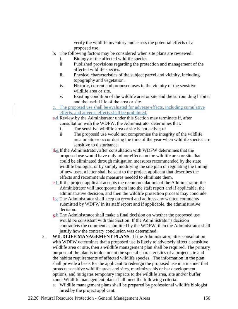
22.20 Natural Resource Protection - General Management Areas 150
verify the wildlife inventory and assess the potential effects of a
proposed use.
b. The following factors may be considered when site plans are reviewed:
i. Biology of the affected wildlife species.
ii. Published provisions regarding the protection and management of the
affected wildlife species.
iii. Physical characteristics of the subject parcel and vicinity, including
topography and vegetation.
iv. Historic, current and proposed uses in the vicinity of the sensitive
wildlife area or site.
v. Existing condition of the wildlife area or site and the surrounding habitat
and the useful life of the area or site.
c. The proposed use shall be evaluated for adverse effects, including cumulative
effects, and adverse effects shall be prohibited.
c.d. Review by the Administrator under this Section may terminate if, after
consultation with the WDFW, the Administrator determines that:
i. The sensitive wildlife area or site is not active; or
ii. The proposed use would not compromise the integrity of the wildlife
area or site or occur during the time of the year when wildlife species are
sensitive to disturbance.
d.e. If the Administrator, after consultation with WDFW determines that the
proposed use would have only minor effects on the wildlife area or site that
could be eliminated through mitigation measures recommended by the state
wildlife biologist, or by simply modifying the site plan or regulating the timing
of new uses, a letter shall be sent to the project applicant that describes the
effects and recommends measures needed to eliminate them.
e.f. If the project applicant accepts the recommendations of the Administrator, the
Administrator will incorporate them into the staff report and if applicable, the
administrative decision, and then the wildlife protection process may conclude.
f.g. The Administrator shall keep on record and address any written comments
submitted by WDFW in its staff report and if applicable, the administrative
decision.
g.h.The Administrator shall make a final decision on whether the proposed use
would be consistent with this Section. If the Administrator’s decision
contradicts the comments submitted by the WDFW, then the Administrator shall
justify how the contrary conclusion was determined.
3. WILDLIFE MANAGEMENT PLANS. If the Administrator, after consultation
with WDFW determines that a proposed use is likely to adversely affect a sensitive
wildlife area or site, then a wildlife management plan shall be required. The primary
purpose of the plan is to document the special characteristics of a project site and
the habitat requirements of affected wildlife species. The information in the plan
shall provide a basis for the applicant to redesign the proposed use in a manner that
protects sensitive wildlife areas and sites, maximizes his or her development
options, and mitigates temporary impacts to the wildlife area, site and/or buffer
zone. Wildlife management plans shall meet the following criteria:
a. Wildlife management plans shall be prepared by professional wildlife biologist
hired by the project applicant.

22.20 Natural Resource Protection - General Management Areas 153
1. In addition to the information otherwise required in site plans, site plans for uses
within 1,000 feet of a sensitive plant shall include a map prepared at a scale of one
(1) inch equals 100 feet (1:1,200) or a scale providing greater detail.
2. A field survey to identify sensitive wildlife areas or sitesplants shall be required for:
a. Land divisions that create four (4) or more parcels;
b. Recreation facilities that contain parking areas for more than ten (10) cars,
overnight camping facilities, boat ramps, and visitor information and
environmental education facilities;
c. Public transportation facilities that are outside improved rights-of-way;
d. Electric facilities, lines, equipment and appurtenances that are thirty-three (33)
kilovolts or greater; and
e. Communications, water and sewer, and natural gas transmission (as opposed to
distribution) lines, pipes, equipment and appurtenances and other project related
activities, except when all of their impacts will occur inside previously
disturbed road, railroad or utility corridors, or existing developed utility sites,
that are maintained annually.
3. Field surveys shall cover all areas affected by the proposed use or recreation
facility.
4. Field surveys shall be conducted by a person with recognized expertise in botany or
plant ecology hired by the project applicant.
5. Field surveys shall identify the precise location of the sensitive plants and delineate
a 200-foot buffer zone.
6. The results of a field survey shall be shown on the site plan map.
B. REVIEW BY THE WASHINGTON NATURAL HERITAGE PROGRAM
(WNHP).
1. Site plans and field surveys for uses proposed within 1,000 feet of a sensitive plant
species shall be submitted by the Administrator to WNHP and shall be reviewed by
WNHP to determine if a proposed use could affect sensitive plants or buffer zones
of sensitive plants.
2. Within twenty (20) days, WNHP staff shall review the site plan and their field
survey records to:
a. Identify/verify the precise location of the affected plants; and
b. Delineate a 200-foot buffer zone on the project applicant's site plan.
3. Proposed uses within 1,000 feet of a sensitive plant species shall be evaluated for
adverse effects, including cumulative effects, and adverse effects shall be
prohibited.
3.4. If the field survey records of the WNHP are inadequate, the project applicant shall
hire a person with recognized expertise in botany or plant ecology to ascertain the
precise location of the affected plants.
4.5. The Administrator shall submit a copy of all field surveys to the WNHP. The latter
shall have twenty (20) days from the date that a field survey is mailed within which
to submit written comments to the Administrator. WNHP should respond within
the twenty (20) days, even if the reply is as simple as “the agency needs an
additional number of days (WNHP to specify the number of days) to review this
field survey”.
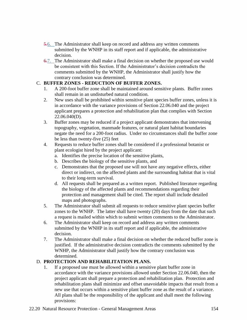
22.20 Natural Resource Protection - General Management Areas 154
5.6. The Administrator shall keep on record and address any written comments
submitted by the WNHP in its staff report and if applicable, the administrative
decision.
6.7. The Administrator shall make a final decision on whether the proposed use would
be consistent with this Section. If the Administrator’s decision contradicts the
comments submitted by the WNHP, the Administrator shall justify how the
contrary conclusion was determined.
C. BUFFER ZONES - REDUCTION OF BUFFER ZONES.
1. A 200-foot buffer zone shall be maintained around sensitive plants. Buffer zones
shall remain in an undisturbed natural condition.
2. New uses shall be prohibited within sensitive plant species buffer zones, unless it is
in accordance with the variance provisions of Section 22.06.040 and the project
applicant prepares a protection and rehabilitation plan that complies with Section
22.06.040(D).
3. Buffer zones may be reduced if a project applicant demonstrates that intervening
topography, vegetation, manmade features, or natural plant habitat boundaries
negate the need for a 200-foot radius. Under no circumstances shall the buffer zone
be less than twenty-five (25) feet
4. Requests to reduce buffer zones shall be considered if a professional botanist or
plant ecologist hired by the project applicant:
a. Identifies the precise location of the sensitive plants,
b. Describes the biology of the sensitive plants, and
c. Demonstrates that the proposed use will not have any negative effects, either
direct or indirect, on the affected plants and the surrounding habitat that is vital
to their long-term survival.
d. All requests shall be prepared as a written report. Published literature regarding
the biology of the affected plants and recommendations regarding their
protection and management shall be cited. The report shall include detailed
maps and photographs.
5. The Administrator shall submit all requests to reduce sensitive plant species buffer
zones to the WNHP. The latter shall have twenty (20) days from the date that such
a request is mailed within which to submit written comments to the Administrator.
6. The Administrator shall keep on record and address any written comments
submitted by the WNHP in its staff report and if applicable, the administrative
decision.
7. The Administrator shall make a final decision on whether the reduced buffer zone is
justified. If the administrative decision contradicts the comments submitted by the
WNHP, the Administrator shall justify how the contrary conclusion was
determined.
D. PROTECTION AND REHABILITATION PLANS.
1. If a proposed use must be allowed within a sensitive plant buffer zone in
accordance with the variance provisions allowed under Section 22.06.040, then the
project applicant shall prepare a protection and rehabilitation plan. Protection and
rehabilitation plans shall minimize and offset unavoidable impacts that result from a
new use that occurs within a sensitive plant buffer zone as the result of a variance.
All plans shall be the responsibility of the applicant and shall meet the following
provisions:

22.22 Cultural Resource Protection - General Management Areas 156
CHAPTER 22.22 CULTURAL RESOURCE PROTECTION – GENERAL
MANAGEMENT AREAS
22.22.010 GENERAL PROVISIONS FOR IMPLEMENTING THE
CULTURAL RESOURCE PROTECTION PROCESS ....................156155
22.22.020 CULTURAL RESOURCE RECONNAISSANCE AND HISTORIC
SURVEYS .........................................................................................160159
22.22.030 EVALUATION OF SIGNIFICANCE ...............................................162161
22.22.040 ASSESSMENT OF EFFECT ............................................................164162
22.22.050 MITIGATION PLANS ......................................................................165164
22.22.060 CULTURAL RESOURCES DISCOVERED AFTER
CONSTRUCTION BEGINS .............................................................166165
22.22.070 DISCOVERY OF HUMAN REMAINS ...........................................167166
22.22.010 GENERAL PROVISIONS FOR IMPLEMENTING THE CULTURAL
RESOURCE PROTECTION PROCESS
A. All cultural resource information shall remain confidential and exempt from public
records requests, according to Section 6(a)(1)(A) of the National Scenic Area Act and
RCW 42.17.310(k). Federal agency cultural resource information is also confidential and
exempt by statue from the Freedom of Information Act under 16 USC 470 hh and 36
CFR 296.18.
B. All cultural resource surveys, evaluations, assessments and mitigation plans shall be
performed by professionals whose expertise reflects the type of cultural resources that are
involved. Principal investigators shall meet the professional standards set out in 36 Code
of Federal Regulations (CFR), Part 61 and in Guidelines for Evaluating and Documenting
Traditional Cultural Properties (Parker and King, no date).
C. Cultural resource surveys, evaluations, assessments, and mitigation plans shall generally
be conducted in consultation with Indian tribal governments and if appropriate, any party
of record. Indian tribal governments shall be consulted if the affected cultural resources
are prehistoric or otherwise associated with Native Americans. If the cultural resources
are associated with non-Native Americans, such as a historic house or pioneer campsite,
the Indian tribal governments do not have to be consulted.
D. The responsibility and cost of preparing an evaluation of significance, assessment or
effect, or mitigation plan shall be borne by the project applicant, except for resources
discovered during construction. The Gorge Commission shall conduct and pay for
evaluations of significance and mitigation plans for resources that are discovered during
construction of small-scale and large-scale uses.
E. RECONNAISSANCE AND HISTORIC SURVEYS AND SURVEY REPORTS.
1. Reconnaissance Survey requirements and exceptions.
a. Each proposed use or element of a proposed use within an application shall be
evaluated independently to determine whether a reconnaissance survey is
required; for example, an application that proposes a land division and a new
dwelling would require a reconnaissance survey if a survey would be required
for the dwelling.
b. A reconnaissance survey shall be required for all proposed uses within 500 feet
of a known cultural resource, including those uses listed as exempt in Section
22.22.010(E)(1)(bc).
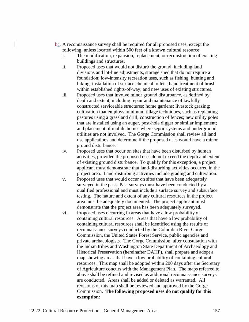
22.22 Cultural Resource Protection - General Management Areas 157
bc. A reconnaissance survey shall be required for all proposed uses, except the
following, unless located within 500 feet of a known cultural resource:
i. The modification, expansion, replacement, or reconstruction of existing
buildings and structures.
ii. Proposed uses that would not disturb the ground, including land
divisions and lot-line adjustments, storage shed that do not require a
foundation; low-intensity recreation uses, such as fishing, hunting and
hiking; installation of surface chemical toilets; hand treatment of brush
within established rights-of-way; and new uses of existing structures.
iii. Proposed uses that involve minor ground disturbance, as defined by
depth and extent, including repair and maintenance of lawfully
constructed serviceable structures; home gardens; livestock grazing;
cultivation that employs minimum tillage techniques, such as replanting
pastures using a grassland drill; construction of fences; new utility poles
that are installed using an auger, post-hole digger or similar implement;
and placement of mobile homes where septic systems and underground
utilities are not involved. The Gorge Commission shall review all land
use applications and determine if the proposed uses would have a minor
ground disturbance.
iv. Proposed uses that occur on sites that have been disturbed by human
activities, provided the proposed uses do not exceed the depth and extent
of existing ground disturbance. To qualify for this exception, a project
applicant must demonstrate that land-disturbing activities occurred in the
project area. Land-disturbing activities include grading and cultivation.
v. Proposed uses that would occur on sites that have been adequately
surveyed in the past. Past surveys must have been conducted by a
qualified professional and must include a surface survey and subsurface
testing. The nature and extent of any cultural resources in the project
area must be adequately documented. The project applicant must
demonstrate that the project area has been adequately surveyed.
vi. Proposed uses occurring in areas that have a low probability of
containing cultural resources. Areas that have a low probability of
containing cultural resources shall be identified using the results of
reconnaissance surveys conducted by the Columbia River Gorge
Commission, the United States Forest Service, public agencies and
private archaeologists. The Gorge Commission, after consultation with
the Indian tribes and Washington State Department of Archaeology and
Historical Preservation (hereinafter DAHP), shall prepare and adopt a
map showing areas that have a low probability of containing cultural
resources. This map shall be adopted within 200 days after the Secretary
of Agriculture concurs with the Management Plan. The maps referred to
above shall be refined and revised as additional reconnaissance surveys
are conducted. Areas shall be added or deleted as warranted. All
revisions of this map shall be reviewed and approved by the Gorge
Commission. The following proposed uses do not qualify for this
exemption:

22.22 Cultural Resource Protection - General Management Areas 158
(1) Residential development that involves two (2) or more new dwellings
for the same project applicant.
(2) Recreation facilities that contain parking areas for more than ten (10)
cars, overnight camping facilities, boat ramps and visitor information
and environmental education facilities.
(3) Public transportation facilities that are outside improved rights-of-way.
(4) Electric facilities, lines, equipment and appurtenances that are thirty-
three (33) kilovolts or greater.
(5) Communications, water and sewer, and natural gas transmission (as
opposed to distribution) lines, pipes, equipment and appurtenances.
d. The Gorge Commission may choose to conduct a reconnaissance survey for
proposed uses exempted under Section 22.22.010(E)(1)(c) if, in its professional
judgment, a reconnaissance survey may be necessary to ensure protection of
cultural resources.
ce. A historic survey shall be required for all proposed uses that would alter the
exterior architectural appearance of buildings and structures that are fifty (50)
years old or older, or would compromise features of the surrounding area that
are important in defining the historic or architectural character of buildings or
structures that are fifty (50) years old or older.
d.f. The Gorge Commission shall conduct and pay for all reconnaissance and
historic surveys for small-scale uses in the General Management Area.
i. When archaeological resources or traditional cultural properties are
discovered, the Gorge Commission also shall identify the approximate
boundaries of the resource or property and delineate a reasonable buffer
zone.
ii. Reconnaissance surveys and buffer zone delineations for large-scale
uses shall be the responsibility of the project applicant.
e.g. Large-scale uses, for the purposes of this Chapter, include:
i. Residential development involving two (2) or more new dwellings;
ii. All recreation facilities;
iii. Commercial and industrial development; public transportation facilities;
iv. Electric facilities, lines, equipment, and appurtenances that are thirty-
three (33) kilovolts or greater; and
v. Communications, water and sewer, and natural gas transmission (as
opposed to distribution) lines, pipes, equipment, and appurtenances.
f.h. Reconnaissance Surveys for small-scale uses shall generally include a
subsurface survey and subsurface testing. They shall meet the following
standards:
i. A surface survey of the project area shall be conducted, except for
inundated areas and impenetrable thickets.
ii. Subsurface testing shall be conducted if the surface survey reveals that
cultural resources may be present. Subsurface probes shall be placed at
intervals sufficient to determine the absence or presence of cultural
resources.
g.i. Reconnaissance Survey Reports for small-scale uses shall be documented in a
confidential report that includes:

22.22 Cultural Resource Protection - General Management Areas 159
i. A description of the fieldwork methodology used to identify cultural
resources, including a description of the type and extent of the
reconnaissance survey.
ii. A description of any cultural resources that were discovered in the
project area, including a written description and photographs.
iii. A map that shows the project area, the areas surveyed, the location of
subsurface probes, and, if applicable, the approximate boundaries of the
affected cultural resources and a reasonable buffer zone.
iv. All written comments and consultation meeting minutes, if applicable,
shall be incorporated into the reconnaissance survey report.
h.j. Reconnaissance Surveys for large-scale uses shall be designed by a qualified
professional. They shall meet the following requirements:
i. A written description of the survey shall be submitted to and approved
by the Gorge Commission’s designated archaeologist.
ii. Reconnaissance surveys shall reflect the physical characteristics of the
project area and the design and potential effects of the proposed use.
iii. Archival research shall be performed before any field work. Archival
research shall include a thorough examination of tax records; historic
maps, photographs and drawings; previous archaeological, historic and
ethnographic research; cultural resource inventories and records
maintained by federal, state and local agencies; and primary historic
accounts, such as diaries, journals, letters and newspapers.
iv. Surface surveys shall include the entire project area, except for
inundated areas and impenetrable thickets.
v. Subsurface probes shall be placed at intervals sufficient to document the
presence or absence of cultural resources.
vi. Archaeological site inventory forms shall be submitted to the
Washington State Department of Archeology and Historic Preservation
(hereinafter "DAHP") whenever cultural resources are discovered.
ik. Reconnaissance Survey Reports for large-scale uses shall be documented in a
confidential report that includes:
i. A description of the proposed use, including drawings and maps.
ii. A description of the project area, including soils, vegetation, topography,
drainage, past alterations and existing land use.
iii. A list of the documents and records examined during the archival
research and a description of any prehistoric or historic events associated
with the project area.
iv. A description of the fieldwork methodology used to identify cultural
resources, including a map that shows the project area, the areas
surveyed, and the location of subsurface probes. The map shall be
prepared at a scale of one (1) inch equals 100 feet (1:1200) or a scale
providing greater detail.
v. Copies of all written comments submitted by Indian tribal governments
and other interested persons.
vi. An inventory of the cultural resources that exist in the project area,
including a written description, photographs, drawings and a map. The

22.28 Natural Resource Protection - Special Management Areas 180
CHAPTER 22.28 NATURAL RESOURCE PROTECTION – SPECIAL
MANAGEMENT AREAS
22.28.010 WATER RESOURCE PROTECTION..................................................... 180179
22.28.020 WILDLIFE AND PLANT HABITAT PROTECTION ............................ 182181
22.28.030 PRACTICABLE ALTERNATIVE TEST ................................................ 186185
22.28.040 NATURAL RESOURCE MITIGATION PLANS ................................... 186185
22.28.010 WATER RESOURCE PROTECTION
A. EXEMPTIONS. Maintenance, repair, reconstruction and realignment of roads and
railroads within their rights of way shall be exempted from application of this chapter
upon demonstration of the following:
1. The wetland within the right of way is a drainage ditch and not part of a larger
wetland outside of the right of way;
2. The wetland is not critical habitat; and
3. Proposed activities within the right of way would not adversely affect a wetland
adjacent to the right of way.
B. BUFFER REQUIREMENTS. All new developments and uses, as described in a site
plan prepared by the applicant, shall be evaluated using the following provisions to
ensure that natural resources are protected from adverse effects. Comments from state
and federal agencies shall be carefully considered.
1. All water resources shall, in part, be protected by establishing undisturbed buffer
zones as specified in 22.28.010(B)(4). These buffer zones are measured
horizontally from a wetland, stream, lake, or pond boundary as defined below.
2. The applicant shall be responsible for identifying all water resources and their
appropriate buffers. However, delineations shall be as required in Section
22.28.010(EF).
3. All buffer zones shall be retained undisturbed and in their natural condition, except
as permitted with a natural resource mitigation plan, Section 22.28.040.
4. Buffer zones shall be measured outward from the bank full flow boundary for
streams, the high water mark for ponds and lakes, the normal pool elevation for the
Columbia River, and the wetland delineation boundary for wetlands on a horizontal
scale that is perpendicular to the wetlands, stream, pond or lake boundary. On the
main stem of the Columbia River above Bonneville Dam, buffer zones shall be
measured landward from the normal pool elevation of the Columbia River. The
following buffer zone widths shall be required:
a. A minimum 200 foot buffer on each wetland, pond, lake, and each bank of a
perennial or fish-bearing stream, some of which can be intermittent.
b. A fifty (50) foot buffer zone along each bank of intermittent (including
ephemeral, non-fish bearing streams).
c. The buffer width shall be increased for the following:
i. When the channel migration zone exceeds the recommended buffer
width, the buffer width shall extend to the outer edge of the channel
migration zone.

22.28 Natural Resource Protection - Special Management Areas 182
3. Unavoidable impacts to wetlands and aquatic and riparian areas and their buffer
zones shall be offset by deliberate restoration and enhancement or creation
(wetlands only) measures as required by the completion of a mitigation plan.
4. When a buffer zone is disturbed by a new use, it shall be replanted with only native
plant species of the Columbia River Gorge.
E. Proposed uses and development within wetlands, streams, ponds, lakes, riparian areas
and their buffer zones shall be evaluated for cumulative effects to natural resources and
cumulative effects that are adverse shall be prohibited.
E.F. DELINEATING WATER RESOURCE BOUNDARIES AND BUFFER
ZONES. Wetlands Boundaries shall be delineated using the following:
1. The approximate location and extent of wetlands in the Scenic Area is shown on the
National Wetlands Inventory (U.S. Department of the Interior 1987). In addition,
the list of hydric soils and the soil survey maps shall be used as an indicator of
wetlands.
2. Some wetlands may not be shown on the wetlands inventory or soil survey maps.
Wetlands that are discovered by the Administrator during an inspection of a
potential project site shall be delineated and protected.
3. The project applicant shall be responsible for determining the exact location of a
wetlands boundary. Wetlands boundaries shall be delineated using the procedures
specified in the ‘1987 Corps of Engineers Wetland Delineation Manual (on-line
Edition).
4. All wetlands delineations shall be conducted by a professional who has been trained
to use the federal delineation procedures, such as a soil scientist, botanist, or
wetlands ecologist.
5. Stream, pond, and lake boundaries shall be delineated using the bank full flow
boundary for streams and the high water mark for ponds and lakes. The project
applicant shall be responsible for determining the exact location of the appropriate
boundary for the water resource.
6. The Administrator may verify the accuracy of, and render adjustments to, a bank
full flow, high water mark, normal pool elevation (for the Columbia River), or
wetland boundary delineation. If the adjusted boundary is contested by the project
applicant, the Administrator shall obtain professional services, at the project
applicant's expense, or the Administrator will ask for technical assistance from the
Forest Service to render a final delineation.
22.28.020 WILDLIFE AND PLANT HABITAT PROTECTION
A. REVIEW OF SITE PLANS.
1. Protection of sensitive wildlife/plant areas and sites shall begin when proposed new
developments or uses are within 1,000 ft of a sensitive wildlife/plant site and/or
area. Sensitive Wildlife Areas and endemic plants are those areas listed in Chapter
22.04, the “Types of Wildlife Areas and Sites Inventoried in the Columbia River
Gorge” and “Columbia Gorge Vicinity Endemic Plant Species” tables, including all
Priority Habitats listed in Table 5 in Section 22.28.020. (USFS) The approximate
locations of sensitive wildlife and/or plant areas and sites are shown in the wildlife
and rare plant inventory.

22.28 Natural Resource Protection - Special Management Areas 186
decision contradicts the comments submitted by the state and federal wildlife
agency/heritage program, the Administrator shall justify how the contrary
conclusion was determined.
9. The Administrator shall require the project applicant to revise the mitigation plan as
necessary to ensure that the proposed use would not adversely affect a sensitive
wildlife/plant area or site.
9.10. Proposed uses and developments within 1,000 feet of sensitive wildlife areas and
sites or within 1,000 feet of rare plants shall be evaluated for cumulative effects to
natural resources and cumulative effects that are adverse shall be prohibited.
B. NATURAL RESOURCE PROTECTION STANDARDS. Soil productivity shall be
protected using the following provisions:
1. A description or illustration showing the mitigation measures to control soil erosion
and stream sedimentation.
2. New developments and land uses shall control all soil movement within the area
shown on the site plan.
3. The soil area disturbed by new development or land uses, except for new
cultivation, shall not exceed fifteen percent (15 %) of the project area.
4. Within one (1) year of project completion, eighty percent (80 %) of the project area
with surface disturbances shall be established with effective native ground cover
species or other soil-stabilizing methods to prevent soil erosion until the area has
eighty percent (80 %) vegetative cover.
22.28.030 PRACTICABLE ALTERNATIVE TEST
An alternative site for a proposed use shall be considered practicable if it is available and the
proposed use can be undertaken on that site after taking into consideration cost, technology,
logistics, and overall project purposes. A practicable alternative does not exist if a project
applicant satisfactorily demonstrates all of the following:
A. The basic purpose of the use cannot be reasonably accomplished using one or more other
sites in the vicinity that would avoid or result in less adverse effects on wetlands, ponds,
lakes, riparian areas, wildlife or plant areas and/or sites;
B. The basic purpose of the use cannot be reasonably accomplished by reducing its proposed
size, scope, configuration, or density, or by changing the design of the use in a way that
would avoid or result in less adverse effects on wetlands, ponds, lakes, riparian areas,
wildlife or plant areas and/or sites; and
C. Reasonable attempts were made to remove or accommodate constraints that caused a
project applicant to reject alternatives to the proposed use. Such constraints include
inadequate infrastructure, parcel size, and land use designations. If a land use designation
or recreation intensity class is a constraint, an applicant must request a Management Plan
amendment to demonstrate that practicable alternatives do not exist.
22.28.040 NATURAL RESOURCE MITIGATION PLANS
A. A Mitigation Plan shall be prepared when:
1. The proposed development or use is within a buffer zone (wetland, pond, lakes,
riparian areas, wildlife or plant areas and/or sites); and

22.28 Natural Resource Protection - Special Management Areas 187
2. There is no practicable alternative (see the “practicable alternative” test set out in
Section 22.28.030).
B. In all cases, Mitigation Plans are the responsibility of the applicant and shall be prepared
by an appropriate professional (botanist/ecologist for plant sites, a wildlife/fish biologist
for wildlife/fish sites, and a qualified professional for water resource sites).
C. The primary purpose of this information is to provide a basis for the project applicant to
redesign the proposed use in a manner that protects sensitive water resources, and
wildlife/plant areas and sites, that maximizes his/her development options, and that
mitigates, through restoration, enhancement, and replacement measures, impacts to the
water resources and/or wildlife/plant area or site and/or buffer zones.
D. The applicant shall submit the mitigation plan to the Administrator. The Administrator
shall submit a copy of the mitigation plan to the Forest Service, and appropriate state
agencies. If the final decision contradicts the comments submitted by the state and
federal wildlife agency/heritage program, the Administrator shall justify how they
reached an opposing conclusion.
E. A project applicant shall demonstrate sufficient fiscal, technical, and administrative
competence to successfully execute a mitigation plan involving wetland creation.
F. Mitigation plans shall include maps, photographs, and text. The text shall:
4.1. Describe the biology and/or function of the sensitive resources (eg. wildlife/plant
species, or wetland) that will be affected by a proposed use. An ecological
assessment of the sensitive resource to be altered or destroyed and the condition
of the resource that will result after restoration will be required. Reference
published protection and management provisions;
5.2. Describe the physical characteristics of the subject parcel, past, present, and future
uses, and the past, present, and future potential impacts to the sensitive resources.
Include the size, scope, configuration, or density of new uses being proposed
within the buffer zone;
6.3. Explain the techniques that will be used to protect the sensitive resources and
their surrounding habitat that will not be altered or destroyed (for example,
delineation of core habitat of the sensitive wildlife/plant species and key
components that are essential to maintain the long-term use and integrity of the
wildlife/plant area or site);
7.4. Show how restoration, enhancement, and replacement (creation) measures will be
applied to ensure that the proposed use results in minimum feasible impacts to
sensitive resources, their buffer zones, and associated habitats; and,
8.5. Show how the proposed restoration, enhancement, or replacement (creation)
mitigation measures are NOT alternatives to avoidance. A proposed
development/use must first avoid a sensitive resource, and only if this is not
possible should restoration, enhancement, or creation be considered as mitigation.
In reviewing mitigation plans, the Administrator, appropriate state agencies, and
the Forest Service shall critically examine all proposals to ensure that they are
indeed last resort options.
G. At a minimum, a project applicant shall provide to the Administrator a progress report
every three (3) years that documents milestones, successes, problems, and contingency
actions. Photographic monitoring stations shall be established and photographs shall be
used to monitor all mitigation progress.