statistical principles of design and analysis for accuracy ... · boston university slideshow title...
TRANSCRIPT
P. Olofsson and S.V. Stehman
Fifth GFOI Regional Technical Workshop: Accuracy Assessment
January 25-29 2016, Santa Rosa, Philippines
Statistical principles of design and analysis for
accuracy assessment and area estimation

Boston University Slideshow Title Goes Here
“Why is this necessary?”
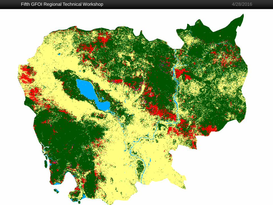
A very common result of remote sensing is an
estimate of an amount, or area (e.g. change map)
The strength of remote sensing is that it often allows
wall-to-wall coverage of the area under consideration
The weakness of remote sensing is that results are
never perfect (e.g., a classified map contains error)
If the map has errors, then mapped areas of the map
categories are incorrect and need adjustment for
errors, and uncertainty in area quantified
Fifth GFOI Regional Technical Workshop
2
4/28/2016

Boston University Slideshow Title Goes Here
Not new stuff! We’re making use of
Cochran (1977) and Särndal et al. (1992);
Card (1982) used these techniques to
improve map estimates
4/28/2016 Accuracy Assessment
Boston University Slideshow Title Goes Here
Fifth GFOI Regional Technical Workshop
4
4/28/2016
Some terminology
We identify classification errors in a map by designing
and implementing an accuracy assessment
Sample the map (i.e. the population) and collect
reference observations for sample: best assessment
of true class at a given location
Reference data: information used to obtain the
reference class
By comparing the map and reference labels –
compute map accuracy: the degree to which the map
corresponds to the reference condition

Boston University Slideshow Title Goes Here
Fifth GFOI Regional Technical Workshop
5
4/28/2016
More terminology
Statistical inference: collect information about
population (map) by analyzing sample of population
A conclusion of the inference is an estimate that best
approximates a particular population parameter
A confidence interval of the estimate is the interval
that contain the true parameter value with a probability
of the confidence level if the sampling is repeated
many times
Bias is the difference between an estimator’s
expected value and the true parameter value

Boston University Slideshow Title Goes Here
Fifth GFOI Regional Technical Workshop
6
4/28/2016
Components of Accuracy Assessment
Sampling design: Decide which elements of the
population (map) to visit
Response design: Determine the true class or
“reference condition” at a location
Analysis: Organize and summarize data to make
inference (accuracy, area) about the population (map)
Where will we observe the true condition?
What is the true (reference) condition?
And how will we use the data?

Boston University Slideshow Title Goes Here
Fifth GFOI Regional Technical Workshop
7
4/28/2016
Sampling design
Many options but we want:
A probability sample
Practical to implement given response design
Yields estimates with small standard errors
Low cost
Spatially well distributed across country
Can allow for change in sample size
Unbiased estimator of variance (not approximate)

Boston University Slideshow Title Goes Here
4/28/2016 Accuracy Assessment
Random
selection
By measuring height of people in
sample we can make inference of
height of population. We get an
estimate of population height (ℎ ).
Population, height (h) unknown
Random sample,
height measured
Simple random sample

Boston University Slideshow Title Goes Here
4/28/2016 Accuracy Assessment
We get a more precise estimate of the
of the height and we can get the
height of each stratum in the
population (ℎ 𝑔, ℎ 𝑏, ℎ 𝑤).
Population, height (h) unknown
Stratified random sample
Stratified random
selection; 3 strata
Stratified random
sample, height
measured
Boston University Slideshow Title Goes Here
Fifth GFOI Regional Technical Workshop
10
4/28/2016

Boston University Slideshow Title Goes Here
4/28/2016 Accuracy Assessment
Simple
Systematic
2-Stage
Clustered
Simple
Random
Stratified
Random

Boston University Slideshow Title Goes Here
Basic Sampling Design Questions
Strata – group assessment units into strata?
Clusters – sample assessment units individually or in
groups?
Selection protocol – select the sample of assessment
units by a systematic or a simple random protocol?

Boston University Slideshow Title Goes Here
Basic Sampling Design Questions
Decisions depend objective of analysis and design
criteria
Clusters – use for costs but complex variance
estimation, larger variance and spatial correlation
Strata – use for objectives and precision
Selection protocol – SYS more difficult to combine with
stratification by map class; SRS unappealing
distribution

Boston University Slideshow Title Goes Here
Response Design
The method use to decide reference condition
Reference condition decided without knowing map class of the location
Four main features of response design
Information to decide reference condition
Spatial unit of the assessment
Assign reference condition
How do define if map class and reference condition agree
Boston University Slideshow Title Goes Here
Spatial Unit of Assessment
Partition region of interest into non-overlapping
spatial units
Common choices are
Pixel
Block of pixels (e.g. 3x3, 5x5)
Segment
Sampling design depends on choice of spatial
unit
Boston University Slideshow Title Goes Here
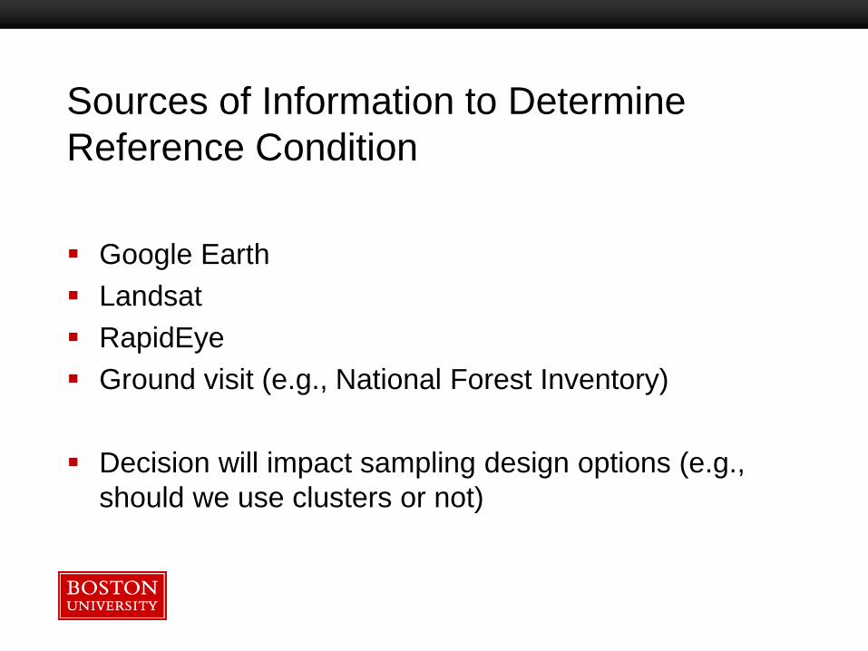
Sources of Information to Determine
Reference Condition
Google Earth
Landsat
RapidEye
Ground visit (e.g., National Forest Inventory)
Decision will impact sampling design options (e.g.,
should we use clusters or not)

Boston University Slideshow Title Goes Here
Analysis
Accuracy Define parameters that describe accuracy
Estimate parameters from sample
Estimate standard errors
Area Reference condition is basis of estimate
Increase precision by incorporating map information into area
estimator
Estimate area and standard errors

Boston University Slideshow Title Goes Here
Error matrix
Reference
Forest loss No loss Map prop.
Ma
p
Forest loss p11 p12 p1+
No loss p21 p22 p2+
Ref. prop. p+1 p+2 1
Fifth GFOI Regional Technical Workshop
18
4/28/2016

Boston University Slideshow Title Goes Here
Reference
Forest loss No loss Map prop.
Ma
p
Forest loss p11 p12 p1+
No loss p21 p22 p2+
Ref. prop. p+1 p+2 1
Bias-adjusted estimator: add omission
error and subtract commission error
Fifth GFOI Regional Technical Workshop
19
4/28/2016
𝑝 +1 = 𝑝1+ + (𝑝 21 − 𝑝 12)
Boston University Slideshow Title Goes Here
Reference
Forest loss No loss Map prop.
Ma
p
Forest loss p11 p12 p1+
No loss p21 p22 p2+
Ref. prop. p+1 p+2 1
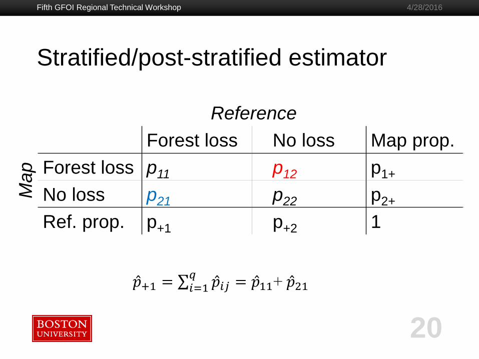
Stratified/post-stratified estimator
Fifth GFOI Regional Technical Workshop
20
4/28/2016
𝑝 +1 = 𝑝 𝑖𝑗𝑞𝑖=1 = 𝑝 11+ 𝑝 21

Boston University Slideshow Title Goes Here
Area estimators
Bias-adjusted estimator
Unbiased for any sample size
Known as a “difference” estimator in sampling texts
More efficient if map class is continuous
Stratified/Post-stratified
Unbiased (but problem if no units from a post-stratum)
Allows use of all map classes as post-strata
More efficient if map classes is categorical
Fifth GFOI Regional Technical Workshop
21
4/28/2016

Boston University Slideshow Title Goes Here
Reference
Forest loss No loss Map prop.
Ma
p
Forest loss p11 p12 p1+
No loss p21 p22 p2+
Ref. prop. p+1 p+2 1
Measures of accuracy
Fifth GFOI Regional Technical Workshop
22
4/28/2016
𝑂 = 𝑝 𝑗𝑗𝑞𝑖=1 = 𝑝 11+ 𝑝 22
𝑈𝑖 = 𝑝 𝑖𝑖 ÷ 𝑝 𝑖+ = 𝑝 11 ÷ 𝑝 1+
𝑃𝑗 = 𝑝 𝑗𝑗 ÷ 𝑝 𝑗+ = 𝑝 11 ÷ 𝑝 +1

Boston University Slideshow Title Goes Here
Conclusions
All maps have errors – can’t count pixels – inference
of area from reference sample necessary
Sample design depends on assessment objectives
and practicalities
We use the map to increase precision in area
estimates – we are not validating the map
Area estimation typically of first priority – accuracy
secondary
Fifth GFOI Regional Technical Workshop
23
4/28/2016