tactical network topology (tnt) m i i t di ti o ti (mio
TRANSCRIPT
Tactical Network Topology (TNT)M i I t di ti O ti (MIO)Marine Interdiction Operation (MIO)
TNT MIO 09-2E i t l Eff t R hEnvironmental Effects Research
D P t G tDr. Peter GuestNaval Postgraduate School
GSEAS Department of MeteorologyGSEAS, Department of Meteorology
Presented to thePresented to theNPS Marine Domain Awareness Working Group
June 10, 2009June 10, 2009

OutlineOutline
• The TNT/CBE Program at NPSThe TNT/CBE Program at NPS• TNT MIO History• TNT MIO 09-2 April 2009 OverviewTNT MIO 09-2 April 2009 Overview• Environmental Effects
Weather and Sea State Effects on– Weather and Sea State Effects on Operations
– Environmental Effects on Target Detection– Environmental Effects on Target Detection and Communications

TNT/CBE Program at NPSTNT/CBE Program at NPS
• Started in 2003 as “STAN”Started in 2003 as STAN• Evolved into two components:
– Concept Based Experimentation (CBE)Concept Based Experimentation (CBE)• Ray Buettner, Chief Scientist (formerly Dave Netzer)• Main NPS venue is Camp Roberts CA
M i I t di ti O ti (MIO)– Marine Interdiction Operations (MIO) • Alex Bordetsky, Chief Scientist• San Francisco Bay area and several other locationsy

Extending the Tactical Networkb L d S d Aiby Land, Sea, and Air

MIO Experiment ConceptMIO Experiment Concept
• Bridging the gap between sensors and• Bridging the gap between sensors and actors on the ship, and decision-makers and analysts on the shorey
• Utilizing COTS networking technology combined with collaborative decision-support tools to compress the timeline of interdiction operations
• Exploring Inter-Agency and Coalition collaborative information sharing

Maritime Interdiction OperationsMaritime Interdiction Operations

Example Scenario and Global Partners
Intel: Nuclear device shipped from Persian Gulf onto 2 possible ships
Austrian Border P t l
LLNL hb k
Swedish Navy
Naval Postgraduate School
Patrol. ..
. ...
...
US MarinesBiometric Fusion Center
USCG
reachback
Singapore Navy
.
.
... .
.. .
US Navy StilletoUS Navy Stilleto

NPS-LLNL MIO Cooperation Partners
Networks: ship-to-ship, ship-to-shoreCollaborative Technology
NPS Team
Participating DoD and U.S. Gov’t.:
Foreign Partners:gy
Operations & Command CenterVPN reachbackUnmanned vehicles
-USSOCOM
-OSD/HD
National University of Singapore/DSTA
Swedish National Defense College/Swedish NavalBiometrics
Environmental Effects-Biometric Fusion Center
-NIST
-MARAD
USCG/D 11
College/Swedish Naval Warfare Center
Salzburg Research
University of Bundeswehr LLNL Team-USCG/D-11
-US Marine Corps
-DOE Radiological Assistance Program
at Munich
State and Local Government
HOPS
Export Control
Radiation Reachback g
-OFT
-DTRAAlameda County SheriffOakland Police Dept.San Francisco Police Dept.
Radiation Reachback
Plume Modeling
Radiation Sources
Radiation DetectionCalifornia Office of Emergency Services
Radiation Detection
Ultra-wide band Communication
Explosives Detection

New element: Three Boarding Parties simultaneously conducted in the open waters, inner bay, and the riverine area

ARAM – Adaptable Radiation Area Monitor used for Drive-by detection of Nuclear Materials (Dave Trombino, Brian Agrawal)
• Real time radiation monitoring system• Spectral data analyzed to quickly provide• Spectral data analyzed to quickly provide
actionable information – flow of commerce not impeded – secondary search possibly not necessary– secondary search possibly not necessary– Spectra transmitted to reachback
20052005
Drive-by detection of radiation sources in small boats; With Reachback 6/6 sources correctly identified

Small Craft Detection And Interdiction

TNT MIO 09-2TNT MIO 09-2
NETWORKING AND INTERAGENCY COLLABORATION ON MARITIME-SOURCEDNUCLEAR RADIATION THREAT AND SMALL CRAFT INTERDICTIONNUCLEAR RADIATION THREAT AND SMALL CRAFT INTERDICTION
San Francisco Bay/ Ft. Eustis, VA/Germany/SwedenApril 20-24, 2009
JOINT NPS-LLNLFIELD EXPERIMENT SPONSORED BY
USSOCOM, OSD/HD AND HLS S&T MDA PROGRAMSPROGRAMS

MIO 09-2 ObjectivesMIO 09 2 Objectives
Evaluate the use of networks advancedEvaluate the use of networks, advancedsensors, and collaborative technology for rapidMaritime Interdiction Operations (MIO), includingth bilit t h f di ti tthe ability to search for radiation sources, set upship to ship and ship to shore communicationswhile maintaining network connectivity withwhile maintaining network connectivity withcommand and control (C2) organizations andcollaborating in response to the radiologicalth t i th S F i B A dthreat in the San Francisco Bay Area andsubsequent events in the Riverine area ofHampton Roads, VA.p ,

MIO 09-2 ObjectivesMIO 09 2 Objectives
The specific goal for MIO 09 2 was to furtherThe specific goal for MIO 09-2 was to furtherexplore new sensors, unmanned systems,networking and situational awarenessnetworking, and situational awarenesssolutions for tagging, monitoring andinterdicting small craft and their crews,possessing nuclear radiation threat andpersistent detection and monitoring of riverine
ti itiactivities.

MIO 09-2 ScenarioMIO 09 2 Scenario
1. Nuclear fuel was stolen from Russian and European Nuclear1. Nuclear fuel was stolen from Russian and European Nuclear reactors.
2. Intelligence reports Al Qaida obtained the fuel. 3 Al Qaida issues an ultimatum for the US to withdraw from3. Al Qaida issues an ultimatum for the US to withdraw from
Afghanistan and Iraq or it will bring the end of the world to “satanic western civilization”
4 Nuclear experts determine that Al Qaida may have developed4. Nuclear experts determine that Al Qaida may have developed am improvised nuclear device (IND).
5. A suspect vehicle is tracked from Croatia to Germany. Vehicle is tagged with a trackig deviceVehicle is tagged with a trackig device.
6. Suspect device is transferred to vessel proceeding to San Francisco Bay.
7 Vessel is interdicted and searched in SF Bay7. Vessel is interdicted and searched in SF Bay.

MIO 09-2 ActivitiesMIO 09 2 ActivitiesSan Francisco Bay
1. Cargo Vessel Search (April 20, 2009)2. Multiple Craft Small Craft Drive by Search (April 21)
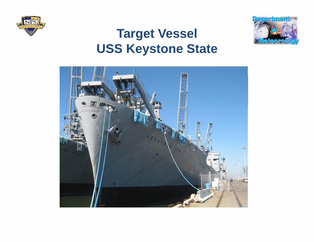
Target VesselUSS K t St tUSS Keystone State

Detection “Procession”Detection Procession
Target vessels Detection Vessels

MIO 09-2 ActivitiesMIO 09 2 ActivitiesFort Eustis, VA
1. Suspect small vessel tagged by divers (April 23)2. Threat of tagged vessel evaluated 3. Vessel chase and interdiction (April 24)

Ft Eustis: Defense of a high value shipFt Eustis: Defense of a high value shipF i dl fF i dl f O iti fO iti ft ust s e e se o a g a ue s pt ust s e e se o a g a ue s p•• Friendly forces:Friendly forces:–– C2 nodeC2 node–– USVsUSVs
•• Opposition forces:Opposition forces:–– NSW swimmersNSW swimmers–– Goal: Goal:
–– Manned patrol boat(s)Manned patrol boat(s)–– Unattended sensors Unattended sensors
•• GroundGround
•• Infiltrate river environmentInfiltrate river environment•• place mineplace mine--like object on hulllike object on hull•• board the vessel for a topside board the vessel for a topside GroundGround
•• ShipboardShipboard•• RiverRiver
ppintel gathering missionintel gathering mission
•• Infiltrate Infiltrate
C2 it (ICARUS b d) it d USV & d l t l fC2 it (ICARUS b d) it d USV & d l t l f C2 site (ICARUS based) monitor sensors and USVs & manned vessel patrol of C2 site (ICARUS based) monitor sensors and USVs & manned vessel patrol of riverine environment.riverine environment.
Dynamic response of USV and manned vessel to sensor alerts.Dynamic response of USV and manned vessel to sensor alerts.
Transition of OPFOR or local Fort Eustis divers to finding and reporting via network Transition of OPFOR or local Fort Eustis divers to finding and reporting via network suspect object attached to hull. suspect object attached to hull.
C2 actions to coordinate response and cordon off and search area with USV and C2 actions to coordinate response and cordon off and search area with USV and manned boat(s).manned boat(s).
Conduct high speed chase of suspect enemy support vessel Conduct high speed chase of suspect enemy support vessel

Ft Eustis AreaFt Eustis Area

Environmental EffectsEnvironmental Effects Peter Guest, PI
Kenneth DavidsonMary Jordan
Dick Lind
1. Support: Ongoing Operations• Morning Weather/Sea State Briefs • WebsiteWebsite• Radar Range Predictions• Visible Range Predictions
2. Research: Improving Detection Range Models• Visible detection

Flow of Environmental InformationD i MIO 09 2During MIO 09-2
Command Centers
ForwardTNT
Network Off-siteExperts VesselSystemsExperts
+ Models
WWW

Model PredictionsD i MIO 09 2During MIO 09-2

Weather/Sea State BriefWeather/Sea State Brief
San Francisco Bay
•April 20: Keystone State Conference Room•April 21: Yerba Buena Coast Guard Station
Key issue: Hot Weather
Fort Eustis, VA•April 23: Remote Presentation using Groove and emailApril 24: Remote Presentation using Groove and email•April 24: Remote Presentation using Groove and email
Key issue: Waves affecting Swimmers and DiversKey issue: Waves affecting Swimmers and Divers

WebsiteWebsite
San Francisco Bay
Fort Eustis, VA
http://www.met.nps.edu/~psguest/tntmio/

AREPS Radar Range PredictionsAREPS Radar Range PredictionsSan Francisco Bay
TNT MIO 21 April 2009TNT MIO 21 April, 2009
Based on upper-air radiosonde launched from OAK

Visible Range PredictionsSNPSVIZ
San Francisco Bay

Visible Range PredictionsgTAWS
San Francisco Bay
21 April 2009

Research: Improving Detection Range ModelsDetection Range Models
Data CollectionData Collection
1 In Situ Measurements1. In Situ Measurements
2. Model Results
3. Visibility Range Photography
4. Surrounding Environmental Information (from WWW)

Research: Improving Detection Range ModelsDetection Range Models
Measurements

Research: Improving Detection Range ModelsDetection Range Models
Measurements
Wind Vector
T tTemperature
HumidityCompassGPS
PressureIR Sea Temp
Data AcquistionSystem
Network NodeNetwork Node(below deck)
SST (bucket)

Meteorology Conditions

Research: Improving Detection Range Modelsg
Optical Turbulence - Over land situation
Sunrise
Sun heats surface which causes surface-air temperature contrast
4 hours later
contrast.
4 hours laterWind tends to equalize temperatures and suppress turbulencesuppress turbulence

Research: Improving Detection Range Modelsg
Optical Turbulence - Over water situationAcross the bay using 1000 mm lens
Sun cannot significantly change surface temperature
Wind brings warmer air over cold water surface
d i iand causes increase in optical turbulence
U = 1 kts U = 7 ktsU = 1 kts1232 PM
U = 7 kts1406 PM
April 21, 2009

Environmental Effects Support and Research During MIO 09-2
Conclusions 1. All measurements successful2. Main weather effects:
• Heat (SF Bay) - forecasted • Waves (Ft Eustis) not forecast• Waves (Ft Eustis) – not forecast
3. Radar Range not verifiable4. Visible range predictions reasonably accurate
• Need to include 1000 m camera5. Interesting Optical Turbulence effects due to
advection of warm air over cold water

The End