the german spatial data strategy - fig · the german spatial data strategy the world with spatial...
TRANSCRIPT

The German Spatial Data Strategy
The world with spatial data in 2025
FIG Congress 2016, May 5th
Susanne KleemannFederal Ministry of the Interior
Presented at th
e FIG W
orking Week 2016,
May 2-6, 2
016 in Christchurch, N
ew Zealand
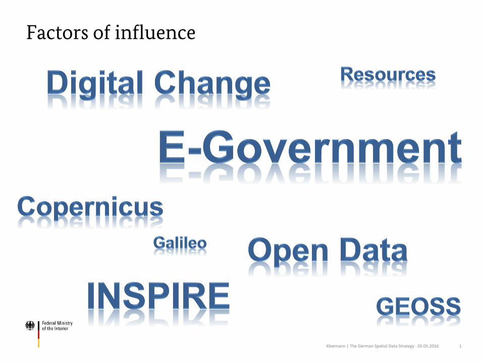
Factors of influence
Kleemann | The German Spatial Data Strategy 05.05.2016 1
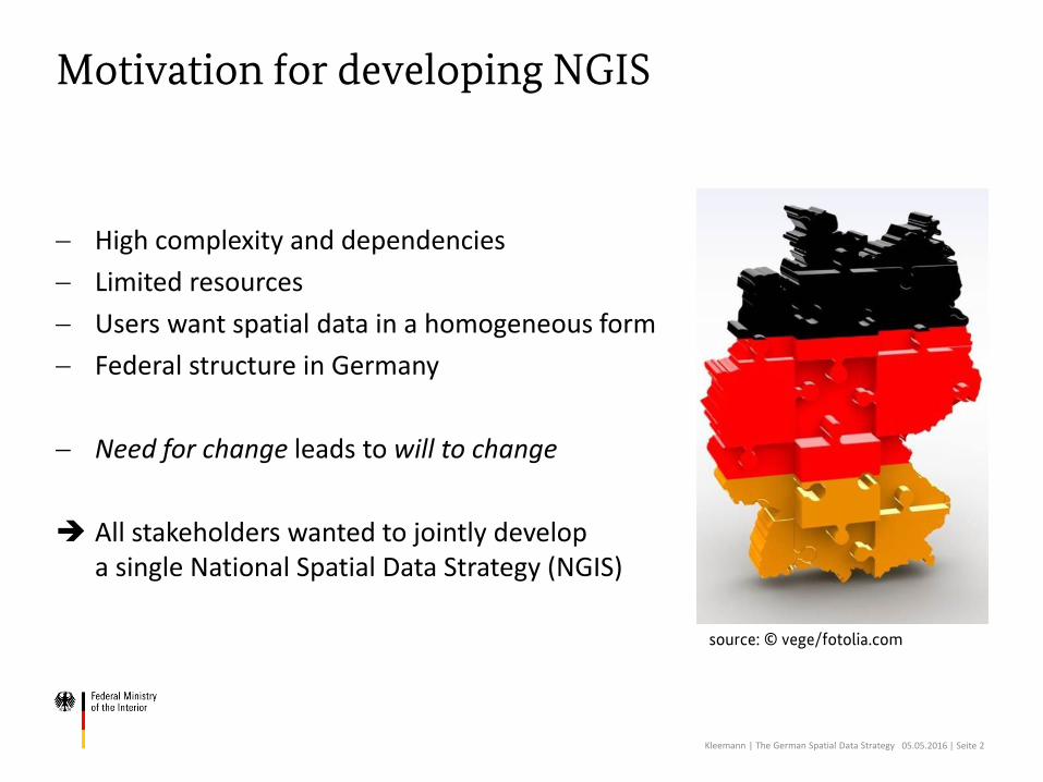
Motivation for developing NGIS
source: © vege/fotolia.com
High complexity and dependencies
Limited resources
Users want spatial data in a homogeneous form
Federal structure in Germany
Need for change leads to will to change
All stakeholders wanted to jointly develop a single National Spatial Data Strategy (NGIS)
Kleemann | The German Spatial Data Strategy 05.05.2016 | Seite 2
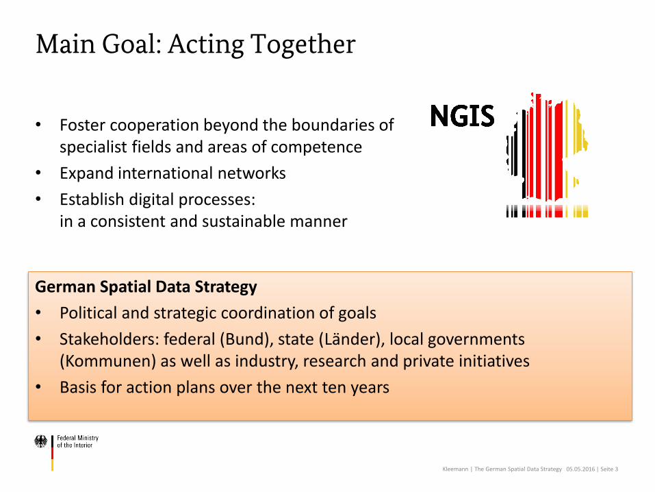
Main Goal: Acting Together
• Foster cooperation beyond the boundaries of specialist fields and areas of competence
• Expand international networks
• Establish digital processes: in a consistent and sustainable manner
Kleemann | The German Spatial Data Strategy 05.05.2016 | Seite 3
German Spatial Data Strategy
• Political and strategic coordination of goals
• Stakeholders: federal (Bund), state (Länder), local governments (Kommunen) as well as industry, research and private initiatives
• Basis for action plans over the next ten years

Who is coordinating?
Kleemann | The German Spatial Data Strategy 05.05.2016 | Seite 4
Spatial Data Infrastructure Germany (GDI-DE) Steering Committee• Professional/political decision-making body responsible for the setup
of GDI-DE; controls and coordinates the GDI-DE, including the implementation of INSPIRE
• Composed of federal, state (Länder) and local governments as well as representatives of industry and research
• Tasks:– Creating rules and determining measures for the establishment and
operation of the GDI-DE– Performing the function of a "National Correspondent" within the
meaning of the INSPIRE directive– Reporting to the political decision-making body IT Planning Council

Steps for Developing the German Spatial Data Strategy
Kleemann | The German Spatial Data Strategy 05.05.2016 | Seite 5
Consolidation Decision
Online Participation
Consultation
Workshop
Brain-storming
Discussion
GDI-DE
IT-PLC
CdS
Collection
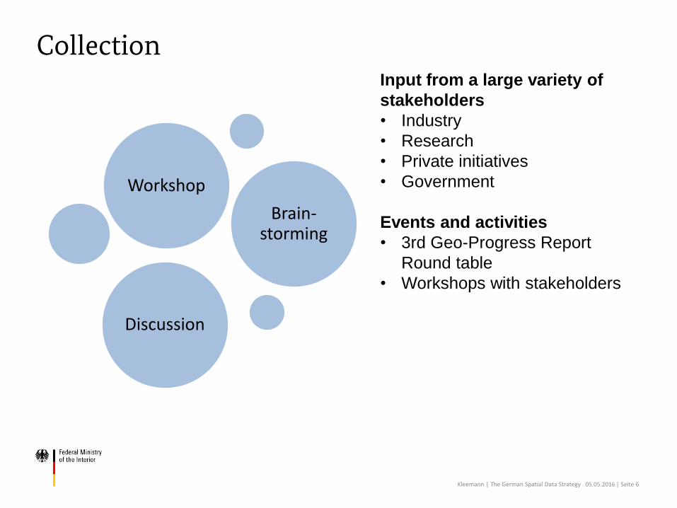
Collection
Kleemann | The German Spatial Data Strategy 05.05.2016 | Seite 6
Workshop
Brain-storming
Discussion
Input from a large variety of
stakeholders
• Industry
• Research
• Private initiatives
• Government
Events and activities
• 3rd Geo-Progress Report
Round table
• Workshops with stakeholders

Strategy Guidelines
Kleemann | The German Spatial Data Strategy 05.05.2016 | Seite 7
Structure oriented towards
National E-Government Strategy
(NEGS)
Define vision (not activities):
The world with spatial data in 2025
Giving guidance
by agreeing on principles
Target groups
• All users and providers
of spatial data
• Policy makers
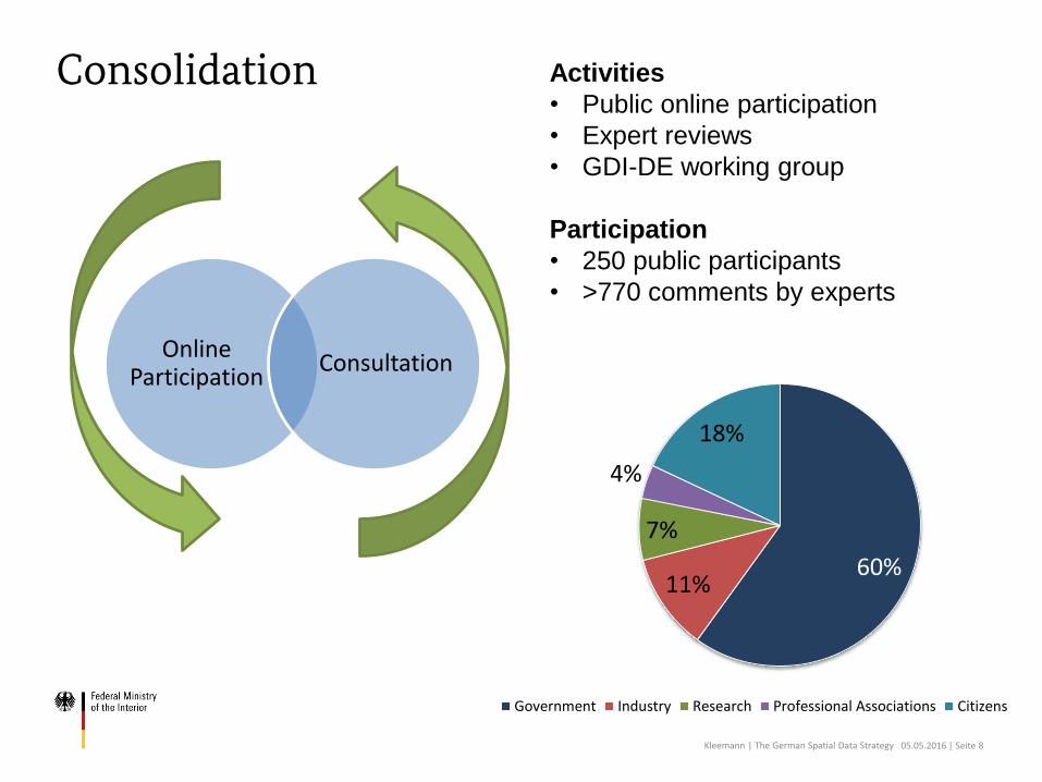
Consolidation
Kleemann | The German Spatial Data Strategy 05.05.2016 | Seite 8
Activities
• Public online participation
• Expert reviews
• GDI-DE working group
Participation
• 250 public participants
• >770 comments by experts
Online Participation
Consultation
60%11%
7%
4%
18%
Government Industry Research Professional Associations Citizens

Decision by Steering Committee
Kleemann | The German Spatial Data Strategy 05.05.2016 | Seite 9
GDI-DE
IT Planning Council
CdS
August 2015
GDI-DE Steering Committee
October 2015
IT Planning Council
November 2015
Chief of Staff of the Federal
Chancellery and his/her
counterparts at state level
(ChefBK / CdS)

Agreed Principles
Kleemann | The German Spatial Data Strategy 05.05.2016 | Seite 10
A broad foundation of spatial data is available for making space-related decisions
Ensuring the basic supply
Extensive support for the multiple use of data is provided
Facilitating multiple use
New services are proposed and tested and support is provided for their implementation
Promoting innovation
Spatial data: Essential raw material for digital society

In Focus: Users of Spatial Data
• Spatial data are accessible and easy to use for everyone
• Spatial data providers are responsible /accountable for data reuse
• Quality and variety of spatial data are determined by user needs
• Spatial data are transparently described and published
• Users are cooperatively involved in the enhancement of spatial data
• Spatial data are available without restrictions
Kleemann | The German Spatial Data Strategy 05.05.2016 | Seite 11
Source: Pressmaster/shutterstock.com
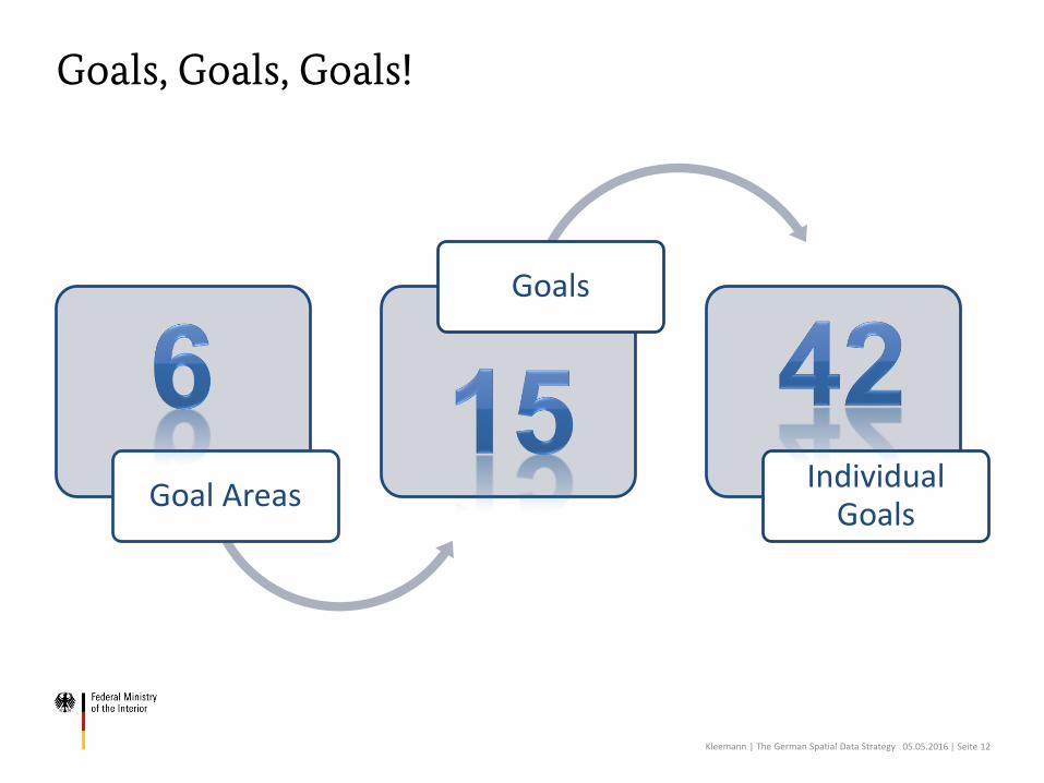
Goals, Goals, Goals!
Goal Areas
Goals
Individual Goals
Kleemann | The German Spatial Data Strategy 05.05.2016 | Seite 12

6 Goal Areas of NGIS
Kleemann | The German Spatial Data Strategy 05.05.2016 | Seite 13
Usefulness for individuals, businesses, the research community and public administration
Cost-effectiveness and efficiency
Transparency and social participation
Data protection and data security
Long-term viability and sustainability
Effective IT support

Success = Good Strategy + Good Implementation
Kleemann | The German Spatial Data Strategy 05.05.2016 | Seite 14
Quelle: © Guido Vrola /fotolia.com
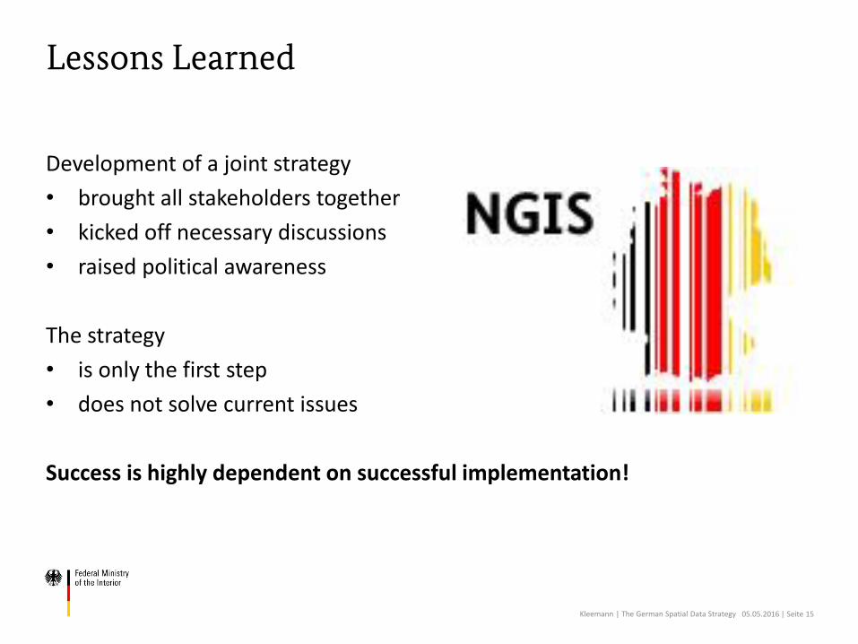
Lessons Learned
Development of a joint strategy
• brought all stakeholders together
• kicked off necessary discussions
• raised political awareness
The strategy
• is only the first step
• does not solve current issues
Success is highly dependent on successful implementation!
Kleemann | The German Spatial Data Strategy 05.05.2016 | Seite 15

Thanks for your attention
ContactSusanne KleemannFederal Ministry of the InteriorDivision O7 - Geodäsie und GeoinformationswesenGraurheindorfer Str. 19853117 BonnGERMANYPhone: +49 22899 681 3135E-Mail: [email protected] site: www.bmi.bund.de