township - cass county, nd | home
TRANSCRIPT
WARREN TOWNSHIP
Cass County, ND
ZONING REGULATIONS
Adopted 10/29/2004
Amended 9/14/2005
Amended 2/7/2012
Amended 1/6/2015

WARREN TOWNSHIP FEE SCHEDULE AS OF 1/6/2015 Application for building permit: Value of work to be done Fee Under $5000 $35. $5000 - $10,000 $70. Over $10,000 $100 plus .002 x market value Application for Conditional Use Permit $250. Application for Zoning Amendment $250. Application for Variance $250. The applicant for a conditional use permit and amendment to the zoning ordinance, or building permit, shall be liable for and pay to the Township Clerk sufficient sums of money to pay for and cover all of the costs incurred by the Township for the processing of such application; including, but not limited to: publication costs; attorney’s fees; mileage; copy expense; etc. Any amount under the fee could be refunded; any amount over will be billed. No Permit could be issued until all costs as these described herein have been paid by the applicant, unless the Township Board of Supervisors has otherwise provided by resolution for a particular case. Conditional Use Permit Fee $500. Variance Permit Fee $500. Moving Structures Permit Fee $250. Utility Lines Permit Fee $500. Plus road repair costs Pipeline Permit Fee $500. Plus road repair costs

i
TABLE OF CONTENTS
ARTICLE 1 INTRODUCTION 1 1.1 Title 1 1.2 Purpose and Intent 1 1.3 Authority 1 1.4 Jurisdiction 1 1.5 Interpretation 1 1.6 Severability 2 1.7 Effective Date 2 1.8 Exceptions 2
ARTICLE 2 RULES AND DEFINITIONS 2
2.1 Rules 2 2.2 Definitions 2
ARTICLE 3 GENERAL PROVISIONS 9 3.1 Compliance 9 3.2 Amendments 9 3.3 Comprehensive Plan 9 3.4 Non-Conforming Uses 10 3.5 Land Suitability 10 3.6 Conditionally Permitted Uses 10 3.7 Road and Highway Access 11 3.8 Road and Highway Setbacks 11 3.9 Watercourse Setbacks 11 3.10 Standards 11 ARTICLE 4 ZONING DISTRICT BOUNDARIES AND MAP 11 4.1 Zoning Districts 11 4.2 Zoning District Map 12 ARTICLE 5 ZONING DISTRICT REGULATIONS 13 5.1 A-1 Agricultural District 13 5.2 R-1 Rural Residential District 17 5.3 I-1 Rural Industrial District 21 5.4 F-1 Flood Plain District Overlay 23

ii
ARTICLE 6 SPECIAL PROVISIONS 24 6.1 Moving Structures 24 6.2 Platting Development and Utilities Regulations 27 6.3 Off-Street Parking 27 6.4 Special Requirements 28 6.5 Signs 28 6.6 Sanitary Landfills and Solid Waste Sites 29 6.7 Junk or Salvage Yards 30 6.8 Public and Non-Profit Wildlife Management Areas 31 6.9 Feedlots 32 6.10 Prohibited Animals 33 6.11 Mining of Sand, Clay, Gravel, Other Earth Materials 33 or Soils 6.12 Garden Sheds 34 6.13 Public Nuisances 35 6.14 Noise 35 6.15 Recreational Vehicles and Travel Trailers 35 6.16 Animal Units on Single-Family Non-Farm 35 Residential and Recreational Districts 6.17 Trees and Tree Plantings 35 6.18 Fences 36 6.19 Home Occupations, Standards for Approval 36 6.20 Adult Entertainment Centers 37 6.21 Utilities 38 ARTICLE 7 ADMINISTRATION AND ENFORCEMENT 38 7.1 Organization 38 7.2 The Zoning Administrator 38 7.3 The Zoning Commission 40 7.4 Violations and Penalties 41 ARTICLE 8 PROCEDURES FOR AMENDMENTS, 42 CONDITIONAL USES, VARIANCES AND APPEALS 8.1 Zoning District Amendments 42 8.2 Conditional Use Permits 43 8.3 Variances 45 8.4 Appeals of Administrative Decisions 47 RESOLUTION 49

1
1. ARTICLE I INTRODUCTION 1.1 Title
These regulations shall be known, and may be cited and referred to as the Warren Township, Cass County, North Dakota Zoning Regulations.
1.2 Purpose and Intent
1.2.1 To protect public health, safety, morals, comfort, convenience, prosperity and general welfare of the Township of Warren, Cass County, North Dakota.
1.2.2 To secure safety from fire, panic, noxious fumes, and other dangers.
1.2.3 To promote orderly development of land and water resources and to prevent
conflict among land uses and structures. 1.3 Authority These regulations are adopted under the authority granted by Chapter 58-03 of the North Dakota Century Code. 1.4 Jurisdiction 1.4.1 General
These regulations shall apply to the use and enjoyment of all lands within the Warren Township, Cass County, North Dakota. 1.4.2 Extraterritorial Areas When an incorporated municipality has declared its intent in exercising its extraterritorial authority as provided by Chapter 40-47 of the North Dakota Century Code, these regulations shall not apply to the area delineated for that purpose.
1.5 Interpretation These regulations shall be held to be minimum requirements adopted for promotion of purposes cited in Section 1.2. Whenever, the requirements of these regulations are at variance with the requirements of other lawfully adopted rules, regulations, ordinances, deed restrictions or covenants, the most restrictive shall govern unless otherwise specifically stated.

2
1.6 Severability If any part, provision or portion of these regulations is adjudged invalid by a court of competent jurisdiction, the remainder of this ordinance shall not be affected thereby. 1.7 Effective Date These regulations shall be effective upon adoption by the Township Board of Supervisors as provided by the North Dakota Century Code. 1.8 Exceptions These regulations shall not apply to the use of land and buildings for agriculture as defined herein with the exception of feedlot operation. ARTICLE 2 RULES AND DEFINITIONS 2.1 Rules In construction of these regulations, the rules and definitions contained in this section shall be observed and applied except when the context clearly indicates otherwise. 2.1.1 Words used in present tense shall include the future. 2.1.2 Words used in singular number shall include the plural number, and the
plural the singular. 2.1.3 Shall is a mandatory word and not discretionary. 2.1.4 May is a permissive word. 2.2 Definitions
2.2.1 “Accessory Building and Uses” means a subordinate building or portion of the main building the use of which is clearly incidental to and serves exclusively the principal building or principal use. The accessory building or use shall be located on the same zoning lot and it is established to contribute to the comfort, convenience or necessity of occupants of the principal building or principal use.
2.2.2 "Adult Bookstore” means an enclosed building having as a substantial or
significant portion of its stock in trade, books, magazines, or other periodicals that are distinguished or characterized by their emphasis on matter depicting or describing sexual activities or anatomic areas, such as genitals, breasts, or buttocks.

3
2.2.3 "Adult Cinema" means an enclosed building used on a regular basis for presenting pictorial materials or other visual images by way of direct or indirect projection, which materials are distinguished or characterized by an emphasis on the depiction of sexual activities or specified anatomical areas, such as genitals, breasts, or buttocks, for observation by patrons therein return for the payment of consideration, irrespective of the number of patrons who may be able to view the presentation at one time.
2.2.4 “Adult Entertainment Facility” means an enclosed building wherein an
admission is charged for entrance, or food or nonalcoholic beverages are sold or intended for consumption, and wherein may be observed live presentation of entertainment distinguished or characterized by an emphasis on matters depicting describing or relating to specified sexual activities as defined by North Dakota Century Code § 40-05-17 or specified anatomical areas, such as genitals, breasts, or buttocks.
2.2.5 “Adult Entertainment Center” means an adult bookstore, adult cinema, adult entertainment facility or any combination thereof.
2.2.6 “Agriculture” means the process of producing food and fiber customary to
the family farming operation with a minimum of 40 acres in area, excluding commercial feedlots, processing and manufacturing of the farm-based products.
2.2.7 “Airport” means any area designated for the landing and takeoff of aircraft
and any appurtenant areas which are used or intended for use for airport buildings and structures including runways, taxi-ways, aircraft storage and tie down areas, hangars and other related facilities and open spaces other than landing strips used for family purposes.
2.2.8 “Animal Feeding Operation” AFO means a place where; livestock have
been, are, or will be confined, concentrated and fed for 45 or more days in any 12 month period; animal waste or manure accumulates. This term does not include an animal wintering operation.
2.2.9 "Animal Hospital or Kennel" means a building or premises set up for
treatment and boarding of domestic animals including veterinary facilities.
2.2.10 “Animal Unit Equivalent” means a unitless number developed from the nutrient and volume characteristics of manure for a specific livestock type. The term animal unit is used to normalize the number of animals (e.g. head) for each specific livestock type which produce comparable bulk quantities of manure.

4
2.2.11 “Base Flood Elevation (BFE) means the elevation of flood water on a property during a flood having a one percent chance of being equaled or exceeded in any given year.
2.2.12 “Borrow Pit” an excavated area where material has been borrowed for use
as fill at another area. 2.2.13 "Building" means any structure designed or intended for shelter, housing,
business, office, and accommodation of persons, animals, chattels or property.
2.2.14 “Building Area” means that portion of the zoning lot that can be occupied
by the principal use, excluding the front, rear and side yards. 2.2.15 “Building Height” means vertical distance from the grade to the highest
point of the roof. 2.2.16 “Building Line” means a line establishing the minimum distance that
structures may be placed from the lot lines or highway right-of-way. For the purposes of these regulations the building line is the same as setback line.
2.2.17 Building, Principal” means a building, the principal use of which is single
family and multi-family dwellings, and offices, shops, stores and other uses. 2.2.18 “Channel” means a natural or man-made watercourse for conducting the
flowing water. 2.2.19 “Club or Lodge” means a private club or lodge which is a nonprofit
association of persons for the purpose of gatherings and entertaining members including consumption of food and beverages.
2.2.20 “Commercial Gravel Pit” means any mining and extraction of earth
materials for commercial or private sale. 2.2.21 “Comprehensive Plan” means a guide for management of the physical
resources and development of the Township as adopted by the Board of Supervisors.
2.2.22 “Conditional Use” means use of a special nature not automatically
permitted in a zoning district and which requires review and recommendation by the Zoning Commission and approval of the Board of Commissioners after public hearings before each such commission.
2.2.23 “Conforming Building or Structure” means a building or structure which
complies with all requirements of these regulations and other regulations adopted by the Township.

5
2.2.24 “Development” means any man-made change to improved or unimproved real estate, including but not limited to the construction of buildings, structures or accessory structures, the construction of additions or alternations to buildings or structures, ditching, lagooning, dredging, filling, grading, paving, excavation and drilling operations.
2.2.25 “Development Plan” means a document including maps and data for
physical development of an area as provided by these regulations. 2.2.26 “Directory Sign” is a sign that directs a person to a business location in
Warren Township. 2.2.27 “District” means a section or sections of the township for which regulations
governing the use of building and premises, the building heights, size of yards, lot area, lot width and the use are uniform.
2.2.28 “Dwelling” means any building or portion thereof, used exclusively for
human habitation including single family and multiple family units but not including hotels or motels.
2.2.29 “Dwelling, Multiple-Family” means a single building or portion thereof,
containing two (2) or more dwelling units. 2.2.30 “Dwelling, Single-Family” means a building containing one dwelling unit
only. 2.2.31 “Encroachment” means any fill, building, structure or use including
accessory uses projecting into the required yard areas or public and private property.
2.2.32 “Establishment” means a place of business for processing, production,
assembly, sales, service of goods and materials. 2.2.33 “Farm Residence” means a dwelling unit occupied by a single person or
family who is an active farmer, a farm laborer, a retired farmer, or a beginning farmer according to qualifications used to determine real estate tax exemption for farm residence in Cass County, not including hotels, motels, boarding or rooming houses or tourist homes.
2.2.34 “Farming or Ranching” means cultivating land for production of
agricultural crops or livestock, or raising, feeding, or producing livestock, poultry, milk, or fruit. The term does not include producing timber or forest products, nor does the term include a contract where a processor or distributor of farm products or supplies provides grain, harvesting, or other farm services.

6
2.2.35 “Feedlot” is a parcel of land which contains an operation for feeding or raising animals.
2.2.36 “Flood Plain” means an area that may be covered by floodwater including
but not limited to regional floods. 2.2.37 “Frontage” means the front part of a lot abutting a public right-of-way, or
road or highway. 2.2.38 “Grade” means the land elevation at the horizontal intersection of the
ground and the building. 2.2.39 “Home Occupation” means any occupation which: (a) carried on in a
dwelling unit by members of the family; (b) is clearly secondary to the use of residential dwelling units and (c) does not create excessive noise, traffic or conflict with adjoining uses.
2.2.40 “Hotel or Motel” means a building in which lodging accommodations, with
or without meals, are provided in return for compensation. 2.2.41 “Junk or Salvage Yard” means an open area where waste or scrap
material, including parts of used motor vehicles, appliances and farm implements are bought, sold, exchanged, stored, baled, parked, disassembled or handled.
2.2.42 “Kennel, Animal” means any premises where dogs, cats and other
household pets are boarded, bred and maintained for compensation. 2.2.43 “Landfill” means especially selected, designed, and operated sites for
disposal of solid waste in accordance with N.D. C.C. 23-29-03 and the provisions of this ordinance.
2.2.44 “Lot” means a piece, parcel, lot or area of land of continuous assemblage
established by survey, plat or deed. 2.2.45 “Lot Lines” means the property lines bounding the lot. 2.2.46 “Lot Width” means the horizontal distance between the side lot lines of a
lot measured at the front building setback line. 2.2.47 “Lot, Zoning” means a single lot, parcel, tract of land within a zoning
district developed or to be developed. 2.2.48 “Mobile Home” means a manufactured trailer intended for family
residential occupancy.

7
2.2.49 “Mobile Home Park” means a parcel of land for which a detailed plan indicating the location of lots, blocks, streets, facilities and utilities exists.
2.2.50 “Non-conforming Building” means any building which does not comply
with any or all of these regulations. 2.2.51 “Non-conforming Use” means any principal use of land or building which
does not comply with any or all of these regulations. 2.2.52 “Open Space” is a portion of a development that is permanently set aside
for public or private use and will not be developed. 2.2.53 “Nursing Home or Convalescent Home” 2.2.54 "Permitted Uses” means those uses, buildings or structures which comply
with the provisions of specific zoning districts. Permitted uses are distinct from conditional uses that are authorized only if certain requirements of these provisions are met after a public hearing and approval by the Board of Supervisors.
2.2.55 “Person” means any individual, firm, corporation, partnership or legal
entity.
2.2.56 “Planned Development” means a grouping of buildings and structures on a site of five (5) or more acres in single ownership which is not limited by the yard or building height limitations but is based on a detailed development plan and recorded in the Office of the County Register of Deeds upon approval by the Township Board of Supervisors.
2.2.57 “Private Gravel Pit” means for private use, incidental to farming, which is
not for sale, the mining and extraction of earth materials. 2.2.58 “Public Roadway or Public Way” means any dedicated and recorded
right-of-way including alleys, sidewalks, streets, roads or highways. 2.2.59 “Regional Flood” means a flood determined by the state and Federal
Emergency Management Agency which is representative of large floods known to have occurred in the County.
2.2.60 “Service Station” means any building or premises where automotive fuels,
automotive related services, lubricants, parts, and supplies are made available to the motorist.
2.2.61 “Sign” means any emblem, name, identification, description or illustration
which is used for outdoor advertising having permanent location on the ground or attached to or painted on a building including bulletin boards,

8
billboards and poster boards, but excluding real estate for sale signs, political campaign signs, public information and traffic signs.
2.2.62 “Single Family Non-Farm Residential” a dwelling unit intended for
residential use including mobile homes occupied by a single person or family who is not an active farmer, a farm laborer, a retired farmer, or a beginning farmer according to qualifications used to determine real estate tax exemption for farm residences in Cass County, not including hotels, motels, boarding or rooming houses or tourist homes.
2.2.63 “Site Plan” means a detailed plan for making improvements to parcel(s) of
land for the purpose of building and development as provided in these regulations.
2.2.64 “Structural Alterations” means any change in the supporting elements of
a building or structure including bearing elements, partitions, columns, beams, girders, roofs, exterior walls and embankment.
2.2.65 “Structure” means anything constructed or erected, the use of which
requires permanent location on the ground including advertising signs and billboards.
2.2.66 "Variance" means the relaxation of the terms of the zoning regulations in
relationship to building height, size of the front, rear and side yards, where the literal enforcement of these regulations could create unreasonable hardship, but it is not contrary to the purposes of the Township Comprehensive Plan and these regulations.
2.2.67 “Wind Energy Conversion Systems” Any device that is designed to
convert wind power to another form of energy such as electricity, mechanical or heat (also referred to by such common names as wind charger, wind turbine, and wind mill).
2.2.68 “Winter Feed Lot” means a parcel of land where animals are sheltered
incidental to farming at any time between October 15 and May 15 of cash production cycle under circumstances in which these animals do not obtain a majority of their feed and nutrients from grazing.
2.2.69 “Yard” means an open space on the zoning lot which is unoccupied or
unobstructed by any portion of a structure from the ground upward. 2.2.70 “Zoning Commission” means a body consisting of the three (3) Township
supervisors and appointed members under the authority of Chapter 58-03-13 of the North Dakota Century Code to review the planning issues, prepare plans, review the zoning requests and plats of subdivision, zoning amendments and conditional uses and make recommendations to the Board of Supervisors.

9
ARTICLE 3 GENERAL PROVISIONS 3.1 Compliance No building or land shall hereafter be used or occupied and no building shall be erected, moved, or altered unless in conformity with these regulations. 3.1.1 Building Height, Lot Area and Yards
No building shall exceed the height, occupy larger part of lot area, and no lot shall be created smaller than the requirements of these regulations.
3.1.2 Substandard Lots
All existing lots at the date of adoption of these regulations shall be deemed buildable unless for the reasons of land suitability, flooding and/or other physical limitations contrary to the purpose of these regulations. All buildable lots created after the date of adoption of these regulations shall only be considered to be buildable if they are in compliance with Cass County regulations of subdivisions pursuant to the authority granted by the home Rule Charter of Cass County and Chapter 11-09.1 of the North Dakota Century Code.
3.2 Amendments The Township Board of Supervisors may, from time to time, amend, supplement or repeal any part of these regulations after a public notice and hearing. 3.3 Comprehensive Plan These regulations are administered and enforced to implement the Comprehensive Plan of the Township, a document adopted by the Board of Supervisors as a policy guide for protecting the township’s natural resources and accommodating the type of development deemed appropriate, including but not limited to the following objectives.
3.3.1 To conserve and enhance the taxable value of land and buildings in the township.
3.3.2 To encourage the most appropriate use of land in the township.
3.3.3 To protect the character and maintain the stability of farming activities and
production.
3.3.4 To regulate and restrict the location and intensity of use of buildings and land not related to farming.

10
3.3.5 To separate and control unavoidable nuisance producing uses to minimize the adverse impacts on the surrounding areas or uses. 3.3.6 To facilitate traffic movement and promote development of compatible uses.
3.4 Non-conforming Uses The lawful use of a building or premises existing at the date of adoption of these regulations may be continued. Where a non-conforming use is discontinued for a period of more than twelve consecutive calendar months any subsequent use or occupancy of such premises shall conform to these regulations. Whenever a building is destroyed or damaged by fire or other casualty to the extent of more than sixty percent (60%) of its market value it shall not be restored unless said building shall conform to the provisions of the district in which it is located. Non-conforming uses shall not be expanded to occupy a larger area of land than existed at the date of adoption of these regulations unless approved by the Township Board of Supervisors after a public hearing, to accrue after Zoning Commission has reviewed request and make recommendation to the Board of Supervisors. The property owner shall have the burden of establishing that a non-conforming use was a lawful use as of the date of adoption of these regulations.
3.5 Land Suitability No land shall be used for a purpose which is held unsuitable for the reason of flooding, soil limitations, inadequate drainage, incompatibility with adjoining uses or any condition likely to be harmful to the health, safety or the welfare of the people in the area. The Township Zoning Commission and the Board of Supervisors may require information and data to determine the land suitability. The Township may consult with county and state agencies to assist in its determination. 3.6 Conditionally Permitted Uses Where a use is classified as a conditional use under these regulations and exists at the date of adoption of these regulations, it shall be considered a permitted use. Where a use is not allowed as a conditional use or permitted use, under these regulations, and exists at the date of adoption of these regulations, it shall be considered non-conforming and shall be subject to the non-conforming buildings and use provisions. Any use not listed as a permitted use or a conditional permitted use shall automatically be reviewed as a conditional use permit which will be approved by the zoning commission and supervisors after a public hearing. 3.7 Road and Highway Access

11
A permit for access to the township roads is required by the Board of Supervisors. In granting the access permit to the township roads, the Board of Supervisors may adopt rules and regulations as to the number of access points per mile, the width, construction and other features of the access to the adjoining properties. The Board of Supervisors may place conditions when granting a road access permit. Farm driveways and field access points are exempt from these provisions. 3.8 Road and Highway Setbacks- Tree Plantings, Shelterbelts All buildings and structures shall be placed at least 100 (one hundred) feet from township, county and state highway rights-of-way for the purpose of preventing hazardous accumulations of snow and to allow for future widening of public right-of-ways. Tree plantings and shelterbelts shall be planted 200’ from center of road. 3.9 Watercourse Setbacks All buildings, structures and sewer systems shall be set back from the centerline of a blue line perennial or intermittent watercourse, as identified on the most recent version of a 1:100,000 or 1:24,000 USGS quadrangle topographic map. The setback from the centerline of the watercourse shall be the greater of 200 feet or the product of the elevation difference in feet between the site of the building, structure or sewer system and the bottom of the adjacent blue line perennial or intermittent watercourse (plus any additional flood plain regulation requirements) multiplied by eight (8). 3.10 Standards
All structures or buildings shall conform to requirements of the North Dakota State Building Code, NDCC 54-21.3, the most recent addition of the National Fire Protection Association, and the National Electrical Code. All individual and community water supply and sewage disposal systems shall conform to the requirements set forth in the North Dakota Plumbing Code and Sanitary Code.

12
ARTICLE 4 ZONING DISTRICT BOUNDARIES AND MAP 4.1 Zoning Districts In order to carry out the purposes and provisions of these regulations, the following zoning districts are hereby established.
4.1.1 A-1 Agricultural District 4.2 Zoning District Map 4.2.1 Zoning Districts
The location and boundaries of the zoning districts are hereby established as shown on the “Zoning District Map” on file in the Office of Township Zoning Administrator. The zoning district maps, together with all information shown thereon and all amendments thereto, shall be an integral part of these regulations.
4.2.2 Public Roads and Highways as Boundary
Where zoning district boundary lines are indicated as following roads and highways or extensions thereof, such boundary lines shall be construed to be the centerline of said roads and highways or extension thereof unless clearly shown to the contrary. 4.2.3 Property Line as Boundary
Where a zoning district boundary line coincides approximately but not exactly with the property line, the zoning boundary shall be construed to be the lot line at that location. All section lines and quarter section lines may be construed as the property lines.
4.2.4 District Description for Unsubdivided Lands
For unsubdivided property, zoning district boundaries are determined by metes and bounds description or by a legal description as deemed necessary.
4.2.5 Vacated Areas
Where a public road or highway is vacated by the official action of the Board of Township Supervisors, the zoning district boundaries shall be extended to the center of the vacated public road or highway.
4.2.6 Zoning District Boundary Interpretation

13
Where any uncertainty exists as to the exact location of the zoning district boundary lines, the Board of Supervisors shall determine the location of such boundary lines.
4.2.7 Certification
The official zoning map shall bear a certificate with the signature of the Township Chairman and certification of the Township Clerk and date of adoption of the zoning map as an integral part of these regulations.

14
ARTICLE 5 ZONING DISTRICT REGULATIONS 5.1 A-1 Agricultural District 5.1.1 Purpose
The purpose of this district is to provide for preservation and protection of agricultural lands and to discourage uses incompatible with agricultural operations or detrimental to agricultural lands utilization.
5.1.2 Permitted Uses
5.1.2.1 All types of farming and ranching operations including dairying,
raising of poultry and livestock, apiaries and fur farming. 5.1.2.1.1 Farm Residential Dwellings 5.1.2.2 Farm Accessory Buildings and Structures. 5.1.2.3 Construction and Maintenance of drainage systems to manage the
water run-off.
5.1.3 Conditionally Permitted Uses
5.1.3.1 Four single family non-farm residential dwellings per quarter section (160 acres) provided that:
(1) Each dwelling shall be located on a separately surveyed and
described parcel or lot. (2) The number of non-farm single family dwellings which may be
allowed shall not exceed four (4) in a quarter section and shall be calculated based on the number of existing non-farm single family dwellings or lots as well as the amount of contiguous property (based on a quarter-quarter rating) under the ownership of a developer in one quarter of the same section of land. The matrix provided below identifies the maximum number of non-farm single family residential dwellings or lots allowed in a quarter section based on existing dwelling or lots of the same type and also ownership of property by the developer to the maximum of 160 contiguous acres in the same section.
The number of contiguous acres in a quarter (160 acres) located entirely within one section and owned by the developer.

15
Existing non-farm single-family dwellings or existing lots of record within a quarter (160 acres).
40 Acres 80 Acres 120 Acres 160 Acres
0 Units 1 2 3 4
1 Units 0 1 2 3
2 Units 0 0 1 2
3 Units 0 0 0 1
4 Units 0 0 0 0
(3) When one (1) or more non-farm single family dwellings are
proposed for a location in a quarter-quarter of farmland which is under the ownership of two or more parties, the developer must submit to the zoning administrator the following materials with the application for a conditional use permit:
(4) a. A complete list of names and addresses of property
owners within the same quarter-quarter. b. A copy of a deed restriction expressing that a development
right has been transferred to the proposed building site from a contiguous quarter-quarter section of land.
c. On a standard 8½ x 11 inch sheet of paper, a map showing the location of the proposed building site’s quarter-quarter section or government lot (the receiving property) and the quarter-quarter section or government lot from which the development right was transferred (the sending property).
d. As part of the conditional use proceedings or the subdivision hearing, the developer of a proposed cluster, (4/160) must also be in compliance with all other applicable section of the zoning regulation including the restrictions or requirements of the A-1 Agricultural district.
e. If a conditional use permit is approved for a cluster (4/160), a separate public hearing for review and approval of a subdivision must be carried out.
5.1.3.1 Non-Farm Residential Accessory Buildings
5.1.3.2 Borrow Pits
5.1.3.3 Cemeteries.
5.1.3.4 Churches.
5.1.3.5 Golf Courses.
5.1.3.6 Grain Elevators and Accessory Structures.
5.1.3.7 Home Occupations.
5.1.3.8 Parks and Playgrounds.

16
5.1.3.9 Mobile Homes.
5.1.3.10 Public and Private Schools.
5.1.3.11 Public Buildings and Facilities Including County Garages.
5.1.3.12 Stock Piling of Sand and Gravel for Road Construction and
Maintenance
5.1.3.13 Utility Lines and Pipe Lines Including Substations for Transformers, Pumping Stations and Lift Stations.
5.1.3.14 Water Reservoirs.
5.1.3.15 Manufacturing and Processing of Wood Products.
5.1.3.16 Antique and Craft Shops.
5.1.3.17 Art Studios.
5.1.3.18 Commercially Operated Air Landing Strip and Accessory Buildings.
5.1.3.19 Feedlots for feeding livestock, furbearers and poultry subject to the
provisions of 6.8.
5.1.3.20 Voltage Transmission Lines and Accessory Structures.
5.1.3.21 Manufacturing and Processing of Agricultural Products Produced in the Area.
5.1.3.22 Radio, TV Stations and Towers.
5.1.3.23 Sale and Services of Agricultural Equipment and Machinery.
5.1.3.24 Salvage and Junk Yards Subject to Provisions of Section 6.4.
5.1.3.25 Sanitary Landfills subject to Provisions of Section 6.5.
5.1.3.26 Sewage Lagoons and Wastewater Treatment Facilities.
5.1.3.27 Skeet, Trap and Rifle Ranges if not Nearer than 1,000 (one
thousand) Feet From Any Residence.
5.1.3.28 Storage of Farm Related Chemicals.

17
5.1.3.29 Veterinary Clinics, Animal Hospitals and Domestic Animal Kennels not nearer than 500 (five hundred) feet from any Residence except the Residence of the Owner or Operator.
5.1.3.30 Mining of Sand, Gravel, Clay and General Excavation subject to
Provisions of Section 6.10.
5.1.4 Lot Area and Lot Width
5.1.4.1 For non-farm residential uses the lot area shall not be less than 2 (two) acres or the minimum required for sewer system by Cass County Public Health, whichever is greater.
5.1.4.2 For non-residential uses the lot area shall not be less than 2 (two)
acres or the minimum required for sewer system by Cass County Public Health, whichever is greater.
5.1.4.3 The lot width for any use in agricultural district shall not be less
than 250 (two hundred fifty) feet.
5.1.5 Yard Requirements
5.1.5.1 The minimum front yard, measured from the front lot line shall not be less than 75 (seventy-five) feet for properties abutting township roads and 100 (one hundred) feet for properties fronting on other rights-of-ways.
5.1.5.2 The minimum rear yard, measured from the rear lot line shall not be less than 25 (twenty-five) feet.
5.1.5.3 The minimum side yard, measured from the side lot line shall not be less than 25 (twenty-five) feet.
5.1.6 Building Height
5.1.6.1 The building height for residential buildings shall not exceed two
and one half stories or 35 (thirty-five) feet except for farm buildings and structures.
5.1.6.2 The building heights for manufacturing of agricultural products shall be determined by the Township Board of Supervisors.
5.1.6.3 The building height, excepting the radio and TV towers and church steeples for all other uses shall not exceed 35 (thirty-five) feet.
5.1.8 Parking Requirements

18
For non-farm uses the parking requirements shall be subject to the provisions of Section 6.1 of these regulations
5.1.9 Sign Requirements
Sign requirements shall be subject to the provisions of Section 6.4 of these regulations.
5.2 R-1 Rural Residential District
5.2.1 Purpose The R-1 rural residential district is primarily established to promote a suitable residential rural environment by encouraging a less sprawling form of development, thus preserving open space, including farmland, as undeveloped land. 5.2.2 Permitted Uses
5.2.2.1 Single family detached dwelling units.
5.2.2.2 Churches, schools and township related facilities.
5.2.2.3 Neighborhood playgrounds and open spaces. 5.2.2.4 Accessory buildings and structures. 5.2.2.5 Home occupation 5.2.2.6 Day care facilities subject to the requirements of the North Dakota
State Department of Health and Consolidated Laboratories. 5.2.3 Conditional Uses
5.2.3.1 Public facilities including parks, public water and sewerage systems, and golf courses except miniature courses or driving ranges operated for commercial purposes.
5.2.3.2 Multi family dwelling units not exceeding 4 (four) units per acre
provided that public water and sewer are available.
5.2.3.3 Mobile home parks, where public water and sewer is available, with the following requirements may be permitted.
(1) A site plan showing location of streets, utilities, off-street parking,
driveways walkways blocks, lots, playground and park area.

19
(2) The mobile home park shall contain a minimum of 5 (five) acres of land.
(3) The maximum number of mobile homes shall be 6 (six) units per gross acre.
(4) Each mobile home shall be placed on a lot at least 50 (fifty) feet wide with a minimum area of 5,000 (five thousand) square feet.
(5) Each unit shall be placed on a stand and anchored to provide a firm foundation and prevent accidental movement or overturning.
(6) Each unit shall have a minimum setback of 10 (ten) feet within the parks and 75 (seventy-five) feet from the township roads and 100 (one hundred) feet from other highway rights-of-way outside of the park.
(7) Each unit shall have a minimum side yard of 10 (ten) feet. (8) The design and construction of private streets within the park
shall conform to the design standards used by Cass County and Warren Township.
(9) All units shall be served by underground utilities unless waived by the Zoning Commission.
(10) There shall be 2 (two) off-street parking spaces per unit.
5.2.3.4 Water reservoirs, water storage tanks, and water pumping stations. 5.2.3.5 Neighborhood Commercial and Neighborhood Office uses:
(1) Retail businesses, such as general merchandise, food, liquor, and hardware stores; eating and drinking establishments; and drugstores provided that:
a. Each business shall have no more than four (4) employees working on site at any one time.
b. No more than four (4) businesses may be grouped in a single building on each lot.
c. No more than 2400 square feet may be used for any one retail business on each lot.
(2) Commercial services, such as branch banks, other financial services and professional offices provided that:
a. Each business shall have no more than four (4) employees working on site at any one time.
b. No more than four (4) businesses may be grouped in a single building on each lot.
c. No more than 2000 square feet may be used for any one commercial service business on each lot.
(3) Personal services such as barber and beauty shops provided that:
a. Each business shall have no more than four (4) employees working on site at any one time.
b. No more than four (4) businesses may be grouped in a single building on each lot.

20
c. No more than 2000 square feet may be used for any one personal service business on each lot.
(4) Public/ semi- public facilities such as police and fire stations, community centers or halls for public meetings, parks and playgrounds.
5.2.3.6 Borrow Pits
5.2.4 Lot Area and Lot Width
5.2.4.1 A lot shall contain no more than 1(one) acre for single-family uses. 5.2.4.2 The minimum lot area shall be 10,000 (ten thousand) square feet. 5.2.4.3 For multifamily uses, the minimum lot area shall be 5,000 (five
thousand) square feet per unit. 5.2.4.4 The minimum lot width shall be less than 75 (seventy-five) feet.
5.2.5 Yard Requirements
5.2.5.1 The minimum front yard, measured from the front lot line, shall be no less than 75 (seventy-five) feet on township roads.
5.2.5.2 The minimum rear yard, measured from the rear lot line, shall not
be less than 50 (fifty) feet. 5.2.5.3 The minimum side yard, measured from the side lot line, shall not
be less than 10 (ten) feet on each side of a lot.
5.2.6 Density and open space requirements
5.2.6.1 The maximum number of dwellings units allowed shall be determined using the following formula:
TU=.5 [A- (R+F)] TU= Total Units A= Total site are in acres R= Road, water and utility right of way acres F= Floodway acres
5.2.6.2 Dedicated open space shall be at least 50% (fifty percent) of site area less right-of-way and floodway acres.
5.2.6.3 The following activities or land uses may not be counted as part of
designated open space:

21
(1) Floodways (2) Existing rights of way and utility easements (3) Setbacks and lawns
5.2.6.4 The following areas shall be high priorities for inclusion in
designated open space:
(1) Land in 100 year flood plain (2) Trees (3) Farmland (4) Parks (5) Storm water management facilities
5.2.6.5 Development in designated open spaces in the future is prohibited. An open space management entity, such as a homeowners association, shall ensure that the open space will be protected in perpetuity from all forms of development, except as shown on an approved development plan.
5.2.6 Building Height No building shall be more than 2½ (two and one-half) stories or 35 (thirty-five) feet high except farm buildings and church steeples. 5.2.7 Parking Requirements
5.2.7.1 There shall be a minimum of 2 (two) off-street parking spaces
provided for each residential dwelling unit. 5.2.7.2 The parking needs for the conditionally permitted uses and non-
residential uses shall be subject to the requirements of Section 6.1. 5.2.8 Sign Requirements
5.2.8.1 There shall be no more than one identification sign per residential
dwelling structure not exceeding 5 (five) square feet in area. The sign may be wall, pedestal, ground or projecting type but it shall not project into the public right-of-way or public property.
5.2.8.2 Temporary signs including “For Rent”, “For Sale” and political
campaign signs greeting signs and rally signs are permitted.
5.3 I-1 Rural Industrial District
5.3.1 Purpose

22
The I-1 rural industrial district is primarily established to accommodate industrial uses and facilities appropriate to rural areas. It is planned to encourage grouping of related industrial uses for preventing intrusion on other uses specifically agriculture and to maintain an orderly, functional and efficient industrial land use system. 5.3.2 Permitted Uses
5.3.2.1 Accessory uses. 5.3.2.2 Agricultural chemical productions and storage. 5.3.2.3 Any industrial or manufacturing operation provided that: (1) dust,
fumes, odors, smoke, vapor, noise, lights and vibration shall be confined within the I-1 district, and: (2) outdoor storage, equipment and refuse areas shall be concealed from view abutting rights-of-way.
5.3.2.4 Any production, processing and treatment of products such as
battery and tire service, concrete and asphalt products, dairy processing, bottling works, ice and cold storage plants, machine and sheet metal shops provided that all operations be conducted entirely in enclosed buildings.
5.3.2.5 Building material and supply establishments. 5.3.2.6 Contractors yards and construction shops. 5.3.2.7 Feed and seed stores. 5.3.2.8 Frozen food lockers 5.3.2.9 Electric power production and substations. 5.3.2.10 Fuel sales establishment including bottle gas. 5.3.2.11 Public utility buildings including water and wastewater facilities and
accessories. 5.3.2.12 Radar stations and towers. 5.3.2.13 Radio and TV stations and studios. 5.3.2.14 Storage and warehousing establishments 5.3.2.15 Wholesaling establishments.
5.3.3 Conditional Uses

23
5.3.3.1 Local and regional sanitary landfills, compost sites and incinerators. 5.3.3.2 Sand and gravel operation. 5.3.3.3 Salvage or junk yards. 5.3.3.4 Conditional uses shall not be located nearer than 500 (five hundred)
feet from any residential area.
5.3.4 Lot Area and Lot Width
5.3.4.1 The minimum lot area for I-1 district shall be one acre subject to township board review.
5.3.4.2 The minimum lot width for I-1 district shall be 200 (two hundred)
feet. 5.3.4.3 All industrial uses permitted under these provisions shall follow
state and Cass County water, sewer, odor, and noise requirements. 5.3.4.4 The principal and accessory uses excluding parking shall not cover
more than 50% (fifty percent) of the lot.
5.3.5 Yard Requirements
5.3.5.1 The minimum setback from any road measured form the right-of-way, shall be 100 (one hundred) feet.
5.3.5.2 The minimum rear building line, measured from the rear lot line,
shall be 50 (fifty) feet. 5.3.5.3 The minimum side building line, measured form the side lot line,
shall be 50 (fifty) feet. 5.3.5.4 No building or structure shall be located a minimum of 500 (five
hundred) feet from the boundary of a residential area.
5.3.6 Parking
5.3.6.1 For industrial uses there shall be one off street parking space for every 2 (two) employees.
5.3.6.2 Additional spaces shall be provided to accommodate trucks and
other related motor vehicles. 5.3.6.3 For non-industrial uses the provisions of Section 6.3 shall apply.

24
5.3.7 Sign Requirements
For signs in I-1 district the provisions of Section 6.4 shall apply.
5.4 F-1 Flood Plain District Overlay
5.4.1 Applicability
The F-1 Flood Plain District consists of all land under the jurisdiction of
these regulations within Warren Township. 5.4.2 Purpose The F-1 Flood Plain District is established to protect life, public property,
and private property from the adverse effects of flooding by preventing unprotected development on lands prone to flooding.
5.4.3 Permitted Uses All uses permitted in any underlying district as designated on the Warren
Township Zoning Map. 5.4.4 Conditional Uses Any use conditionally permitted in any underlying district as designated on
the Warren Township Zoning Map and subject to the specific criteria relating to each use.
5.4.5 Flood Proofing Measures All buildings must be elevated to a minimum of 2.5 feet above the Base
Flood Elevation (BFE) approved by the Zoning Administrator. The Zoning Administrator shall obtain, review and reasonably utilize any BFE and floodway data available from a federal, state or other source in order to administer this section.
5.4.6 See Revised Floodplain Ordinance dated 1/6/2015 on pages 50-60.

25
ARTICLE 6 SPECIAL PROVISIONS 6.1 Moving Structures
6.1.1 Permit Required
No building or structure shall be moved into Warren Township from any place outside the township or wholly within the township from one lot or parcel to another, or from the township to a point of the township without first making application to the Zoning Administrator and securing a permit therefore as hereinafter provided. A permit fee shall accompany each application for a moving permit.
6.1.2 Building Exempted
No moving permit shall be required for moving farm structures of any size. No moving permit shall be required for the moving of any other house, building, or structure or part thereof in size smaller than the following dimension: 8 feet high, 10 feet wide and 15 feet long.
6.1.3 Code Compliance Required
Whether or not a permit is required, no building or structure shall be moved to a location within the township unless it will conform to the building, plumbing, heating, electrical and other construction regulations of the township relating to new structures. If construction, alteration or repair work on such building or structure will be necessary to make it conform to such regulations, permit for such work shall be obtained before such building or structure is moved in the township, which shall make provision for the doing of such work within 90 days after such building or structure is so located. Buildings or structures moved in Warren Township must be attached to a permanent foundation. All buildings must meet International building code. No such building or structure shall be moved to a location within the township unless it will conform to the zoning regulations of Warren Township and will be a building or structures of the same general character and appearance as other state code buildings or structures in the vicinity. If the Zoning Administrator shall be in doubt as to whether such building or structure will sufficiently conform to the character of the neighborhood into which it is proposed to be moved, he may refer the matter to the Board of Township Supervisors of Warren Township for determination, or, in the event that the Zoning Administrator refuses or neglects to issue a moving permit, the applicant has the right to petition the Board of Township Supervisors of Warren Township for a hearing. The Township Supervisors may hold a public hearing on said question and shall determine whether or not such building or structure will be permitted at the proposed location.
26
6.1.4 Contents of Applications
Upon making an application required by these regulations, the applicant shall furnish the Zoning Administrator with such information as he may require relative to the size, location, method of construction and type of building or structure, the equipment proposed to be used in the moving, the length of time that such building or structure will be on the township roads, the days and hours when such moving to be made, the financial responsibility of the applicant and the insurance protection carried by the applicant. The applicant shall give access to said building or structure to the Zoning Administrator to inspect the equipment to be used in such moving. No such application for a moving permit shall be granted by the Zoning Administrator unless such building or structure can be moved with reasonable safety to persons or property within the township. The Zoning Administrator may impose such conditions as are necessary to assure compliance with the regulations of the township and to assure the public safety from injury to persons or property within the township.
6.1.5 Special Condition of Permit
If any conditions are imposed upon the proposed moving operation, said permit shall not be granted until the applicant shall have agreed to and assented to such conditions in writing.
6.1.6 Cash Deposit Required
Before any permit is issued, the applicant shall make a cash deposit with the Zoning Administrator to reimburse the township for any expense incurred in connection with said moving and to guarantee that all rubbish and materials will be removed from premises form which the building or structure has been moved, and that all wells and excavations be filled and leveled to existing grade and left in a safe and sanitary condition. If such conditions with respect to such premises are not met, the Zoning Administrator shall proceed to do the necessary work and charge the cost thereof against the cash deposit. After all work under said permit is completed and after deducting any expenses incurred by the township, any monies remaining in the cash deposit shall be returned to the person making such deposit. If said deposit is inadequate, the applicant shall, by reason of such application and permit, be obligated to pay any such additional expense within 30 days after the completion of said work. The amount of cash deposit or bond shall, in each instance, be set by the Board of Township Supervisors after inspection of the building to be moved, but said cash deposit or bond shall not exceed $2,000.00.
6.1.7 Preparation Required Prior to Moving

27
Before moving any house, or structure, the owner of the premises from which it is moved shall plug the sewer line with a concrete stopper, shut off the water, and pay for all sewer and water service previously provided. The electric, telephone and gas service which might be connected to or with the house or structure shall be removed by the said company.
6.1.8 Displacement of Wires
In every case in which moving operation shall require the displacement of any overhead wires, it shall be performed by the person, firm or corporation owning, operating and controlling such wires. Prior to the issuance of a permit for moving operations which will entail the moving of overhead wires, the applicant shall furnish the Zoning Administrator with satisfactory proof that the displacement of such wires will be made by the person, firm, or corporation owning, operating and controlling such wires on the dates and at the times designated for the passage of such house or structure.
6.1.9 Emergency Orders
At any time during such moving operation, the Zoning Administrator may issue any further order, whether of an emergency nature or otherwise, as may be necessary to compel compliance with these regulations, the terms of the application and permit, or to insure the public safety.
6.1.10 Revocation of Permit
Refusal by the permit holder or any person acting on his behalf to comply with the terms or provisions of these regulations or to adopt any safety or precautionary device or method imposed upon such moving operation shall be a violation of these regulations and shall be cause for immediate revocation of the permit.
6.1.11 Safety Measures
Any flares, street barriers, parking signs or similar safety devices required by law or required pursuant to the terms of these regulations shall be provided by the permit holder at his own expense.
6.2 Platting Development and Utilities Regulations When platting or subdivision of land is proposed by a property owner or his agents, the proposed plat shall be submitted to the Board of Township Supervisors for approval. The Board shall consider whether the subdivision of land by the proposed plat is in conformity with the zoning plan area, whether the land is suitable for the purpose intended, and whether adjoining developments previously in existence will be protected and not unreasonably injured. Land subdivided into more than two lots

28
containing less than forty acres shall each be platted and streets dedicated. Road construction shall be made to conform to township specifications at the cost of the owner.
6.3 Off-Street Parking
6.3.1 Purpose
The purpose of this section is to provide for the off-street parking regulations to:
6.3.1.1 Increase the safety and capacity of public roads by requiring off-street parking or loading facilities.
6.3.1.2 Minimize adverse effects of off-street parking and off-street loading
facilities on the adjacent properties. 6.3.1.3 Lessen congestion and preventing the overtaxing of public roads by
regulating the location and capacity of off-street parking or off-street loading facilities.
6.3.1 General Requirements
6.3.2.1 An off-street automobile parking space shall be at least 9 (nine) feet wide and 20 (twenty) feet long, exclusive of access drives or ramps.
6.3.2.2 All open off-street parking areas with 4 (four) or more spaces and
all loading berths shall be: (1) Improved with all weather surfaces to provide a durable and dust
free surface;
(2) Graded to dispose of all surface water run-offs but not be diverted to adjoining properties.
6.4 Special Requirements
6.4.1 No building shall be erected or enlarged without meeting the following parking requirements.
(1) Business; professional or public office building, studio, bank, medical or
dental clinics, three (3) parking spaces plus one additional space for each four hundred (400) square feet of floor area over one thousand (1,000) square feet.
29
(2) Hotels and motels; one parking space for each room plus one space for each two hundred (200) square feet of eating and drinking establishments or restaurants.
(3) Private club or lodge; one parking space for each two hundred (200)
square feet of service area.
(4) Restaurant, eating and drinking establishment; one parking space for each one hundred (100) square feet of floor area.
6.5 Signs 6.5.1 Purpose
The purposes of regulating signs in the Township is to provide for a visually pleasant environment and minimize potentially unsafe conditions for all age groups, but yet offer many opportunities for public and private information and advertising.
6.5.2 General Requirements
6.5.2.1 No sign shall be located, erected, moved, reconstructed, extended,
enlarged or structurally altered without obtaining a permit from the Township Zoning Administrator.
6.5.2.2 Signs shall not be permitted within 300 (three hundred) feet of any
road crossing which is measured from the point of intersection of the road centerlines. For state and federal highways the state and federal sign requirements shall apply.
6.5.2.3 Directory signs shall not be larger than 20 (twenty) square feet in
area for permitted uses. 6.5.2.4 All signs not specifically permitted shall require a conditional use
permit.
6.6 Sanitary Landfills and Solid Waste Sites 6.6.1 Compliance with North Dakota State Laws and Rules Any person who operates sanitary landfills or solid waste sites shall comply with all North Dakota state laws and administrative rules set forth by the state agencies. 6.6.2 Compliance with County Ordinances and Procedures

30
Where a county solid waste ordinance exists, any person who operates a sanitary landfill or solid waste site shall comply with the County Ordinance, rules and procedures. 6.6.3 Township Ordinance and Procedures The Township hereby adopts solid waste provisions, subject to the provisions of NDCC 11-33-20, to assure meeting the purposes of these regulations and the township comprehensive plan. 6.6.4 Purpose The purpose of these provisions is to protect public health, ground and surface water, conflict with present land uses and preservation and protection of natural resources in the Township. 6.6.5 Site Approval Requirements All solid waste sites require approval by Township Board of Supervisors. 6.6.6 Locational Standards
6.6.6.1 No landfill, incinerator shall be located within 1 mile of residential uses or unincorporated community.
6.6.6.2 No landfill shall be located in areas, which due to high water table,
flooding, or soil conditions may affect the quality of surface and ground water.
6.6.6.3 No landfill operation shall be located nearer than 200 (two hundred)
feet of all road and highway rights-of-way.
6.6.7 Data Submission Requirements
6.6.7.1 Maps of area showing existing features such as roads, highways, vegetation cover, watercourses, drainage ways, soils, topography, water table depth, wetlands, sloughs, existing uses, buildings and structures including existing utility lines.
6.6.7.2 A plan for operation of the site including a descriptive text
explaining consistency or inconsistency with the natural or manmade environment.
6.6.7.3 Records of data and information submitted to the state of North
Dakota appropriate agencies and the county as a part of application for state and county permits.

31
6.6.7.4 The Township Board of Supervisors may require additional
information if it deems it necessary. 6.6.8 Statement of Findings Upon the public notification and a public hearing the Township Board of Supervisors shall determine whether the proposed site meets the requirements of these regulations. The Township Board of Supervisors may place conditions for approval of the site. 6.7 Junk or Salvage Yards 6.7.1 Purpose The purpose of these requirements is to preserve and protect the visual and other environmental amenities of the rural areas while allowing the salvage or junk yards as business places. 6.7.2 Site Approval Requirements All sites for salvage and junk yards require approval by the Township Board of Supervisors. 6.7.3 Locational Standards
6.7.3.1 No salvage or junkyard shall be located within 500 (five hundred) feet of a residential district and 200 (two hundred) feet of commercial buildings and structures.
6.7.3.2 No salvage or junkyard shall be located in areas which due to high
water table, flooding and soil conditions may affect the quality of surface and ground water.
6.7.3.3 No salvage or junkyard shall be located nearer than 100 (one
hundred) feet of all road and highway rights-of-way. 6.7.3.4 All salvage yards and operations shall be screened form the public
view unless the salvage material is placed 500 (five hundred) feet away from any highway right-of-way and screened by natural vegetation, building and landform.
6.8 Public and Non-Profit Wildlife Management Areas 6.8.1 Purpose

32
These provisions are designated to address the need for Public Wildlife Management Areas and at the same time preserve and protect the interest of the township for its tax lease and investment in construction and maintenance of public roads. 6.8.2 General Requirements
6.8.2.1 All publicly owned and non-profit agency wildlife management areas established after adoption of these regulations require a conditional use permit subject to the provisions of Section 8.2.
6.8.2.2 If the area is leased for this purpose, the public agency is required
to provide the following as a part of the petition for a conditional use permit:
(1) A road maintenance agreement specifying duties and
responsibilities of the owner/lessee for access and through roads (2) Duties and responsibilities of the owner/ lessee for the control of
noxious weeds in the wildlife management area.
6.8.2.3 If the land purchased by a public agency for such a purpose, the public agency shall arrange for compensating the township for the loss of the property tax.
6.8.2.4 When a township road provides access to the wildlife management
area, a road maintenance agreement specifying the duties and responsibilities of the public agency shall be a part of the conditional use permit.
6.9 Feedlots 6.9.1 Purpose These regulations are designed to allow feedlots for feeding of livestock, furbearers and poultry at the same time protect the adjoining uses against odor, run off, and other incompatible characteristics associated with feedlots. 6.9.2 General Requirement
(1) All feedlots as defined by this code are only permitted as conditional uses subject to the provisions of this code and the requirements of the North Dakota State Health Department. Wherever the provisions of this ordinance conflict with the requirement of ND State Health Department, the more restrictive requirements shall apply.

33
(2) All feedlots shall be designed and constructed with all reasonable preventative measures to avoid surface run-off including construction of sealed collection and retention pounds.
(3) Where appropriate, there shall be sufficient drainage to avoid pollution of the ground and surface water from the standing effluents.
(4) Feedlots shall not be placed in the floodplains. (5) The applicant, as part of the site approval application, shall submit a plan
for removal and disposal of the liquid and solid waste generated by the feedlot.
(6) An “animal unit equivalent” is a unitless number developed from the nutrient and volume characteristics of manure for a specific livestock type. The term “animal units” is used to normalize the number of animal (e.g., head) for each specific livestock type which produces comparable bulk quantities of manure. The animal unit equivalents for types of livestock and the numbers of livestock for facility size thresholds of 300 and 1,000 animal units (a.u.) are listed in the following table.
(7) An Animal feeding operation or AFO means a lot of facility (other than an aquatic animal production facility) where the following conditions are met: a) Animals (other than aquatic animals) have been, are, or will be stable or confined and fed or maintained for a total of 45 days or more in any 12 month period; and b) Crops, vegetation, forage growth, post-harvest residues are not sustained in the normal growing seasons over any portion of the lot or facility. All AFO shall apply to the setback distance as listed in the following table. In no event shall an AFO be located nearer than .50 miles from a residential platted development, Commercial Zoning district, or any city limits, park, cemetery, church, school or residence other than owner, operator’s residence.
(8) The requirements are not applicable to winter feedlots as defined in the definitions.
EQUIVALENT NUMBERS OF LIVESTOCK (head) FOR TWO SIZES (a.u.) OF ANIMAL FEEDING OPERATIONS
Livestock Type Animal Unit Equivalent
300 a.u. 1,000 a.u.
1 horse 1.0 300 head 1,000 head
1 dairy cow 1.33 225 750
1 mature beef 1.0 300 1,000
1 beef feeder-finishing
1.0 300 1,000
1 beef feeder-backgrounding
0.75 400 1,333
1 mature bison 1.0 300 1,000
1 bison feeder 1.0 300 1,000
1 swine, >55 lbs. 0.4 750 2,500
1 goose or duck 0.2 1,500 5,000
1 sheep 0.1 3,000 10,000

34
1 turkey 0.2 1,500 5,000
1 chicken 0.1 3,000 10,000
SETBACK DISTANCES FOR ANIMAL FEEDING OPERATIONS
NUMBER OF ANIMAL UNITS
HOG OPERATIONS OTHER OPERATIONS
Small AFO, 100-299 1 mi. 0.50 mi.
Medium AFO, 300-999 2 mi. 1 mi.
Large AFO , 1000 or more 3 mi. 2 mi.
6.10 Prohibited Animals Dangerous and/or exotic animals such as but not limited to lions, tigers, cheetahs, bears, venomous reptiles, alligators, etc. are prohibited except for traveling fairs, circuses, and brief veterinary care. 6.11 Mining of Sand, Clay, Gravel, 0ther Earth Materials or Soils 6.11.1 Purpose
The purpose of these provisions is to provide for mining and extraction of materials for commercial uses, and to protect and preserve agricultural land by guiding such operations, and to minimize the traffic, noise, dust, fume and vibration impact on the adjoining uses and the city.
6.11.2 Site Approval Requirements
All excavation sites require approval by the Township. See definitions of “commercial gravel pit” and “private gravel pit”. All new excavations are considered conditional uses and shall conform to provisions of the conditional use permit requirements of these regulations.
6.11.3 Data Submission Requirements
(1) A site plan for operation and reclamation of the mined land including maps showing location of the land to be mined, location of roads and point of access to the site, adjacent residences within one mile of site, maps showing the existing and proposed contours after the land is mined and a time table for operation of the site. There will be a minimum 1 to 3 slope. All top soil shall be replaced and planted to natural protected vegetation.
(2) Reclamation of the site shall be completed within one year of the
resource being exhausted, abandoned or closure of the operation of the site.

35
(3) Proof of compatibility with the existing landform including the vegetation, surface and ground water resources.
(4) Bonding required as follows
0-5 acres No bond 6-19 acres $25,000
20-39 acres $50,000 40+ acres $100,000
6.11.4 Proximity to Existing Uses The operation of sand, clay and gravel sites shall not be nearer than 500 (five
hundred) feet from any residential uses. 6.11.5 Permit Requirements Any person who operates a sand and gravel operation shall obtain a permit from
the planning and zoning committee before starting any mining or excavation of the sand and gravel sites, and after review by the planning and zoning board and approval by the Township Board.
6.12 Garden Sheds A garden shed shall be no larger than twelve (12) feet by twelve (12) feet and no greater than twelve (12) feet in height. Garden sheds shall be located no less than three (3) feet from the rear and side lot lines in rear corners of the property. There shall be no more than two (2) garden sheds on any zoning lot. Said structures shall have doors facing into the property. 6.13 Public Nuisances The maintenance of public nuisances including, but not limited to noxious weeds, smoke, gases, radio interference, blighted structures or buildings, substantial noise in excess of 75 dB during the day and 65 dB at night, measured from property line where the alleged nuisance is occurring. Accumulation of junk, trash, rubbish, automobiles, dead or diseased trees shall be subject to the provisions of the Township. 6.14 Noise Sustained noise of over 75 dB during the day and 65 dB at night, measured from the property line where the alleged nuisance is occurring, is not allowed. 6.15 Recreational Vehicles and Travel Trailers

36
The use of recreational vehicles, travel trailers and other trailers used for temporary occupancy shall be limited to two hundred forty (240) days per year within the township. Storage of residents’ recreational vehicles is unlimited. 6.16 Animal Units on Single Family Non-Farm Residential and Recreational Districts
1. Animal Units not exceeding one (1) unit per acre density provide that: (a horse is considered one animal unit)
a. The parcel in question comprises an area of at least 3 acres, there shall be a minimum of one (1) acres for one animal unit, and an additional acre for every additional animal unit kept on the property. More animal units on acreage will require a conditional use permit.
b. The residential use area shall be separated from the area to be used as an animal enclosure by a fence, and that the entire animal enclosure area shall be fenced to prevent escape and subsequent damage to adjacent property.
c. No structure intended for housing animals or any manure pile shall be closer than 500 feet from any residential structures other than that of the owner.
d. All manure and other animal wastes be removed and disposed of properly on at least an annual basis. Burning manure is not considered a proper disposal method and will not be allowed.
e. The number of animal units permitted shall be based on the size of the portion of the parcel to be used as an animal enclosure, and that animal enclosure areas shall not be less than 2 acres.
6.17 Trees and Tree Plantings
1. No person or persons, corporations or otherwise, whether owners or tenants of any property along the streets or roadways of the Township shall permit any trees to project more than eight (8) feet over the sidewalks, streets, and roadways, and less than twelve (12) feet above the streets and roadways.
2. It is the duty of all persons, whether owners or tenants to keep the trees along public streets and roadways adjoining such property trimmed in such manner that trees shall not interfere with travel on said streets, roadways, and sidewalks.
3. No persons, firms or corporations shall plant any tree, shrub, or other vegetable growth except lawn grass on any road right-of-way, or within confines of the ditch back slope.
4. For the purpose of insuring reasonable visibility at street or roadway intersections, trees shall be trimmed to at least twelve (12) feet above the street or roadway surface and eight (8) feet over sidewalks.
5. Hedges may be planted two hundred (200) feet from the center of road if they do not exceed a height of twenty-four (24) inches.
6. Shelterbelts shall not be planted closer than two hundred (200) feet from center of road.

37
7. Farmstead windbreaks set back shall be two hundred (200) feet away from center of road or at discretion of the Township Supervisors. Any changes from this guideline shall be assessed a permit fee to cover site inspections and other incurred costs.
6.18 Fences
1. No site-obscuring fence over forty-eight (48) inches in height shall be erected within the front yard of any lot used for residential purposes.
2. No fence shall exceed a height of six (6) feet without first obtaining a permit from the Zoning Administrator.
3. No permanent fence shall be erected on a road right-of-way of within the confines of the ditch backstop.
4. Electrical fences shall conform in all respects to the State of North Dakota regulations for electrical wiring, and shall be energized only with underwriters laboratories approved equipment.
6.19 Home Occupations, Standards for Approval - Home occupations shall be considered as a conditional use and shall conform to the provisions of the conditional use permit requirements of these regulations.
1. A Home Occupation in an unincorporated community: a. The occupation shall be limited to the dwelling and the area of the
occupation shall not exceed twenty-five (25) percent of the main floor area, but not including basement or garage floor space.
b. Structural changes shall not be made in the dwelling, unless a building permit is obtained.
c. Employees are limited to two full-time or four part-time besides owners without special permit.
d. No sign may be permitted larger than four (4) square feet. e. Evidence of the occupation shall not be visible from the road. f. The occupation shall not adversely affect the character of the uses
permitted in the district in which it is located. 2. Rural Home Occupations:
Rural home occupations shall conform to the requirements for unincorporated community homes except:
a. Rural Home Occupations may be located in a separate non-residential or farm building provided any building principally used for the home occupation shall not exceed one thousand two hundred and eighty (1,280) square feet. Minimum lot size for a separate non-residential building shall be one (1) acre.
b. Employees are limited to two full time or four part time personnel. c. Structural additions may be made to a dwelling provided the alterations
shall not exceed twenty-five (25) percent of the main floor of the area of the dwelling, but not including basement or garage floor area. A building permit is required.
38
d. Location site shall be limited to single lot residential sites or farmstead sites.
6.20 Adult Entertainment Center- Shall be considered as a conditional use and shall conform to the provisions of the conditional use permit requirements of these regulations.
1. An adult entertainment center shall not be located within 1,250 feet of any religious institution, cemetery, school, park or recreation facility (bike paths excluded). They shall be located in an industrial zoning district.
2. An adult entertainment center shall not be located within 1,250 feet of any establishment that dispenses alcohol on-premises.
3. An adult entertainment center shall not be located within 1,250 feet of any other adult entertainment center.
4. An adult entertainment center must prohibit entrance by persons less than 18 years of age.
5. An adult entertainer center may not display any signs visible from the exterior of the adult entertainment center, except for signs identifying it as an adult entertainment center, as an adult bookstore, adult entertainment facility, adult cinema or combination thereof.
6. No material depicting specified sexual activities or specified anatomical areas shall be visible from the exterior of an adult entertainment center.
7. The business premises of an adult entertainment center that are generally open to its patrons are open equally at the same time to members of any law enforcement agency who may wish to enter thereon provided the entry is in the course of the discharge of the law enforcement officer’s duties.
6.21 Utilities
1. The term “utilities” includes but is not limited to, electric power, electrical transmission lines, electrical towers and substations, natural gas pipelines, the petroleum product pipelines, water and sewer lines, telephone lines and other above ground or underground communication and energy transfer lines and pipelines.
2. All new utility lines and pipelines require a permit. 3. All new utility lines and pipelines are considered conditional uses and shall
conform to the Conditional Use Permit requirements of these regulations. 4. All pipelines, natural gas, petroleum pipelines and other energy transfer lines
shall be placed deep enough in the ground so as to not interfere with or become hazardous to normal farming operations.
5. Excavation for tunneling of any pipelines under roads, farm drains, group drains and local drains shall be done by the company owning or leasing said pipelines and the cost of said excavation and damages to be born by the sad company.
6. All wind generators shall be set back one thousand (1,000) feet from residences other than that of the owner/ operator.
7. All utilities shall notify the township supervisor within thirty days of abandoning a tower site or utilities. All utilities shall be removed within one year after abandonment.

39
8. All above ground utilities, excluding wind generators, shall be set back from the edge of public highway right of way a distance equal to the height of the tower plus twenty-five percent (25%), with a minimum distance of 100 ft.

40
ARTICLE 7 ADMINISTRATION AND ENFORCEMENT 7.1 Organization To administer these regulations the following bodies are hereby vested with authority to act.
7.1.1 The Zoning Administrator
7.1.2 The Zoning Commission 7.2 The Zoning Administrator
The Zoning Administrator is a duly appointed township official authorized by the Board of Supervisors and is responsible to administer Zoning Regulations, to assist the Board of Supervisors on any matter related to planning for and development of the Township.
7.2.1 Duties
7.2.1.1 Issue all zoning certificates, permits and maintain records thereof. 7.2.1.2 Issue all building and repair permits. 7.2.1.3 Maintain zoning related records and zoning district map including
records of all amendments, conditional uses and variances. 7.2.1.4 Receive, file and forward to the Zoning Commission and Board of
Supervisors all applications for zoning amendments, site approvals and conditional uses.
7.2.1.5 Prepare and publish notices and notify adjoining property owners. 7.2.1.6 Notify, in writing, the property owner or user upon finding violation
of these regulations and cite the nature of violation clearly and require compliance within a reasonable time. If the notification is not replied to or steps are not taken to correct the violations within 30 (thirty) days, the Zoning Administrator shall make a report of the findings to the Board of Supervisors.
7.2.2 Interpretation of Regulations
All questions of interpretation of these regulations shall be presented to the Zoning Administrator and that such questions shall be presented to the Board of Supervisors only on appeal from the decision of the Zoning Administrator.
7.2.3 Building Permit Applications

41
Any person or persons intending to construct or reconstruct or relocate a building or make alteration, shall, before proceeding with the work, or commencing any excavation in connection with it, shall obtain a permit from the Zoning Administrator. These regulations shall also apply to the mobile homes.
7.2.3.1 Each application for a building permit shall be accompanied by a
legal description and a map showing the actual dimension of the lot to be built upon, the size, shape and location of the building for observing the yard requirements of these regulations.
7.2.3.2 The application shall specify the type of the building, structure,
material of which it is composed, the part or portion of the lot to be occupied by the principal building and accessory buildings and the probable building cost, together with such additional plans and specifications as required by these regulations.
7.2.4 Permits
The Zoning Administrator shall issue a building permit if the proposed building or structure conforms to zoning and building provision of these regulations. If the Zoning Administrator denies a permit because of non-conformance with these regulations, he shall inform the applicant of his/her right to appeal to the Board of Supervisors.
7.2.5 Permit Fees
The Zoning Administrator may charge and collect a fee according to the Resolution of Fees and Schedules established by the Township Board of Supervisors. The applicant for a conditional use permit and amendment to the zoning ordinance, or building permit, shall be liable for and pay to the Township Clerk sufficient sums of money to pay for and cover all of the costs incurred by the Township for the processing of such application, including, but not limited to: publication costs; attorney’s fees; mileage; copy expense, etc. No Permit shall be issued until all such costs as these described herein have been paid by the applicant, unless the Township Board of Supervisors has otherwise provided by resolution for a particular case.
7.2.6 Certificate of Occupancy or Use
The Zoning Administrator shall issue a certificate of occupancy upon inspection of the completed building, including placement of mobile homes and manufactured homes and assurance that all provisions and conditions set forth by the authority of these regulations are met. In the event the Zoning Administrator finds violations and deviations from the terms and conditions of these regulations, he shall make a report and recommendation for action to the Board of Supervisors.

42
7.2.7 Conditional Use and Site Approval Permits
The Zoning Administrator shall issue a conditional use or site approval permit upon approval of the application by Zoning Commission and Board of Supervisors stipulating all conditions set forth.
7.2.8 Variances
The Zoning Administrator shall issue a permit if the Board of Supervisors reverses the decision. The terms of the variance or special use shall be stipulated in the permit.
7.3 The Zoning Commission The Zoning Commission shall consist of the three township supervisors. Where a city is exercising extraterritorial zoning jurisdiction within the Township, two additional members may be appointed by the city to the township zoning commission.
7.3.1 Duties
7.3.1.1 To hear and recommend action to the Board of Supervisors on all applications for amendments to zoning districts.
7.3.1.2 To hear and recommend action to the Board of Supervisors on all
applications for conditional uses and site approvals in the manner prescribed in these regulations.
7.3.1.3 To study, examine and recommend action to the Board of
Supervisors on issues which may adversely affect the natural resources and farming operations in the Township.
7.3.1.4 To serve in an advisory capacity to the Township Board of
Supervisors whereby final action is implemented.
7.3.2 Notice of Hearings
The Zoning Commission shall fix a reasonable date for hearing of applications for zoning district amendments, conditional use permits, site approval applications and other matters before it, give public notice thereof in the official newspaper of the county and the nearest regularly published newspaper at least 15 (fifteen) days prior to the hearing. The notices shall give time and place of hearing and shall state the purpose of the hearing and that the applications and supporting documents for zoning district amendments and conditional use permits shall be available for public inspection by the Zoning Administrator.
7.3.3 Meetings

43
Meetings of the Zoning Commission shall be held at the call of the Chairperson and at such other times as the Zoning Commission may determine. All meetings shall be open to the public and any person may testify for or against a petition.
7.4 Violations and Penalties
Any person who violates any provision of these regulations or fails to comply with any of its requirements including the conditions or modification of use, building or structure shall upon conviction thereof forfeit not more than $100 and in addition pay all expenses involved in the case. Each day such violation continues shall constitute a separate offense.

44
ARTICLE 8 PROCEDURES FOR AMENDMENTS, CONDITIONAL USES, VARIANCES AND APPEALS 8.1 Zoning District Amendments 8.1.1 Public Hearing Notice
The notice of all such public hearings shall be published at least 15 (fifteen) days prior to the hearing in the official newspaper of the county. The notice of hearing shall include: (1) the time and place of hearing; (2) description of the property by street address for platted lands and clearly identifiable location for the unplatted lands; (3) the proposed use and requested zoning district change; (4) time and place for public inspection of the documents before the hearing.
Property owners within one (1) mile of the proposed use shall be notified of the hearing by US postal mail or electronic mail. Adjacent zoning jurisdictions shall also be sent notice of the hearing by US postal mail or electronic mail. 8.1.2 Public Hearings
The Zoning Commission at the public hearing shall listen to all persons who may speak in support of or in opposition to the proposal. Upon the completion of its review, the Zoning Commission shall take action for recommendation of approval, denial or modification of the petition. The Zoning Commission may require additional information before it completes its findings and makes recommendation to the board of supervisors. Thereafter, the Board of Supervisors shall review the matter at a public hearing for final decision.
8.1.3 Data Submission Requirements
Petitions for zoning district change and conditional uses shall be submitted with the following information:
8.1.3.1 Legal description of the area proposed to be rezoned, the mile of
the site. 8.1.3.2 A map showing the existing land uses and zoning district
classification of the area. 8.1.3.3 A site plan showing buildings and uses in the zoning district
proposed to be changed and the requested zoning district classification.
8.1.3.4 A fee shall be paid in accordance with the schedule established by
the Warren Township Board of Supervisors. 8.1.4 Deliberation and Decision

45
Following public hearing, the Zoning Commission, upon due deliberation, shall make a report of its findings and recommendation and forward the same to the Board of Supervisors on the proposed amendment within 30 (thirty) days after the hearing. In making their findings, the Zoning Commission and Board of Supervisors shall ascertain as to whether the proposal for zoning district amendment is consistent with the township Comprehensive Plan and meets all requirements of these regulations and other regulations of the township and recommend and forward the same to the Board of Supervisors.
8.2 Conditional Use Permits 8.2.1 Purpose
The development of these regulations is based upon division of the township into districts, within which district the use of land and building bulk and locations of building and structures are mutually compatible and substantially harmonious. However, there are certain uses which, because of their unique characteristics, cannot be properly classified as permitted uses in any particular district, without consideration, in each case, of impact of those uses upon neighboring premises. Such uses, nevertheless, may be necessary or desirable to be allowed in a particular district provided that due consideration is given to location, development and operation of such uses.
8.2.2 Public Hearing Notice
Shall be the same as the provisions set forth for public hearing notice for zoning district amendment in Section 8.1.1.
8.2.3 Public Hearings
Shall be the same as the provisions set forth for public hearing for zoning district amendment in Section 8.1.2.
8.2.4 Data Submission Requirements
Shall be the same as the provisions set forth for data submission requirements for zoning district amendment in Section 8.1.3.
8.2.5 Deliberation and Decision
Shall be the same as the provisions set forth for deliberation and decision for zoning district amendment in Section 8.1.4
8.2.6 Standards

46
No application for conditional use shall be approved unless findings are made that all of the following conditions are present.
8.2.6.1 That the establishment, maintenance or operation of the conditional
use will not be detrimental to or endanger the public health, safety, morals, comfort or general welfare.
8.2.6.2 That the uses, values and enjoyment of other property in the
neighborhood for purposes already permitted shall be in no foreseeable manner substantially impaired or diminished by the establishment, maintenance or operation of the conditional use.
8.2.6.3 That the establishment of the conditional use will not impede the
normal and orderly development and improvement of the surrounding property for uses permitted in the district.
8.2.6.4 That adequate utilities, access roads, drainage and other
necessary site improvements have been or are being provided. 8.2.6.5 That adequate measures have been or will be taken to provide
ingress and egress so designed as to minimize traffic impact on the area.
8.2.6.6 That the conditional use shall substantially conform to all applicable
regulations of the district in which it is located.
8.2.7 Conditions and Guarantees
8.2.7.1 Prior to the decision on any conditional use, the Board of Supervisors may stipulate such conditions and restrictions upon the establishment, location, construction, maintenance and operation of the conditional use as deemed necessary to promote the public health, safety and general welfare of township and to secure compliance with the standards and requirements specified in Section 8.2.6. In all cases in which conditional uses are granted, the Board of Supervisors shall require such evidence and guarantees as it may deem necessary as proof that the conditions stipulated in connection therewith are being and will be complied with.
8.2.7.2 No alteration of a conditional use shall be permitted unless
approved by the Board of Supervisors. Where the Board of Supervisors has approved or conditionally approved an application for a conditional use, such approval shall become null and void within 12 (twelve) months of the date of the Board of Supervisors action unless the use is commenced, construction is underway or the current owner possesses a valid building permit.

47
8.3 Variances
Variance from the terms of these regulations as to building height, lot area and yard requirements may be granted provided that the applicant establishes proof of practical difficulty or undue hardship.
8.3.1 Public Hearing Notice
Notice of all such public hearings shall be published at least 15 (fifteen) days prior to the hearing in the official newspaper of the county. The notice of hearing shall include: (1) the time and place of hearing; (2) description of the property by street address for platted lands and clearly identifiable location for the unplatted lands; (3) the proposed use and requested zoning variance; (4) time and place for public inspection of the documents before the hearing.
8.3.2 Public Hearings
Shall be the same as the provisions set forth for public hearing notice for zoning district amendment in Section 8.1.
8.3.3 Data Submission Requirements
Petitions for variances shall be submitted with the following information.
8.3.3.1 Description of the property by street address for platted land and clearly identifiable location for the unplatted lands, the name and addresses of all owners of property lying within one mile of the site.
8.3.3.2 A map showing the existing land uses and zoning district
classification of the area. 8.3.3.3 A fee shall be paid in accordance with the schedule established by
the Zoning Commission. 8.3.4 Deliberation and Decision
In making its finding, the Zoning Commission and Board of Supervisors shall follow the same provisions set forth for deliberation and decision for zoning district amendments in Section 8.1.4.
8.3.5 Standards

48
No application for variance shall be approved unless it is found that all of the following are present.
8.3.5.1 That special conditions and circumstances exist which are peculiar
to the premises and which are not applicable to other premises in the same zoning district.
8.3.5.2 That literal interpretation of these regulations would deprive the
applicant of rights commonly enjoyed by other properties in the same zoning district.
8.3.5.3 That the special conditions and circumstances have not resulted
from actions of the applicant. 8.3.5.4 That granting the variance requested will not confer upon the
applicant any special privileges that are denied by these regulations to other premises.
8.3.6 Justification
8.3.6.1 That the reasons set forth in the application justify the granting of the variance.
8.3.6.2 The variance is the minimum which would make possible a
reasonable use of the premises. 8.3.6.3 That the granting of variance will be in harmony with the general
purpose of these regulations and will not be injurious to the surrounding premises, neighborhood or the city and will not be contrary to the comprehensive plan and the purposes of these regulations.
8.3.6.4 That there is practical difficulty or unnecessary hardship in use of
the premises if the strict application of the regulations were to be carried out.
8.3.7 Authorized Variances
A variance shall not be granted for any yard or setback less than the yard or setback as required by these regulations. 8.3.7.1 To reduce not by more than twenty percent (20%) the applicable
requirements for lot area and lot width. 8.3.7.2 To reduce the applicable off-street parking or loading facilities by no
more than fifty percent (50%) of the requirements.

49
8.3.7.3 To permit the use of lot of record if it is smaller than the minimum size required by these regulations.
8.3.7.4 To permit roof alterations to provide additional windows, headroom
or area for occupancy of third level. 8.3.7.5 To permit conversion of an existing building to a permitted
residential use provided that is shall not conflict with the above standards cited in Sections 8.3.5 and 8.3.6.
8.4 Appeals of Administrative Decisions
8.4.1 Applicability The Board of Township Supervisors shall be authorized to hear and decide appeals where it is alleged there is an error in any order, requirement, decision or determination made by an administrative official of the Township in the administration or enforcement of this land development code. 8.4.2 Right to Appeal Appeals of Administrative Decisions may be filed by any person aggrieved or by any officer, department, board or agency affected by any decision of the administrative officer. 8.4.3 Application Submittal Applications for Appeals of Administrative Decisions shall be submitted to the Codes Administrator in a form established by the Codes Administrator along with a nonrefundable fee that has been established by the Board of Township Supervisors. No application shall be processed until the application is complete and the required fee has been paid. 8.4.4 Time of Filing Appeal Appeals of Administrative Decisions shall be filed within 10 days of the date of the decision being appealed. 8.4.5 Effect of Filing The filing of a complete application for appeal stays all proceedings in furtherance of the action appealed, unless the official whose decision is being appealed certifies to the Board of Township Supervisors, after the appeal is filed, that, because of facts stated in the certification, a stay would cause immediate peril to life or property. In such case, proceedings shall not be stayed other than by a restraining order, which may be granted by the Board of Township Supervisors, or by a court of record.
50
8.4.6 Transmittal of Papers The Codes Administrator or the official whose decision is being appealed shall transmit to the Board of Township Supervisors all papers constituting the record upon which the action appealed is taken. 8.4.7 Review and Action- Board of Township Supervisors Appeals of Administrative Decisions shall be taken to the Board of Township Supervisors. The Board of Township Supervisors shall grant to the administrative official’s decision a presumption of correctness, placing the burden of persuasion of error on the appellant. In exercising the appeal power, the Board of Township Supervisors shall have all powers of the official from whom the appeal is taken, and the Board of Township Supervisors may reverse or affirm wholly or partly or may modify the decision being appealed. If the Board of Township Supervisors determines that it is necessary to obtain additional evidence in order to resolve the matter, it shall remand the appeal to the official from whom the appeal is taken, with directions to obtain such evidence ad to reconsider the decision in light of such evidence. A concurring vote of three members of the Board of Township Supervisors shall be necessary to reverse any order, requirement, decision, or determination of an administrative official. 8.4.8 Review Criteria; Findings of Fact An appeal shall be sustained only if the Board of Township Supervisors finds that the administrative official erred. Every decision of the Board of Township Supervisors shall be accompanied by written findings of fact specifying the reason for that decision. These findings shall be filed in the office of the Board of Township Supervisors within 15 days after the date of the final action.

51
RESOLUTION
Whereas, the Township Zoning Commission has approved this amended Township Zoning Ordinance, and recommends it adopted by the Township Board of Supervisors. Now and therefore, be it resolved that the Township Board of Supervisors hereby adopts the Warren Township Zoning Ordinance.
Township Clerk Date
Chairman Date

52
Warren Township Floodplain Ordinance FEMA CID #380265 Cass County, North Dakota Reference: Flood Insurance Rate Map #38017C072G; 0764G; 0766G; 0768G 38017CIND0A; 3802650001C SECTION 1.0 1.1 STATUARY AUTHORIZATION
The Legislature of the State of North Dakota has in North Dakota Century Code, Chapters 40-47, 11-33, and 58-03, delegated the responsibility to local governmental units to adopt regulations designed to promote the public health, safety and general welfare of its citizenry. Therefore, the Supervisors of Warren Township, North Dakota does ordain as follows:
1.2 FINDINGS OF FACT
(1) The special flood hazard areas of Warren Township are subject to periodic inundation which can endanger life, result in loss of property, create health and safety hazards, disrupt commerce and governmental services, cause extraordinary public expenditures for flood protection and relief, and impair the tax base, all of which adversely affect the public health, safety and general welfare.
(2) Flood losses caused by the cumulative effect of obstructions in the special flood
hazard area cause increases in flood heights and velocities. Inadequately floodproofed, elevated or otherwise unprotected structures also contribute to the flood loss.
1.3 METHODS OF REDUCING FLOOD LOSSES
In order to limit and prevent flood damages in Warren Township, this ordinance has provisions for restricting, prohibiting and guiding development activities that are subject to flood damage.

53
1.4 DISCLAIMER
This ordinance shall not create liability on the part of Warren Township, any officer or employee thereof, or the Federal Emergency Management Agency, for any flood damage that results from reliance on the ordinance or any administrative decision lawfully made thereunder.
1.5 DEFINITIONS “Base Flood or 100-year Flood” means the flood having a one percent chance of being equaled or exceeded in any given year. “Base Flood Elevation” (BFE), means the height of the base flood or 100-year flood usually in feet above mean sea level. “Basement” means any area of the building having its floor subgrade (below ground level) on all sides. “Best Available Data” (BAD) means water elevation information from any source used to estimate or determine a base flood elevation (i.e. high water mark). “Conveyance or hydraulic conveyance” means a geometric characteristic of a river or watercourse at a given point that determines the flow-carrying capacity at that point. “Development” means any man-made change to improved or unimproved real estate, including but not limited to buildings or other structures, mining, dredging, filling, grading, paving, excavation or drilling operations located within the special flood hazard area. “Flood Insurance Rate Map” (FIRM), means the official map issued by the Federal Emergency Management Agency where special flood hazard areas are designated as Zone A. “Flood or Flooding” means a general and temporary condition of partial or complete inundation of normally dry land areas from the overflow of inland or tidal waters and nor from the unusual and rapid accumulation or runoff of surface waters from any source. “Floodproofing” (Dry) means protection provided a structure, together with attendant utilities and sanitary facilities, which is watertight two feet above the base flood elevation with walls that are substantially impermeable to the passage of water.

54
“Floodway or Regulatory Floodway” means the channel of a river or other watercourse and the adjacent land areas that must be reserved in order to discharge the base flood without cumulatively increasing the water surface elevation more than one foot. “Lowest Floor” means the lowest floor of a structure including the basement. “Manufactured Home” means a structure, transportable in one or more sections, which is built on a permanent chassis and is designed for use either or without a permanent foundation when connected to the required utilities. The term “manufactured home” does not include a “recreational vehicle”, but does include a “mobile home”. “Manufactured Home Park or Subdivision” means a parcel (or contiguous parcels) of land divided into two or more manufactured home lots for rent or sale. “New Construction” means structures for which the “start of construction” commenced on or after the effective date of this ordinance. “Reasonable Safe from Flooding” means base waters will not inundate the land or damage structures to be removed from the special flood hazard area, and that any subsurface waters related to the base flood will not damage existing or proposed buildings. “Recreational Vehicle” means a vehicle which is:
(a) Built on a single chassis (b) 400 square feet or less when measured at the largest horizontal
projection (c) Designed to be self-propelled or permanently towable by a light duty
truck (d) Designed primarily not for use as a permanent dwelling but as temporary
living quarters for recreational camping, travel or seasonal use; including, but not limited to:
(e) Travel trailers, trailers on wheels, park-model trailers and other similar vehicles.
“Special Flood Hazard Area” (SFHA) means an area of land that would be inundated by a flood having a one-percent chance of occurring in any given year. “Start of Construction” includes substantial improvement, and means the date the building permit was issued, provided the actual start of construction, repair, reconstruction, placement or other improvement was within 180 days of the permit date. The actual start means the first placement of permanent construction of a structure on a site, such as the pouring of slab or footings, the installation of piles, the construction of columns, or any work beyond the stage of excavation or the placement of a manufactured home on a foundation. Permanent construction does

55
not include land preparation, such as clearing, grading and filling; nor does it include the installation of streets and/or walkways; nor does in include excavation for a basement. Footing, piers or foundations or the erection of temporary forms; now does it include the installation on the property of accessory buildings, such as garages or sheds not occupied as dwelling units or not part of the main structure. “Structure” means a walled and roofed building, including manufactured homes and gas or liquid above-ground storage tanks. “Substantial Damage” means damage of any origin sustained by a structure whereby the cost of restoring the building to its pre-damaged condition would equal or exceed 50 percent of the market value of the structure before the damage occurred. “Substantial Improvement” means any repair, reconstruction or improvement of a structure, the cost of which equals or exceeds 50 percent of the market value of the structure either: (1) Before the improvement or repair is started; or (2) If the structure has been damaged and is being restores, before the damage
occurred. For the purposes of the definition, “substantial improvement” is considered to occur when the first alteration of any wall, ceiling, floor or other structural part of the building commences, whether or not that alteration affects the external dimensions of the structure.
The term does not, however, include either: (1) Any project for improvement of a structure to comply with existing state or local
health, sanitary or safety code specifications which are solely necessary to assure safe living conditions; or
(2) Any alteration of a structure listed on the National Register of Historical Places or a State Inventory of Historic Places.
1.6 LANDS TO WHICH THIS ORDINANCE APPLIES
This ordinance shall apply to all special flood hazard areas within the jurisdiction of Warren Township as identified by the Federal Emergency Management Agency in its latest Flood Insurance Rate Map, dated January 16. 2015. This map is adopted by reference and declared to be a part of this ordinance. It is on file at the residence of the township clerk.
SECTION 2.0 PERMIT PROCEDURES

56
2.1 PERMITS
Before any construction or development begins within a special flood hazard area, a permit shall be obtained from the building inspector, hereinafter referred to as the responsible person. The permit shall include:
(1) Elevation in relation to mean sea level, of the lowest floor (including basement) of all proposed structures;
(2) Elevation in relation to mean sea level to which any structure will be floodproofed; (3) Certification by a registered professional engineer or architect that the
floodproofing methods for any non-residential structure meet the floodproofing criteria in Section 3.2(2); and
(4) Description of the extent to which any watercourse will be altered or relocated as a result of proposed development.
2.2 USE OF OTHER BASE FLOOD DATA
When base elevation data has not been provided in accordance with Section 1.6, LANDS TO WHICH THIS ORDINANCE APPLIES, the responsible person shall obtain, review and reasonable utilize and base flood elevation and floodway data available from a federal, state or other source, (known as best available data) in order to administer this section, Section 3.1, GENERAL STANDARDS, and Section 3.2. SPECIFIC STANDARDS.
2.3 PERMIT REVIEW
All permit applications shall be reviewed (using the best available base flood elevation data from any federal, state or local source) to: a. Assure sites are reasonable safe from flooding b. Determine that all necessary permits have been obtained from those federal,
state or local agencies from which prior approval is required; and c. To determine if the proposed development adversely affects the flood carrying
capacity of a flood-prone area. For the purpose of this ordinance, “adversely affects” means damage to adjacent properties because of rises in flood stages attributed to physical changes of the channel and the adjacent overbank areas. (1) If it is determined that there is no adverse effect and the development is not a
building, then the permit shall be granted without further considerations. (2) If it is determined that there is an adverse effect, then technical justification (i.e.
a registered professional engineer) for the proposed development shall be required.

57
(3) If the proposed development is a building, then the following provisions of the ordinance shall apply.
SECTION 3.0 STANDARDS
3.1 GENERAL STANDARDS In all special flood hazard areas, the following standards are required:
1) Anchoring
a. All new construction and substantial improvements (including additions) shall be anchored to prevent flotation, collapse or lateral movement of the structure.
b. All manufactured homes must be elevated and anchored to resist flotation, collapse or lateral movement. Methods of anchoring may include, but are not limited to, use of over-the-top or frame ties to ground anchors. This requirement is in addition to applicable State and local anchoring requirements for resisting wind forces.
2) CONSTRUCTION MATERIALS AND METHODS
a. All new construction and substantial improvements shall be constructed
using methods and with materials and utility equipment that resist or minimize flood damage.
b. All new construction and substantial improvements shall be constructed using methods and practices that minimize flood damage.
c. All new construction and substantial improvements shall be constructed with electrical, heating, ventilation, plumbing and air conditioning equipment and other service facilities that are designed and/or located so as to prevent water from entering or accumulating within the components during conditions of flooding.
3) UTILITIES
a. All new replacement water supply systems and sanitary sewer systems shall be designed to minimize or eliminate infiltration of floodwaters into the system.
b. New and replacement sanitary sewage systems shall be designed to minimize or eliminate infiltration of flood waters into the systems and discharge from the systems into flood waters.

58
c. On-site waste disposal systems shall be located to avoid impairment to them or contamination from them during flooding.
4) SUBDIVISION PROPOSALS a. All subdivision proposals shall be consistent with the need to minimize flood
damage. b. All subdivision proposals shall have public utilities and facilities such as
sewer, gas, electrical and water systems located and constructed to minimize flood damage.
c. All subdivision proposals shall have adequate drainage provided to reduce exposure to flood damage.
d. Base flood elevation data shall be provided for subdivision proposals and other proposed development which contain at least 50 lots or 5 acres (whichever is less).
5) ENCROACHMENTS
Encroachments, including fill, new construction, substantial improvements and other development shall be prohibited in any floodway unless a technical evaluation demonstrates that the encroachments will not result in any increase in flood levels during the occurrence of the base flood damage.
3.2 SPECIFIC STANDARDS
1) Residential Construction
a. New construction and substantial improvement of any residential structure shall have the lowest floor, including basement, elevated on fill to at least one foot above the base flood elevation.
b. Manufactured homes shall be placed so that the lowest floor is elevated to
at least one foot above the base flood elevation.
2) Nonresidental Construction
New construction and substantial improvement of any nonresidential structure shall either have the lowest floor, including basement, elevated on fill to at least one foot above the base flood elevation or together with attendant utility and sanitary facilities shall:

59
a. Be adequately floodproofed up to an elevation no lower than two feet above the base flood elevation.
b. Be floodproofed so that below two feet above the base flood elevation, the structure is watertight with walls substantially impermeable to the passage of water. A registered professional engineer or architect shall develop and/or review structural design, specifications and plans for construction and shall certify that the design methods on construction are in accordance with accepted standards of practice.
c. Have structural components capable of resisting hydrostatic and hydrodynamic loads and effects of buoyancy.
d. Be certified by a registered professional engineer or architect that the standards of the subsection are satisfied. Such certification shall be provided to the responsible person as set forth in Section 4.1.
SECTION 4.0 ADMINISTRATIVE REQUIREMENTS 4.1 INFORMATION TO BE OBTAINED AND MAINTAINED The responsible person shall:
1) Obtain and record the actual elevation (in relation to mean sea level) of the lowest floor (including basement) of all new or substantially improved structures, whether or not the structure contains a basement.
2) For all new or substantially improved floodproofed structures: a. Obtain and record the actual elevation (in relation to mean sea level) to
which the structure has been floodproofed. b. Maintain the floodproofing certifications required in Section 3.2(2).
3). Maintain for public inspection all records pertaining to the provisions of this ordinance.

60
4.2 ALTERATION OF WATERCOURSES The responsible person shall:
1) Notify nearby communities, water resource districts and the North Dakota State Engineer, as necessary, prior to any alteration or relocation of a watercourse and submit evidence of such notification to the Federal Emergency Management Agency.
2) Require that maintenance is provided within the altered or relocated portion of said watercourse so that the flood carrying capacity is not diminished; and
3) Notify the appropriate water resource district prior to removal or placement of fill within two hundred feet of the bank of a body of water during normal flow or stage.
4.3 PENALTIES FOR NON-COMPLIANCE
1) Violations of the provisions of this ordinance or failure to comply with any of its requirements, including violations on conditions and safeguards established in connection with grants or variances or conditional uses, shall constitute a misdemeanor. Any person who violates this ordinance or fails to comply with any of its requirements shall upon conviction thereof by punished by a fine not exceeding $500 or by imprisionment for each such offense and in addition shall pay costs and expenses involved in the case. Each day such violation continues shall be considered a separate offense.
2) Nothing herein contained shall prevent Warren Township from taking such other lawful action as is necessary to prevent or remedy any violation.
DATED THIS 6TH DAY OF JANUARY, 2015.

61
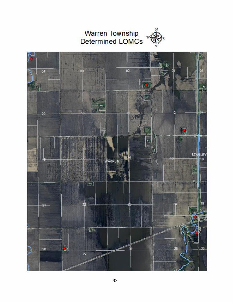
62

63

64
Warren Township
Application for Conditional Use Permit
Date
Applicant Name
Applicant Address
Owner of premises on which construction is to take place
Owner Name
Owner Address
Legal description or other description of land
Section Township Range
Proposed use of land
Number of acres or square feet
Sketch of drawing submitted
Application fee $
Applicant Signature Date

65
Warren Township
Application for Variance
Date
Applicant Name
Applicant Address
For
Legal description or other description of land
Section Township Range
Description of Variance
Sketch of drawing submitted
Application fee $
Applicant Signature Date