types of maps#namibia
TRANSCRIPT
Types of maps
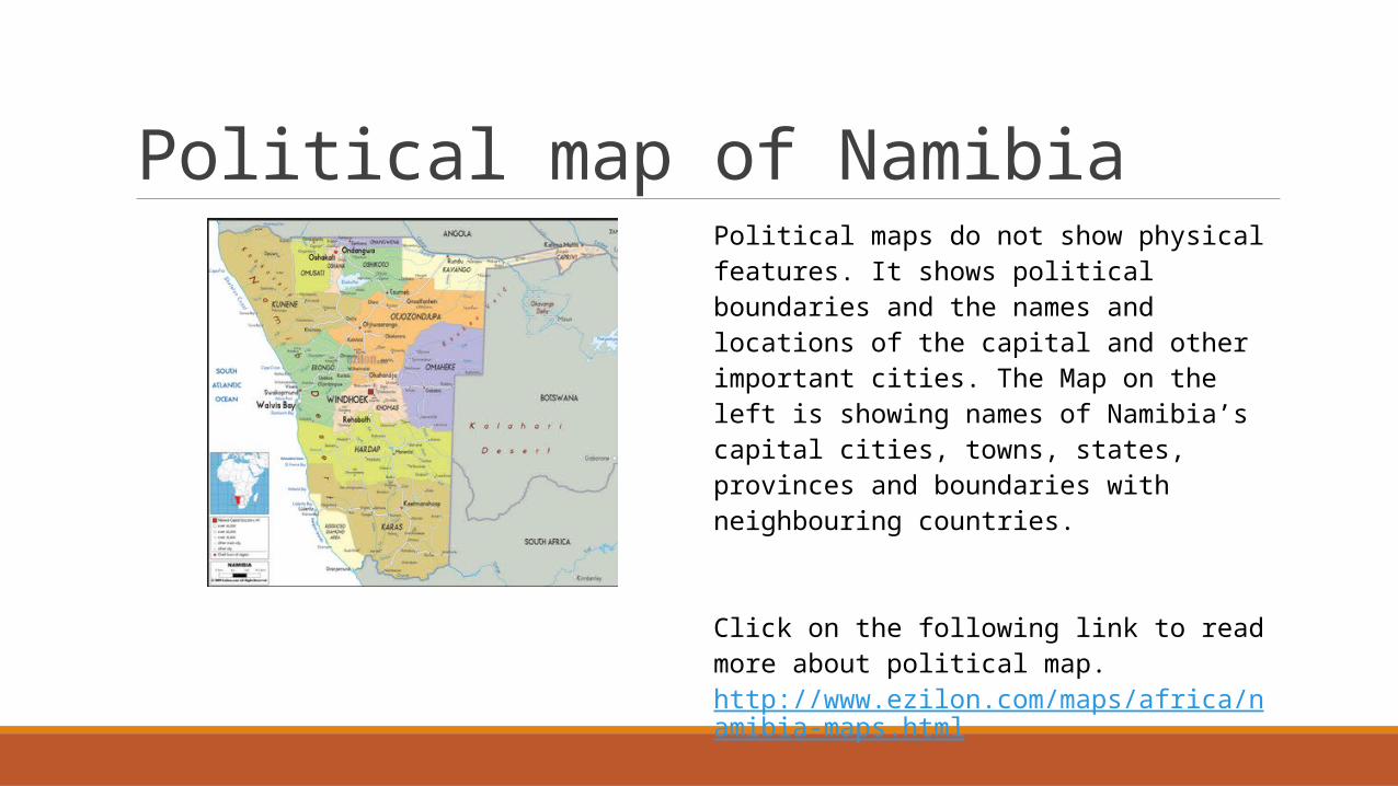
Political map of NamibiaPolitical maps do not show physical features. It shows political boundaries and the names and locations of the capital and other important cities. The Map on the left is showing names of Namibia’s capital cities, towns, states, provinces and boundaries with neighbouring countries.
Click on the following link to read more about political map.http://www.ezilon.com/maps/africa/namibia-maps.html

Weather map of Namibia
http://travelnewsnamibia.com/wp-content/uploads/2013/11/18-NOVEMBER.jpg
Weather maps show storms, air masses, and fronts. It displays various meteorological features (various symbols which all have specific meanings e.g. air temp. cloud cover, etc.) across a particular point in time.
Click on the following link to watch interactive weather map.http://www.namibiaweather.info/
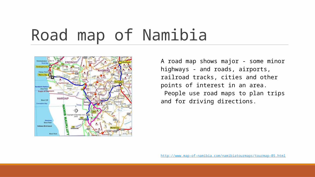
Road map of NamibiaA road map shows major - some minor highways - and roads, airports, railroad tracks, cities and other points of interest in an area. People use road maps to plan trips and for driving directions.
http://www.map-of-namibia.com/namibiatourmaps/tourmap-05.html
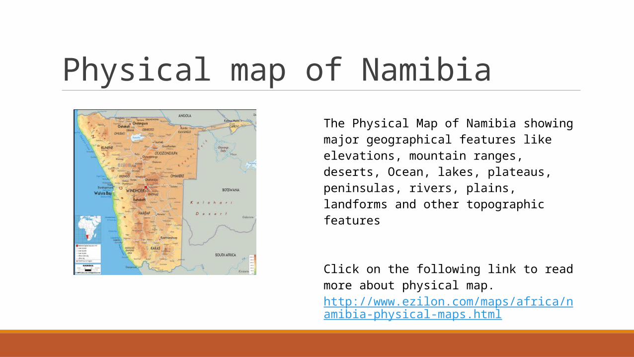
Physical map of NamibiaThe Physical Map of Namibia showing major geographical features like elevations, mountain ranges, deserts, Ocean, lakes, plateaus, peninsulas, rivers, plains, landforms and other topographic features
Click on the following link to read more about physical map.http://www.ezilon.com/maps/africa/namibia-physical-maps.html
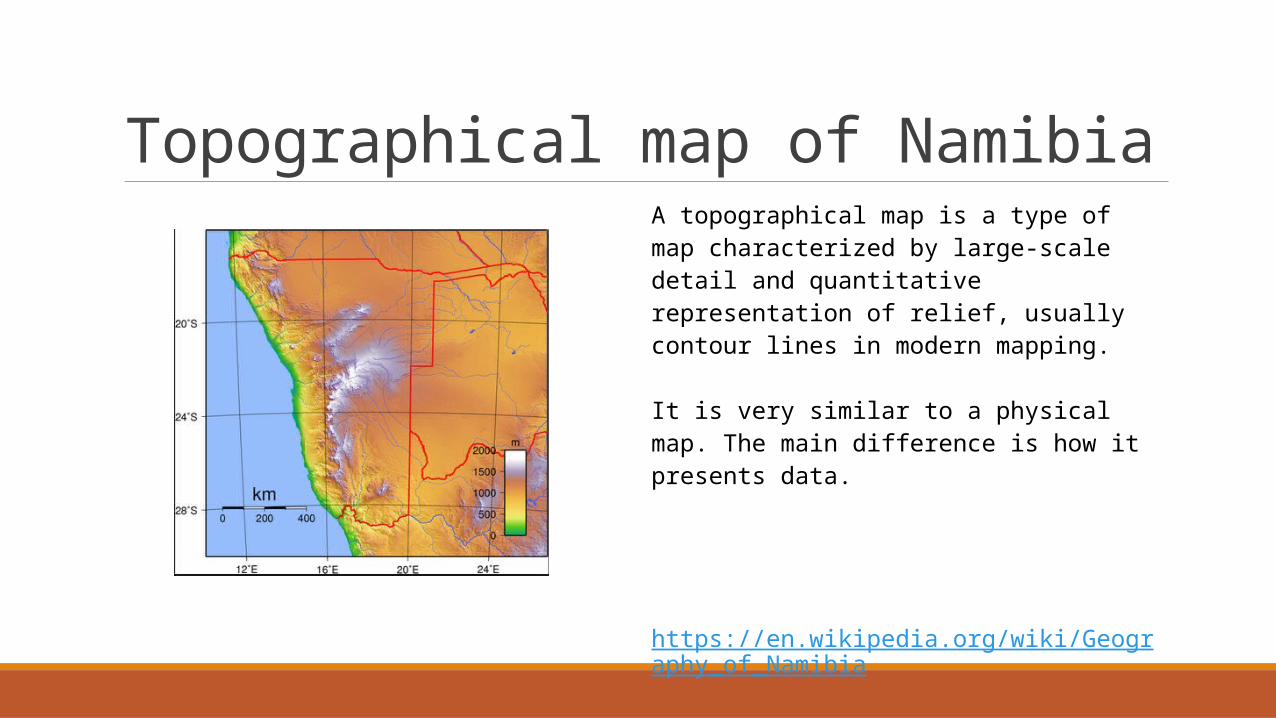
Topographical map of NamibiaA topographical map is a type of map characterized by large-scale detail and quantitative representation of relief, usually contour lines in modern mapping.
It is very similar to a physical map. The main difference is how it presents data.
https://en.wikipedia.org/wiki/Geography_of_Namibia