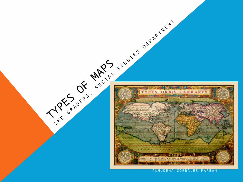
types of maps year2
TRANSCRIPT
A L M U D E N A C O R RA L E S M A R B Á N
TYPES OF M
APS
2 N D GR A D E R S . S
O C I AL S
T U D I ES D
E P A R T M E N T
A L M U D E N A C O R RA L E S M A R B Á N
1. INTRODUCTION
In geography, maps are one of the most important tools researchers, cartographers, students and others can use to examine the entire Earth or a specific part of it.
A L M U D E N A C O R RA L E S M A R B Á N
2. WHAT IS A MAP?
Simply defined, maps are pictures of the Earth's surface.
They can be general reference and show landforms,
political boundaries, water, the locations of cities, or in
the case of thematic maps, show different but very
specific topics such as the average rainfall distribution for an
area or the distribution of a certain disease throughout a
county. Today with the increased use of GIS, also known as
Geographic Information Systems, thematic maps are growing
in importance.
A L M U D E N A C O R RA L E S M A R B Á N
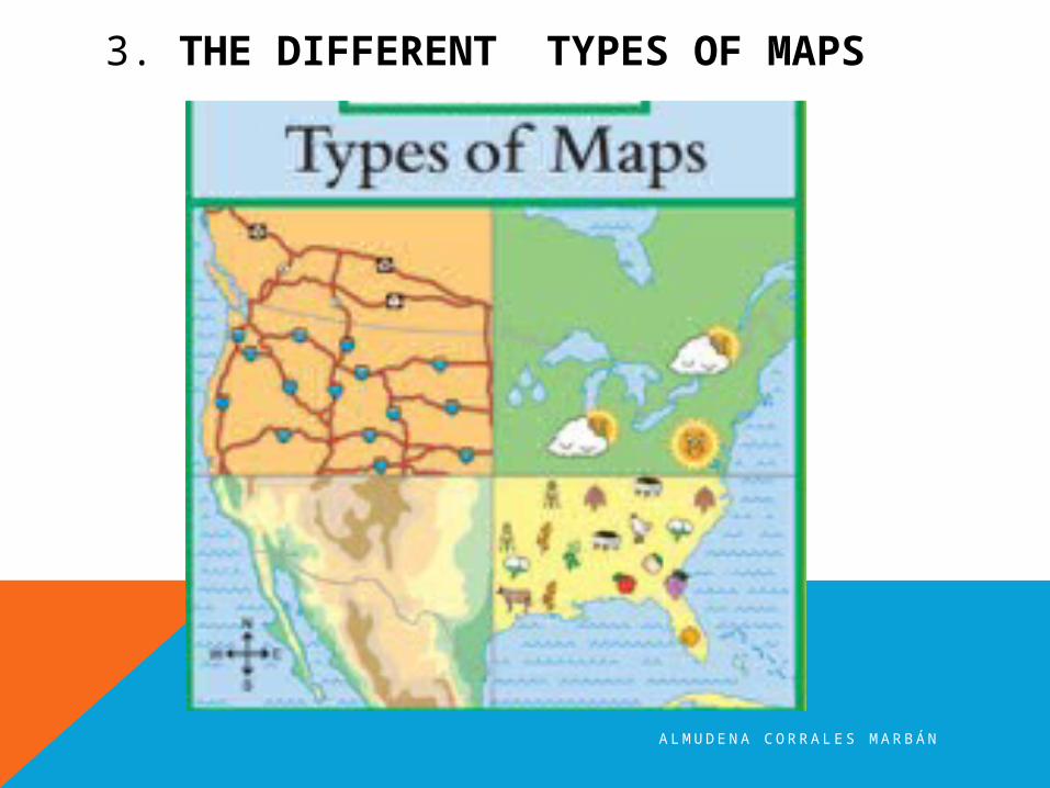
3. THE DIFFERENT TYPES OF MAPS
A L M U D E N A C O R RA L E S M A R B Á N
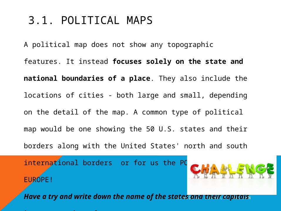
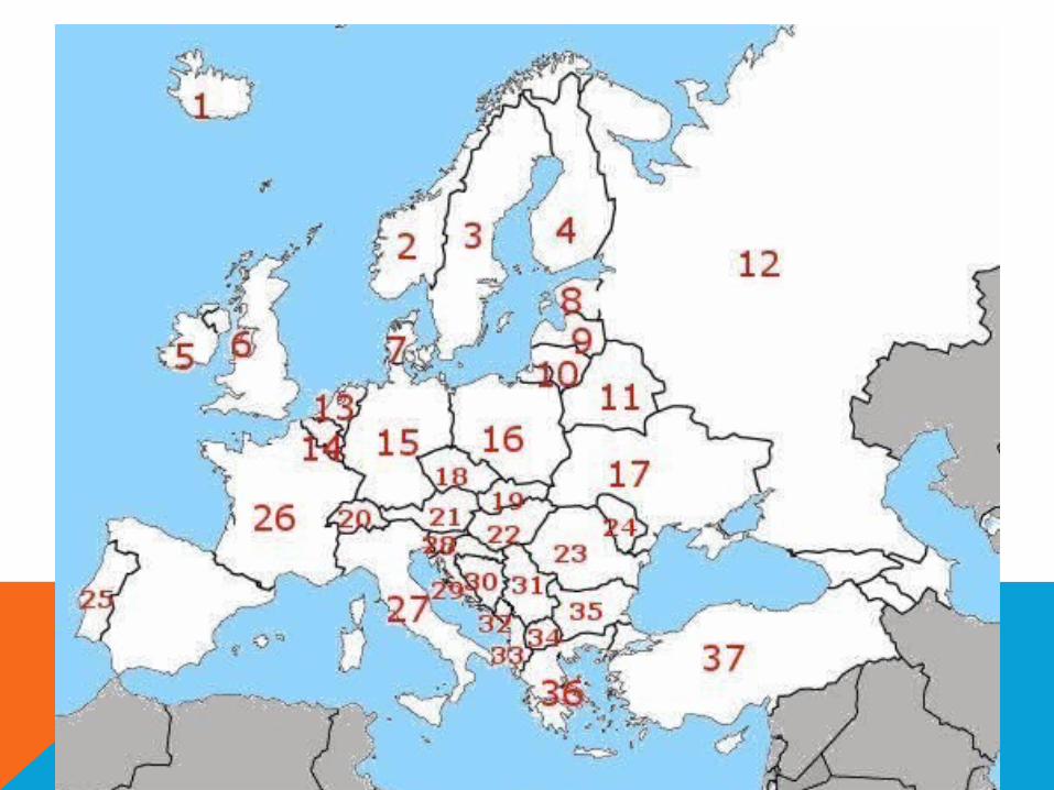
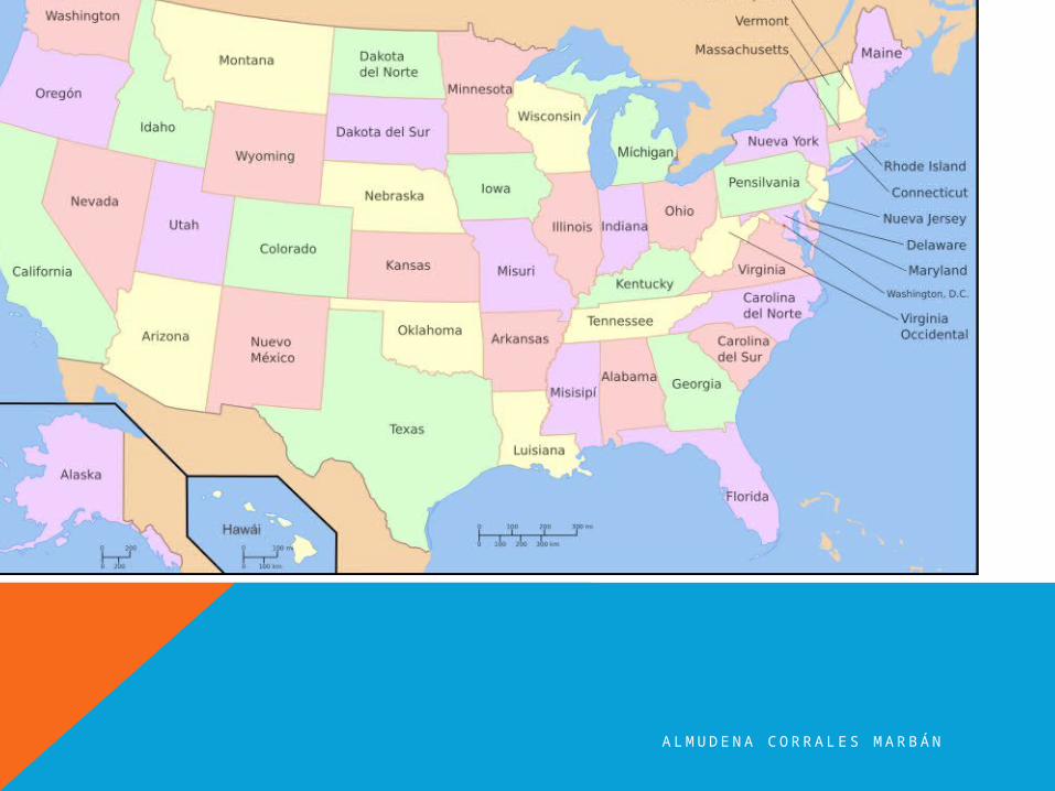
3.1. POLITICAL MAPSA political map does not show any topographic features. It
instead focuses solely on the state and national
boundaries of a place. They also include the locations of
cities - both large and small, depending on the detail of the
map. A common type of political map would be one showing
the 50 U.S. states and their borders along with the United
States' north and south international borders or for us the
POLITICAL MAP OF EUROPE!
Have a try and write down the name of the states and
their capitals in a separate sheet of paper.
1…………….
2………………..
A L M U D E N A C O R RA L E S M A R B Á N
A L M U D E N A C O R RA L E S M A R B Á N

A L M U D E N A C O R RA L E S M A R B Á N
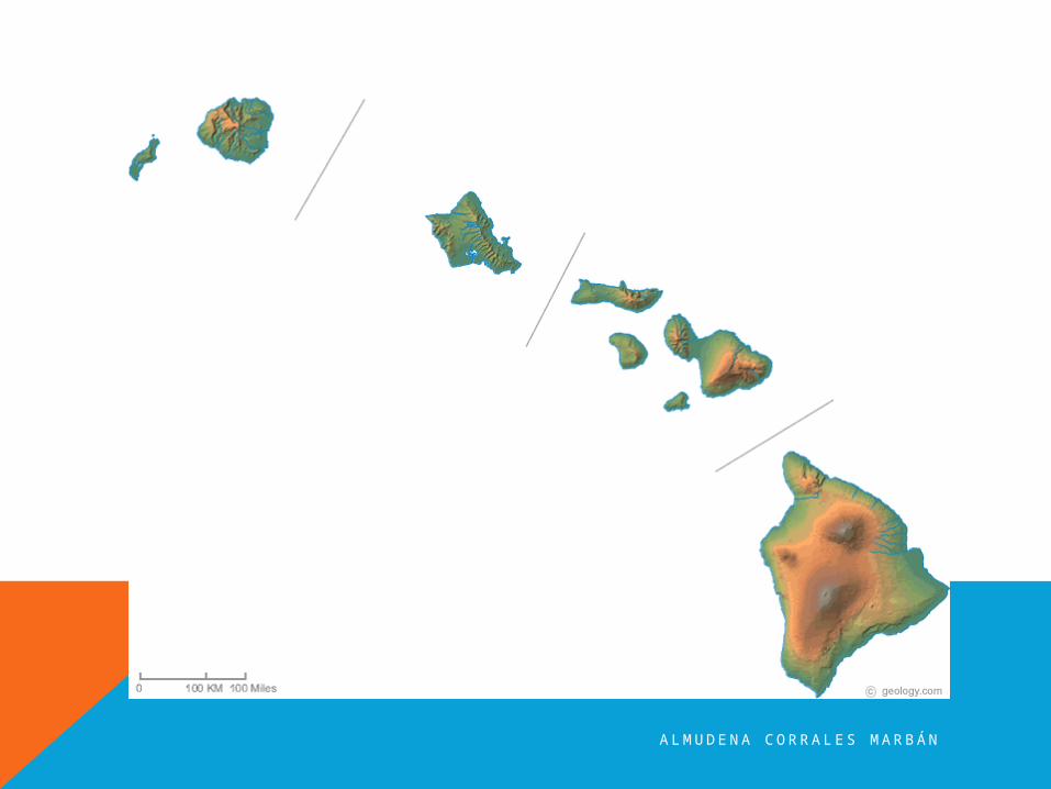
3.2. PHYSICAL MAPS
A physical map is one that shows the physical landscape
features of a place. They generally show things like
mountains, rivers and lakes and water is always shown with
blue. Mountains and elevation changes are usually shown with
different colors and shades to show relief. Normally on physical maps
green shows lower elevations while browns show high elevations. An
example of a physical map is one showing the state of Hawaii . Low
elevation coastal regions are shown in dark green, while the higher
elevations transition from orange to dark brown. Rivers are shown in
blue.
A L M U D E N A C O R RA L E S M A R B Á N
A L M U D E N A C O R RA L E S M A R B Á N
3.3. THEMATIC MAPSA thematic map is a map that focuses on a particular theme or
special topic and they are different from the six aforementioned
general reference maps because they do not just show natural
features like rivers, cities, political subdivisions, elevation and
highways. If these items are on a thematic map, they are background
information and are used as reference points to enhance the map's
theme.
A L M U D E N A C O R RA L E S M A R B Á N
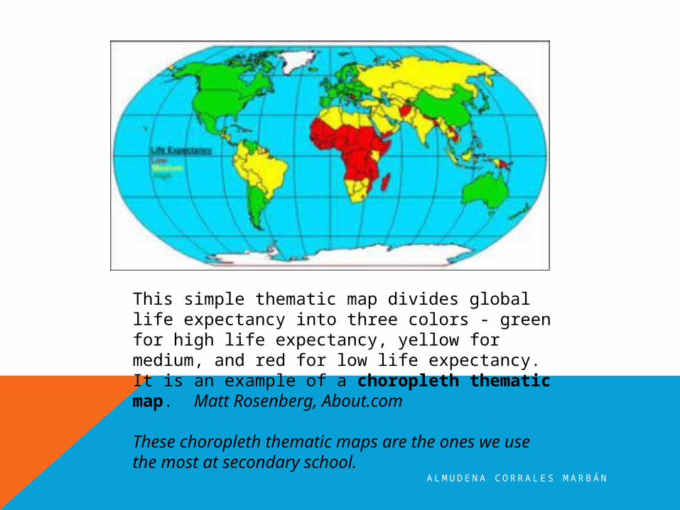
This simple thematic map divides global life expectancy into three colors - green for high life expectancy, yellow for medium, and red for low life expectancy. It is an example of a choropleth thematic map. Matt Rosenberg, About.com
These choropleth thematic maps are the ones we use the most at secondary school.
A L M U D E N A C O R RA L E S M A R B Á N
4. THEMATIC MAPS THROUGH HISTORYThematic maps did not develop as a map type until the mid-17th
Century because accurate base maps were not present prior to this time.
Once they became accurate enough to display coastlines, cities and other
boundaries correctly, the first thematic maps were created. In 1686 for
example, Edmond Halley, an astronomer from England, developed a
star chart. In that same year, he published the first meteorological
chart using base maps as his reference in an article he published about
trade winds. In 1701, Halley also published the first chart to show lines of
magnetic variation- a thematic map that later became useful in
navigation.
Halley's maps were largely used for navigation and the study of the
physical environment.
A L M U D E N A C O R RA L E S M A R B Á N
MAIN SOURCES:
http://geography.about.com/
http://www.lib.utexas.edu/maps/world.html