understanding census geography lisa neidert mccormick specialized training institute october 28 –...
Post on 22-Dec-2015
215 views
TRANSCRIPT
Understanding Census Geography
Lisa Neidert
McCormick Specialized Training InstituteOctober 28 – October 30, 2009
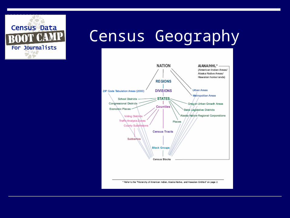
Census Geography

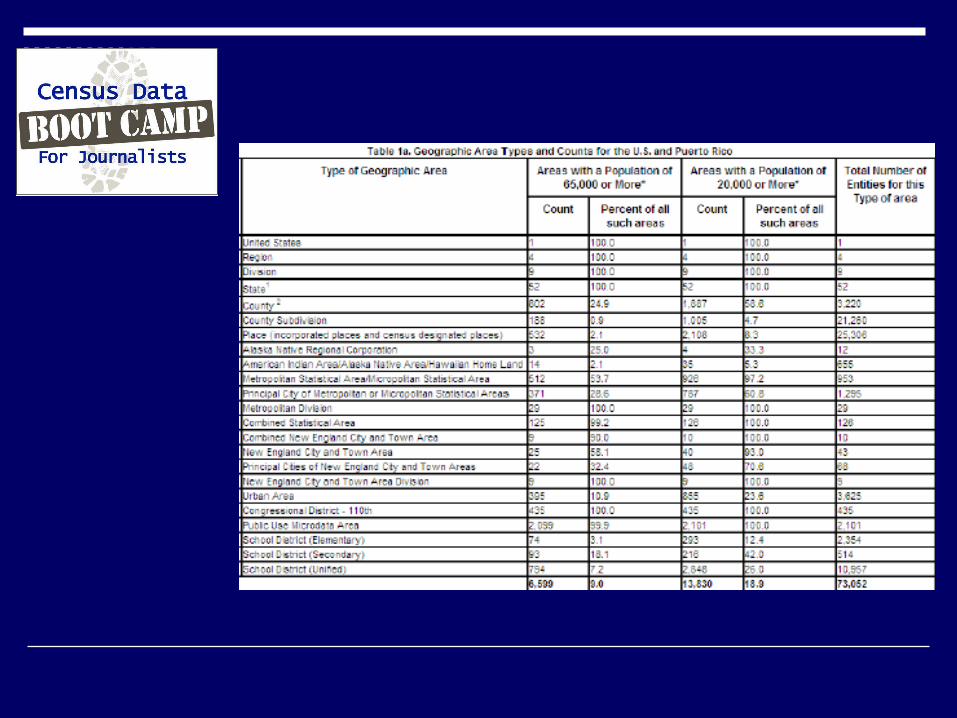
Geographic Areas: with 1-year and 3-year data

Geographic Areas: with 1-year and 3-year data

What’s available in the ACS for single year data: via maps
Maps showing counties and places for each state (or the nation)
http://www.census.gov/acs/www/Products/users_guide/acs_2008_reference_maps.htm

Counties with single year data: ACS 2008
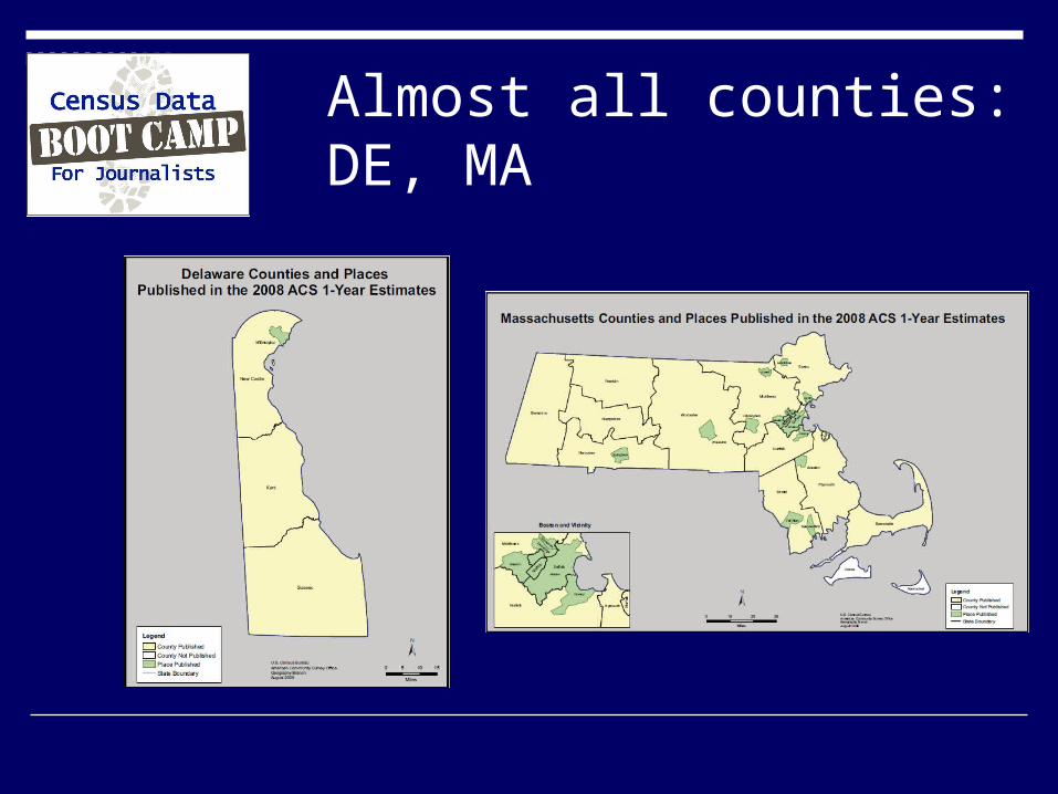
Almost all counties: DE, MA

Few counties, no places: VT and WY

State with American Indian Places: AK, AL, LA, NC, OK

Counties with 3-year data: ACS 2006-2008

States where all counties are over 20,000
Connecticut Delaware District of Columbia New Hampshire New Jersey Rhode Island

What geographies are available in the 2006-2008 ACS?
http://www.census.gov/acs/www/acs-php/2006_2008_beginner_users_guide.php

What’s available in the ACS: via Look-up tables
Geographic entities available for 1-year data (2007)
Geographic entities available for 3-year data (2005-2007)

Not ready for prime-time: census tracts and zip codes
Need 5-year estimates file 2005 – 2009 Available 2010
Annual updates thereafter 2006 – 2010 2007 – 2011, etc.

Example Census Tracts for community districts
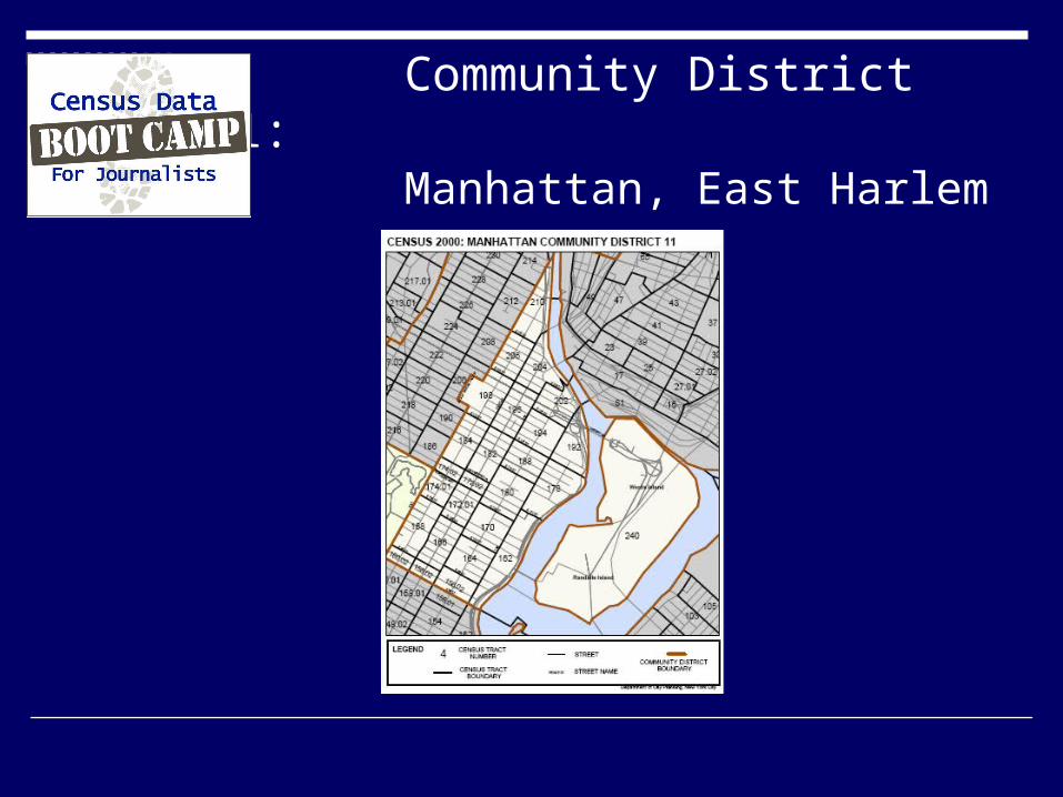
Community District 11: Manhattan, East Harlem
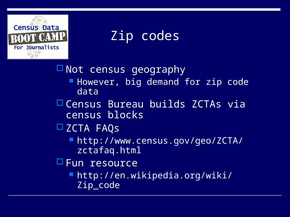
Zip codes
Not census geography However, big demand for zip code data
Census Bureau builds ZCTAs via census blocks
ZCTA FAQs http://www.census.gov/geo/ZCTA/
zctafaq.html Fun resource
http://en.wikipedia.org/wiki/Zip_code


What are PUMAs?
Public Use Microdata areas Combination of population geographies
that sum to at least 100,000 population. In rural areas, several counties will form
a PUMA. In an urban area, a county will be subdivided into multiple PUMAs.
PUMAs do not cross state boundaries

PUMAs. . . .
PUMAs do not have good comparability over time (1990, 2000).
PUMA geographies for the ACS are the same as the 2000 boundaries
PUMAs are reasonable substitutes for counties
Smallest geography available in the microdata.

PUMAs. . .
Can be valuable for bypassing geographic restrictions when one wants national information at the county level
Create pseudo counties based on a cross-walk between PUMAs and counties
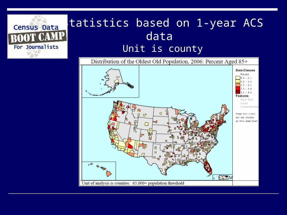
Statistics based on 1-year ACS data Unit is county
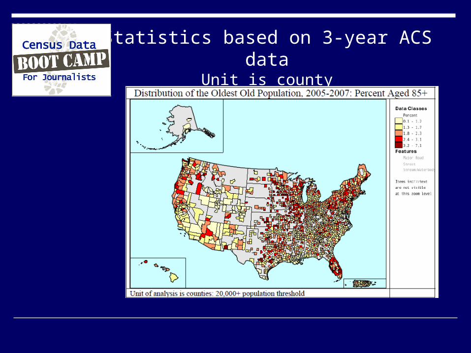
Statistics based on 3-year ACS dataUnit is county

Statistics based on 1-year ACS dataUnit is PUMA

Illinois example: PUMA to county example
PUMAs via Maps
Reasonable tool for rural parts of a state Somewhat unwieldy for urban areas Multiple maps per state
http://usa.ipums.org/usa/volii/2000pumas.shtml

PUMAs via text
Describes PUMA composition By:
County County subdivision Place Census tract
http://usa.ipums.org/usa/volii/2000pumas.shtml
Metropolitan areas
Defined by Office Management Budget (OMB) http://www.census.gov/population/www/estimat
es/metrodef.html
Frey, et. al. “Field Guide” http://www.psc.isr.umich.edu/dis/census/brookin
gs.pdf
Users are free to follow own definitions Census Bureau follows OMB definitions