upper batley conservation area - kirklees · the revised upper batley conservation area has 2...
TRANSCRIPT


UPPER BATLEY C O N S E R V A T I O N A R E A A P P R A I S A L
Contents
1.0 INTRODUCTION 1
2.0 LOCATION AND POPULATION 2
3.0 HISTORICAL ANALYSIS 3
4.0 THE CHARACTER OF UPPER BATLEY 5
5.0 BOUNDARY DEFINITION 7
6.0 OPEN SPACE AND TREE COVERAGE 10
7.0 URBAN GRAIN AND SETTLEMENT PATTERN 11
8.0 BUILDING TYPES 12
9.0 AREAS AT RISK 14
10.0 NEGATIVE FACTORS 14
11.0 ECONOMIC NEED 14
12.0 PUBLIC CONSULTATION 15
13.0 CONCLUSION 17
APPENDIX 1: Summary of Upper Batley Conservation Area 18
APPENDIX 2: Listed Buildings 19
APPENDIX 3: Relevant policies from Kirklees UDP (1999) 20
BIBLIOGRAPHY 26

UPPER BATLEYC O N S E R V A T I O N A R E A A P P R A I S A L
1.0 INTRODUCTION
This report put forward the redefinition of the Upper Batley Conservation Area.
The revised Upper Batley conservation area comprises the older parts and core of the village of Upper Batley. The area
includes a number of dwellings and farm buildings, mostly dating from the early to the mid 19th Century, a few large late
Victorian houses and a series of 19th Century terraced housing in the south of the area, on or near to Grosvenor Road. The
area also has two Victorian school buildings and a Grade II Listed church.Trees comprise an important feature
in this conservation area, the majority of which are covered by Tree Preservation Orders. The north-east of the revised
conservation boundary is bordered by greenbelt land.
1.1 Conservation Areas
Upper Batley is one of 59 existing conservation areas in Kirklees. Kirklees Council have expanded the boundary of the
existing conservation area to encompass the large Victorian properties at Batley Field Hill and on or near Grosvenor Road,
a Grade II Listed church, and Victorian schools on Carlinghow Hill.
A conservation area is an ‘area of special architectural or historic interest, the character or appearance of which it is
desirable to preserve or enhance.’ (Section 69 of the Town and Country Planning [Listed Buildings and Conservation Areas]
Act 1990). Conservation areas are recognised for the contribution they make to cultural heritage and economic well being of
the country and to the locality.
An area with conservation area status imposes a duty on Kirklees Council have expanded the quality and character of the
conservation area. Designation as a conservation area strengthens existing development policy in the Kirklees Unitary
Development Plan (UDP) to preserve and enhance the appearance and character of conservation area. Upper Batley is
already recognised as a conservation area due to its special architectural and historic interest. It has a unique Victorian
suburban quality which contrasts with the predominant industrial character of main Batley.
‘In considering further designations authorities should bear in mind that it is important that conservation areas are seen to
justify their status and that the concept is not devalued by the designation of areas lacking any special interest.’ (Para. 4.3.
PPG15: Planning and the Historic Environment)
Kirklees Council when designating a new conservation area has a statutory duty to undertake a Conservation Area
Appraisal which this document comprises. English Heritage has produced guidance on preparing conservation area
appraisals, which has formed the basis of this document, in conjunction with local criteria and policies contained in PPG15:
Planning and the Historic Environment.
1
UPPER BATLEYC O N S E R V A T I O N A R E A A P P R A I S A L
When designating a conservation area, there is an expectation by Central Government that supplementary guidance
will be developed for each conservation area to further preserve and enhance the quality of the environment. The
planning system in England is currently undergoing reform. In the future a series of Local Development Frameworks
will replace the Unitary Development Plan for Kirklees.
The LDF will include a core strategy to set out the key elements of the planning framework for the area. This may set
criteria for identifying locations and priorities for area action plans to be prepared. Area action plans, covering
conservation areas, should set out policies and proposals for action to preserve and enhance the area, including
defining areas where specific conservation measures are proposed and areas which will be subject to specific
controls over development.
This conservation area appraisal may be used as a basis for an action plan in conjunction with the LDF.
2.0 LOCATION AND POPULATION
Upper Batley conservation area was first designated by Kirklees Council in 1979 and was redesignated in 2006.
It is located approximately 1 km north-west of Batley town centre.
In 2001 the population of the whole population of Batley was 44,709.
2
UPPER BATLEYC O N S E R V A T I O N A R E A A P P R A I S A L
3.0 HISTORICAL ANALYSIS
3.1 Archaeology
Batley lies on the middle coal measure. Historically surface outcropping of the coal seam was common and
contributed to the early development of Batley. However, coal mining in the area has long since ceased. Sandstone
was also relatively abundant. The sandstone in the area comprise good building stone, and over time quantities of
sandstone have been used locally to construct buildings.
3.2 Origins and development of Upper Batley
Prior to the 1700s little is known of the history of Batley, and in particular Upper Batley. The name Batley probably
derived from the Old English personal name ‘Bata’ and ‘leah’ meaning forest or glade. The 1086 Domesday Book
lists the village as having “6 villagers and 4 smalholders with 5 ploughs” in the village. In the 1700s Batley did not
contain a single principal village, but rather encompassed a number of small settlements, all of a similar size. Strung
along the valley bottom and on the surrounding slopes were loosely grouped a small number of additional hamlets
which included Upper Batley. Most of the housing in the Batley area probably took the form of small cottages, with
the exception of Batley Old Hall – a manor house with an agriculturally orientated hamlet adjacent.
This situation began to change with the invention of shoddy by a Batley man around 1813. Shoddy is a form of cloth
manufactured from reclaimed rags, an early form of recycling which laid the foundations of prosperity for a
conglomeration of small towns which were to become collectively known as the Heavy Woollen district.
As members of Batley gained in wealth, Upper Batley began to develop as a favoured suburban location for wealthy
mill owners. The larger Victorian properties in Upper Batley are grand in size and design with equally large gardens
and mature trees to further emphasise the grandeur of the buildings and the status of the owners of these buildings.
In keeping with the values prevalent in Victorian Britain, these local wealthy business people invested in the Church of
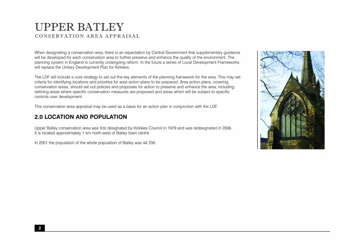
St Thomas at Grosvenor Road. The church occupies a prominent position on the top of a hill and can be seen clearly
from Batley town centre.
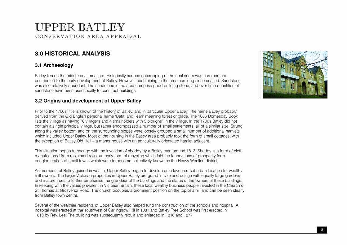
Several of the wealthier residents of Upper Batley also helped fund the construction of the schools and hospital. A
hospital was erected at the southwest of Carlinghow Hill in 1881 and Batley Free School was first erected in
1613 by Rev. Lee. The building was subsequently rebuilt and enlarged in 1818 and 1877.
3

UPPER BATLEYC O N S E R V A T I O N A R E A A P P R A I S A L
3.3 Historic Patronage
The prosperity of Batley developed during the early 19th Century and is directly linked to the growth of shoddy and
mungo textile manufacturing. Until this time the settlement was basically agricultural with some coal mining and a
domestic industrial organisation. The industrialisation process brought a corresponding population increase from
10,000 in 1851 to almost 45,000 in 1968. During the latter half of the 19th Century the growing prosperity of
manufacturers in the area was reflected in the spacious properties and grounds they built for themselves. Unlike the
rest of Batley which is largely characterised by mills, Upper Batley is characterised by Victorian suburban housing
built from the wealth created during the boom of shoddy textiles interspersed with early agricultural buildings and
buildings built during the growth of civic pride.
4
UPPER BATLEYC O N S E R V A T I O N A R E A A P P R A I S A L
4.0 THE CHARACTER OF UPPER BATLEY
Upper Batley is a relatively unspoilt example of mid and late Victorian suburban ideals superimposed on a much
earlier rural community and is rare in this part of Kirklees. Equally important, the enlarged conservation area also
includes the former hospital, Victorian schools and St Thomas Church, all of which historically reiterate the late
Victorian ideals of the time of civic pride and betterment and architecturally are of merit.
4.1 The contribution made by key unlisted buildings
The revised Upper Batley conservation area has 2 listed buildings, (The Church of St. Thomas and the Banqueting
House, Batley Hall) as identified in Appendix 2. The area also encompasses many buildings of high
quality and historical importance which are not listed.
One of the oldest buildings in Upper Batley is Batley Hall. The history of Batley Hall is somewhat obscure but it is
known that in the 12th Century, the Copley family held the manor of Batley which comprised the whole of the
township of Batley and which was held under the Crown as part of the Duchy of Lancaster. The present Hall was built
in 1857 as a farmhouse on the foundations of the building erected by William Copley in 1370 which had fallen into
disrepair and had been demolished a few years earlier. All that now remains is an unusual small brick structure (which
is today a listed structure) in the grounds which was once thought to be a private chapel built in 1465 for Lady
Elizabeth Copley. The grounds of Batley Hall once extended up to the eastern side of Upper Batley Low Lane but
were divided by the construction of a railway line (now abandoned) in the mid 19th Century. In the section of grounds
detached from the Hall, Elmwood House was built in 1861 for a local mill owner and a second house, Oakwood
House, was built a few years later.
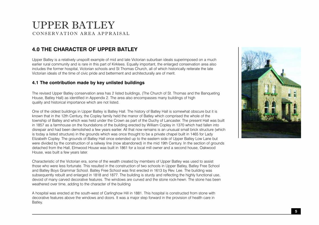
Characteristic of the Victorian era, some of the wealth created by members of Upper Batley was used to assist
those who were less fortunate. This resulted in the construction of two schools in Upper Batley, Batley Free School
and Batley Boys Grammar School. Batley Free School was first erected in 1613 by Rev. Lee. The building was
subsequently rebuilt and enlarged in 1818 and 1877. The building is sturdy and reflecting the highly functional use,
devoid of many carved decorative features. The windows are curved and the stone rock-hewn. The stone has been
weathered over time, adding to the character of the building
A hospital was erected at the south-west of Carlinghow Hill in 1881. This hospital is constructed from stone with
decorative features above the windows and doors. It was a major step forward in the provision of health care in
Batley.
5

UPPER BATLEYC O N S E R V A T I O N A R E A A P P R A I S A L
4.2 Views and Vistas
Parts of Upper Batley enjoy splendid panoramic views of the surrounding countryside. Batley Hall is bounded by
greenbelt land helping accentuate the rural feel of the area in a predominately suburban setting.
The Church of St Thomas at Grosvenor Road is an important landmark from Batley town centre. The church occupies
a prominent position, due to the topography of the location of the church, the church vista is easily seen from Batley
Town Centre. It is highly likely the church was purposely designed to architecturally cast the watchful eye of God over
Batley, reflecting the Victorian values and importance attached to the church. The clear vista of the church from the
town would remind the workers of Batley to be respectful to (and fearful of) God.
6

UPPER BATLEYC O N S E R V A T I O N A R E A A P P R A I S A L
5.0 BOUNDARY DEFINITION
The boundary of the Upper Batley conservation area is redefined to include the Grosvenor Road area and the school
and former hospital at Carlinghow Hill. The character and setting of the extensions are in keeping with the original
smaller conservation area of Upper Batley. The common use of stone, similar construction styles, abundance of
established trees, and historic link of the buildings to the wealth located in Upper Batley create a unifying effect to this
conservation area.
5.1 Included Areas
1: The large Victorian properties at or near Elmwood House with their large gardens are the core character of Upper
Batley conservation area. The buildings are not listed, but are high quality and unique to the area. The large gardens
of these properties create a unique mix of country-house meets suburbia in Batley.
2: The Victorian properties at or near Batley Field Hill and Grosvenor Road are large in size, although not as large as
the properties at Elmwood House. The properties are well designed and built around the late 19th Century. The
gardens of these properties are smaller than at Elmwood House, but still add character to the area and the street
vista. The streets are well treed creating added depth and character
3: The Church of St Thomas is a Grade II listed building. The church is a prominent landmark and marks the change
from industrial Batley to Victorian suburban Batley.
4: The school and former hospital on Carlinghow Hill have been included in the revised boundary due to the
architectural merit of the buildings and the historic importance of these schools to the character of Upper Batley and
the growth of civic pride and wider social awareness in Batley. The playing fields attached to these properties provide
important areas of open space and help frame and protect the character and setting of the conservation area.
5: A series of farm buildings and yards which reflect an earlier period of Batley, prior to the industrial changes brought
by shoddy. The buildings are architecturally and historically important, and add to the character and setting of Upper
Batley conservation area.
7
UPPER BATLEYC O N S E R V A T I O N A R E A A P P R A I S A L
5.2 Excluded Areas
A: North and West of Carlinghow Hill are a series of late 20th Century properties and Batley Boys High School. The
use of materials, design and layout are not in keeping with the character and setting of the propoed revised
conservation area.
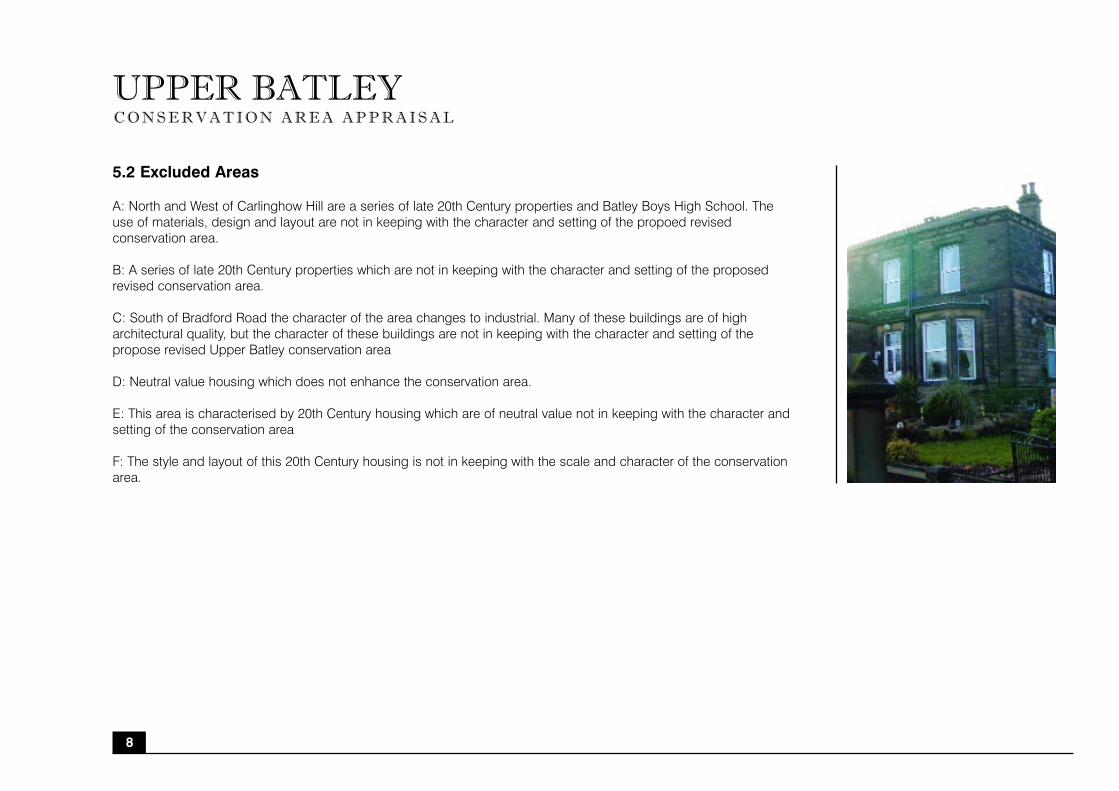
B: A series of late 20th Century properties which are not in keeping with the character and setting of the proposed
revised conservation area.
C: South of Bradford Road the character of the area changes to industrial. Many of these buildings are of high
architectural quality, but the character of these buildings are not in keeping with the character and setting of the
propose revised Upper Batley conservation area
D: Neutral value housing which does not enhance the conservation area.
E: This area is characterised by 20th Century housing which are of neutral value not in keeping with the character and
setting of the conservation area
F: The style and layout of this 20th Century housing is not in keeping with the scale and character of the conservation
area.
8

9
UPPER BATLEYC O N S E R V A T I O N A R E A A P P R A I S A L
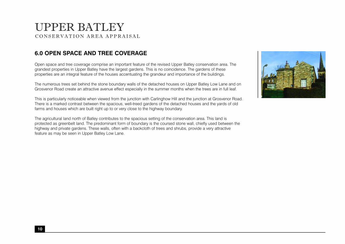
6.0 OPEN SPACE AND TREE COVERAGE
Open space and tree coverage comprise an important feature of the revised Upper Batley conservation area. The
grandest properties in Upper Batley have the largest gardens. This is no coincidence. The gardens of these
properties are an integral feature of the houses accentuating the grandeur and importance of the buildings.
The numerous trees set behind the stone boundary walls of the detached houses on Upper Batley Low Lane and on
Grosvenor Road create an attractive avenue effect especially in the summer months when the trees are in full leaf.
This is particularly noticeable when viewed from the junction with Carlinghow Hill and the junction at Grosvenor Road.
There is a marked contrast between the spacious, well-treed gardens of the detached houses and the yards of old
farms and houses which are built right up to or very close to the highway boundary.
The agricultural land north of Batley contributes to the spacious setting of the conservation area. This land is
protected as greenbelt land. The predominant form of boundary is the coursed stone wall, chiefly used between the
highway and private gardens. These walls, often with a backcloth of trees and shrubs, provide a very attractive
feature as may be seen in Upper Batley Low Lane.
10

UPPER BATLEYC O N S E R V A T I O N A R E A A P P R A I S A L
7.0 URBAN GRAIN AND SETTLEMENT PATTERN
Elmwood House and gardens provide a central nucleus to the area and help define the character of the remainder of
the proposed revised conservation area as Victorian suburban ideals built on former agricultural-orientated hamlets.
This predominance of spacious Victorian properties creates a unique settlement pattern to Upper Batley within the
wider Batley area. The earlier settlement pattern of farmsteads is still visible in the yards of old farms
and houses located north-west of Elmwood House.
Carlinghow Hill and Grosvenor Road form a long spine to Upper Batley. The Victorian development along these roads
is ribbon-style, with few Victorian buildings built away from the main road.
11
UPPER BATLEYC O N S E R V A T I O N A R E A A P P R A I S A L
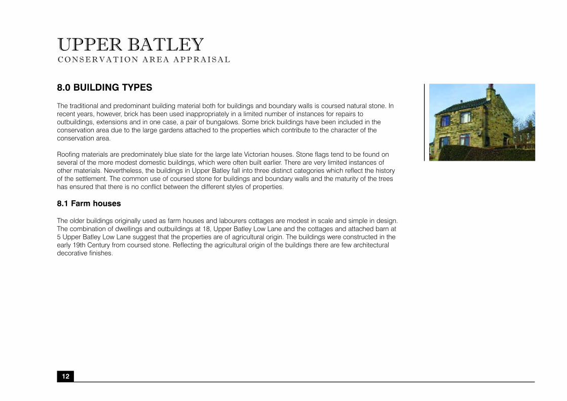
8.0 BUILDING TYPES
The traditional and predominant building material both for buildings and boundary walls is coursed natural stone. In
recent years, however, brick has been used inappropriately in a limited number of instances for repairs to
outbuildings, extensions and in one case, a pair of bungalows. Some brick buildings have been included in the
conservation area due to the large gardens attached to the properties which contribute to the character of the
conservation area.
Roofing materials are predominately blue slate for the large late Victorian houses. Stone flags tend to be found on
several of the more modest domestic buildings, which were often built earlier. There are very limited instances of
other materials. Nevertheless, the buildings in Upper Batley fall into three distinct categories which reflect the history
of the settlement. The common use of coursed stone for buildings and boundary walls and the maturity of the trees
has ensured that there is no conflict between the different styles of properties.
8.1 Farm houses
The older buildings originally used as farm houses and labourers cottages are modest in scale and simple in design.
The combination of dwellings and outbuildings at 18, Upper Batley Low Lane and the cottages and attached barn at
5 Upper Batley Low Lane suggest that the properties are of agricultural origin. The buildings were constructed in the
early 19th Century from coursed stone. Reflecting the agricultural origin of the buildings there are few architectural
decorative finishes.
12

UPPER BATLEYC O N S E R V A T I O N A R E A A P P R A I S A L
8.2 Victorian Villas
The Victorian villas were built in the late 19th /early 20th Century. The buildings are large in size and scale. The
largest villas also have the largest gardens further reflecting the importance of the buildings (and at the time of
being built, the occupants.) The majority of villas are constructed from ashlar stone with decorative features at the
windows and doors. Typical of buildings from the Classical architecture era, the ornamentation is restrained, whilst the
front designs are symmetrical. Several of the villas still retain ornate iron railings around the windows, this is unusual.
During the Second World War across the country many iron railings were often removed from buildings and other
public places to be melted down for materials to help the war effort.
8.3 Public Buildings
The Church of St. Thomas, Batley Boys Grammar School and Batley Free School are late 19th Century buildings,
typical of the Victorian period. The schools are not listed, but have still managed to retain many of their original
features; some still have original windows, and in most cases the stonework, in particular the ornate detailing has
not been altered.
13

UPPER BATLEYC O N S E R V A T I O N A R E A A P P R A I S A L
9.0 AREAS AT RISK
The character and setting of many of the Victorian villas are at risk from development pressures to encroach on the
historically important gardens attached to these properties. Every effort should be made to resist encroachment on
these lands.
10.0 NEGATIVE FACTORS
The small number of detractive features and buildings within the conservation area are mostly of recent construction
and are identified by the use of artificial materials, poor design and detailing which does not respect the
quintessential character of the area. For example, artificial stone which does not patinate to harmonise with real stone
and crudely designed windows and doors have sometimes been introduced.
11.0 ECONOMIC NEED
Upper Batley has many large dwellings which combined with their setting and location are still popular residential
locations for the wealthier citizens of Batley. Batley as a town is economically underperforming, but Upper Batley
has retained its status partly due to its growing popularity as a popular commuter base to neighbouring cities and
towns.
14
UPPER BATLEYC O N S E R V A T I O N A R E A A P P R A I S A L
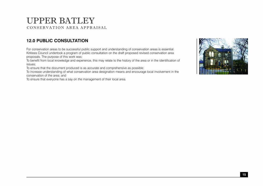
12.0 PUBLIC CONSULTATION
For conservation areas to be successful public support and understanding of conservation areas is essential.
Kirklees Council undertook a program of public consultation on the draft proposed revised conservation area
proposals. The purpose of this work was:
To benefit from local knowledge and experience, this may relate to the history of the area or in the identification of
issues;
To ensure that the document produced is as accurate and comprehensive as possible;
To increase understanding of what conservation area designation means and encourage local involvement in the
conservation of the area; and
To ensure that everyone has a say on the management of their local area.
15

UPPER BATLEYC O N S E R V A T I O N A R E A A P P R A I S A L
Public Consultation Methods Used
Public consultation methods undertaken included:
• The revised draft conservation area appraisal was made available at Batley library and at the reception of planning
services in Civic Centre III, Huddersfield;
• A leaflet outlining the conservation area proposals, maps of the proposed conservation area boundaries and a
questionnaire about the proposals was sent to all householders within the proposed revised conservation areas. Further
information was provided stating the detailed proposals were able to be viewed at Batley library and the date of the public
meeting at Batley Library;
• The local civic society, prominent local historian and local councillors were all invited to attend the public meeting and
made aware of the public exhibition;
• A public exhibition was held in Batley library between 23rd March and the 8th April 2006 and a postal box was made
available for questionnaires to be returned;
• Email responses to the conservation areas were accepted to the contact given at the public exhibition, public meeting
and public leaflet;
• Two public meetings were held. One meeting was held at Batley library (5-7pm on the 29th March) and a subsequent
meeting was held at Batley Town Hall (5-7pm on the 6th April). The meetings were publicised through leaflets, posters
(displayed in Batley library, swimming baths, local shops and health centres) and through the local media – Batley News,
published weekly;
• The format of the public meetings was an initial overview of the conservation area boundaries provided by members of
Kirklees Council conservation and design team. This was then followed by groups being sub-divided into the conservation
area they were most interested in. Participants then had a guided discussion covering key elements and subsequently
drew the conservation area boundary on what they felt should be included in a conservation area.
Feedback from Public Consultation
Upper Batley generated the highest level of public feedback of all the conservation areas in Batley. Nearly 70% of postal
responses related specifically to Upper Batley, whilst over half of attendees of the conservation areas public meetings
were specifically interested in Upper Batley conservation area.
16
UPPER BATLEYC O N S E R V A T I O N A R E A A P P R A I S A L
To incorporate the feedback from the majority of respondents, the proposed conservation area boundary for Upper Batley
has been subsequently amended to incorporate parts of Sunny Bank Road and Ebury Street. Additional properties on
Linefield Road, up to the dismantled railway have been included. The conservation area boundary at Batley Field Hill has
been extended up to the junction with Glen Avenue to incorporate further historic properties which are in keeping with the
character and setting of Upper Batley conservation area. The modern properties at Hollybank Avenue and east of Ebury
Close has been excluded in line with public feedback and the character of the conservation area.
Over 80% of respondents believed the historic buildings were the most important feature of the conservation area.
This was closely followed by trees, open space, then street surfaces. The importance of trees, open space, and
street surfaces to the character and quality of Upper Batley cannot be overstated. Each has an integral part to play
in contributing to the overall character of Upper Batley.
Over 80% of postal respondents were in favour of an Article 4(2) Direction for Upper Batley. At the public meetings, over
90% of participants were in favour of additional special planning controls including an Article 4(2) Direction. The majority of
respondents strongly believed conservation area designation was not enough for Upper Batley and the area was in danger
of losing its intrinsic value through piece-meal changes which the existing conservation area designation did not control.
At the public meeting on the 29th March 2006 participants were asked to identify what they perceived were the different
‘character zones’ of Upper Batley. Four main character zones were identified: the ‘public buildings zone’ encompassing the
southern part of Carlinghow Hill; the ‘super-rich zone’ encompassing the largest properties in Upper Batley; the ‘Blenheim’
zone encompassing earlier 1860s development; and the ‘Grosvenor Road’ zone encompassing the church and
surrounding properties. The participants believed that whilst these character zones each had their own distinct
characteristics, the overall character of the zones had a strong link which enabled them to be identified as Upper Batley
conservation area rather than separate conservation areas. The character zones identified by the public loosely correlate to
character zones identified by the conservation and design department of Kirklees Council.
A letter outlining how the views of the public had been incorporated into the final conservation area appraisal was sent to all
respondents and the findings will be made available on the Kirklees Council Web Page.
13.0 CONCLUSION
Upper Batley could be further enhanced through streetscape initiatives which would restore more of the historic fabric
of the area. The area still manages to retain a strong sense of community despite considerable development pressures.
The proposed expansion of the conservation area does not mean that new development will not permitted, but that such
development will be of high quality and respect the open space and gardens which are integral to the character and setting
of Upper Batley conservation area. 17

UPPER BATLEY APPENDIX 1 Summary of Upper Batley
C O N S E R V A T I O N A R E A A P P R A I S A L
PPG 15 & English Heritage Criteria Kirklees Council Commentary on Upper Batley Conservation Area
Location and population Upper Batley is located 1km from Batley.
The origins and development of the settlement Upper Batley was originally an agricultural farmstead. Over time the area evolved into the preferred
location for wealthy members of Batley who had gained financially from shoddy textiles.
The prevailing former uses within the area The area developed as a suburban residential location within Batley. This pattern still persists today.
and their historic patronage
Archaeological significance and potential of Upper Batley has sparse archaeological significance and potential.
the area
The architectural and historic qualities of the The buildings reflect the classical school of architectural design. Well built, symmetrical buildings,
buildings and their contribution they make to the utilising local stone which has been carved to accentuate the door and window features.
special interest of the area
The contribution made by key unlisted buildings Upper Batley contains several grand suburban properties which are unique to Batley. The buildings
reflect Victorian suburban ideals superimposed on Batley. The former schools and church reflect the
Victorian values of the time held by the wealthy elite.
The character and relationship of spaces The spacious gardens are integral to defining the historical importance attributed to the Victorian villas
within the area which are situated in their gardens.
Prevalent and traditional building materials, Stone which has weathered over time is the dominant building material. The buildings are predominately
textures and colours coursed rock-faced stone with ashlar faced windows, lintels and doors.
Local details The Victorian villas, their spacious gardens and the subsequent development of Victorian schools and
Church of St Thomas together contribute to the uniqueness and special quality of Upper Batley.
The contribution made by green spaces, trees, The spacious gardens surrounding the properties are of fundamental importance to the conservation
hedges and other natural or cultivated elements to area. Traditionally the more prestigious and larger properties had the largest gardens to reflect the stature
the character of the area of the gardens. Trees both within the grounds of properties, and also lining the streets are important
features contributing to the leafy suburban character of Upper Batley.
The setting of the conservation area and its The conservation area is bounded on the north by open countryside which further emphasises the
relationship with the landscape or open stature of the largest properties located in this area. The southern parts of the conservation area are
countryside bounded by areas increasingly industrial in character, the smaller properties are located here.
The extent of loss, intrusion or damage, i.e. The area has been subject to considerable development pressures which has resulted in the grounds of
the negative factors one property being sub-divided into smaller residential plots. This is intrusive and detrimental to the
character of the conservation area and every effort should be made to resist this type of development.
The existence of any neutral areas A series of 1930s dwellings neither add nor detract
18

UPPER BATLEYC O N S E R V A T I O N A R E A A P P R A I S A L
APPENDIX 2 Listed Buildings
Banqueting House, Batley Hall, Old Hall Road. Grade II*
Presumed to be a banqueting house or garden house built in the 17th Century. Brick with plastered, mullioned and
transomed chamfered windows. Stone slate roof. 2 storeys. Small single cell building with lean-to stair turret to rear
(west). 2 course string between floors and corbelling at eaves which continues across gables. East and south
elevations each have central arched doorway with flanking Pilasters with moulded brick volutes, though badly eroded,
and brick capitals at string level. Corner pilasters on south side. East doorway is flanked by cross window to-left and
single light with transom to right. South doorway has single light with transom to each side. At Ist floor level of both
main facades is central 6-light mullioned and transomed window both with flanking pilasters but with capitals on
south side only. 2 bays of distinctive raised brick diamond patterning in sunk-panels to each side. The same
patterning occurs in panels below windows,- though some have been blocked at later a date.- 6-light mullioned and
transomed window on north side. Some-original plastering to windows survives, though in poor repair. Much of the
brick detailing is very badly eroded. Roof timbers appear to be original. Roof and stairs of turret gone. Most windows
now blocked.
Church of St Thomas, Grosvenor Road. Grade II
Gothic Revival Church in Early English style. 1867-8 by Walter Hanstock.Slightly pitched faced stone with quoins and
ashlar dressings. Steeply pitched slate roof. 5 bay nave with lean-to buttressed aisles. 3 bay chancel with vestry wing
on north side. 3 tier tower in south west corner, with slender stone spire. Paired stained glass lancets, slightly cusped
to aisles, and similar smaller lights to clerestory. Lean-to aisles have hood moulds with figure head and foliated stops.
2-light stained glass chancel windows with simple bar tracery. 5-light cusped geometric east. 3-tier tower has
reducing angle buttresses with off-sets. Paired louvered openings to bell chamber, with heavily moulded arches on
round louvred colonnettes with foliated capitals. Perforated parapet with octagonal pinnacles, and gargoyles. Blind
oculus to each 2nd tier face, presumably for clock. Entrance on south side with heavily moulded archon round
colonnettes with foliated capitals. Similar entrance at west end of nave with 4-light geometrical window over. Interior:
North and South arcades with double chamfered arches on columns with foliated capitals. Tall chancel arch on
engaged colonnettes with richly carved capitals, supported on fluted tapering corbels. Hammer beam roof.
Octagonal marble font.
19
UPPER BATLEYC O N S E R V A T I O N A R E A A P P R A I S A L
APPENDIX 3: Relevant policies from Kirklees UDP (1999)
THE DEVELOPMENT FRAMEWORK
Urban Greenspace
D2 Planning permission for the development (including change of use) of land and buildings without notation on
the proposals map, and not subject to specific policies in the plan, will be granted provided that proposals do not
prejudice:
The implementation of proposals in the plan;
The avoidance of over-development;
The conservation of energy;
Highway safety;
Residential amenity;
Visual amenity;
The character of the surroundings;
Wildlife interests; and
The efficient operation of exiting and planned infrastructure
D3 On sites designated as urban greenspace planning permission will not be granted unless the development
proposed:
Is necessary for the continuation or enhancement of established uses or involves change of use to alternative open
land uses, or would result in specific community benefit, and, in all cases, will protect visual amenity, wildlife value
and opportunities for sport and recreation; or
Includes alternative provision of urban greenspace equivalent in both quantitative and qualitative terms to that which
would be developed and be reasonably accessible to exiting users.
D5 On sites designated as provisional open land planning permission will not be granted other than for development
required in connection with established uses, changes of use to alternative open land uses or temporary uses which
would not prejudice the contribution of the site to the character of its surroundings and the possibility of development
in the longer term.
20
UPPER BATLEYC O N S E R V A T I O N A R E A A P P R A I S A L
D8 Within the green belt, except in very special circumstances to be demonstrated by applicants, planning
permission will not be granted for inappropriate development, i.e.:
The construction of new buildings other than for agriculture and forestry, essential facilities for outdoor sport and
outdoor recreation, limited affordable housing which complies with policy H11, cemeteries and other uses of land
which preserve the openness of the green belt and do not conflict with the purpose of including land within it, namely:
Regulating the growth of urban areas;
Preventing the coalescence of settlement;
Preserving the open land that extends into the urban area for recreational and amenity use;
Providing for easy access to open country and assisting in the process of urban regeneration; and
The carrying out of engineering and other operations and changes of use unless they maintain the openness of the
green belt and do not conflict with the purpose of including land within is (set out in 1. above).
Development which is appropriate should not detract from the visual amenity of the green belt by reason of siting,
materials or design.
21

UPPER BATLEYC O N S E R V A T I O N A R E A A P P R A I S A L
BUILT ENVIRONMENT
Strategy
BE1 All development should be of a good quality design such that it contributes to a built environment which:
Creates or retains a sense of local identity;
Is visually attractive;
Promotes safety, including crime prevention and reduction of hazards to highway users;
Promotes a healthy environment, including space and landscaping about buildings and avoidance of exposure to
excessive noise or pollution;
Is energy efficient in terms of building design and orientation and conducive to energy efficient modes of travel, in
particular walking, cycling and the use of public transport.
Quality of Design
BE2 New development should be designed so that:
It is in keeping with any surrounding development in respect of design, materials, scale, density, layout, building
height or mass;
The topography of the site (particularly changes in level) is taken into account
Satisfactory access to existing highways can be achieved; and
Existing and proposed landscape features (including trees) are incorporated as an integral part of the proposal.
Heritage
Listed Buildings
BE3 Any application for listed building consent for the alteration, extension or change of use of a listed building, and
any application for planning permission which would affect its setting should pay special attention to the desirability of
preserving the listed building or its setting or any features of special architectural or historic interest which it
BE4 Demolition of listed buildings will not normally be considered acceptable unless:
It can be demonstrated that the building has no beneficial use and no potential viable use; and
The structure of the building cannot be made sound.
22
UPPER BATLEYC O N S E R V A T I O N A R E A A P P R A I S A L
Conservation Areas
BE5 Proposals for new development within conservation areas, including extensions or changes of use to existing
buildings, should respect the architectural qualities surrounding buildings and their materials of construction, and
contribute to the preservation or enhancement of the character or appearance of the area.
BE6 Development on infill sites will not normally be permitted when it would adversely affect the character or
appearance of a conservation area.
BE7 Where it is considered that a building makes a positive contribution to the character or appearance of a
conservation area, proposals involving its demolition or partial demolition will not normally be acceptable unless:
The building cannot be beneficially used in the future or is structurally unsound; and
All possible efforts have been made to retain the building in use.
If appropriate, it will be a requirement of any planning permission that an acceptable replacement building is
immediately erected on the site.
BE8 Development proposals within conservation areas which include the provision or replacement of road or
footpath surfaces, or new street furniture should be sympathetic to their setting and contribute to the preservation of
the character or appearance of the area.
Building Materials
BE11 New developments should be constructed in natural stone of a similar colour and texture to that prevailing in
the area where the proposal is located:
In areas within which stone has been the predominate material of construction;
Within conservation areas; and
Within town and local centres.
23

UPPER BATLEYC O N S E R V A T I O N A R E A A P P R A I S A L
Residential Areas
Space About Buildings
BE12 New dwellings should be designed to provide privacy and open space for their occupants, and physical
separation from adjacent property and land.
The minimum acceptable distance will normally be:
21.0m between a habitable room window of a facing dwelling;
12.0m between a habitable room window of a dwelling and a blank wall or a wall containing the window of a non
habitable room;
10.5m between the habitable room window of a dwelling and the boundary of any adjacent land (other than below a
highway).
Distances less than these will be acceptable if it can be shown that, by reason of permanent screening, changes in
level, or innovative design, no detriment would be caused to existing or future occupiers of the dwellings or any
adjacent premises or potential development land which may be affected.
Extension to Dwellings
BE13 Extensions to dwellings should be respect the design features of the existing house and adjacent building,
including:
• Materials of construction;
• Window openings;
• Roof styles; and
• Architectural detailing.
Extension to dwellings in conservation areas, or dwellings which are listed as being of architectural or historic interest
should, where the proposals already comply with policy BE3 or BE5, be designed so that the intrinsic value o the host
building and its surroundings is retained and the original building remains the dormant element.
24
UPPER BATLEYC O N S E R V A T I O N A R E A A P P R A I S A L
BE14 Unless the proposal would have detrimental effect on visual amenity, adjoining dwellings or any occupier of
adjacent land, extensions to terraced, semi-detached or closely detached dwellings will normally be permitted where
the proposal:
Is to the front or main elevation of the premises and is relatively small in scale;
Is to the rear and does not exceed 3.0m in overall projection; or
Does not result in an undesirable terracing effect being established in relation to adjoining dwellings.
BE17 New shop fronts on buildings within conservation areas or which affect listed buildings should preserve or
enhance the character and appearance of the building being altered. Original traditional features should be retained
or replaced, and any signage provided should be in a style appropriate to the period and character of the building.
RECREATIONPublic Open Space
R7A Proposals to develop public open space, private playing fields or land last used as private playing fields will not
be permitted unless:
Replacement provision of equivalent community benefit is made; or
Only the redevelopment of a small part of the site is involved and this provides the best means of retaining and
enhancing sport and recreation facilities; or
It is demonstrated that the site will not be required in the longer term for community sport, recreation or amenity use.
All proposals should make provision for the safeguard of visual and residential amenity and established wildlife.
R18 Proposals for development adjacent to canals and rivers should take account of:
The character of the waterside environment;
The existing or proposed recreational use of the canal or river;
The ecological and heritage value of the site and its surroundings; and
Opportunities to improve public access to the canal or riverside including access by disabled people.
THE NATURAL ENVIRONMENTNature Conservation
NE3 Development proposals within or in the vicinity of a site of scientific interest will not normally be permitted unless
there is an exceptional requirement for development and measures will be taken to minimise any detriment to the site.
25
UPPER BATLEYC O N S E R V A T I O N A R E A A P P R A I S A L
BIBLIOGRAPHY
Batley City Challenge (1992) “from Rags to Riches”. KMC
Caffyn, L. (1986) Workers’ Housing in West Yorkshire 1750-1920. London: HMSO
Clifton-Taylor, A. & Ireson, A.S. (1983) English Stone Building. Victor Gollancz Ltd.
Craig, G. et al (1980) From Rags to Ruins. Batley, woollen textiles and industrial change. CDPPEC
Ellis, N. (1996) The archive photographic series. Around Batley. Chalford Publishing
English Heritage (1995) Conservation Area Practice. English Heritage guidance on the management of conservation areas. English Heritage
English Heritage (2005) Guidance on Conservation Area Appraisals. English Heritage
English Heritage (2005) Guidance on the Management of Conservation Areas. English Heritage
English Heritage (1997) Preparing the action plan. English Heritage conservation area partnership schemes leaflet 2. English Heritage
Girouard, M. (1990) The English Town. Guild Publishing
Haigh, M. (1978) The History of Batley 1800-1974. Smith Settle
Haigh, M. (1987) Historical Snapshots of Batley and Birstall. Unknown.
Kirklees MC (1990s) Batley Town Centre Strategy and Action Programme. KMC
Kirklees MC (1991) Station Road, Batley Conservation Area. Enhancement Scheme. Report of Survey 1991. KMC
Kirklees MC (1992) Batley Market Place. Conservation area enhancement scheme. KMC
William, J. (1880) Batley Past and Present. Its rise and progress since the introduction of shoddy. Unknown.
WYAS (1996) Batley Textile Mills. An historical overview. West Yorkshire Archaeology Service
26