us 70 access management study clayton€to · pdf file ·...
TRANSCRIPT

US 70 ACCESS MANAGEMENT STUDYCLAYTON TO MOREHEAD CITY, NCPrepared for:
North CarolinaDepartment of Transportation
Prepared by:
July 2005

US 70 Access Management StudyClayton to Morehead City, NC
Prepared for:North Carolina
Department of TransportationDivision of Highways
Prepared by:KimleyHorn and Associates, Inc.
(919) 6772000
011036112
July 2005
The US 70 Access Management Study represents a preliminary conceptual analysis forproviding access management applications for the 134mile corridor. Additional analysis and
coordination will be required in subsequent phases prior to implementation.
US 70 Access Management
Table of Contents
INTRODUCTION ................................................................................ 1
STUDY PURPOSE ................................................................................ 1
EXISTING CONDITIONS................................................................... 2EXISTING TRAFFIC VOLUMES .................................................................................... 5CRASH DATA ............................................................................................................ 6ADJACENT LAND USES ............................................................................................ 13ENVIRONMENTAL CONSIDERATIONS ........................................................................ 14
PUBLIC INVOLVEMENT..................................................................15PHASE I STUDY CITIZENS WORKSHOP, WAYNE COUNTY .......................................... 15US 70 CORRIDOR SUMMIT ....................................................................................... 18ADDITIONAL PUBLIC WORKSHOPS AND MEETINGS ................................................... 18
ACCESS MANAGEMENT CONCEPTS ............................................19TOOL BOX .............................................................................................................. 19PLANNING LEVEL COST ESTIMATES ......................................................................... 22
CONCEPTUAL ACCESS MANAGEMENT PLAN.......................... 22
PRIORITY SEGMENTS AND INTERSECTIONS...........................31
SUMMARY AND CONCLUSIONS ................................................... 32
APPENDIX.......................................................................................... 34
List of Figures and TablesFigure 1. Project Study Area: Johnson, Wayne, and Lenoir Counties....... 3Figure 2. Project Study Area: Jones, Craven, and Carteret Counties ......... 4Figure 3a. Responses from Public Survey Questions .............................. 16Figure 3b. Responses from Public Survey Questions .............................. 17
Table 1. US 70 Corridor Traffic Volumes ................................................ 5Table 2. US 70 Corridor Crash Statistics .................................................. 7Table 3. US 70 Countywide and Segmental Crash Rate Comparsions ...... 8Table 4. Crash Summary for Select US 70 Intersections......................... 10Table 5. US 70 Access Management Recommended Improvements ....... 24

US 70 Access Management
AcknowledgementsThe development of the US 70 Access Management Study was acollaborative process that involved numerous stakeholders, includingNCDOT Divisions 2 and 4, select county planning and elected officials,consultant team and the general public.
Special thanks to the following NCDOT Staff for their directinvolvement.
NCDOT StaffDivision 2:Neil LassiterJohn RouseWayne NottinghamDwayne AlligoodSteve HamiltonMary MooreDavid MortonAaron Everett
Division 4:Jim TrogdonAndy BrownJimmy EatmonJerry PageHaywood DaughtryTim Little
ConsultantsMike HornRoger HendersonAllison LockwoodNatalie MengelkochMike RutkowskiAngela KellerTodd EdwardsTodd DelkBrett WoodMatt NoonkesterRichard Adams
1
US 70 Access Management
Introduction
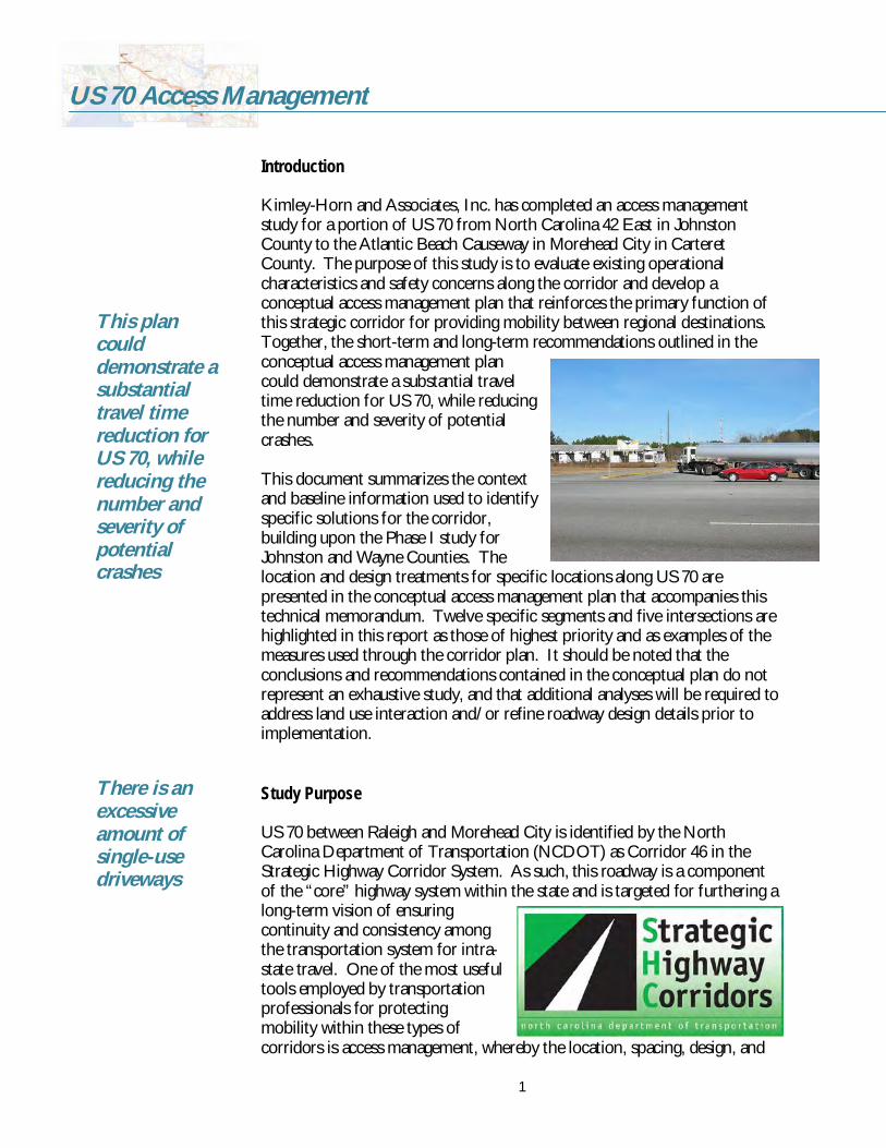
KimleyHorn and Associates, Inc. has completed an access managementstudy for a portion of US 70 from North Carolina 42 East in JohnstonCounty to the Atlantic Beach Causeway in Morehead City in CarteretCounty. The purpose of this study is to evaluate existing operationalcharacteristics and safety concerns along the corridor and develop aconceptual access management plan that reinforces the primary function ofthis strategic corridor for providing mobility between regional destinations.Together, the shortterm and longterm recommendations outlined in theconceptual access management plancould demonstrate a substantial traveltime reduction for US 70, while reducingthe number and severity of potentialcrashes.
This document summarizes the contextand baseline information used to identifyspecific solutions for the corridor,building upon the Phase I study forJohnston and Wayne Counties. Thelocation and design treatments for specific locations along US 70 arepresented in the conceptual access management plan that accompanies thistechnical memorandum. Twelve specific segments and five intersections arehighlighted in this report as those of highest priority and as examples of themeasures used through the corridor plan. It should be noted that theconclusions and recommendations contained in the conceptual plan do notrepresent an exhaustive study, and that additional analyses will be required toaddress land use interaction and/or refine roadway design details prior toimplementation.
Study Purpose
US 70 between Raleigh and Morehead City is identified by the NorthCarolina Department of Transportation (NCDOT) as Corridor 46 in theStrategic Highway Corridor System. As such, this roadway is a componentof the “core” highway system within the state and is targeted for furthering alongterm vision of ensuringcontinuity and consistency amongthe transportation system for intrastate travel. One of the most usefultools employed by transportationprofessionals for protectingmobility within these types ofcorridors is access management, whereby the location, spacing, design, and
There is anexcessiveamount ofsingleusedriveways
This plancoulddemonstrate asubstantialtravel timereduction forUS 70, whilereducing thenumber andseverity ofpotentialcrashes

2
US 70 Access Management
operation of driveways, median openings, and street connections arecontrolled in a systematic, predictable manner. Such methods preserve safetyand efficiency of the transportation system. In many instances, guidelinesunder access management will extend to spacing criteria for traffic signalsand regulations for allowing vehicular access to adjoining land uses.
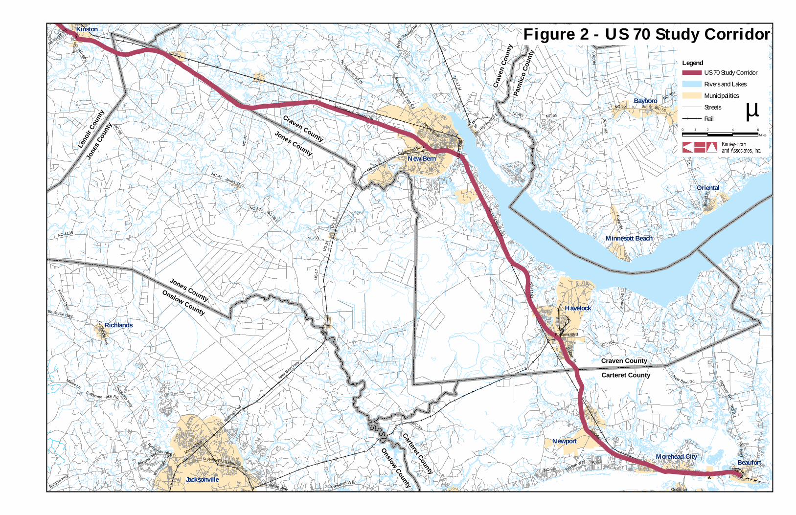
The focus of this access management study is the 134mile segment of US 70from NC 42 East in the Town of Clayton to the SR 1182 Atlantic BeachCauseway in Morehead City. Figures 1 and 2 illustrate the extents of thiscorridor. This section of US 70 traverses through relatively flat, ruralportions of Johnston, Wayne, Lenoir, Jones, Craven and Carteret Countiesand terminates on the east end in the coastal community of Morehead City.Small pockets of development existthroughout the corridor, characterizedby an excessive amount of singleusedriveways. Continued developmentpressures in the area reinforce theneed for implementing an accessmanagement plan that limits and/orconsolidates driveway locations aswell as median openings.
The corridor predominately serves ‘through’ traffic desiring a quickconnection between Raleigh, larger communities, and the beaches, includingtruck traffic generated by the deep water port in Morehead City andpetroleum and natural gas facilities along the corridor. The combination ofmixedtraffic (including agriculture equipment), excessive travel speeds,speed differential, and unexpected traffic control/driveway locations withinthe developed areas contribute to safety and mobility concerns related to the‘unpredictable nature’ of the corridor.
Existing Conditions
The foundation for recommendations made in the access management planrests upon baseline information collected from aerial photographs, fieldvisits, historical traffic count data, crash reports, planning staff work sessionsand land use data available for the corridor. Information summarizingtraffic volumes, crash data, access to adjacent land uses, and environmentalconsiderations are provided below.
Thecombinationof mixedtraffic,excessivetravel speeds,speeddifferential,andunexpectedtraffic control/drivewaylocationswithin thedevelopedareascontribute tosafety andmobilityconcerns

NC-58
US-11
7
NC-91
US-701 S
US-264
US-25
8NC
-11
NC-581
NC-121
US-301 N
NC-90
3
US-13
Nc Hwy 55 E
US-13 S
US-13 N
US-301 S
NC-11 N
NC-58 S
NC-111
NC-58 N
Nc H
ighw a
y 39
NC-55 E
US-70A E
NC-403
NC-42
NC-43 N
NC-903
S
Nc H
ighwa
y 96 N
NC-111 SNC-50 S
US-70 W Bus
NC-55
Hobbton Hwy
Mt Olive Hwy
E Ash St
Suttontown Rd
Nc Highway 42 E
N C-222
NC-90
3N
Newton Grove Hwy
Nc Hwy 42 E
W Wilson St
N C 58
1 Nort
hUS
Hwy 1
17 (A
lt)
US-117 S
N c Hwy 222 E
US-117 N
S Brightleaf B
lvd
Main StHarnett-Dunn Hwy
Goldsboro Hwy
S Main
St
N Que
en St
Dick inson Ave
N C Hwy 55W
Nc High
way 2
22
US-70 Bus E
US Hwy 264 (Alt)
W New Bern Rd
Nc Hwy 111 S
NC-11
S
NC-55 W
Arrington Bridge Rd
W Harper St4317 Hwy S
Nc Highway 91
NC-55W
Nc Highway 210
NC-123
NC-102 W
Greenvil
le Hwy
Richlands R
d
Kingold Blvd
NC-50 E
E 2nd St
May Blvd
US-135
Highw
ay 11
1
Old Smithfield Rd
N Brea
zeale
Ave
W Ash St
NC-117 (B
us)
NC-96
S
McLain St
U S 135 Hwy
Nc H
ighwa
y 96 S
N C Hwy 222 W
Crest D
r
E Market St
Nc 55 E
S Pollock S
t
Julius Sutton Hwy
Highw
ay 96
S
N Willia
m St
Highw
ay 96
S
W Grantham St
Nc 55E Trento
n Hwy
Nc Hwy 222
Kinsto
n St
Mt Olive Dr
N Berkeley Blvd
Ms Kelly
Victory L
n
S Cas
well S
t
S Wilso
n St
Nc 42 E
SR#1591
E Main St
Cole Rd
Jame
s Pric
e Rd
Patet
own R
d
US-70 East
Golds
boro
St
E Wellons St
US-13 S
US-13 S
NC-123
NC-222
NC-11
1
US-11
7 NUS
-117
NC-222
N C Hwy 55W
NC-123
US-26
4
US-70 W Bus
S Wilso
n St
US-117
NC-55
US-13
NC-121
NC-222
NC-58 S
Nc Highway 210
US-13
NC-58 S
NC-58
NC-58
NC-903
US-258
NC-903
NC-222
NC-581
US-11
7
Nc Highway 222
US-25
8
NC-903
NC-96 S
US-13
US-258
NC
-111
Nc Hi
ghwa
y 222
NC-11 N
NC-123
NC-91
US-264
NC-903
US-301 S
NC-11
NC-90
3
NC-111
0 2 4 61Miles
µ
LegendUS 70 Study Corridor
Rivers and Lakes
Municipalities
Streets
Rail
Figure 1 - US 70 Study Corridor
John
ston C
ounty
Wayn
e Cou
nty
PrincetonBenson
Clayton
Selma
Smithfield
Wilsons Mills
Goldsboro
Pine Level
Pikeville
Walnut Creek
Mount Olive
Kinston
Snow Hill
Farmville
Newton Grove
La Grange
Saratoga
Black Creek
KenlyWayne CountyWilson County
Wilson County
Johnston County Wilson County
Greene County
Gree
ne C
ounty
Wayn
e Cou
nty
Wayne CountySampson County
Sampson CountyJohnston County
Wayne CountyDuplin County
Leno
ir Cou
ntyWa
yne C
ounty
Lenoir CountyGreene County
Greene County
Pitt County
NC-58
NC-41 W
Point Rd
NC-101US-17 N
NC-41
NC-30
6
NC-24
US-17
NC-58 S Nc H ighway 55 W
Richlands Hwy
Burgaw Hwy
NC-55
New Bern Hwy
Ferry
Rd
Lejeune Blvd
US-17 S
Freedom Way
Kinston Hwy
D StNeuse Blvd
NC-304
N ew Ber n Rd
E Main St
Washingt on Post Rd
Catherine Lake Rd
Arendell
Clarendon Blvd
Wey
erhauser Rd
Richlands R
d
Wilm
ington
Hwy
SR#1162
Marine Blvd
Beulaville Hwy
Broad
St
Gethsemane Church Rd
Nc Highw
ay 55 E
Jones St
Cedar St
Mesic Blvd
Mattie Ln
SR#1159
Fontana Blvd
5th St
US-70
Bus
Railroad
Grd
Highway 101Pennsylvania Ave
Trento
n Hwy
SR#1174
Main
St
Lake
Rd
Wildlife Way
Cedar Ln
NC-58
NC-55
Richlands Hwy
NC-55 Point Rd
NC-101
NC-58
Freedom Way
NC-58 S
NC-58
NC-304
NC-55
Lejeune Blvd
NC-55
US-17
NC-304
NC-304
Richlands Hwy
NC-41
NC-24Burgaw Hwy
NC-55
US-17
0 2 4 61Miles
µ
LegendUS 70 Study Corridor
Rivers and Lakes
Municipalities
Streets
Rail
Figure 2 - US 70 Study Corridor
Richlands
Kinston
Bayboro
New Bern
Oriental
Newport
BeaufortMorehead City
Jacksonville
Havelock
Minnesott Beach
Jones County
Craven County
Crav
en C
ounty
Onslow County
Leno
ir Cou
ntyJo
nes C
ounty
Craven County
Jones CountyOnslow County
Carteret County
Carteret County
Paml
ico Co
unty

5
US 70 Access Management
Existing Traffic VolumesAverage Annual Daily Traffic (AADT) count information for US 70 wascollected from 2004 Traffic Count Maps maintained by the North CarolinaDepartment of Transportation (NCDOT) for the state highway system.Existing traffic volumes along the corridor range between 14,000 and 54,000vehicles per day, demonstrating the drastic differences between urban andrural environments encountered along the 134mile corridor.
For comparison, transportation professionals commonly agree that the levelof service D generalized link capacity for a fourlane, divided arterial withfewer than two signalized intersections per mile is approximately 35,000vehicles per day within an urban environment. In rural conditions, thegeneralized link capacity for this same facility could rise to approximately56,000 vehicles per day and maintain level of service D based on higheroperating speeds and fewer traffic signals, median breaks, and drivewaysalong the corridor. Table 1 provides a summary of the traffic volume datacollected for this stretch of US 70.
Table 1US 70 Corridor Traffic Volumes
(20032004 AADT)
Location AADT Location AADT
East of NC 42 48,000 Kinston Bypass 21,000East of Clayton Town Limits 36,000 West of NC 58 28,000
East of Wilson Mills 22,000 Lenoir/Jones Co. Line 14,000
East of Pine Level 22,000 West of NC 43 15,000Inside Princeton Town Limits 21,000 West of Trent River 44,000
Johnston/Wayne Co. Line 23,000 Trent River Bridge (New Bern) 35,000
West of NC 581 22,000* East of NC 17 44,000West of Goldsboro Bypass 35,000* West of NC 101 (Havelock) 30,000
Goldsboro Bypass 54,000* East of Havelock 37,000
West of NC 111 26,000* West of Newport 22,000West of Walnut Creek 19,000 East of NC 24 (Morehead City) 33,000
Wayne/Lenoir Co. Line 16,000 West of Atl. Beach Causeway 29,000
East of Little Baltimore 19,000 East of Atl. Beach Causeway 25,000West of US 258 41,000 Newport River Bridge 20,000* 2002 traffic volumes reported by NCDOT
Trafficvolumesalong thecorridorrangebetween14,000 and54,000vehiclesper day

6
US 70 Access Management
In addition, existing turning movement count data for key intersections alongthe corridor were obtained from NCDOT Divisions 2 and 4 to refine therecommended concepts being considered for addressing safety concerns andimproving traffic flow at signalized intersections.
Crash DataCrash data was collected from the North Carolina Department ofTransportation for a 3year period (October 1, 2001 – September 31, 2004).At the request of the NCDOT staff, data was used to determine the incidentrate and crash patterns at intersections and segments along the US 70Corridor. Collectively, the numbers of crashes reported at the intersectionsare predominately composed of rear end (34%), angle (17%), and left turn(9%) collisions. Table 2 outlines a summary of crash statistics for thecorridor.
The crash reports indicate a fairly even distribution of crashes throughout theday, month, and year. Fortyfive fatalities were reported in fortytwo crashesduring the analysis period, translating to 1 fatality per 100 crashes in thecorridor. Fatality crash rates were higher than the corridor average inJohnston and Wayne Counties, but notably, sowere crash rates involving DUIs (driving underthe influence). Injury crashes were moreprevalent in Jones and Carteret Counties duringthe study period. Compared to the corridor,Johnston had considerably higher percentagesof fixed object and headon collisions; Wayne,sideswipe same direction crashes; and Carteret,rearend and angle crashes. Carteret Countyalso reported 14 of the 34 crashes involvingpedestrians or cyclists, which may be attributedto the coastal setting and a higher percentage oftourist and recreational traffic. Statistics fromJones County proved to be the most dissimilarfrom the corridor, with considerably higher percentages of crashes at night orin wet conditions and of crashes involving fixed objects, animals, andmotorists running off the road. Reader should note that 72% of the US 70Corridor in Jones County is access controlled.
Table 3 provides a comparison of the countywide crash rates for the studyperiod versus the latest statewide crash rates for those road types. Based onreview of crash data for the corridor, it appears that select segments of US 70in Johnston, Lenoir, and Craven exceed the statewide average crash rate forsimilar roadways. Of particular note, the segments in these three countieswith full access control all exceeded the state average.
Selectsegments ofUS 70 inJohnston,Lenoir, andCravenexceed thestatewideaveragecrash rate forsimilarroadways

7
US 70 Access Management
Table 2US 70 Corridor Crash Statistics, by Severity, Special Conditions, and Type
Crashes by Severity ConditionsTotalCrashes Fatal Injury PDO* Night Wet DUI
Johnston 885 12 (1.4%) 341 (38.5%) 532 (60.1%) 212 (24.0%) 167 (18.9%) 45 (5.1%)Wayne 663 10 (1.5%) 261 (39.4%) 392 (59.1%) 179 (27.0%) 105 (15.8%) 34 (5.1%)Lenoir 605 6 (1.0%) 238 (39.3%) 361 (59.7%) 167 (27.6%) 111 (18.3%) 20 (3.3%)Jones 105 0 (0.0%) 42 (40.0%) 63 (60.0%) 55 (52.4%) 32 (30.5%) 3 (2.9%)Craven 1073 6 (0.6%) 369 (34.4%) 698 (65.1%) 276 (25.7%) 268 (25.0%) 31 (2.9%)Carteret 1193 8 (0.7%) 493 (41.3%) 692 (58.0%) 184 (15.4%) 148 (12.4%) 46 (3.9%)Total 4524 42 (0.9%) 1744 (38.5%) 2738 (60.5%) 1073 (23.7%) 831 (18.4%) 179 (4.0%)
TypesTotalCrashes Rearend Angle Sideswipe,
same direction Fixed object Ran off road Left turn,same roadway
Johnston 885 263 (29.7%) 159 (18.0%) 88 (9.9%) 102 (11.5%) 22 (2.5%) 61 (6.9%)Wayne 663 221 (33.3%) 87 (13.1%) 77 (11.6%) 28 (4.2%) 93 (14.0%) 33 (5.0%)Lenoir 605 167 (27.6%) 108 (17.9%) 40 (6.6%) 56 (9.3%) 54 (8.9%) 37 (6.1%)Jones 105 6 (5.7%) 8 (7.6%) 5 (4.8%) 15 (14.3%) 34 (32.4%) 2 (1.9%)Craven 1073 385 (35.9%) 131 (12.2%) 53 (4.9%) 89 (8.3%) 111 (10.3%) 47 (4.4%)Carteret 1193 482 (40.4%) 285 (23.9%) 73 (6.1%) 50 (4.2%) 21 (1.8%) 77 (6.5%)Total 4524 1524 (33.7%) 778 (17.2%) 336 (7.4%) 340 (7.5%) 335 (7.4%) 257 (5.7%)
TotalCrashes Animal Left turn,
diff. roadwaysPedestrian/pedcyclists
Sideswipe,opp. directions Headon Other
Johnston 885 47 (5.3%) 28 (3.2%) 3 (0.3%) 3 (0.3%) 12 (1.4%) 97 (11.0%)Wayne 663 26 (3.9%) 17 (2.6%) 5 (0.8%) 7 (1.1%) 4 (0.6%) 65 (9.8%)Lenoir 605 57 (9.4%) 13 (2.1%) 2 (0.3%) 4 (0.7%) 1 (0.2%) 66 (10.9%)Jones 105 29 (27.6%) 0 (0.0%) 1 (1.0%) 0 (0.0%) 0 (0.0%) 5 (4.8%)Craven 1073 82 (7.6%) 46 (4.3%) 9 (0.8%) 8 (0.7%) 4 (0.4%) 108 (10.1%)Carteret 1193 8 (0.7%) 38 (3.2%) 14 (1.2%) 9 (0.8%) 8 (0.7%) 128 (10.7%)Total 4524 249 (5.5%) 142 (3.1%) 34 (0.8%) 31 (0.7%) 29 (0.6%) 469 (10.4%)
*PDO Property Damage Only

8
US 70 Access Management
Table 3US 70 Countywide and Segmental Crash Rate Comparisons
to 20002002 Statewide Crash Rates
County Setting Access Length AADT CrashesVehicle
Exposure(MVMT)
CrashRateA
StatewideCrash Rate
ComparisonNC 42 to Wayne County Line 127.89
No/partial 20.8 26,000 688 592.7 116.08 83.22 – 131.76Johnston
RuralFull 3.9 20,000 197 85.5 230.44 64.29
Countywide 103.71Rural No/partial 8.9 20,000 176 195.1 90.22 83.22 – 131.76
No/partial 8.0 28,000 370 245.5 150.71 245.66 – 432.42
Wayne
UrbanFull 4.3 54,000 117 254.5 45.97 155.81
Countywide 142.56No/partial 14.5 21,000 455 333.7 136.34 83.22 – 131.76RuralFull 4.1 16,000 53 71.9 73.72 64.29
Lenoir
Urban TWLTL 0.8 28,000 97 24.6 395.11 374.08Countywide 71.86
No/partial 3.9 12,000 54 51.3 105.28 83.22 – 131.76Jones
RuralFull 8.1 11,000 51 97.7 52.23 64.29
Countywide 107.87No/partial 7.9 26000 116 225.1 51.53 83.22 – 131.76RuralFull 18.5 18000 249 365.0 68.23 64.29No/partial 10.0 33,000 559 361.7 154.56 245.66 – 432.42
Craven
UrbanTWLTL 1.3 31,000 149 44.2 337.35 374.08
Countywide 259.46Rural No/partial 7.4 22,000 228 178.4 127.78 83.22 – 131.76
Carteret
Urban No/partial 10.9 31,000 965 370.3 260.57 245.66 – 432.42State Average Crash RatesB
Roadway Type Rural US Route Urban US Route4+ lanes undivided 156.36 631.414+ lanes with continuous leftturn lane 119.77 374.084+ lanes with no control access 131.76 432.424+ lanes with partial control access 83.22 245.664+ lanes with full control access 64.29 155.81Notes: A– County crash rates developed by NCDOT using AADT for study period 20012004,
2003 AADT used for segmental analysisB– Crash rate is reported as number of crashes per 100 million vehicle miles traveled

9
US 70 Access Management
Angle and left turn collisions are often the result of driversmisjudging speed and/or distance of oncoming traffic and mistakenlyturning in front of or into the path of en oncoming vehicle. This isusually a function of either a driver’s disregard for or failure to see atraffic control device, or an inadequate amount of sight distancecaused by a physical obstruction or geometric conditions. Rearendcollisions commonly occur as the result of sudden stops coupled withinadequate following distance. The potential for rearend collisionsgreatly increases on roadways with inadequate sight distance and/orexcessive speed differentials caused by traffic control devices,frequent driveways, unprotected turning movements, and a mix ofmotor vehicles.
Based on intersection crash data provided by NCDOT, the followingcritical intersections were identified for safety improvements basedon consideration of the combination of crash frequency and severityof incidents:
US 70 & SR 1901 Powhatan Road (Johnston)US 70 & SR 2307 Peedin Road Extended (Johnston)US 70 Bypass Ramps (W. Graham Street) between Paul Streetand SR 1302 Florida Street (Wayne)US 70 & NC 581 (Wayne)US 70 & SR 1234 Ebenezer Church Road/Capps Bridge Roads(Wayne)US 70/NC 111 & SR 1711 Oak Forest Road (Wayne)US 70 & SR 1719 Beston Road (Wayne)US 70 & SR 1525 W. Measley Road/SR 1327 J. Sutton Drive(Lenoir)US 70 & US 258 (Lenoir)US 70 & NC 11/55 (Lenoir)US 70 & US 258 Business (Lenoir)US 70 & NC 58 (Lenoir)US 70 & SR 1116 Thurman Road (Craven)US 70 & Stonebridge Trail (Craven)US 70 & SR 1824 McCotter Boulevard (Craven)US 70 & SR 1124 Nine Foot Road/SR 1245 Howard Boulevard(Carteret)US 70 & SR 1141 Hibbs Road (Carteret)US 70 & Mansfield Parkway (Carteret)US 70 & SR 1182 Atlantic Beach Causeway/23rd & 24th Streets(Carteret)
Table 4 summarizes the number of recorded crashes, crash rates,and severity index scores for select intersections included in thestudy. The following intersection crash data was provided byNCDOT and reflects information recorded between 2001 – 2004.
The potentialfor rear endcollisionsgreatlyincreases onroadways withinadequatesight distanceand/orexcessivespeeddifferentialscaused bytraffic controldevices,frequentdriveways,unprotectedturningmovements,and a mix ofmotor vehicles

10
US 70 Access Management
Table 4Crash Summary for Select US 70 Intersections
(2001 2004)
Crash SummaryIntersectionC No. of
CrashesCrashRateA
SeverityIndexB
Johnston CountyUS 70 & SR 2522 (Martin Livestock Rd.) 1 4.13 8.40US 70 & SR 1929 (West Oak St.) 5 17.28 2.48US 70 & SR 1901 (Powhatan Rd.) 8 21.66 12.33US 70 & SR 2307 (Peedin Road Ext.) 22 79.03 10.25Wayne CountyUS 70 Bypass Ramps (W. Graham St.)between Paul St. & SR 1302 (Florida St.) 10 584.88 1.74
US 70 & NC 581 19 65.92 8.49US 70 & SR 1234 (Ebenezer Church Rd.) 7 25.96 25.83US 70/NC 111 & US 70 Bypass 4 9.46 2.85US 70/NC 111 & SR 1711 (Oak Forest Rd.) 18 49.47 7.68US 70 & SR 1719 (Beston Rd.) 17 74.22 9.38Lenoir CountyUS 70 & SR 1548 (Hill Farm Rd.)/Sussex St. 22 52.82 4.36US 70 & SR 1525 (W. Measley Rd.)/SR 1327 (J.Sutton Dr.) 17 77.55 15.14
US 70 & US 258 46 153.74 3.57US 70 & Mt. Vernon Park Rd. 21 46.73 4.88US 70& NC 11/55 41 191.84 6.28US 70 & US 258 Business 61 271.5 3.43US 70 & Meadowbrook Rd. 6 35.32 3.47US 70 & US 58 29 145.38 5.66Craven CountyUS 70 & SR 1167 (Williams Rd.) 42 87.09 4.52US 70 & SR 1131 (Airport Rd.) 18 44.39 4.29US 70 & Taberna Way 11 37.17 5.71US 70 & SR 1116 (Thurman Rd.) 14 47.31 6.29US 70 & SR 1760 (Hickman Hill Loop Rd.) 6 19.55 4.70US 70 & SR 1765 ( Slocum Rd.) 18 71.41 3.47US 70 & SR 1745 (Greenfield Blvd.)/ Catawba St. 21 72.58 1.70US 70 & SR 1757 (Ketner Blvd.) 3 10.95 1.00US 70 & Stonebridge Trl. 5 18.25 17.64US 70 & Chadwick Dr. 15 47.19 2.48US 70 & Holly Dr. 16 50.34 2.39
A – Crash rate is reported as number of crashes per 100 million vehicles entering theintersectionB – Severity Index = ((76.8*(F+A))+(8.4*(B+C))+PDO)/Total CrashesC – All intersection crash data reflect information received over a 3year period.

11
US 70 Access Management
Table 4 (continued)Crash Summary for Select US 70 Intersections
(2001 – 2004)
Crash SummaryIntersectionC No. of
CrashesCrashRateA
SeverityIndexB
Craven County (continued)US 70 & Jackson Dr. 17 51.70 3.18US 70 & NC 101/SR 1763 (Fontana Blvd./ MillerBlvd.) 34 72.14 2.52
US 70 & SR 1737 (Roosevelt Blvd.) 15 54.74 2.48US 70 & SR 1735 (Cunningham Dr.) 15 36.99 3.47US 70 & Hollywood Blvd. 6 14.80 2.23US 70 & Nunn St. 11 27.13 3.02US 70 & SR 1824 (McCotter Blvd.) 10 24.66 10.06Carteret CountyUS 70 & SR 1124 (Nine Foot Rd.)/SR 1245(Howard Blvd.) 27 111.98 11.89
US 70 & SR 1140 (Roberts Rd.) 20 82.95 4.33US 70 & SR 1141 (Hibbs Rd.) 22 91.24 8.15US 70 & SR 1237 (Harris Rd.) 26 76.52 3.85US 70 & Cypress Bay Shopping Center Ent. 8 23.55 1.92US 70 & NC 24 31 54.39 3.39US 70 & SR 1177 (Country Club Rd.) 25 69.12 5.81US 70 & Mansfield Parkway 18 49.77 12.30US 70 & SR 1605 (Friendly Rd.) 25 73.58 3.07US 70 & SR 1602 (35th St.) 24 75.51 3.77US 70 & 30th St. 10 31.46 3.22US 70 & 29th St. 3 9.44 3.47US 70 & SR 1182 (Atlantic Beach Causeway)/23rd
St.39 122.70 2.90
A – Crash rate is reported as number of crashes per 100 million vehicles entering theintersectionB – Severity Index = ((76.8*(F+A))+(8.4*(B+C))+PDO)/Total CrashesC – All intersection crash data reflect information received over a 3year period.
Additional review of data in the corridorwide crash reports helped toidentify the following intersections as points of concern. Theirselection and recommended actions are included in the followingreview.
US 70 and SR 1570 Pony Farm Road (Johnston): cluster ofrearend crashes (7 related injuries) –Recommendation longterm median closure and removal of signal

12
US 70 Access Management
US 70 and SR 1643 Swift Creek Road (Johnston): cluster ofangle and turning crashes (2 fatalities, 18 related injuries) –Recommendation long term grade separation and removalof signalUS 70 and SR 1913 Wilson Mill Road (Johnston): cluster ofrearend and turning movement crashes (9 related injuries) –Recommendation long term grade separation andinterchangeUS 70 and SR 2309 Peedin Road (Johnston): cluster of rearend and turning movement crashes (27 related injuries) –Recommendation short term mainline directional crossoverand signal removalUS 70 and SR 2372 Pearl Street (Johnston): cluster ofturning movement crashes (11 related injuries) –Recommendation short term mainline directional crossoverand signal removalUS 70 and SR 1323 Promise Land Road (Lenoir): cluster ofangle crashes (7 related injuries) – NCDOT TIP R2554Ccloses this intersectionUS 70 and SR 1603 Washington Street (Lenoir): Cluster ofangle and turning crashes (5 related injuries) –Recommendation long term median closure prohibitsturning movementsUS 70 and SR 1324 Eason Road (Lenoir): cluster of anglecrashes (6 related injuries) –Recommendation long termmedian closure due to NCDOT TIP R2719AUS 70 and Mount Vernon Park Road (Lenoir): cluster ofrearend and angle crashes (14 related injuries) –Recommendation installation of leftover prohibits crossingtraffic and will channelize left turning movementUS 70 and SR 1167 Williams Road (Craven): cluster of rearend crashes (31 related injuries) –Recommendation longterm signal removal and access closure to US 70US 70 and SR 1132 Pender Street (Craven): cluster ofangle/turning movement crashes as well as rearend crashes (1pedestrian fatality, 15 related injuries) –Recommendation short term median closure and long term access closure to US70US 70 and SR 1131 Airport Road (Craven): cluster ofangle/turning movement and rearend crashes (15 relatedinjuries) –Recommendation long term signal removal andaccess closure to US 70

13
US 70 Access Management
A balancebetweenmobility andaccessibilityrequires aconcertedeffort betweenstate and localgovernmentalagencies tobetter linktransportationand land usedecisions
US 70 and SR 1124 Grantham Road (Craven): cluster ofturning movement and angle crashes (19 related injuries) Recommendation short term mainline leftover to prohibitside street traffic from crossing, long term access closure to US70US 70 and SR 1772 Pine Grove Road / Hickman Hill Loop(Craven): cluster of rearend crashes (19 related injuries) –NCDOT TIP R1015A removes through traffic Recommendation proposed signal removal and long termmainline leftover to prohibit side street crossing trafficUS 70 and Shepard Street (Craven): cluster of turningmovement crashes (11 related injuries) –Recommendation short term mainline leftover to prohibit side street traffic fromcrossingUS 70 and SR 1127 Mason Town Road (Carteret): cluster ofturning movement crashes (1 fatality, 21 related injuries) –Recommendation short term mainline leftover to prohibitside street traffic from crossingUS 70 and SR 1152 Old Airport Road (Carteret): cluster ofturning movement crashes (8 related injuries) –Recommendation short term median closure to prohibitcrossing trafficUS 70 and Jones Road (Carteret): cluster of rearend andturning movement crashes (11 related injuries) –Recommendation Morehead City scenarios 1 and 3 proposeinstallation of raised center median to prohibit turningmovementsUS 70 and NC 24 (Carteret): cluster of rearend and turningmovement crashes (12 related injuries) –Recommendation Morehead City scenario’s 24 propose removal of signal andseparation of opposing traffic by oneway pair systems (2 and 4)and grade separation (3)
Adjacent Land UsesOne of the most important considerations forimplementing a successful access management plan forUS 70 is the interrelationship between transportationand land use. US 70 is designated as a US Highway bythe Federal Highway Administration and identified as aStrategic Corridor by the NCDOT, charged withmaintaining mobility between regional destinations. Assuch, the priority for US 70 is to move traffic safely andefficiently through the corridor.
14
US 70 Access Management
Unfortunately, existing development and current zoning for stillundeveloped lands adjacent to the corridor favor access to thetransportation system via single use driveways onto US 70. Theemphasis for ‘accessibility’ to these properties quickly erodes away atthe ‘mobility’ function established forUS 70 as a strategic corridor. Findinga balance between mobility andaccessibility requires a concerted effortbetween state and local governmentalagencies to better link transportationand land use decisions.
One opportunity for coordination willbe the conceptual access managementplan whereby shortterm improvements are identified to addressimmediate safety concerns caused by excessive driveways and medianbreaks along the corridor, while longterm improvements emphasizealternative routes for local traffic comprising frontage roads and/oran expanded collector street system parallel to US 70. These couldprovide access to properties adjacent to the strategic corridor fromthe rear of the property.
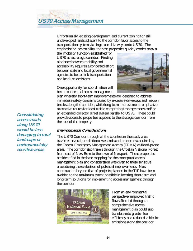
Environmental ConsiderationsThe US 70 Corridor through all the counties in the study areatraverses several jurisdictional wetlands and properties acquired bythe Federal Emergency Management Agency (FEMA) as floodproneareas. The corridor also travels through the Croatan National Forestfrom east of New Bern to the town of Newport. These propertiesare identified in the base mapping for the conceptual accessmanagement plan and consideration was given to these sensitiveareas during the evaluation of potential improvements. Newconstruction beyond that of projects planned in the TIP have beenavoided to the maximum extent possible in locating shortterm andlongterm solutions for implementing access management throughthe corridor.
From an environmentalperspective, improved trafficflow afforded through acomprehensive accessmanagement plan could alsotranslate into greater fuelefficiency and reduced vehicularemissions along the corridor.
Consolidatingaccess roadsalong US 70would be lessdamaging to rurallandscape orenvironmentallysensitive areas

15
US 70 Access Management
Furthermore, consolidating access roads along US 70 would be lessdamaging to rural landscapes or environmentally sensitive areas thanallowing numerous individual private driveways.
Public Involvement
The purpose of this conceptual access management plan is to providea series of recommendations for protecting access and mobility alongthe 134mile corridor. These recommendations were shared withcitizens and local officials at a series of public meetingsand open houses held at different points along thecorridor in order to gain insight and reaction to thepreliminary improvements outlined in the conceptualplan.
Phase I Study Citizens Workshop, Wayne CountyPublic involvement is of key importance to projectslike thisone and opportunities for citizens to provide input tothe study via public workshops were included in thestudy. To share and discuss the findings of the Phase I(Johnston and Wayne counties) Access ManagementStudy, NCDOT and KimleyHorn held a citizenworkshop April 18, 2005 at East Wayne High School.Large maps detailing the proposed improvements weredisplayed for review and the project staff made a shortpresentation on the project background, accessmanagement basics, and the preliminary findings andimprovements. Approximately 60 participants attendedthe session and 26 completed a public survey handedout to solicit feedback. Participants were allowed tospeak oneonone with the project team as well as writetheir comments directly on the plan mapping usingmarkers and stickynotes. Responses received duringthe workshop were compiled and a sampling of thesubmitted comments and improvement suggestions aresummarized in the following list and the charts inFigure 3.
Too many signals is the cause of problems associated withUS 70Flashing lights before stop lights “flashing to slow down” areneededBridge over/under Oak Forest ASAPMake Hwy 70 right lanes fast speed and left lanes local traffic
“Flashinglights beforestop lights‘flashing toslow down’are needed”

16
US 70 Access Management
In your opinion, what are the problems associated with the US 70 corridor?
Too many vehicles exceedingspeed limit
30%
Difficult to merge onto oraccess highway
19%Too many traffic accidents14%
Too much traffic12%
Too many driveways andstreet connections
9%
Poor design5%
Too many trucks4%
Unpleasant to walk/bike onnearby streets
2%Other5%
I understand that Hwy 70 is important for business traffic aswell as tourist traffic, but do not inconvenience the localpeople who have to travel the road every day for the “beachgoers” on the weekends.Not obeying the 45 mph speed limit; not enough or largeenough reduce and limit signsMost accidents are rear end collision not cross over. This isbecause of back up from intersection of 111 and 70.Close a lot of lesser used medians that do not connect toroads. Those that connect to vacant land or 12 homes donot benefit many people but have the potential to cause rearend collisions.You can’t see traffic in turn lane going to LaGrange whencoming from Kinston.At median closures, do not remove median but put poles toclose median so when future bypass is built the existingmedians can be reopened and save money.Enforce speed laws.Once a highway becomes a “slowway” deal with it ascheaply as possible. There is no going back to freewayspeeds.Closing Camden Park median would be a mistake. Themedian services at least 5 businesses and a neighborhood.Lengthen the turn lane to Camden Park and pave theshoulder.
30% of publicsurveyparticipantsidentifies that“too manyvehiclesexceedingspeed limit”was the numberone problem onUS 70
Figure 3a. Responses from Public Survey Questions

17
US 70 Access Management
The open discussions with attendees at the workshop covered avariety of issues, primarily covering those topics listed above as wellas:
US 70 at Oak Forest RoadFlasher with sign – stop ahead when flashing
US 70 at BestonToo dark need better street lightingCitizens petitioned for traffic signalNeed to enforce speed limitNot enough law enforcement so why not put in a signalAngle (Tbone) crashes area real problem at Beston/70
Goals: 1) Protect lives, 2) Reduce congestionWhat percentage of traffic is from Johnston or Waynecounties vs. RaleighCoast traffic?People need to slow down.Different trip purpose results in wide difference in trafficspeedsOak Forest Road at 70 has the most rearend crashes.Keep Lake Wakena Road open.Make 70 Highway right lanes Autobahn high speed. Keep leftlanes local traffic.Entrance to Walnut Creek must remain openStop lights are cheaper than bridges… put some in.Contact Highway Patrol; ask why officers aren’t writingtickets like in 1995.
*Reader should note, there were two petitions submitted by the public against the proposed improvements atthe intersections of US 70/Beston Road and US 70/Uzzell Road. As a result, the proposed improvements(or timing of improvements) at these two locations may have been modified.
The number onesuggestedimprovement (at30%) to US 70 asidentified bysurveyparticipants wasto “build bridgesandinterchanges”along thecorridor.
What potential solutions can we make to the corridor?
Build bridges andinterchanges
30%
More signals22%Less signals
12%
Build a network of streets toserve development
12%
Other24%
Figure 3b. Responses from Public Survey Questions

18
US 70 Access Management
US 70 Corridor SummitThe US 70 Corridor Summit was held on May 11, 2005 at theGlobal Transpark Education and Training Center from 10:00a.m. to 3:00 p.m. The goals of the Summit were to discuss andexplain the current and short term activities along the corridor,including all projects; discuss the longterm vision for thecorridor; and present information on nontraditional andinnovative funding mechanisms for financing constructionprojects. Approximately 170 elected officials, staff, and otherstakeholders attended the meeting.
Additional Public Workshops and MeetingsIn addition to the workshop and summit, the project team alongwith NCDOT staff conducted several public outreach initiativesthroughout the study including a public presentation/meeting inJohnston County, meetings with local Transportation AdvisoryCommittees (TAC), and presentations to elected county officialsand Board of Transportation members. Additional publiccomments were received by direct mail, email, and phone by theproject staff.
The study has garnered coverage and editorial comments inregional and local newspapers in the communities along thecorridor; many of these articles are provided in the appendix.
“Peopleneed toslowdown”
170 electedofficials, staff,and otherstakeholdersattended themeeting

19
US 70 Access Management
Example of uturntreatment
Access Management Concepts
Tool BoxWith an understanding of baseline conditions, a “tool box” ofsuitable access management solutions was created to address theunique characteristics of US 70 through eastern North Carolina.Generally, these solutions provide greater ‘predictability’ to thecorridor by consolidatingmedian openings and/orremoving left turns at majorintersections in favor of uturns facilitated upstream ordownstream from theintersection.
Median UTurn Treatment:Median uturn treatments (ordirectional crossovers) areoften used to control turningmovements along roadwayswith medians. Typically,crossovers allow for indirect left turns at major intersections and uturns between full median openings. They reduce delay for themainline and allow for twophase traffic signal operations byremoving directional (i.e., mainline or minor leg) left turns and uturns from the intersection. However, they should be used onlywhere sufficient space is available for uturn maneuvers within themedian and be designed sufficiently to accommodate the turningradius of the intended design vehicle. The design vehicle used todesign the median uturns along US 70 for this study was a WB50tractor trailer.
This application also greatly reducesthe number of conflict points forvehicles within the intersection andis attributed with significantlydecreasing the frequency of crashes(especially angle collisions) whencompared with intersections thatallow for left turns and uturns. In fact, a study published by theInstitute of Transportation Engineers (ITE) and the University ofFlorida, Gainesville, reported that "the results of the before and afterstudy conclude that the implementation of the UTurn concept forroadway access control and safety improvement can reduce thefrequency of accidents by 22% which should produce a worthwhileproject to enhance roadway safety" (ITE Compendium of Technical
Thesesolutionsprovide greater‘predictability’to the corridor
Thisapplicationalso greatlyreduces thenumber ofconflict pointsfor vehicleswithin theintersection

20
US 70 Access Management
Papers, pg 49). Disadvantages for implementing median uturntreatments include increased delay, travel distance, and stops for leftturning vehicles as well as driver confusion immediately afterimplementation. Installing median uturns at multiple locations alonga corridor could help alleviate driver confusion, as replacingnumerous openings and intersections would normalize the corridorfrom its current “unpredictable nature.” Much consideration shouldbe given to locations of median openings in order to provideadequate weaving space without creating excessive travel distancesfor leftturning vehicles.
Traffic Signal Coordination: The distancebetween most of the traffic signals in this 134mile stretch of US 70 are spaced sufficientlyenough that they operate independently;however, coordination of traffic signals in themore urban areas of the corridor coulddemonstrate improved travel times and safetyalong US 70. Coordination typically involvessynchronizing traffic signals on a corridor tominimize through traffic delay. Signalcoordination can be accomplished either usingtimebased signal plans or by interconnectingthe signals in a system.
OnSite Traffic Circulation: One way to reduce the number ofvehicle conflicts along US 70 is to promote the concept of onsitetraffic circulation and/or shareduse driveways through localgovernment ordinances for approving development applications.Pushing back the ‘throat’ of a driveway helps to avoid spillback ontothe highway. Shareduse driveways, or joint access, improve both thesafety and efficiency of the roadway by concentrating slowingvehicles in appropriate areas and providing for rightturn decelerationlanes to facilitate access to abutting properties. Shareduse drivewaysalso limit the number of access points into development along thecorridor by considering developments with multiple lots and landuses into one property for the purposes of access regulation. Onlythe minimum number of connections necessary to providereasonable access should be permitted.
Interchange Retrofitting: In certain locations, intersection volumeslimit the number of feasible solutions that can both increase safetyand maintain current levelsofservice. At such locations, gradeseparated interchanges may be one of the more feasible alternativesto achieving both of these goals. Although interchanges represent amajor construction cost and may require additional rightofway. Inrural locations, the land may be available to construct the ramps
Coordination oftraffic signals inthe more urbanareas of thecorridor coulddemonstrateimproved traveltimes and safety
Sharedusedriveways, orjoint access,improve boththe safety andefficiency ofthe roadway

21
US 70 Access Management
After
Before
necessary to provide for traffic flow through the interchange andbetween facilities. Freeways in more urban locations frequently arefronted by adjacent business, especially at intersection corners whereramps would be located. Therefore, innovativepractices are called for to balance publictransportation needs and private interests.
For several specific segments of US 70 wherethere may be difficulties with environmentalpermitting and rightofway acquisition forinterchange or bypass construction, “rampover” interchanges (with slip camps) mayprovide a solution. The concept entails a stepbystep process to create an interchange withina minimum 130foot rightofway and 1/4milelength of the existing freeway. This applicationapplies to the section of US 70 between JamesCity and the Havelock Bypass (TIP #R1015),where additional rightofway for service roadsexist. The construction phases for retrofitting US 70 into acontrolledaccess freeway using the “rampover” interchange conceptinclude:
1) Construct access roads and associated intersections at the crossstreet adjacent to the existing freeway (if not already present).Traffic is not interrupted on the existing US 70 facility.
2) Construct atgrade slip ramps from the freeway to the accessroads approximately 1/8 mile from the cross street convertaccess road to one way and temporarily divert traffic to theaccess road.
3) Using retaining walls and prefabricated systems, reconstruct thefreeway section to include a grade separation at the crossstreet.This includes ramping the approaches at a 3% slope, up to abridge structure over the preexisting intersection.
4) Upon completion of the freeway section, reopen the freeway totraffic and restripe the slip ramps to become the accelerationand deceleration lanes for access to the cross streets.
5) Rampover interchanges should be made at a minimum of onemile spacing intervals
Such an interchange provides benefits to both local and throughtraffic by eliminating intersection stops for through traffic andreducing intersection volumes on the cross streets. The reductionallows for short cycle lengths and less storage requirements as thethrough traffic is removed. The cross street will be served at a muchhigher frequency and accident exposure is reduced. Additional “slipramps” can be implemented where adequate interchange spacing
NCDOTshouldapproachlocalgovernmentsimpacted bythis portionof US 70 topartner inorder toidentify bothshort andlongtermsolutions

22
US 70 Access Management
exists to improve local access and circulation. In addition,communities and the NCDOT could coordinate to use landscapingand textured facades to lessen the visual effect of the new retainingwalls and bridge structures.
Planning Level Cost EstimatesFor planning level purposes, probable construction unit costestimates for implementing the recommended improvements in theconceptual access management plan were quantified usingconstruction cost values maintained by the North CarolinaDepartment of Transportation. The following preliminary unitconstruction cost estimates are assumed:
Direction Crossover (with tractortrailer bulbout) $200,000 $300,000Strain Pole Signal $75,000 $100,000TwoLane Rural Collector Street (per mile) $1.3 – $1.6 millionDiamond Interchange $3.5 – $5.0 million“Rampover” interchanges $4.0 – $6.5 million
A more detailed analysis of traffic conditions, available rightofwayand other design variables should be conducted as the next phase ofthis study. In addition, the NCDOT should approach localgovernments impacted by this portion of US 70 to partner in order toidentify both short and longterm solutions for implementing landuse controls which support access management, overlay districts andconnectivity requirements for collector streets.
Conceptual Access Management Plan
The application and general designcharacteristics for the access managementsolutions incorporated into the conceptualaccess management plan for US 70 are basedon the tool box created for the corridor andthe location/design criteria set forth in theNCDOT Policy on Street and Driveway Access toNorth Carolina Highways, NCDOT RoadwayDesign Manual Part I: Median CrossoverGuidelines, and NCDOT Roadway StandardDrawings Manual (English). In general, no single improvement willsolve transportation issues along US 70, but together, the phasedimprovements recommended in the conceptual access managementplan facilitate a safer, more systematic, predictable, and efficienttransportation corridor consistent with the goals for the StrategicCorridor. Longterm solutions recommended in the plan begin to
No singleimprovementwill solvetransportationissues along US70, but together,the phasedimprovementsrecommendedin theconceptualaccessmanagementplan facilitate asafer, moresystematic,predictable, andefficienttransportationcorridor
Spacingbetweenremaining fullmedianopenings ismaintained at2,000 feet orgreater

23
US 70 Access Management
establish the transportation hierarchy for the street system that willultimately protect US 70 from encroaching development.
Under existing conditions, this 134mile stretch of US 70 contains264 full median openings, including 57 existing and/or proposedtraffic signals. The proposed conceptual access management planrecommends closing 89 of the full median openings, converting 85 ofthem to directional median openings, and maintaining 90 of theexisting full median openings in the future. In addition, medianinstallations will provide access control for four segments (totaling18,950 feet in length) with twoway left turn lanes and two additionalsegments in Morehead City (totaling 4,300 feet in length) separatedby striping alone.
In all cases, the spacing between remaining full median openings ismaintained at 2,000 feet or greater, consistent with NCDOTguidelines for divided highways with a posted speed limit greater than45 miles per hour. In addition, 12 traffic signals are eliminated withinthe corridor in favor of closed medians. Fortyfive existing and/orpreviously proposed traffic signals remain in the concept plan toprovide convenient access to certain secondary roadways or majordestinations, with one of those being relocated. The majority ofthese signals are located in Goldsboro, Havelock, and Morehead Cityand are planned for signal system upgrades and timing coordination.
The proposed conceptual US 70 Access Management Study mapsdisplay the recommendations for the corridor. The summary mapsfollow the Conclusions and Summary section. Descriptions of thesegments shown in each map sheet are provided in Table 4. Itshould be noted for information on specific improvements, thereader is advised to review the large (“E” size) plan maps available atthe NCDOT Division 2 and 4 offices.
Ultimately, 75%of the 134milecorridor will beconverted to afreeway or willhave a US 70Bypass topreserve themobility of thecorridor

24
US 70 Access Management
Table 5US 70 Access Management Recommended Improvements
Vicinity Segment descriptionMap #Description of recommendationsClayton NC 42 East to SR 1537 Olive RoadJohnston1Shortterm: Numerous mainline directional crossovers and median closuresfrom NC 42 to start of proposed TIP Project #R2552 Clayton BypassLongterm: Additional median closures and new roadway connections withcompletion of TIP Project #R2552 Clayton BypassWilsons Mill SR 1537 Olive Road to SR 1555 Barbour RoadJohnston2Shortterm: Two mainline directional crossovers and signal timing/coordinationLongterm: Access roads; one additional mainline directional crossover; oneminor street directional crossover; one grade separation and signal removal;one interchange constructionSelma SR 1555 Barbour Road to Interstate 95Johnston3Shortterm: One mainline directional crossover and one median closure withdeceleration lane from Barbour Road to beginning of Buffalo Roadinterchange; advisory signing for truck trafficLongterm: No additional recommendationsSouthSmithfield
Interstate 95 to SR 2310 Davis Mill RoadJohnston4
Shortterm: Numerous mainline directional crossovers and median closuresbeginning at SR 1205 Firetower Road; one signal removalLongterm: New roadway connections and mainline directional crossoverPine Level SR 2310 Davis Mill Road to SR 2314 Pondfield RoadJohnston5Shortterm: Numerous mainline directional crossovers and median closures;one minor street directional crossover at Martin Livestock RoadLongterm: New roadway connections and closure of one mainlinedirectional crossoverPrinceton US 70A to SR 1331 Bridgers Road (Wayne Co.)Johnston6Shortterm: Numerous mainline directional crossovers; one signal removal;intersection improvements for truck movements off mainline; one turn laneremoval; one WB Uturn only median installmentLongterm: Closure of one mainline directional crossover
* For specific details on recommendations, see large mapping available at your local NCDOT Division 2 and 4 offices.

25
US 70 Access Management
Table 5 (continued)US 70 Access Management Recommended Improvements
Vicinity Segment terminiMap #
Description of recommendations
Rosewood SR 1331 Bridgers Road to East of NC 581Wayne1Shortterm: Numerous mainline directional crossoversLongterm: No additional recommendations
NW Goldsboro East of NC 581 to US 13/70/NC 117 ExpresswayWayne2
Shortterm: Numerous mainline directional crossovers and median closureswest of Westwood Drive; proposed signals and signal timing/coordination inconjunction with TIP #R1030 NC 117 Southern BypassLongterm: Additional eastbound leftturn storage bay at SR 1453 PerkinsMill Road, completion of TIP #R2554 Goldsboro Bypass
Wayne3 Shortterm: Closure of service road access from Expressway east of WilliamsSt. interchangeNote: US 13/70/NC 117 Martin Luther King, Jr. Expressway has full access control
SE Goldsboro US 13/Berkley Boulevard interchange to SR 1721Casey Chapel Road
Wayne4
Shortterm: “Signal ahead” flashers/signage at Oak Forest Road; numerousmainline directional crossovers; one median closureLongterm: Interchange conversion at Oak Forest Road, closure of WB leftturn lane to US 70 Business/Ash Street, new roadway connections,completion of TIP #R2554 Goldsboro Bypass
Walnut Creek SR 1721 Casey Chapel Road to Wayne County LineWayne5
Shortterm: Numerous median closures; one minor street directionalcrossover with side street left turn lanes at Beston RoadLongterm: Two new mainline directional crossovers, new roadwayconnections, and connections to TIP #R2554 Goldsboro Bypass
* For specific details on recommendations, see large mapping available at your local NCDOT Division 2 and 4 offices.

26
US 70 Access Management
Table 5 (continued)US 70 Access Management Recommended Improvements
Vicinity Segment terminiMap #
Description of recommendations
La Grange Wayne County Line to SR 1603 Washington StreetLenoir1
Shortterm: Mainline directional crossover east of Washington StreetLongterm: Median closure at Washington Street, new roadway connectionfor Washington Street to Jim Sutton Drive
Little Baltimore SR 1525 W. Measley Road/SR 1327 J. Sutton Drive toSR 1519 Eason Road/SR 1324 Kennedy Home Road
Lenoir2
Shortterm: Numerous mainline directional crossovers and median closures;one minor street directional crossover at H. Sutton Road; one median UturnLongterm: Flashing yellow leftturn signal at Measley/Sutton intersection,new roadway connection; longterm controlled access from WashingtonStreet to H. Sutton Road west of TIP# R2553 Kinston Bypass; closure ofone mainline directional crossover
Falling Creek SR 1519 Eason Road/SR 1324 Kennedy Home Roadto Neuse River Bridge
Lenoir3
Shortterm: Two mainline directional crossovers with one signal removal;addition of right turn lane to one property; leftturn channelization for EBentrance ramps from WB US 70 BusinessLongterm: Numerous median closures; ramp connections to TIP #R2719future Crescent Road; new roadway connections; new access for oneproperty when current entrances closed; completion of TIP# R2553Kinston Bypass
Kinston Neuse River Bridge to east of Lenoir CommunityCollege
Lenoir4
Shortterm: Numerous mainline directional crossovers and median closures;one minor street directional crossover; addition of raised median east ofNC 258 Business and from NC 258 Business to NC 58; one signal removalLongterm: New roadway connections; completion of TIP# R2553 KinstonBypass
* For specific details on recommendations, see large mapping available at your local NCDOT Division 2 office.

27
US 70 Access Management
Table 5 (continued)US 70 Access Management Recommended Improvements
Vicinity Segment terminiMap #
Description of recommendations
Kelly Pond Lenoir Comm. College to Roy White Road (JonesCo.)
Lenoir5
Shortterm: Numerous mainline directional crossovers; one median closureLongterm: New roadway connections; interchange with proposed KinstonBypass (TIP#R2553); longterm controlled access east of Kinston Bypass
Dover Roy White Road to east of SR. 2021 Kornegay DriveJones1
Shortterm: Two mainline directional crossovers; two median closures; onemedian Uturn with EB acceleration lane; offset leftturn lanes on mainline atKornegay DriveLongterm: Interchange at Kornegay Drive; new roadway connections
US 70 from Kornegay Drive to Trent River Bridge (New Bern) not detailed based on existing full accesscontrol
James City US 17 interchange to east of SR 1131 Airport RoadCraven1
Shortterm: Numerous median closuresLongterm: Rampover interchange at Airport Road; conversion to onewayaccess road system; slip ramp access with median closure and signal removalat Williams Road; closure of remaining mainline access points and medianopenings
Thurman East of SR 1131 Airport Road to Day Star LaneCraven2
Shortterm: Numerous mainline directional crossovers and median closuresLongterm: Rampover interchanges at Grantham and Thurman Roads;conversion to oneway access road system with service road extensions; slipramp access with median closure and signal removal at Taberna Way; closureof remaining mainline access points and median openings
* For specific details on recommendations, see large mapping available at your local NCDOT Division 2 office.

28
US 70 Access Management
Table 5 (continued)US 70 Access Management Recommended Improvements
Vicinity Segment terminiMap #
Description of recommendations
Croatan Day Star Lane to SR 1107 Flanners Beach RoadCraven3
Shortterm: Numerous mainline directional crossovers; one median closureLongterm: Rampover interchanges at Camp Kiro, Fisher, and Catfish LakeRoads; conversion to oneway access road system with service roadextensions, roadway connections and new culdesacs; slip ramp access withmedian closure and signal removal at Taberna Way; closure of remainingmainline access points and median openings
Carolina Pines SR 1107 Flanners Beach Road to McDonaldBoulevard
Craven4
Shortterm: Numerous mainline directional crossovers and median closuresLongterm: Rampover interchange at Carolina pines Boulevard withadditional interchange improvements; conversion to oneway access roadsystem north of Carolina Pines Boulevard with service road extensions; twoway service road system south of Carolina Pines Boulevard; connections toTIP#R1015 Havelock Bypass; closure of remaining mainline access pointsand median openings
NorthHavelock
McDonald Boulevard to SR 1737 Cunningham DriveCraven5
Shortterm: Median closure south of Slocum Road; median closures andsignal removals at Jackson Drive and Roosevelt Boulevard; mainlinedirectional crossovers and signal removal at Stonebridge Trail and ChadwickAvenueLongterm: Service road extensions from north south of Slocum Road;Service road extensions at Church Road; installation of raised median fromFontana Boulevard south to Pineview Street; completion of TIP# R1015Havelock Bypass
* For specific details on recommendations, see large mapping available at your local NCDOT Division 2 office.

29
US 70 Access Management
Table 5 (continued)US 70 Access Management Recommended Improvements
Vicinity Segment terminiMap #
Description of recommendations
South Havelock SR 1737 Cunningham Drive to south of SR. 1247 W.Chatham Street (Carteret Co.)
Craven6
Shortterm: Numerous mainline directional crossovers; two median closures,one median Uturn; installation of raised median at Chatham Street with EBacceleration lane improvements to existing signal system and signalcoordinationLongterm: Installation of raised median from Fontana Boulevard south toPineview Street; connections to TIP# R1015 Havelock Bypass; medianclosures and signal removal per bypass plans; cross parcel access streetNewport SR 1129 Tom Mann Road to SR 1247 E Chatham
StreetCarteret1
Shortterm: Numerous mainline directional crossovers; one median closure;installation of bulbout at Tom Mann Road for Uturns; cross parcel accessthrough rightofway pavingLongterm: New roadway connections additional mainline directionalcrossover
Wildwood SR 1247 E Chatham Street to SR 1177 Country ClubRoad
Carteret2
Shortterm: : Numerous mainline directional crossovers; one medianclosure; one median Uturn; addition of auxiliary acceleration lane for leftturn from Silver Hill Road; upgrade for existing copper wire signalinterconnect to fiber optic from Harris Road to 4th StreetLongterm: Paving for street connections
White Oak SR 1153 Arthur Farm Road to NC 1176 BridgesStreet.
Carteret3
Shortterm:Option 1 – Installation of raised median from Hestron Drive to BridgesStreet with signalized intersection at Bridges St. Extended, Country ClubRoad, Mansfield Parkway, and Friendly Road; improvements to existingsignal system and signal coordination
* For specific details on recommendations, see large mapping available at your local NCDOT Division 2 office.

30
US 70 Access Management
Table 5 (continued)US 70 Access Management Recommended Improvements
Vicinity Segment terminiMap #
Description of recommendations
White Oak SR 1153 Arthur Farm Road to NC 1176 BridgesStreet.
Carteret3(cont’d)
Shortterm:Option 2 – Creation of oneway pair with eastbound US 70 Arendell St. andwestbound NC 1176 Bridges Street; new connection between Arendell andBridges Streets with northern extension of Lake Avenue; improvements toexisting signal system and signal coordinationLongterm:Option 3 – Rerouting of US 70 to Bridge Street with grade separations foreither end of segment; redesignation of Arendell Street from Bridge StreetExtended to Bridge Street as US 70 Business; construction of functionalaccess between US 70 and US 70 Business with new street connections fromJones Street to Country Club Road; removal of rail crossing on Bridge StreetExtended with grade separation; new connection between Arendell andBridges Streets with northern extension of Lake Avenue
Morehead City NC 1176 Bridges Street to SR 1182 Atlantic BeachCauseway/23rd Street
Carteret4
Shortterm: Maintenance of twoway traffic flow; one median closure; onemedian Uturn; improvements to existing signal system and signalcoordinationLongterm:Option 2 (continued) – Extension of oneway pair system with eastbound US70 Arendell St. and westbound NC 1176 Bridges Street; three additionalmedian closures; one signal relocation from 30th Street to 28th Street
Radio Island SR 1182 Atlantic Beach Causeway/23rd Street toBeaufort
Carteret4
Shortterm: Improvements to existing signal system and signal coordination
* For specific details on recommendations, see large mapping available at your local NCDOT Division 2 office.

31
US 70 Access Management
Priority Segments and Intersections
Based on crash statistics and public comments, improvements atcertain highway segments and intersections rank as a high priority.The recommendations provided by the conceptual managementaccess study were reviewed in conjunction with the crash data inorder to select the segments highlighted below. Crash rates, crashseverity indices, corridor segment congestion, frequency of publiccomments, relation to adjacent segments, development pressure, andimplementation issues were considered. The following segmentsrepresent critical areas for improvement to meet the goals of theStrategic Highway Corridor Initiative to “enhance the mobilityfunction of critical highway facilities,” as stated in the program’spolicy statement. These areas are typified by numerous businesses,industries, and residences fronting US 70 with direct driveway access.Cross streets and side roads require the addition of turn lanes andmedian openings, creating conflict points and decreasing safetythrough the area. Most of the intersections highlighted in the earliersection are included in these segments:
Segment #1 NC 42 East to SR 1905 Gordon Rd.East of Clayton, Johnston Co.
Segment #2 SR 2308 Peedin St. Ext./US 70 BUS toSR 2309 Stevens Chapel Rd.East of Selma, Johnston Co.
Segment #3 SR 2316 Barden St./Old Rock Quarry Rd. toSR 1129 Luby Smith Rd.Princeton, Johnston/Wayne Co.
Segment #4 Leslie Rd. to Little River BridgeNorthwest Goldsboro, Wayne Co.
Segment #5 East of US 70 Business/Ash St. to SR 1721 CaseyChapel Rd.East of Goldsboro, Wayne Co.
Segment #6 Beston Rd. Intersection ImprovementsEast of Goldsboro, Wayne Co.
Segment #7 Electrolux Entrance to US 70/258 BUS RampsKinston, Lenior Co.
Segment #8 NC 11/55 to Lenoir Community College EntranceKinston, Lenoir County

32
US 70 Access Management
Segment #9 SR 1167 Williams Rd. to SR 1176 Carolina PinesBlvd.James City to north of Havelock, Craven Co.
Segment #10 SR 1757 Ketner Blvd. to SR 1735 Cunningham Blvd.Havelock, Craven Co.
Segment #11 SR 1124 Nine Foot Rd./SR 1245 Howard Blvd. toSR 1141 Hibbs Road, Newport, Carteret Co.
Segment #12 SR 1237 Harris Rd. to Lockhart St.Morehead City, Craven Co.
Segment #13 Lockhart St. to SR 1182 Atlantic Beach CausewayMorehead City, Craven Co.
Outside these segments, the following intersections warrantconsideration as spot safety projects based on the criteria set forthfor the segments above:
SR 1234 Ebenezer Church Road/Capps Bridge Road (Johnston)SR 1711 Oak Forest Road (Wayne)SR 1831 Beston Road (Wayne)SR 1237 Jimmy Sutton Drive/SR 1525 William Measley Road(Lenoir)SR 1824 McCotter Blvd. (Craven)
Summary and Conclusions
The goal of the US 70 Access Management Study looked to analyzeexisting conditions along the corridor in order to develop aconceptual access management plan to prioritize mobility on thefacility. As a part of NCDOT Strategic Corridor program, US 70provides a transportation link from the coast and the port ofMorehead City to points inland like Kinston, Goldsboro, and Raleighas well as other major US interstate, US primary, and NC primaryroutes. The shortterm and longterm recommendations presented inthis report and the conceptual access management plan offeropportunities that realize the Initiative’s vision. Implementation ofthe treatments over any segment or the entire study area would serveto reduce travel time for motorists traveling on US 70 as well asreducing the number and severity of potential crashes, therebyincreasing highway safety.

33
US 70 Access Management
For more detailed information on specific improvements or schedule for implementation ofimprovements, contact your local NCDOT Division office:
For Johnson and Wayne Counties For Lenoir, Jones, Craven, and (Division 4): Carteret Counties (Division 2):
Jerry Page, P.E. John Rouse, P.E. Division Project Manager Project Engineer (252) 2376164 (252) 8303490
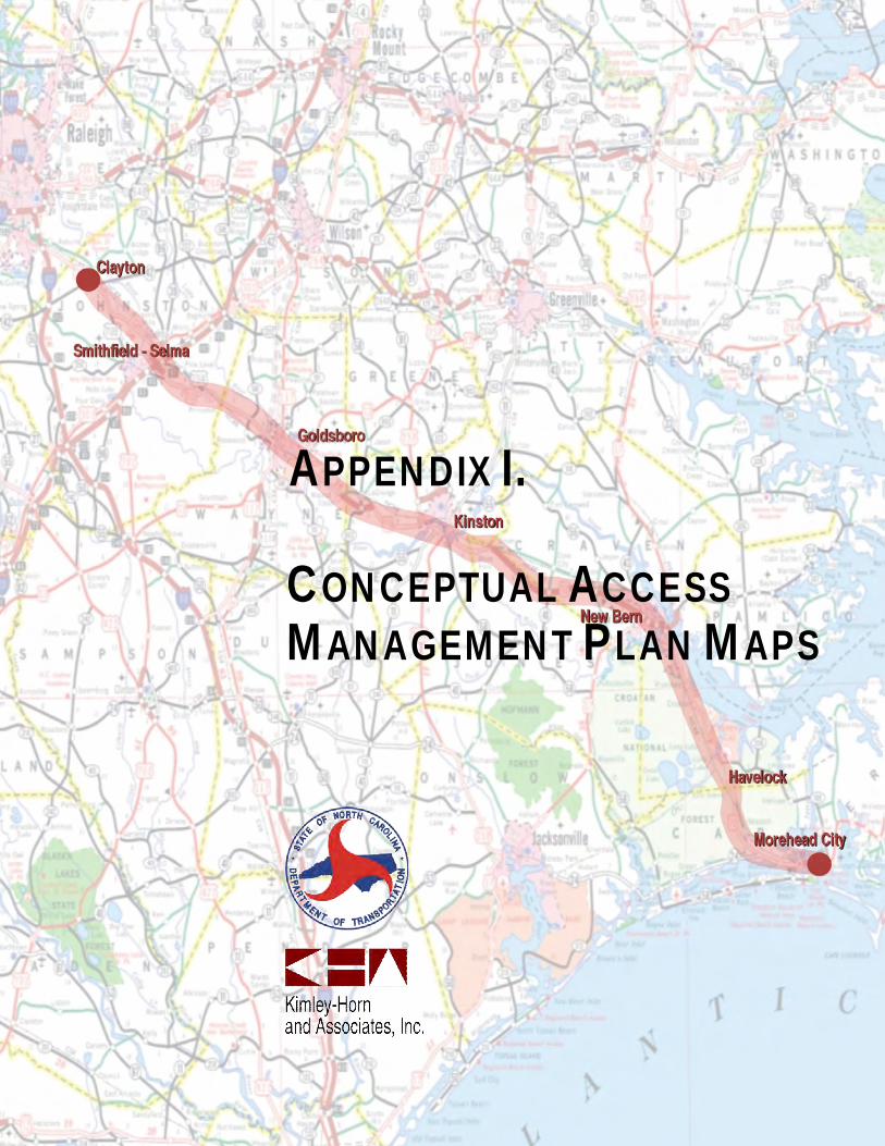
APPENDIX I.
CONCEPTUAL ACCESSMANAGEMENT PLAN MAPS