using gis and gps to deliver transportation projects in ... · to deliver transportation projects...
TRANSCRIPT
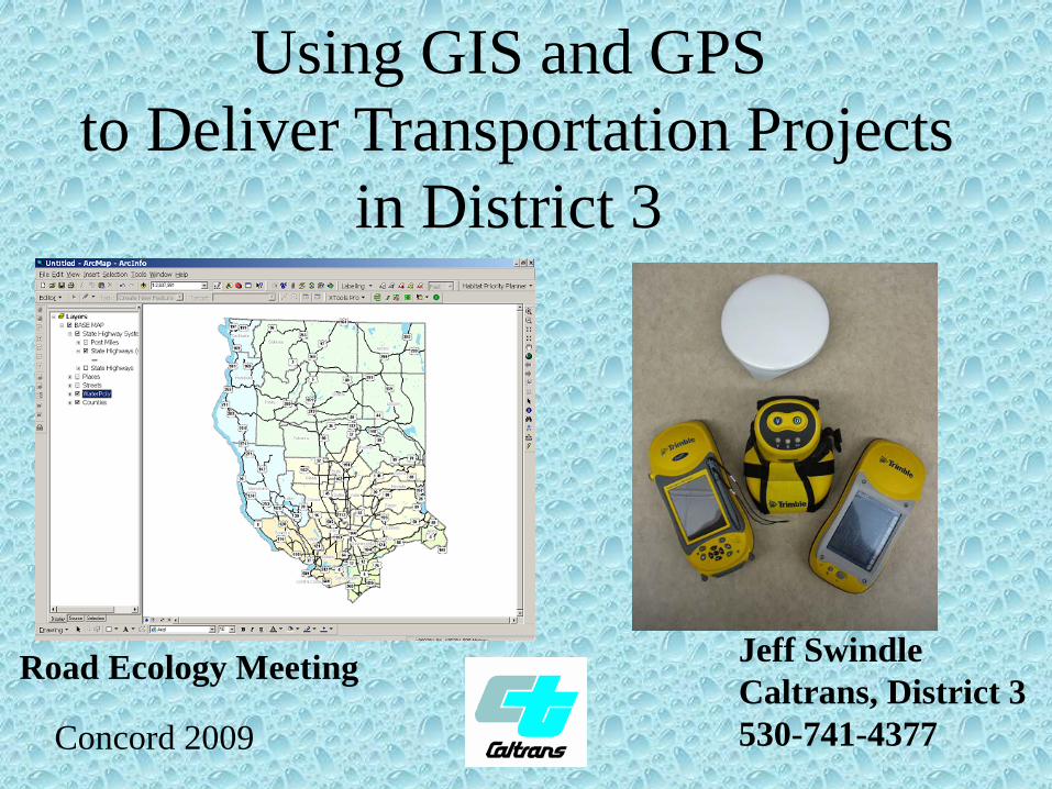
Using GIS and GPSto Deliver Transportation Projects
in District 3
Concord 2009
Jeff SwindleCaltrans, District 3530-741-4377
Road Ecology Meeting
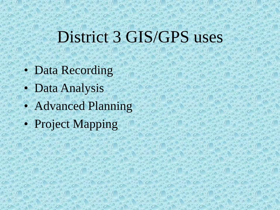
District 3 GIS/GPS uses
• Data Recording• Data Analysis• Advanced Planning• Project Mapping

Data Recording - FleemanMitigation site for Valley Elderberry Longhorn Beetle (VELB) impacts for 5 projects.
Data used to determine annual success and to develop the required yearly reports.

Fleeman

Data Analysis - Hanley
The property was identified in cooperation with CDFG for potential oak compensation. To determine the cost / benefit ratio, an analysis of the acreage and location of different habitat types was required. GIS allows for the placement of parcel split line.

Data Analysis - UBBWA
In order to determine if we are meeting success criteria a sampling methodology was used that allowed for random sampling and if necessary adaptation to a stratified random sampling scheme. Locations can be uploaded into the GPS unit and sampling locations can be determined in the field.
ISSUES: tried fishplot but couldn’t place a point to navigate to it.
Have excel spreadsheet Confidence Interval formula but won’t upload to GPS unit.

Advanced Mitigation Planning

Caltran’s Cottonwood Conservation
Area574 Total Acres:
•91.08 acres of Vernal Pools•447.38 acres of Swainson’s Hawk and Burrowing Owl foraging habitat
•Landowner negotiated an envelope for house site.

Vernal Pool Mapping
Consultant mapped location and shape of all vernal pool shrimp habitat and location of all shrimp sightings.

Service Area
Identified Service Area was agreed to by USFWS.

Exotic Plant Locations
As agreed to in the Operation and Maintenance plan, the landowner is required to keep the exotic plant distribution at the current level or lower.

Utility Easement Mapping
Identified location and size of Utility Easements for negotiations. USFWS wanted to remove all habitat within easement. Negotiated removal of only half. Saved 6.75 acres (approximately $675,000)

Tools that may be of interest.
• Xtools• GeoProcessing Wizard• Post Miler

Xtools - Feature Conversions
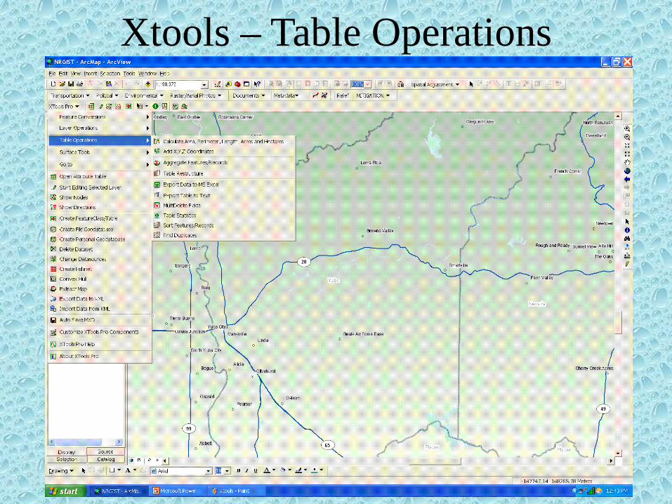
Xtools – Table Operations

XTools• It is an extension that can be added to ArcMap.• Full extension can be purchased but there are
several free tools that are available. Have had issues with subscription timing out and having to reload the extension.
• Find at www.xtoolspro.com/download.html• Must turn on Toolbar.
– Under pull down menu View. Click Toolbars and scroll to bottom.
– Under pull down menu Tools. Click on Extensions and click on box next to Xtools
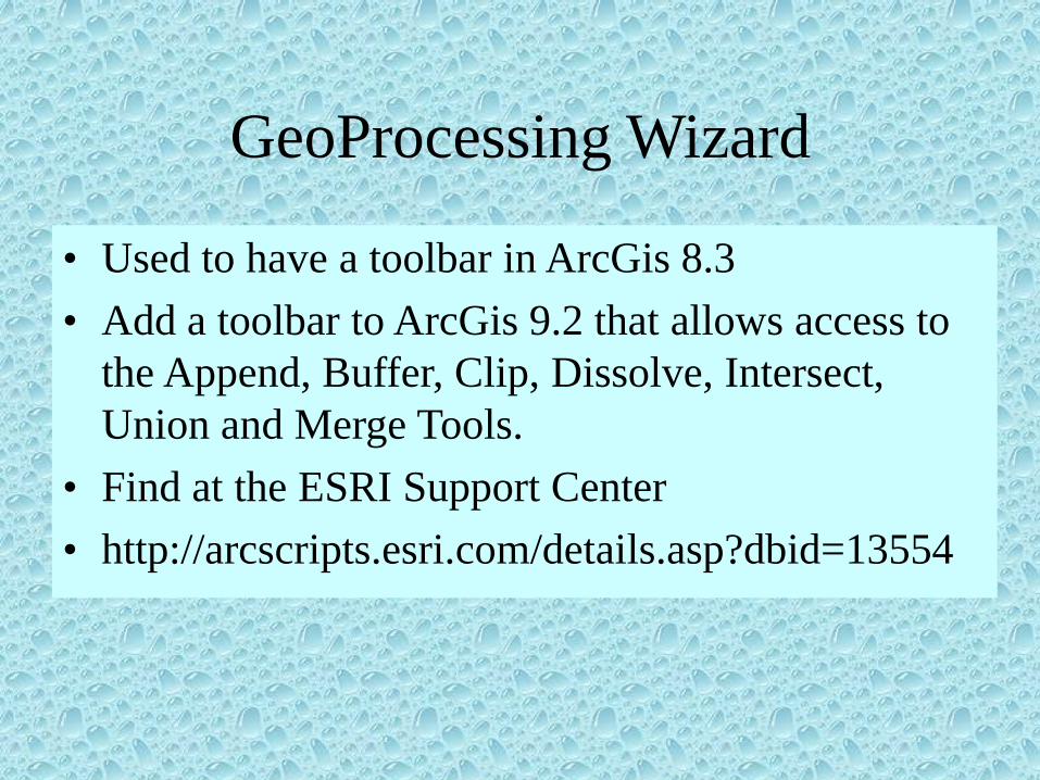
GeoProcessing Wizard
• Used to have a toolbar in ArcGis 8.3• Add a toolbar to ArcGis 9.2 that allows access to
the Append, Buffer, Clip, Dissolve, Intersect, Union and Merge Tools.
• Find at the ESRI Support Center• http://arcscripts.esri.com/details.asp?dbid=13554

GeoProcessing Toolbar
AppendBufferClipDissolveIntersectUnionMerge

Postmiler Toolbar• Creates a linear or point shape file based on
the beginning and ending post miles of your project.
Postmile Validation WizardPostmile Query Tool

WAKE UP!
WAKE UP!!
WAKE UP!!!

Projects in Development
• Mitigation and Monitoring Tracking• Pre-project Funding• Mitigation Bank Tool• Mitigation Button• Training

Mitigation and Monitoring Tracking
Identifying all properties where mitigation has taken place and where
monitoring may be required.

Pre-Project Funding
Identifying all projects (TSDP and Project Focus) and estimating impacts to determine mitigation needs.

Mitigation BanksAttempting to develop pull down menus that shows the location of each bank and the service area. Without it, the information is too cluttered.

Mitigation Button

Training

GPS Training• Several “how to” guides developed and borrowed:
– Quick guide to data collection– Transferring data to office computer– Differential Correction– Bluetooth Setup (from Culvert Inspection Program)– Laser Range Finder Setup (from Culvert Inspection
Program)– Trimble Hurricane Antenna setup (from Culvert
Inspection Program)• Binder with “Lessons Learned” tabs (ex. quick
start guide, using geobeacon, importing shape files from ArcMap, etc.)
• Had a Student Assistant that was to do one-on-one training – we know what happened with that.

GIS Training
• Need above and beyond ESRI Classes.• Developed an outline several years ago of tasks
we want to be able to do. Provided to our GIS Coordinator and HQ.
• We are working on developing 1-2 hour seminars on specific tasks. Converting DGNs, layouts, etc.
• Binder with “Lessons Learned” tabs (ex. export to CADD, Snapping, Tracing, DGN issues, polygon splitting, label expressions)

Developing Data
• Collect with GPS Units• Digitizing (DHIPP-0.3 meter resolution, NAIP – 1 meter resolution)
• Importing DGN Files• Data Concerns• Data Sources• NRGIST• Postmiler

GIS Data Concerns
• Takes a huge amount of time to keep the data up to date
• District 3 has a library of data that has been downloaded from the HQ library. Takes time to move down to local servers
• Serious issue with data being moved and links being broken
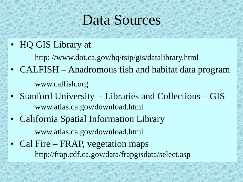
Data Sources• HQ GIS Library at
http: //www.dot.ca.gov/hq/tsip/gis/datalibrary.html• CALFISH – Anadromous fish and habitat data program
www.calfish.org• Stanford University - Libraries and Collections – GIS
www.atlas.ca.gov/download.html• California Spatial Information Library
www.atlas.ca.gov/download.html• Cal Fire – FRAP, vegetation maps
http://frap.cdf.ca.gov/data/frapgisdata/select.asp

GPS Concerns• Need someone to update the GPS Units.• For 2005 Series GeoXT make sure unit is
backed up using the Backup program• Do not keep in the charging cradle more
than a week at a time.• Always check charge before going into field• Always check settings before collecting
data. Don’t want to use someone else’s offsets.
• Make sure Terrasync hasn’t disappeared. May need to restore.
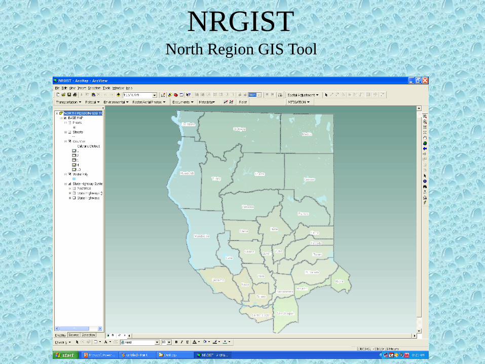
NRGISTNorth Region GIS Tool

NRGIST - Critical Habitat

Questions?Comments?Other Uses?
Jeff SwindleCaltrans, District 3530-741-4377
If it doesn’t frustrate you, you aren’t using it enough.If isn’t working – try it again and then try it again on someone else’s machine.Someone else has already done the suffering – find them and pick their brain.
Some machines are just possessed and like to see how hard you can hit the keyboard.