walks around gayton · for the last century or so, ... in this new version of ‘walks around...
TRANSCRIPT
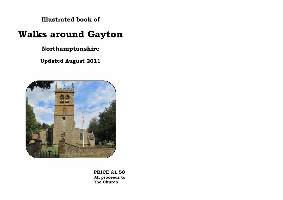
Illustrated book of
Walks around Gayton
Northamptonshire
Updated August 2011
PRICE £1.50 All proceeds to
the Church.
Walks around Gayton
Foreword to the Original Version
The twelve walks described in this booklet all begin and end at Fiveways
in the centre of the village. They vary in length from three to six miles
and they cover all the public footpaths in the parish and many in the
neighbouring villages of Tiffield, Rothersthorpe, Eastcote, Dalscote and
Blisworth.
The walks were originally compiled by members of the ‘Gayton Walkers’
group in 2003/2004 and have been featured in the Gayton News and on
the Gayton website. All twelve have been rewalked by the writer in the
spring and summer of 2006 and the descriptions and maps have been
revised to take account of any changes to our footpaths, such as the new
bridge over the railway line and canal on Banbury Lane, replacing the
level crossing, and any improvements, such as new stiles, gates and steps.
We are surrounded by beautiful, mostly unspoilt countryside here in
Gayton and the network of footpaths described in these pages, gives us
easy access to many fine views and points of interest. For our forefathers
these ancient rights of way were the essential links between villages and
were trodden by them for countless generations, as they went about their
daily lives. For the last century or so, they have been less vital perhaps,
and less used, but they remain, nevertheless, a priceless asset, available
or the enjoyment of all our residents, providing a source of healthy
exercise and an escape from hustle and bustle. Even in the turmoil of the
early 21st century, some of the best things in life are still free!
However like any valuable asset, it cannot be taken for granted. Access to
our footpaths is far from perfect. As mentioned in some of the
descriptions that follow, a number of footpath signs are missing or
broken, some stiles and bridges over streams are overgrown with hedges
and therefore inaccessible, or are in need of repair; some footpaths are
unmarked, where they cross cultivated fields. Constant vigilance is
required to ensure these rights of way remain open and accessible.
Finally, a few acknowledgements and thanks – to my fellow members of
the ‘Gayton Walkers’ group who helped compile these walks,
specifically Dennis Shaw, Geoff and Joan Wood, and Carol and David
Coppock; to Stanley Watterson, Parish Footpath Warden for providing us
with the ‘Rights of Way Definitive Map’ for our parish and for liaising
with the Rights of Way Department of the County Council; to Colin
Wicks of the Rights of Way Department, for taking the time to come and
talk to us and for responding to our footpaths survey of 2004; and to my
wife Wendy, for the fine hand drawn maps that illustrate the walks and
her editorial skills in pulling the booklet together into a coherent format.
Barry Steer, June 2006.
Foreword to the revised version.
In this new version of ‘Walks around Gayton’, the 12 routes are
unchanged, but the text has been revised to take account of the
several improvements to our 17 footpaths and 1 bridleway, which have
been made since 2006. Three new bridges have been installed, one on the
bridleway at the boundary with Pattishall, one on the footpath on Tiffield
Road and one on the footpath between Park Lane and Wrights Lane near
the sewage works. We have a number of new stiles and several new
finger post footpath signs. Last but not least, the Village Green
development has given us a new tarmac surface on the footpath across the
Green between the Village Hall and the School.
Consequently, many of the shortcomings on our footpaths, referred to in
the original foreword (written in 2006 and reproduced above), no longer
apply. On the other hand there are still broken stiles to repair or replace,
and there will always be plenty to do, to keep our footpaths open, clear
and accessible. Having taken over from Stan as Parish Footpath Warden,
I do try to walk all our paths at least once a year and I know I can count
on the help of ‘Gayton Walkers’ for any clearing work that needs doing.
Several new pictures have been included, many of them illustrating
the improvements.
Barry Steer, August 2011.
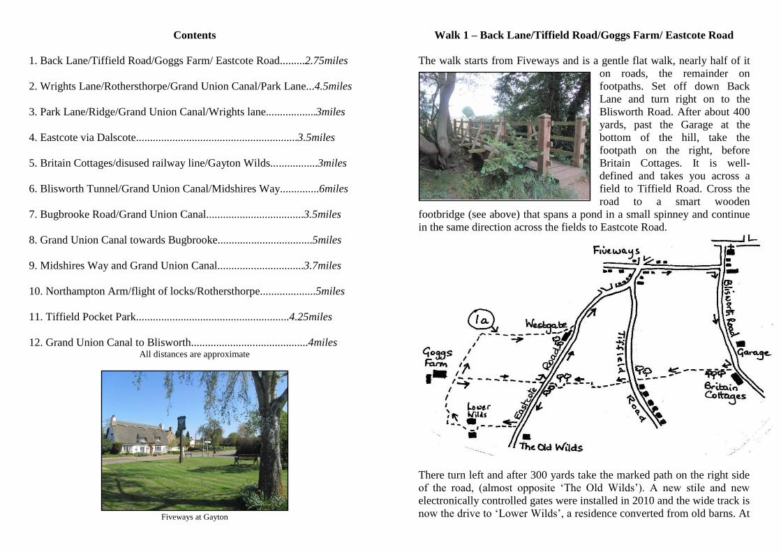
Contents
1. Back Lane/Tiffield Road/Goggs Farm/ Eastcote Road.........2.75miles
2. Wrights Lane/Rothersthorpe/Grand Union Canal/Park Lane...4.5miles
3. Park Lane/Ridge/Grand Union Canal/Wrights lane..................3miles
4. Eastcote via Dalscote..........................................................3.5miles
5. Britain Cottages/disused railway line/Gayton Wilds.................3miles
6. Blisworth Tunnel/Grand Union Canal/Midshires Way..............6miles
7. Bugbrooke Road/Grand Union Canal...................................3.5miles
8. Grand Union Canal towards Bugbrooke..................................5miles
9. Midshires Way and Grand Union Canal...............................3.7miles
10. Northampton Arm/flight of locks/Rothersthorpe....................5miles
11. Tiffield Pocket Park.......................................................4.25miles
12. Grand Union Canal to Blisworth..........................................4miles All distances are approximate
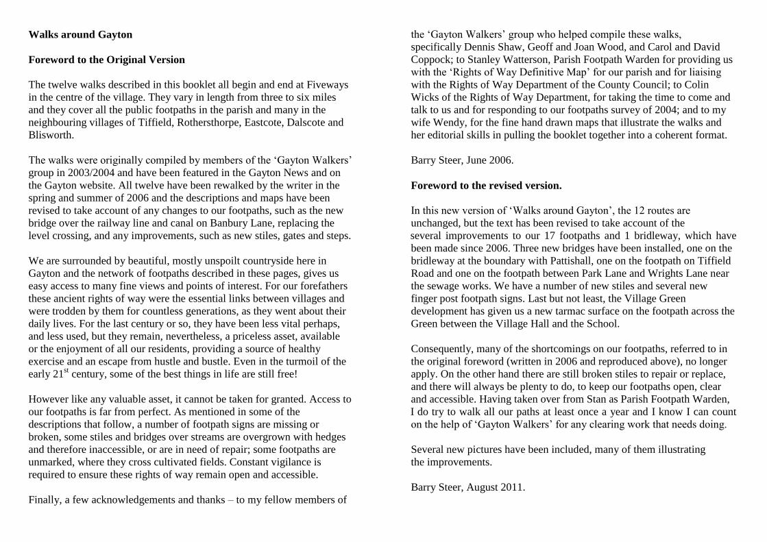
Fiveways at Gayton
Walk 1 – Back Lane/Tiffield Road/Goggs Farm/ Eastcote Road
The walk starts from Fiveways and is a gentle flat walk, nearly half of it
on roads, the remainder on
footpaths. Set off down Back
Lane and turn right on to the
Blisworth Road. After about 400
yards, past the Garage at the
bottom of the hill, take the
footpath on the right, before
Britain Cottages. It is well-
defined and takes you across a
field to Tiffield Road. Cross the
road to a smart wooden
footbridge (see above) that spans a pond in a small spinney and continue
in the same direction across the fields to Eastcote Road.
There turn left and after 300 yards take the marked path on the right side
of the road, (almost opposite ‘The Old Wilds’). A new stile and new
electronically controlled gates were installed in 2010 and the wide track is
now the drive to ‘Lower Wilds’, a residence converted from old barns. At

the end of the drive, the path goes between the house and a new stable
building and then immediately right around the end of the garden to a gap
in the hedge, which leads onto a horse exercise track. Go straight across
the track and through another gate, set into the horse track fence, which
you have to duck under – the headroom is about 4 feet. Then walk
diagonally across the field to a stile set in the hedge, on your left. Go over
the stile, turn right and walk along to the end of the field to another stile,
which brings you out to the very grand gates of Goggs Farm. At this point
you turn right and walk back towards Eastcote Road along the footpath
which runs parallel with the drive to Goggs Farm but to the right of the
hedge. The grassy path leads to a stile in the hedge and out onto Eastcote
Road.
From there you have a straight walk back to Fiveways via Hillcrest Road
and past the Village Hall. From the paths of the latter part of the walk
there are extensive views across the countryside towards Bugbrooke.
Walk 1a
This is a variation on walk 1. When you reach the gates of Goggs Farm,
instead of turning right, walk straight on through a gap on the other side
of the gates with the fence and hedge on your right. At the end of the first
paddock, go through a narrow gate, cross the second paddock and go
through another narrow gate. Then cross the third paddock and go over a
stile, into a cultivated field. Continue following the hedge on your right
and at the end of this field is another stile. The path then veers to the right
and takes you back to Eastcote Road just after Westgate. Turn left and
walk along the road back to Gayton. Length of walk about 2.75 miles
Walk 2 -Wrights Lane/Rothersthorpe/Grand Union Canal/Park Lane
From Fiveways, set off via Baker Street to Wrights Lane opposite the
churchyard. Almost immediately on the right, at the public footpath sign,
go through the gate into a paddock. Walk across to the stile in the far left
hand corner and go over it into another paddock, cross it and go through a
swing gate into a cultivated field. The correct route of the footpath is
diagonally across the field, going downhill, to a stile. However the path is
not marked and it is easier to walk around the edge of the field on the
grassy verge, until you reach the stile, set in the hedge at the bottom of the
field. Climb over the stile into a grassy field and walk downhill towards
the bridge over the railway line, in the bottom right hand corner. Climb
over the stile next to the new gate, walk over the railway bridge and then
over the canal bridge.
Continue in the same direction towards Rothersthorpe, keeping close by
the hedge on the right. After about 250 yards, you will arrive at a copse
where you need to veer left for a few yards to reach a small opening into
the woods, that leads onto a
footbridge (see left) across a
stream. After the bridge, the path
bears right and continues through
the copse for about 120 yards,
emerging into a field. Follow the
right edge of the field to the corner,
where you go through a gap in the
hedge and turn left. You then go
straight ahead, crossing 2 fields,
keeping the hedge on your left.
Go over a stile and make for the white cottage about 300 yards on the
other side of the field. There, go through a swing gate and into a lane by
the church in Rothersthorpe. On reaching the road, turn right, soon
passing the Baptist chapel and two mid-17th century cottages (the Old
Bakehouse and Garden Cottage).
After a few yards, climb over a stile at the gap in the wall on the right.
This path leads across a field for about 100 yards to a stile and a bridge

over a stream. In a short distance along the beaten path go over another
stile and continue for about 200 yards along the path, bearing partly left to
one more stile close to the road. Go over the stile and ignoring the
adjacent stile, which leads on to the road, continue on the path bearing
right away from the road, towards a gate.
After the gate, the path runs almost parallel to a wire fence, a few metres
to your left. The path moves gradually closer to the fence and eventually
crosses it via a stile. Follow the path down to a large pond, complete with
island and resident ducks. Continue round the pond to a rusty iron gate.
Go through the iron gate (not the wooden swing gate to your right) and
follow the direction of the arrow marker, bearing about 20 degrees away
from the hedge on your right, across a grassy field to a stile just to the left
of a stone and brick building in the next field. Go over the stile, walk
around the building (described on the map as Oldfield) and down to a tall
hedge on the right. The path follows the hedge to Milton Road.
Turn right on Milton road and walk up to the canal bridge. Join the
towpath on the near side of the bridge, turn sharp right and walk back
under the bridge in the direction of Wrights Lane. Leave the towpath at
the second bridge (Wrights Lane) and walk up the road towards Gayton.
A short distance past the railway bridge take the sign-posted footpath to
the right. The sign post has an elder tree growing round it, so for much of
the year is almost invisible. Next to it is a stile, which is overgrown by the
hedge and unusable. So go through the adjacent gate. The correct route of
the footpath is across the field, but as it is usually cultivated and the path
unmarked, it is easier to go right along the edge of the field for about 300
yards to the long wooden bridge over a stream. Crossing this, and keeping
fairly close to the hedgerow, on your left, climb gently uphill across the
grassy field for about a quarter mile and pass through the gate (there is no
stile) into a lane bordered by hedges.
In a short while you'll reach Park Lane and turning left you'll eventually
reach the High Street in Gayton via the Eykyn Arms car park. And so
going past the two village pubs, you'll arrive back at Fiveways.
Length of walk about 4.5 miles
Walk 3 – Park Lane/Ridge/new bridge/Grand Union Canal/Wrights
Lane
From Fiveways set off down the High Street to Park Lane past the Eykyn
Arms car park. Continue to the end of the lane, ignoring the first footpath
sign to the right, turn right at the second footpath signpost on to a wide
track between two hedgerows. From this track, known locally as the
Ridge, are extensive panoramic views all round. The hedgerow on the
left ends after about 200 yards and you continue along the track keeping
close to the hedgerow on the right. Pause for a while at the green steel
seat, located to the right of the path, at a gap in the hedge. From here you
can enjoy some of the best views in the county, over the Nene valley, to
the Grand Union canal, to Bugbrooke and beyond.
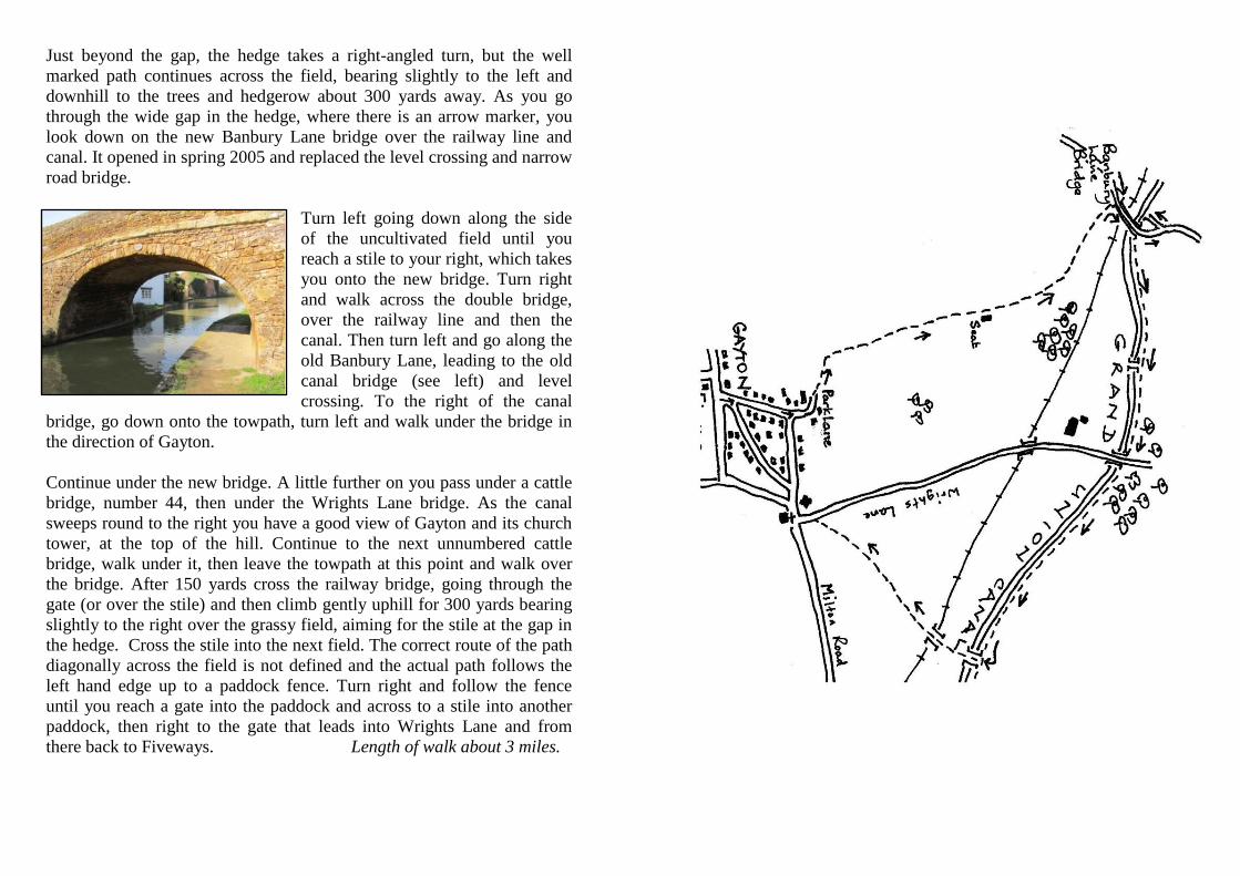
Just beyond the gap, the hedge takes a right-angled turn, but the well
marked path continues across the field, bearing slightly to the left and
downhill to the trees and hedgerow about 300 yards away. As you go
through the wide gap in the hedge, where there is an arrow marker, you
look down on the new Banbury Lane bridge over the railway line and
canal. It opened in spring 2005 and replaced the level crossing and narrow
road bridge.
Turn left going down along the side
of the uncultivated field until you
reach a stile to your right, which takes
you onto the new bridge. Turn right
and walk across the double bridge,
over the railway line and then the
canal. Then turn left and go along the
old Banbury Lane, leading to the old
canal bridge (see left) and level
crossing. To the right of the canal
bridge, go down onto the towpath, turn left and walk under the bridge in
the direction of Gayton.
Continue under the new bridge. A little further on you pass under a cattle
bridge, number 44, then under the Wrights Lane bridge. As the canal
sweeps round to the right you have a good view of Gayton and its church
tower, at the top of the hill. Continue to the next unnumbered cattle
bridge, walk under it, then leave the towpath at this point and walk over
the bridge. After 150 yards cross the railway bridge, going through the
gate (or over the stile) and then climb gently uphill for 300 yards bearing
slightly to the right over the grassy field, aiming for the stile at the gap in
the hedge. Cross the stile into the next field. The correct route of the path
diagonally across the field is not defined and the actual path follows the
left hand edge up to a paddock fence. Turn right and follow the fence
until you reach a gate into the paddock and across to a stile into another
paddock, then right to the gate that leads into Wrights Lane and from
there back to Fiveways. Length of walk about 3 miles.
Walk 4 - Eastcote via Dalscote – 3.5 miles
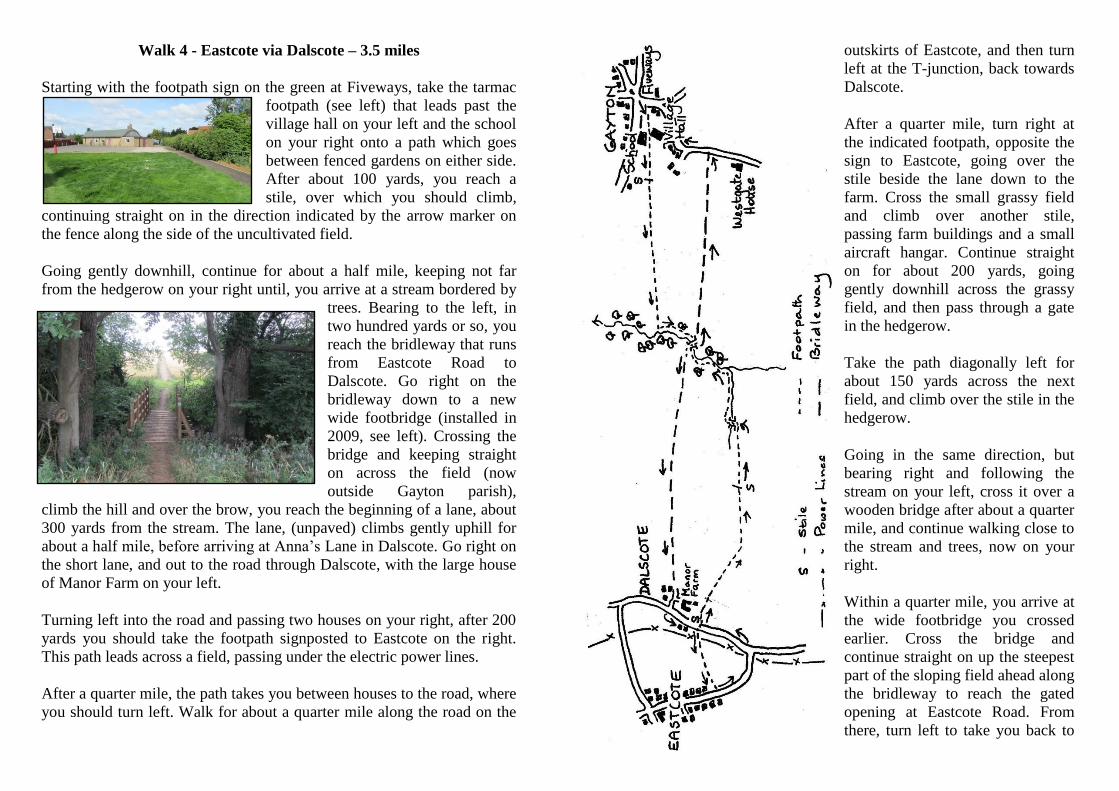
Starting with the footpath sign on the green at Fiveways, take the tarmac
footpath (see left) that leads past the
village hall on your left and the school
on your right onto a path which goes
between fenced gardens on either side.
After about 100 yards, you reach a
stile, over which you should climb,
continuing straight on in the direction indicated by the arrow marker on
the fence along the side of the uncultivated field.
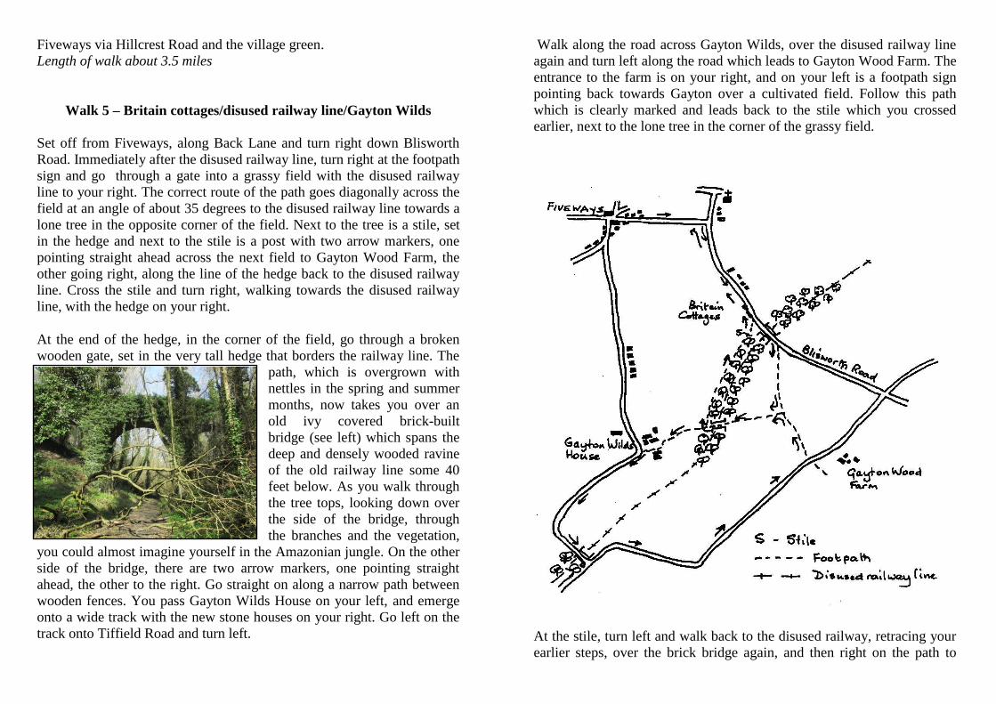
Going gently downhill, continue for about a half mile, keeping not far
from the hedgerow on your right until, you arrive at a stream bordered by
trees. Bearing to the left, in
two hundred yards or so, you
reach the bridleway that runs
from Eastcote Road to
Dalscote. Go right on the
bridleway down to a new
wide footbridge (installed in
2009, see left). Crossing the
bridge and keeping straight
on across the field (now
outside Gayton parish),
climb the hill and over the brow, you reach the beginning of a lane, about
300 yards from the stream. The lane, (unpaved) climbs gently uphill for
about a half mile, before arriving at Anna’s Lane in Dalscote. Go right on
the short lane, and out to the road through Dalscote, with the large house
of Manor Farm on your left.
Turning left into the road and passing two houses on your right, after 200
yards you should take the footpath signposted to Eastcote on the right.
This path leads across a field, passing under the electric power lines.
After a quarter mile, the path takes you between houses to the road, where
you should turn left. Walk for about a quarter mile along the road on the
outskirts of Eastcote, and then turn
left at the T-junction, back towards
Dalscote.
After a quarter mile, turn right at
the indicated footpath, opposite the
sign to Eastcote, going over the
stile beside the lane down to the
farm. Cross the small grassy field
and climb over another stile,
passing farm buildings and a small
aircraft hangar. Continue straight
on for about 200 yards, going
gently downhill across the grassy
field, and then pass through a gate
in the hedgerow.
Take the path diagonally left for
about 150 yards across the next
field, and climb over the stile in the
hedgerow.
Going in the same direction, but
bearing right and following the
stream on your left, cross it over a
wooden bridge after about a quarter
mile, and continue walking close to
the stream and trees, now on your
right.
Within a quarter mile, you arrive at
the wide footbridge you crossed
earlier. Cross the bridge and
continue straight on up the steepest
part of the sloping field ahead along
the bridleway to reach the gated
opening at Eastcote Road. From
there, turn left to take you back to
Fiveways via Hillcrest Road and the village green.
Length of walk about 3.5 miles
Walk 5 – Britain cottages/disused railway line/Gayton Wilds
Set off from Fiveways, along Back Lane and turn right down Blisworth
Road. Immediately after the disused railway line, turn right at the footpath
sign and go through a gate into a grassy field with the disused railway
line to your right. The correct route of the path goes diagonally across the
field at an angle of about 35 degrees to the disused railway line towards a
lone tree in the opposite corner of the field. Next to the tree is a stile, set
in the hedge and next to the stile is a post with two arrow markers, one
pointing straight ahead across the next field to Gayton Wood Farm, the
other going right, along the line of the hedge back to the disused railway
line. Cross the stile and turn right, walking towards the disused railway
line, with the hedge on your right.
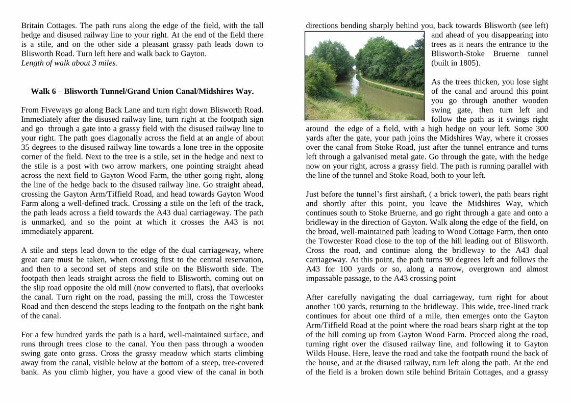
At the end of the hedge, in the corner of the field, go through a broken
wooden gate, set in the very tall hedge that borders the railway line. The
path, which is overgrown with
nettles in the spring and summer
months, now takes you over an
old ivy covered brick-built
bridge (see left) which spans the
deep and densely wooded ravine
of the old railway line some 40
feet below. As you walk through
the tree tops, looking down over
the side of the bridge, through
the branches and the vegetation,
you could almost imagine yourself in the Amazonian jungle. On the other
side of the bridge, there are two arrow markers, one pointing straight
ahead, the other to the right. Go straight on along a narrow path between
wooden fences. You pass Gayton Wilds House on your left, and emerge
onto a wide track with the new stone houses on your right. Go left on the
track onto Tiffield Road and turn left.
Walk along the road across Gayton Wilds, over the disused railway line
again and turn left along the road which leads to Gayton Wood Farm. The
entrance to the farm is on your right, and on your left is a footpath sign
pointing back towards Gayton over a cultivated field. Follow this path
which is clearly marked and leads back to the stile which you crossed
earlier, next to the lone tree in the corner of the grassy field.
At the stile, turn left and walk back to the disused railway, retracing your
earlier steps, over the brick bridge again, and then right on the path to
Britain Cottages. The path runs along the edge of the field, with the tall
hedge and disused railway line to your right. At the end of the field there
is a stile, and on the other side a pleasant grassy path leads down to
Blisworth Road. Turn left here and walk back to Gayton.
Length of walk about 3 miles.
Walk 6 – Blisworth Tunnel/Grand Union Canal/Midshires Way.
From Fiveways go along Back Lane and turn right down Blisworth Road.
Immediately after the disused railway line, turn right at the footpath sign
and go through a gate into a grassy field with the disused railway line to
your right. The path goes diagonally across the field at an angle of about
35 degrees to the disused railway line towards a lone tree in the opposite
corner of the field. Next to the tree is a stile, set in the hedge and next to
the stile is a post with two arrow markers, one pointing straight ahead
across the next field to Gayton Wood Farm, the other going right, along
the line of the hedge back to the disused railway line. Go straight ahead,
crossing the Gayton Arm/Tiffield Road, and head towards Gayton Wood
Farm along a well-defined track. Crossing a stile on the left of the track,
the path leads across a field towards the A43 dual carriageway. The path
is unmarked, and so the point at which it crosses the A43 is not
immediately apparent.
A stile and steps lead down to the edge of the dual carriageway, where
great care must be taken, when crossing first to the central reservation,
and then to a second set of steps and stile on the Blisworth side. The
footpath then leads straight across the field to Blisworth, coming out on
the slip road opposite the old mill (now converted to flats), that overlooks
the canal. Turn right on the road, passing the mill, cross the Towcester
Road and then descend the steps leading to the footpath on the right bank
of the canal.
For a few hundred yards the path is a hard, well-maintained surface, and
runs through trees close to the canal. You then pass through a wooden
swing gate onto grass. Cross the grassy meadow which starts climbing
away from the canal, visible below at the bottom of a steep, tree-covered
bank. As you climb higher, you have a good view of the canal in both
directions bending sharply behind you, back towards Blisworth (see left)
and ahead of you disappearing into
trees as it nears the entrance to the
Blisworth-Stoke Bruerne tunnel
(built in 1805).
As the trees thicken, you lose sight
of the canal and around this point
you go through another wooden
swing gate, then turn left and
follow the path as it swings right
around the edge of a field, with a high hedge on your left. Some 300
yards after the gate, your path joins the Midshires Way, where it crosses
over the canal from Stoke Road, just after the tunnel entrance and turns
left through a galvanised metal gate. Go through the gate, with the hedge
now on your right, across a grassy field. The path is running parallel with
the line of the tunnel and Stoke Road, both to your left.
Just before the tunnel’s first airshaft, ( a brick tower), the path bears right
and shortly after this point, you leave the Midshires Way, which
continues south to Stoke Bruerne, and go right through a gate and onto a
bridleway in the direction of Gayton. Walk along the edge of the field, on
the broad, well-maintained path leading to Wood Cottage Farm, then onto
the Towcester Road close to the top of the hill leading out of Blisworth.
Cross the road, and continue along the bridleway to the A43 dual
carriageway. At this point, the path turns 90 degrees left and follows the
A43 for 100 yards or so, along a narrow, overgrown and almost
impassable passage, to the A43 crossing point
After carefully navigating the dual carriageway, turn right for about
another 100 yards, returning to the bridleway. This wide, tree-lined track
continues for about one third of a mile, then emerges onto the Gayton
Arm/Tiffield Road at the point where the road bears sharp right at the top
of the hill coming up from Gayton Wood Farm. Proceed along the road,
turning right over the disused railway line, and following it to Gayton
Wilds House. Here, leave the road and take the footpath round the back of
the house, and at the disused railway, turn left along the path. At the end
of the field is a broken down stile behind Britain Cottages, and a grassy
path leads down to Blisworth Road. Here turn left, and follow the road to
Gayton. Length of walk about 6 miles.
Walk 7 – Bugbrooke Road/Grand Union Canal
From Fiveways walk along Bugbrooke Road past the school and between
the last bungalow and the new houss, take the footpath on the right. At the
beginning it runs to the left of the hedge, but after a short distance, goes
through a gap in the hedge and runs along the right side of the hedge to
the end of the field, where you reach a wide often muddy track. Turn right
on the track and walk back towards Park Lane and Gayton, then before
the first house, turn left on the footpath that leads down the hill, between
two high hedges. Continue until you reach a metal gate that leads into a
grassy field. At this point you have extensive views down to the railway
line the canal and to
Northampton. Go through
the gate and walk down
across the field towards the
bottom right corner. You
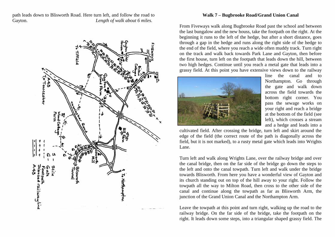
pass the sewage works on
your right and reach a bridge
at the bottom of the field (see
left), which crosses a stream
and a hedge and leads into a
cultivated field. After crossing the bridge, turn left and skirt around the
edge of the field (the correct route of the path is diagonally across the
field, but it is not marked), to a rusty metal gate which leads into Wrights
Lane.
Turn left and walk along Wrights Lane, over the railway bridge and over
the canal bridge, then on the far side of the bridge go down the steps to
the left and onto the canal towpath. Turn left and walk under the bridge
towards Blisworth. From here you have a wonderful view of Gayton and
its church standing out on top of the hill away to your right. Follow the
towpath all the way to Milton Road, then cross to the other side of the
canal and continue along the towpath as far as Blisworth Arm, the
junction of the Grand Union Canal and the Northampton Arm.
Leave the towpath at this point and turn right, walking up the road to the
railway bridge. On the far side of the bridge, take the footpath on the
right. It leads down some steps, into a triangular shaped grassy field. The
path follows the line of the railway fence, on your right, across the field,
then across a wooden bridge that spans a stream and up a slope to Milton
Road. Turn left and walk up the hill to Gayton and Fiveways.
Length of walk about 3 ½ miles.
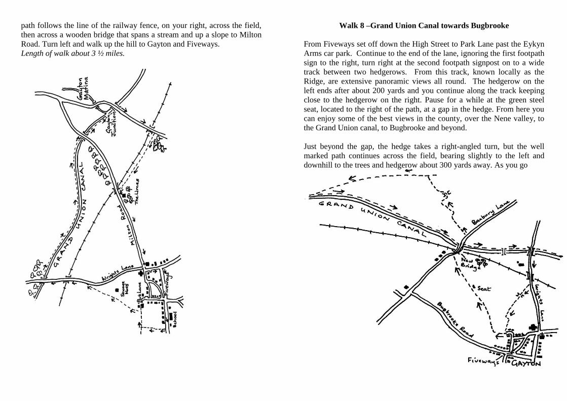
Walk 8 –Grand Union Canal towards Bugbrooke
From Fiveways set off down the High Street to Park Lane past the Eykyn
Arms car park. Continue to the end of the lane, ignoring the first footpath
sign to the right, turn right at the second footpath signpost on to a wide
track between two hedgerows. From this track, known locally as the
Ridge, are extensive panoramic views all round. The hedgerow on the
left ends after about 200 yards and you continue along the track keeping
close to the hedgerow on the right. Pause for a while at the green steel
seat, located to the right of the path, at a gap in the hedge. From here you
can enjoy some of the best views in the county, over the Nene valley, to
the Grand Union canal, to Bugbrooke and beyond.
Just beyond the gap, the hedge takes a right-angled turn, but the well
marked path continues across the field, bearing slightly to the left and
downhill to the trees and hedgerow about 300 yards away. As you go
through the wide gap in the hedge, where there is an arrow marker, you
look down on the new Banbury Lane bridge over the railway line and
canal. It opened in spring 2005 and replaced the level crossing.
Turn left going down along the side
of the uncultivated field until you
reach a stile to your right, which
takes you onto the new bridge (see
left). Turn right and walk across the
double bridge, over the railway line
and then the canal. Continue along
Banbury Lane in the direction of
Rothersthorpe for about 300 yards to
the foot path sign on your left. Take
this footpath, heading northwest in
the direction of Bugbrooke, with the hedge on your left. At the end of the
hedge, the well marked path crosses a cultivated field to a wooden bridge
over a stream. Continue over another cultivated field, and about three
quarters of the way across, you come to a fenced grassy field to your
right. Continue along the path with the fence on your right to an arrow
marker pointing left. Turn left, go over a stile and along a grassy path for
about 200 yards to another stile.
You are now on a wide farm track, which you follow to the junction of
Bugbrooke road and the Grand Union Canal. Turn left and walk down
onto the canal tow path, then left again and walk back towards Gayton.
You walk under the old Banbury Lane bridge, then under the new one,
then under a cattle crossing bridge
and you leave the tow path at
Wrights Lane.
Cross over the canal bridge (see left)
towards Gayton, cross the railway
bridge and take the footpath to the
right. There is a footpath sign in the
hedge and a stile, which is unusable,
because it is overgrown by the
hedge, so go through the gate. The
path should go diagonally across the field, but is unmarked, so it is easier
to follow the grassy verge around the edge of the field with the hedge on
your right, until you reach a wooden bridge, that goes through the hedge
and over a stream. You then walk uphill across a grassy field to the gate
in the top left hand corner. Go through the gate, (there is no stile) and up
the track which brings you back to Park Lane. Turn left and return to
Fiveways.
Length of walk about 5 miles.
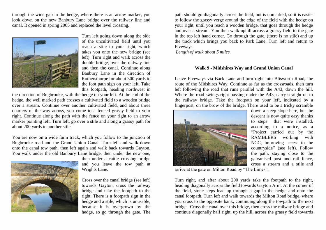
Walk 9 - Midshires Way and Grand Union Canal
Leave Fiveways via Back Lane and turn right into Blisworth Road, the
route of the Midshires Way. Continue as far as the crossroads, then turn
left following the road that runs parallel with the A43, down the hill.
Where the road swings right passing under the A43, carry straight on to
the railway bridge. Take the footpath on your left, indicated by a
fingerpost, on the brow of the bridge. There used to be a tricky scramble
down a steep slope here, but the
descent is now quite easy thanks
to steps that were installed,
according to a notice, as a
“Project carried out by the
RAMBLERS working with
NCC, improving access to the
countryside” (see left). Follow
the path, staying close to the
galvanised post and rail fence,
cross a stream and a stile and
arrive at the gate on Milton Road by “The Limes”.
Turn right, and after about 200 yards take the footpath to the right,
heading diagonally across the field towards Gayton Arm. At the corner of
the field, stone steps lead up through a gap in the hedge and onto the
canal footpath. Turn left and walk towards the Milton Road bridge, where
you cross to the opposite bank, continuing along the towpath to the next
bridge. Cross the canal over this bridge, then cross the railway bridge and
continue diagonally half right, up the hill, across the grassy field towards
Gayton. Cross the stile, set in the hedge, and go into the next field. The
correct route of the path diagonally across the field is not defined and the
actual path follows the left hand edge up to a paddock fence. Turn right
and follow the fence until you reach a gate into the paddock and across to
a stile into another paddock, then right to the gate that leads into Wrights
Lane and from there back to Fiveways.
.
Length of walk about 3.7 miles
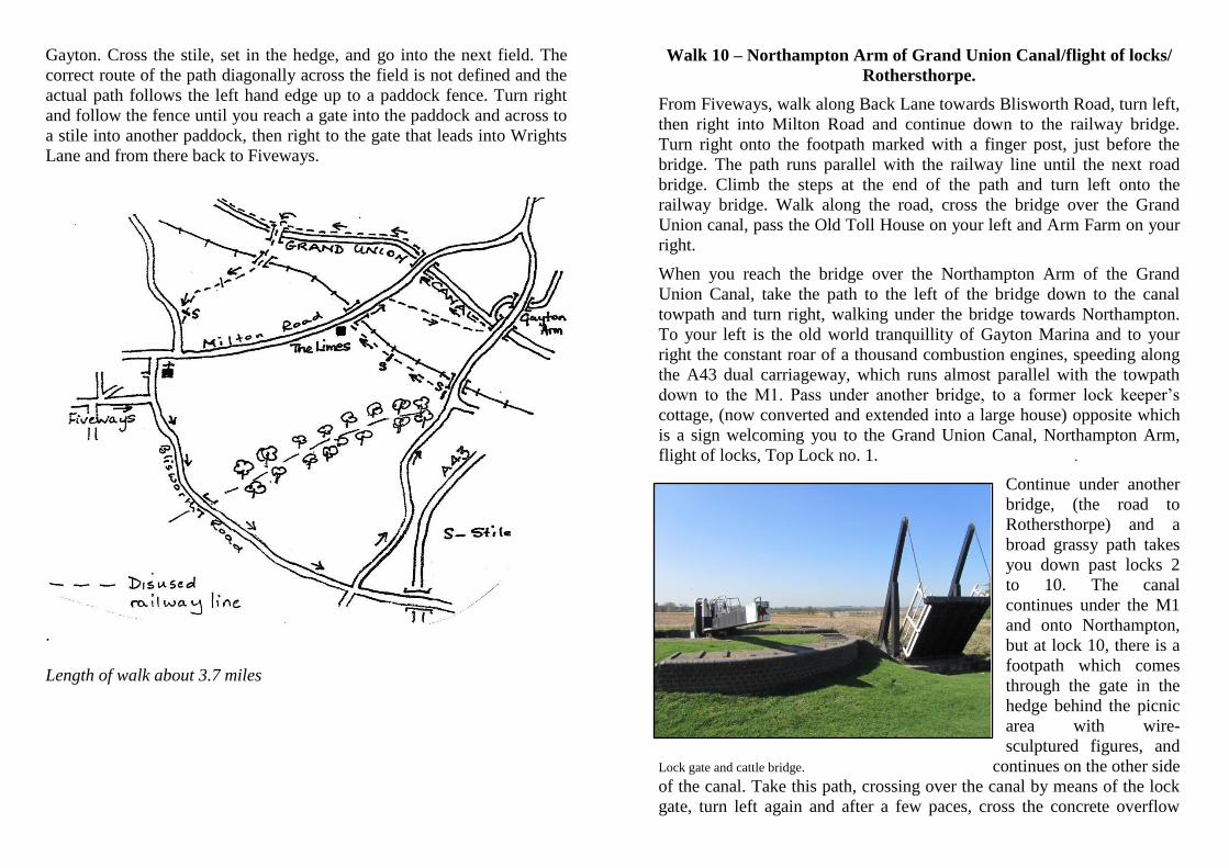
Walk 10 – Northampton Arm of Grand Union Canal/flight of locks/
Rothersthorpe.
From Fiveways, walk along Back Lane towards Blisworth Road, turn left,
then right into Milton Road and continue down to the railway bridge.
Turn right onto the footpath marked with a finger post, just before the
bridge. The path runs parallel with the railway line until the next road
bridge. Climb the steps at the end of the path and turn left onto the
railway bridge. Walk along the road, cross the bridge over the Grand
Union canal, pass the Old Toll House on your left and Arm Farm on your
right.
When you reach the bridge over the Northampton Arm of the Grand
Union Canal, take the path to the left of the bridge down to the canal
towpath and turn right, walking under the bridge towards Northampton.
To your left is the old world tranquillity of Gayton Marina and to your
right the constant roar of a thousand combustion engines, speeding along
the A43 dual carriageway, which runs almost parallel with the towpath
down to the M1. Pass under another bridge, to a former lock keeper’s
cottage, (now converted and extended into a large house) opposite which
is a sign welcoming you to the Grand Union Canal, Northampton Arm,
flight of locks, Top Lock no. 1. .
Continue under another
bridge, (the road to
Rothersthorpe) and a
broad grassy path takes
you down past locks 2
to 10. The canal
continues under the M1
and onto Northampton,
but at lock 10, there is a
footpath which comes
through the gate in the
hedge behind the picnic
area with wire-
sculptured figures, and
Lock gate and cattle bridge. continues on the other side
of the canal. Take this path, crossing over the canal by means of the lock
gate, turn left again and after a few paces, cross the concrete overflow
ditch (you have to jump!) and head along the edge of the spinney until
you reach a field. Alternatively it is a little easier to cross the canal at lock
9 and join the path where it enters the field.
On the map, the path now crosses cultivated fields and is unmarked. The
actual path follows the edge of the field, with the spinney to your right
then goes left, following the hedge and stream to the right. Ignore the
first gap in the hedge, identified by a plank and two large diameter pipes,
and cross the stream at the next gap, over a concrete bridge.
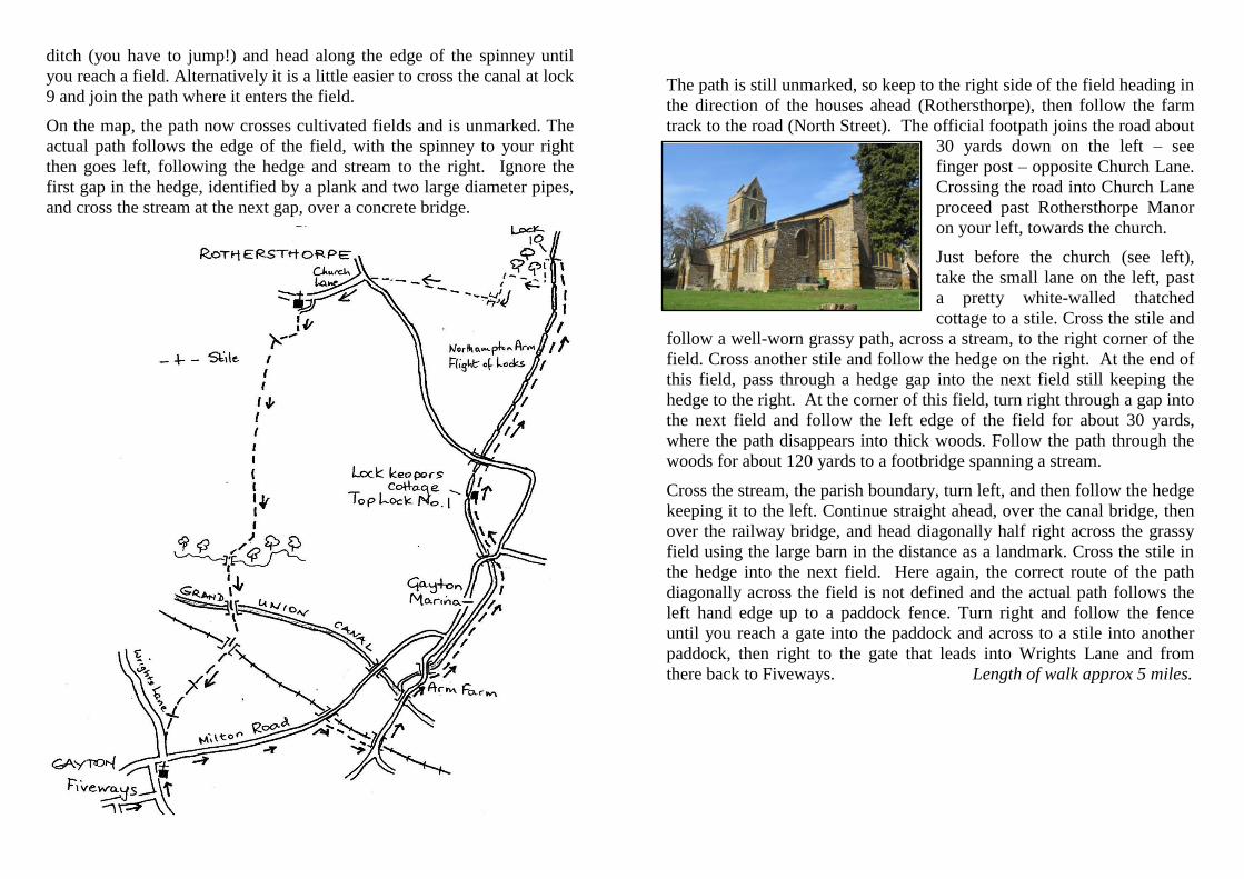
The path is still unmarked, so keep to the right side of the field heading in
the direction of the houses ahead (Rothersthorpe), then follow the farm
track to the road (North Street). The official footpath joins the road about
30 yards down on the left – see
finger post – opposite Church Lane.
Crossing the road into Church Lane
proceed past Rothersthorpe Manor
on your left, towards the church.
Just before the church (see left),
take the small lane on the left, past
a pretty white-walled thatched
cottage to a stile. Cross the stile and
follow a well-worn grassy path, across a stream, to the right corner of the
field. Cross another stile and follow the hedge on the right. At the end of
this field, pass through a hedge gap into the next field still keeping the
hedge to the right. At the corner of this field, turn right through a gap into
the next field and follow the left edge of the field for about 30 yards,
where the path disappears into thick woods. Follow the path through the
woods for about 120 yards to a footbridge spanning a stream.
Cross the stream, the parish boundary, turn left, and then follow the hedge
keeping it to the left. Continue straight ahead, over the canal bridge, then
over the railway bridge, and head diagonally half right across the grassy
field using the large barn in the distance as a landmark. Cross the stile in
the hedge into the next field. Here again, the correct route of the path
diagonally across the field is not defined and the actual path follows the
left hand edge up to a paddock fence. Turn right and follow the fence
until you reach a gate into the paddock and across to a stile into another
paddock, then right to the gate that leads into Wrights Lane and from
there back to Fiveways. Length of walk approx 5 miles.
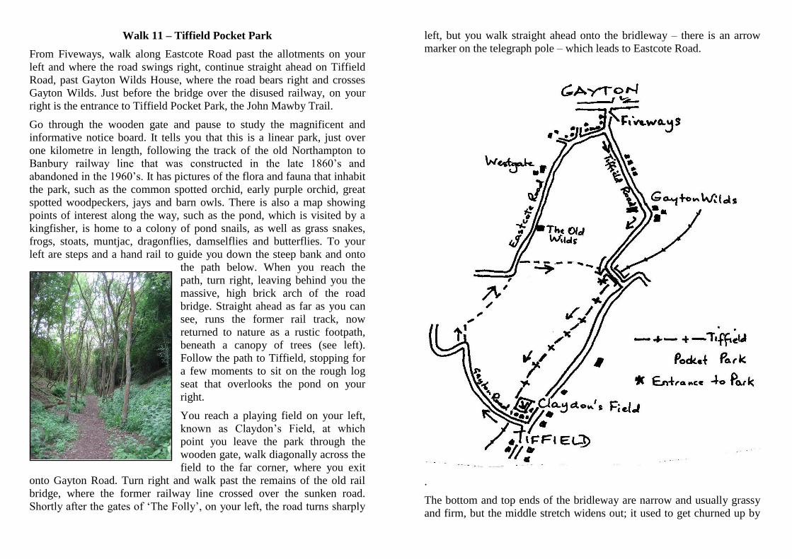
Walk 11 – Tiffield Pocket Park
From Fiveways, walk along Eastcote Road past the allotments on your
left and where the road swings right, continue straight ahead on Tiffield
Road, past Gayton Wilds House, where the road bears right and crosses
Gayton Wilds. Just before the bridge over the disused railway, on your
right is the entrance to Tiffield Pocket Park, the John Mawby Trail.
Go through the wooden gate and pause to study the magnificent and
informative notice board. It tells you that this is a linear park, just over
one kilometre in length, following the track of the old Northampton to
Banbury railway line that was constructed in the late 1860’s and
abandoned in the 1960’s. It has pictures of the flora and fauna that inhabit
the park, such as the common spotted orchid, early purple orchid, great
spotted woodpeckers, jays and barn owls. There is also a map showing
points of interest along the way, such as the pond, which is visited by a
kingfisher, is home to a colony of pond snails, as well as grass snakes,
frogs, stoats, muntjac, dragonflies, damselflies and butterflies. To your
left are steps and a hand rail to guide you down the steep bank and onto
the path below. When you reach the
path, turn right, leaving behind you the
massive, high brick arch of the road
bridge. Straight ahead as far as you can
see, runs the former rail track, now
returned to nature as a rustic footpath,
beneath a canopy of trees (see left).
Follow the path to Tiffield, stopping for
a few moments to sit on the rough log
seat that overlooks the pond on your
right.
You reach a playing field on your left,
known as Claydon’s Field, at which
point you leave the park through the
wooden gate, walk diagonally across the
field to the far corner, where you exit
onto Gayton Road. Turn right and walk past the remains of the old rail
bridge, where the former railway line crossed over the sunken road.
Shortly after the gates of ‘The Folly’, on your left, the road turns sharply
left, but you walk straight ahead onto the bridleway – there is an arrow
marker on the telegraph pole – which leads to Eastcote Road.
.
The bottom and top ends of the bridleway are narrow and usually grassy
and firm, but the middle stretch widens out; it used to get churned up by

horses and was very muddy but it
was recently resurfaced and is
now easier to walk.
When you emerge onto Eastcote
Road (see left), continue straight
ahead in the direction of Gayton
and after about 30 yards, turn
right onto a byway, which leads,
almost in a straight line, with the
hedge to your left, back to
Gayton Wilds. You reach the road just before the entrance to the Pocket
Park. Turn left and walk back to Gayton.
Length of walk about 4 ¼ miles.
For a shorter walk, comprising the 2 ¼ mile circuit starting at the entrance
to the Pocket Park, you can drive and park off the road at the start of the
byway, a few yards before the gate leading into the pocket park.
Walk 12 – Grand Union Canal to Blisworth
From Fiveways, walk down Baker Street, along Springs’ Orchard,
enjoying to your left the panoramic view of rolling green countryside and
straight ahead the Elizabethan manor house, an architectural Tudor gem,
and Gayton’s ancient church. Continue along Milton Road, down the hill,
over the railway
bridge and take the
footpath to the right,
which leads across
fields to Blisworth
Arm, the junction of
the Grand Union
Canal and the
Northampton Arm.
Alternatively, you
Marina at Blisworth Arm. can continue down Milton
Road to the canal bridge and walk along the towpath, on the right side of
the canal, towards Blisworth.
At Blisworth Arm, cross over the road bridge to the left side of the canal
and follow the towpath to Blisworth, walking under two road bridges on
the way.
At Blisworth, you walk past the garden gates of the houses on your left
and the former Blisworth Mill, now converted to flats, on your right.
Continue under the Towcester Road bridge, then leave the towpath here,
walk up the incline to the Towcester Road, cross the road, turn left and
right along the road that leads back to Gayton with Blisworth Mill on
your right. There is a footpath on the left side of this road, opposite
Blisworth Mill, which leads back to Gayton via Gayton Wood farm. Go
past this and take the second footpath. There is a wide grassy entrance,
between the end of the hedge and the end of a cottage garden, opposite
the entrance to a canal hire company. It leads to a wide padlocked
wooden gate, with a swing gate for walkers on the left.
Go through the gate and cross a grassy meadow, up a steep slope to the
opposite corner, where there is an oak tree, surrounded by thick nettles. A
narrow path leads through the nettles, (long trousers recommended here),
to a stile. Cross over the stile and follow the very well marked path uphill
through a large cultivated field. It joins the Blisworth Road just after Hill
Farm. From this point you walk along Blisworth Road, route of the
Midshires Way, and back to Gayton. Length of walk about 4 miles.
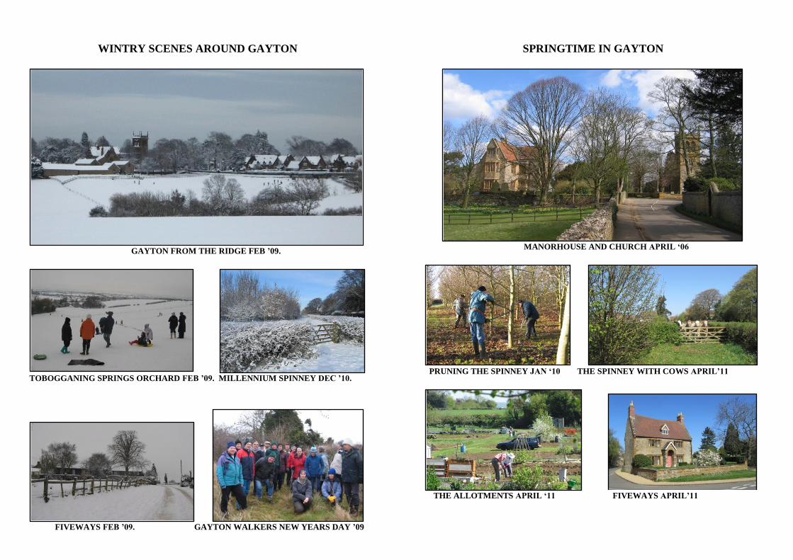
WINTRY SCENES AROUND GAYTON
GAYTON FROM THE RIDGE FEB ’09.
TOBOGGANING SPRINGS ORCHARD FEB ’09. MILLENNIUM SPINNEY DEC ’10.
FIVEWAYS FEB ’09. GAYTON WALKERS NEW YEARS DAY ’09
SPRINGTIME IN GAYTON
MANORHOUSE AND CHURCH APRIL ‘06
PRUNING THE SPINNEY JAN ‘10 THE SPINNEY WITH COWS APRIL’11
THE ALLOTMENTS APRIL ‘11 FIVEWAYS APRIL’11