wetland and forest monitoring in colombia carlos pedraza ...€¦ · k&c phase 4 – status...
TRANSCRIPT
K&C Phase 4 – Status report
Wetland and forest monitoring in ColombiaCarlos Pedraza
The Nature Conservancy
Science Team meeting #22Tokyo, Japan, February 16-18, 2016

The Nature Conservancy-Conserving critical lands, securing freshwater, restoring our
oceans and reducing impacts of climate change (avoid emissions, sequester carbon).
Understand flood plain dynamics (extent and vegetation associated) and monitor forest and carbon tendencies
Project outline and objectives

Sustainable cattle ranching in Colombia as an strategy for climate change: Carbon sequestration and emissions
reduction
Forest Monitoring , carbon mapping and environmental
Conservation

58,6million hectares of forests – 51%(IDEAM, 2014)
34.9 million hectares in pasture,occupies 32% of the territory (IGAC,2012)
> 75% of the agricultural land
22.6 million heads (Fedegan, 2014).Low inventory related to the area occupied
Cattle ranching in Colombia

At Landscape LevelConnectivity Corridors
Core strip
Buffer Strips
- Natural ecosystem fragments - Forest restoration
Only farmers that commit to strict conservation are part of the project
- Natural ecosystem fragments- Scattered trees- Intensive silvopastoral systems- Live fences- Wind breaks
Payment for land uses sufficientlycompatible with conservation
- Natural ecosystem fragments- Scattered trees- Intensive silvopastoral systems- Live fences- Wind breaks
Payment for land uses sufficientlycompatible with conservation
SEPLAN 2013; Estado de Acre

Fotos:CIPAV,Julián Chara
Carbon sequestration (land use) and emissions reduction (best practices)

Carbon Monitoring (Above ground and organic soil carbon sequestration
Soil and Life Cycle – GHG)
Areas to asses the mitigation effect to climate change
Feces, Urine
Aboveground Biomass forest, shrub, pastures
yAparent Density, Texture,
Humidity and Carbon

2007
Zero Deforestation Commitment

2008
Zero Deforestation Commitment
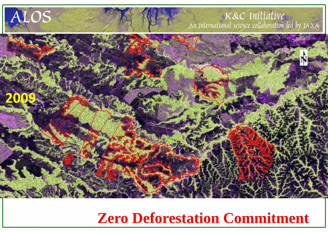
2009
Zero Deforestation Commitment
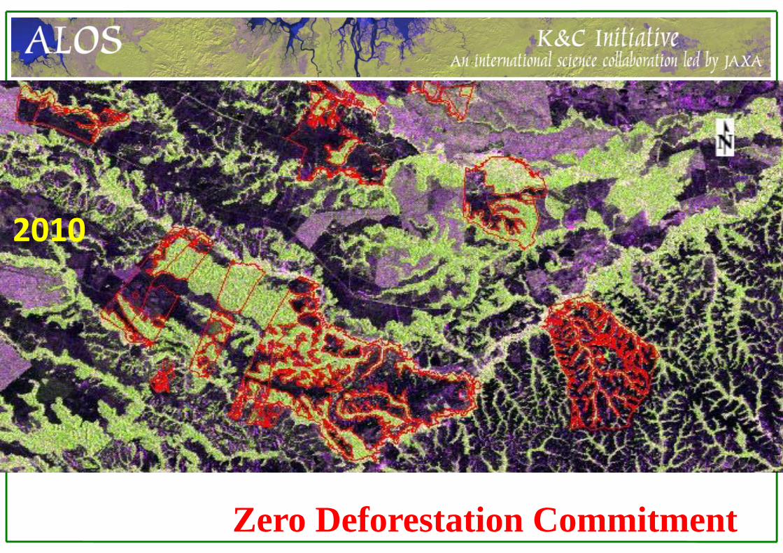
2010
Zero Deforestation Commitment

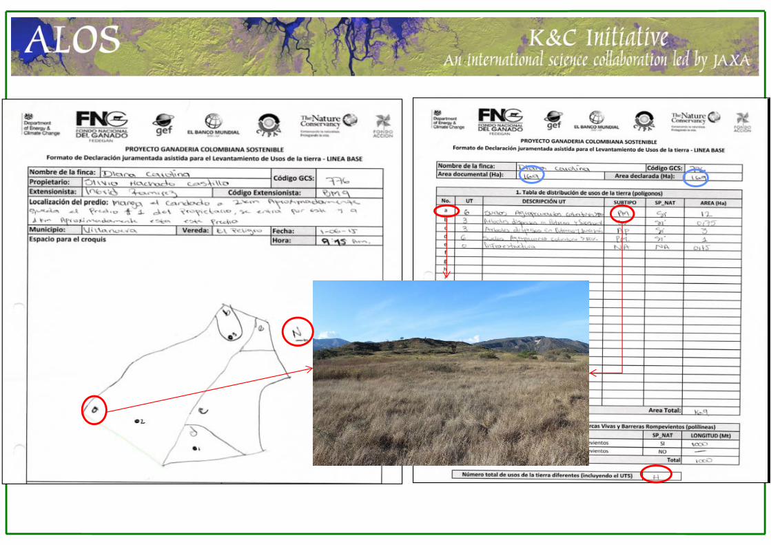
2700 farms deforestation monitoring and LULCC
91 Forest plots and 98 non-forest plots (carbon estimations)

SACLA-J Web
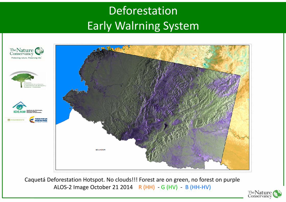
Caquetá Deforestation Hotspot. No clouds!!! Forest are on green, no forest on purpleALOS‐2 Image October 21 2014 R (HH) ‐ G (HV) ‐ B (HH‐HV)
DeforestationEarly Walrning System

Caquetá Deforestation Hotspot. No clouds!!! Forest are on green, no forest on purpleALOS‐2 Image January 05 2015 R (HH) ‐ G (HV) ‐ B (HH‐HV)
DeforestationEarly Walrning System

Application to National, departmental and basin level.
DeforestationEarly Walrning System
Deforestation drivers analysis

SCIENTIFIC WORKFLOW FOR ALOS‐1 and ALOS‐2
PRE‐PROCESSING

Scripting


Yearly forest/non-forest maps for all cattle ranching areas (fine products) 2007-2010. 2014-Dec. 2017Monthly forest/non-forest maps for Caquetá hotspot (ScanSar product) 2015-2016 Dec. Deforestation drivers analysisGeophotos of LULCC associated to sustainable cattle ranching project farms LULC Maps associated to sustainable cattle ranching project farms Dec. 2017 Yearly above ground biomass maps for three cattle ranching areas (fine products). 2016-2018
Project milestones & Data sharing
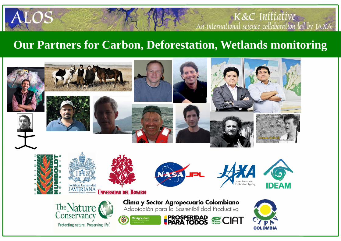
Our Partners for Carbon, Deforestation, Wetlands monitoring