whitefish point: wrecks and rescues - center for science...
TRANSCRIPT

lesson twelve
Wrecks and RescuesWhitefish Point:
Subject/Grade: Grades 6-8, Math and Social Studies
Duration: Three class periods
Materials needed: Per class:
• 1DVDorvideo:Tragedies in the Mist or Ghost Ships of the Great Lakes
• DVDplayerandprojectororTV-VCR
• Glossaryofshippingterms(Appendix)
Optional Supplies:
• Markers,coloredpencils,coloredpaper,glue,posterboard,transparencies
• Computerswithinternetaccess(1perstudentor1pergroup)
• ComputerProjector
Per student or group:
- VocabularyPyramids
- Datacollectionforms
- 2sheetsofpaper&pencil
Lesson OverviewStudents will research shipwrecks of Lake Superior, especially near Whitefish Point, and use their findings to create and analyze statistical data displays. Students will use “real-world” data to apply their mathematical presentation and data analysis skills. The lesson will demonstrate the essential role of mathematics in helping us to better understand our world.
Learning ObjectivesAfter this lesson, students will be able to1. Collect shipwreck data either via the internet or by visiting
the Great Lakes Shipwreck Museum at Whitefish Point.
2. Create various types of data displays using frequency table, scatter plot, box-and-whiskers plot, etc.
3. Analyze data to recognize patterns, trends, line of best fit, measures of central tendency.
4. Describe data: identify clusters, gaps, outliers, extremes, range.
5. Make data-based predictions or assessments from the results.
Carrie Miller

118 Lesson twelve Great Lakes Maritime Transportation
BackgroundThe Great Lakes system includes Lakes Ontario, Erie, Huron, Michigan, and Superior, their connecting waters, and the St. Lawrence River. It is one of the largest concentrations of fresh water on Earth. The opening of the St. Lawrence Seaway in 1959 allowed ocean-going vessels to travel through a system of canals from the Atlantic Ocean to the Great Lakes, as far as Duluth, MN in Lake Superior in order to access the great industrial and agricultural heartland of the North American continent. The entire distance totals 2,340 miles (3,768 km) to Duluth and 2,250 miles to Chicago, IL at the southern tip of Lake Michigan.
See “Surf Men of Shipwreck Coast” in this booklet for a short history of shipping on the Great Lakes and the establishment of the U.S. Life-Saving Service.
Advance Preparation If you cannot show a movie, download a story to read. Go to Shipwreck Stories Archives with more than 20 short stories to choose from---a good choice is “Lightkeepers Lost on the Lambton” because it is one of Lake Superior’s most tragic, yet nearly forgotten shipwrecks. http://www.shipwreckmuseum.com/stories.phtml?artid=60
Make copies of vocabulary pyramids or prepare Powerpoint slides with vocabulary pyramids for displaying with computer and projector. Use different words on each pyramid. Make 5 or more pyramids, depending upon number of students and amount of time available to play the game.
Make copies of data collection forms.
Note to Teachers: Students will need the skills and tools for collecting, organizing, summarizing, and analyzing
standardsMichigan Grade Level Content Expectations (GLCEs) Addressed
Grade 6 MathStrand A - AlgebraA.RP.06.08Understandthatrelationshipsbetweenquantitiescanbesuggestedbygraphsandtables.
A.RP.06.10Representsimplerelationshipsbetweenquantitiesusingverbaldescriptions,tables,andgraphs
Grade 7 MathStrand D - Data and ProbabilityD.RE.07.01Representandinterpretdatausingcirclegraphs,stemandleafplots,histograms,andbox-and-whiskerplots,andselectappropriate representation to address specificquestions.
D.AN.07.02Createandinterpretscatterplotsandfindlineofbestfitanduseanestimatedlineofbestfittoanswerquestionsaboutthedata.
D.AN.07.04Findandinterpretthemedian,quartiles,andinterquartilerangeofagivendataset.
Grade 8 MathStrand D - Data and ProbabilityD.AN.08.01Determinewhichmeasuresofcentraltendency(mean,median,ormode)bestrepresentadataset;justifythechoicemade.
D.AN.08.02Recognizepracticesofcollectinganddisplayingdatathatmaybiasthepresentationoranalysis
Grade 8 Social Studies8-U6.2.1UsehistoricalperspectivestoanalyzeissuesintheU.S.fromthepastandthepresent; conduct research on a historical issueortopic,identifyaconnectiontoacontemporaryissue,i.e.movementofgoods.

Great Lakes Maritime Transportation Lesson twelve 119
data such as using frequency tables, interpreting line and bar graphs and scatter plots. They should be able to analyze graphs to make predictions. Students should be able to make line plots, stem-and-leaf plots, box-and-whisker plots, bar graphs, and histograms. They should understand the three measures of central tendency (mean, median, and mode).
Procedure Focus Questions• WhatcausedshipwrecksontheGreatLakes?• WhichGreatLakehasthemostshipwrecks?
Why?• Whichmonthhasthemostshipwrecks?••
Whichtimeperiodhadthemostwrecks?Why?• Whichtypeofvesselisshipwreckedmost
frequently?• Howmanytotalliveshavebeenlostonthe
GreatLakes?
1. Watch a movie about Great Lakes shipwrecks, TragediesintheMist or GhostShipsoftheGreat Lakes, or read aloud Shipwreck Stories from the Great Lakes Shipwreck Museum website.
2. Discuss some of the common causes of shipwrecks (fog, wind, storms, shoals, navigational or human errors). Where do many of the shipwrecks take place? What would it have been like to work on one of these ships? What information do archaeologists use to determine the identity of shipwrecks in the Great Lakes? (The material the ship was made from, location of shipwreck, ship design.) Which shipwreck features are usually still present, and which features are often missing? (Visible features include masts, bow stem, anchor chain,
cargo hold, deck beams. Missing features could be deck planking.) Which is more important in identifying a shipwreck–historical or archival information? (They’re both important).
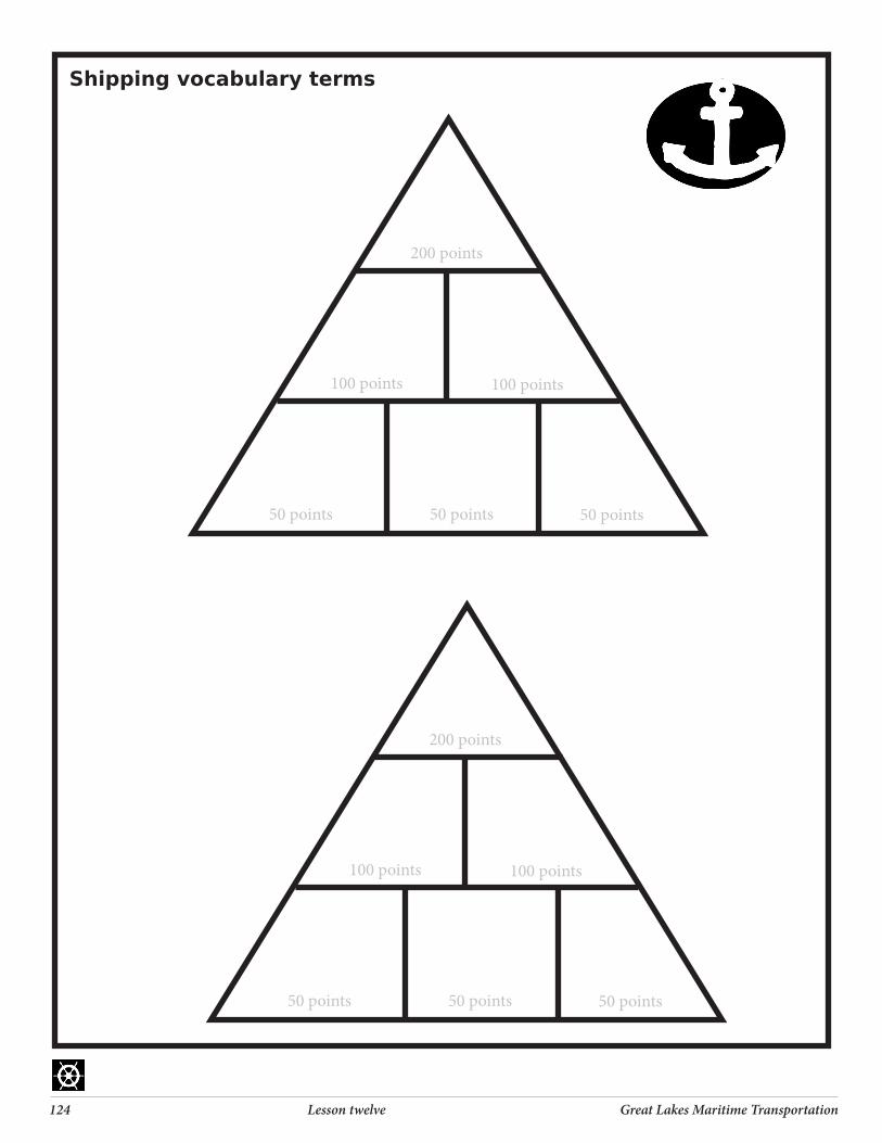
3. Play VocabularyPyramid game to generate interest, familiarize students with ship terms, and identify level of background knowledge. Tell students the topic of the terms is Great Lakes Shipping. Student should begin at the 50 point level and work their way up to the 200 point level. Give 15 – 30 seconds (depending on students’ abilities) to solve for each word. One student gives clues to another student who tries to guess the word. After playing once through all the words, students switch roles, get a new pyramid of different words and play again. Highest score wins. See attached list for words and for example of pyramid. Optional: make a powerpoint and use a projector to display photos of maritime words and topics.
4. Students will work in small groups or independently to research shipwrecked vessels–about 20 each. There are many ways to approach this research. All students may research the same vessels (see data collection tables: Shipwrecks at Whitefish Bay, or Whitefish Point), students may focus on shipwrecks at random in all of the Great Lakes system, or students may be assigned groups based on location (by lake: Ontario, Erie, Huron, Michigan, Superior, their connecting waters, and the St. Lawrence River).
5. There are many different variables that are possible to research. Suggested data to collect for each vessel includes: • Typeofvessel• Locationofshipwreck(whichGreatLake)

120 Lesson twelve Great Lakes Maritime Transportation
• Depthofshipwreck• Dateofshipwreck• Causeofshipwreck(storms,strandings,fires,
explosions, ice damage, collisions)• Vessellength• Vesselgrosstonnage• Yearoflaunch• Numberofliveslost
6. Use WebsitesforStudentUse to collect data and use the data collection forms to organize data. Forms with names of vessels lost at Whitefish Point and Whitefish Bay are included, as well as blank forms.
7. Create at least one appropriate data display: stem-and-leaf plot, frequency table, scatter plot, circle graph, box-and-whiskers plot, or histogram. Possible data displays:
a. Stem-and-leaf plot of the largest vessels’ length.
b. Stem-and-leaf plot of the largest vessels’ gross tonnage.
c. Frequency table of shipwrecks by location (Great Lake).
d. Frequency table of ships lost by year.e. Frequency table of shipwrecks by type of
vessel.f. Frequency table of shipwrecks by month.g. Scatter plot of month and number of
shipwrecks.h. Scatter plot of century and number of
shipwrecks.i. Scatter plot of type of vessel and number of
lives lost.j. Scatter plot of location (lake) and number of
shipwrecks.k. Circle graph of the percentage of causes of
shipwrecks.l. Circle graph of percentage of shipwrecks by
century.
m. Circle graph of percentage of wrecks by month.
n. Box-and-whiskers plot of the depth of the shipwrecks.
o. Bar graph of percentage of shipwrecks by month.
p. Histogram of number of lives lost per shipwreck.
q. Histogram of the number of wrecks and the percent of total losses.
r. Create your own choice of data display . . . as you can see the options are endless!
8. Analyze data. Find the measures of central tendency (mean, median, and mode). Which measure of central tendency best represents the data? Explain your reasoning.
9. If a box-and-whiskers plot is created, interpret the median, quartiles, and interquartile range.
How is the data spread out? What is the range? Describe any trends.
10. If a scatter plot is created, find the line of best fit and describe any obvious relationships.
11. Make data-based predictions from the results. If the trend or relationship continues into the future, what could you conclude? For example, if a ship were to sink, where and when would it be most likely to happen?
Assessment of Student Learning Students will present their findings to the class. Students should show the data display they created and explain their interpretation of the data, including any trends or relationships identified. They may present by writing on the board, creating

Great Lakes Maritime Transportation Lesson twelve 121
a poster, using overhead transparencies, or using an Excel spreadsheet to create data displays and show results to the class with a computer and a projector.
ExtensionsCreate a poster identifying parts of a ship.Create a map to display locations of shipwrecks on Lake Superior or the Great LakesCreate a bar graph showing volume various cargos shipped on the Great Lakes or traveling through the Soo Locks.Use a graphing calculator to make box-and-whisker plots.Use Great Lakes & Seaway Shipping (www.boatnerd.com ) to track your favorite vessel around the Great Lakes system.
Swayze, Dave. 1992. Shipwreck! Harbor House Publishers. Boyne City, Michigan
Great Lakes Seaway Shipping (Great Lakes Shipwreck File and Great Lakes Facts and Figures) http://www.boatnerd.com
Great Lakes Shipwreck Museum http://www.shipwreckmuseum.com (Shipwreck Stories Archives)
Great Lakes Shipwreck Preservation Society. http://www.glsps.org/
Great Lakes Under Water http://www.greatlakesunderwater.com/shipwreckmap.html
Lake Carriers Association (for information on ships, routes, cargoes, and volume shipped) http://www.lcaships.com
websites for student use
122 Lesson twelve Great Lakes Maritime Transportation
References A&E History Channel. Great Lakes Ghost Ship DVD(50min)
Great Lakes Shipwreck Museum. Lightkeepers Lost on the Lambton – April 19, 1922. http://www.shipwreckmuseum.com/
Hancock, Paul. (2004). Shipwrecks of the Great Lakes. Thunder Bay Press. Holt, MI.
Thunder Bay Marine Sanctuary & Underwater Pre-serve. Tragedies in the MistDVD(30min.)Alpena,MI. http://www.thunderbay.noaa.gov/

Great Lakes Maritime Transportation Lesson twelve 123
50 point words 100 point words 200 point wordsBeacon Galley Peninsula
Lifeboat Stern Elevation
Buoy Portside Ballast
Shoal Starboard Bulkhead
Capsize Saltie Maritime
Shipwreck Locks Furlong
Rudder Taconite Sagging
Mast Hogging
Bow Listing
Cargo
Freighter
Vocabulary Pyramid Game
Lake Elevation
Portside Starboard
Capsize Lifeboat Shoal
200 points
100 points 100 points
50 points50 points 50 points
Shipping vocabulary terms
124 Lesson twelve Great Lakes Maritime Transportation
200 points
100 points 100 points
50 points50 points 50 points
Shipping vocabulary terms
200 points
100 points 100 points
50 points50 points 50 points

Great Lakes Maritime Transportation Lesson twelve 125
Name ofShip
Type ofVessel
Date sunk
Depth found
Typeofloss Lossoflife
1
2
3
4
5
6
7
8
9
10
11
12
13
14
15
16
17
18
19
20
Shipwreck data collection table
OtherCategories(variables)toresearchcouldinclude:• Vessel’slength• Yearoflaunch

126 Lesson twelve Great Lakes Maritime Transportation
Shipwrecks at Whitefish Bay
Source: Shipwreck! by David Swayze
Name ofShip
Type ofVessel
Date sunk
Depth found
Typeofloss Lossoflife
1 CoastGuard
2 Comet freighter Aug 26 300 ft Collision 11
3 JohnB.Cowle freighter July 12 220 ft Collision 14
4 WilliamS.Crosth-
5 OraEndress
6 SuperiorCity
7 Vienna
8 Yosemite
9 Zillah
10
11
12
13
14
15
16
17
18
19
Types of Vessels:freighter,schooner,tug,passenger,etc.Types of Loss:galesorstorms,strandings,firesorexplosions,icedamage,collisions,orother

Great Lakes Maritime Transportation Lesson twelve 127
Name ofShip
Type ofVessel
Date sunk
Depth found
Typeofloss Lossoflife
1 Alberta
2 Algosoo
3 Bennington
4 Charlie
5 BerthaEndress
6 EdmundFitzgerald
7 GreyEagle
8 W.C.Griswold
9 HarrietAHart
10 Huronton
11 Invincible
12 Major
13 Milan
14 Missoula
15 John Mitchell
16 Myron
17 AlexNimick
18 Nucleus
19 JohnMOsborne
20 JuliaPalmer
21 Panther
22 Pearl
23 Plover
24 Sattelite
25 Saturn
26 WilliamFSauber
27 Servia
28 CJSheffield
29 AdellaShores
Shipwrecks at Whitefish Point
Source: Shipwreck! by David SwayzeTypes of Vessels:freighter,schooner,tug,passenger,etc.Types of Loss:galesorstorms,strandings,firesorexplosions,icedamage,collisions,orother

128 Lesson twelve Great Lakes Maritime Transportation
Sample of student work

Great Lakes Maritime Transportation Lesson twelve 129
Sample of student work

130 Lesson twelve Great Lakes Maritime Transportation
Sample of student work

Great Lakes Maritime Transportation Lesson twelve 131
Aft Behind or back
Aid to Navigation Device that is external to the vessel whose purpose is to assist a navigator in determining position.
Ballast Weight added to lower ship’s center of gravity in the water, to make it less top heavy when traveling with-out cargo. Fresh or salt water are most commonly used.
Bathymetry The topography of the lake or ocean bottom.
Beacon Light to aid navigation.
Bearing The direction to an object as measured from the boat.
Berth A place where a ship anchors or ties up to a dock.
Boat Smaller than a ship
Bow The front of the ship.
Broach When a vessel veers broadside to the wind and waves. See “listing.”
Buoy A floating object moored to the bottom to mark a channel to aid in navigation.
Buoyancy Upward force on an object produced by the sur-rounding liquid and equal to the weight of the displaced liquid
Cargo Goods carried by a ship. General cargo is boxed, bagged, crated or placed on a pallet. Bulk cargo is
loose–such as grain, iron ore, taconite pellets, or coal.
Cartographers Map-makers.
Channel The deeper part of a river or harbor for ships to pass through; a route between two bodies of water.
Chart Map of navigablewaterways; nautical version of a highway road map.
Commodity Anything that is bought and sold.
Course Direction in which a boat is intended to be steered.
Danger signal Five short toots.
Day beacon Unlighted fixed aid to navigation.
Deck Flat surface on the upper part of the ship where the crew and passengers can walk. Passenger ships have several decks, whereas a cargo ship (freighter) may have only one deck.
Dredging Removes bottom materials in order to keep navigation channels barrier-free and deep enough for ships to pass through. Dredging may disturb aquatic ecosystems by disrupting bottom-dwelling organisms, and may expose contaminated sediments previously buried on the lake bottom. Dredged materials require proper disposal.
Dock A long platform built next to the water as a landing place for ships.
Elevator A building for storing grain.
Glossary of Nautical Terms

132 Lesson twelve Great Lakes Maritime Transportation
Export To send goods from one country for sale in another.
Foghorn A horn blown during foggy weather to warn ships of danger.
Grounded When a ship runs aground in shallow waters or on rocky outcrops on the .
Harbor A place where ships may anchor and be safe from storms.
Hatch Doorway on a vessel. Hatchcovers are on the deck of a freighter where the vessel is loaded with cargo.
Head Bathroom on a vessel.
Heading The direction the boat is pointing.
Hogging Improper loading can cause vessel to “hog” causing a convex curve in hull.
Hull Lowermost portion of a ship floating partially sub-merged.
Import To bring goods into one country from another.
Inter-modal transportation Moving cargo using more than one mode of trans-portation, such as truck, railway, ship, or plane.
Invasive species Non-native species that are transported to a new area that typically have no natural predators (ex: zebra mussels).
Leg of a journey Portion of a trip.
Lifeboat Small craft aboard a ship to allow for emergency escape
Lighthouse Marks entrance to harbor or warns ship captain of shallow water or obstructions.
Line All ropes on a vessel are called lines.
Listing Tipping to the side
Locks Section of a waterway that can raise or lower water levels to allow vessels to move between water bodies of different elevations.
Longshoreman A person who works on the waterfront loading and unloading ships.
Marina Harbor where recreational boats may dock and pick up supplies.
Maritime Having to do with sailing or shipping on; nautical.
Maritime shipping Transportation of cargo via waterways.
Navigate Steer or control the course of a ship.
Navigational aids Device that is external to the vessel that assists a navigator in determining location; may include lighthouses, compasses, buoys, radios, etc.

Great Lakes Maritime Transportation Lesson twelve 133
Radar Radar helps ships find their way in the dark or in the fog.
Pilothouse Enclosed structure on the dick of a ship from which it can be navigated.
Port 1. A city or town with a harbor for loading/unloading ships. 2. Left-hand side of a vessel, facing forward.
Quarry Limestone and other stone used in construction and steel-making is mined from quarries and loaded into Great Lakes ships.
Range Two visible objects in a line, or the distance to an object
Sagging Improper loading can cause vessel to “sag” causing a concave curve in hull.
Ship Vessellargerthanaboat.
Shipping route Route which a freighter travels from one port to another.
Shipping Transportation of cargo via water, road, rail or air-plane using a freighter, train,
truck, or plane.
Shipwreck Remains of a wrecked ship.
Shipyard A place where ships are built or repaired.
Sonar Technique that uses sound waves (usually underwa-ter) to navigate, communicate or detect other vessels (SOund NAvigation and Ranging).
Starboard The right-hand side of a vessel, facing forward.
Stern Back of the ship
Taconite Iron ore that is refined and formed into small marble-sized pellets
Terminal Facilities at either end of a carrier line with manage-ment offices, storage warehouses, and freight or pas-senger facilities serving as a junction point with other lines or modes (methods) of transportation.
Ton A unit of weight equivalent to 2,000 pounds.
Track The path the boat has actually followed.
Tugboats Help move ships around in harbors or rivers.
U.S. Coast Guard Oversees programs to protect the Great Lakes’ envi-ronment (pollution spills, invasive species control), security, navigation of foreign vessels, search & rescue,aswellastheVesselTrackingServicewhichknows where every ship is at any time in the Great Lakes system.
Vessel General term for any watercraft.

134 Lesson twelve Great Lakes Maritime Transportation