workshop on census cartography and management, port-of-spain, trinidad and tobago, 22–26 oct 2007...
TRANSCRIPT

Workshop on Census Cartography and Management, Port-of-Spain, Trinidad and Tobago,22–26 Oct 2007
Results Generated from the questionnaire disseminated prior to the workshop
Workshop on Census Cartography and Management, Port-of-Spain, Trinidad and Tobago,22–26 Oct 2007
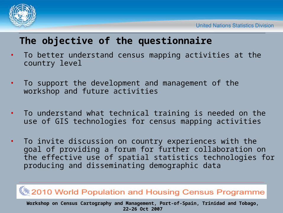
The objective of the questionnaire• To better understand census mapping activities at the country
level
• To support the development and management of the workshop and future activities
• To understand what technical training is needed on the use of GIS technologies for census mapping activities
• To invite discussion on country experiences with the goal of providing a forum for further collaboration on the effective use of spatial statistics technologies for producing and disseminating demographic data
Workshop on Census Cartography and Management, Port-of-Spain, Trinidad and Tobago,22–26 Oct 2007
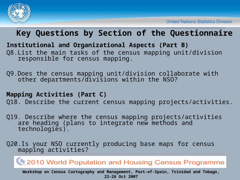
Key Questions by Section of the Questionnaire
Institutional and Organizational Aspects (Part B)Q8.List the main tasks of the census mapping unit/division
responsible for census mapping.
Q9.Does the census mapping unit/division collaborate with other departments/divisions within the NSO?
Mapping Activities (Part C)Q18. Describe the current census mapping projects/activities.
Q19. Describe where the census mapping projects/activities are heading (plans to integrate new methods and technologies).
Q20.Is your NSO currently producing base maps for census mapping activities?
Workshop on Census Cartography and Management, Port-of-Spain, Trinidad and Tobago,22–26 Oct 2007
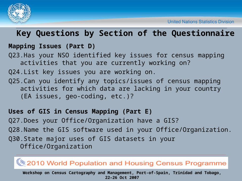
Key Questions by Section of the Questionnaire
Mapping Issues (Part D)Q23.Has your NSO identified key issues for census mapping
activities that you are currently working on?Q24.List key issues you are working on.Q25.Can you identify any topics/issues of census mapping
activities for which data are lacking in your country (EA issues, geo-coding, etc.)?
Uses of GIS in Census Mapping (Part E)Q27.Does your Office/Organization have a GIS?Q28.Name the GIS software used in your Office/Organization.Q30.State major uses of GIS datasets in your Office/Organization
Workshop on Census Cartography and Management, Port-of-Spain, Trinidad and Tobago,22–26 Oct 2007
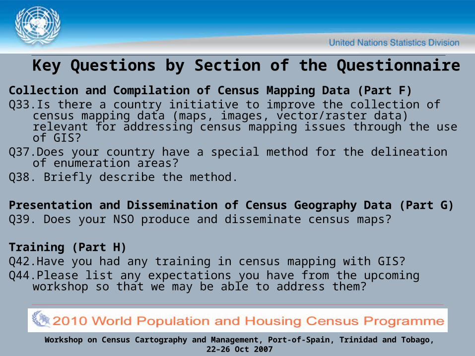
Key Questions by Section of the Questionnaire
Collection and Compilation of Census Mapping Data (Part F)Q33.Is there a country initiative to improve the collection of census
mapping data (maps, images, vector/raster data) relevant for addressing census mapping issues through the use of GIS?
Q37.Does your country have a special method for the delineation of enumeration areas?
Q38. Briefly describe the method.
Presentation and Dissemination of Census Geography Data (Part G)
Q39. Does your NSO produce and disseminate census maps?
Training (Part H)Q42.Have you had any training in census mapping with GIS?Q44.Please list any expectations you have from the upcoming workshop so
that we may be able to address them?
Workshop on Census Cartography and Management, Port-of-Spain, Trinidad and Tobago,22–26 Oct 2007
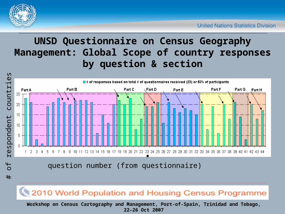
# of
res
pond
ent
coun
trie
s
question number (from questionnaire)
UNSD Questionnaire on Census Geography Management: Global Scope of country
responses by question & section
Workshop on Census Cartography and Management, Port-of-Spain, Trinidad and Tobago,22–26 Oct 2007
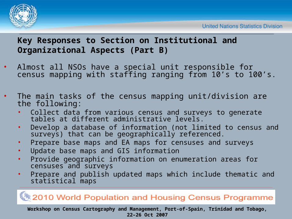
Key Responses to Section on Institutional and Organizational Aspects (Part B)
• Almost all NSOs have a special unit responsible for census mapping with staffing ranging from 10’s to 100’s.
• The main tasks of the census mapping unit/division are the following:• Collect data from various census and surveys to generate tables at
different administrative levels.• Develop a database of information (not limited to census and
surveys) that can be geographically referenced.• Prepare base maps and EA maps for censuses and surveys• Update base maps and GIS information• Provide geographic information on enumeration areas for censuses
and surveys• Prepare and publish updated maps which include thematic and
statistical maps

Workshop on Census Cartography and Management, Port-of-Spain, Trinidad and Tobago,22–26 Oct 2007
Key Responses to Section on Institutional and Organizational Aspects (Part B)
• Close to all census mapping agencies collaborate regularly/occasionally with other departments & other NSOs or divisions within the NSO.
• Just over 50% of countries have statistical laws or laws governing the statistical production that explicitly deal with the production and/or dissemination of census data and/or maps.
• Many NSOs have groups of national users of census maps and spatial data, such as private and public institutions, to help identify core issues and data needs of users
• More than half the country respondents have a National Spatial Data Infrastructure, with several others proposed or in-the-works.

Workshop on Census Cartography and Management, Port-of-Spain, Trinidad and Tobago,22–26 Oct 2007
Key Responses to Section on Mapping Activities (Part C)
• Currently, most NSOs are heavily engaged census mapping projects/activities
• Most are integrating (or plan to integrate) new methods and technologies into census mapping activities
• More than half are currently producing base maps for census mapping activities
• Scales range largely from 1:1000 to 1:1,000,000 depending on the application (Country level, district level etc.)

Workshop on Census Cartography and Management, Port-of-Spain, Trinidad and Tobago,22–26 Oct 2007
Key Responses to Section on Mapping Issues (Part D)
• A summary of some the key issues for census mapping are:• Mapping of individual sites & specific areas (health/slums etc.) • Mapping of EAs and related issues (digitizing/coding/splitting)• Preparing and maintaining a spatial database of digital information
and associated attribute data• Using new technologies for census mapping operations• Preparing maps and databases for the operation of the census• Educating the NSO office of the importance of geographic data and
information• Acquiring better resolution imagery & increased GPS accuracy for
mapping operations• Improving training/recruiting staff in GIS & census mapping
Workshop on Census Cartography and Management, Port-of-Spain, Trinidad and Tobago,22–26 Oct 2007
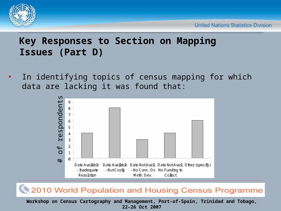
Key Responses to Section on Mapping Issues (Part D)
• In identifying topics of census mapping for which data are lacking it was found that:
0
1
2
3
4
5
6
7
8
9
Data Available - InadequateResolution
Data Available- But Costly
Data Not Avail.- No Conc. Or
Meth. Dev.
Data Not Avail.No Funding to
Collect
Other (specify)
# of
res
pond
ents
Workshop on Census Cartography and Management, Port-of-Spain, Trinidad and Tobago,22–26 Oct 2007
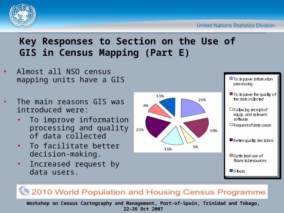
Key Responses to Section on the Use of GIS in Census Mapping (Part E)
• Almost all NSO census mapping units have a GIS
• The main reasons GIS was introduced were:• To improve information
processing and quality of data collected
• To facilitate better decision-making.
• Increased request by data users.
To improve informationprocessing
To improve the quality ofthe data collected
Following receipt ofequip. and relevantsoftware
Request of data users
Better quality decisions
Optimized use offinancial resources
Others
To improve informationprocessing
To improve the quality ofthe data collected
Following receipt ofequip. and relevantsoftware
Request of data users
Better quality decisions
Optimized use offinancial resources
Others
Workshop on Census Cartography and Management, Port-of-Spain, Trinidad and Tobago,22–26 Oct 2007
Populatio
n Cen
sus
Household
Sur
veys
Health
Educatio
n
Others
Trade
Transp
ortatio
n
Tourism
Indus
try
Min
ing a
nd Ener
gy
Agricultu
re
Others
Land U
se
Wate
r qual
ity a
nd use
Fauna
and F
lora
Others
0
2
4
6
8
10
12
14
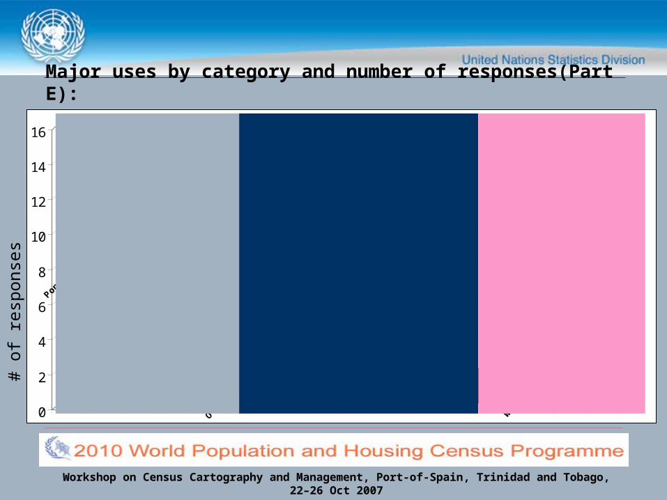
16 Demographic & Social Statistics
Economic Statistics
EnvironmentStatistics
# of
res
pons
es
Major uses by category and number of responses(Part E):

Workshop on Census Cartography and Management, Port-of-Spain, Trinidad and Tobago,22–26 Oct 2007
Key Responses to Section on the Use of GIS in Census Mapping (Part E)
• Major problems encountered in using GIS
0 2 4 6 8 10 12 14 16
Shortage of skilled staff
Cost of data collection or capture
Data source availability inadequate
Inadequate financial allocations
Software Compadibility
Hardware Reliability
Level of geographic detail at which data are collected
Incomplete data
Level of geographic detail from available sources
System user-friendliness
Lack of sources
# of respondents
Workshop on Census Cartography and Management, Port-of-Spain, Trinidad and Tobago,22–26 Oct 2007
Key Responses to Section on the Collection and Compilation of Census Mapping Data (Part F)
• Almost all country respondents have an initiative to improve the collection of census mapping data (maps, images, and vector/raster data) relevant for addressing census mapping issues through the use of GIS
• Many countries have special methods for the delineation of enumeration areas- several did not define a method
• Close to half of the country respondents have any initiative to improve the collection of data on topics of census mapping concerning mapping activities through geo-coding
Workshop on Census Cartography and Management, Port-of-Spain, Trinidad and Tobago,22–26 Oct 2007
Key Responses to Section on the Presentation and Dissemination of Census Geography Data (Part G)
• The majority of NSOs regularly produce and disseminate census maps (thematic, statistical, topographic, etc.)
• The remaining plan to produce and disseminate census maps
• Several countries refer to documents published online for widespread use
Workshop on Census Cartography and Management, Port-of-Spain, Trinidad and Tobago,22–26 Oct 2007
Key Responses to Section on Training (Part H)
• Just over half the respondent NSOs have had no training in census mapping with GIS either through workshops, formal/academic training, short and/or long term
• Several individually delegated respondents by country have had individual training
• Training of individual countries varies based on the level of GIS infrastructure use in census mapping activities
Workshop on Census Cartography and Management, Port-of-Spain, Trinidad and Tobago,22–26 Oct 2007
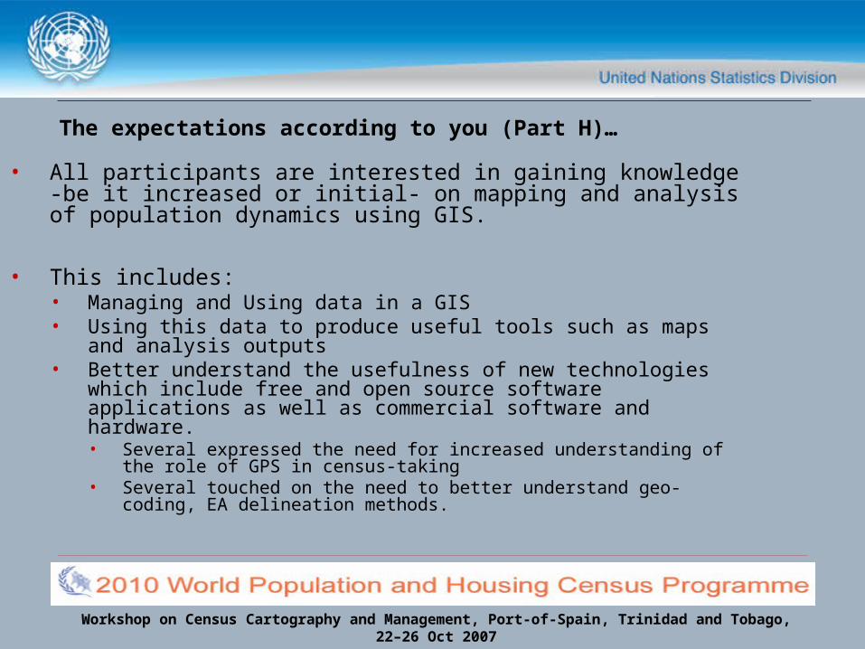
The expectations according to you (Part H)…
• All participants are interested in gaining knowledge -be it increased or initial- on mapping and analysis of population dynamics using GIS.
• This includes:• Managing and Using data in a GIS • Using this data to produce useful tools such as maps and
analysis outputs• Better understand the usefulness of new technologies
which include free and open source software applications as well as commercial software and hardware.• Several expressed the need for increased understanding of the
role of GPS in census-taking• Several touched on the need to better understand geo-coding,
EA delineation methods.
Workshop on Census Cartography and Management, Port-of-Spain, Trinidad and Tobago,22–26 Oct 2007
Results Generated from the questionnaire disseminated prior to the workshop:
Regional Workshop Synopsisfor the Caribbean
Workshop on Census Cartography and Management, Port-of-Spain, Trinidad and Tobago,22–26 Oct 2007
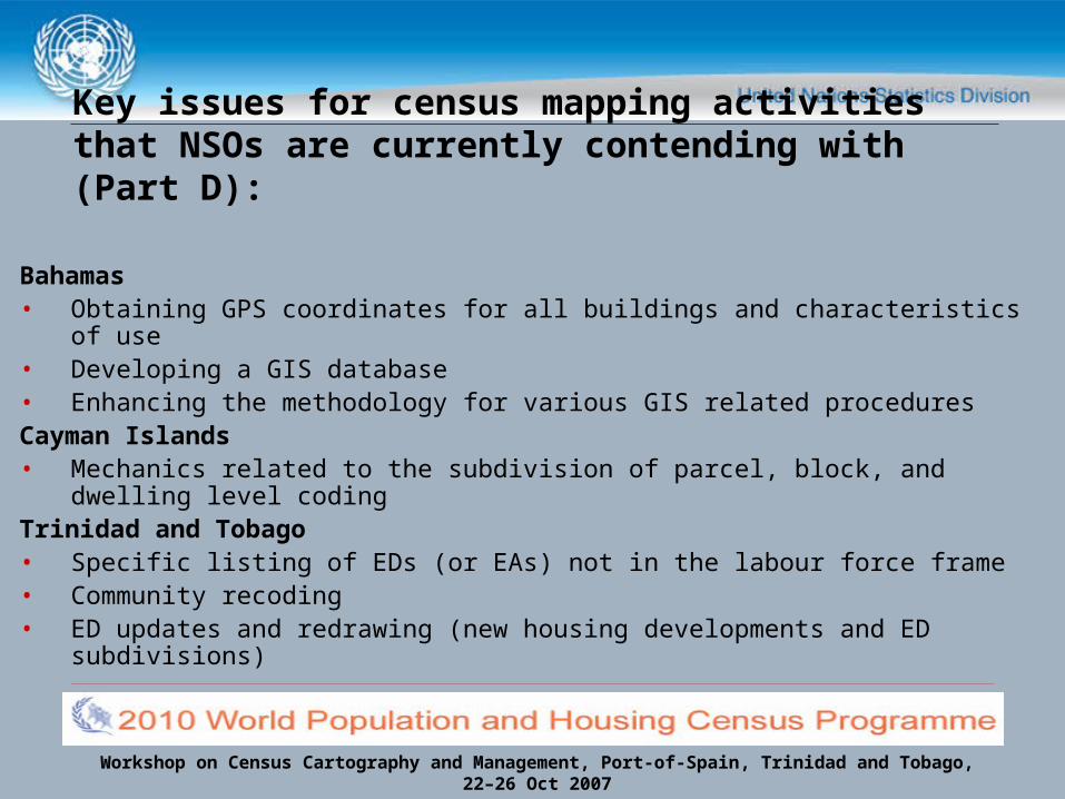
Key issues for census mapping activities that NSOs are currently contending with (Part D):
Bahamas• Obtaining GPS coordinates for all buildings and characteristics of use• Developing a GIS database• Enhancing the methodology for various GIS related proceduresCayman Islands• Mechanics related to the subdivision of parcel, block, and dwelling level
codingTrinidad and Tobago• Specific listing of EDs (or EAs) not in the labour force frame• Community recoding • ED updates and redrawing (new housing developments and ED
subdivisions)
Workshop on Census Cartography and Management, Port-of-Spain, Trinidad and Tobago,22–26 Oct 2007
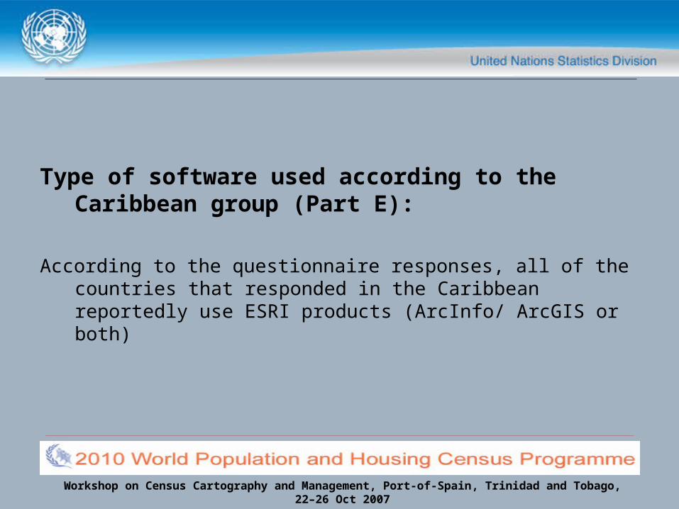
Type of software used according to the Caribbean group (Part E):
According to the questionnaire responses, all of the countries that responded in the Caribbean reportedly use ESRI products (ArcInfo/ ArcGIS or both)
Workshop on Census Cartography and Management, Port-of-Spain, Trinidad and Tobago,22–26 Oct 2007
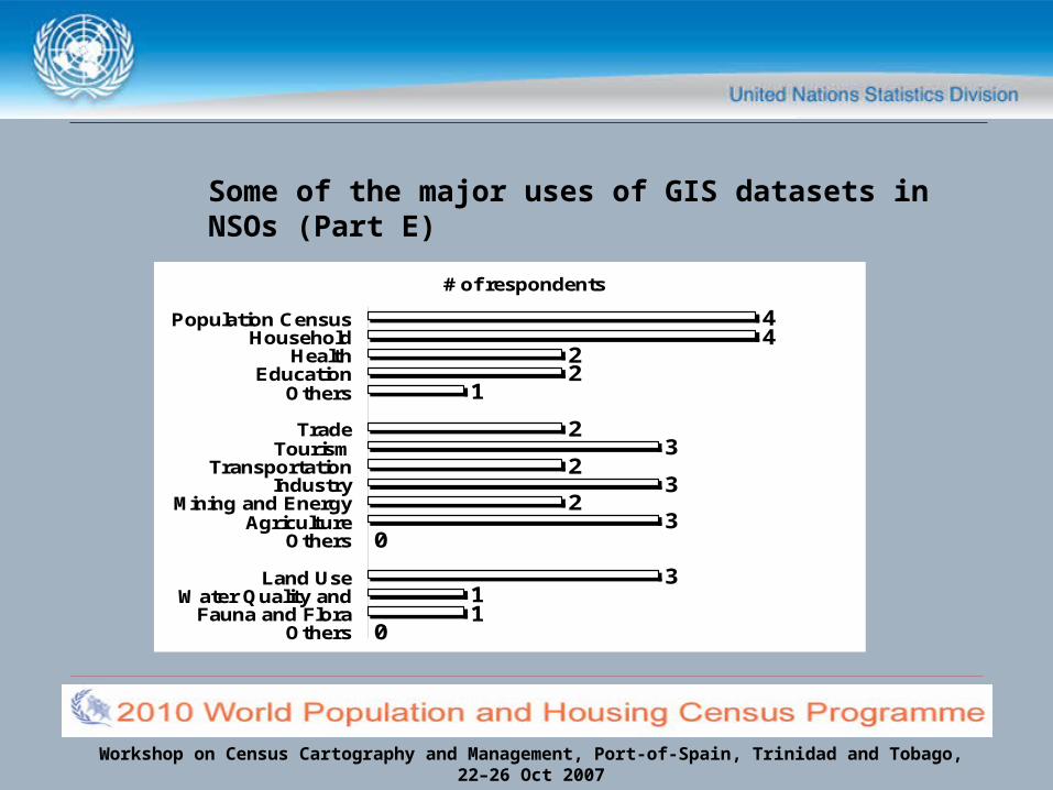
Some of the major uses of GIS datasets in NSOs (Part E)
44
22
1
23
23
23
0
311
0
Population CensusHousehold
HealthEducation
Others
TradeTourism
TransportationIndustry
Mining and EnergyAgriculture
Others
Land UseWater Quality and
Fauna and FloraOthers
# of respondents
Workshop on Census Cartography and Management, Port-of-Spain, Trinidad and Tobago,22–26 Oct 2007
Special methods for the delineation of enumeration areas (Part F):
Bahamas• Scale of coverage was at the dwelling unit level• EA delineation conducted based on the natural geographical
division of the country (islands) and then the political divisions of the islands into constituencies.
• Constituencies were used as supervisory districts and further delineated into EA districts of ~100 households.
• Delineation at the settlement level was done for all islands (except New Providence and Grand Bahamas, where political constituencies were used)

Workshop on Census Cartography and Management, Port-of-Spain, Trinidad and Tobago,22–26 Oct 2007
Special methods for the delineation of enumeration areas (Part F):
Belize• All ED data was produced manually on hardcopy maps.• EDs were chosen based on the number of households.
Grenada• Based on subdividing existing boundaries through parishes, a
grouping of approximately 125 households was deemed manageable for an enumerator to canvass
Workshop on Census Cartography and Management, Port-of-Spain, Trinidad and Tobago,22–26 Oct 2007
Special methods for the delineation of enumeration areas (Part F):
Trinidad and Tobago• The CSO developed the delineation of EDs from the 1960 Census
using 150-200 households as a proper Census workload • These have since been updated, re-coded and subdivided over
the years to accommodate a workload less than 200 households, and 100 households in squatting and terrain areas
• Work is progressing at a Community level on urban/rural classification at an ED level
• ED maps are drawn to graphical scale to accommodate 11’x17’ photocopying size
Workshop on Census Cartography and Management, Port-of-Spain, Trinidad and Tobago,22–26 Oct 2007
Training according to the Caribbean group (Part H):
• Staff from less than half of the respondent offices have had training in census mapping with GIS. Several of the respondents themselves have had training

Workshop on Census Cartography and Management, Port-of-Spain, Trinidad and Tobago,22–26 Oct 2007
Expectations according to the Caribbean group (Part H):
• Become informed about the role GIS and geospatial technologies (such as GPS) play in census mapping
• Learn how new technology can help to facilitate data collection and monitoring field activities
• Understand how to produce census data thematically and to provide census results visually in a GIS
• Learn more about ArcGIS and its use for census mapping and surveys• Learn how to harness the latest, most efficient and effective technology
and uses of GIS in census mapping• Assist other countries with their census mapping and GIS challenges

Workshop on Census Cartography and Management, Port-of-Spain, Trinidad and Tobago,22–26 Oct 2007
Expanded Country Discussion Welcomed
END