a n d h r a u n i v e r s i t y · web viewtacheometric surveying – principles of tacheometry,...
TRANSCRIPT

A N D H R A U N I V E R S I T Y
Regulations and Syllabus relating to
BACHELOR OF TECHNOLOGY (B.Tech.)GEOINFORMATICS ENGINEERING
DEGREE EXAMINATION
(Under Semester System)
(with effect from 2007-2008)
REGULATIONS
1. The Degree of Bachelor of Technology (4 – year course) / Bachelor of Engineering (4 – year course) will be conferred on a candidate who satisfies the following conditions.
1.1 (i) Candidates shall have passed (a) the two year Intermediate Examination with Mathematics and Physical Sciences as optional subjects under Part-III conducted by the Board of Intermediate Education, Andhra Pradesh.
OR(b) The Intermediate Examination with vocational courses in Engineering and
Technology conducted by Board of Intermediate Education, Andhra Pradesh.OR
(c) The Diploma Examination in Engineering of State Board of Technical Education and Training, Andhra Pradesh, provided they pass 10th Class examination of Board of Secondary Education, Andhra Pradesh or its equivalent examination.
OR(d) An examination recognized by the Academic Senate of the Andhra University as
equivalent to the aforesaid examinations with a minimum of 12 years of schooling with Mathematics and Physical Sciences.
(ii) Candidates must have qualified themselves at the Entrance examination(s) as prescribed by the University for purpose of admission into B.Tech./B.E. courses.
(iii) Candidates from other countries and other states permitted to study B.Tech./B.E. courses by the Govt. of India may be exempted by the Executive Council from appearing for the entrance examination, provided they satisfy all other conditions.
1.2 (i) The normal duration of the course is four academic years for B.Tech./B.E. Degree. The first academic year shall comprise of semester I & II combined together and each of the subsequent academic years shall be divided into two semesters hereinafter referred to as 2nd year Semester – 1, 2nd year Semester – II, 3rd year Semester – 1, 3rd year Semester – II and so on in chronological order.
1

(ii) Candidates shall have pursued a regular course of study, as detailed below, for not less than four years and shall have fulfilled the academic requirements laid down and shall have passed all the prescribed examinations.
2.1 A regular course of study during an academic year/semester means a minimum attendance of 75% of all the subjects of the year / semester, as the case may be, computed by
*First year common to all branches of BE/B.Tech of AUtotaling the number of periods of lectures, workshops laboratories, drawing, tutorials,
project and any other practicals, held in every subject over the year / semester as specified in the schemes of instruction.
However, in special case and for sufficient cause shown, the Vice-Chancellor may, on the recommendation of the Principal and Head of the Department concerned, condone the deficiency in the average attendance to an extent of 9% for reasons such as ill-health, if the application for condonation is submitted at the time of actual illness and is supported by certificate of authorized Medical Officer approved by the Principal.
In the case of students, who participate in activities like N.S.S., N.C.C., Inter-collegiate tournaments conducted by Andhra University, Inter-University tournaments conducted by the Inter-University Board and any such other activities involving the representation of the College/University with the prior approval of the Principal, the candidate may be deemed to have attended the college during the actual period of such activity, solely for the purpose of attendance.
2.2 A candidate who cannot satisfy the attendance requirements as specified in clause 2.1, because of late admission under special circumstances, reasonable and acceptable to the University on the basis of documents, shall attend at least 50% of the total scheduled periods during that academic year and shall have attended at least 90% of the total periods of instructions held from the date of admission.
2.3 A candidate, who fails to satisfy the regulation under clause 2.1 or 2.2, shall not be allowed for the University examinations at the end of the year in case of first year or semester and shall not be allowed for promotion to the next semester of study. He / she shall be required to repeat the entire regular course of study of that academic year in case of first year or semester in case of semester.
2.4 The criteria for promotion from 1 year to II/IV Semester – 1 and to subsequent Semesters is based on the requisite attendance put up by the candidate and satisfactory completion of the course of study during the year / semester.
2.5 (i) If a candidate fails more than three subjects or if he obtains less than 50% aggregate in the first year, he shall not be promoted to third year.
(ii) If a candidate fails in more than three subjects or if he obtains less than 50% aggregate in the Semester – I and Semester – II of the 2nd year putting together, he shall not be promoted to fourth year.
3.1 The schemes of instruction and examination for the first year course shall be on annual pattern. The period of instruction shall ordinarily be from July to April and shall comprise of a minimum of 180 instruction days. The year-end examinations shall ordinarily be held during the month of May.
2

3.2 The schemes of instruction and examination for courses other than 1 year shall be on semester pattern. The period of instruction for Semester – I of each year (from 2nd year to final year) shall ordinarily be from July to November and for Semester – II of each year (from 2nd year to final year) shall ordinarily be from December to April. Each semester shall comprise of a minimum of 16 weeks of instruction. The end examinations of Semester – 1 of each year shall ordinarily be held during the month of November and that of Semester – II of each year shall ordinarily be held during the month of May of the academic year.
3.3 Three shall be no supplementary examinations except for Semester – I and Semester – II of the final year. The supplementary examinations shall ordinarily be held during the month of June/July for Semester – I and Aug./Sept. for Semester – II of the final year.
4.1 The examinations for the B.Tech./B.E./B. Arch. Degree shall be conducted as per the prescribed Schemes for the following branches of study:
(i) For the B.Tech. Degree (4 – Year course) 1. Chemical Engineering 2. Chemical Engineering (Elective: Petroleum Engineering) 3. Chemical Engineering (Elective: Biotechnology) 4. Computer Science and Engineering 5. Instrumentation Technology 6. Information Technology. 7. Geoinformatics Engineering
(ii) For B.E. Degree (4 – Year Course) 1. Civil Engineering 2. Civil Engineering with Environmental Engg. (Elective) 3. Electrical and Electronics Engineering 4. Electronics and Communication Engineering 5. Electronics and Instrumentation Engineering 6. Mechanical Production and Industrial Engineering 7. Mechanical Engineering 8. Metallurgical Engineering 9. Mechanical Engineering (with Marine Engg. Electives) 10. Naval Architecture.
(iii) for B.Arch. Degree (5 – Years course)and for any other branch of Engineering / Technology as and when approved by the University from time to time.
4.2 There shall be Regular Examinations at the end of Year / Semester as listed below.
B.Tech./B.E./B. Arch. 1 YearB.Tech./B.E./B. Arch. Semester – I of 2nd yearB.Tech./B.E./B. Arch. Semester – II of 2nd yearB.Tech./B.E./B. Arch. Semester – I of 3rd yearB.Tech./B.E./B. Arch. Semester – II of 3rd yearB.Tech./B.E./B. Arch. Semester – I of 4th yearB.Tech./B.E./B. Arch. Semester – II of 4th yearB. Arch . Semester – I of 5th yearB. Arch . Semester – II of 5th yearSupplementary Examinations shall be conducted only forB.Tech./B.E. Semester – I & II of 4th yearB.Arch. Semester – I & II of 5th year
5. Assessment for the award of the Degree shall consist of
3

(i) Internal evaluation of the work done by the students during the year / semester for 30 marks in each theory subject and for 50 marks or such other marks prescribed in the scheme of examination, in each practical and project.
(ii) Year / semester end examination as detailed in the scheme of examination for 70 marks in each theory subject and for 50 marks or such other marks prescribed in the scheme of examination, in each practical and project.
5.1 The marks for the internal evaluation shall be awarded by the concerned teachers based on class work, quiz, viva-voce, two mid-examinations etc., according to a scheme / schedule to be notified by the Department at the beginning of the year / semester.
5.2 The year / semester and examination in each theory subject, for a maximum of 70 marks, shall be conducted by the University through duty constituted Boards of Examiners.
5.3 The year / semester end examination in practicals / project for 50 marks or such other marks prescribed in the scheme of examination, shall be conducted by the University by two examiners one of them being external to the college.
5.4 Candidates shall be required to produce complete and certified records of the work done by them in each of the practical subjects at the time of year / semester end practical examination, failing which they will not be allowed for such examination.
6.1 A candidate shall be declared to have passed in any subject (theory/practical) if he / she secures in the University examinations, not less than 40% in theory and not less than 50% in practicals, provided that the result otherwise not withheld.
6.2 A candidate shall be deemed to have satisfied the minimum requirement for the award of the Degree; (i) If he / she is declared to have passed all the subjects (theory and practicals) included in the Scheme of Examination of I year and subsequent six semesters for the award of B.Tech./B.E. Degree and subsequent eight semesters for the award of B.Arch. Degree. and
(ii) If he/she secures 50% marks in the overall aggregate of both the University examinations and sessional marks put together of all the subjects of B.Tech./B.E./B.Arch. course.
6.3 Candidates, who fail to satisfy clause 6.2 (ii) may be permitted to attain the overall aggregate upto 50% within 4 years after completing the course of study by appearing at the University examinations only of B.Tech./B.E./B.Arch. subjects of their choice. The so attained overall aggregate shall be limited to 50% only. Any candidate who fails to attain the minimum aggregate of 50% even after such appearances, during a total of eight academic years from the year of admission, shall become ineligible for the award of B.Tech./ B.E./B.Arch. Degree.
6.4 A candidate may be permitted to improve his/her performance by reappearing for the whole of the University examinations, only in all the theory subjects of a year / semester,
4

after completion of the 4-year/5-year course of study, as the case may be, and during the four consecutive examinations only.
Such an improvement can be availed of only once, for each of the annual / semester examinations of the course of study, provided that all the subjects of the year / semester shall have been passed as per the clause 6.1. When considered in its totally, better of the two performances (as a whole but not subject wise) shall be taken into consideration for the purpose of awarding First Class. There shall be no subject wise improvement permitted in any year / semester of study for the above purpose. In any case, no such improvement shall be permitted after completion of eight academic years from the year of admission.
6.5 There shall be no provision for the improvement of sessional marks in any theory or practical subject in any year / semester of study.
7. Whenever there is a change of regulations, scheme and syllabi (such as from Unit pattern to Semester System), a candidate who fails in any subject or who wants to improve his/her performance as per clause 6.4, will be permitted to appear for the University examinations conducted during the subsequent 4 years only, under the previous regulations, scheme and syllabi. There after, such candidates shall be required to appear for such examinations under new regulations and syllabi in the equivalent subjects as decided by the Board of Studies.
8. All the candidates who have satisfied the minimum requirement as specified above, shall be arranged in two classes based on the aggregate marks obtained in the examinations of I year to final year for the award of B.Tech./B.E./B.Arch. Degree.
5

2nd Year Semester – I
Code No.
Subject L T Lab Total Univ. Exam
Sessl. Marks
Total Marks
Credits
Hrs Marks
GI 201 Information Technology and Applications
4 - 0 4 3 70 30 100 4
GI 202 Engineering Mathematics – III
4 1 0 5 3 70 30 100 4
GI 203 Fundamentals of Geology
4 1 0 5 3 70 30 100 4
GI 204 Engineering Mechanics
4 1 0 5 3 70 30 100 4
GI 205 Geomorphology 4 1 0 5 3 70 30 100 4GI 206 Surveying 4 0 0 4 3 70 30 100 4
PRACTICALGI 207 Geology and
Geomorphology Practical
0 0 6 6 3 50 50 100 2
GI 208 Surveying Practical 0 0 6 6 3 50 50 100 2Total 24 4 12 40 - 520 280 800 28
2nd Year Semester – II
Code No.
Subject L T Lab Total Univ. Exam
Sessl. Marks
Total Marks
Credits
Hrs Marks
GI 209 Fundamentals of Atmospheric Systems
4 1 0 5 3 70 30 100 4
GI 210 Photogrammetry and Photo interpretation
4 1 0 5 3 70 30 100 4
GI 211 Remote Sensing - I 4 1 0 5 3 70 30 100 4GI 212 Environmental Studies 4 0 0 4 3 70 30 100 2GI 213 JAVA Programming 4 0 0 4 3 70 30 100 4GI 214 Probability and
Statistics4 1 0 5 3 70 30 100 4
PRACTICALGI 215 Photogrammetry and
Remote Sensing Practical
0 0 6 6 3 50 50 100 2
GI 216 JAVA Programming Practical
0 0 6 6 3 50 50 100 2
Total 24 4 12 40 - 520 280 800 26
6

3rd Year Semester - ICode No.
Subject L T Lab Total Univ. Exam Sessl. Marks
Total Marks
Credits
Hrs MarksGI 301 Principles of Physical
Oceanography4 1 0 5 3 70 30 100 4
GI 302 Digital Image Processing – I
4 1 0 5 3 70 30 100 4
GI 303 Database Management Systems
4 0 0 4 3 70 30 100 4
GI 304 Operations Research 4 0 0 4 3 70 30 100 4GI 305 Remote Sensing–II 4 1 0 5 3 70 30 100 4GI 306 Elective – I 4 1 0 5 3 70 30 100 4
PRACTICALGI 307 Digital Image
Processing– I Practical0 0 6 6 3 50 50 100 2
GI 308 Database Management Systems Practical
0 0 6 6 3 50 50 100 2
GI 309 Soft Skills 100 100 1Total 24 4 12 40 - 520 380 900 29
Elective-I GI 306-1 Geoinformatics for Environmental Monitoring GI 306-2 Geoinformatics for Earth Science Applications
3rd Year Semester – IICode No.
Subject L T Lab Total Univ. Exam Sessl. Marks
Total Marks
CreditsHrs Marks
GI 310 Artificial Intelligence 4 1 0 5 3 70 30 100 4GI 311 Geographic
Information Systems-I4 1 0 5 3 70 30 100 4
GI 312 Elements of Cartography
4 0 0 4 3 70 30 100 4
GI 313 Hydrology and Geophysics
4 1 0 5 3 70 30 100 4
GI 314 Digital Image Processing – II
4 1 0 5 3 70 30 100 4
GI 315 Elective – II 4 0 0 4 3 70 30 100 4PRACTICAL
GI 316 Geographic Information Systems-I Practical
0 0 6 6 3 50 50 100 2
GI 317 Digital Image Processing–II Practical
0 0 6 6 3 50 50 100 2
Industrial Training(Summer vacation)
Total 24 4 12 40 - 520 280 800 28
Elective-II GI 315-1 Geoinformatics for Ocean Resources EvaluationGI 315-2 Mathematical Morphology in Image Processing
7

4th Year Semester - I
Code No.
Subject L T Lab Total Univ. Exam Sessl Marks
Total Marks
CreditsHrs Marks
GI 401 Digital Photogrammetry
4 1 0 5 3 70 30 100 4
GI 402 Microwave Remote Sensing
4 1 0 5 3 70 30 100 4
GI 403 Computer Graphics 4 0 0 4 3 70 30 100 4GI 404 Urban Planning and
Information Systems4 1 0 5 3 70 30 100 4
GI 405 Economics and Business Finance for Engineers
4 - 0 4 3 70 30 100 4
GI 406 Elective – III 4 1 0 5 3 70 30 100 4PRACTICAL
GI 407 Digital Photogrammetry Practical
0 0 6 6 3 50 50 100 2
GI 408 Urban Planning and Information Systems Practical
0 0 6 6 3 50 50 100 2
GI 318 Industrial Training (Assessment)
0 0 0 0 0 0 100 100 2
Total 24 4 12 40 - 520 380 900 30
Elective-III GI 406-1 Geoinformatics for Watershed ManagementGI 406-2 Geoinformatics for Coastal Zone ManagementGI 406-3 Geoinformatics for Forestry and EcologyGI 406-4 Geoinformatics for Soil and Agriculture Surveys
4th Year Semester – II
Code No.
Subject L T Lab Total Univ. Exam Sessl Marks
Total Marks
CreditsHrs Marks
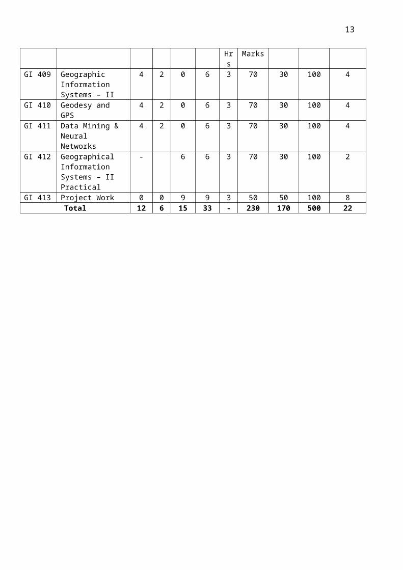
GI 409 Geographic Information Systems – II
4 2 0 6 3 70 30 100 4
GI 410 Geodesy and GPS 4 2 0 6 3 70 30 100 4GI 411 Data Mining &
Neural Networks4 2 0 6 3 70 30 100 4
GI 412 Geographical Information Systems – II Practical
- 6 6 3 70 30 100 2
GI 413 Project Work 0 0 9 9 3 50 50 100 8Total 12 6 15 33 - 230 170 500 22
8

SYLLABUS
GI 201 Information Technology and Applications
L T PD Total Pds
Univ. Exam Sessional Marks
Total Marks
CreditsHrs. Marks
4 1 - 5 3 70 30 100 4
Unit I Computer FundamentalsIntroduction to computers, types of computers, basic components of computer systems- CPU-memory, Input devices-Keyboard, smart cards, Light pen, touch screen, mouse, digitizer.Output devices – Video display devices, flat panel display, printers, audio output (chap 9) Unit IIData Acquisition: Chapters (2,3,4,5)Acquisition of Numbers and Textual Data : Input units, internal representation of numeric data, representation of characters, error detecting codes. Acquisition of image data : Acquisition of textual data, pictures, storage format for pictures, fundamentals of image compression, image acquisition with digital camera. Acquiring Audio Data : basics of audio signals, acquiring and storing audio signals.Acquisition of Video: Capturing a moving scene with a video camera, compression of video data , MPEG compression standard.Unit III Computer Software (chap 10)Overview of Operating Systems: operating system fundamentals, software – system software, application software (overview of Word, Excel, PowerPoint). Overview of Windows; Linux (Windows-Desktop-Control panel -Start menu; Operations on file (new, save, copy, edit, etc). Unit IV Business Information Systems and E-commerce ( chap 16 ,17)Types of information needed by organizations, Management structure and information needs, design of an operational information system, system life cycle, computer system for transaction processing.E-commerce : Introduction, Business to business, business to customer and customer to customer e-commerce, their advantages and disadvantages. E-commerce system architecture, payment schemes, electronic cheque payment, Cash transactions, EDI, Intellectual properties rights and e-commerce.Unit V Computer Networks and Internet. (Chapter 8, 15)Overview of computer Networks and Internet: computer networks - LA N, WAN and their applications, intranet, naming computers connected to internet. Some Internet Applications : Email, Information browsing, WWW, Information retrieval from the web, Other facilities provided by the browser, audio on the internet, pictures, animation, video on the internet. Introduction to applications such as Google maps and Google earth. Text books1. Introduction to Information technology by V. Rajaraman, PHI
Reference Books1. Introduction to Computers by Peter Norton.
9

GI 202 Engineering Mathematics-III
L T PD Total Pds
Univ. Exam Sessnl. Marks
Total Marks
Credits Hrs. Marks
4 1 - 5 3 70 30 100 4
Unit – I Vector Calculus: Differentiation of Vectors, Curves in Space, Velocity and acceleration, relative velocity and acceleration, scalar and vector point functions, vector operator V, V applied to scalar point functions, gradient, V applied to vector point functions, divergence and curl.
Unit - IIPhysical interpretations of V.F and VxF, V applied twice to point functions, V applied to products of point functions, integration of vector, line integral, circulation, work surface integral-flux, Green’s theorem in the plane, Stoke’s theorem, volume integral, divergence theorem, irrotational and solenoidal fields, Green’s theorem, Introduction of orthogonal curvilinear coordinates: Cylindrical, spherical and polar coordinates.
Unit - IIIIntroduction Of Partial Differential Equations: Formation of partial differential equations, solutions of PDEs, equations solvable by direct integration, linear equations of first order, homogeneous linear equations with constant coefficients, rules for finding the complimentary function, rules of finding the particular integral, working procedure to solve homogeneous linear equations if any order, non homogeneous linear equations.
Unit - IVApplications Of Partial Differential Equations: Method of separation of variables, Vibrations of a stretched string-wave equations, one-dimensional and two-dimensional heat flow equations, solution of Laplace equation, Laplace equation in polar co-ordinates.
Unit - VIntegral Transforms: Introduction, definition, Fourier integral, Sine and Cosine Integrals, Complex forms of Fourier Integral, Fourier Transform, Fourier Sine and Cosine Transforms, Finite Fourier Sine and Cosine Transforms. Properties of F-Transforms, Convolution Theorem for F-Transforms, Parseval’s identity for F-Transforms, Fourier Transforms of the derivatives of a function, applications to boundary value problems, using inverse Fourier Transforms only.
Text Book: 1. Higher Engineering Mathematics (34th edition 1998) by B.S. Grewal.
References: 1. A Text Book on Engineering Mathematics by M.P. Bali et. al., 2. Higher Engineering Mathematics by M.K. Venkata Raman, 3. Advanced Mathematics for Engineering Students, Vol-2 & 3, by Narayanan et. al., 4. Advanced Engineering Mathematics by Erwin Kreyszig, 5. Engineering Mathematics by P.P. Gutpa, 6. Advanced Engineering Mathematics by V.P. Jaggi and A.B. Mathur, 7. Engineering Mathematics by S.S. Sastry, 8. Advanced Engineering Mathematics by M.L. Dass.
10

GI 203 Fundamentals of Geology
L T PD Total Pds
Univ. Exam Sessional. Marks
Total Marks CreditsHrs. Marks
4 1 - 5 3 70 30 100 4
Unit – I General GeologyBranches of geology – Origin of the Earth, Age of the Earth, Interior of the Earth, Isostasy, Elementary knowledge on continental drift and plate tectonics with evidences. Earthquakes, Volcanoes, Groundwater
Unit – II MineralogyElementary knowledge on symmetry elements of important cystallographic systems – physical properties of minerals – study of the following rock forming minerals – Olvine family, Quartz family. Feldspar family, Amphibole Family, Pyroxene family, Mica family, Augite, Hornblende, Biotite, Muscovite, calcite, Garnet – properties, behavior and engineering significance of clay minerals – Fundamentals of process of formation of ore minerals – Coal and petroleum – Their origin and occurrence in India.
Unit – III PetrologyClassification of rocks – Distinction between Igneous, Sedimentary and Metamorphic rocks. Description occurrence, distribution of following rocks. Igneous rocks – Granite, Syenite, Diorite, Gabbro, Pegmatite, Dolerite and Basalt Sedimentary rocks sandstone, Limestone, shale, Conglomerate and breccia. Metamorphic rocks. Quartzite, Marble, Slate, Phyllite, Gniess and Schist, Khondalite, Charnockite.
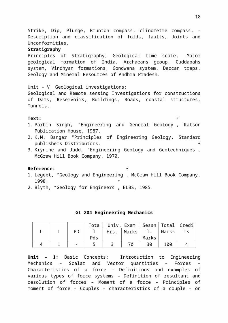
Unit – IV Structural Geology Strike, Dip, Plunge, Brunton compass, clinometre compass, - Description and classification of folds, faults, Joints and Unconformities. Stratigraphy Principles of Stratigraphy, Geological time scale, -Major geological formation of India, Archaeans group, Cuddapahs system, Vindhyan formations, Gondwana system, Deccan traps. Geology and Mineral Resources of Andhra Pradesh.
Unit – V Geological investigations:Geological and Remote sensing Investigations for constructions of Dams, Reservoirs, Buildings, Roads, coastal structures, Tunnels.
Text:1. Parbin Singh, “Engineering and General Geology”, Katson Publication House, 1987. 2. K.M. Bangar “Principles of Engineering Geology. Standard publishers Distributors.3. Krynine and Judd, “Engineering Geology and Geotechniques”, McGraw Hill Book
Company, 1970.
Reference:1. Legeet, “Geology and Engineering”, McGraw Hill Book Company, 1998.2. Blyth, “Geology for Engineers”, ELBS, 1985.
11

GI 204 Engineering Mechanics
L T PD Total Pds
Univ. Exam Sessnl. Marks
Total Marks
Credits Hrs. Marks
4 1 - 5 3 70 30 100 4
Unit – 1: Basic Concepts: Introduction to Engineering Mechanics – Scalar and Vector quantities – Forces – Characteristics of a force – Definitions and examples of various types of force systems – Definition of resultant and resolution of forces – Moment of a force – Principles of moment of force – Couples – characteristics of a couple – on transformations of a couple – Resolution of a force into a force and couple. Resultants of Force Systems, Possible resultants of different types of force systems – Resultants of a concurrent, co planar force systems – Resultants of a non-concurrent coplanar force system – Resultant of parallel, non-coplanar force systems – Resultant of a system of couples in space – Resultant of non-concurrent, non-coplanar, non-parallel force system – screw of Wrench. Unit - II: Equilibrium: Free body diagrams – Equations of equilibrium for a concurrent coplanar force system – Equilibrium of Bodies acted on by two or three forces - Equilibrium of Bodies acted on by non-concurrent coplanar force system - Equilibrium of Bodies acted on by parallel, non-coplanar force system – Equilibrium of non-concurrent, non-coplanar, non-parallel force system.Unit – III: Centroids and centres of Gravity: Centre of gravity of parallel forces in a plane – Centre of gravity of parallel forces in space – centroids and centres of gravity of composed bodies – Theorems of Pappus – Distributed Loads of Beams, Moments of Inertia, Definition – Parallel axis theorem for areas – Second moments of areas by integration – Radius of gyration of areas – Moments of inertia of composite areas – Parallel axis and parallel plane theorems for masses – Moments of Inertia of composite masses. Friction: Nature of friction – Laws of Friction – Coefficient of Friction – Angle of friction – Cone of friction – Problems involving frictional forces – Frictional forces on flexible bands and belts – Rolling friction. Method of Virtual Work: Principles of Virtual Work – Equilibrium of ideal system – Stability of equilibrium.Unit – IV: Kinematics: Absolute Motion: Introduction – Recapitulation of basic terminology of mechanics – Newton’s Laws – Introduction to Kinematics of Absolute Motion – Rectilinear motion of a particle – Angular motion of a line – Curvilinear motion of a particle using rectangular components – Motion of projectiles – Curvilinear motion using Radial and Transverse Components – (Simple Problems only) – basics of simple harmonic motion (Simple problems) – Motion of rigid bodies. Kinematics: Relative Motion: Introduction to kinematics of relative motion – Relative displacement – Relative velocity – Instantaneous centre – Relative acceleration.Unit V: Kinetics: Introduction to Kinetics – Force, Mass and Acceleration approach – Newtons Laws of Motion – Equation of motion for a particle. Motion of the mass centre of a system of particles – D Alembert’s principle – Rectilinear translation of a rigid body – Curvilinear translation of a rigid body – Rotation of a rigid body – Plane motion of a rigid body – Reserved effective forces and couples and their use in Dynamic Equilibrium methods. Kinetics: Work and Energy approach – Work done by a force – Work done by a couple- Work done by a force system – Energy: Potential energy – Kinetic energy of a particle – Kinetic energy of a rigid body – Principle of Work and kinetic energy – Conservation of energy – Power and efficiency. Impulse – Momentum approach – Linear impulse – Linear momentum – Principle of linear impulse and linear momentum – Conservation of linear
12
momentum – Elastic impact – Angular impulse – Angular momentum – Principles of angular impulse and angular momentum.
Text / References: 1) Engineering Mechanics by Singer. 2) Engineering Mechanics by Timoshenko and D. H. Young. 3) Engineering Mechanics by J. L. Meriam 4) Mechanics for Engineers Statics and Dynamics by F. B. Beer and E. R. Johnston 5) Applied Mechanics by I. B. Prasad.
GI 205 Geomorphology
L T PD Total Pds
Univ. Exam Sessnl. Marks
Total Marks CreditsHrs. Marks
4 1 - 5 3 70 30 100 4
Unit IDefinition and scope of geomorphology; Fundamental concepts in geomorphology; Endogenetic processes: volcanism and tectonism; Exogenetic processes: weathering, Mass-wasting and erosion; geomorphic agents.
Unit IIFluvial processes and landforms: valleys and valley forming processes - associated features; Alluvium – active and relict alluvium; Floodplain morphology; Types of streams - Genetic classification of streams; Alluvial fans and deltasShore Zone processes and landforms: shore line, shore zone and coast; Wind waves, tides, littoral currents, storm surges and tsunamis; Erosional and depositional landforms
Unit IIIGlacial processes and landforms: ice and glaciers; types of glaciers; glacial motion; Regimen of glaciers – nourishment and wastage of glaciers; active, passive and dead glaciers; erosional and depositional landforms.Eolian processes and landforms; dominance of wind processes in arid and semi-arid regions; erosional and depositional landforms
Unit IVScope and significance of soil studies; soil and regolith; soil forming factors – geological, climatic, topographical, biological and time factors; Soil components – mineral matter, organic matter, soil water and soil air; Soil Properties – colour, texture, structure, acidity and alkalinity; soil profile; Pedogenic regimes – laterisation, gleisation, podzologisation, calcification and salinisation; soil classifications – zonal system, and Seventh approximation system.
Unit VApplied geomorphology: landform interpretation for groundwater explorations; mineral exploration – surface expressions of ore bodies; weathering residues, placer deposits; applications in engineering projects: route selection – highways, canals, transmission lines; site selections – dam sites, industries; townships
13

Text Books1. Geomorphology by A.L. Bloom, Waveland Pr.Inc. 20042. Principles of Geomorphology by W.D. Thornbury, Wiley Eastern, 19843. Landscape Systems by T.L. McKnight, Pretice-Hall International, 19874. Fundamentals of Geomorphology by R. Huggett, Routledge, 2007
GI 206 Surveying
L T PD Total Pds
Univ. Exam Sessnl. Marks
Total Marks CreditsHrs. Marks
4 - - 4 3 70 30 100 4
Unit – 1Principles of Surveying, Classification of Surveying, Introduction to various traditional surveys – Chain Surveying: Instruments, Sources of errors – Compass Surveying: Definitions of Bearings, Theory of Magnetic Compass, Problems and errors in compass survey – Plane Table Surveying: Working Operations, Leveling – Centering – Orientation, Methods of Plane Table Surveying.
Unit – 2Leveling – Methods of Leveling – Dumpy Level: Differential Leveling, Profile Leveling, Cross sections, Reciprocal Leveling, Precise Leveling – BS, FS, IS, HI, TP, reduction of levels – Theodolite: Measurement of horizontal and vertical angles, Open and Closed traversing, Concepts of Trigonometric leveling.
Unit – 3Tacheometric Surveying – Principles of Tacheometry, Stadia method - Principle of Stadia method, Distance and Elevation formulae for staff vertical & staff normal, Subtense method - Principle of Subtense method, vertical base observations, horizontal base subtense measurement, methods of reading the staff, Tangential method – constant base tangential measurements, variable base tangential measurements.
Unit – 4Concepts of Triangulation – Geodetic surveying, classification of triangulation systems, Triangulation figures and systems, Topographic Surveying – methods of representing relief, contours and contour interval, characteristics of contours, procedure in topographic surveying, contour interpolation.
Unit – 5Advanced Methods of Surveying – Electronic devices: Total Station, Global Positioning System, Differential Global Positioning System, Remote Sensing, Aerial Photogrammetry.
Text Books1. B.C. Punmia. Surveying (Volume 2). Laxmi Publications2. Paul R Wolf. Elements of Photogrammetry – With Application in GIS. Mc Graw Hill
14

GI 207 Geology and Geomorphology Practical
L T PD Total Pds
Univ. Exam Sessnl. Marks
Total Marks CreditsHrs. Marks
0 0 6 6 3 50 50 100 2
a. Geology exercisesGeological maps and sectionsIdentification of some important rock forming minerals. Description and Identification of typical rocks. Description structural models-folds, faults and joints. b. Geomorphology exercises Description of landform modelsTopographic profiles – projected and composite profilesPreparation of slope mapsStream profiles from topographic mapsLandform interpretation from topographic mapsDrainage Morphometry
GI 208 Surveying Practical
L T PD Total Pds
Univ. Exam Sessnl. Marks
Total Marks CreditsHrs. Marks
- - - 6 3 50 50 100 2
Chain surveyPrismatic Compass surveyDumpy Level SurveyPlane Table SurveyTotal Station SurveyGPS SurveyIntegration of field surveys with various software.
GI 209 Fundamentals of Atmospheric Systems
L T PD Total Pds
Univ. Exam Sessnl. Marks
Total Marks CreditsHrs. Marks
4 1 - 5 3 70 30 100 4
Unit IThe Atmosphere: Nature, origin, composition and vertical structure.Insolation and Heat Budget: Insolation, solar constant, distribution, atmospheric depletion of solar radiation, heat budget, latitudinal heat budget. Temperature of the atmosphere: Heat and temperature, processes of heat energy transfer, heating and cooling of atmosphere. Controls of temperature. Distribution of temperature: Air temperature and its measurement,
15

measurement of sunshine and insolation; Horizontal distribution, seasonal distribution, vertical distribution, temperature inversion.
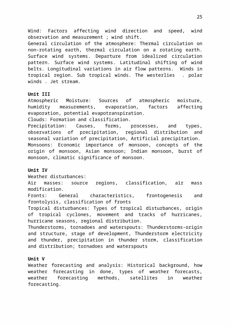
Unit IIAir Pressure and winds: Measurement of air pressure, variations of air pressure and weather, pressure gradient; Pressure variations: diurnal and seasonal; basic atmospheric pressure patterns; vertical variation in air pressure; horizontal distribution of pressure; seasonal variations in pressure pattern; Wind: Factors affecting wind direction and speed, wind observation and measurement ; wind shift.General circulation of the atmosphere: Thermal circulation on non-rotating earth, thermal circulation on a rotating earth. Surface wind systems. Departure from idealized circulation pattern. Surface wind systems. Latitudinal shifting of wind belts. Longitudinal variations in air flow patterns. Winds in tropical region. Sub tropical winds. The westerlies . polar winds . Jet stream.
Unit IIIAtmospheric Moisture: Sources of atmospheric moisture, humidity measurements, evaporation, factors affecting evaporation, potential evapotranspiration.Clouds: Formation and classification.Precipitation: Causes, forms, processes, and types, observations of precipitation, regional distribution and seasonal variation of precipitation, Artificial precipitation.Monsoons: Economic importance of monsoon, concepts of the origin of monsoon, Asian monsoon; Indian monsoon, burst of monsoon, climatic significance of monsoon.
Unit IVWeather disturbances:Air masses: source regions, classification, air mass modification.Fronts: General characteristics, frontogenesis and frontolysis, classification of frontsTropical disturbances: Types of tropical disturbances, origin of tropical cyclones, movement and tracks of hurricanes, hurricane seasons, regional distribution.Thunderstorms, tornadoes and waterspouts: Thunderstorms-origin and structure, stage of development, Thunderstorm electricity and thunder, precipitation in thunder storm, classification and distribution; tornadoes and waterspouts
Unit VWeather forecasting and analysis: Historical background, how weather forecasting in done, types of weather forecasts, weather forecasting methods, satellites in weather forecasting. Applied climatology: climate and natural vegetation, climate and agriculture, climate and animal husbandry, climate and housing, Air pollution and health, climate and human comfort, climate and urban planning.
Textbooks:1. Climatology, Lal, D.S., Sharda Pustak Bhawan,11,University road,Allahabad,20032. General climatology, Howard J. Critchfield, Prentice-Hall of India private Limited,
New Delhi, 19873. Physical Geography, Tikka, R.N., Kedar Nath Ram Nath &Co, Meerut, 20064. Meteorology Today, C.Donald Ahrens, West Publishing company, New York, Third
edition.5. Atmosphere,weather and climate, Siddhartha, K., Kisalaya Publications Pvt.Ltd.,2004.
16

GI 210 Photogrammetry and Photo interpretation
L T PD Total Pds
Univ. Exam Sessnl. Marks
Total Marks CreditsHrs. Marks
4 1 - 5 3 70 30 100 4
Unit IFundamentals of Photogrammetry and photo interpretation; History of aerial photography; Types of photographs: vertical and oblique photographs.Aerial cameras: lens, optical axis, focal length, focal plane and fiducial marks; Principal Point; Geometry of vertical photographs
Unit II Scale on vertical photographs – over flat terrain and variable terrain; average photo scale; Methods of determining the scale on vertical photographsOverlap, side lap and flight planningStereoscopic viewing of vertical photographs; Depth perception; Stereoscopes and their use; Vertical exaggeration – factors involved and determination
Unit IIIRelief Displacement on vertical photographsDetermination of horizontal ground lengths, directions and angles from photo coordinatesParallax: Y-parallax and X-Parallax; Parallax measurement – monoscopic method and stereoscopic method – principle of floating mark
Unit IVAerial mosaics: comparison with mapsElements of air photo pattern: rock types, landforms, surface drainage patterns, erosion features, gray tones, vegetative and land use details
Unit VApplications of aerial photographic techniques in soil surveys; forest surveys, agricultural and land use planning; geological and geomorphological investigations; civil engineering projects
Textbooks 1. ‘Elements of Photogrammetry’ by P.R.Wolf and B.A. Dewitt, McGraw Hill, 20042. ‘Remote Sensing and image Interpretation’ by Thomas M. Lillesand and Ralph W.
Kiefer, John Wiley & Sons, Inc., 20003. ‘Aerial Photographic interpretation’ by Donald R. Lueder, McGrah Hill 1959
17
GI 211 Remote Sensing –I
L T PDTotal Pds
Univ. Exam Sessional Marks
Total Marks
Credits
Hrs. Marks4 1 - 5 3 70 30 100 4
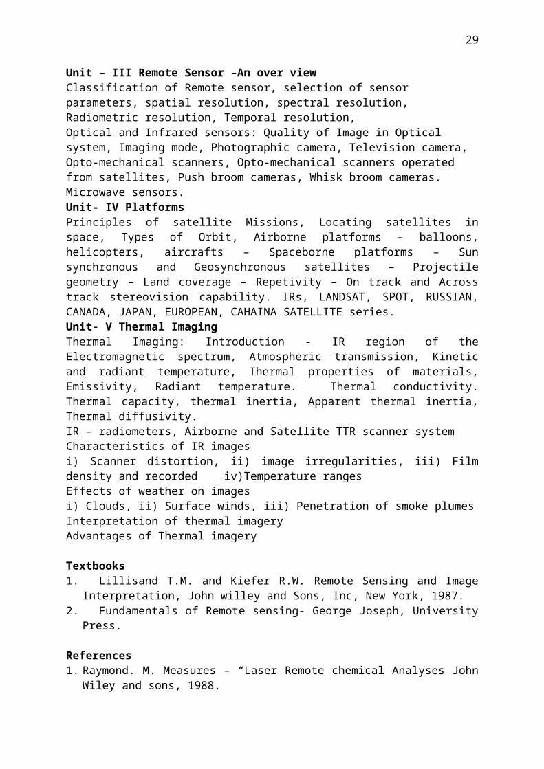
Unit – I Introduction:Sun and atmosphere, Concept of Signature, Remote sensing system, Observe Earth from space, Remote sensing-A historic prospective, Indian remote sensing programme, The earth Observation Evolution –Paradigm shift, Legal and ethical aspect. Electro Magnetic Radiation (EMR): Velocity of EM radiation, Polarization, coherent radiation, Propagation of EM waves, from one medium to another, Attenuation, quantum nature of EM radiation, Thermal radiation, Source of EM radiation, for Remote sensingFundamentals of Radiometry: Measure Geometry-concept of the solid angle, radiometric quantities, Surface characteristic for Radiometric Mesurements, Observation geometry in Remote sensing, Radiometric Mesurements, scene Reflectance Measurement. Physical Basis of Signature: Signature in the Reflective OIR region, Thermal Infrared (TIR), Microwave region.Unit – II EMR Interaction with AtmosphereAtmospheric characteristics – atmospheric gas composition – pressure and temperature variation with altitude – Rayleigh and Mie scattering – atmospheric windows – Atmopheric effects on solar radiation and microwave spectrum – Water droplet interaction with EMR – Atmospheric pollution. Thermal infrared radiation – Emissivity – Emittance of materials – Kichoff’s law in spectroscopy – Wien’s Displacement law, Stefan Boltzman Law – ocean colour temperature measurement – Thermography and its applications. Introduction to Microwave Remote sensing.EMR Interaction with Earth materials:Spectral signature concepts – spectral reflectance and emittance – specular reflection and non-specular reflectance – Albedo of materials – EMR interaction with rocks, minerals, vegetation and water – Factors affecting spectral reflectance of materials. Instruments used to study the spectral reflectance – spectrophotometer – spectro-radiometer.Unit – III Remote Sensor –An over viewClassification of Remote sensor, selection of sensor parameters, spatial resolution, spectral resolution, Radiometric resolution, Temporal resolution, Optical and Infrared sensors: Quality of Image in Optical system, Imaging mode, Photographic camera, Television camera, Opto-mechanical scanners, Opto-mechanical scanners operated from satellites, Push broom cameras, Whisk broom cameras. Microwave sensors.Unit- IV Platforms Principles of satellite Missions, Locating satellites in space, Types of Orbit, Airborne platforms – balloons, helicopters, aircrafts – Spaceborne platforms – Sun synchronous and Geosynchronous satellites – Projectile geometry – Land coverage – Repetivity – On track and Across track stereovision capability. IRs, LANDSAT, SPOT, RUSSIAN, CANADA, JAPAN, EUROPEAN, CAHAINA SATELLITE series. Unit- V Thermal Imaging Thermal Imaging: Introduction - IR region of the Electromagnetic spectrum, Atmospheric transmission, Kinetic and radiant temperature, Thermal properties of materials, Emissivity, Radiant temperature. Thermal conductivity. Thermal capacity, thermal inertia, Apparent thermal inertia, Thermal diffusivity.
18

IR - radiometers, Airborne and Satellite TTR scanner systemCharacteristics of IR imagesi) Scanner distortion, ii) image irregularities, iii) Film density and recorded iv)Temperature rangesEffects of weather on imagesi) Clouds, ii) Surface winds, iii) Penetration of smoke plumesInterpretation of thermal imageryAdvantages of Thermal imagery
Textbooks1. Lillisand T.M. and Kiefer R.W. Remote Sensing and Image Interpretation, John willey
and Sons, Inc, New York, 1987.2. Fundamentals of Remote sensing- George Joseph, University Press.
References1. Raymond. M. Measures – “Laser Remote chemical Analyses John Wiley and sons, 1988.2. Pandey S.N. Principles and Applications of Photogeology. Wiley Eastern, 1987.3. Floyd F. Sabins, Jr. Remote Sensing – Principles and Interpretation W.H. Freeman and
Company, New York, 1986.4. Druny S.A. Image Interpretation in Geology, Chapman and Hall, London, 1983.5. Arumugam. M. Engineering Physics, Anuradha Publishers, 1998.6. Janza. F.J., Blue, H.M., and Johnston, J.E., “Manual of Remote Sensing Vol. I., American
Society of Photogrammetry, Virginia, U.S.A., 1975.
GI 212 Environmental Studies
L T PDTotal Pds
Univ. Exam Sessional Marks
Total Marks
Credits
Hrs. Marks4 1 - 5 3 70 30 100 4
Module 1: Introduction – Definition, scope and importance; measuring and defining environmental development indicators (1 Lecture)
Module 2: Ecosystems: introduction, types, characteristic features, structure and functions of Ecosystems – Forest, Grassland, Desert, Aquatic (lakes, rivers and estuaries) (2 Lectures)
Module 3: Environment and natural Resource Management: Land resources – land as a resource; Common property resources; Land degradation; Soil erosion and desertification; effects of modern agriculture; fertilizer-pesticide problemsForest resources – Use and over-exploitationMining and Dams – their effect on forest and tribal peopleEnergy resources – Energy needs; renewable and non-renewable energy sources; use of alternative energy sources; impact of energy use on environment (8 Lectures)
Module 4: Bio-diversity and its conservationValue of bio-diversity – consumptive and productive use; social, ethical aesthetic and option values
19

Bio-geographical classification of India – India as mega diversity habitatTreats to bio-diversity – hotspots; habitat loss; poaching of wildlife; loss of species; seeds, etc.Conservation of bio-diversity – in situ and ex situ conservation
(3 Lectures)Module 5: Environmental Pollution – Local and Global Issues
Causes, effects and control measures of air pollution, indoor air pollution; Water pollution; Soil pollution; Marine pollution; Noise pollution; Solid waste management – composing, vermiculture; Urban and industrial wastes, recycling and re-useNature of thermal pollution and nuclear hazards; Global warming; Acid rain; Ozone depletion (8 Lectures)
Module 6: Environmental problems in India: Drinking water; Sanitation and public health; Effects of activities on the quality of environment, Urbanisation, Transportation, Industrialisation, Green revolution; Water scarcity and Groundwater depletion; Controversies on major dams – resettlement and rehabilitation of people – problems and concerns;Rainwater harvesting; cloud seeding and watershed management
(5 Lectures)Module 7: Economy and Environment: The economy and environment interaction,
Economics of development, preservation and conservation; Sustainability – theory and practice; Limits of growth; Equitable use of resources for sustainable lifestyles; Environmental impact assessment (4 Lectures)
Module 8: Social issues and the environment: Population growth and environment; Environmental education; Environmental movements; Environment vs. developmentEnergy resources: Energy needs; renewable and non-renewable energy sources; Use of alternative energy sources; Impact of energy use on environment (2 Lectures)
Module 9: Institutions and governance: Regulation by government; Monitoring and enforcement of environmental regulation; Environmental Acts: Water (Prevention and control of pollution) act; Air (prevention and control of pollution) act; Environmental protection act; Wildlife protection act; Forest conservation act; Coastal zone regulationsInstitutions and policies relating to IndiaEnvironmental governance (5 Lectures)
Module 10: International conventions: Stockholm Conference 1972; Earth Summit 1972; World Commission for Environmental Development (WCED)
(2 Lectures)Module 11: Case Studies: Chipko Movement; Narmada Bachao Andolan; Silent Valley
Project; Madhuar Refinery and Taj Mahal; Industrialisation of Pattancheru; Nuclear Reactor at Nagarjuna Sagar; Tehri dam; Ralegaon Siddhi (Anna Hazare); Kolleru Lake – aquaculture; Fluorosis in Andhra Pradesh
(3 Lectures)Module 12: Fieldwork:
Visit to a local area to document and mapping of environmental assets -river/forest/grass/land/hill/mountainStudy of local environment –common plants, insects, birdsStudy of simple ecosystems – pond, river, hillslopes, etc
20

Visits to industries – water treatment plants, effluent treatment plants(5 Lectures)
Textbooks1. Environmental Studies, A. Kaushik and C.P. Kaushik, New Age International Publishers
(P) Ltd2. Principles of Environmental Science and Engineering, P. Venugopala Rao, Pretice-Hall
India (P) Ltd., New Delhi3. Environmental Sciences, P.D. Sarma4. Environmental Studies, S. Mukherjee and A. Ghosh, Books and Allied (P) Ltd., Kolkata
GI 213 Java Programming
L T PDTotal Pds
Univ. Exam Sessional Marks
Total Marks
Credits
Hrs. Marks4 1 - 5 3 70 30 100 4
Unit 1Fundamentals of Object-Oriented Programming: Basic concepts, benefits and applicationsJAVA Evolution: Features of java, relation with Internet and WWWUnit 2JAVA Language: Basics of Java, Constants, Variables, and Data Types, Operators and Expressions, Decision Making and Branching, Decision Making and Looping, Class fundamentals, Declaring objects, Assigning object reference variables, Introducing methods, Constructors, The this keyword, Garbage collection, The Finalize() method, A stack class, Over loading constructors, Using objects as parameters, Arguments passing, Returning objects, Recursion.Unit 3Advanced OOP in Java: Arrays, Strings and VectorsInheritance basics, Member access and inheritance, Using super class, Creating a multilevel hierarchy, Method overriding, Dynamic method dispatch, Using abstract classes, Using final with inheritance, The object class.Unit 4Packages: Putting Classes Together, Defining a package, Understanding classpath, Importing Packages, Defining an interface, Implementing interfaces, Applying Interfaces, Variable in interfaces.Multithreaded Programming, Managing Errors and ExceptionsUnit 5Applet Programming: The applet class, Applet architecture, An applet skeleton: Initialization and termination, Overriding update(), Status window, Handling events: The event class, Processing mouse events, Handling keyboard events, HTML applet tag, Passing parameters to applets, Applet context and show document(), The audioclip & appletstub interface, Outputting to the console. Swing concepts, JDBC connectivityManaging Input/Output Files in JAVA
21

Text Books:1. Programming with Java: A Primer,3E, E BALAGURUSAMY, Tata McGraw Hill2. The Complete Reference JAVA, Patrick Naughton and Herbert Schildt , Tata McGraw-
Hill Publishing Company Ltd.
GI 214 Probability and Statistics
L T PD Total Pds
Univ. Exam Sessnl. Marks
Total Marks
Credits Hrs. Marks
4 1 - 5 3 70 30 100 4
Unit-I Probability And Random VariablesProbability concepts, Random variables, Moments, Moment Generating function, Binomial, Poisson, Geometric, Negative binomial, Exponential, Gamma, Weibull distributions, Functions of random variable, Chebychev inequality.Unit –IITwo Dimensional Random VariablesMarginal and conditional distributions, Covariance, Correlation and Regression, Transformation of random variables, Central limit theorem.Unit – IIIRandom ProcessesClassification, Stationary and Markov processes, Poisson process, Pure birth process, Birth and death process, Markov chains, Markovian queueing models.Unit – IV Reliability EngineeringConcepts of reliability, Hazard function, Series and parallel systems, Reliability and Availability of Markovian systems, Maintainability, Preventive maintenance.Unit – VDesign of Experiments And Quality ControlCompletely randomised design, Randomised block design, Latin square design, Process control, Control charts of measurements and attributes, Tolerance limits.
Textbooks1. Miller, I.R and Freund, J.D., Probability and Statistics for engineers, Prentice-Hall, 1995.2. Kapur, J.N and Saxena, H.C, Mathematical statistics, S. Chand & Company Ltd., New
Delhi, 1997.3. Balagurusamy, E, Reliability engineering, Tata-McGraw Hill Publishers, New Delhi,
1984.4. Bhat, U.N, Elements of applied stochastic processes, Wiley Series in Probability and
Mathematical statistics, New York, 1983.
22

GI 215 Photogrammetry and Remote Sensing Practical
L T PD Total Pds
Univ. Exam Sessnl. Marks
Total Marks CreditsHrs. Marks
- - - 6 3 50 50 100 2
a. Aerial Photographic interpretationTesting stereo visionUse of Lens stereoscope and Mirror stereoscopeUse of Parallax Bar for height calculation from aerial photographsCalculation of scale of the photographsMarking Principal point and conjugate principal point on the stereopairsPreparation of aerial mosaicsInterpretation of aerial photographs for identification of landforms of fluvial, Aeolian, glacial, coastal, volcanic and arid processesIdentification of tectonic elements from aerial photographsb. Remote Sensing PracticalOperating Spectroradiometer in the field to collect radiometric values from various natural and artificial features of land surface. Identification of various land features from the satellite images in association with topo sheets and field visits.Calculations of coverage of satellite images for different latitudes, number of swath paths for various satellites.Study of imagery indexesVisual study of single band images Visual study of multi-spectral imagesPreparation of base maps from the topo sheetsPreparation of thematic maps from visual interpretation
GI 216 JAVA Programming Practical
L T PD Total Pds
Univ. Exam Sessnl. Marks
Total Marks CreditsHrs. Marks
- - 6 6 3 50 50 100 2
1. Programs implementation streams and file operations using JAVA 2. Programs on implementation of packages in JAVA3. Programs on exception handling mechanism through JAVA 4. Programs on Applets and applications 5. Programs on implementation of multi-threading in JAVA6. Fundamental applications using swing
23

GI 301 Principles of Physical Oceanography
L T PD Total Pds
Univ. Exam Sessnl. Marks
Total Marks CreditsHrs. Marks
4 1 - 5 3 70 30 100 4
Unit IThe World Oceans; Physical Properties of Sea Water and their Distribution: Salinity of Sea Water: Factors Affecting Salinity, Salinity Distribution in Oceans.Temperature in the Oceans: Factors Influencing Sea Water Temperature, Temperature Distribution in Oceans. Pressure; Density: Factors Affecting Density of Ocean Water, Density distribution in the Oceans; Colour of Sea Water: Colour Determination, Factors influencing the Colour of Sea Water. Light Transmission in Sea Water: Extinction Coefficients in the Sea, Variation of Extinction Coefficient; Sound Transmission in Sea Water: Velocity of Sound Waves, Variation of Sound Velocity in the Ocean, Refraction of Sound-Shadow Zone and Sound Channel, Attenuation of Sound in the Ocean.Unit IIOceanographic Instruments and methods: Sea Water Temperature Measurement, Salinity Measurement, Current Measurement, Ocean Wave Measurements, Tide Measuring Instruments, Water Transparency Measurement, Radiation Measurement and Platform- Sea and Airborne and Remote Sensing Satellites, Satellite Navigation, DGPS, Eco-sounder.Unit IIIOcean Waves: Classification of Ocean Waves, Characteristics of Waves, Motion of an Ocean Wave, Wind-Generated Waves, Wave Height Conditions in Different Regions of the Oceans, Deep Water Wave Characteristics in the Arabian Sea and Bay of Bengal of Indian Coasts, Wave Propogation in Shallow Water, Problem Waves.Ocean Tides: Tide Producing Forces, Tide Characteristics, Tidal Theories, Harmonic Analysis and Prediction of Tides, Tidal Ranges and Tidal Periods, Tidal BoreUnit IVWater Masses: Introduction, T-S diagrams, Properties of Water Masses, Types of Water Masses.Ocean Circulation: Introduction, Currents: Some General observations, Factors controlling Ocean Circulation, El Nino, Western Intensification of currents, Currents in Atlantic Ocean, Currents in Pacific Ocean, Currents in Indian Ocean.Unit VSea level changes: Introduction, Evidences for Sea level Changes, Mechanisms of Sea level Changes, Impact of Sea level Change, Impact of Projected Sea level rise.Marine Resources: Introduction, Maritime zones, Types of Marine Resources, Resources: extent, distribution and utilisation, Problems of Marine Resources-Marine Pollution, Conservation of Marine Resources.
Text Books:1. Descriptive Physical Oceanography, Reddy, M.P.M., Oxford & IBH Publishing Co.
20012. Oceanography – A Brief Introduction, Siddhartha, K., Kisalaya Publications, 20043. Introductory Oceanography, Harold V.Thurman, Macmillan Publishing Company,
19944. Introductory Oceanography, J.Weisberg and H.Parish, McGraw-Hill Kogakusha,19745. Descriptive Physical Oceanography, Gorge L. Pickard and William J. Emery,
Pergamon Press, Fourth Edition
24
GI 302 Digital Image Processing – 1
L T PD Total Pds
Univ. Exam Sessnl. Marks
Total Marks CreditsHrs. Marks
4 1 - 5 3 70 30 100 4
Unit -1Introduction – Introduction to data sources, Characteristics of digital Image data, Spatial data sources, Digital data acquisition, Digital Image Data formats, Image processing system considerations.
Unit -2Initial Statistics Extraction – Univariate and Multivariate Statistics, Histogram – Contrast modification of Image data, Histogram Equalization, Histogram matching, Density slicing.
Unit -3Image Pre-processing – Sources and Corrections of Radiometric distortions, Sources and Corrections of Geometric distortions, Image registration.
Unit -4Interpretation of Digital Image Data – Approaches to Interpretation, Forms of Imagery for image interpretation, Computer processing for image interpretation, Quantitative analysis.
Unit -5Image Enhancements – Image Reduction & Magnification, Transects, Geometric Enhancement using Image Domain techniques – Neighborhood Operations, Template Operators, Convolution Operation, Spatial Filtering, Edge Detection, Line Detection, Texture, Spatial Correlation – The Semivariogram, Shape Detection.
Textbooks1. John, R.Jensen. Introductory Digital Image Processing – Prentice Hall, New Jersey,
1986.2. John A. Richards – Xiuping Jia. Remote Sensing Digital Image Analysis – An
Introduction – Springer Berlin Heidelberg, New York.
GI 303 Database Management Systems
L T PDTotal Pds
Univ. Exam Sessnl. Marks
Total Marks
Credits
Hrs. Marks4 - - 4 3 70 30 100 4
Chapter 1 - Databases and Database UsersIntroduction , Characteristics of the Database Approach, Actors on the Scene, Workers behind the Scene, Advantages of Using the DBMS Approach, A Brief History of Database Applications, When Not to Use a DBMS.Chapter 2 - Database System Concepts and ArchitectureData Models, Schemas, and Instances, Three-Schema Architecture and Data Independence, Database Languages and Interfaces, The Database System Environment, Centralized and Client/Server Architectures for DBMSs, Classification of Database Management Systems.
25

Chapter 3 - Data Modeling Using the Entity-Relationship (ER) ModelUsing High-Level Conceptual Data Models for Database Design, An Example Database Application, Entity Types, Entity Sets, Attributes, and Keys, Relationship Types, Relationship Sets, Roles, and Structural Constraints, Weak Entity Types, Refining the ER Design for the COMPANY Database, ER Diagrams, Naming Conventions, and Design Issues, Relationship Types of Degree Higher Than Two. Chapter 4 - The Relational Data Model and Relational Database ConstraintsRelational Model Concepts, Relational Model Constraints and Relational Database Schemas, Update Operations, Tranactions, and Dealing with Constraint ViolationsChapter 5 - The Relational Algebra and Relational CalculusUnary Relational Operations: SELECT and PROJECT, Relational Algebra Operations from Set Theory, Binary Relational Operations: JOIN and DIVISION, Additional Relational Operations, Examples of Queries in Relational Algebra, The Tuple Relational Calculus, The Domain Relational Calculus .Chapter 6 - Relational Database Design by ERand EER-to-Relational MappingRelational Database Design Using ER-to-Relational Mapping, Mapping EER Model , Constructs to RelationsChapter 7 - SQL-99: Schema Definition, Constraints, Queries, and ViewsSQL Data Definition and Data Types, Specifying Constraints in SQL,Schema Change Statements in SQL, Basic Queries in SQL, More Complex SQL Queries INSERT, DELETE, and UPDATE Statements in SQL, Specifying Constraints as Assertions and Triggers, Views (Virtual Tables) in SQL,Additional Features of SQLChapter 8 - Introduction to SQL Programming TechniquesDatabase Programming: Issues and Techniques, Embedded SQL, Dynamic SQL, and SQLJ Database Programming with Function Calls: SQL/CLI and JDBC, Database Stored Procedures and SQL/PSMChapter 9 - Functional Dependencies and Normalization for Relational DatabasesInformal Design Guidelines for Relation Schemas, Functional Dependencies,Normal Forms Based on Primary Keys, General Definitions of Second and Third Normal Forms, Boyce-Codd Normal FormChapter 10 - Relational Database Design Algorithms and Further DependenciesProperties of Relational Decompositions, Algorithms for Relational Database Schema Design ,Multivalued Dependencies and Fourth Normal Form , Join Dependencies and Fifth Normal Form, Inclusion Dependencies, Other Dependencies and Normal FormsChapter 11 Emerging Database Technologies and ApplicationsMobile Databases, Multimedia Databases , Geographic Information Systems (GIS), Genome Data Management
Fundamentals of Database Systems, 5/E (Chap 1-3,5-11 and 30) Ramez Elmasri, Shamkant B. Navathe, Pearson Ed.
Reference : 1. Database System Concepts, 5/E, Avi Silberschatz, Henry f.Korth, S.Sudarshan, Tata Mc
GrawHill
26

GI 304 Operations Research
L T PD Total Pds
Univ. Exam Sessnl. Marks
Total Marks CreditsHrs. Marks
4 - - 4 3 70 30 100 4
Unit IOverview of operations research: OR models, OR techniquesLinear Programming: introduction, graphical solution, graphical sensitivity analysis, standard form of linear programming problems, basic feasible solutions, unrestricted variables, simplex algorithms, artificial variables, big M and two phase method, degeneracy, alternative optima, unbounded solutions, infeasible solutions.Unit IIDual problems, relation between primal and dual problems, dual simplex method, integer programming, branch and bound algorithms cutting plan algorithm Unit IIITransportation model, starting solutions, northwest corner rule, lowest cost method, Vogels approximation method, transportation algorithms, assignment problem, Hungarian methodUnit IVNetwork Models, Project scheduling - CPM and PERT - their algorithmsUnit VDynamic Programming: recursive nature of dynamic programming, forward and backward recursionGame theory: two persons zero sum games, mixed strategy games and their algorithms
Text books1) Introductions to operations Research by Hillier/Lieberman, Tata McGraw Hill2) Operations Research by R.Panneerselvan, prentice Hall of India
RS 305 Remote Sensing - II
L T PD Total Pds
Univ. Exam Sessnl. Marks
Total Marks CreditsHrs. Marks
4 1 - 5 3 70 30 100 4
Unit-I Data reception, Data processing & Data generation Satellite Data Receiving Station, Data generation, Data processing & correctionRemote Sensing SatellitesData Acquisition Systems In Remote SensingMultispectral Scanner (MSS) used in Landsat series satellitesReturn Beam Vidicon (RBV) used in Landsat series satellitesThematic Mapper (TM) used in Landsat series satellitesHigh Resolution Visible (HRV) Imager used in SPOT SatelliteLinear Image Self Scanning (LISS) Camera used in IRS seriesThermal ScannersSatellite Data Products available in India and world
Unit-II Radiometric and Geometric correctionsRadiometric corrections Random noise correction
27

Atmospheric correction, Geometric errors and corrections, Distortion evaluated from tracking data, distortion evaluated from ground control Image correction.Ground Investigation in support of Remote sensing Uses of ground data, calibration correction, Interpretation of properties, Training sets, Accuracy evaluation, test sites, Ground truth Instruments and spectral signature, Spectral Reflectance and spectral signature of vegetation other materials.
Unit-III Image Interpretation Introduction to image InterpretationBasic principles of Image InterpretationElements of Image InterpretationTechniques of image InterpretationInterpretation KeysMethods of searching and sequence of InterpretationMethods of analysis and Reference levels
Unit-IV Data InterpretationSpectral data products interpretation Thermal Data InterpretationMicrowave data Interpretation
Unit-V ApplicationsScope of Remote Sensing applications - potentials and limitationsResource mapping and integrated information for sustainable developmentResource evaluation: Soils, minerals forest and agriculture.
Environmental applicationsMapping and monitoring of Natural hazards
a) Cyclones / floods b) Droughts c) Landslides d) Volcanoes e) EarthquakesAnalysis of human-induced hazards
a) Pollution b) Deforestation c) Erosion d) Siltatione) Degradation of water bodies and wetlands
Text Books1. Applied Remote Sensing, C.P. Lo, Longman, Scientific and Technical Publishers2. Remote Sensing in hydrology, Engman, E.T. Gurney, R.J.3. Remote Sensing in water management in command areas, Govardhan, V.
GI 306-1 Geoinformatics for Environmental Monitoring (Elective-I)
L T PD Total Pds
Univ. Exam Sessnl. Marks
Total Marks CreditsHrs. Marks
4 1 - 5 3 70 30 100 4
Unit –1 Water and the EnvironmentR.S. of fluorescence – water quality – water pollution – potential pollution sources – water runoff, Remote Sensing and Water quality management – snow surface cover – flood prediction. Soils and land forms – insects and disease – soil erosion – salinity – flood damage – soil limitation – soil degradation using Remote Sensing and GIS.Unit –II Urban EnvironmentGeneral consideration rural structure – Urban areas – Impact of industrial pollution – chemical effluents, land reclamation – disposal of solid waste – mining pollution.
28
Unit- III Marine EnvironmentSensors for environmental monitoring – sensors – visible and outside visible wave length – absorption spectrometers – selection of ground truth sites – sea truth observations – Radar techniques for sensing ocean surface – thermal measurements – application of sensing, mapping oil slicks – Chlorophyll detection – Fisheries resources – Coastal marine studies – determination of temperature and sea state.Unit –IV Air pollution and Global ClimatologyR.S. techniques for Air quality monitoring – case studies – weather forecasting and climatology – emissivity characteristics – measurement of atmospheric temperature – composition – constituent distribution and concentration – wind flows and air circulation – Hurricane tracking – meteorological satellite systems.Unit –V Case studies
References1. Baretl, E.C. and Culis I.F. Introduction to Environmental Remote Sensing, second
edition, Chapman and Hall, New York, 1993.2. Lintz, J. and Simonent, D.S. Remote Sensing of environment Addision Wesley, Rading
mars, 1976.
OR
GI 306-2 Geoinformatics for Earth Science Applications (Elective-I)
L T PD Total Pds
Univ. Exam Sessnl. Marks
Total Marks CreditsHrs. Marks
4 1 - 5 3 70 30 100 4
Unit – I: Remote sensing applications to lithologyIntroduction , Scope for Geological applications in Multy spetral data, Thermal Data, Microwave data. Mapping of Broad scale Lithological Units in General, Igneous, sedimentary and metamorphic rock, Identification of Mineral Assemblage, their physical properties mode of origin and mode of occurrence. Lithological mapping using aerial photos and satellite imagery, Digital analysis for lithological discrimination.Unit – II: Remote Sensing applications to structural analysisBedding and simple dipping strata, Folds, Faults, Neovolcanic rift zone, Lineament, Unconformity, Structural mapping – structural analysis using aerial and satellite data, digital techniques for structural analysis.Unit- III: Remote sensing application to geomorphologyNature and type of landforms like denudational structural fluvial marine aeolian glacial and volcanic landforms their pattern configuration.Unit – IV: Remote sensing application to geological investigationRemote sensing in Mineral Exploration, Main types of Mineral Deposits and their surface indications, Strtigraphic & lithological Guides, Geomorphological guides, Structural guides, Guide formed by Rock alteration, Geobotanical gudes. Groundwater, Petroleum,. Hydrogeological mapping, Engineering Geological studies, Land slide studies and disaster management studies using Remote Sensing and GIS techniques – case studies.Unit- V: Engineering & Sub-surface exploration & Disaster AssementEngineering geological Investigations, River valley projects, Dams and Reservoirs, Route location ( high ways and Rail ways) canal and Pipe line alignments. Neotechtonism, seismic Hazard and damage Assessment, Local ground condition, Disaster assessment,Volcanic and
29

Geothermal Energy applications, Volcanic Mapping and monitorning, Identification of coal fires. Environmental geologyResistivity, aeromagnetic and electromagnetic survey for subsurface explorations.
Textbooks1. Ravi P.Gupta, Remote sensing Geology-Springer Publisher,A1 Books Co.in.2. Joseph Lintz (Jr) and David Simonett Remote Sensing of environment, Addison Wesley
Publishing Company London, 1976.3. Parbinsingh Geology Katson Publishing House Ludhiana 4th edition 1985.4. Manual of Remote Sensing Vol. II, American Society of Photogrammetry falls church
virginia – 1985.5. Three Dimensional Applications in Geographical Information Systems – by Jonathan
Raper, Dept. of Geology, Birkbeck College, University of London – 1989.
GI 307 Digital Image Processing-I Practical
L T PD Total Pds
Univ. Exam Sessnl. Marks
Total Marks CreditsHrs. Marks
- - 6 6 3 50 50 100 2
Study of Digital Data Products – Characteristics of digital Images, Importing different satellite data products, converting hardcopy images to digital formatRadiometric Enhancements – LUT Stretch, Histogram equalization, Histogram matching, Image filteringGeometric Enhancements – Geometric correction, Mosaic of images, Resolution mergeFunctions & Operations on digital imagery
GI 308 Database Management Systems Practical
L T PD Total Pds
Univ. Exam Sessnl. Marks
Total Marks CreditsHrs. Marks
- - 6 6 3 50 50 100 2
Study features of a commercial RDBMS package such as ORACLE, MS Access, MYSQL & Structured Query Languages (SQL) used with the RDBMS. (Select two of RDMSS)Laboratory exercises should include defining schemes for applications, creation of a database, writing SQL Queries, to retrieve information from the database, use of host Languages, interface with the embedded SQL, use of forms& report writing packages available with the chosen RDBMS product.Some sample examples, which may be programmed, are given below:Accounting package for a shop,Database manager for a magazine agency or a newspaper agency,Ticket booking for performances,Preparing greeting cards & birthday cards,Personal accounts- insurance, loans, mortgage payments, etc,Doctor’s dairy & billing system,Personal bank accountClass marks management, hostel accounting,
30

Video tape library,History of cricket scores,Cable TV transmission program manager,Personal library.
GI 309 – Soft Skills
L T PD Total Pds
Univ. Exam Sessnl. Marks
Total Marks CreditsHrs. Marks
- - 3 3 100 100 1
Communication:Importance of communicationNon verbal communicationPersonal appearancePostureGesturesFacial expressionsEye contactSpace distancing
Goal setting: Immediate, short term, long term, Smart goals, strategies to achieve goals
Time management: Types of time Identifying time wastersTime management skills
Leadership and team management: Qualities of a good leader Leadership stylesDecision makingProblem solvingNegotiation skills
Group discussions: Purpose (Intellectual ability, creativity, approach to a problem, solving, tolerance, qualities of a leader)Group behavior, Analyzing performance
Job interviews:Identifying job openings Preparing resumes & CV Covering letterInterview (Opening, body-answer Q, close-ask Q), Types of questions
Reference books: 1. ‘Effective Technical Communications’ by Rizvi M. Ashraf, McGraw–Hill Publication2. ‘Developing Communication Skills’ by Mohan Krishna & Meera Banerji, Macmillan3. ‘Creative English for Communication’ by N.Krishnaswami & T.Sriraman, Macmillan 4. ‘Professional Communication Skills’ by Jain Alok, Pravin S.R. Bhatia & A.M. Sheikh,
S.Chand & Co.
31

GI 310 Artificial Intelligence
L T PD Total Pds
Univ. Exam Sessnl. Marks
Total Marks CreditsHrs. Marks
4 1 - 5 3 70 30 100 4
Unit – IIntroduction to Artificial Intelligence: overview of AI, definition of AI, relationship between AI systems and other computing systems, comparison between AI programming and other conventional programming. Sub areas of AI, key issues of AI research, AI problems, AI techniques, problem characteristics and production systems.Unit – IIKnowledge representation: knowledge - general concepts, procedural vs. declarative knowledge, formal systems, symbolic representation- syntax and semantics of FOPL, Properties of w.f.f, clausal forms, resolution and unification, structural representation - semantic nets, conceptual graphs, conceptual dependencies, frames and scripts, probabilistic reasoning - Bayesian networks, non-monotonic reasoning - TMS.Unit – IIIAI languages: LISP-basic list manipulation functions, predicates, LISP constructs, I/O operations in LISP, iteration and recursion in LISP, prolog- syntax characters, predicates, rules, facts and goals in LISP variables, conjunctions, operators, back tracking, I/O operations and cut predicatesUnit – IVSearch and control strategies- example of search problems, uninformed search - BFS, DFS and comparisons, heuristic search - hill climbing, best - first search, constraints satisfaction and means end analysis, matching techniques.Unit – VExpert system – rule-based systems, backward vs. forward chaining, expert system shells, natural language processing - syntactic and semantic analysis, pragmatic processing, examples of NLP systems, goal state planning, non-linear planning and Hierarchical planning.
Text Books:1. Artificial Intelligence by E. Rich & Knight K- Tata McGraw-Hill2. Introduction to Artificial Intelligence by O.W.Patterson- Prentice-Hall India3. Artificial Intelligence for R. Schelkoff, McGraw-Hill
GI 311 Geographic Information Systems –I
L T PD Total Pds
Univ. Exam Sessnl. Marks
Total Marks CreditsHrs. Marks
4 1 - 5 3 70 30 100 4
Unit – I Introduction to Geographical Information Systems: Introduction maps and spatial information. Computer assisted mapping and map analysis, Map Projections – Usage of Maps Geographic Information Systems. The components of geographical Information System. Future directions and trends in GIS.
32

Data display, Data Storage, Spatial Indexes, Data analysis tool – Computer Assisted Cartography – Advantages, Disadvantages, GIS and Computer Assisted Cartography – History of GIS – Basic Components of GIS – Hardware, Software, Organizational Context – Comparison of GIS and Hardcopy Maps – GIS Software available in Market.Unit – IIData Files and Data bases- Data Types – Non-Spatial Data – Nominal, Ordinal, interval, ratio-Spatial Data – Points, Lines and Polygons / Area – File Types – Simple lists, Ordered Sequential Files – Indexed Files – Data Base – Functions, Data base structures – Hierarchical, Network, Relational.Unit – IIIRaster Data structures - Raster Data Model – Creating a raster – Cell by cell entry, digital data, Scanner – Tesselations – Regular, Irregular – Geometry of Regular Tesselations – Shape, Adjacency, Connectivity, Orientation – Resolution of Regular Cell – Data Encoding, Rule of dominance, Rule of importance, Centre of Cell, Space Filling Curves – Runlength, Block, Row Order, Prime Row Order, Peano Order, Pi Order – Variable Resolution regular cells – Quadtree data structure – Irregular Tesselations – Theissen polygons, Triangulation, Delaunay triangles.Unit – IVVector Data Structure - Vector Data Model – Arcs, Storing area – Data Base Creation – Digitizer, On Screen Digitizing – Topology – Euler Equation, Topological Consistency, Topological Errors, Error identification, Topological Editing, Line weeding, Node matching, Dangle truncation, Fuzzy tolerance, Digital Line Graph, Arc Node Structure, DIME etc.Unit – V Continuous Surface Representation - Digital Elevation Models – Elevation data capture, Interpolation, DEM representation – Altitude matrix, TIN structure – DEM interpretation, Scale, Visualisation, Applications.
Text Books1. Burrough P.A., Principles of Geographical Information Systems for Land Resources
Assessment, Oxford University Press.2. Robert Laurini and Derek Thompson, Fundamentals of Spatial Information Systems,
Academic Press, 1996.3. Paul A Longley, Michael F Goodchild, David J Maguire, David W Rhind, Geographical
Information Systems, Volume I and II, John Wiley and Sons, Inc., 1999.4. Star J. Estes. J GIS – An Introduction, Prentice Hall, NJ, USA, 1990.
GI 312 Elements of Cartography
L T PD Total Pds
Univ. Exam Sessnl. Marks
Total Marks CreditsHrs. Marks
4 1 - 5 3 70 30 100 4
Unit IMaps: basic characteristics of maps; types of maps – classified by scale, function and subject matter. Map scale; Representation of scale on maps; Determining the scale of a map; Geographical coordinates - latitudes and longitudes; Properties of the graticuleUnit II
33

Map Projections - conformal, equivalent and azimuthal projections; Perspective projections, Non-perspective projections, Conventional projectionsConical projections; Cylindrical Projections; Zenithal projections; Space map projectionUnit IIISources of Map dataGround surveys: Principles of surveying; Measurement technology – traditional and automated survey systemsRemote sensing: aerial photography and satellite-based imaging; Census: population enumerations, geocoding – entity focus and aggregationSpatial sampling: sample size, sampling units, dispersion of sampling units, sample distributionUnit IVCartographic design: Graphic elements of map design; Contrast, Figure-ground, colour and balanceTypography and lettering - type form, type size and type colour; Methods of lettering - cerographic technique, free-hand lettering, stick-up lettering, mechanical lettering; Guidelines for positioning of letters; lettering as a graphic symbol
Unit VRelief representation on maps: Pictorial methods– hachuring, hill-shading; Quantitative methods – spot heights, Bench Marks, contours Slope representation: Methods of expression of slopes – degrees, gradient percentage; finding slopes from contours – Wentworth’s method and Smith’s methodBlock diagramsDigital Cartography
Textbooks1. ‘Elements of Cartography’ by A.H. Robinson, J.L. Morrison, P.C. Muehrcke, A.J.
Kimerling and S.T. Guptill, John Wiley & Sons, 20042. ‘Elements of Cartography’ by A.H. Robinson and K.D. Sale, John Wiley & Sons3. ‘Fundamentals of Cartography’ by R.P. Misra and A. Ramesh, McMillan Co., New Delhi4. ‘Elements of Practical Geography’ by R.L. Singh, Kalyani Publishers, New Delhi
GI 313 Hydrology and Geophysics
L T PD Total Pds
Univ. Exam Sessnl. Marks
Total Marks CreditsHrs. Marks
4 1 - 5 3 70 30 100 4
Unit-IHydrological cycle, precipitation- measurements, raingauge by radar measurements, rain gauge net works, analysis of rainfall data, IDF curves, PMP curves; water balance- evaporation, transpiration, evapotranspiration, infiltration, soil moisture, field capacity; Run-off estimation- catchment characteristics, rainfall-runoff process, computing runoff by various empirical formulae.Unit-IIStream gauzing- site selection, gauzing techniques- notches, weirs, gauzing instruments; hydrographs- unit hydrograph, unit hydrographs for complex storms, Bernard’s distribution curve, instantaneous unit hydrograph, S-curve unit hydrograph, synthetic unit hydrographs.
34

Unit – IIIFloods-estimation and control- definition and causes of floods, estimating design flood and flood flows; flood control measures- flood prepared ness, relief and recovery, flood plain zoning; flood fore casting techniques- flood routing, inflow-out flow correlation curves, time of travel and duration of the peak.Unit – IVGravity methods- principles and elementary theory, gravitational potential, potential field equations, gravity of earth, figure of the earth, gravity reductions, densities of rocks and minerals, Magnetic methods- principles and elementary theory; magnetism of the earth – nature of geomagnetic field, the main field, the external magnetic field, magnetism of rocks and minerals, magnetic susceptibilities of rocks and minerals; Unit – VSeismic methods- seismic theory- theory of elasticity, wave motion, seismic velocity; geometry of seismic wave paths, reflection wave paths, refraction wave paths; reflection field methods Electrical methods- Electrical properties of rocks and minerals, electrical potentials, electrical conductivities, Self potential method-origin of potentials; Resistivity methods- elementary theory, single electrode, two electrode and line electrodes at surface, Equipment for resistivity field work, apparent resistivity, electrode spreads, field procedures, Interpretation.Geophysical Application to a) groundwater exploration, c) sub-soil exploration, e) bed rock investigation for civil structures.
Text Books:1. Hydrology and water Resourses Engineering – S.K.Garg, Khanna publishers, New
Delhi.2. Hydrology – H.M. Raghunath, Wiley Eastern limited, New Delhi.3. Applied Geophysics by Telford,W.M, Geldart, L.P Oxford & IBH Publishing co. pvt.
Ltd.4. Oil Exploration Techniques by Nettleton, L.L
References:1. Applied Hydrolody- K.N.Mutreja, Tata McGraw-Hill Company limited, New Delhi.2. Irrigation and water power Engineering – B.C.Punmia& Pande B.B.Lal, Laxmi
publications, New Delhi3. Engineering Hydrology – E.M.Wilson, ELBS
GI 314 Digital Image Processing – II
L T PD Total Pds
Univ. Exam Sessnl. Marks
Total Marks CreditsHrs. Marks
4 1 - 5 3 70 30 100 4
Unit -1Image Transformation – Multi Spectral Transformation of Image Data – Principal Component Transformation, Noise adjusted Principal Component Transformation, Tasseled Cap Transformation, Image Indices – Arithmetic, Ratioing, Vegetation.
Unit -2
35

Image Transformation - Fourier Transformation of Image Data – Special Functions, Fourier Series, Fourier Transform, Convolution, Sampling Theory, Discrete Fourier Transform, Concept of Spatial Frequency.
Unit -3Classification – Supervised Classification – Maximum Likelihood, Minimum Distance, Parallelepiped, Other Supervised Classifications, Context Classifications, Non-parametric Classification – Linear Discrimination, Support Vector Classifier, Neural Network Approach, Unsupervised Classification – Delineation of Spectral Classes, Similarity metrics and clustering criteria, Iterative Optimization, Single pass Clustering Technique, Agglomerative Hierarchical Clustering, Clustering by Histogram Peak Selection, Classification Accuracy Assessment.
Unit -4Interpretation of Hyper-spectral Image Data – Data Characteristics, Challenges to Data Interpretation, Data Calibration Techniques, Interpretation using Spectral Information, Hyperspectral Interpretation by Statistical Methods, Feature Reduction, Regularized Covariance Estimators.
Unit -5Change Detection – Nature of Change Detection, Change Detection Algorithms – Image Differencing, Image Ratioing, Classification Comparisons, Preprocessing to Improve Change detection.
Textbooks1. John, R.Jensen. Introductory Digital Image Processing – Prentice Hall, New Jersey,
1986.2. John A. Richards – Xiuping Jia. Remote Sensing Digital Image Analysis – An
Introduction – Springer Berlin Heidelberg, New York.
GI 315-1 Geoinformatics for Ocean Resources Evaluation (Elective-II)
L T PD Total Pds
Univ. Exam Sessnl. Marks
Total Marks CreditsHrs. Marks
4 1 - 5 3 70 30 100 4
Unit – I: Interaction of EMR with water: Definitions, wave particle duality, Maxwell’s equations, Interaction of EMR with water. Fresnel’s equation, scattering, absorption. Fundamentals of Ocean Optics and their utility in Remote sensing of Ocean Colour: Definitions of fundamental radiometric qualities, Dowmwelling Irradiance, Upwelling Irradiance, Scalar Irradiance, Attenuation Coefficient, Scattering coefficient, Subsurface Diffused Reflectance Beam attenuation coefficient.Unit – IIRetrieval of Oceanic parameters from ocean colour sensor (Techniques, Algorithms and Applications): Atmospheric Correction: Rayleigh Scattering, Mie Scattering, Atmospheric absorption, Atmospheric correction procedure for Ocean colour sensors, Computation of aerosol optical thickness. Applications of RS data for pigment mapping & productivity estimation, Suspended Sediment Concentration, Ocean Colour Mapping.Unit – IIIPrinciples of TIR/Passive microwave radiometer, Retrieval of Oceanographic parameters (SST, WV, Wind Speed): Physics of thermal radiation, Planck’s radiation law, Stefan-Boltzman Law, Wein’s law. Physical principles of passive radiometry, Rayleigh-Jeans
36

approximation; Microwave property of sea water; Dielectric constant. Retrieval method of SST, Water vapour and wind speed from the satellite. Principles of SAR, Altimeter, Scatterometer and their applications in Ocean Studies: Principles of Satellite Altimeter, measurements of ocean current, Tidal observation, Ocean topography. Principles of Scatterometer, retrieval of wind speed from scatterometer data. Principles of Synthetic Aperture Radar (SAR) and its applications for oceanographic studies.Sea-bed Surveys: Echo-sounding, sub-bottom profiling, swath-bathymetry.Unit – IVRemote Sensing Applications in Coastal Marine Ecology. Fundamentals of marine ecology: Eco-system structure & organization, Bio-pyramids pelagic, non – pelagic, benthos, beach and sub-tidal ecology, coastal dune ecosystem, plant-animal interaction, coastal wetlands, salt mashes and mangroves. Remote Sensing application in coastal and marine ecology (mangrove, coral reefs, sea grass etc.): Remote sensing applications for the study of mangroves, coral reefs, sea grass. Integration of in situ data with remote sensing data for assessment of costal features. Coastal eco-system mapping and monitoring, Sea Level Change and impact on Coastal/Estuary/Lagoonal Ecosystem: Elements of coastal ecosystem, parameters required to study coastal ecosystem. Methodology to monitor coastal ecosystem and Role of RS. Sea level change and its impact on Coastal/Estuary/Lagoonal ecosystem.Unit – VMarine GIS (MGIS) Ocean State Forecasting: Materials and methods for Ocean State Forecasting.Ocean Observing System (GPS, Ships, Buoys, Platforms): Principles of GPS, Conventional methods for marine observations, Sensor performance in coastal studies: camera, multispectral scanners, thermal scanner, laser sensor, Microwave radiometer, Radar altimeter, scatterometer.
Textbooks1. Introduction to Satellite Oceanography, 1985, G. A. Maul, Martinus Nijhoff Publishers,
Dordrecht.2. Satellite Oceanography, 1985, I. S. Robinson, Ellis Horwood, New York.3. Marine Optics, 1976, N. G. Jerlov, Elsevier, Amsterdam.4. Remote Sensing Applications in marine Science & Technology, 1982, Edited by A. P.
Cracknell, Dorderecht D. Reidel.5. Ocean Environmental Management, 1995, Ernst Frankel, Printice hall PTR, New Jersey.6. SEA management, 1992, A theoretical Approach, Adal berto Vallega, Elsevier Science
Publishers.OR
GI 315-2 Mathematical Morphology in Image Processing
L T PD Total Pds
Univ. Exam Sessnl. Marks
Total Marks CreditsHrs. Marks
4 1 - 5 3 70 30 100 4
Unit - IOverview of mathematical morphology-Basic set theory and logical operations-Euclidean space- continuous and discrete space-Image Representation-Image and grey level images-shapes-quantisation-shape-binary images- translation-rotation-scaling.
37

Unit - II Mathematical Morphology-Binary Mathematical Morphology-Erosion, Dilation, Opening, Closing Hit or Miss Transformation-Basic morphological algorithms-boundary extraction-region filling-Convex Hull-Thinning-Thickening- Unit - IIIDigital Skeletons-Grey Scale Mathematical Morphology-Greyscale Erosion-Grey Scale dilation-Grey Scale Opening and Closing-Application of grey scale morphology-(Non-Linear filtering techniques)-Morphological Smoothening-Morphological gradient-Black and White Top-Hot transformations.Unit - IV Binary and Grey level image segmentation-Skeletization by Zone of Influence Technique-Watershed segmentation technique- Segmentation of SPOT, RADARSAT, ERS SAR, and IRS data-Morphology based noise removal techniques for Microwave remote sensing data analysis-Granulometries for feature analysisUnit - VExact dilations-Distance-transformations-Exact distance transforms through exact dilations-Vornoi Diagrams (Graph Theory)-Scale space skeletonization-Multi-scale morphological transformations-Shape Morphology for DEM analysis and terrain characterizationTextbooks1. J. Serra, Image Analysis and Mathematical Morphology, Academic Press (London),
1982, p. 6102. C. R. Giardina and Edward Dougherty, Mathematical Morphology in Image and Signal
Processing, Prentice Hall, New Jersy, 1988.3. suggested Reading4. Gonzalez, Digital Image Processing5. R. M. Haralick, and L. G. Shapiro, Computer and Robot Vision, Addison Wesley,
Reading, v. 1, 1992, p. 453-507.6. Technical Periodicals: IEEE Geosciences and Remote Sensing, IEEE Pattern Analysis &
Machine Intelligence, IEEE Image Processing, IEEE Signal Processing
GI 316 Geographic Information Systems -I Practical
L T PD Total Pds
Univ. Exam Sessnl. Marks
Total Marks CreditsHrs. Marks
- - 6 6 3 50 50 100 2
Classification of spatial data, layer and symbol concept using a GIS software, GIS project overview.Exercise on digitizing entities like point, line and polygon dataEditing and adding labels, cleaning and generating coverage topologyExercise on scanner and different scanner format and raster to vector conversionAttribute data addition and query generationSimple overlay analysis, map and report output
GI 317 Digital Image Processing– II Practical
L T PD Total Pds
Univ. Exam Sessnl. Marks
Total Marks CreditsHrs. Marks
38
- - 6 6 3 50 50 100 2
Multi Spectral Transformation of Image Data – Principle Component Analysis, Tasseled CAP, Calculation of indicesFourier Transformation of Image Data – Fourier Transformation, Inverse Fourier Transformation, Discrete Fourier Transformation, ConvolutionClassification - Supervised Classification, Unsupervised Classification.Topographic Analysis – Creation of Slope map, Aspect map, Contour map, Viewshed analysisChange Detection Analysis.
GI 318 – Industrial Training(Summer Vacation)
Students will have to visit laboratories of government organizations like NRSA, ISRO, RRSSCs, etc., and reputed private institutes engaged in Geoinformatics-related projects for training and interaction during summer vacation.
GI 401 Digital Photogrammetry
L T PD Total Pds
Univ. Exam Sessnl. Marks
Total Marks CreditsHrs. Marks
4 1 - 5 3 70 30 100 4
Unit -1 Introduction to Analytical Photogrammetry – Image measurements, Control points, Collinearity condition, Coplanarity condition, Space resection by collinearity, Space intersection by collinearity, Analytical Stereo model, Analytical Interior Orientation, Analytical Relative Orientation, Analytical Absolute Orientation, Analytical Self-calibration.Unit – 2Principles of Softcopy Photogrammetry – System Hardware, Image measurements, Orientation procedures, Epipolar geometry, Digital image matching, Automatic production of digital elevation model and Orthophotos.Unit – 3Ground Control for Aerial Photogrammetry & Aerotriangulation – Traditional field survey methods of establishing horizontal & vertical controls. Ground control surveys by GPS, Pass Points for Aerotriangulation, Sequential construction of Strip model from Independent models, Independent model Aerotriangulation by simultaneous Transformations, Bundled Adjustment, Bundled Adjustment by GPS control, Triangulation with Satellite images, Computational strategies for triangulation.Unit – 4DEM Quality assessment- Vertical & Horizontal Accuracy, Post Spacing, Vertical & Horizontal Datum, Projection and Coordinate system, DEM Editing, TIN/DEM Accuracy testing, Quality Control, TIN interpolationDEM User Requirements – Accuracy and Cost Considerations – Technology-based cost comparisons, Area-based cost comparisons, and Accuracy-based cost comparisons.Unit – 5Photogrammetric Applications in GIS – Hazardous Waste Management, Water Quality Management, Wild Life Management, Environmental Restoration, Land Development, Transportation, Hydrography, Multi purpose Land Information System.
39

Text Books1. Paul R Wolf. Elements of Photogrammetry – With Application in GIS. Mc Graw Hill2. David F. Maune. Digital Elevation Model Technologies and Applications: The DEM
User Manual. The American Society of Photogrammetry and Remote Sensing, Bethesda, Maryland.
40
GI 402 Microwave Remote Sensing
L T PD Total Pds
Univ. Exam Sessnl. Marks
Total Marks CreditsHrs. Marks
4 1 - 5 3 70 30 100 4 Unit 1. Fundamentals.Introduction , Microwaves for Remote sensing , History of Microwave Remote Sensing , The E M R , radar operating principal ;Radar equations, Definitions Incidence angle, Look angle, depression angle , Azimuth angle, Spatial Resolutions in Radar , Range Resolution , Azimuth Resolution.Unit - II. Radar Remote Sensing.Principles of Microwave Remote Sensing , Attenuation of Microwaves, Microwave Radiation, Surface scattering , Types of Antenna , Characteristics of Antenna.Unit - III. Microwave Sensors.Types of Microwave sensors , Real Aperture Radar ( RAR) , Synthetic Aperture Radar (SAR), Geometry of Radar Imagery , Microwave Radiometers , Microwave Scatterometer , Microwave Altimeter , Airborne and Space born Platforms and Sensors , SEASAT , SIR-A, SIR-B , JERS , ERS and EOS.Unit - IV. Radar data & Data Interpretation , Spatial Resolutions in Radar: Range resolution , Azimuth Resolution , Radar return and Image signature , System properties (Wavelength , Polarization and Incidence angle ).Terrain properties : Di-electric constant , Surface Roughness ,Feature Orientation . Forms of Radar return : Spectral Reflection ,Corner Reflection or Diffused scattering , Unit – V Applications. Radar image characteristics, slant range distortion, Relief displacement, Lay-over, Foreshortening, Radar shadow, Parallax and Stereo capability, speckle. Interpretation of SLAR image, SAR Image, Atmospheric applications, Ocean and Land, SAR interferometry.
References:1. Ulaby, F.T.., Moore , R.K. Fung., A.K.., Microwave remote sensing active and passive,
Vol. 1 , Addison- Wesley publication company 1981 , 1982 and 1986.2. Slater , P. N . Remote sensing ,optics and optical systems , 1980.3. Haralick, R.M. and Simmonett Image processing for remote sensing , 1983.4. Colwell , R.N. Manual of Remote sensing , Vol. 1 American society of Photogrammetry,
1983.5. Remote sensing note edited by Japan Association of Remote sensing @ JARS 1999.6. Remote sensing and image interpretation .Lillesand Keifer7. Imaging radar for Resource survey , Remote sensing applications , w.Travelt , Chapman
& Hall.
41

GI 403 Computer Graphics
Unit IOverview of Graphics Systems.Random-scan and raster scan monitors, Color CRT, Plasma panel displays, LCD Panels, Plotters, Film recorders, Graphics workstations, Display processors, Graphics software, Input/Output Devices, Touch panels, light pens, graphics tables.Output primitives Points and lines, DDA, Bresenham’s Line algorithm, parallel line algorithm, line function, circle generating algorithm, filled area primitives and pixel addressing.Unit IITwo-Dimensional Geometric Transformations and viewing. Use of homogeneous coordinate systems, Translation, scaling, rotation, Mirror reflection, Rotation about an arbitrary point, Zooming and panning, Rubber band methods, dragging, Parametric representation of a line segment.point-line and polygon clippingThree-Dimensional Concepts and object representationspolygon surfaces,Curved lines and surfaces, Quadric surfaces, Blobby objects, Spline representations, Cubic Spline Interpolation methods, Bezier curves and surfaces.Unit IVThree-Dimensional Geometric and Modeling Transformations. translation,Rotation,Scaling,Other Transformations,Composite transformations,Three imensional transformation functions, modeling and coordinate transformations.Three-Dimensional Viewing. Viewing coordinates, projections, Clipping, Three dimensional viewing functions.Three dimensional viewing.Visible-Surface Detection Methods. Back face detection,Depth buffer method, Depth sorting method, Area subdivision method, Visibility detection functions.Unit VIllumination Models and Surface-Rendering Methods. Halftone Patterns and dithering techniques, Polygon rendering methods,Environment mapping.Color Models and Color Applications. Properties of light, Intuitive color concepts,RGB,YIQ,CMY,HSV color models.
Text book :1. Computer graphics C version , second edition2. Donald Hearn & m.Pauline baker
42

GI 404 – Urban Planning and Information Systems
L T PD Total Pds
Univ. Exam Sessnl. Marks
Total Marks CreditsHrs. Marks
4 1 - 5 3 70 30 100 4
Unit – I IntroductionPlanning: background and principles; Need for planning; Urbanisation and its impact, Distribution of land use/land cover; Town planning in ancient India and new towns of India; Requirements and possible types of development of towns; Geoinformatics application in Urban PlanningUnit II Formulation of PlansObjectives and contents; Regional plan; Perspective plan; Master plan; Development plan; Project (scheme) plan; Delineation of planning area; Trend analysis; Land suitability analysis; Land use planning; Zoning and principles of zoning; Building Bye-laws and its principles; Requirement of urban & regional planners; Remote sensing for different levels of development planning Unit – III Housing Importance of housing; Urban housing demand and production; Slums and squatters; Housing problem in India; National Housing policy; Site analysis - Layout design; Housing projects / Slum housing; Urban renewal projects; Urban infrastructure planningUnit – IV Transportation planning Classification of urban roads; Traffic surveys: speed, time, delay surveys; Use of speed, journey time and delay studies; Traffic volume; Origin Destination surveys; Parking surveys; Utility of remote sensing in traffic and transportation studiesUnit – V Urban Information SystemInformation system: Land; Housing; Transportation; Infrastructure; Trends in mapping using remote sensing, GIS and GPS; Database creation for Infrastructure development Decision support system for urban and regional management
Textbooks1. Rangwala, Town Planning, Charotar Publishing House, Anand, India2. Gallian B. Arthu and Simon Eisner, The Urban Pattern, City Planning and Design.3. Affiliated Press Pvt. Ltd., New Delhi 1985.4. Margaret Roberts, Ana Introduction to Town Planning Techniques, Hutchinson, London,
1980.
GI 405 Principles of Economics and Management
L T PD Total Periods/week Univ. Exam
Marks Sessional Marks Total Marks
4 - - 4 3 hrs 70 30 100
1. Nature of Economics – Wealth, Welfare and Scarce Definitions of Economics; Micro and Macro Economics; Utility; Law of Diminishing Marginal Utility and limitations; Demand: Law of Demand, Elasticity of Demand, types of elasticity and factors determining price elasticity of Demand (8 Periods)
2. Characteristics of Factors of Production – Land, Labour and Capital; Laws of Returns: Law of Diminishing Returns, its limitations and importance (6 Periods)
43

3. Conditions of Direct Market Structures – Perfect Competition, Imperfect Competition, Monopolistic Competition, Monopoly, Oligopoly and Duopoly
(8 Periods)4. Forms of Business Organisations – Salient features of sole proprietorship,
Partnership, Joint Stock Company – Private limited companies, public enterprises and their types (6 Periods)
5. General Management – Functions of management, evolution of management thought: Taylor’s scientific management and Henry Fayol’s principles of management; organization: types of organization structures (6 Periods)
6. Human resource management – basic functions of HR manager: manpower planning, recruitment, selection, training; development, placement, compensation, and performance appraisal (4 Periods)
7. Production management – Production planning and control, plant location, plant layout and types of layout; break-even analysis and its importance (4 Periods)
8. Financial management – functions of financial management, types of capital, fixed and working capital and methods of raising finance; depreciation: straight line and diminishing balance methods (4 Periods)
9. Market management – functions of marketing and distribution channels(4 Periods)
10. Entrepreneurship – Entrepreneurial functions, entrepreneurial development: objectives, training, benefits; phases of installing a project (4 Periods)
Textbooks1. K.K. DEWETT, Modern Economic Theory, S.Chand and Co., New Delhi 552. S.C. SHARMA and BANGA T.R., Industrial Organisation & Engineering Economics,
Khanna Publications, Delhi 6
Reference Books1. A.R. ARYASRI, Management Science, Tata McGrah-Hill, New Delhi 20
GI 406-1 Geoinformatics for Watershed Management (Elective-III)
L T PD Total Pds
Univ. Exam Sessnl. Marks
Total Marks CreditsHrs. Marks
4 1 - 5 3 70 30 100 4
Unit-1 (Watershed Concept)a) Issues in watershed management - land degradation, agricultural productivity, reservoirs
sedimentation, depletion of bioresources, floods and droughts. Principles and approaches - principles of watershed management, different approaches in watershed management; Problem oriented approach, three dimensional approaches, integrated approach, steps in watershed management.
b) Watershed characteristics - size, shape physiography, slope, climate, drainage, landuse, vegetation, geology, soils, hydrology, hydrogeology, socio-economics. Linear aspects of channel systems - Aerial aspects of drainage basins.
Unit-2 (Land Management)a) Survey, layout ; Preparation and Development. Contour demarcation, Bush clearance,
updating, store picking and packing, leveling, shaping and consolidation, fencing, ploughing; soil and soil moisture conservation. Soil survey; conservation measures.
44

Contour techniques, ploughing, furrowing, trenching and staking, Gully control. Previous check dams. Brushwood dam, Rock fill dam, Gabion; Impervious check dams.
b) Land capability classification, land degradation and problem soils. Reclamation of saline soils, alkaline soils, saline soils, acidic soils, sulphide soils; sediment yield modeling and watershed prioritisation. The universal soil loss equation, sediment yield index method, statistical regression model, the European soil erosion model; Site selection from conservation measures.
Unit-3 (Water Management) a) Surface water - Study of rainfall, estimation of run-off at micro catchments, stream
gauging; Rainwater harvesting catchment, harvesting, harvesting structures, Ground water - exploration of canal command areas, potential areas; integrated water resources management, conjunctive use.
b) Dry land Agriculture - Runoff agriculture, micro catchment forming, irrigation with saline water, reusing water, conserving water, sprinkler irrigation, drip irrigation, pot irrigation, other systems, reducing crop land percolation losses, reducing transpiration losses, selection of water use efficiency crops.
Unit-4 (Integrated Management) a) Agriculture - Crop husbandry, soil enrichment, inter, mixed and strip cropping, clopping
pattern; sustainable agriculture, Hybrid and improved seeds; Biomass management, crop rotation, legumes, organic fertilization, spider farming, pastures and silvipastures; horticulture; tree culture; form forestry; bund utilization, boundary plantation; social forestry; Energy - Renewable resource water power, solar energy wind power; biomass, fire food synthetic fuels, burning of municipal / garbage, ocean tides and waves.
b) Appropriate Technology - Farm Equipment; Contour Methods; Check Dams, Water catchment and Harvesting, Kunds, Depression Harvesting, Harvesting below ground level, Harvesting below stream bed level, Ground water harvesting; low cost technology, Water Conservation, Utilization of Wasted Natural Resources, Novelities; Rural Technological Delivery Systems, Cultivating Wasted Lands, Tree Culture, Farm Forestry, Silvipastures, horticulture, Social Forestry, Afforestation, Wonder ways.
Unit-5 (Monitoring and Evaluation) a) People's Part - Awareness, participation, Response; State and integrated approach,
Appreciation of the concept, training, transfer of technology, Resource and Development, Agro-industrial infrastructure; Sustainable society, livestock, small animal farming, pisiculture, sericulture, Health and hygiene education, transport, cues.
b) Monitoring and Evaluation - Purpose of Monitoring and Evaluation, Nature of Monitoring and Evaluation - An interactive dynamic Process, Design of Monitoring programs - Determining information needs, Setting information-need priorities, Determining means of collecting information, Information management in monitoring programs; Monitoring Biophysical Data, Monitoring Socio-economic Data, Monitoring Project Activities and outputs, Design of Evaluation Procedures, Types of Evaluation, Focus of Evaluation, Reporting Evaluation Results, Insuring Use of Monitoring and Evaluation Information, A Final Word of Caution.
Text Books and References1. Watershed Management, J.V.S. Murthy - Publishers; New Age International (P) Ltd.,
New Delhi.2. Space Technology Applications for Sustainable Developments at Watersheds, Technical
Report, ISRO-HQ-TR-104-95, ISRO, Bangalore.3. Watershed Management Project Planning, Monitoring and Evaluation; A Manual for the
Asian Region - Asian-US Watershed Project - Forestry for sustainable Development
45

Program. University of Mirnesota, College of Natural Resources, St. Paul Mirnesota, U.S.A.
OR
GI 406-2 Geoinformatics for Coastal Zone Management (Elective-III)
L T PD Total Pds
Univ. Exam Sessnl. Marks
Total Marks CreditsHrs. Marks
4 1 - 5 3 70 30 100 4
Unit ICoastal and littoral zones – definitions and scope of studyShore zone processes – waves, tides and currentsCoastal landforms;River deltas: types of deltas and dynamics of the delta-fringe coastsCoastal classificationUnit IICoastal wetlands – Mangrove swamps, marshes, lagoons, tidal channels/creeks and their significance in coastal stability and economic importanceContinental margins – forms and processes; territorial waters and Exclusive Economic ZoneSea level changes – factors involved; effects of sea level oscillations on coastal zonesUnit IIICoastal Hazards: Storm surges and TsunamisOrigin, propagation and run-up of tsunamis; Tsunami impact – role of coastal topography and vegetation;Geoinformatics in tsunami studies;Coastal hazard preparedness – coastal protection, education and awareness of coastal communitiesUnit IVHuman activity and coastal environment – deforestation, agriculture/aquaculture, pollution and coastal structures, and their effect on coastal zonesCoastal vegetation; shelter belts; coastal aquifers; freshwater-seawater interfaceMorphology of Indian coastsUnit VCoastal zone management – concepts, models and information systemsApplication of remote sensing in coastal zone studiesRole of Geographic Information Systems in coastal zone studies
Text books1. Geomorphology by A.L. Bloom, Waveland Pr.Inc. 20042. Deltas, Coleman, J.M., Continuing education Publication Co.Inc. 19763. Coastal Sedimentary Environments, Davis, A.R. (Jr.), Springer-Verlag, 1985.4. Beaches and Coasts, King, C.A.M., Edward Arnold, 19725. Introduction to Marine Geology and Geomorphology, King, C.A.M., Edward Arnold,
19746. Applications in Coastal Zone Research Management, Martin, K.St. (ed), U.N.
Institute for Training and Research, 1993.
46

7. Integrated Ocean and Coastal Management, Sain, B.C., and Knecht, R.W.,UNESCO Publication, 1998.
8. Subtle Issues in Coastal Management, Sudarshan et al., (ed), IIRS, Dehra Dun, 2000.9. Tsunamis – Case Studies and Recent Developments, Satake, K. (ed), Springer, 2005
References:1. The role of Physical Processes in Mangrove Environments by Y. Mazda,
E.Wolanski and P.V. Ridd, Terrapub, Tokyo, 2007
OR
GI 406-3 Geoinformatics for Forestry and Ecology (Elective-III)
L T PD Total Pds
Univ. Exam Sessnl. Marks
Total Marks CreditsHrs. Marks
4 1 - 5 3 70 30 100 4
Unit I. Forest ClassificationsNatural vegetation of India and its classification: Concept of natural vegetation, forest / vegetation types of India and its classification.Spectral properties of vegetation & other features: Spectral response from vegetation under different spectral regions, effects of phenological changes on spectral behaviour, spectral signatures etc.Aerial photo interpretation for forestry and ecological information extraction: Qualitative characteristics for interpretation of forest types, specifications for aerial remote sensing data, forest mapping using aerial photographs.Quantitative measurements from aerial photos: Measurements of crown diameter, crown counts and tree/stand height, volume/biomass and area estimation, data requirements, methods of data collection, processing, and complication techniques.Unit – II Forest MappingVisual interpretation of Satellite imagery and Change Detection: Image elements for extraction of vegetation related information from space borne images, monitoring forest change and damage by visual interpretation.Digital image processing for forest vegetation, mapping and change detection: Enhancements, spectral indices, data compressions techniques, Classification approach, Change detection techniques, Accuracy estimation criteria & methods.Unit – III Microwave remote sensing and its applications in forestryConcepts involved in interpretation of micro wave remote sensing data for forest and land use information extraction, merging multi spectral and microwave data, utility for volume/density classification.Forest Canopy Density mapping: Mapping Canopy density of forest/vegetation types.Forest disease detection & monitoring: Application of remote sensing data for disease detection & monitoring.Unit IV. Forest Management (FM)Forest fire assessment and risk zonation: Concepts and introduction about fire behaviour; Fire mapping possibilities using RS data; Identification of fire prone areas using RS and GIS based spactial modeling. Forest resources information system: Concept of forest resources information system, compilation, integration and interpretation of various information for forest management.
47

Biodiversity conservation planning: Concept of biodiversity characterization at landscape level.Unit V Forest ecology Ecological principles and concepts: Ecological principles and concepts, Ecological approaches for evaluation of various ecosystems.Structural analysis of vegetation: Spectral vegetation indices and enhancing; vegetation response in remote sensing data, Vegetation classification and mapping using RS data for ecological studies – terrestrial, wetland and Estuarine vegetation, Phytosociological analysis.Functional analysis of vegetation and biomass estimation: Biological productivity components and their relationship with remote sensing data; Bio-productivity cycle; Terrestrial ecology; Biomass estimation.Landscape ecology: Concepts of landscape ecology, parameters involved in landscape study, landscape analysis approaches etc.Environmental impact assessment: Environmental policy and strategy; Environmental management system; Impact assessment; Vegetation monitoring and modeling landscape dynamics, Decision Support System.
Reference1. Manual of Rfemote Sensing by American Society of Photogrammetry (latest edition)2. Principles of Remote Sensing by P. J. Curran (1985).3. Revised Forest Types of India by H. G. Champion & S. K. Seth (1968).4. Vegetation Mapping by A. W. Kuchlar & I. S. Zonneveld.5. Aerial Photographs in Land Use and Forest Surveys by M. S. Timar & A. R. Maslekar
(1974).6. Special Properties of Plants. Appl. Opt. 4, pp 11-20 by D. M. Gates, H. J. Keegan, J. C.
Shelter and V. R. Weidner (1965).7. Procedure of Change Detection. Int. J. Remote Sensing, 2, 277-291 by 8. P. J. Howarth & C. M. Wicks (1981) 9. Land Evaluation for Forestry by food and agricultural Organization (FAO) (1984).10. Use of Aerial Photographs in working Plans. Indian Forester, 102(2), 98 – 108 by M. S.
Tomar (1979).11. Land Use and Forest Type Classification Proposed for Aerial Photo Interpretation by M.
S. Tomar (1976). 12. Remote Sensing and its Scope in Indian Forestry. Indian Forester, 100(3), 192 – 210.13. Remote Sensing for Forest Surveys and Management by S. P. S. Kushwaha In: Proc.
ISTE, Varanasi (1987).14. Wildlife management by R. H. Giles (1978).15. Ecology and Field Biology by R. L. Smith (1974). 16. Fundamentals of Ecology by E. P. Odum (1976).17. A Handbook of Ecology by R. S. Ambasht & N. K. Ambasht (1993).18. Landscape Ecology by T. T. R. Forman and M. Godron (1986).19. Remote sensing of Green Biomass. Photogramm. Engg. & Remote Sensing 48(2), 243 –
25 (1982).
OR
48

GI 406-4 Geoinformatics for Soil and Agriculture Surveys (Elective-III)
L T PD Total Pds
Univ. Exam Sessnl. Marks
Total Marks CreditsHrs. Marks
4 1 - 3 70 30 100 4
Unit I. Crop Inventory And Agricultural Water ManagementLand Use / Land Cover: Information needs for Crop Inventory and agricultural water management, Digital and Visual techniques of land use mapping, Digital land use change detection, Accuracy assessment.Crop Inventory: Importance of Remote Sensing in agriculture, Spectral characteristics of crops (Optical, Thermal & Microwave), Vegetative Indices, Principles of crop discrimination and acreage estimation, Principles and Approaches of Crop Yield Modeling using Remote Sensing, Crop condition, Stress assessment using temporal data. Canopy parameters retrieval (LAI, Biomass, Phenology etc.)Agricultural Water Management: Remote sensing techniques for irrigated/un-irrigated crop inventory, irrigation water requirement, irrigation scheduling using remote sensing based crop water stress indices, ET estimation using remote sensing techniques, importance and assessment of soil moisture using remote sensing techniques (Optical, Thermal and Microwave), Definition and types of drought, Conventional and remote sensing based methods of agricultural drought assessment, (NADAM Project (National Agricultural Drought Assessment and Monitoring)Unit II. Soil Survey, Mapping & Land Evaluation (SMLE)Remote Sensing of soils: Information needs for soil survey, mapping and land evaluation. Spectral characteristics, factors affecting reflectance from soils, optical and microwave remote sensing, hyper spectral remote sensing, Spectral soil indices and its relationship with soil classification.Soil Profile Properties: Definition of soils, pedogenesis, Morphological characteristics of soil profile, genetic horizons and their nomenclature.Soil Survey & Mapping: Kinds of soil survey, Taxonomic units & mapping units, methodology of soil mapping using remote sensing techniques (aerial & satellite), Patten analysis, Physiognomic & physiographic analysis, Cost Time & Accuracy assessment, Soil Information Systems. Unit III. Crop Resource Survey (CR)Satellite Agro-meteorology: Satellite sensors & specifications for agro-meteorological applications, agro-meteorological parameters retrieval ABHRR applications in agro-meteorology GIS based land surface flux modeling.Advances in Crop resource Survey: Hyperspectral Imaging for Crop growth monitoring Precision agriculture, Canopy reflectance modeling, radiation interaction with plant canopies, various radiant transfer models, sun and sensors geometry effects on reflectance.Unit IV. Soil Conservation (SC)Genesis & Mapping of degraded lands and their potential: Formation and agents, site characteristics of degraded lands, GIS application for assessment of potentiality and productivity, Genesis of shifting cultivation, salt – affected soils, wet lands, ravenous and gullied lands, desertic lands. Mapping using aerospace data. Comparison of empirical and process based models for soil loss estimation.Study of soil maps, USDA Soil Classification System, Interpretation of soil map for land capability, hydrological soil groups and soil suitability analysis (FAO Framework) for soil conservation planning.
49

Unit V. Soil Survey (SS)Soil Classification: Soil forming factors, process: podzolization, laterization, salinization, gleization. Genesis of soil of different orders, epipedons, sub-surface diagnostic horizons, soil temperature and moisture regimes.Categories of USDA soil classification system: orders, sub-orders, great groups, sub-groups, family and series. Examples of soil classification.Soil Survey Applications: Arable farming, plantation, forestry, engineering, planning & development, irrigation.
Textbooks1. Evapotranspiration and irrigation water requirements, edited by M. E. Jenson, R. D.
Burman and R. G. Allen (1994). ASLE Manual and Reports on Engineering Practice.2. Scaling up in Hydrology using Remote sensing (1996). John Wiley Publication. Edited
by J. B. Stewert, E. T. Engman, R. A. Feddes and Y. Ken.3. Mutreja, K. N. (1986) Applied Hydrology. Tata McGraw-Hill Pub. New Delhi, pp: 314 –
171.4. Remote sensing Applications in agriculture by Eston & Clarke.5. Applications of Remote Sensing to Agrometeorology (Ed. F. Toselli), Kulwer Academic
Publishers.6. Introduction to Agrometeorology (1994), Second Edition by H. S. Man Oxford & IBH
Publishing Co. Pvt Ltd.7. Bocoo, G.; Palacio, J. and Valenzuela, C. R. 1990. Gully erosions modelling using GIS
and geomorphic knowledge, ITC Journal, 1990-3: 253-261.8. Csillag, F., Pasztor, L., and Biehl, 1993. Spectral band selection for the characterization
of salinity status of soils. Remote sensing of Environment, 43, 231-242.9. Dwivedi, R. S. and Sreenivas, K. 1998. Image Transforms as a tool for the study of soil
salinity and alkalinity dynamics. Int. J. Remote sensing, 19 (14): 605-619.10. Baumgardner, M. F., L. F. Silva, L. L. Biehl, and E. R. Stoner, 1985. Reflectance
properties of soils, Adv. Agron., 38, 1-44.11. Ben-Dor, E., Irons. And Epema, G. F., 1999. Soil reflectance in remote Sensing of earth
Sciences: Manual of Remote Sensing, (Edited by Andrew N. Renez) 3rd edition, Vol. 3, pp. 111-118. (John Wiley & Sons. Inc.).
12. Burrough, P. A., 1986. Principles of geographical information systems for land resources assessment. Oxford Univ. Press, New York.
GI 407 Digital Photogrammetry Practical
L T PD Total Pds
Univ. Exam Sessnl. Marks
Total Marks CreditsHrs. Marks
- - 6 6 3 50 50 100 2
Creation of Non-oriented Digital Stereo ModelsCreation of Oriented Digital Stereo ModelsAccuracy of Digital Stereo ModelsMeasurements of 3 Dimensional informationCollecting & Editing 3D GIS dataAerial TriangulationTriangulation with Satellite ImageryOrthorectificationAutomatic Digital Terrain Model Extraction
50

GI 407 Urban Planning and Information Systems Practical
L T PD Total Pds
Univ. Exam Sessnl. Marks
Total Marks CreditsHrs. Marks
- - 6 6 3 50 50 100 2
Identification of urban objects on aerial photographs/satellite imagery of various scalesUrban land use/ land cover classification & interpretation on aerial photographs/satellite imagery
- Visual interpretation- Digital classification
Urban facility mapping through GPS and analysisUrban environmental analysis Database creation for urban area analysis – a case study
GI 409 Geographic Information Systems –II
L T PD Total Pds
Univ. Exam Sessnl. Marks
Total Marks CreditsHrs. Marks
4 1 - 5 3 70 30 100 4
Unit – I :Spatial Data Manipulation and TransformationLine intersections – Point-in-line, Point-in-segment, Point-in-polygon, line intersection with polygons, Union and Intersections of Polygons, shape measures of polygons, buffer zones – Data Transformation – Change in Dimensionality, Change in position – Rubber Sheeting, Tin Sheeting – Vector to Raster, Raster to Vector Conversion.Unit – II: Spatial and Non-spatial Data Analysis – Raster and VectorDisplay of raster data – Local operators – recoding, overlaying – Local Neighbourhood operators – Filtering, Slopes and Aspects – Extended Neighbourhood operators – Distance, Buffer zones, Visible area or Viewshed – Zonal operations – Zone identification, Zone area, Zone Perimeter, Distance from Zone boundary – Vector data – Polygon overlay, polygon statistics, Network Analysis – Non-spatial data analysis – Structured Query Language.Unit – III: Spatial ModelingModeling – Definition – Spatial Modeling – External Model, Conceptual Model, Logical Model, Internal Model – GIS applications in Resource Management – AM / FM studies.Unit – IV: Data Quality and Error Data Propagation in GISData Quality – Accuracy – Spatial Accuracy, Temporal Accuracy, Thematic Accuracy – Resolution – Spatial resolution, thematic Resolution, Temporal resolution – Consistency – Completeness – Data Quality in Spatial Data Transfer Standards – Lineage, Positional, Attribute accuracy, Logical Consistency, Completeness – Error Propagation.Unit – V: Miscellaneous TopicsMulti Criteria Evaluation in GIS – Data capture using GPS for GIS FM studies – Object Oriented Database Models. Recent trends in GIS.
Text Books1. Burrough P.A., Principles of Geographical Information System for Land Resources
Assessment, Oxford University Press.2. Robert Laurini and Derek Thompson, Fundamentals of Spatial Information Systems,
Academic Press, 1996.
51

3. Paul A Longley, Michael F Goodchild, David J Maguire, David W Rhind, Geographical Information Systems, Volume I and II, John Wiley and Sons, Inc., 1999.
4. Star J. Estees, J GIS – An Introduction, Prentice Hall, NJ, USA, 1990.
GI 410 Geodesy and GPS
L T PD Total Pds
Univ. Exam Sessnl. Marks
Total Marks CreditsHrs. Marks
4 2 - 6 3 70 30 100 4
Unit IBasic principles of Geodesy; History of Geodesy; Spherical Earth; Ellipsoidal Earth; Geoidal Earth; Geodetic Survey Systems; Horizontal Positioning – Determination of Astronomic position, Triangulation, Trilateration; Vertical Positioning.Unit IIFundamentals of Reference Systems and Frames: Geodetic and Cartesian coordinate system; principles of coordinate transformation; Datums: Horizontal and vertical datums – national, regional and local datums; Major datums and Indian datum; World Geodetic System (WGS) WGS84; tidal datums; Unit IIISatellite Geodesy: definition; observational systems: Historical systems; Doppler; laser; radar altimetry; Unit IVGlobal Positioning System (GPS): Definition; GPS elements – space segment, user segment and control segment; Observation principles; phase measurement techniques; determining orthometric heights; GPS Error Sources and Error Handling Procedures: Atmospheric effects, clock and orbital errors, multipath, anti-spoofing and selective availability, etc; interference and jamming. Accuracy issues, GPS satellite navigation message; GPS time, fundamental and derived frequencies.Unit VGPS receivers: Multi-channel, sequential and multiplexing receivers; GPS applications: Defense, civilian, Navigational and Geodetic applications; GPS-GIS integrationGPS applications in surveying, mapping, GIS and land navigation and precision farming; integration with other sensors: GPS in intelligent transportation and fleet management
Textbook 1. Physical Geodesy by Weikko A. Heiskanen and Helmet Moritz, W.H.Freeman and
Company2. The gravity field of the Earth, International Geophysics Series- Vol-10 by Michele
Caputo, Academic Press, New York.3. Global Positioning System – Theory and Practice – Hofmann W.B, Lichtenegger. H,
Collins. J – Springer Verlag Wein, New York4. GPS: Theory and Practice, B. Hofmann-Wellenhof, H. Lichtenegger and J.Collins,
5th Revised Edition, Springer, Wien, New York, 2001.5. GPS Satellite Surveying, A. Leick, 2nd edition, John Wiley & Sons, 1995.6. GPS: Theory and applications, B. Parkinson, J. Spilker, Jr. (Eds), Vol. I & II, AIAA,
370 L'Enfant Promenade SW, Washington, DC20024, 1996.7. GPS for Geodesy, A. Kleusberg and P. Teunnisen (Eds), Springer-Verlag, 1996.
52

8. Surveying, F. Moffitt and J. Bossler, 10th edition, Addison Wesley Longman, Inc., 1998, Chapter 10: The Global Positioning System, pp. 349-368 (optional).
GI 411 Data Mining and Neural Networks
L T PD Total Pds
Univ. Exam Sessnl. Marks
Total Marks CreditsHrs. Marks
4 2 - 6 3 70 30 100 4
Part A: Data MiningUnit IIntroduction to Data Mining: importance and motivation of data mining, relational databases, data warehouses and data mining, translational databases, advanced database systems and advanced database application, data mining functionalities, pattern classification of data mining systems, major issues in data mining.Data mining primitives, definition of data mining tasks, data mining query language, designing of graphical user interface based on data mining query language and architecture of data mining systemsUnit IIClassification and Clustering, classification and prediction concepts and issues regarding classification and prediction, classification by decision tree introduction, Bayesian classification, classification by back propagation, classification based on concepts from Association rule mining , K- nearest neighborhood classifiers, case based reasoning, genetic algorithms, roughest approach, fuzzy set approaches and prediction.Cluster analysis: introduction to cluster analysis, types of data in cluster analysis, categorization of major clustering methods.Unit IIIData mining applications: GIS and Data Mining – geospatial data mining for market intelligence; data mining for automated GIS data collectionPart B: Neural NetworksUnit IVNeural network fundamentals: introduction to Hopfield networks, learning in neural networks, applications of neural networks, recurrent networks, distributed representations, multilayer networks and back propagation algorithm.Unit VNeural networks applications: neural network-based land transformation models; ANN and GIS in natural resource applications
Textbooks: 1. Introduction to Data Mining by A. Addisan Weeley Publication 2. Neural Networks and Fuzzy systems by B. Kosko, Prentice_hall India
References1. Geospatial Data Mining for Market Intelligence by Paul Duke
(http://www.tdan.com/view-articles/4921)2. Data mining for automated GIS data collection by K-H Anders, Photogrammetric Week
01, 2001 pp 263-272 (http://www.ifp.uni-stuttgart.de/publications/phowo01/Anders.pdf)
53

3. Using GIS artificial Neural networks and remote sensing to model urban change in the Minneapolis-St Paul and Detroit Metropolitan areas, by B.C. Pijanowski and B.A. Shellito (http://web.ics.purdue.edu/~bpijanow/ASPRS%202001%20pijan.pdf)
4. Integration of GIS and Artificial Neural Networks for Natural Resources Applications by Gregory L. Easson, and David J. Barr (http://gis.esri.com/library/userconf/proc96/TO150/PAP126/P126.HTM)
GI 412 Geographic Information Systems - II Practical
L T PD Total Pds
Univ. Exam Sessnl. Marks
Total Marks CreditsHrs. Marks
- - 6 6 3 50 50 100 2
1. Design a project based on cadastral/line drawing / map of a town/region for GIS project; identification of project problem.
2. Data input (spatial and attribute) editing and creating topology3. Performing Geographic Analysis for the designed project4. Presenting the results (map/report) of the analysis
Viva presentation
GI 413 Project Work
L T PD Total Pds
Univ. Exam Sessnl. Marks
Total Marks CreditsHrs. Marks
- - 9 9 3 50 50 100 8
Each student has to take up a project work on a chosen field of interest within the scope of the degree in consultation with the teacher-guide allotted to him/her and submit a dissertation at the end of the stipulated time period, and face a viva-voce before a committee appointed for the purpose
54