an evaluation of the seismic risk in istanbul
TRANSCRIPT
Istanbul at the Threshold: An Evaluation of the Seismic Risk in Istanbul
Jacob H. Pyper Griffiths, Ayhan Irfanoglu M.EERI, and Santiago Pujol
Corresponding author: Santiago Pujol
Mailing address: 1040 S. River Rd., West Lafayette, IN., 47907
Phone: 765-4968368
Fax: 765- 496-1105
E-mail address: [email protected]
Submission date for review copies:
Submission date for camera-ready copy:

2
Istanbul at the Threshold: An Evaluation of the Seismic Risk in Istanbul
Jacob H. Pyper Griffiths a), Ayhan Irfanoglu a) M.EERI, and Santiago Pujol a)
There is no convincing evidence indicating that future ground motion in at
least two-thirds of Istanbul, Turkey, shall be less demanding than the ground
motions that devastated the city of Düzce, Turkey, in 1999. Comparison of
vulnerability indices calibrated for Turkish construction indicates that the
structures of the buildings in Istanbul are no better than the structures of buildings
in Düzce. On the basis of these arguments, we project that a future earthquake
near Istanbul may cause severe damage or collapse of approximately one quarter
of a million buildings. Leaving the vulnerable buildings as they are and
organizing for emergency response is not an option for Istanbul.
INTRODUCTION
Istanbul, Turkey, has experienced several earthquake disasters1. The 1509 earthquake
caused the worst recorded disaster. Parsons et al. (2000a) estimate the magnitude and
distance between the epicenter and Istanbul were approximately 7.6 and 60 km, respectively.
Ambraseys and Finkel (1991) estimate the earthquake caused 5,000 fatalities and collapsed
1,000 houses. At the time, the population of Istanbul was approximately 160,000 (Ambraseys
and Finkel, 1991)2. It is estimated that, today, Istanbul houses approximately 12 million
people (DIE, 2005) in about one million buildings (DIE, 2000). Figure 1 shows Istanbul with
its European and Asian districts divided by the Bosporus Strait. The number of recorded
devastating earthquakes for Istanbul is sufficiently large that we accept that there will be
another one soon. Therefore, in this note, we examine the possible consequences of a
devastating earthquake striking Istanbul within the next ten years.
a) Purdue University, West Lafayette, IN. 1 The historic structures still found in a state of “tolerable preservation” in the Marmara Sea region should not be interpreted as an indication of lack of seismic activity. Many of these structures have in fact sustained damage during past earthquakes (Ambraseys and Finkel, 1991). 2 The 160,000 estimate in 35,000 households was given for year 1480.

3
In 1999, two devastating earthquakes shook Düzce, Turkey—a provincial capital city
located about 200 km east of Istanbul. In Düzce, the 1999 earthquakes caused almost 600
fatalities and significantly damaged or collapsed approximately 3,500 buildings out of
approximately 12,000 buildings (DPT, 2001) 3. The population of Düzce at the time was
approximately 80,000 (estimate based on 1997 census data, DIE, 1997). To examine the
possible consequences of another devastating earthquake in Istanbul, we contrast two sets of
data—the history of earthquakes and the vulnerability of buildings—for Istanbul and Düzce.
We suggest that the ground motion that devastated Düzce in 1999 would be comparable to
that expected for Istanbul. We compare data showing that the vulnerability of the buildings in
Düzce in 1999 was not higher than the vulnerability of the current buildings in Istanbul.
Given these similarities, we conclude that what took place in Düzce probably represents, at a
smaller scale, what will happen in Istanbul.
THE 1999 EARTHQUAKES IN TURKEY
GROUND MOTION
In 1999, there were two earthquakes in the Marmara sea region exceeding magnitude 7.
Both earthquakes shook Düzce and caused the ground to rupture along parts of the surface
trace of the North Anatolian and associated faults. The Marmara earthquake occurred on 17
August. Its epicenter was located near Izmit, Turkey, approximately 100 km from Istanbul. It
had an Mw magnitude of 7.4 (USGS) and caused damage from Istanbul to Düzce. The Düzce
earthquake occurred on 12 November (Figure 2). Its epicenter was located near Düzce. It had
an Mw magnitude of 7.2 (USGS) and caused damage from Bolu (Figure 3) to Düzce (Figure
4).
Figure 4 shows the distribution of damage within Düzce and the relative location of the
ground motion recording station in the city. The recorded peak ground acceleration (PGA)
for the Düzce earthquake was 0.5 g at about 8 km from the surface trace of the fault, and 0.8
g at about 15 to 20 km from the surface trace of the fault (Table 1). The peak ground velocity
(PGV) was 90 cm/sec at about 8 km from the fault trace and 60 cm/sec at about 15 to 20 km
from the fault trace (Table 1). Differences in soil properties do not explain the differences in
3 The Turkish State Planning Organization (DPT) reported in 2001 that in the provincial capital of Düzce the damage distribution among all buildings, i.e. regardless of the construction material and style, cumulative of the two 1999 earthquakes was: collapsed/heavy damage (3491 buildings), medium damage (3,170 buildings), and light damage (5,366 buildings).

4
the ground motion (Dönmez, 2005). There are probably too few recorded ground motion data
to distinguish a relation between distance and PGA or PGV for the Düzce earthquake.
However, documented information on the distribution of damage shows no clear trend
between distance and damage within 20 km from the fault (Figures 2 to 4).
STRUCTURAL RESPONSE
Data reported by Dönmez (2005) indicate that approximately 40% of the buildings in
Düzce sustained severe damage or collapsed during the 1999 earthquakes. Among buildings
with three or more stories, this ratio is 50%. Approximately 90% of the buildings studied
were reinforced concrete structures. Dönmez (2005) refers to local structural failures as
severe damage (in general, shear and anchorage failures, and buckling or fracture of
reinforcement).
Dönmez (2005) showed that the distribution of structural damage in Düzce is consistent
with a measure of vulnerability proposed by Hassan and Sozen (1997). This measure is
named priority index and is computed as the ratio of “effective” column and wall cross-
sectional areas to the total floor area of a given building:
Priority Index = Column Index + Wall Index (1)
∑
=floor
columns
AA
21IndexColumn (2)
∑+
=floor
walls101
wallsRC
AA
Index Wall masonryA (3)
where Acolumns is the cross-sectional area of all columns at base level, ARC walls is the cross-
sectional area of reinforced concrete walls at base level, Amasonrywalls is the cross-sectional area
of masonry walls filling entire frame bays, and ΣAfloor is the summation of floor areas above
the base of the structure.
Figure 5 shows that, for buildings in Düzce, priority index decreased with increasing
number of stories, indicating that column and wall areas do not increase proportionately with
increases in number of stories. Figure 5 also shows that damage concentrated in buildings
with priority indices lower than 0.4%.
5
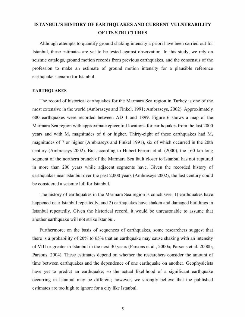
ISTANBUL’S HISTORY OF EARTHQUAKES AND CURRENT VULNERABILITY
OF ITS STRUCTURES
Although attempts to quantify ground shaking intensity a priori have been carried out for
Istanbul, these estimates are yet to be tested against observation. In this study, we rely on
seismic catalogs, ground motion records from previous earthquakes, and the consensus of the
profession to make an estimate of ground motion intensity for a plausible reference
earthquake scenario for Istanbul.
EARTHQUAKES
The record of historical earthquakes for the Marmara Sea region in Turkey is one of the
most extensive in the world (Ambraseys and Finkel, 1991; Ambraseys, 2002). Approximately
600 earthquakes were recorded between AD 1 and 1899. Figure 6 shows a map of the
Marmara Sea region with approximate epicentral locations for earthquakes from the last 2000
years and with Ms magnitudes of 6 or higher. Thirty-eight of these earthquakes had Ms
magnitudes of 7 or higher (Ambraseys and Finkel 1991), six of which occurred in the 20th
century (Ambraseys 2002). But according to Hubert-Ferrari et al. (2000), the 160 km-long
segment of the northern branch of the Marmara Sea fault closer to Istanbul has not ruptured
in more than 200 years while adjacent segments have. Given the recorded history of
earthquakes near Istanbul over the past 2,000 years (Ambraseys 2002), the last century could
be considered a seismic lull for Istanbul.
The history of earthquakes in the Marmara Sea region is conclusive: 1) earthquakes have
happened near Istanbul repeatedly, and 2) earthquakes have shaken and damaged buildings in
Istanbul repeatedly. Given the historical record, it would be unreasonable to assume that
another earthquake will not strike Istanbul.
Furthermore, on the basis of sequences of earthquakes, some researchers suggest that
there is a probability of 20% to 65% that an earthquake may cause shaking with an intensity
of VIII or greater in Istanbul in the next 30 years (Parsons et al., 2000a; Parsons et al. 2000b;
Parsons, 2004). These estimates depend on whether the researchers consider the amount of
time between earthquakes and the dependence of one earthquake on another. Geophysicists
have yet to predict an earthquake, so the actual likelihood of a significant earthquake
occurring in Istanbul may be different; however, we strongly believe that the published
estimates are too high to ignore for a city like Istanbul.

6
STRUCTURES
Much of the city was built in the last 40 years in a frantic effort to respond to a large
demographic explosion (Figure 7).The rush led to an inventory of buildings with poor
structures, the vulnerability of which, as we shall discuss, is comparable to the vulnerability
of structures affected by the 1999 Marmara and Düzce earthquakes. It is important to
recognize that construction of more than half of the buildings in Istanbul is unmonitored and
undocumented (Green 2005).
Since the 1999 earthquakes in Izmit and Düzce, several surveys have been carried out to
estimate characteristics of the building inventory for Istanbul. A census conducted in 2000
provided information regarding number of stories and type of construction for buildings
throughout the city. These data have been used by JICA (2002) to make projections about
structural vulnerability. Ozcebe et al. (2006) conducted a study of a specific neighborhood
(Zeytinburnu) in which data regarding cross-sectional areas of structural elements and floor
areas were collected for approximately 3000 reinforced concrete buildings. The data
collected by Ozcebe at al. are used in this study.
WHAT IS EXPECTED FOR ISTANBUL?
EXPECTED EARTHQUAKE
The northern segments of the main Marmara Sea fault zone are approximately 5 to 15 km
south of the southern shoreline of Istanbul (Figure 8). Approximately two-thirds of the city is
within 20 km of the fault zone (Figure 9, adapted from JICA 2002). Therefore, in terms of
distance to the seismic source, one cannot make a clear distinction between Istanbul and
Düzce (Table 1, Figure 8). The orientation of the Marmara Sea fault zone near Istanbul is
different from the orientation of the North Anatolian fault zone near Düzce, and the
consequences of these differences in future earthquakes are difficult to estimate.
According to JICA (2002), the faults near Istanbul are capable of generating earthquakes
with Mw magnitudes of 6.9 to 7.7. It should be noted that the earthquakes considered in the
JICA (2002) study are similar in magnitude and intensity characteristics to those given by
Parsons (2004), in which earthquakes with magnitude ≥ 7 are considered, and Parsons et al.
(2000), in which earthquakes causing ≥ 8 shaking intensity are considered. Parsons (2004)
projected that the probability of an event with M≥7 near Istanbul in the period 2004-2034 is

7
approximately 40%. The Düzce and Marmara earthquakes had Mw magnitudes of 7.2 and
7.4. Again, in terms of magnitude, one cannot identify a clear distinction between a plausible
earthquake in Istanbul and the 1999 earthquakes.
Although Düzce is located on 250-m deep alluvial deposits (Dönmez, 2005), acceleration
records obtained in 1999 do not indicate strong influence of soils. In fact, the spectra for the
records from Düzce resemble spectra for records obtained on stiff soils in California. In
contrast, the 1999 Marmara earthquake made evident the presence of soft soil deposits in the
European side of Istanbul. We note that although the properties of soil deposits could vary
significantly over a few hundred meters in Istanbul (JICA, 2002), we suggest that
uncertainties and variations in ground motion are too large to warrant incorporation of
microzonation statistics into our forecasts.
On the basis of the similarities described, it is reasonable to expect that the intensity of
future ground motions in the southern two-thirds of Istanbul, i.e. within 20 km of the fault
zone (Figure 9), will not be less than the ground motion intensity observed in Düzce during
the 1999 earthquakes.
STRUCTURES
Teams lead by researchers from the Middle East Technical University (Ozcebe et al.,
2006) conducted a detailed investigation of the building stock in the Zeytinburnu district of
Istanbul. This district is located on the south-eastern region of the European part of Istanbul
(see Figure 10) and houses approximately 240,000 people (about 2% of the population of
Istanbul) in 16,000 buildings (about 1.6% of the total number of buildings in Istanbul).
Approximately 3,000 buildings were surveyed. Each survey included information on total
column, wall and floor areas. The average column index computed for the buildings surveyed
is 0.17%, the average wall index is 0.03%. Observe that the average relative amount of walls
is very small. The mean priority index is 0.19% with a standard deviation of 0.08%,
indicating that 99% of the buildings in Zeytinburnu are likely to have a priority index of less
than 0.40% (Figure 11). Recall that, in Düzce, severe structural damage and collapses
concentrated in buildings with priority indices not exceeding 0.40% (see Figure 5).

8
INFERENCES
The discussions above lead to two simple conclusions: 1) there is no substantial evidence
indicating that future ground motion in the parts of Istanbul that are within 20 km from the
fault zone will be less demanding than the ground motions that devastated Düzce; 2) the
structures of buildings in Istanbul are no better than the structures of buildings in Düzce.
If our conclusions are correct, one should expect the percentage of buildings that may
experience severe damage or collapse in the southern parts of Istanbul to be the same as that
of Düzce (40%). Assuming that two-thirds of the buildings in Istanbul are within 20 km from
the fault zone, we could expect that at least 250,000 buildings may be severely damaged
during a future earthquake in Istanbul. To obtain this estimate, we have ignored the fact that
there is a higher percentage of buildings with three or more stories in Istanbul than in Düzce
(compare the distribution of buildings in Figures 5 and 11). As Figure 5 indicates, those
buildings may be more vulnerable.
Even if we are wrong by a factor of two, our projection is alarming. We cannot estimate
with certainty the number of buildings that may collapse but almost any sensible guess leads
to a grim conclusion.
CONCLUSIONS
There is no convincing evidence indicating that future ground motion in the parts of
Istanbul within 20 km from the fault zone will be less demanding than the ground motions
that devastated Düzce in 1999. The structures of the buildings in Istanbul are no better than
the structures of buildings in Düzce. On the basis of these arguments, we project that a future
earthquake near Istanbul may cause severe damage or collapse of approximately one quarter
of a million buildings.
Given the current state of building inventory in Istanbul and the high probability of a
significant earthquake striking in the near future, we believe that Istanbul is facing a
tremendous risk of experiencing a catastrophe of unseen proportions. We do not believe that
leaving the vulnerable buildings as they are and organizing for emergency response is an
option for Istanbul. Efficient mitigation efforts must be undertaken urgently to improve or
replace the buildings in Istanbul.

9
ACKNOWLEDGMENTS
This work was completed thanks to support provided by the National Science Foundation’s
Structural Systems & Hazard Mitigation of Structures Program (award # CMS 0512964).
TABLES
Table 1. Strong motion information for Bolu and Düzce recorded during the 1999 earthquakes (from Ozturk, 2003)
Station Earthquake Distance to Fault
PGA PGV
[km] [g] [cm/sec] BOLU 17 Aug. 50 --- ---
12 Nov. 15-20 0.8 60 DÜZCE 17 Aug. 10-15 0.4 60
12 Nov. 8 0.5 90

10
FIGURES
IstanbulIstanbul
Figure 1. True-color photograph of Istanbul and the Bosporus Strait (adapted from NASA/EOS,
2004).

11
Figure 2. Locations of Düzce and Bolu with respect to fault of 12 November 1999 earthquake (from Dönmez, 2005)
Figure 3. Bolu and the location of the ground motion recording station (from Dönmez, 2005).

12
Figure 4. The distribution of damage in Düzce and the relative location of the ground motion recording station (from Dönmez, 2005)
PRIORITY INDEX VS. NUMBER OF STORIES
0.0%
0.2%
0.4%
0.6%
0.8%
1.0%
1.2%
1.4%
0 1 2 3 4 5 6 7
NUMBER OF STORIES
PRIO
RIT
Y IN
DEX
Severe Damage and Collapse
No Damage to Moderate Damage
Figure 5. Priority index for the buildings surveyed in Düzce (adapted from Dönmez, 2005).

13
Figure 6. Estimated Spatial Distribution of Earthquakes in the Marmara Sea region during last 2000 years (adapted from Ambraseys and Finkel, 1991). Note: the 1999 events are not included in this
figure.
0
2,000,000
4,000,000
6,000,000
8,000,000
10,000,000
12,000,000
1927 1935 1940 1945 1950 1955 1960 1965 1970 1975 1980 1985 1990 1997
Year
Popu
latio
n
Figure 7. Growth of population in Istanbul (adapted from IMM, 2005). DIE (2005) projects the population of the city as approximately 12 million for 2006.

14
Figure 8. Bathymetric map of part of the Marmara fault zone (adapted from Le Pichon et al., 2001). Main active faults are shown with thick black lines.
Figure 9. Istanbul and the area within 20 km of the Marmara fault (adapted from JICA, 2002).

15
Figure 10. Zeytinburnu, Istanbul (large circle) (adapted from JICA, 2002).
ISTANBUL (ZEYTINBURNU)
0.0%
0.2%
0.4%
0.6%
0.8%
1.0%
1.2%
1.4%
0 1 2 3 4 5 6 7NUMBER OF STORIES
PR
IOR
ITY
IND
EX
99%
Figure 11. Zeytinburnu number of stories versus priority index distribution.
16
REFERENCES
Ambraseys, N., and C. Finkel, 1991, Long-term seismicity of Istanbul and of the Marmara Sea region,
Terra, 3, 527-539.
Ambraseys, N., 2002, The Seismic activity of the Marmara Sea region over the last 2000 years,
Bulletin of the Seismological Society of America, 92, 1, 1-18.
Devlet Istatistik Enstitusu (DIE), 1997, General Census, Republic of Turkey, Prime Ministry State
Institute of Statistics, http://www.die.gov.tr.
Devlet Istatistik Enstitusu (DIE), 2005, Mid-year Population Projections by Provinces, 2000-2010,
Republic of Turkey, Prime Ministry State Institute of Statistics, http://www.die.gov.tr.
Devlet Planlama Teskilati (DPT), 2001. Düzce ili raporu. eds. Özaslan, M., G. Ersahin, D. Akkahve,
and A. Sabuncu. The Prime Ministry of Republic of Turkey, State Planning Organization.
http://ekutup.dpt.gov.tr/iller/duzce/2001.pdf (in Turkish)
Dönmez, 2005, “Spatial Distribution of Damage Caused by the 1999 Earthquakes in Turkey,”
Earthquake Spectra, EERI.
Green, P., 2005, Disaster by design: corruption, construction and catastrophe. British Journal of
Crimonology, vol. 45, 528-546.
Hassan, A.F. and M.A. Sozen, 1997, Seismic vulnerability assessment of low-rise buildings in regions
with infrequent earthquakes. American Concrete Institute Structural Journal, vol. 94, no. 1, 31-39.
Hubert-Ferrari, A., A. Barka, E. Jacques, S.S. Nalbant, B. Meyer, R. Armijo, P. Tapponnier, and
G.C.P. King, 2000, Seismic hazard in the Marmara Sea region following the 17 August 1999
Izmit earthquake, Nature, 404, 269-273.
Istanbul Metropolitan Municipality (IMM), 2005, Census Results for Istanbul, http://www.ibb.gov.tr.
Japan International Cooperation Agency (JICA), 2002, The Study on Disaster Prevention/Mitigation
Basic Plan in Istanbul including Seismic Microzonation in the Republic of Turkey: Final Report,
vol 2.
Le Pichon, X., Şengör, A.M.C., Demirbağ, E., Rangin, C., İmren, C., Armijo, R., Görür, N., Çağatay,
N., Mercier de Lepinay, B., Meyer, B., Saatçılar, R., and Tok, B., 2001, The active Main
Marmara fault, Earth and Planetary Science Letters, 192, 595-616.
NASA, 2004. Istanbul, Turkey: The Crossroads of Europe and Asia. The National Aeronautics and
Space Administration Earth Observatory website: http://earthobservatory.nasa.gov.
Ozcebe, G., H. Sucuoglu, M. S. Yucemen, A. Yakut, and J. Kubin, 2006. Seismic Risk Assessment of
Existing Building Stock in Istanbul: A Pilot Application in Zeytinburnu Districti. Proceedings of
17
the 8th U.S. National Conference on Earthquake Engineering, Paper No. 1737, April 2006, San
Francisco, CA.
Ozturk, B.M., 2003. Seismic drift response of building structures in seismically active and near-fault
regions. Ph.D. Thesis. Purdue University, West Lafayette, Indiana.
Parsons, T., 2004, Recalculated probability of M>=7 earthquakes beneath the Sea of Marmara,
Turkey, Journal of Geophysical Research, Vol. 109, B05304.
Parsons, T., S. Toda, R.S. Stein, and J.H. Dieterich, 2000a. Influence of the 17 August 1999 Izmit
earthquake on seismic hazards in Istanbul, in A. Barka, O. Kozaci, S. Akyuz and E. Altunel
(Eds.), The 1999 Izmit and Düzce Earthquakes: Preliminary results, pp. 295-310.
Parsons, T., S. Toda, R.S. Stein, A. Barka, and J.H. Dieterich, 2000b, Heightened odds of large
earthquakes near Istanbul: an interaction-based probability calculation, Science, 288, 661-665.