an introduction to data interoperability -...
TRANSCRIPT

2012 Technical Workshops |
Esri International User Conference San Diego, California
An Introduction to Data Interoperability
Bruce Harold - Esri
Dale Lutz – Safe Software
July 24/25

Background Why Data Interoperability?

What is the Data Interoperability Extension?
• Format Support – Adds support for 130+ data formats – Custom Formats – Direct use in ArcGIS Desktop
• Quick Data Translation – Data Interoperability Tools Toolbox – Convert between data formats
• Spatial ETL (Extract, Transform, Load) – Schema Mapping (may be Dynamic) – Transformation of Geometry – Logic Controls Data Flow – Per Feature
ESRI & SAFE Co-Development based on FME

ArcGIS 10.0 Data Interop Common Tasks
• Data Integration - Bring multiple datasets together
• Data Migration - Process of moving data between systems
• Data Cleanup / Data Manipulation - Clean up errors in the data and streamline data preparation
• Data Distribution - Distribute data to different systems
• Change Detection - Determine changes between two different files
• Data Validation - Verify and validate spatial data
• Managing Databases – Spatial types in a DBMS
ETL

Data Interoperability Differentiators Not Just About Schema Manipulation
• 3D PDF Writing - Share “data” with the world
• Vertical Datum Handling - When working with water, transmission
• XML Documents as Features or Attributes • JSON Documents as Attributes • HTTP interaction • GeoRSS interaction • Cross-platform SQL support
- SQLite temporary workspace
• Parallel Processing

Basics: OGC Support What you get just by installing
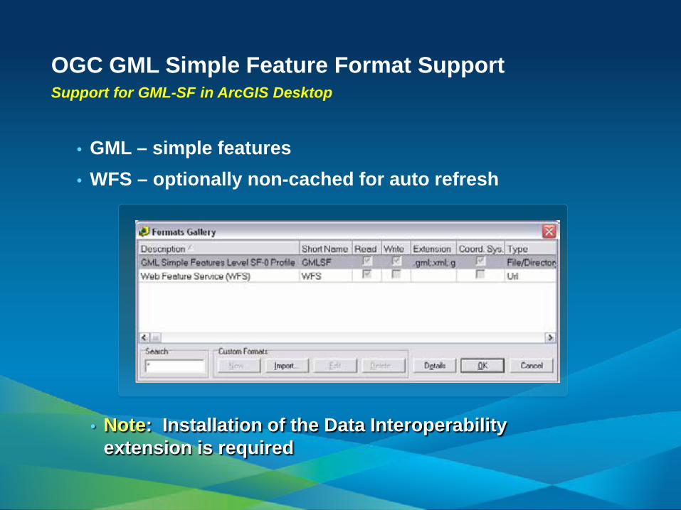
OGC GML Simple Feature Format Support Support for GML-SF in ArcGIS Desktop
• GML – simple features • WFS – optionally non-cached for auto refresh
• Note: Installation of the Data Interoperability extension is required

OGC Demo: GML & WFS
Bruce Harold

Demo Summary: GML & WFS
• Comes Free - But you have to install - Simple Features Only
• Better with the extension licensed
- Non-simple parameters supported
• Direct Read of GML, consume WFS
• Important in many jurisdictions

Using Formats Direct Read of any format
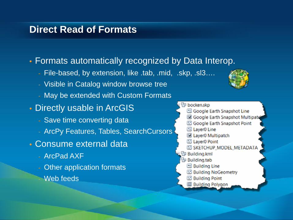
Direct Read of Formats
• Formats automatically recognized by Data Interop. - File-based, by extension, like .tab, .mid, .skp, .sl3…. - Visible in Catalog window browse tree - May be extended with Custom Formats
• Directly usable in ArcGIS - Save time converting data - ArcPy Features, Tables, SearchCursors
• Consume external data - ArcPad AXF - Other application formats - Web feeds

Easy Format Selection
• Browse or Search

When to Browse and when to Connect Browse & Direct Read uses format defaults
• Many formats have optional parameters - Select subsets, set conditions, passwords, filters…
• Connections give you access to format parameters • Connections let you set Coordinate Systems

Interoperability Connections Persist between application sessions
• Convenient to access in browse tree • Retain your settings • Off-disk data
- Web Feeds - Google Spreadsheets
• Share with colleagues - .FDL file created - C:\Users\<user>\AppData\Roaming\Safe
Software\Interoperability

Bruce Harold Formats Demo: Direct Read

Demo Summary: Direct Read
• Direct Read Summary - Directly read, inspect and browse within ArcGIS - Works like native ESRI formats
- Access directly in ArcMap, Geoprocessing
- No development or customization required
• Just works!

Quick Translation Quick Import & Quick Export GP Tools
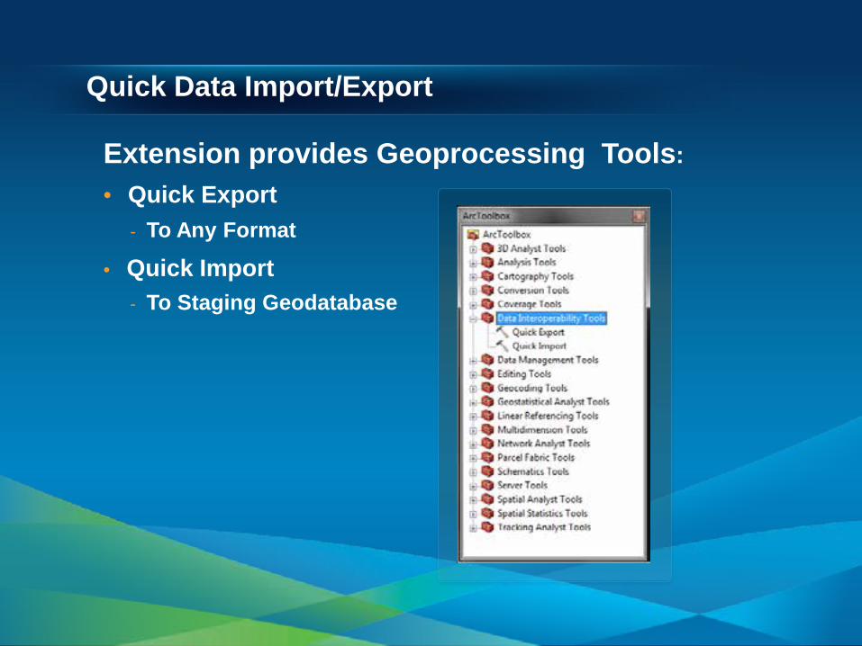
Quick Data Import/Export
Extension provides Geoprocessing Tools: • Quick Export
- To Any Format
• Quick Import - To Staging Geodatabase

Automation and Quick Translations
• Use Quick Tools in ModelBuilder - Get any format into a temporary File GDB - Handle Multiple Formats In/Out

Bruce Harold
Quick Translate Demo: Quick Export

Demo Summary: Quick Import/Export
• “Quick” GP Tools - Useful in ModelBuilder - Also Scriptable in Python
- Easy interaction with others
- Departments - Contractors - 3rd Party Software Users

Leveraging Formats Custom Formats
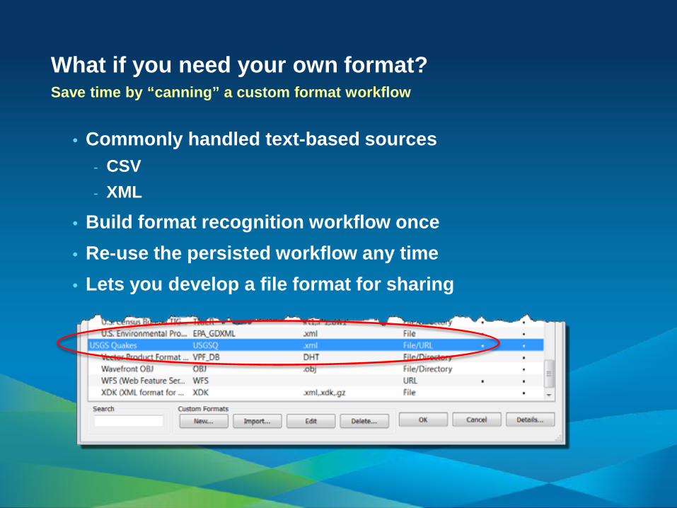
What if you need your own format? Save time by “canning” a custom format workflow
• Commonly handled text-based sources - CSV - XML
• Build format recognition workflow once • Re-use the persisted workflow any time • Lets you develop a file format for sharing
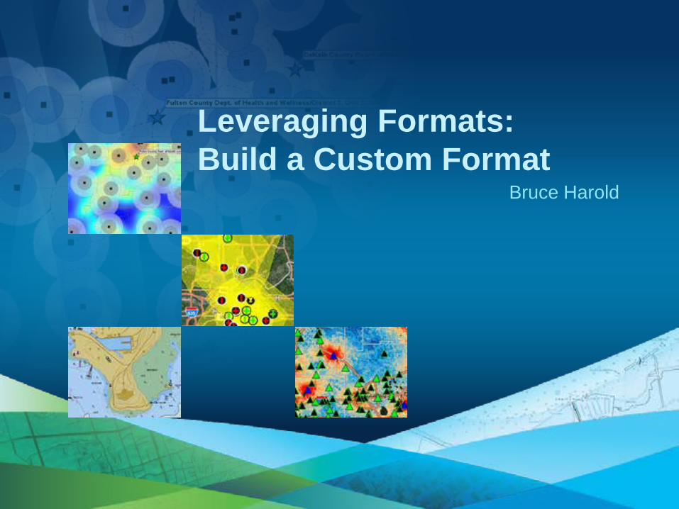
Bruce Harold
Leveraging Formats: Build a Custom Format
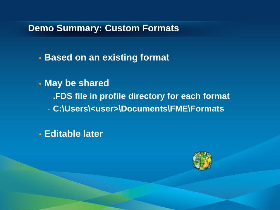
Demo Summary: Custom Formats
• Based on an existing format
• May be shared - .FDS file in profile directory for each format - C:\Users\<user>\Documents\FME\Formats
• Editable later

The Power of Transformation Spatial ETL

The Full Power of Spatial ETL
• Formats are only part of the story • Often the format does not change *
- But the schema does
• Transformation is key - Many categories of transformer - Feature by Feature or Dataset by Dataset - Geometry or Attribute transformations
• Many Inputs Many Outputs is OK
*like shapefile to shapefile
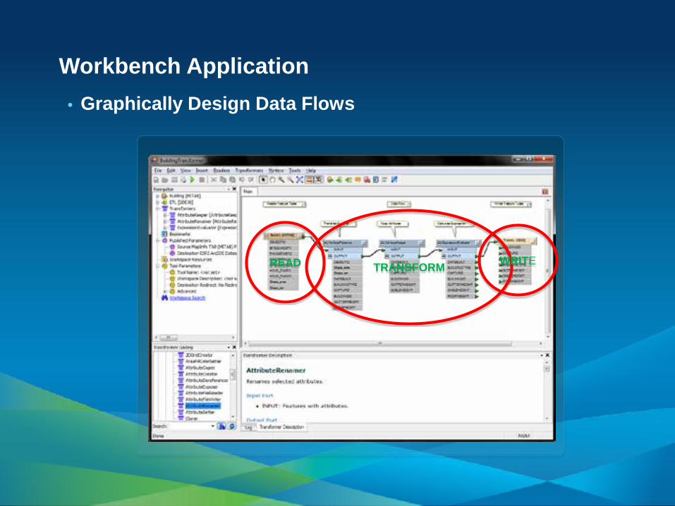
Workbench Application • Graphically Design Data Flows
READ TRANSFORM WRITE

It’s a Pipeline
• Readers send features into the workspace - Geometry – X:Y:Z:M - Attributes – with a schema
• Transformers “do something’ - May operate “per feature” and pass it immediately - May work on sets or all features together - Some offer parallel processing
• Writers send features to the destination
DATA

Some Transformers Are All You Need • This example derives Adds, Deletes and NoChanges in one
step - Esri Community Maps contributor data is processed this way

The Power of Transformation • Using Spatial ETL
• 100’s of Transformers - Categorized
• Browse • Search • Popup in Workbench • Navigate to in Workbench • Don’t see what you need?
- Ask for it!

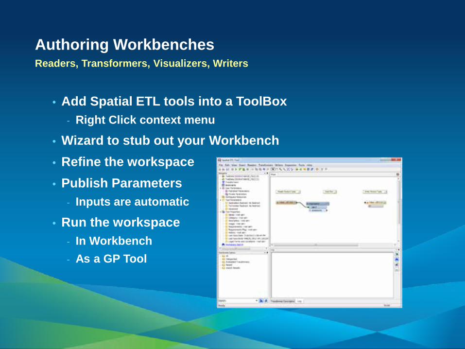
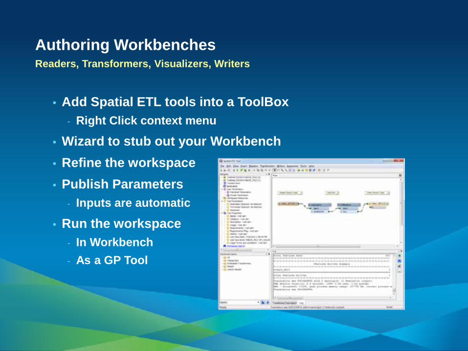
Authoring Workbenches Readers, Transformers, Visualizers, Writers
• Add Spatial ETL tools into a ToolBox - Right Click context menu
• Wizard to stub out your Workbench • Refine the workspace • Publish Parameters
- Inputs are automatic
• Run the workspace - In Workbench - As a GP Tool
Authoring Workbenches Readers, Transformers, Visualizers, Writers
• Add Spatial ETL tools into a ToolBox - Right Click context menu
• Wizard to stub out your Workbench • Refine the workspace • Publish Parameters
- Inputs are automatic
• Run the workspace - In Workbench - As a GP Tool

Authoring Workbenches Readers, Transformers, Visualizers, Writers
• Add Spatial ETL tools into a ToolBox - Right Click context menu
• Wizard to stub out your Workbench • Refine the workspace • Publish Parameters
- Inputs are automatic
• Run the workspace - In Workbench - As a GP Tool
Authoring Workbenches Readers, Transformers, Visualizers, Writers
• Add Spatial ETL tools into a ToolBox - Right Click context menu
• Wizard to stub out your Workbench • Refine the workspace • Publish Parameters
- Inputs are automatic
• Run the workspace - In Workbench - As a GP Tool

Bruce Harold
Full ETL Demo: Some LiDAR Workflows

Demo Summary: Spatial ETL
• Complements Core Functionality
• Analogous to ModelBuilder, except… - Feature by Feature granularity - Feature geometry manipulable - Non-Esri data sources are OK

Wrapping Up More on use cases…
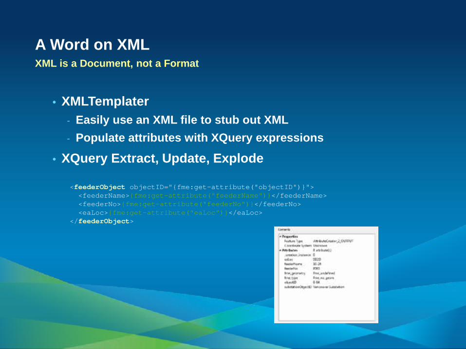
A Word on XML XML is a Document, not a Format
• XMLTemplater - Easily use an XML file to stub out XML - Populate attributes with XQuery expressions
• XQuery Extract, Update, Explode
<feederObject objectID="{fme:get-attribute("objectID")}"> <feederName>{fme:get-attribute("feederName")}</feederName> <feederNo>{fme:get-attribute("feederNo")}</feederNo> <eaLoc>{fme:get-attribute("eaLoc")}</eaLoc> </feederObject>

Organizational Interaction
State
Federal
Regional / County
ETL
National GIS

ArcGIS Server and Data Interoperability 64bit
• Non-Native formats in Map Services • Publish ETL as GP services • Esri WFS services more flexible
- Non-cached streaming option - Setting in interop connection
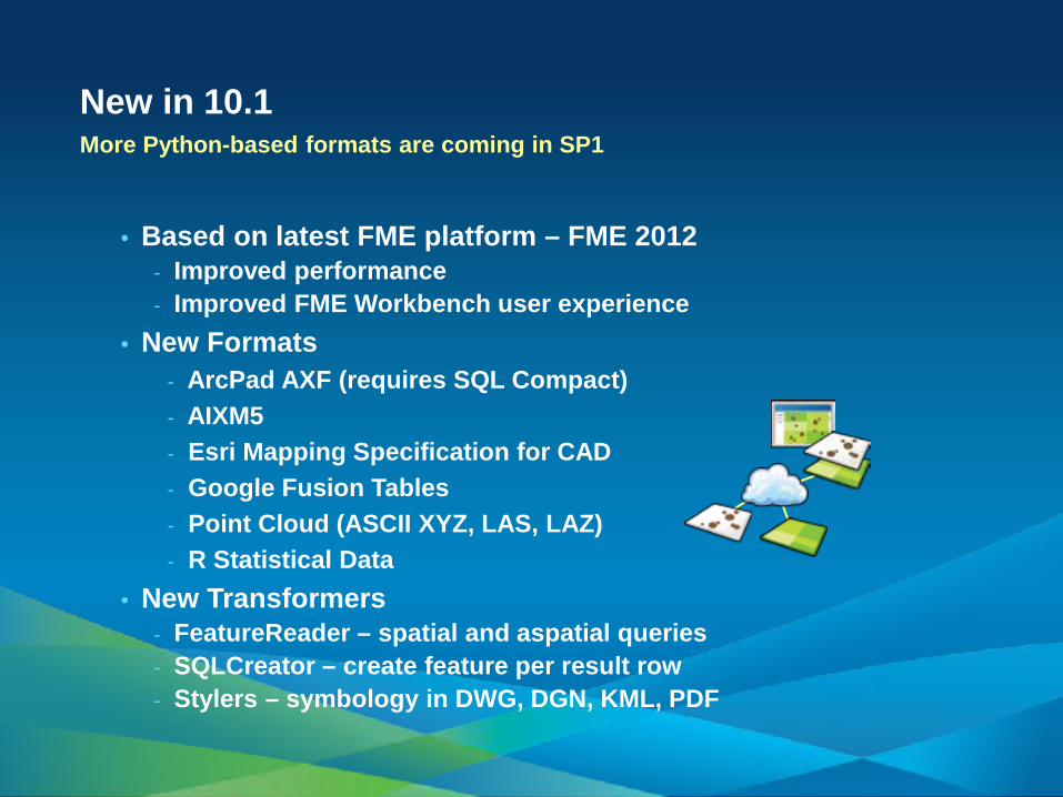
New in 10.1 More Python-based formats are coming in SP1
• Based on latest FME platform – FME 2012 - Improved performance - Improved FME Workbench user experience
• New Formats - ArcPad AXF (requires SQL Compact) - AIXM5 - Esri Mapping Specification for CAD - Google Fusion Tables - Point Cloud (ASCII XYZ, LAS, LAZ) - R Statistical Data
• New Transformers - FeatureReader – spatial and aspatial queries - SQLCreator – create feature per result row - Stylers – symbology in DWG, DGN, KML, PDF

Resources: Learn More
• How do I try it? - Request software evaluation (60 days): - http://www.esri.com/software/arcgis/extensions/datainte
roperability/evaluate
• How do I learn it? - Two free courses (new for-fee courses coming): - http://training.esri.com/gateway/index.cfm?fa=catalog.w
ebCourseDetail&courseid=1720 - http://training.esri.com/gateway/index.cfm?fa=catalog.w
ebCourseDetail&courseid=1588
• Who do I talk to? - Visit the Analysis Island in the Esri Showcase or the SAFE
Software booth (#2400) in the exhibit hall.

Steps to evaluate UC sessions www.esri.com/ucsurveysessions
• My UC Homepage > “Evaluate Sessions”
• Choose session from planner OR
• Search for session

• Thank you for attending
• Have fun at UC2012
• We are now open for Questions
• Please fill out the evaluation:
www.esri.com/ucsessionsurveys
First Offering (Tuesday) ID: 1164
Second Offering (Wednesday) ID: 752