burrillville reconnaissance report · blackstone valley heritage landscape inventory 3 burrillville...
TRANSCRIPT

BURRILLVILLE RECONNAISSANCE REPORT
BLACKSTONE VALLEY HERITAGE LANDSCAPE INVENTORY
Rhode Island Historical Preservation and Heritage Commission Blackstone River Valley National Heritage Corridor Commission

PROJECT TEAM Rhode Island Historical Preservation and Heritage Commission Richard E Greenwood, Ph.D., Deputy Director Blackstone River Valley National Heritage Corridor Commission Joanna Doherty, Community Planner Project Consultants Gretchen G. Schuler Shary Page Berg Local Project Coordinator Thomas Kravitz, Town Planner December 2010 Cover Photographs: Agricultural field on Croff Road, dam in Harrisville (BRVNHCC photo), Harrisville Common in winter (BRVNHCC photo)

CONTENTS Introduction . . . . . . . . . . . . . . . . . . . . . . . . . . . . . . . . . . . . . . . . . . . . . . . . . . . . .1 Regional Historical Themes . . . . . . . . . . . . . . . . . . . . . . . . . . . . . . . . . . . . . . . . 2 Burrillville History . . . . . . . . . . . . . . . . . . . . . . . . . . . . . . . . . . . . . . . . . . . . . . . .4 Priority Heritage Landscapes. . . . . . . . . . . . . . . . . . . . . . . . . . . . . . . . . . . . . . . 5 Pascoag Village
Sayles-Cook Burial Ground Sweet’s Hill Farm Wakefield Pond Wallum Lake
Regional Critical Concerns . . . . . . . . . . . . . . . . . . . . . . . . . . . . . . . . . . . . . . . .13 Agricultural Landscapes Burial Grounds Civic and Institutional Properties
Lakes, Ponds and Reservoirs Local Scenic Roads Mill Villages
Stone Walls General Preservation Planning Recommendations . . . . . . . . . . . . . . . . . . . . 15 Survey of Heritage Landscapes National Register Program Community-Wide Preservation and Zoning Strategies
Agricultural Landscapes Burial Grounds Civic and Institutional Properties Lakes, Ponds and Reservoirs Local Scenic Roads Mill Villages Stone Wall Preservation Funding of Preservation Projects Conclusions . . . . . . . . . . . . . . . . . . . . . . . . . . . . . . . . . . . . . . . . . . . . . . . . . . . . 25 Appendices
A. Heritage Landscapes Identified by Community . . . . . . . . . . . . . 26
B. Existing Resource Documentation and Planning Tools. . . . . . . . 31 Inventory of Historic and Architectural Resources
State and National Registers of Historic Places Planning Documents and Tools

Blackstone Valley Heritage Landscape Inventory 1 Burrillville Reconnaissance Report
INTRODUCTION The Blackstone River Valley National Heritage Corridor includes 24 communities in Rhode Island and Massachusetts that are linked by a common geography and by historical events that helped to shape the Industrial Revolution, which is central to America’s economic, social and political development. Five Rhode Island communities – Burrillville, Glocester, Lincoln, North Smithfield and Smithfield – have joined together to participate in a study of their shared legacy, a rich cultural heritage that represents the dynamic interaction between nature and culture. Heritage landscapes are special places created by human interaction with the natural environment that help define the character of a community and reflect its past. They are dynamic and evolving; they reflect the region’s history and provide a sense of place; they include the natural ecology that influenced land use patterns; and they often have scenic qualities. These landscapes are central to each community’s character, yet heritage landscapes are vulnerable and ever changing. For this reason it is important to take the first steps towards their preservation by identifying those landscapes that are particularly valued by each community – a favorite local farm, a distinctive mill village, a unique Native American site or an important river corridor. The program is funded by the Rhode Island Historical Preservation and Heritage Commission (RIHPHC) and the Blackstone River Valley National Heritage Corridor Commission (BRVNHCC). The primary goal of the program is to help communities identify a wide range of landscape resources, particularly those that are significant and unprotected. The focus is on connecting landscapes to show how they are part of the larger heritage landscape that is the defining character of a community. Another important goal of the program is to provide communities with strategies for preserving heritage landscapes. The methodology for Heritage Landscape Inventory programs was developed in Massachusetts and is outlined in the Massachusetts Department of Conservation and Recreation’s publication Reading the Land. This methodology, which was used to study Blackstone River Valley communities in Massachusetts in 2007, has provided a baseline for the HLI program in Rhode Island. In each community the town planner served as the Local Project Coordinator (LPC) to assist the RIHPHC-BRVNHCC consulting team. The LPC organized a heritage landscape identification meeting at which interested residents and town officials offered input by identifying heritage landscapes. This meeting was followed by a fieldwork session including the consulting team and the LPC, often accompanied by other community members. This group visited the priority landscapes identified in the meeting and gathered information about the community. The final product is this Reconnaissance Report, prepared for each participating community.

Blackstone Valley Heritage Landscape Inventory 2 Burrillville Reconnaissance Report
REGIONAL HISTORICAL THEMES Each of the five communities participating in the program is unique, yet there are strong connections in their historic patterns of development – the ways in which the land was used and in which that history emerges today. Rhode Island’s Blackstone Valley is located in the northern part of the state and comprises cities like Providence and Pawtucket as well as small towns. The rich natural resources of this region attracted and supported Native Americans for thousands of years. Narragansetts, Nipmucks and Wampanoags moved through the area fishing along the rivers, hunting in the uplands, and establishing settlements where they cultivated crops and left behind burial and ceremonial sites. Although this region was considered part of the Providence Plantation established in 1636, it was not until the late 1660s and early 1670s, just before the King Philip’s War, that Europeans began to establish themselves in the Blackstone Valley. Early farms were supported by grist and saw mills on the many rivers that flowed through these communities. In 1731 the study area (Burrillville, Glocester, Lincoln, North Smithfield and Smithfield) separated from the town of Providence to become Smithfield and Glocester. The water power at the early mill sites was a key factor in the shift of the region’s solely agrarian economy to a new base of textile mills and agriculture. This began with the 1793 Slater Mill in Pawtucket and was quickly followed by many small mill villages, which were the nuclei of development throughout the 19th and into the 20th century. The rise in the textile industry led to expansion of the agrarian economy to sustain the mill villages. Transportation patterns connecting the villages and their mills were important to the growth of the region. Several main routes followed old Indian trails and eventually were supplemented by the first turnpikes. The Blackstone Canal was constructed in 1824-1828 roughly paralleling the Blackstone River, and serviced the mills and villages in the valley. Most of the towns flourished during the 19th century, with a wider variety of industrial activities taking place – initially small-scale mills but by mid century larger mill complexes, most of which took advantage of the water power provided by the extensive network of rivers and streams. It was during this era that the present day village centers, which remain the focal point of all five communities, emerged. Many of the communities developed their social infrastructure in the 19th century – schools, granges, churches, burial grounds. The early twentieth century brought better transportation systems – improved roads for the new travel modes of automobiles as well as trolleys – and new recreational use of the region’s many lakes. However, at the same time came the decline of industrial activity in the Northeast, hence the reduction in use of the many large mill structures.

Blackstone Valley Heritage Landscape Inventory 3 Burrillville Reconnaissance Report
The second part of the 20th century brought further improvements to the transportation system and new patterns of suburban development. The decline of industrial activity continued except in a few instances where modern companies such as Tupperware reused factory buildings. Other businesses that have helped to sustain the regional economy include institutions, corporate headquarters and local commerce necessary in all communities. Today, many of the region’s residents commute to Providence.
Blackstone River Participating Communities Other Rhode Island Communities in Blackstone Valley
BLACKSTONE VALLEY HERITAGE LANDSCAPE INVENTORY

Blackstone Valley Heritage Landscape Inventory 4 Burrillville Reconnaissance Report
BURRILLVILLE HISTORY
Although Native Americans, especially the Nipmucks and the Pascoag sub-tribe, occupied the Burrillville area for thousands of years, there are few confirmed sites. Waterways such as the Branch, Chepachet, Clear and Pascoag Rivers were fertile ground for fishing, hunting, gathering and some agriculture. Burrillville, located in the northwest corner of Rhode Island, was part of the Providence Plantation from 1636, but European settlers did not arrive until the late 17th century. In 1731 the area was carved into several towns, with Burrillville initially the northern part of Glocester. Agriculture was the dominant land use through the 18th century with scattered rural population. Remnant houses, stone walls and road patterns remain from this period. By the end of the 18th century there were small-scale industries scattered along the waterways. Burrillville became a separate community in 1806, named for James Burrill, a Rhode Island State Senator and Attorney General who was instrumental in establishing the town. The community’s numerous waterways provided power for a growing number of mills, which formed the nuclei of the small villages, such as Harrisville, Mapleville and Pascoag, which remain characteristic of the community’s land use patterns. Initially the mills were small and diversified but by the second half of the 19th century, most of the economy was devoted to woolen mills, with many large mill complexes constructed, such as the Mapleville Mills, Oak Valley Mills and the Stillwater Mill complex. The textile industry was active into the 20th century but gradually the mills ceased operation. Many were destroyed, while others have been converted to new uses such as housing or office space. Mill worker housing, which expanded greatly in the late 19th century, remains a characteristic housing type in Burrillville today. Agriculture, which had always been difficult due to the shallow rocky soil, declined during this period. A few farms remain but much of the agricultural land has reverted to forest.
Around 1900 the electric street railway brought urban residents to the area’s
many lakes for recreation. Spring Lake became a resort, with campsites also along Wallum Lake and Pascoag Reservoir. Suburban development began around 1900 and has intensified since the 1960s, but there are also large areas of unoccupied land, including 6,000 acres of state forest. Mill villages remain a focal point of the community and are central to Burrillville’s cultural heritage. The town also has a large number of institutional buildings such as schools and churches, as well as the Zambarano Unit of the Eleanor Slater Hospital. Early settlers in Burrillville came primarily from within Rhode Island. By the mid-19th century, there was an influx of immigrants who came to work in the mills, first the Irish, followed by French Canadians. The population was 6,317 in 1900, with residents concentrated in the villages along the rivers. While the villages remain central to Burrillville’s identity, since the 1950s there has also been growing suburbanization, which brought the population to 15,796 by 2000.
Blackstone Valley Heritage Landscape Inventory 5 Burrillville Reconnaissance Report
PRIORITY HERITAGE LANDSCAPES Burrillville’s Heritage Landscape Identification meeting was held on May 20, 2010. During the meeting residents compiled a lengthy list of the town's heritage landscapes, which is included in Appendix A. Attendees were then asked to articulate the value of each landscape and the issues relating to its preservation. Based on the information gathered, community members identified a group of priority landscapes to be visited by the consulting team during the fieldwork. Each of the priority landscapes is highly valued, contributes to community character and is not permanently protected or preserved. These landscapes, which are listed alphabetically, represent a range of scales and types of resources, from individual properties to an entire mill village. Several include areas that have multiple layers. For example, a mill village that is considered a heritage landscape may also include specific features that are individually recognized as heritage landscapes. Such layering shows the complexity and interdependence that are characteristic of most heritage landscapes. The descriptions and recommendations included here are an initial step in identifying resources valued by the community and suggesting action strategies. Pascoag Village Pascoag is one of Burrillville’s two main villages, located along the Pascoag River west of Harrisville. Saw and grist mills were established there by 1746, with later development of fulling and dressing mills, as well as many late 19th and early 20th residential properties in the compact village center. With the decline of the industrial economy in the 1950s, many of the mills were demolished and replaced by retail stores and commercial services. However, much of the rest of the historic village fabric remains intact. A 2005 economic redevelopment plan for Pascoag prepared by the Cecil Group identified opportunities and constraints, as well as resources to improve the physical and economic conditions of the village. One of the key issues identified in the report was disinvestment in the village, as many of the buildings are in poor condition and underutilized. Major recommendations included: redevelopment of key properties to serve as anchors for the village; providing incentives to owners for making improvements for their buildings; traffic and roadway improvements; and investment in infrastructure. Since that time the town has made a major investment in the Riverwalk that runs through the downtown area. Additional solutions might include:
Reconsider National Register eligibility of Pascoag Village. There are a large number of properties in Pascoag that have been determined eligible for the National Register. Review list and determine whether a National Register district or individual NR nominations would be the most useful planning tool.

Blackstone Valley Heritage Landscape Inventory 6 Burrillville Reconnaissance Report
Review current Village Commercial Zoning to ensure that it supports economic redevelopment efforts and the recommendations in the Economic Redevelopment Plan.
Explore potential funding sources for a façade grant program.
Develop sign design guidelines to encourage some consistency
in sign design, which can have a positive effect on the streetscape.
Consider establishing a Neighborhood Conservation District in
Pascoag, which could be less restrictive than traditional Local Historic District zoning but still preserve the character of the village by addressing features such as scale and massing.
Streetscape on Pascoag Main Street Sayles-Cook Burial Ground
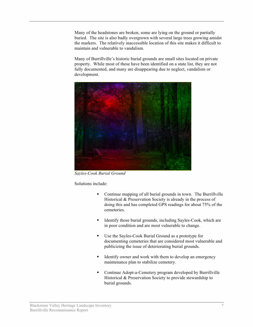
There are 132 recorded historic burial grounds in Burrillville. The Sayles-Cook Burial Ground (Burrillville Cemetery #118), which dates to the middle of the 19th century, was identified as representative of the issues facing many historic cemeteries. It is located in Pascoag, in a wooded area off Main Street and behind a CVS. It is accessible only by foot. The burial ground is 75’ by 100’ and is set on a sloping site overlooking the northern end of the Pascoag Reservoir. Access is from the uphill side. A granite block retaining wall surrounds the site on the lower sections. Most of the iron fence that once stood on top of the wall has been dismantled, with pieces piled on site, or missing altogether. The state inventory lists 22 burials, which are represented by various types of monuments. These include: two upright obelisks, two obelisks lying on the ground and approximately 12-15 headstones, predominantly marble. One of the most evocative is a small badly eroded lamb commemorating “Little Etti”.
Blackstone Valley Heritage Landscape Inventory 7 Burrillville Reconnaissance Report
Many of the headstones are broken, some are lying on the ground or partially buried. The site is also badly overgrown with several large trees growing amidst the markers. The relatively inaccessible location of this site makes it difficult to maintain and vulnerable to vandalism. Many of Burrillville’s historic burial grounds are small sites located on private property. While most of these have been identified on a state list, they are not fully documented, and many are disappearing due to neglect, vandalism or development.
Sayles-Cook Burial Ground Solutions include:
Continue mapping of all burial grounds in town. The Burrillville
Historical & Preservation Society is already in the process of doing this and has completed GPS readings for about 75% of the cemeteries.
Identify those burial grounds, including Sayles-Cook, which are
in poor condition and are most vulnerable to change.
Use the Sayles-Cook Burial Ground as a prototype for documenting cemeteries that are considered most vulnerable and publicizing the issue of deteriorating burial grounds.
Identify owner and work with them to develop an emergency
maintenance plan to stabilize cemetery.
Continue Adopt-a-Cemetery program developed by Burrillville Historical & Preservation Society to provide stewardship to burial grounds.

Blackstone Valley Heritage Landscape Inventory 8 Burrillville Reconnaissance Report
Consult organizations such as the Association for Gravestone Studies http://www.gravestonestudies.org, which are a good source of information for citizens interested in documenting burial grounds. Stone conservation work should only be undertaken by a trained conservator.
Sweet’s Hill Farm Sweet’s Hill Farm, which was known as Indian Acres when it was owned by Liston Sweet, is located on the north side of East Avenue just east of the high school. There is one large parcel of approximately 150 acres, which includes land that has not been farmed in some time. The open fields are now becoming overgrown and there are no longer any agricultural buildings on the property. Three farmhouses, which front on East Avenue and were formerly associated with the property, have been divided off into separate parcels.
Aerial view of Sweet’s Hill Farm with boundary delineated in yellow

Blackstone Valley Heritage Landscape Inventory 9 Burrillville Reconnaissance Report
East Avenue is a major route into town and residents value the 2000’ of undeveloped frontage that serves as a gateway to Harrisville and other villages in the western part of Burrillville. It is also an important open space that connects with the Black Hut Management Area and Spring Lake to the north. The site is currently located in an F5 zone that allows farming on five-acre parcels with a minimum of 450’ of frontage. The property owner is interested in exploring other development options but has recently been denied a comprehensive permit. Many town residents would like to see the area remain as open space. Rhode Island DEM is also interested but could not come to an agreement with the owner on purchase price. Others are concerned that removing this large property from the tax base would have a negative impact on the community. Solutions include:
Use Cluster Development or Rural Residential Development Ordinance to cluster development in one area and preserve the character of the large parcel.
Use of these zoning strategies can be a solution for both issues expressed by concerned residents – maintaining the view and enhancing, not decreasing, the tax base. Wakefield Pond Wakefield Pond is a 76-acre pond located south of Wakefield Road in the far western part of Burrillville, with a dam at its southwest end, just over the town/state border in Thompson, Connecticut. It was identified as a significant area in the town’s 2005 Comprehensive Plan. The pond is valued in part because there is limited development with a Boy Scout camp and only about 30 cottages on the perimeter of the pond. There are large, state-owned parcels to the north and south, as well as large nearby parcels that are owned by conservation organizations. Residents who value the area cited the good water quality and the rural atmosphere, unlike some of Burrillville’s other ponds, which are more densely developed around the perimeter. Preserving these characteristics was the primary goal expressed for the area.
Wakefield Pond

Blackstone Valley Heritage Landscape Inventory 10 Burrillville Reconnaissance Report
Solutions include:
Identify key parcels for potential acquisition by the town or by conservation organizations.
Develop water-quality testing program. Advertise results with
interpretive information.
Develop brochure for property owners on methods of protecting water quality by not using chemicals on lawns, etc. This type of educational information can be general for all water sources and personalized to the specific resource with photographs and facts about the water source.
An important partner in solutions for Wakefield Pond may be
Save the Lakes (www.stlri.org), an organization dedicated to preserving and improving fresh water in Rhode Island. Workshops presented by the organization have included information about backyard sustainable landscaping practices that protect the quality of water.
Wallum Lake Wallum Lake, located on Wallum Lake Road in the northwest corner of town, is a 275-acre lake with the southern half located in Burrillville and the northern half in Douglas, Massachusetts. Like many of the town’s lakes and ponds it was a popular recreational destination by about 1900 with small cottages built primarily along the eastern edge. It was also identified as a significant landscape in Burrillville’s 2005 Comprehensive Plan. Along the western shore of the lake is the state-owned Black Hut Management Area, which is largely forested and is managed for wildlife and recreation. At the southeastern corner of the lake is the Zambarano Unit of Eleanor Slater Hospital, a state-owned facility that was built as a tuberculosis hospital but is now used as a long-term care facility. The hospital was established in 1905 but has grown over the years to an extensive well-landscaped campus whose early buildings still reflect unique features of a TB sanatorium. The hospital is an important institution in Rhode Island that has touched the lives of many people who either worked there or had family members who were patients there. Along the eastern edge of the lake is a relatively low-density residential area consisting mostly of small, older cottages along the waterfront. However, there has been extensive sub-division of land within the area, which could lead to much greater impacts on the relatively rural lake area. One of the major issues articulated by community members was concern about water quality. This is partly due to the fact that the hospital draws its water from the lake and partly because the lake is in two states, which have different regulations. Motorized boats are not allowed in the Rhode Island section but are allowed in Massachusetts.

Blackstone Valley Heritage Landscape Inventory 11 Burrillville Reconnaissance Report
The second concern was about the future of the hospital. When it was established, the remote location was an advantage because at that time it was considered desirable to house TB patients away from major population centers. However the location is no longer advantageous for a medical facility, which is also under-utilized and expensive to operate. Solutions include:
Form a planning committee with town and hospital officials to consider issues such as the historical significance of the property, its proximity to the lake, conditions of buildings, and the hospital’s importance as a local employer.
Develop water-quality testing program. Advertise results with
interpretive information.
Develop brochure for property owners on methods of protecting water quality by not using chemicals on lawns, etc. This type of educational information can be general for all water sources and personalized to the specific resource with photographs and facts about the water source.
An important partner in solutions for Wallum Lake may be Save
the Lakes (www.stlri.org), an organization dedicated to preserving and improving fresh water in Rhode Island. Workshops presented by the organization have included information about backyard sustainable landscaping practices that protect the quality of water.
Wallum Lake viewed from Zambarano Hospital

Blackstone Valley Heritage Landscape Inventory 12 Burrillville Reconnaissance Report
Note: Priority landscapes are shown in red BURRILLVILLE’S PRIORITY LANDSCAPES BLACKSTONE VALLEY HERITAGE LANDSCAPE INVENTORY
Blackstone Valley Heritage Landscape Inventory 13 Burrillville Reconnaissance Report
REGIONAL CRITICAL CONCERNS
In addition to the five specific landscapes identified as priority landscapes, which are described in the preceding section, Burrillville residents identified 48 landscapes overall, many of which reflect issues that are common to all five communities participating in the Heritage Landscape Inventory. The full list of landscapes that were identified for Burrillville is in Appendix A, but the regional issues that they represent are summarized below. Agricultural Landscapes Farmers are the stewards of agricultural landscapes that represent important scenic resources provide fresh, locally grown food and other products to the community, and convey the agrarian lifestyle of days past. Loss of active farming and development of agricultural property were concerns of residents who attended meetings in each of the study area’s five towns. Burrillville identified eight agricultural landscapes. Preservation of agricultural land is best addressed comprehensively by establishing priorities. Priorities will depend on the physical attributes of each farm; its economic viability; the wishes of the owner; and the importance of the farm to the community. In part those were the questions asked during the landscape identification meeting in each community. Burial Grounds Each town in the study area has a large number of burial grounds, which are identified on a statewide list. The inventory lists 132 burial grounds in Burrillville, some of which were identified at the meeting as critical because they are often not known, not accessible and threatened by lack of maintenance or development. Many of these are small family burial grounds which are seriously overgrown and have damaged or missing monuments. Civic and Institutional Properties Many historic buildings, such as schools, churches and granges, have outlived their primary or original function, yet they are important as part of the historical record and often an important aspect of the visual and ephemeral character of the rural countryside or of a village center. Unless they have a valid present use, funds are typically not available to preserve them. Burrillville residents identified three properties in this category, including two camps and Zambarano Hospital. Lakes, Ponds and Reservoirs Bodies of water such as lakes, ponds and reservoirs, in each community of the study area, present challenges to nearby residents and to the town. Most lakes and ponds have a distinct historical background connected with early mills and recreational activities. Many reservoirs were created to provide drinking water.

Blackstone Valley Heritage Landscape Inventory 14 Burrillville Reconnaissance Report
They are part of the background story and important to the quality of life today. Challenges are impacts of present-day uses, which are more intense than in the past, and in many cases are impacting water quality. Invasive species tend to thrive due to the high level of nitrates in the water often caused by lawn and farm fertilizers. Burrillville identified seven resources in this category. Local Scenic Roads One of the many ways that Burrillville residents see and enjoy their town is traveling along the public roads, many of which retain their historic alignment, narrow road width and scenic views over open fields. Stone walls line some of Burrillville’s rural roads and delineate the boundaries of former agricultural fields. Qualities that make a road scenic are stone walls, mature trees, few curb cuts and views across fields. Threats are road widening, loss of trees and stone walls, and many new curb cuts. Mill Villages Mill villages along the rivers enrich the landscape, but pose challenging issues, particularly when they include large mill structures which are underused or no longer occupied. Small mill structures are easier to adapt to new uses while large mill structures tend to face more difficult issues such as contamination and complex ownership structure, as well as utility and infrastructure voids that are problematic. In addition, the dams associated with mills, many of which are privately owned but publicly regulated, can be costly to maintain and rebuild. With the absence of industrial uses and reuse of mill structures particularly for housing, there are new residents, some of whom may be less connected with the community due to work locations outside of Burrillville, but also there may be new residents who are interested in supporting community heritage and conservation issues. Stone Walls Stone walls line roadways and cut across fields and woods marking property lines or outlining former pasture land, wood lots or other rural special places. They tend to have specific regional characteristics and contribute to the scenic and historic character of each and every community. In this northern region of Rhode Island stone walls are single and double width, of varying heights and are made of various sizes of rounded irregular fieldstones rather than flat fieldstones common to coastal regions in Rhode Island.

Blackstone Valley Heritage Landscape Inventory 15 Burrillville Reconnaissance Report
GENERAL PRESERVATION PLANNING RECOMMENDATIONS Recommendations pertaining directly to the priority heritage landscapes can be found in the section that describes the specific landscape. This section of the Reconnaissance Report offers more general recommendations relevant to preserving the character of the community that are applicable to a wide range of community resources and that cover some of the “Regional Critical Concerns” discussed in the preceding section. Burrillville’s residents place high value on the community's strong sense of place, which is created by its varied natural features and land use patterns that made use of the fertile land as well as the rivers and streams for water power. The town is looking beyond the obvious resources to the more subtle values of landscapes, streetscapes, rural roads, mill village neighborhoods and other natural and cultural assets that define the overall fabric of the community. Like most municipalities, Burrillville is facing multiple pressures for change that threaten land-based uses and natural resources, especially its remaining farms and mill villages. Special places within the community that were once taken for granted are now more vulnerable than ever to change. Preservation planning is a three-step process: identification, evaluation and protection. It also is essential to form partnerships as no one entity and no one strategy is sufficient in effecting comprehensive preservation planning. In Rhode Island the RIHPHC (www.preservation.ri.gov/), the BRVNHCC (www.nps.gov/blac/), Preserve Rhode Island (http://preserveri.org/) and Grow Smart Rhode Island (www.growsmartri.org) all are significant partners in preservation that can provide education, planning strategies and technical assistance for preservation activities.
Rhode Island’s mandatory comprehensive planning – resulting in Comprehensive Plans that must be updated every five years – recognizes the importance of natural and historical resources, which are discussed in their own section in the plans. Heritage landscapes have been addressed in some plans and less so in others; however, now is the time to incorporate them into the Comprehensive Plan. The inclusion will enhance the overall planning for these rich cultural aspects of each community. Traditionally preservation planning has involved a limited set of strategies that target specific types of historic resources. However, a more comprehensive approach has been gaining recognition, leading preservation planners to better understand the way in which planning goals as reported in Comprehensive Plans and the local zoning code may impact the cultural resources of the town. To this end the recommendations include some proposed changes and additions to local comprehensive plans and zoning ordinances. Recommendations that apply to a broad range of resources are discussed below. These recommendations are listed in the order in which they are most logically addressed when applying the three-step preservation planning process as

Blackstone Valley Heritage Landscape Inventory 16 Burrillville Reconnaissance Report
described above. Thus the goal will be to (1) identify, (2) evaluate, and (3) protect using traditional as well as more progressive strategies. Survey of Heritage Landscapes While the heritage landscape inventory process helped to identify a wide range of resources that are valued by Burrillville residents, only the priority landscapes are described in any detail in this report. Thus the vital first step in developing preservation strategies for heritage landscapes is to record more detailed information about these and other resources. One cannot advocate for something unless one knows precisely what it is – the physical characteristics and the historical development. It is this information that often engages the public in wanting to preserve resources. The RIHPHC survey methodology is a starting point. Many of the heritage landscapes may be more critically understood with a cultural landscape identification approach as outlined by the National Park Service in Bulletin #30, Guidelines for Evaluating and Documenting Rural Historic Landscapes http://www.nps.gov/history/nr/publications/bulletins/nrb30/. Compile a list of resources that are under-represented or not sufficiently
documented, beginning with the heritage landscapes already identified by the community.
Document unprotected resources first, beginning with the most threatened
resources. Make sure to document secondary features on rural and residential
properties, such as outbuildings, stone walls, and landscape elements such as circulation networks, boundaries and land use patterns that are physically apparent.
Record a wide range of historic resources including rural landscapes and
industrial resources.
Include heritage landscapes in the next Comprehensive Plan Update.
Ongoing community-wide archaeological reconnaissance survey would help to identify patterns of ancient Native American and later European occupation and to identify known and probable locations of archaeological resources associated with these patterns. Known and potential ancient Native American and historic archaeological sites should be documented in the field for evidence of their cultural association and/or integrity. Care should be taken to keep archaeological site information in a secure location with restricted access.
National Register Program While the National Register does not automatically preserve a property, it does provide an opportunity for state review of proposed modifications in cases where federal or state monies or permits are being utilized.

Blackstone Valley Heritage Landscape Inventory 17 Burrillville Reconnaissance Report
Using the lists of potentially National Register eligible properties that were included in the 1982 Preliminary Report of Burrillville’s Historic and Architectural Resources and the 2005 update to the Comprehensive Plan, Burrillville could expand its National Register of Historic Places program to augment the properties and districts already listed. The first step is to re-evaluate each property and district on the potentially eligible lists in Appendix B for eligibility, followed by developing a National Register listing plan, taking into consideration each property’s integrity and vulnerability. Properties that are in need of recognition in order to advance preservation strategies should be given priority. In addition, evaluation of archaeological sites and other historic resources not on these lists may yield additional resources that are potentially eligible for National Register listing. See Appendix B for more details about additional properties that are potentially eligible for listing on the National Register.
Tinkham House, East Avenue Community-Wide Preservation and Zoning Strategies Nearly all preservation strategies address village and neighborhood character in some manner. As described above, thorough documentation is an important first step in the preservation planning process, followed by National Register listing where appropriate. Following identification and evaluation, each community looks for strategies to protect the special areas in the community. There are traditional preservation planning strategies as well as land use and planning strategies that have been used to support preservation. Some of the tools are described below. Local historic district zoning is one of the most effective traditional preservation strategies in many Rhode Island communities. A local historic district ordinance, which is adopted through a local initiative, recognizes special areas within a community where the distinctive characteristics of buildings and places are preserved and protected by the designation. These districts are one of the strongest forms of protection for the preservation of historic resources. They are adopted by the Town Council.

Blackstone Valley Heritage Landscape Inventory 18 Burrillville Reconnaissance Report
A demolition delay ordinance provides a time period in which municipalities and property owners can explore alternatives to demolition. While relatively rare in Rhode Island, demolition delay ordinances are employed more widely in other states. Such ordinances allow communities to defer demolition of historic structures for an allotted period of time. This delay may help to deter developers and owners from demolishing historic structures that need new systems or are in the middle of a lot making it more challenging to subdivide. In Rhode Island demolition delay has only been adopted in a couple of communities and is part of the zoning ordinance.
Neighborhood architectural conservation districts are local initiatives that recognize special areas within a community where the distinctive characteristics of buildings and places are preserved and protected. They are less restrictive than local historic districts but still embrace neighborhood character. These districts are used in many states across the nation and are similar to local historic district designation but less restrictive; regulations tend to address massing and scale rather than materials and architectural detail. However Rhode Island’s state statute for local historic districting can be tailored to the needs of a community in a more flexible way than in many states. Therefore the flexibility and the less restrictive standards of a neighborhood architectural conservation district may be less applicable than in other states. Perhaps in instances where a local historic district ordinance has been written for one part of a neighborhood or village in a town, a neighborhood architectural conservation district may be more appropriate for another neighborhood where there is a need to embrace neighborhood character without the restrictive regulations of an already established local historic district. Conservation cluster development seeks to preserve open space while allowing for the same building yield with more compact development. While most ordinances are similar in goals and implementation there may be ways to make this approach to subdivision more enticing or a requirement for large rural parcels in particular. This would be a particularly effective way in which to develop a large parcel. It is a method in which to preserve certain land uses as well. For parcels in large parcel zoning districts subdivision should require the submittal of a conventional subdivision plan and a conservation development plan. The reviewing board should be able to approve the better of the two plans and offer an additional unit or percentage of units based on the size of the land area and development size. The open space set aside could be farm land that remains in agricultural use. Flexible zoning gives the Planning Board the ability to shift some of the dimensional requirements in a subdivision in order to preserve certain features on a property such as key historic structures, stone walls, a stand of trees, or a promontory, as long as there is no increase in density. Overlay districts provide a new set of rules for the development of land in a particular area that supersedes the underlying zoning can help to accomplish goals without creating a whole new zoning district. Overlay districts may be used to preserve certain vistas along rural roads, or certain development patterns in a village center.

Blackstone Valley Heritage Landscape Inventory 19 Burrillville Reconnaissance Report
Agricultural Landscapes As land use pressures intensify, farm owners now need multiple tools and partners to retain and work their land. Thus, preservation strategies require partnerships to assist in that stewardship. North Smithfield is presently developing an agricultural business zone, which will allow more “as-of-right” development for agricultural development including infrastructure. Document historic barns and other farm outbuildings. Consider The Trustees
of Reservations (TTOR) “Barns in the Highland Communities” report as a model.
Encourage owners to investigate the sale of development rights through the
Farmland Preservation Act (Rhode Island General Law Chapter 42-82) administered by Department of Environmental Management’s Division of Agriculture.
Enroll farmland in program established by the Farm, Forest and Open Space
Act (Rhode Island General Law Chapter 44-27) to ensure that the land is assessed at its farming use value rather than potential development use. Enrollment requires an approved conservation plan outlining best management practices.
Adopt the Right to Farm Act (Rhode Island General Law, Chapter 2-23) in
order to support farmers when there are conflicts in adjacent land uses.
Form an Agricultural Preservation Commission to help advocate for farmers, develop zoning that is beneficial to farmers, and assist in implementing goals to preserve farming that appear in study area Comprehensive Plans and Updates.
Join Rhode Island Agricultural Partnership, a newly formed coalition with a
mission to enhance agriculture and local food systems and develop a five-year strategic plan to sustain and improve agriculture in Rhode Island.
Support Rhode Island Center for Agricultural Promotion and Education
www.rifarmways.org and its New England FarmWays program. This organization supports farmers in planning, research, management, marketing, local communication, tourism and other pertinent topics.
Burial Grounds While the Rhode Island Historical Cemetery Commission http://www.historicalcemeteries.ri.gov/ has a data base of all of its burial grounds, in most cases very little is known about the historic resources, current ownership and existing conditions of each burial ground, particularly the smaller, less well-known ones.
Map all burial grounds in town, preferably with GPS locations.

Blackstone Valley Heritage Landscape Inventory 20 Burrillville Reconnaissance Report
Prepare updated inventory to identify burial grounds that are particularly vulnerable to change, followed by preservation plans for those that are at the highest risk.
Consult organizations such as the Association for Gravestone Studies
http://www.gravestonestudies.org, which are a good source of information for citizens interested in documenting burial grounds. Stone conservation work should only be undertaken by a trained conservator.
Expand current Adopt-a-Cemetery program to provide care for additional
burial grounds in poor condition. Adopt an ordinance that preserves and protects burial grounds and cemeteries
as well as a buffer area around the same. North Smithfield has such an ordinance, which preserves a 25-foot buffer area around the limits of burial grounds and cemeteries.
Civic and Institutional Properties Reuse of civic and institutional properties requires knowledge of land use regulations in the area, needs of the community and a conditions assessment of the property in order to understand cost and benefit of reuse options.
Zambarano Unit of Eleanor Slater Hospital at Wallum Lake Develop assessment report of building or structure to include architectural
description, history, conditions, zoning, allowed uses, options, etc. Form friends groups to raise private funds to maintain civic and institutional
properties and to solicit private partners such as local businesses to assist in funding preservation of historic civic and institutional buildings.
Arrange adaptive reuse charrettes to brainstorm about ways in which to
preserve under-used or vacant buildings.

Blackstone Valley Heritage Landscape Inventory 21 Burrillville Reconnaissance Report
Lakes, Ponds and Reservoirs Preservation of water bodies such as lakes, ponds and reservoirs takes cooperation among abutters and other users of the water bodies. Some of the challenge is lack of information about the ill-effects of certain types of activities.
Develop water-quality testing program. Advertise results with interpretive
information.
Develop brochure for property owners on methods of protecting water quality by not using chemicals on lawns, etc. This type of educational information can be general for all water sources and personalized to the specific resource with photographs and facts about the water source.
An important partner in solutions for water bodies may be Save the Lakes (www.stlri.org), an organization dedicated to preserving and improving fresh water in Rhode Island. Workshops presented by the organization have included information about sustainable landscaping practices that protect water quality. Local Scenic Roads Scenic roads are an integral part of the historic fabric of a community. They are highly valued by residents and visitors alike. Yet, roads must also accommodate modern transportation needs and decisions regarding roadways are often made with travel requirements as the only consideration. The visual quality of a road is made up of characteristics that are within the public right-of-way and those that are on private property including tree canopies, stone walls and views across open fields. Rhode Island has a Scenic Roadways program for the designation and preservation of scenic state roads. Only eight roads have been so designated one of which is in Lincoln – one of the towns participating in the Heritage Landscape Inventory program. The local Highway Department can request designation of a particular state road or sections thereof; however that would not apply to the many winding rural roads that are evocative of Burrillville’s agricultural past. The best protection is for the town to adopt a local designation process with an ordinance that provides review for certain actions that may change the scenic quality of roads. Protection of scenic roads therefore requires more than one approach. Complete an inventory with descriptions and photo documentation of each of
the roads in Burrillville including the character-defining features that should be retained. The 2005 Comprehensive Plan Update also recommends inventory of a number of scenic roads.
Adopt design criteria to be considered when approving removal of trees and
stone walls, such as a provision allowing only one driveway cut per property on scenic roads. This is particularly applicable to subdivisions and not appropriate for working farms that often require multiple entrances. Once adopted coordinate procedures between the Highway Department and the Planning Board that reviews subdivisions.

Blackstone Valley Heritage Landscape Inventory 22 Burrillville Reconnaissance Report
Consider a scenic overlay district that may provide a no-disturb buffer on private property bordering on scenic roads or adopt flexible zoning standards to protect certain views.
Develop local policies and implementation standards for road maintenance
and reconstruction, including bridge reconstructions, which address the scenic and historic characteristics while also addressing safety. This is an important public process in which the community may have to accept responsibility for certain costs to implement standards that are not acceptable to projects funded by Rhode Island Department of Transportation. Such standards should have a section addressing the way in which the local Highway Department maintains roads, for example requiring a public hearing if any trees or stone walls are to be removed or if additional pavement is to be added to a town road during reconstruction or repair. Policies can be adopted by local boards having jurisdiction over roads, or can be adopted through an ordinance passed by the Town Council. In developing policies consider factors such as road width, clearing of shoulders, walking paths, posted speeds. A delicate balance is required.
Mill Villages Preservation strategies appropriate for mill villages often support economic development due to the cohesiveness of villages and the character of many of the buildings. To maintain the size, scale and massing within the village as well as preserve distinctive building types, local historic district designation is the most effective tool. Other zoning strategies may help to make large mill buildings more viable such as: overlay districts that may provide additional allowed uses; and flexible zoning that may allow flexibility in dimensional requirements. The Rhode Island Historic Homeowner’s Tax Credit can be an important preservation tool for residences that are listed in the National Register, providing homeowners with a 20% tax credit for approved, exterior restoration work. The Federal Historic Preservation Tax Credit provides tax incentives for the rehabilitation of income-producing properties, as does the state Historic Preservation Investment Tax Credit (currently unavailable but could be re-instituted). Stone Wall Preservation Stone walls are vulnerable to development of rural parcels, widening of rural roads and even as a source of revenue. There are two mechanisms that have been used in some Rhode Island communities – one is an incentive, the other is a regulation. A state statute (R.I.G.L. § 44-3-43) provides a valuation exemption of up to $5,000 that can be subtracted from the assessed value of a property that retains its stone walls. A municipality must adopt an ordinance to take advantage if this state statute. Within this statute the definition of “historic stone walls” is those stone walls that pre-date 1900 and are a vertical alignment of natural stones. The tax exemption can only be applied to walls that are at least three feet in height, at least 50 feet in length and are maintained.

Blackstone Valley Heritage Landscape Inventory 23 Burrillville Reconnaissance Report
Four communities in Rhode Island have developed regulatory ordinances that provide a modicum of protection. Each relies on the definition of “historic stone walls” in the tax exemption statute. The Town of Smithfield has developed an ordinance that has become the model for other communities - the Smithfield Stone Wall Protection and Preservation Ordinance. This law gives the legal authority to the municipality to fine an owner who removes stone walls without necessary permits or conditions in a permit. Other communities in this study area are working to adopt an ordinance similar to Smithfield’s.
Grace Note Horse Farm on Jackson Schoolhouse Road Funding of Preservation Projects Funding for preservation projects is an important aspect of implementing preservation strategies. Both the RIHPHC and BRVNHCC have limited funding programs to assist communities in preservation-related issues. Communities that have adopted historic district zoning are eligible for Certified Local Government (CLG) status. Once designated a CLG by the RIHPHC, the community is eligible for some survey and planning grants through the RIHPHC. Other funding sources include: Preservation is Local grants for planning and documentation projects that
have been leveraged with CLG funding – grant program only operated in 2009 and future is unknown. RIHPHC Program.
Community Development Block Grant (CDBG) funds for improving
community facilities, neighborhood revitalization, and economic development. A limited funding source particularly for non-entitlement communities which includes all five towns in the study area.
The Federal Investment Tax Credit (ITC) can make a difference in the
financing of a project that is completing a substantial rehabilitation of an income producing property that is listed in or eligible for listing in the National Register of Historic Places. A “certified rehabilitation” that is carried out in accordance with the Secretary of Interior's Standards for

Blackstone Valley Heritage Landscape Inventory 24 Burrillville Reconnaissance Report
Rehabilitation is eligible for a 20% investment tax credit. Contact RIHPHC for information.
The Historic Preservation Investment Tax Credit is presently not funded but
may be re-instituted. It played a significant role in preserving many important historic resources and was particularly useful in the redevelopment of large mill structures. RIHPHC Program.
The Historic Homeowner’s Tax Credit can assist owners in the cost for
rehabilitating their National Register-listed home. RIHPHC Program.
Local funding sources such as the real estate conveyance tax payable to municipality may be redirected to preservation of heritage landscapes such as agricultural land. Use of these funds is community policy determined at the local level. Other sources may be local businesses that may benefit from preservation of property.
Funding for state programs varies from year to year. When planning Burrillville’s heritage landscape inventory program, contact relevant agencies to determine whether funding is available.

Blackstone Valley Heritage Landscape Inventory 25 Burrillville Reconnaissance Report
CONCLUSIONS The Burrillville Reconnaissance Report is a critical tool in starting to identify the town’s rich and diverse heritage landscapes and in beginning to think about preservation strategies. Burrillville will have to determine the best way to implement the recommendations discussed above. One approach that might help Burrillville to begin the process is to form a Heritage Landscape Committee which would work with other boards and commissions to implement a comprehensive landscape inventory and to guide implementation of recommendations of this report. Landscapes identified in this report, especially the priority landscapes, will typically need further documentation. That documentation in turn can be used in publicity efforts to build consensus and gather public support for their preservation. Implementation of recommendations will require a concerted effort that includes partnerships among municipal boards and agencies, local non-profit organizations, and state agencies and commissions. Distribution of this Reconnaissance Report to the municipal land use boards and commissions will assist in making this one of the planning documents that guides Burrillville in preserving important features of the community’s character. The recommended tasks will require cooperation and coordination among boards and commissions, particularly the Planning Board, and Conservation Commission. It also is advisable to present this information to the Town Council. Distribution of the report to the Burrillville Land Trust, neighborhood associations and any other preservation-minded organizations such as the Burrillville Historical and Preservation Society will broaden the audience and assist in gathering interest and support for Burrillville's heritage landscapes. Finally, this report should be distributed to the owners of landscapes identified through this process, especially the high-priority landscapes. This could help owners understand the significance of their property, its importance to the community, and options for protection.

Blackstone Valley Heritage Landscape Inventory 26 Burrillville Reconnaissance Report
APPENDIX A: HERITAGE LANDSCAPES IDENTIFIED BY COMMUNITY This list was generated by local participants at the Heritage Landscape Identification Meeting held in Burrillville on May 20, 2010. The follow-up fieldwork was completed on June 10, 2010. There are undoubtedly many other heritage landscapes that were not identified at the HLI meeting noted above. The chart has two columns, the names and locations of resources are in the first; notes about resources are in the second. Landscapes are grouped by land use category. Abbreviations are listed below. CR = Conservation Restriction LHD = Local Historic District NR = National Register PR = Preservation Restriction * = Priority Landscape
Agriculture
Addieville East Farm 200 Pheasant Drive
Pheasant farm. 900 acres of upland habitat used for hunting, fly fishing and sporting clays.
Cardone’s Field Mohegan Road, Nasonville
Part of Cardone’s Dairy Farm. Behind restaurant near Route 7 and 102. Approximately 50 acres. Abuts other farms. Now zoned general commercial.
Diamond Egg Farm 585 Stone Barn Road, Pascoag
Near Squaw Pond. Scenic area, road necks down so farm is very visible, chicken coops, rare stone barn etc. Valued by community. About 19 acres. Not active, under development pressure. Potential part of greenway corridor in southern part of town.
Grace Note Horse Farm 969 Jackson Schoolhouse Road
Active farm in northwest corner of town adjacent to George Washington Management Area. Was the Benjamin Smith homestead farm ca. 1730. Currently a horse farm where riders can bring their horses and use the local trail system. Also a bed and breakfast.
Hickory Hill Farm 1606 Hill Road
37-acre active farm, with farm stand & CSA, participates in farmers market.
My Blue Heaven Farm 50 Lapham Farm Rd
Pig farm with old house. Produces beef, chicken, pork, turkey. Vulnerable to development.
Sherman Farm Sherman Farm Road
Former dairy farm whose pastures extended into Massachusetts. Grazing areas were between Sherman Farm and Round Top Roads. The fields went to Shippee Bridge and along the river adjacent to the athletic field in Harrisville.
* Sweet’s Hill Farm 714 East Avenue Harrisville
Former dairy farm, no longer actively farmed. Very visible, over 2,000’ of frontage. Several farmhouses remain at western edge of property.

Blackstone Valley Heritage Landscape Inventory 27 Burrillville Reconnaissance Report
Burial Grounds and Cemeteries Darling Family Cemetery 100 Broncos Highway
Located in Crystal Lake Golf Course, which has been built around the cemetery.
Family Burial Plots Callahan School Street
Across from the fire station in Harrisville there is a collection of family plots that were traditionally cared for by the individual families. The Conley family had a large plot.
Historical Cemetery North Hill Road
Cemetery is reached by a right-of-way behind the Randall house on Stewart Court. Family name of cemetery unknown.
* Sayles-Cook Burial Ground Pascoag Main Street
RI Historic Cemetery #118, 75’ x 100’, 22 burials. Behind CVS. Handsome burial ground with granite block wall, tall obelisks and headstones. Overlooking northern end of Pascoag Reservoir. Overgrown, in poor condition with evidence of vandalism. One of many small burial grounds in town. Note: historic burial grounds were identified as a general issue in town, and this one was selected as a typical example.
Centers / Villages
Harrisville Village Harrisville Main Street
Harrisville is the civic center of Burrillville, with extensive historic resources. Includes village of Harrisville, as well as adjacent Graniteville. NR district includes roughly 220 structures: industrial, commercial, public, religious, social and residential, as well as scenic mill pond and dam. Identified as significant landscape in Comprehensive Plan.
Mapleville Copper Hill Road
Area originally settled by Quakers. Housing was later constructed by mill owner and is currently occupied by private owners. Substantial historic architecture remains intact.
* Pascoag Village Pascoag Main Street
One of Burillville’s two main villages, located along the Pascoag River. Pascoag includes Bridgeton and Laurel Hill. Historically the center of Burrillville’s wool manufacturing. Historic resources include mill sites, commercial buildings, churches and residential buildings. Town priority is to encourage development of empty buildings.
Civic / Institutional
Boy Scout Camp West Shore Lane
Owned by Buck Hill Boy Scout Council. Frontage on Wakefield Pond. Used primarily for tent camping with a few buildings. Has hardly changed since the 1930s.
Camp Dixie Camp Dixie Road
Camp Dixie Road extends along a peninsula at the northern edge of Pascoag Reservoir to a former picnic spot that was popular at the turn of the 20th century (exact location unknown). The Knibbs owned the land prior to development.
Zambarano Hospital Wallum Lake Road
Part of Wallum Lake priority landscape. Established by the State of Rhode Island in 1905 as tuberculosis hospital. Campus expanded gradually until World War II. In the 1950s, the hospital broadened its mission to include long-term care for patients with other lung disorders, as well as developmentally disabled children. Now called Eleanor Slater Hospital. Area may have Narragansett connections.

Blackstone Valley Heritage Landscape Inventory 28 Burrillville Reconnaissance Report
Industrial Mapleville Mill Complex Main St, Mapleville
Built ca. 1901 by Charles Fletcher of Coronet Worsted. On Chepachet River. There are currently development pressures as the mill went out of business. Two buildings across the street from one another are vacant and heavily contaminated.
Quarries at Spring Lake
There are 9 or 10 quarries in town that were used for surface mining for granite and cobblestones. The one at Spring Lake is particularly large.
Stillwater Mill Complex East Ave.
Entire site is being redeveloped with mill conversion, new library etc. Historic tax credits are needed to renovate mill buildings.
Native American
Ceremonial Stone Landscapes
Potential sites at Black Hut Management area, Boy Scout Camp, Wakefield Pond, Wallum Lake area, Wilson Trail.
Princess Red Wing Property East Avenue
Also known as Glasgow Property. Large property across from high school. Princess Red Wing (d. 1987), a Narragansett active in preserving tribal customs, lived there. She may have been attracted to this site because it had an earlier Native American history.
Wilson Trail Area Sites Buck Hill Road
Trail runs along power line easement northeast of Wakefield Pond. Also an area of interface between Narragansett and Nipmuc tribes. May have Native American ceremonial or burial sites.
Natural / Open Space / Parks
Black Hut Management Area Douglas Turnpike
State-owned land, 1,548 acres. The area is primarily forest with smaller areas of wetlands and agricultural land. May have been Native American campsite.
Buck Hill Management Area Buck Hill Road
State-owned land, 2,049 acres. The area is primarily forest with smaller areas of wetlands and agricultural lands. The DFW maintains a wildlife marsh, which attracts waterfowl, furbearers such as muskrat, and other wetland-dependent birds.
Fox’s Caves Snake Hill Road
On Snake Hill Road in Glendale. Fox's Caves or Chasms was a much talked about and visited spot in the past.
George Washington Management Area Munyon Trail
State-owned land, 3,489 acres in southwestern part of town. Tent and trailer campsites, swimming, boating, fishing and hiking trails. Primarily forest, small areas of wetlands and agriculture. Conservation plan targets adjacent areas for acquisition, including large landlocked parcel owned by Algonquin Gas Company and other private interests.
Nipmuc Property Round Top Road
Nipmuc is 213-acre town-owned parcel adjacent to George Washington Management Area. Managed by Burrillville Conservation Commission. Has 1.8-mile nature trail and path to view the Nipmuc River.
Screech Hole Bog NE corner of town
Wetland bog with rare plants and animals.

Blackstone Valley Heritage Landscape Inventory 29 Burrillville Reconnaissance Report
Residential
Seven Sisters Park Avenue
Row of seven two-story houses, set gable end to the road. Built as prototype mill worker housing ca. 1902 by Ernest Tinkham.
Glendale “New” Village Josliin Road
Located in east central Burrillville. In the 1930s, the Glendale mills were purchased by Austin T. Levy, who built worker housing that is considered an excellent example of the type.
Harrisville “New” Village Steere Street
North of East Avenue. Housing built ca. 1918 by Austin T. Levy for workers in the Harrisville mills. Contains 22 neo-colonial houses designed by architectural firm of Jackson, Robertson and Adams.
Austin T. Levy House East Avenue Harrisville
House, called “Southmeadow”, was built in 1856 by Ernest Tinkham and was purchased by Austin T. Levy in 1915. Levy was a local industrialist and benefactor who also built Harrisville “New” Village, town hall annex and the old post office. It is a 2½ story Greek Revival set close to the road. There are terraced gardens to the rear.
Sayles House Church St., Pascoag
This house was once owned by the Sayles family, owners of the granite mill. It is across from CVS almost behind the Pascoag Library.
Tinkham Mansion East Avenue
Queen Anne house with turret and cross-gabled roof, built by Ernest Tinkham ca. 1880. Set far back from the street with landscaped grounds in front.
Transportation
Jackson Schoolhouse Road
Largely wooded scenic area west of Pascoag Reservoir that also includes Knibb Road. Also identified as significant area in Comprehensive Plan.
Knibb Road
Scenic area west of Pascoag Reservoir that also includes Jackson Schoolhouse Road. Few houses, large lots, F5 zoning. Also identified as significant landscape in Comprehensive Plan.
Round Top Road (Route 96)
Scenic road north of Harrisville.
Sherman Farm Road (Route 98)
Scenic road north of Harrisville.
Victory Highway
Scenic tree-lined road. Route 102 Study Committee instituted a 50’ “no cut” setback from the state right of way and recommended limiting the number of curb cuts along the roadway to maintain rural character and traffic flow. Overlay zone already in effect on Route 102 between North Smithfield and Glocester.
Waterbodies
Branch/Clear River
Popular fishing spot with boat ramp east of Harrisville.

Blackstone Valley Heritage Landscape Inventory 30 Burrillville Reconnaissance Report
Chepachet River Very scenic, especially the section through Mapleville, where the Branch and the Clear
Rivers meet.
Pascoag Reservoir
424 acres, largest water body in Burrillville. Recreational area, runs into Union Pond. Summer cottages, small lots, some converted to larger year-round houses. Inadequate septic, too much impervious.
Spring Lake
Popular recreation area includes town beach, arcade and cottage neighborhoods.
Union Pond
Downstream from Pascoag Reservoir.
* Wakefield Pond Wakefield Road
76 acres, partially in Connecticut. Also identified as significant landscape in Comprehensive Plan. Relatively undeveloped around perimeter with Boy Scout camp and about 30 cottages.
* Wallum Lake South Shore Road
275 acres. Also identified as significant landscape in Comprehensive Plan. Partly in Douglas, MA. Campsites around the edges by ca. 1900. May have Native American connection. No motorized boats allowed in Rhode Island part of lake, only in Massachusetts. Zambarano Hospital is located on south shore of lake and uses water for drinking.

Blackstone Valley Heritage Landscape Inventory 31 Burrillville Reconnaissance Report
APPENDIX B: EXISTING RESOURCE DOCUMENTATION AND PLANNING TOOLS Burrillville already has important planning tools in place to document current conditions within the town; identify issues of concern to town residents; and develop strategies for action. This section of the Reconnaissance Report identifies some of the existing planning documents and tools that provide information relevant to preserving heritage landscapes in the community. Survey of Historic and Architectural Resources The Rhode Island Historical Preservation and Heritage Commission’s (RIHPHC) Survey of Historic and Architectural Resources is a statewide program that identifies significant historic resources in each municipality in the State. Historic properties are listed on RIHPHC data sheets, which record the basic information about properties: descriptions, location recorded on historic maps, and names associated with the property. Most of Burrillville’s properties were recorded in the 1970s and analyzed in Historic and Architectural Resources of Burrillville, Rhode Island: A Preliminary Report published in 1982. Some properties have been preserved using recommendations included in the Preliminary Report; others have been altered or lost; and still others remain undocumented. The town’s Historic District Commission undertook a review of survey data in the early 2000s. Its report concurred with most of the RIHPHC recommendations but also included some additional properties that were recommended for survey. Landscape survey work done by Lucinda Brockway for RIHPHC in the 1980s included the following Burrillville properties and recommends that the Wright Farm on Buxton Street receive further study for possible nomination to the National Register.
Tamarack Farm, S. Paine House, 122 Barnes Road Wright Farm, 500 Buxton Street Town Buildings, 70 East Avenue Esten Farm, 85 Mount Pleasant Road (also on 1982 list and 2005 list) Diamond Egg Farm, 585 Stone Barn Road
There are archaeological sites in Burrillville that have been documented and are on file at the RIHPHC. State and National Registers of Historic Places The National Register of Historic Places is the official federal list of districts, sites, buildings, structures and objects that have been determined significant in American history, architecture, archaeology, engineering and culture. Burrillville has two National Register districts: Harrisville Mill Village Historic District, roughly bounded by Wood and Sherman Roads, East Avenue, Main, Chapel, School and River Streets Oakland Historic District, Alice, Remington and Whipple Avenues, Victory Highway, Maple Lane, Mill, Pond, River and School Streets Three properties are individually listed in the National Register including:
Moses Taft House, 111 East Wallum Lake Road Bridgeton School, 16 Laurel Hill Avenue

Blackstone Valley Heritage Landscape Inventory 32 Burrillville Reconnaissance Report
Pascoag Grammar School, 265 Sayles Avenue
The NR districts were established in the 1980s, while the individual nominations are more recent. The 1982 Preliminary Report of Burrillville’s Historic and Architectural Resources recommended consideration of other properties for inclusion in the National Register, and its 2005 Comprehensive Plan Update, also included a list of “Properties and District with Potential for Inclusion in the National Register of Historic Places.” The properties from the 2005 list that are also included on the 1982 list are marked with an asterisk. Properties that are on the 2005 list that are not included in the 1982 list are shown with a + symbol.
A. Paine Farm, West Road* Albert L. Sayles Residence, c. 1800, Pascoag* Ballou-Bligh House, 18th century, Joslin Road* Calvary Episcopal Church, 1894, Church Street, Pascoag* D. Smith House, Federal, Hill Road* D. H. Whipple House (Lawton House), 41 Main Street+ Eagle Peak School, Eagle Peak Road+ Esten Farm, Mount Pleasant Road* First Baptist Church, 1839, Church Street, Pascoag Greene House, Smith Hill Road* House, Pole 353, Old Route 102+ House, 78 South Main Street, Pascoag+ J. Millard House/Barksfield, c. 1754, East Wallum Lake Road* John White Farm, Spring Lake Road+ Logee-Whiting House, Federal, Buck Hill Road* M. Smith House, c. 1750, Victory Highway* Nasonville School, Douglas Pike+ Nasonville Bridge, Douglas Pike over Branch River+ Pascoag Historic District+ Reuben Keach House, 18th century, 66 Central Street* Richardson-Arnold House, Round Top Road+ S. Eddy House, 1807, Reservoir Road* Smith-Nichols House, ca. 1800, Colwell Road, Oakland-Tarkiln* Sweet’s Hill Historic District, East Avenue* Young-Sherman House, c. 1865, Sherman Farm Road* Wright Farm, 500 Buxton Street (recommended in Brockway report)
Planning Documents and Tools All municipalities in Rhode Island are required to write a Comprehensive Plan and to update that plan every five years. The town’s latest update to the Burrillville Comprehensive Plan was written in 2005. Burrillville also has other important planning documents that provide a framework for town decision-making. Important regulatory accomplishments related to community character and heritage landscapes are:
Cluster Development. A mechanism that encourages clustering of building lots in order to preserve natural features including scenic views over meadows and archaeological sites. The number of lots is determined by a conventional subdivision plan.

Blackstone Valley Heritage Landscape Inventory 33 Burrillville Reconnaissance Report
Rural Residential Compound. Flexible zoning to preserve natural, historic and rural characteristics of a large parcel by allowing flexibility in dimensions as well as lot size. Village Planned Development Land Development Overlay Zone. A mechanism by which to encourage clustering of development in the existing villages of Harrisville, Pascoag and Nasonville. Route 102 Development Management Zone. To protect the scenic character of the major route into town.