developing and utilizing a comprehensive gis based · pdf filedeveloping and utilizing a...
TRANSCRIPT
Developing and Utilizing a Comprehensive GIS Based MS4 Map
Elizabeth Young, GISP Project Manager – City of Fort Worth
Brad Daugherty
Vice President – GIS Operations – NTB Associates, Inc.
• Background
• Development of Comprehensive
GIS
• Final Deliverable
• Internal Uses
• MS4 Uses
Presentation Outline
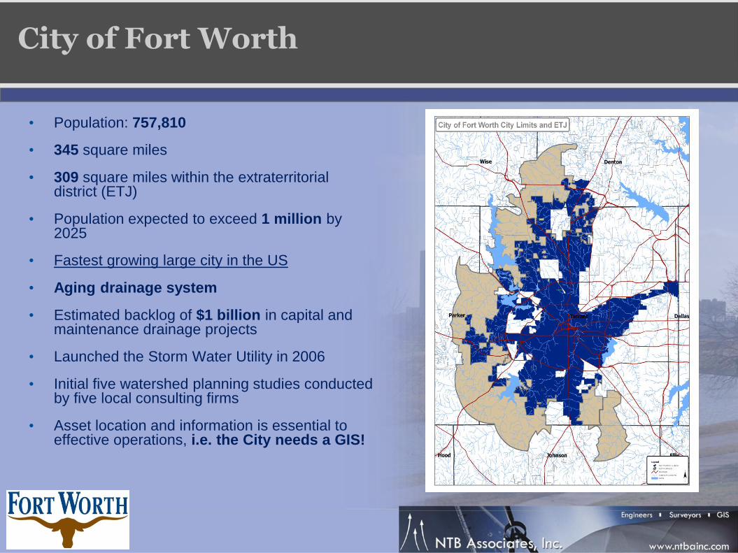
• Population: 757,810
• 345 square miles
• 309 square miles within the extraterritorial district (ETJ)
• Population expected to exceed 1 million by 2025
• Fastest growing large city in the US
• Aging drainage system
• Estimated backlog of $1 billion in capital and maintenance drainage projects
• Launched the Storm Water Utility in 2006
• Initial five watershed planning studies conducted by five local consulting firms
• Asset location and information is essential to effective operations, i.e. the City needs a GIS!
City of Fort Worth
Create a complete and comprehensive GIS representing
the open and enclosed storm water system allowing
the City of Fort Worth to better manage storm water
runoff while protecting the environment and providing
the highest quality of life for all residents.
Vision

Utilization of GIS Database
• Work Management
• Asset Management
• Condition Assessment
• Document Management
• Easement Tracking
• Emergency Response
• Capital Project Planning
• Budgeting

Project Team
• City of Fort Worth
• Halff Associates, Inc.
• Jacobs
• NTB Associates, Inc.
• Inventive Concepts
• Franzi Davis, GISP
• Lone Star Record & Abstract
• Inframetrix
• DFW Infrastructure
• ANA Consultants
• Gorrondona and Associates
• Fulton Surveying
• Surveying and Mapping
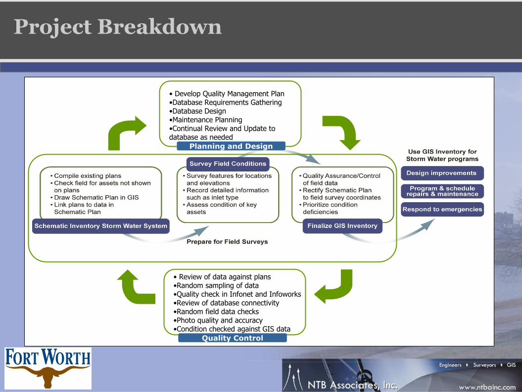
Project Breakdown
Quality Control
Planning and Design
• Develop Quality Management Plan •Database Requirements Gathering •Database Design •Maintenance Planning •Continual Review and Update to database as needed
• Review of data against plans •Random sampling of data •Quality check in Infonet and Infoworks •Review of database connectivity •Random field data checks •Photo quality and accuracy •Condition checked against GIS data
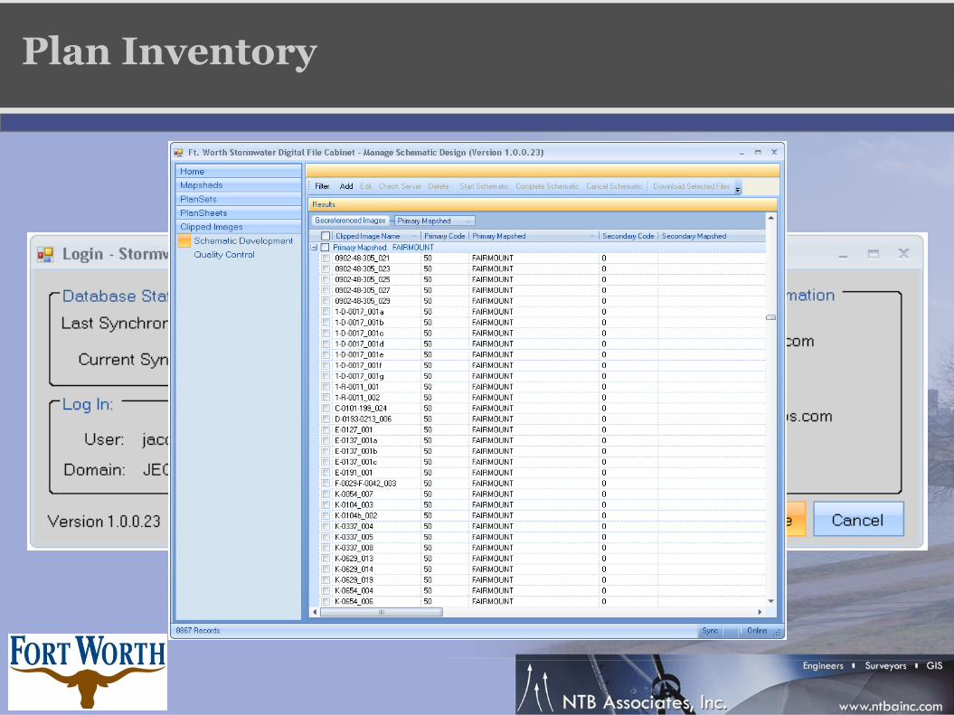
Plan Inventory
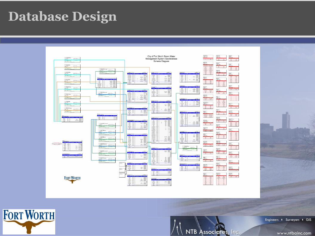
Database Design
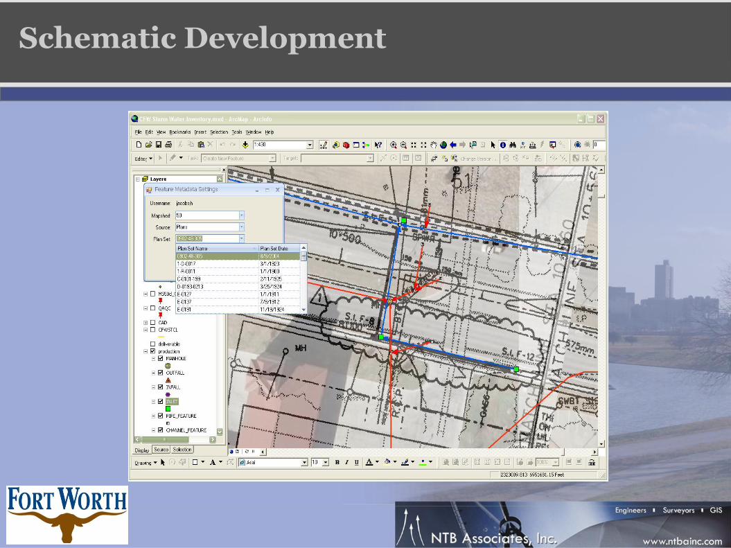
Schematic Development
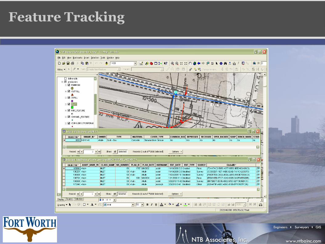
Feature Tracking
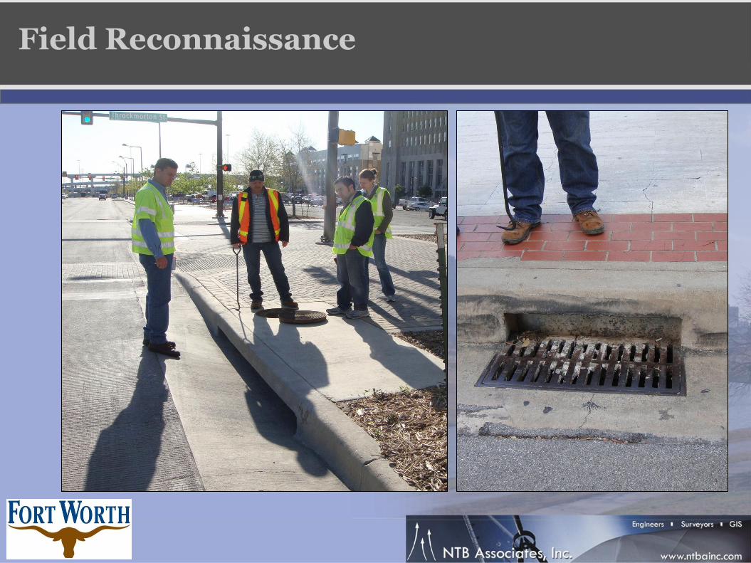
Field Reconnaissance

Field Survey
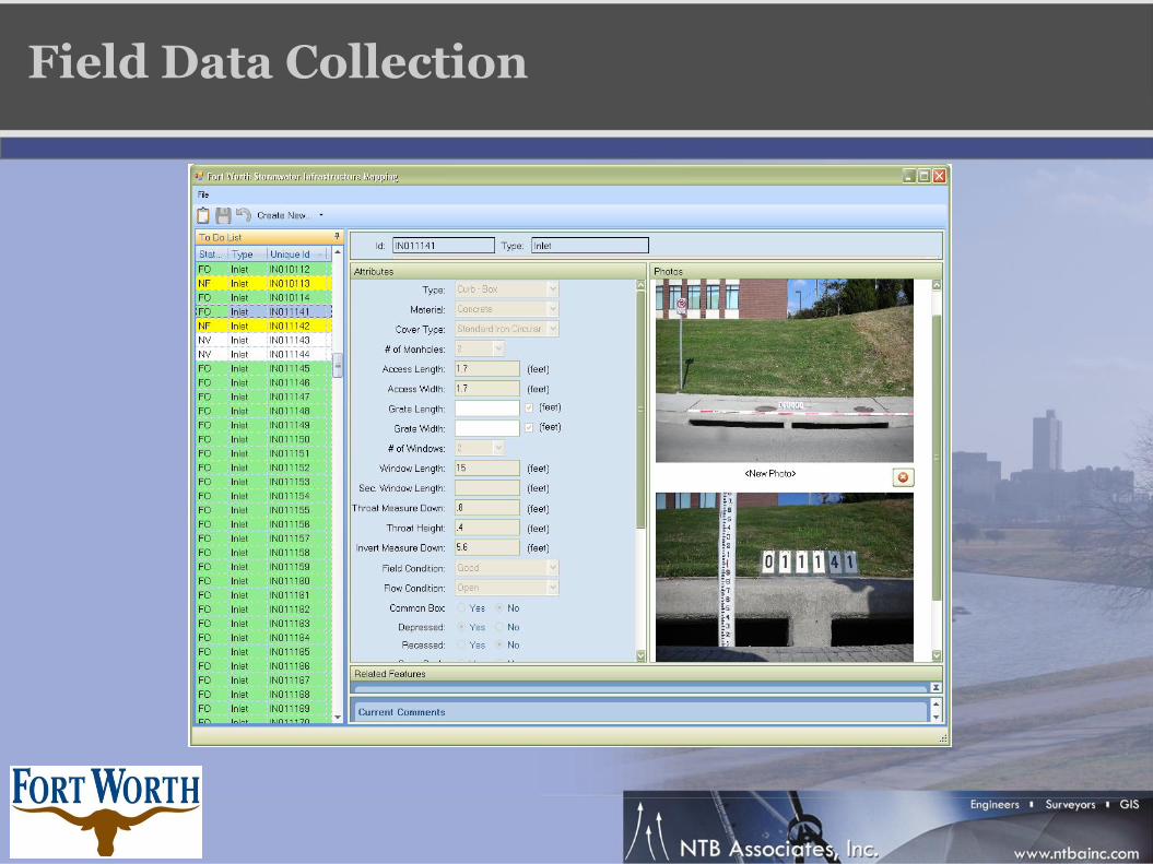
Field Data Collection
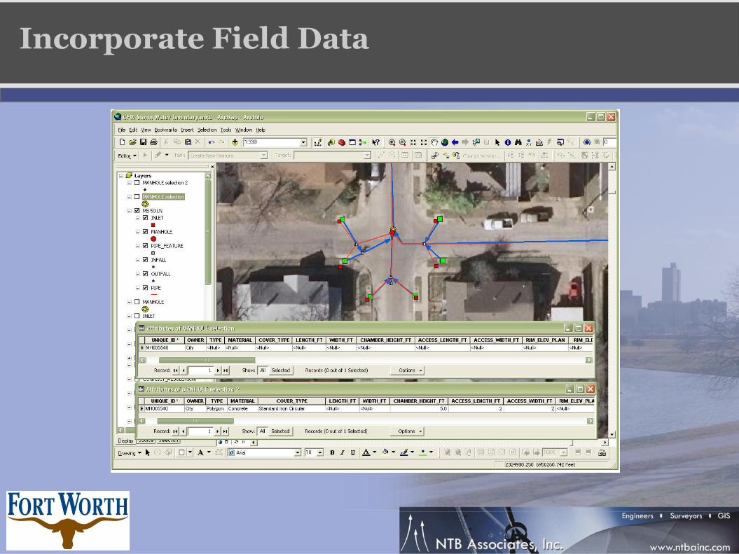
Incorporate Field Data
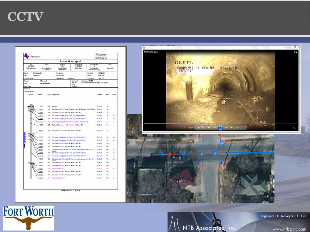
CCTV
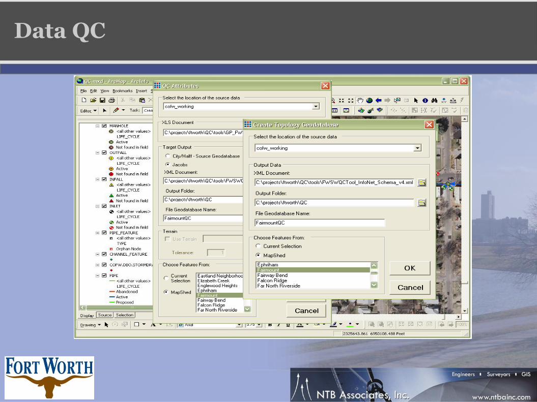
Data QC
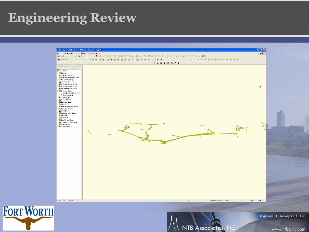
Engineering Review

Final QC
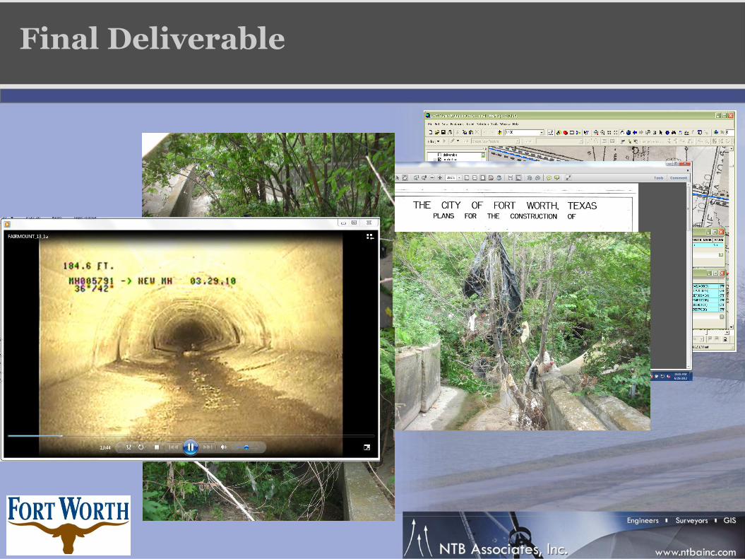
Final Deliverable
Project Statistics
• Plan Sheets Georeferenced – ~19,000
• Inlets – 36,031
• Manholes – 8,671
• Infalls – 5,007
• Outfalls – 8,435
• Pipes – 1,103 miles
• Drains – 636 (22 miles)
• Flumes – 1,089 (32 miles)

GIS
Asset Management
Maintenance & Operations
Condition Assessment
Customer Service
Watershed Planning Studies
Emergency Operations /
Environmental Compliance
Storm Water GIS
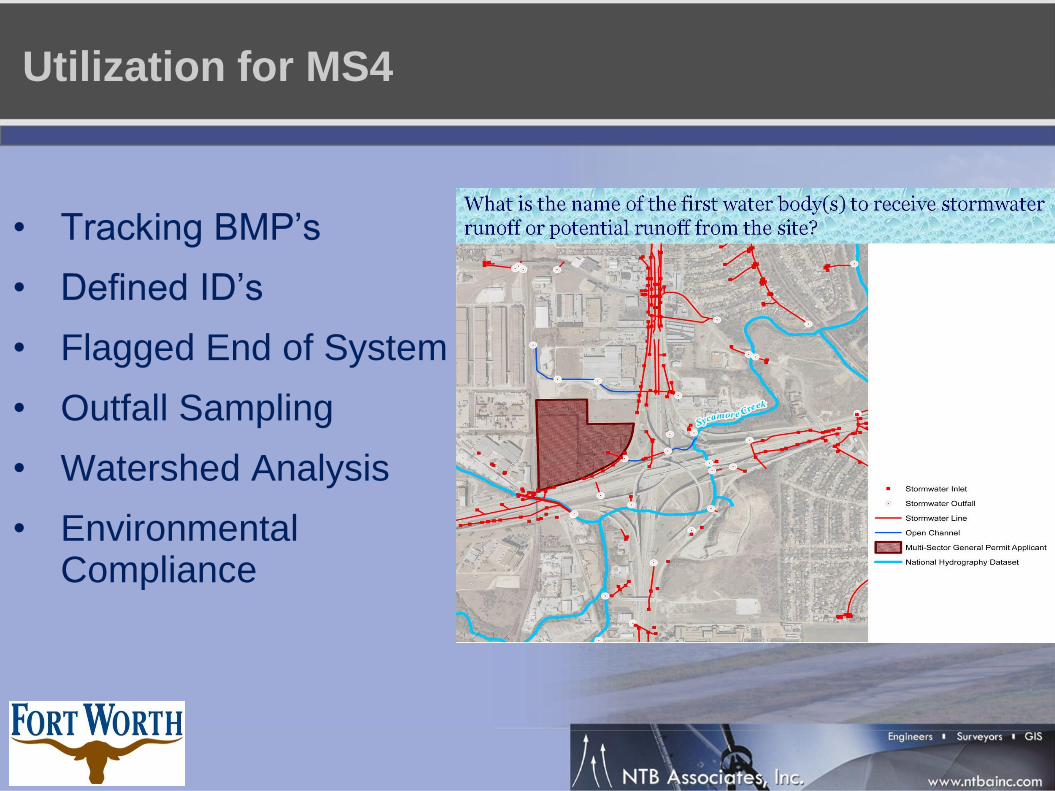
Utilization for MS4
• Tracking BMP’s
• Defined ID’s
• Flagged End of System
• Outfall Sampling
• Watershed Analysis
• Environmental Compliance
Questions?
Elizabeth Young, GISP
Project Manager – City of Fort Worth
Brad Daugherty
Vice President – GIS Operations – NTB Associates, Inc.