forecasting, modeling and risk assessment in ukrainian national … · 2014-06-04 · development...
TRANSCRIPT

Alex Ischuk, Dmitry KushnirUnited Software Corporation
GIS Analyst Center
Forecasting, Modeling and Risk Assessment in Ukrainian National Level System

ABSTRACT
A National System on Disaster Management became a priority for the Ukrainian Government following the 1986 Chernobyl Nuclear Disaster. After this global incident a number of internationally funded projects took place in Ukraine. These projects using the expertise of local scientists and software developers became a base for the development of the Ukrainian Government Information and Analytical System onEmergency Situations (GIAS ES).
To manage the different kinds of data that must be integrated and to facilitate a number of simulation and optimization tools, GIS applications from ESRI were selected to be a part of the Forecasting, Modeling and Risk Assessment Subsystems.

Development of the GIS-based informational and analytical system for Chernobyl
Exclusion Zone, 1993 - 1999
As a result of this project more than 100 layers of the digital maps, satellite images and other types of spatial data were developed and located in the integrated database of Chernobyl exclusion zone
History of GIS projects in Disaster Management Area in Ukraine
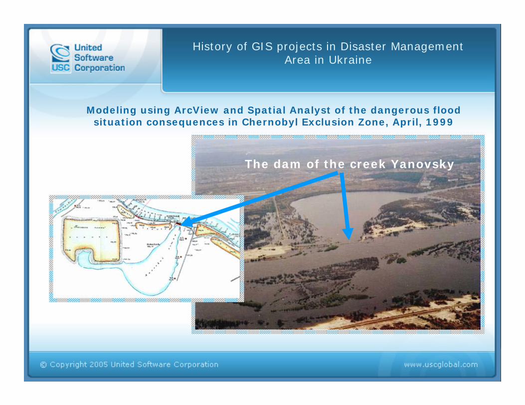
The dam of the creek Yanovsky
Modeling using ArcView and Spatial Analyst of the dangerous flood situation consequences in Chernobyl Exclusion Zone, April, 1999
History of GIS projects in Disaster Management Area in Ukraine

Modeling using ArcView and Spatial Analyst of the dangerous flood situation consequences in Chernobyl Exclusion Zone, April, 1999
Modeling flood areas
History of GIS projects in Disaster Management Area in Ukraine
Ukrainian Government Information and Analytical System on Emergency Situations
The development of the Ukrainian Government Information and Analytical System on Emergency Situations (GIAS ES) began in 2001. It started when the Cabinet of Ministers of Ukraine requested that the Ministry of Emergency Situations develop national levelstandards and technology on Disaster Management.
GIAS ES had to use the best approaches to Disaster Management and utilize world class technologies and software from global leaders.

Floods
Mudflows Chemical Air Pollutions
Forecasting and Modeling Subsystem for Ukrainian Government Information and Analytical System on
Emergency Situations

Main objectives of the project:
Integration of different types of data.
Development of the GIS-based integrated modeling system for simulation of real-world processes such as the dangerous geologicalphenomena, emission in an atmosphere of dangerous chemical and radioactive substances, flooding, etc.
Development of modeling subsystems for forecasting of emergency situation consequences and risks assessment on the GIS platform.
Decision Making Support for Counteraction Against Complex Emergency Situations using GIS, Remote Sensing and Emergency Operations Optimization and Planning Systems.
Ukrainian Government Information and Analytical System on Emergency Situations
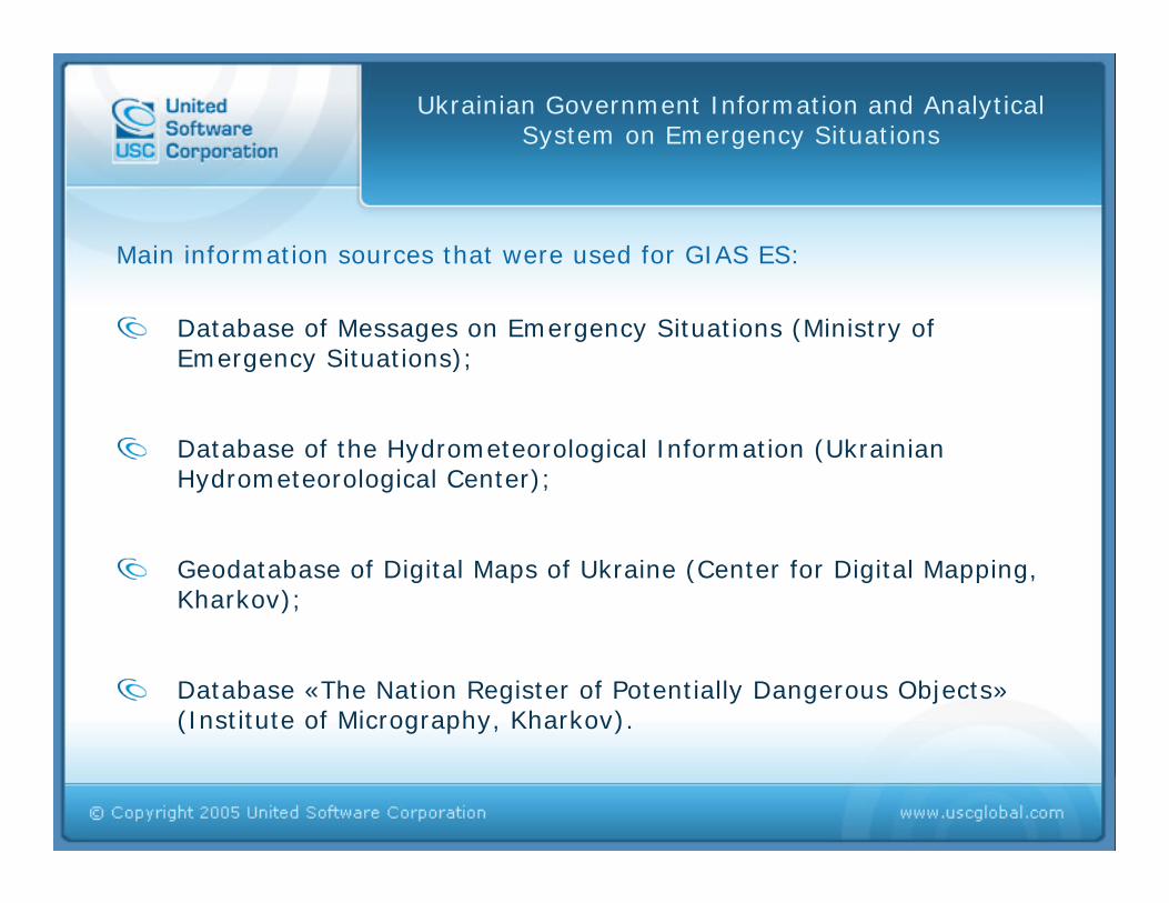
Database of Messages on Emergency Situations (Ministry of Emergency Situations);
Database of the Hydrometeorological Information (Ukrainian Hydrometeorological Center);
Geodatabase of Digital Maps of Ukraine (Center for Digital Mapping, Kharkov);
Database «The Nation Register of Potentially Dangerous Objects»(Institute of Micrography, Kharkov).
Main information sources that were used for GIAS ES:
Ukrainian Government Information and Analytical System on Emergency Situations

During 2001 – 2005 such forecasting, modeling and risk assessment subsystems were developed:
Forecasting and an estimation of consequences of flood situations FMS “Flood“
Forecasting and estimation of consequences of mudflows FMS “Mudflow“
Forecasting and estimation of consequences of emissions in an atmosphere of dangerous chemical substances FMS"Chemistry“
Spatial estimation of possible consequences of geological processes FMS "Karst“, FMS “Landslide“, FMS “Underflooding“, ets.
Risk Assessment Subsystem.
Ukrainian Government Information and Analytical System on Emergency Situations
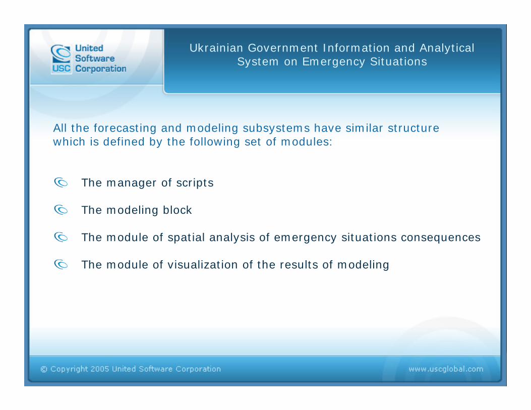
All the forecasting and modeling subsystems have similar structure which is defined by the following set of modules:
The manager of scripts
The modeling block
The module of spatial analysis of emergency situations consequences
The module of visualization of the results of modeling
Ukrainian Government Information and Analytical System on Emergency Situations

Integrated Database of GIAS ES
DBMS Informix (Oracle)
ArcIMS
ArcView
FMS1
Forecasting Department Analysts
Emergency Personal (Decision Makers)
The general structure of Forecasting and Modeling Subsystems
FMS2 FMS3
ArcView ArcView
ArcSDE

User Interfaces of Forecasting and Modeling Subsystem “Flood"

Spatial Modeling of the Flood Situation for Tisa River Basin, 2001
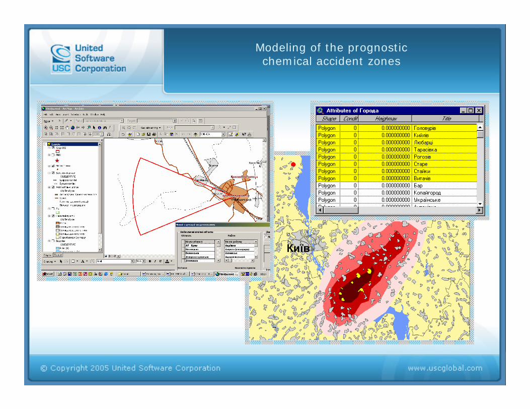
Modeling of the prognostic chemical accident zones

The forecast for reduction and for increase of the intensity of the
precipitations
The Mudflow Modeling Subsystem
ArcGIS

Selection of objects classes for the spatial analysis of the consequences

Development of resulting maps and tables
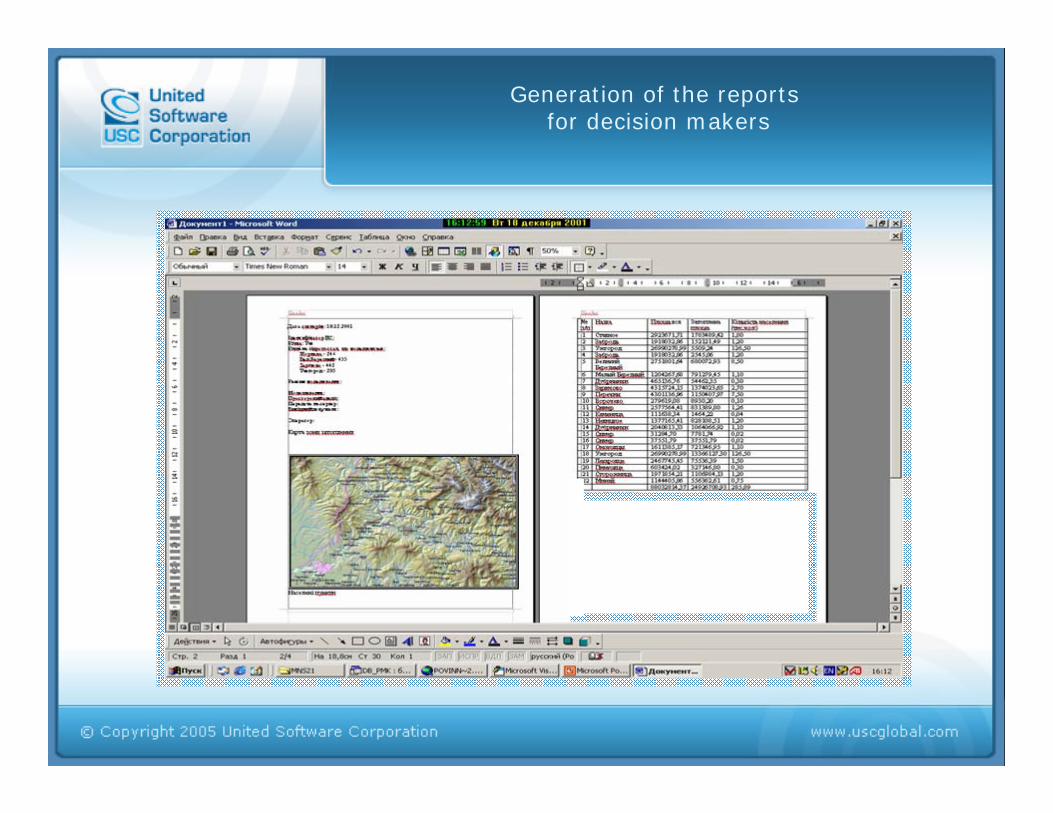
Generation of the reports for decision makers

The results of geological risks estimation for regions of Ukraine
Risk Assessment Subsystem

The results of risks estimation for chemical dangerous zones for cities of Ukraine
Risk Assessment Subsystem

Actualization of data - the major criteria for efficiency of information system
Landsat 7 ETM+, 2002
Data of the State Map, 1982

Results of Forecasting, Modeling and Risk Assessment Subsystems Development for
Ukrainian Government Information and Analytical System on Emergency Situations
Emergency response personnel can develop simulation scenarios for floods, mudflows, emissions into the atmosphere of dangerous chemical substances and geological processes consequences.
Results from the subsystems are transferred in XML format to integrated database of GIAS ES and decision making support subsystems for the emergency operational plans alternatives development.
Results of risk assessment subsystem, such as risk maps for human activities due to dangerous natural hazards are used for planning of the territory development.
Possibility to visualize forecasting scenarios on the hard copy maps to brief top government officials on possible situations development

Future of Ukrainian Government Information and Analytical System on Emergency Situations -
Common Operative Picture
ES Forces

Decision Making Support System Structure
Future of the Ukrainian National Disaster Management System

End notes
Development of National Level Disaster Management Standard is becoming a priority for most countries. Ukrainian Government Information and Analytical System on Emergency Situations is among the most important parts for such standards development.
GIS based Forecasting, Modeling and Risk Assessment Subsystems provide valuable input into data integration, simulation and estimation capabilities of Ukrainian Government Information and Analytical System on Emergency Situations.
GIS based subsystems will become a base for integrated real time visualization of the disaster information on the Common Operative Picture (COP)

THANK YOU!
Dmitry KushnirVice PresidentProducts & TechnologiesUnited Software Corporation
6A Pirogova Str., Kyiv, Ukraine, 01030Phone: +38 044 569 5699Fax: +38 044 569 [email protected]
Alexey IschukHead of GIS Analyst CenterUnited Software Corporation
6A Pirogova Str., Kyiv, Ukraine, 01030Phone: +38 044 569 5699Fax: +38 044 569 [email protected]