geophysical report on the clergue township …€¦ · 42a10ne0041 2 16676 clergue 010 geophysical...
TRANSCRIPT

42A10NE0041 2 16676 CLERGUE 010
GEOPHYSICAL REPORT
ON THE
CLERGUE TOWNSHIP PROPERTIES
LOCATED IN
CLERGUE TOWNSHIP - PORCUPINE MINING DIVISION
FOR
MONETA PORCUPINE MINES INC.
' ^.M.MT, LANDS BRANCH
Submitted byifJt.J. Me i k leRayan~~EoTJrt"orat ion Ltd. May,l996

TABLE OF CONTENTS
INTRODUCTION............ . . . . . . . . . . .. . . . . . . . . . . . . . . . . . . . lLOCATION AND ACCESS.......... ... . . . . . . . . . . . . . . . . . . . . . . . lCLAIMS............................. . .... . . . . . . . . . . . . . . . lPERSONNEL................................ . . . . . . . . . . . . . . 2GEOLOGY. . .. . . . . . .. . . . .. . .. . . . . . . . . . . . . . . . . . . . . . . . . . . . . . 2GEOPHYSICAL WORK PROGRAM............................... 3MAGNETOMETER SURVEY..................... . . . . . . . . . . . . . . . 3SURVEY RESULTS.... . . . . . . . . . . . . . . . . . . . . . . . . . . . . . . . . . . . . . 4RECOMMENDATIONS AND CONCLUSIONS........... . . . . . . . . . .. . . 4CERTIFICATE............................. . . . . . . . . . .. . .. . 5
LIST OF FIGURES
LOCATION MAP REGIONAL LOCATION MAP CLAIM
FIG. lFIG. 2FIG. 3
O O
APPENDIX
MAGNETOMETER SPECIFICATIONS....................APPENDIX A
LIST OF MAPS
CONTOURED and POSTED MAGNETOMETER - 1204567/568....l:5000

INTRODUCTION
Rayan Exploration Limited of Timmins, Ontario was hired by Moneta Porcupine Mines Inc. to conduct a Total Field Magnetometer Survey on a group of claims located in Walker, Clergue, and Taylor Townships. This report describes the parameters and results on two non-contiguous claims in Clergue Twp. located in the Larder Lake Mining Division, Ontario.
The purpose of the survey was to map the magnetic susceptibility to help interpret the geology and areas to do follow up work on. The survey was done along chained compass lines tied in to claim boundaries and topography and as such was intended as a reconnaissance survey.
LOCATION AND ACCESS
The two claims are located in the southeast corner of Clergue Township, approximately 12km south OL' the town of Iroquois Falls. Cochrane District. Larder Lake Mining Division. Ontario (see f igs.l.2,3) .
Access to the claims is excellent, via Hwy. lin and secondary roads west from the Hwy. to the northwest corner of claim 1204567.
CLAIM STATUS
The work was done on 2 non-contiguous block claims in Clergue Twp., Larder Lake Mining Division. Ontario.
The 2 claims are described as foliows:
CLAIM NO.
1204567
1204568
NO. UNITS LEGAL DESCRIPTION TOWNSHIP
N part, Si/2. Lots 3,4 CLERGUE CON. l
NW 1/4, S 1/2, Lot5 CON. l CLERGUE
W \LKER

•3 90 ao 73
33
30"
43-
U.S.A.
33
•st
43
•O •3 60
PROVINCE OF ONTAR10
FIG l
MONETA PORCUPINE MINES
CLERGUE TWP PROPERTIES
LOCATION MAP

•l- H^c;4ff
FI9 4
ci.-nL:MONETA PORCUPINEu; CLERGUE TWP PROPERTIES
TitU: REGIONAL
LOCATION SKETCH
RAYANBPLORATICN LTD

CLERGUE TWP
lotFI6 3
MONETA PORCUPINE MINES... CLERGUE TWP PROPERTIES
Till*:
CLAIM SKETCH
RAYAN'BeURATICM LTt

PERSONNEL
The people directly involved in this program were all employed by Rayan Exploration Limited, between May 22/96 - May 23/96, and are as follows:
Lanny Anderson. . . . . . . .. .. . . . .. .. . ....TimminsAure l Chaumont . . . . . . . . . . . . . . . . . . . . .. .TimminsWayne Pearson...... . . .. ... . .... .. ....Timmi nsDanny Brazeau........................Timmins
All work was supervised by R.J. Me i k le. Timmins.
GEOLOGY
The property is shown on the Timmins-Ki rk l and Lake Map No. 22U5. to be situated within the Abitibi Greenstone Belt which covers much of northeastern Ontario and northwestern Quebec.
Generally this belt is underlain by a variety of mafic- to felsic volcanics and related sediments as well as felsic to u l l rama fie intrusive.
Map 2205, Timmins Kirkland Lake Geological Compilation Series shows both claims to be underlain by Mafic Volcanics with tile possibility of e/ne trending' ma f i c/u i t rama f i cs . Numerous north south diabase dvkes are shown on the claim areas.
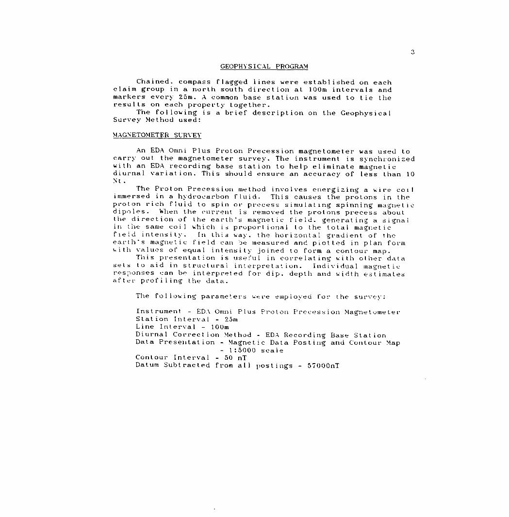
GEOPHYSICAL PROGRAM
Chained, compass flagged lines were established on each claim group in a north south direction at 100m intervals and markers every 25m. A common base station was used to tie the results on each property together.
The following is a brief description on the Geophysical Survey Method used:
MAGNETOMETER SURVEY
An EDA Omni Plus Proton Precession magnetometer was used to carry out the magnetometer survey. The instrument is synchronized with an EDA recording base station to help eliminate magnetic diurnal variation. This should ensure an accuracy of less than 10 Nt .
The Proton Precession method involves energizing a wire coil immersed in a hydrocarbon fluid. This causes the protons in the proton rich fluid to spin or precess simulating spinning magnetic dipoles. When the current is removed the protons precess about the direction of the earth's magnetic field, generating a signal in the same coil which is proportional to the total magnetic field intensity. In this way. the horizontal gradient of the earth's magnetic field can be measured and plotted in plan form with values of equal intensity joined to form a contour map.
This presentation is useful in correlating with other data sets to aid in structural interpretation. Individual magnetic responses can be interpreted for dip. depth and width estimates after profiling the data.
The following parameters were employed for the survey:
Instrument - EDA Omni Plus Proton Precession MagnetometerStation Interval - 25mLine Interval - 100mDiurnal Correction Method - EDA Recording Base StationData Presentation - Magnetic Data Posting and Contour Map
- l:5000 scale Contour Interval - 50 nT Datum Subtracted from all postings - 57000nT

SURVEY RESULTS
The reconnaissance magnetometer surveys carried out on the Clergue Township properties was successful in outlining a number of features, most likely defining Ultramafic units and numerous north south diabase dikes. It should be noted that the same base station value was used for all the data resulting in one common base level for the values. The results of the Magnetometer Survey for each claim are discussed below:
Claim * 1204567
Three n/s trending linear mag highs were outlined and are most likely defining diabase dikes. No other significant magnetic features were encountered. The dikes correlate with OGS Map 2205 depicting numerous interpreted dikes in the area.
Claim 4 1 204568
The magnetics show the tip of a broad mag high in the 'j/W corner of the claim. This may be an expression of relatively narrow units of Ul atramafics shown on Map 2205. If this is the case, the contact with the mafics may be a prospective place to find gold mineralization.
RECOMMENDATIONS AND CONCLUSIONS
The magnetometer surveys carried out in this work program outlined several features, both dikes and Ultramafic Units. The magnetometer results should be compiled with all other available data to determine further exploration plans.
The edge of the interpreted Ultramafic in the S/W corner of claim 1204568, should be followed up by an I.P. Survey, and or a diamond dri l l program.
Drilling on Claim 1204567 should be preceded by a more detailed magnetometer survey if in the vicinity of the above mentioned dikes, to avoid intersecting them.

CERTIFICATION
thatI, Raymond Joseph Meikle of Timmins, Ontario hereby certify
l. I hold a Haileybury School 1975.
three year Technologist Diploma from theof Mines. Haileybury. Ontario, obtained in May
2. I have been practising my profession since 1973 in Ontario, Quebec. Nova Scotia. New Brunswick. Newfoundland. NWT. Manitoba, Germany and Chile.
3. I have been employed directly with Teck Corporation. Me t a l lgessel lschaft Canada Ltd. Sabina Industries, .S. Middleton Exploration Services Ltd.. self employed 1979-1935 (Rayan Exploration Ltd.) and currently with Rayan Exploration Ltd.
4. I have based conclusions and recommendations contained in this report on knowledge of the area, my previous experience and on the results of the field work conducted on the property during 1996.
5. I hold no interest, directly or indirectly in this property, nor do I expect to receive any interest or considerations from the property other than professional and contract fees for services rendered.
Dated this 27th day of May at Timmins. Ontario.
1996
;R . J . Me i k l e

APPENDIX A
EDA OMNI PLUS MAGNETOMETER

Major Benefits of the OMNI PLUS9 Combined VLF/Magnetometer/cradiometer System* No Orientation Required* Three VLF Magnetic Parameters Recorded 9 Automatic Calculation of Fraser Filter 0 Calculation of Ellipticity0 Automatic Correction of Primary Field Variations
Measurement of VLF Electric Field

Specifications*Frequency Tuning Range........ 15 to 30 kHz, with bandwidth of 150 Hz; tuningrange accommodates new Puerto Rico station at 28.5 kHzTransmitting stations Measured.. up to 3 stations can be automatically measuredat any given grid location within frequency tuning rangeRecorded VLF Magnetic
Parameters ................ .Total field strength, total dip, verticalquadrature (or alternately, horizontal amplitude)
Standard Memory capacity...... 800 combined VLF magnetic and VLF electricmeasurements as well as gradiometer and magnetometer readingsDisplay ...................... .Custom designed, ruggedized liquid crystaldisplay with built-in heater and an operating temperature range from -400Cto *550C.The display contains six numeric digits, decimal point, battery status monitor, signal strength status monitor and function descriptors.RS232C Serial I/O interface ...... 2400 baud rate, 8 data bits, 2 stop bits, no parityTest Mode .................... A. Diagnostic Testing (data and programmablememory)
B. Self Test (hardware)Sensor Head .................. Contains 3 orthogonally mounted coils withautomatic tilt compensationOperating Environmental
Range ...................... -400C to +550C;O -10096 relative humidity; Weatherproof
Power Supply ................. Non-magnetic rechargeable sealed lead-acid 18VDC battery cartridge or belt; 18V DC disposable battery belt; 12V DC external power source for base station operation only.Weights and Dimensions
instrument Console .......... 2.8 kg, 128 x 150 x 250 mmSensor Head................ .2.1kg. 130 dia. x 130 mmVLF Electronics Module........ 1.1 kg. 40 x 150 x 250 mmLead Acid Battery Cartridge ... 1.8 kg, 235 x 105 x 90 mm Lead Acid Battery Belt ....... .1.8 kg, 540 x 100 x 40 mmDisposable Battery Belt ....... 1.2 kg. 540 x 100 x 40 mm Preliminary
BM instruments inc. 4 Thomdiffe Park Drive. Toronto. Ontario Canada M4H1H1 Telex. 06 23222 EDA TOR. Cables: instruments Toronto (416)425-7800
in USA.EDA instruments inc..5151 ward Road.wheat Ridge. ColoradoU.S.A. 80033(3031422-9112
Printed in canada

Ministry ui
Korthern Development and Mines
riepon 01 wuriv After Recording Claim
Mining Actntario0
rsonal Information collected on this form to obtained under the authority of the M : collection should be directed to the Provincial Manager. Mining Lands. Mini dbury. Ontario. P3E 6A5. telephone (70S) 670-7264.
42A10NEOO41 2 16676 CLERGUEstructlons: - Please type or print and submit in duplicate.- Refer to the Mining Act and Regulations for requ..~...~...- -. ......B
Recorder.- A separate copy of this form must be completed for each Work Group.- Technical reports and maps must accompany this form in duplicate.- A sketch, showing the claims the work is assigned to. must accompany this form.
900
XKded HoUerft) J i l /O ' jf ' ) flffiHJWt ff^ffiat^p/kf- /U/Ula /iff-
hm ———————————————————— ~~A
JoV /?V T/- S- , r-0- wif rt i f ^TflLL i^. /^j j Qi2iling OMskm . Townshlp/AnM
tek From: fft 7 7 /99f. To: ^ erlormed "l*y t-*- )'7 'f*
)rtc Performed (Check One Work Group Only)WorkGroup
Geotechnical Survey
Physical Work. Including Drilling
Rehabilitation
Other Authorized Work
Assays
Assignment from Reserve
al Assessment Work
Type
Mi*4**zi ?^^ XC~-f f
Cttent No. 1-7.7 x— 7
Telephone No. .70S'- 2eW-"22^
— MorOPtan~Na ~~ 1^
•*7 * 5", A/;
—s — i A fi 7 8 ———— j** 9 J. " — ————————————
[RFcElVifDl
HJL 1 5 1996 l
ttJ.rirlAMnc; BRANCH]JJWL—
y i CP^""~
Claimed on the Attached Statement of Cnsts f 5r^
holder cannot verify expenditures claimed in the statement of costs within 30 days of a request for verification,
rsons and Survey Company Who Performed the Work (Give Name and Address of Author of Report)
Nairn Address
k/.in ut f
ach a schedule If necessary)
lineation of Beneficial * See Note No. 1 on
ertify that at the time the work was performed, the claims covered hi this work Mrt were recorded In the current holder's name or held under a beneficial Interest the current recorded holder.
r Agent (Signature)
lineation of Work Reportertify thai 1 have a personal knowtodga of tha facts sat forth in completion and annexed report is true.
ie and Addreee of Penon Certifying
1 /' ;pone No.
this Work report.
innis ^'tDate
having performed tha work or witnessed same during and/or altar
A/A' 7 "7^c^- .

illto'?1
r*
•A IIIf
CO
^ z ~HI*
liZ* II
V
-nQ3
Lo;
Credits you are claiming in this report may be cut back. In order lo minimize the adverse effects of such deletions, please indicate from
which claims you wish to priorize the deletion of credits. Please mark (.x) one of the following:
1. S Credits are to be cut back starting with the claim listed last, working backwards.
2. D Credits are to be cut back equally over all claims contained in this report of work.
3. D Credits are to be cut back as priorized on the attached appendix.
In the event that you have not specified your choice of priority, option one will be implemented.
ite 1: Examples of beneficial Interest are unrecorded transfers, option agreements, memorandum of agreements, etc.. with respect
to the mining claims.
ile 2: If work has been performed on patented or leased land, please complete the following:
certify thai the recorded holder had a beneficial interest in the patented |Signature (Date |

Ontario
Ministry ofNorthern Developmentand Mines
Ministere du Pivetoppement du Nord ei des mines
Statement of Costs for Assessment Credit
Etat des couts aux fins du credit d'evaluation
Mining Act/Loi sur les mines
Transaction No./N0 de transaction
Personal informatkx) collected on this form is obtained under the authority of the Mining Act. This information will be used to maintain a record and
ongoing status of the mming claim(s). Questions about this collection should
be directed to the Provincial Manager. Minings Lands. Ministry of Northern
Development and Mines. 4th Floor. 159 Cedar Street. Sudbury. Ontario
P3E 6A5. telephone (70S) 670-7264.
Les renseignements personnels conlenus dans la presenie formule sont
recueillis en wenu de la Lot sur tea mines el serviront a tenir a jour un registre
des concessions minieres. Adresser toute question sur la coltece de ces
renseignements au chef provincial des terrains miniers. ministere du
Developpement du Nord et des Mines. 159. rue Cedar. 40 etage. Sudbury
(Ontario) P3E 6A5. telephone (705) 670-7264.
1. Direct Costs/CoOte directs
Type
Wages Salaires
Contractor's and Consultant's Fess Drottsds ('entrepreneur et de I'expert- consell
Supplies Used Fountltures utilise**
Equipment Rental Location de materiel
Description
Labour Main-d'oeuvre
Field Supervision Supervision sur le terrain
Type ./llajJzi- Sfc^r/iL/SJt**/*/^,' t.pl^;.
Type
Type
Amount Montant
2tt
2V
Total Direct Costs Total des couts directs
Totals Total global
?rte
li^c
2. Indirect Costs/Gouts indirects
* * Note: When claiming Rehabilitation work Indirect costs are not allowable as assessment work.Pour le remboursement des travaux de rehabilitation, les couts indirects ne sont pas admissibles en tant que travaux devaluation.
Type
Transpoi Transpoi
tationt
HIEjMININ
Food and Lodging Nourriture et
Mobilization and Demobilization Mobilisation et demobilisation
Description
Typeu^u
CEIVED
UL 1 5 1996
3 UNDS BRANCH
Amount Montant
V
Sub Total of Indirect Costs Total partiel des couts indirects
Amount Allowable (not greater than 20H of Direct Costs) Montant admissible (n'excedant pas 20 H des couts directs)
Total Value of Asse (Total of Direct and t Indirect costs)
ssiMtit Cradtt Vflfouf totate du ciMH Allowable d'evahistion
(Total dt* cofltt dbcct*
Totals Total global
"S'
*~,y
"C
Z^cT
Note: The recorded holder will be required to verify expenditures claimed in
this statement of costs within 30 days of a request for verification. If
verification is not made, the Minister may reject for assessment work
all or part of the assessment work submitted.
Note : Le titulaire enregistrg sera tenu de verifier les depenses demandees dans
le present elai des couts dans les 30 jours suivant une demande d eel
effel. Si la verification n'est pas effectuee. le ministre peut rejeler tout
ou une partie des travaux d'evalualkm presentes.
Filing Discounts
1. Work filed within two years of completion is claimed at 1004b of
the above Total Value of Assessment Credit.
Remises pour depot
1. Les travaux deposes dans les deux ans suivant tour achevement sont
rembourses a 100 *M) de la valeur totate susmentionnee du crerJt Devaluation.
2. Work filed three, four or five years after completion is claimed at
504fc of the above Total Value of Assessment Credit. See:
calculations below:
Total Value of Assessment Credit Total Assessment Claimed
x 0.50
2. Les travaux deposes trois. quatre ou cinq ans apres tour achevement
sont remfxxirses a 50 (ft de la valeur totale du credit d'evaluatkm
susmerilionne. Voir les calcute ci-dessous.
Valeur totale du credit devaluation
x 0.50
Evaluation totale demandee
Certification Verifying Statement of Costs Attestation de I'etat des couts
l hereby certify:that the amounts shown are as accurate as possible and these costs
were incurred white conducting assessment work on the lands shown
on the accompanying Report of Work form.
that as(Recorded Holder. Agent. Position m Company)
to make this certification
J'atteste par la presente :que les montants indiques sont le plus exact possible el que ces
depenses ont ete engagees pour effectuer les travaux devaluation
sur les terrains indiques dans la formule de rapport de travail ci-joint.
l am authorized Et qu'a litre de(lituiaire enregistre. representant. poste
a faire cette attestation.
upeje suis autorisg
i la compagnie)
Signature Date
0212l04f9l|Nota Dans cette tormule. lorsqu'il desiqne des personnes. to masculin est ulilrs* au sens neulre

OntarioMinistry of Ministere duNorthern Development Developpement du Nordand Mines et des Mines
Geoscience Assessment Office 933 Ramsey Lake Road 6th Floor Sudbury, Ontario P3E 6B5
August 13, 1996
Telephone: (705) 670-5853 Fax: (705) 670-5863
Our File: 2.16676 Transaction #: W9660.00370
Mining RecorderMinistry of Northern Development St Mines60 Wilson Avenue, 1st FloorTimmins, OntarioP4N 2S7
Dear Mr. White:
SUBJECT: APPROVAL OF ASSESSMENT WORK CREDIT ON MINING LAND, CLAIM(S) 1204567 ft 1204568 IN CLERGUE TOWNSHIP
Assessment work credit has been approved as outlined on the Declaration of Assessment Work Form accompanying this submission. The credit has been approved under Section 14, Geophysics (MAG), of the Assessment Work Regulation.
The approval date is August 13, 1996. Please indicate this approval on the claim record.
If you have any questions regarding this correspondence, please contact Steven Beneteau at (705) 670-5855.
Yours sincerely, ORIGINAL SIGNED BY:
GashinskiSenior Manager, Mining Lands Section Mines and Minerals Division
SBB/jf
cc: Resident Geologist Timmins, Ontario
Assessment Files Library Sudbury, Ontario

LEGEND
AREAS WITHDRAWN FROM DISPOSITION
M.R.O. - MINING RIGHTS ONLY
t.R.O. - SURFACE RIGHTS ONLY
M.+ S. - MINING AND SURFACE RIGHTS
Oncription Order No. Dm Dwotition FileCALVERT TOWNSHIP
Mf. \. , i l A.VS f T'
!l H K, H I , If VVA Y
: T li - i 'N* S
\, -, .-. n t \MAi S'Mf AM
l i M l M, (J H f l OUDlNCi H K, NTS Si HI 'vislON OH COMPOSITE Pt AN H* St H v ATIONS
ORIGINAL SHORf l INt-
MAHSH OR Ml (S
MINf-S
RSF MONUMENT
DISPOSITION OF CROWN LANDSSurf ac* Right* Withdrawn under S*e. 36,Th. Mining Act R.S.O. I08O. ORDER NO. W-OI/ )I7ONT
TYPE OF DOOJME-NT
(Trans Canada Plp*lln* Right of Way and Buffer - ne particularly 4O.25 m*t*rs or 132 ft. en illh*r sid* of c*ntr* lin* of right of way)
PATtNT SURF ACE 8. MINING RIGHTS SURFACE RiCjHTSONLYMINING HIGHTSONLV
LtASt SUH^ACt 4 MINING RIGHTS SUHfACf RIGHTS ONLYMINING RIGHTSONI Y
LlCtNCt Of OCCUPATION ORDER IN COUNCIL . RF SF R VAT ION
CANCEL L tt)
NOT! M iNIMl, Rlf.MTS ,N ^ AHrjLS ^ AlfNTtO^RlOR TUMAY 6 19)3 VlSTfl, IN ORlC.lNAi P ATJNTEf B f T M( PUBLIC LANt)b AC i nS'i '"*'O i MAP ISO SEC 63 S UBStl i
3 i l ~? /T ~?ri r v f
HI o 'O 10 30 40 SO 60 70
1000 7000 3090 4000 ',000
SCALE 1:20 0001206601 II7G77" ( 4 uriits
SNOWMOBILE TRAIL NOTICE RECEIVED 92-DEC-09
."L..292768 Ip
I 292767
.,--l
..JLL.L ri10355 4796
o- i/unteithf*
- . —— J ——...
^OKCjr^f WNiNC
2367*4 j 2367tS
. 4 "UNITSTOWNSHIP1304367
CLERGUE206686
12066879
l IIOO0171206668
MMR ADMINISTRATIVE DISTRICT
COCHRANEMINING DIVISION
PORCUPINELAND TITLES 7 REGISTRY DIVISION
COCHRANE
1206673^T Tio437l
IHW8M, RT l***. '?0f213THE INFORMATION THAT APPEARS ON THIS MAP HAS BEEN COMPILED FROM VARIOUS SOURCES. AND ACCURACY IS NOT GUARANTEED. THOSE WISHING TO STAKE MIN ING CLAIMS SHOULD CON SULT WITH THE MINING RECORDER, MINISTRY OF NORTHERN DEVELOP MENT AND MINES, FOR AD DITIONAL INFORMATION ON THE STATUS OF THE LANDS SHOWN HEREON.
^ 7S690C 7M607
l j^.^ ̂ ^. ^ rOKTOwC*
1129486
Ministry of Ministry ofNatural Northern DevelopmentResources and Mine*'STOCK TOWNSHIP
SEPTEMBER, 1986
G-3487
42A10NE0041 2.11676 CLERQUE 200

CONNJ/2- CO'N
SI 1 1
CLERGUE TOWNSHIP 2. 16 6 7
LOT 5 LOT 4 LOT 3 LEGEND
2BB i ea 2BB
ami PLUS PROTON PRECESSIONPARAMETER WASUCD: EAUTWS TOTAL NAG FIELD
OIIMNAL6 CURRECIEO WITH BASE STATION
CONTTU* INTERVAL: M NANO-TEOJVS
READING INTERVAL: ZB METERS
DATUt SUBTRACTED: 5flM nT
cii.ni:MONETA PORCUPINE MINES Pr00.r-iu: CLERGUE TWP PROPERTIESTitli
POSTED and CONTOUREDMAGNETOMETER SURVEY
1204567 1204568
42A10NE0041 2.16676 CLERGUE 210RAYAN
EXPLORATION LTD