installation report bangladesh (hkh-hycos project - …
TRANSCRIPT
INSTALLATION REPORT –
BANGLADESH
(HKH-HYCOS PROJECT - PHASE II)
Real Time Solutions Pvt. Ltd.
Dhobighat, Patan -44600
Lalitpur, Nepal
Phone: +977-1-5538687 / 5529953
Fax: +977-1-5525695
URL: www.rts.com.np, www.wscada.com
A REPORT
ON
INSTALLATION OF HYDROLOGICAL AND METEOROLOGICAL STATIONS
IN
BANGLADESH
(HKH HYCOS PROJECT – PHASE II)
Submitted by:
Real Time Solutions Pvt. Ltd.
Dhobighat, Patan – 44600
Lalitpur, Nepal
P.O.Box # 25090
Phone: +977-1-5538687 / 5529953
Fax: +977-1-5525695
URL : www.wscada.com
Submitted to:
HKH-HYCOS Steering Committee
ICIMOD,
Khumaltar, Nepal
Date of Submission: 2nd August 2014
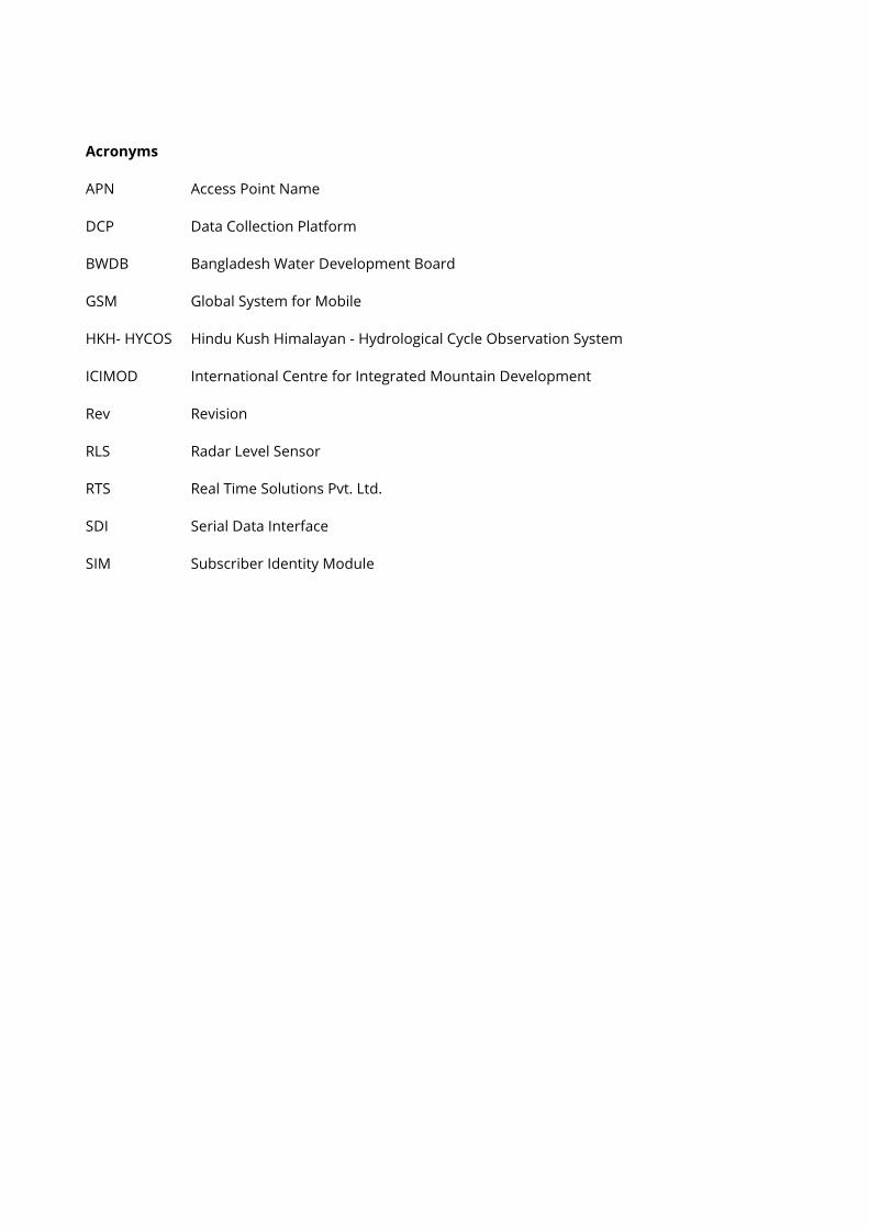
Acronyms
APN Access Point Name
DCP Data Collection Platform
BWDB Bangladesh Water Development Board
GSM Global System for Mobile
HKH- HYCOS Hindu Kush Himalayan - Hydrological Cycle Observation System
ICIMOD International Centre for Integrated Mountain Development
Rev Revision
RLS Radar Level Sensor
RTS Real Time Solutions Pvt. Ltd.
SDI Serial Data Interface
SIM Subscriber Identity Module
Installation Report – Bangladesh | HKH HYCOS Project – Phase II
Real Time Solutions Pvt. Ltd. 1
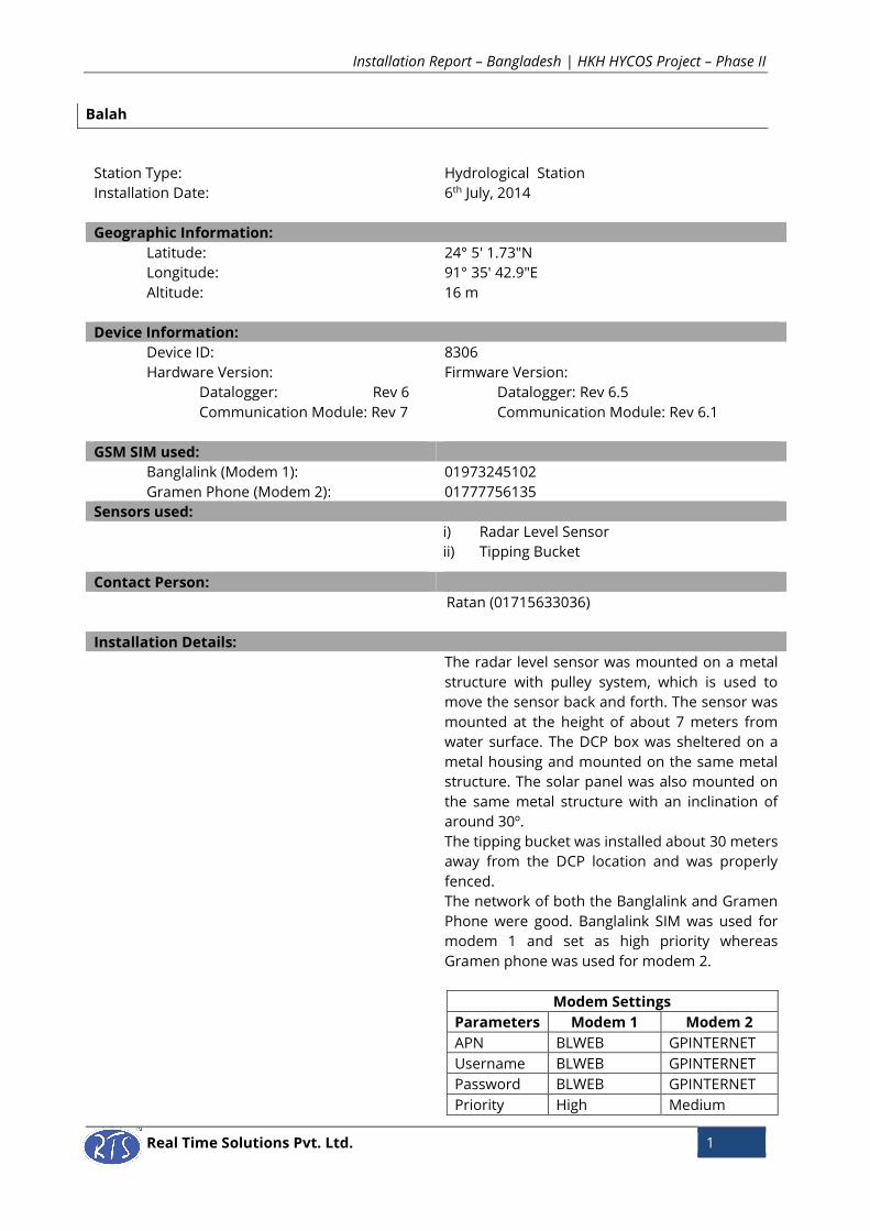
Balah
Station Type: Hydrological Station
Installation Date:
6th July, 2014
Geographic Information:
Latitude: 24° 5' 1.73"N
Longitude: 91° 35' 42.9"E
Altitude: 16 m
Device Information:
Device ID: 8306
Hardware Version: Firmware Version:
Datalogger: Rev 6 Datalogger: Rev 6.5
Communication Module: Rev 7 Communication Module: Rev 6.1
GSM SIM used:
Banglalink (Modem 1): 01973245102
Gramen Phone (Modem 2): 01777756135
Sensors used:
i) Radar Level Sensor
ii) Tipping Bucket
Contact Person:
Ratan (01715633036)
Installation Details:
The radar level sensor was mounted on a metal
structure with pulley system, which is used to
move the sensor back and forth. The sensor was
mounted at the height of about 7 meters from
water surface. The DCP box was sheltered on a
metal housing and mounted on the same metal
structure. The solar panel was also mounted on
the same metal structure with an inclination of
around 30º.
The tipping bucket was installed about 30 meters
away from the DCP location and was properly
fenced.
The network of both the Banglalink and Gramen
Phone were good. Banglalink SIM was used for
modem 1 and set as high priority whereas
Gramen phone was used for modem 2.
Modem Settings
Parameters Modem 1 Modem 2
APN BLWEB GPINTERNET
Username BLWEB GPINTERNET
Password BLWEB GPINTERNET
Priority High Medium
Installation Report – Bangladesh | HKH HYCOS Project – Phase II
Real Time Solutions Pvt. Ltd. 2
List of Equipment
Offset Calculation for Waterlevel:
Staff Gauge Reading (x) = 20.242
Initial Sensor Reading (y) = 7.153
Offset = x + y
= 20.242 + 7.153
= 27.361
People Involved:
Saroj Dhoj Joshi and Uday BC (RTS)
Alamgir Hossain and Akram (BWDB)
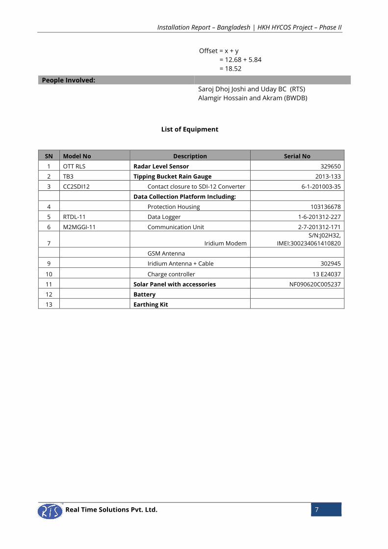
SN Model No Description Serial No
1 OTT RLS Radar Level Sensor 329648
2 TB3 Tipping Bucket Rain Gauge 2013-130
3 CC2SDI12 Contact closure to SDI-12 Converter 6-1-201003-34
Data Collection Platform Including:
4 Protection Housing 103136677
5 RTDL-11 Data Logger 1-6-201312-192
6 M2MGGI-11 Communication Unit 2-7-201312-186
7 Iridium Modem
S/N: J02HOK, IMEI: J02HOK
300234061412840
GSM Antenna
9 Iridium Antenna + Cable 302937
10 Charge controller 13J14087
11 Solar Panel NF09605C004837
12 Battery
13 Earthing Kit
Installation Report – Bangladesh | HKH HYCOS Project – Phase II
Real Time Solutions Pvt. Ltd. 3
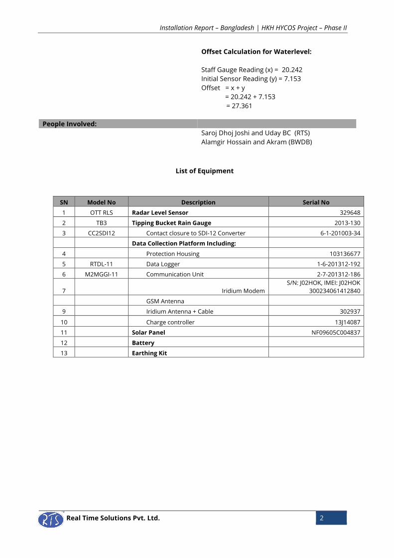
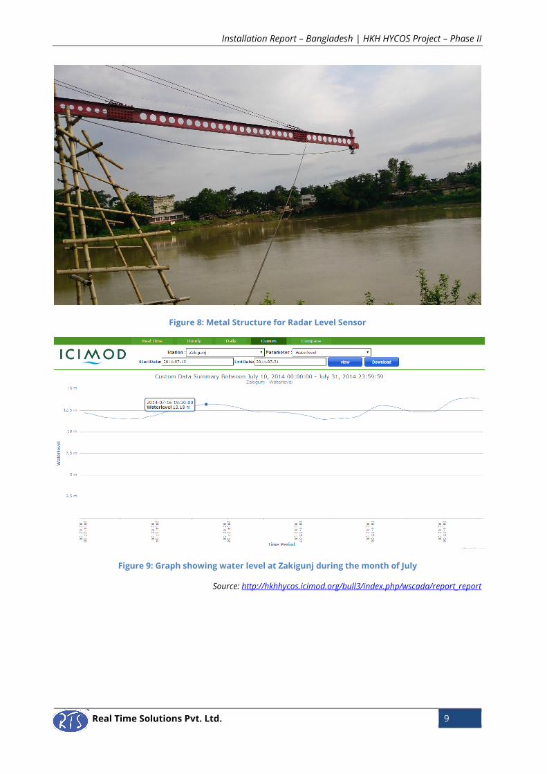
Figure 1: Metal Structure for Mounting Radar Level Sensor
Figure 2: Metal Housing for DCP Box
Shelter for DCP Box
Installation Report – Bangladesh | HKH HYCOS Project – Phase II
Real Time Solutions Pvt. Ltd. 4
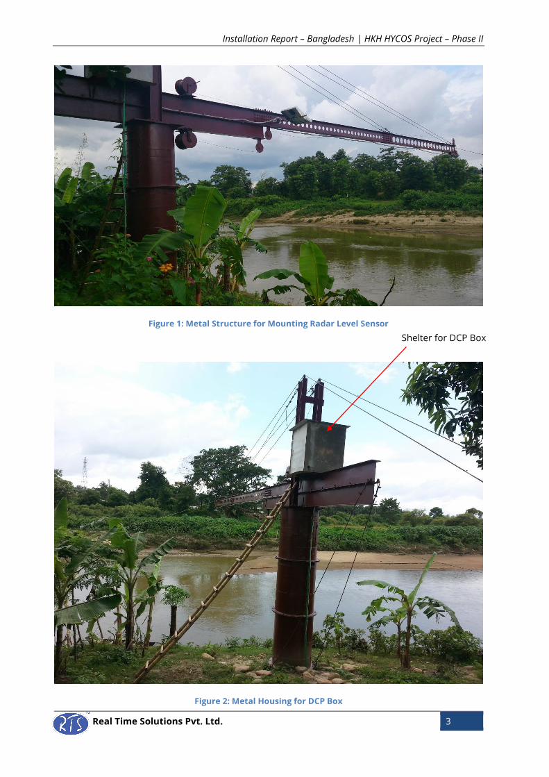
Figure 3: Radar Level Sensor
Figure 4: Fencing for Tipping Bucket
Installation Report – Bangladesh | HKH HYCOS Project – Phase II
Real Time Solutions Pvt. Ltd. 5
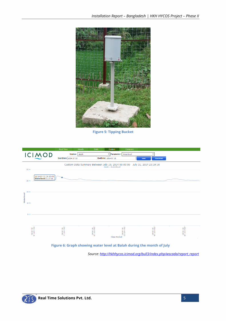
Figure 6: Graph showing water level at Balah during the month of July
Source: http://hkhhycos.icimod.org/bull3/index.php/wscada/report_report
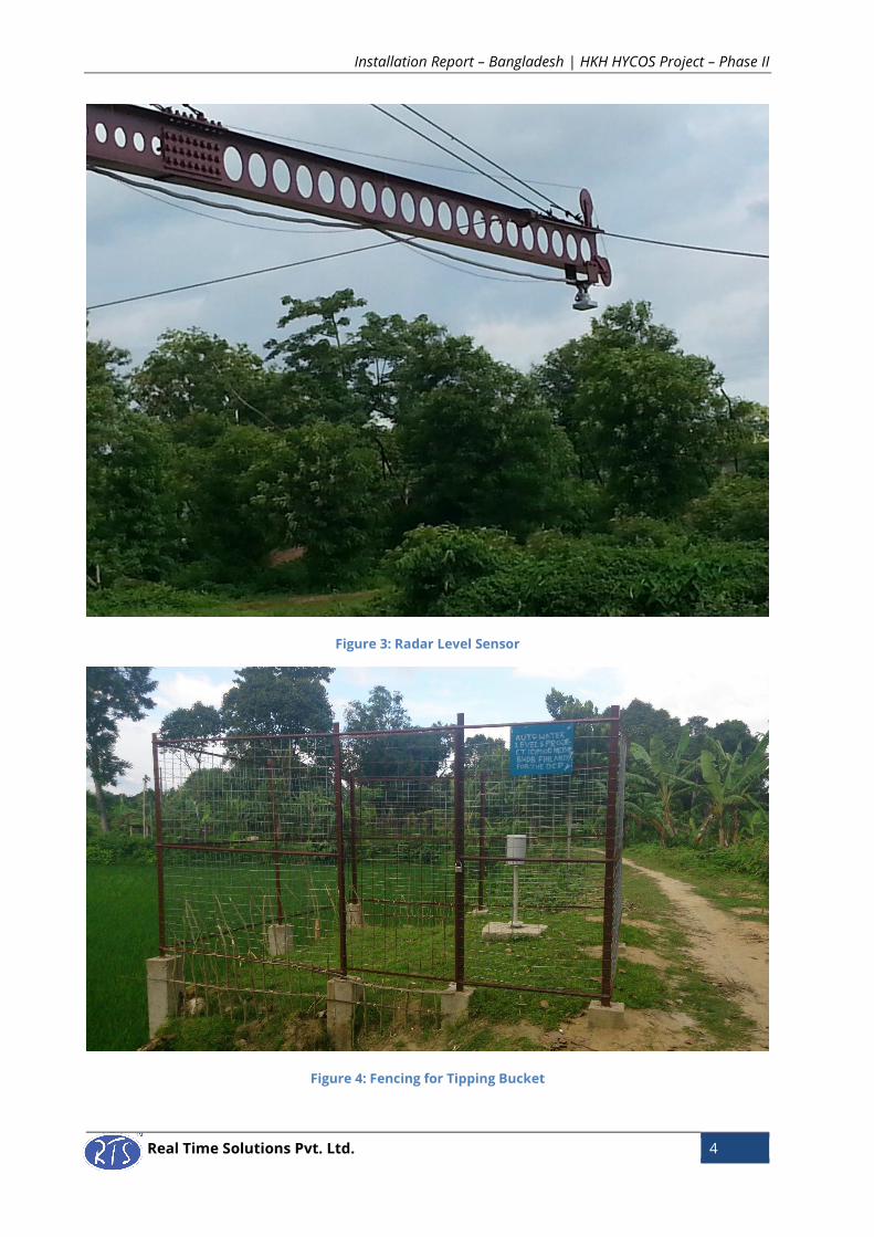
Figure 5: Tipping Bucket

Installation Report – Bangladesh | HKH HYCOS Project – Phase II
Real Time Solutions Pvt. Ltd. 6
Zakigunj
Station Type: Hydrological Station
Installation Date:
River:
7th July, 2014
Kushiara
Geographic Information:
Latitude: 24° 52' 25.08"N
Longitude: 92° 21' 48.5"E
Altitude: 9 m
Device Information:
Device ID: 8309
Hardware Version: Firmware Version:
Datalogger: Rev 6 Datalogger: Rev 6.5
Communication Module: Rev 7 Communication Module: Rev 6.1
GSM SIM used:
Banglalink (Modem 1): 01973245101
Gramen Phone (Modem 2): 01777756134
Sensors used:
i) Radar Level Sensor
ii) Tipping Bucket
Contact Person:
Hamid Zukigon (01735466900)
Installation Details:
The radar level sensor was mounted on a metal
structure with pulley mechanism. The tipping
bucket was mounted on the roof of the gauge
house which was about 100m away from the
radar location. The solar panel was mounted on
a pole fixed on the roof of the gauge house.
GSM SIM of Banglalink was used for modem 1
and that of Gramen Phone was used for modem
2. Modem 1 was set as high priority for data
transmission.
Modem Settings
Parameters Modem 1 Modem 2
APN BLWEB GPINTERNET
Username BLWEB GPINTERNET
Password BLWEB GPINTERNET
Priority High Medium
Offset Calculation for Water Level:
Staff gauge reading (x) = 12.68
Initial sensor reading (y) = 5.84
Installation Report – Bangladesh | HKH HYCOS Project – Phase II
Real Time Solutions Pvt. Ltd. 7
List of Equipment
Offset = x + y
= 12.68 + 5.84
= 18.52
People Involved:
Saroj Dhoj Joshi and Uday BC (RTS)
Alamgir Hossain and Akram (BWDB)
SN Model No Description Serial No
1 OTT RLS Radar Level Sensor 329650
2 TB3 Tipping Bucket Rain Gauge 2013-133
3 CC2SDI12 Contact closure to SDI-12 Converter 6-1-201003-35
Data Collection Platform Including:
4 Protection Housing 103136678
5 RTDL-11 Data Logger 1-6-201312-227
6 M2MGGI-11 Communication Unit 2-7-201312-171
7 Iridium Modem
S/N:J02H32,
IMEI:300234061410820
GSM Antenna
9 Iridium Antenna + Cable 302945
10 Charge controller 13 E24037
11 Solar Panel with accessories NF090620C005237
12 Battery
13 Earthing Kit

Installation Report – Bangladesh | HKH HYCOS Project – Phase II
Real Time Solutions Pvt. Ltd. 8
Figure 7: Tipping Bucket and Solar Panel on the roof of gauge house
Installation Report – Bangladesh | HKH HYCOS Project – Phase II
Real Time Solutions Pvt. Ltd. 9
Figure 8: Metal Structure for Radar Level Sensor
Figure 9: Graph showing water level at Zakigunj during the month of July
Source: http://hkhhycos.icimod.org/bull3/index.php/wscada/report_report
Installation Report – Bangladesh | HKH HYCOS Project – Phase II
Real Time Solutions Pvt. Ltd. 10
Sunamgunj
Station Type: Hydrological Station
Installation Date:
River:
9th July, 2014
Surma
Geographic Information:
Latitude: 27°26'30.2"N
Longitude: 91°34'56.4"E
Altitude: 854 m
Device Information:
Device ID: 8308
Hardware Version: Firmware Version:
Datalogger: Rev 6 Datalogger: Rev 6.5
Communication Module: Rev 7 Communication Module: Rev 6.1
GSM SIM used:
Banglalink (Modem 1): 01973245103
Gramen Phone (Modem 2): 01777756132
Sensors used:
i) Radar Level Sensor
ii) Tipping Bucket
Contact Person:
Syeddilsadmir (01813345312)
Sadikoramad (01729132371)
Installation Details:
The radar level sensor was mounted on a 6 m
long metal structure with pulley mechanism;
constructed on a metal pole. The DCP box with all
the components – datalogger, communication
module, power unit was wall mounted inside the
gauge house which was about 60 meters away
from the radar location. The tipping bucket was
installed 15 m away from the gauge house.
The solar panel was roof mounted on top of the
gauge house, inclined at an angle of 30º.
GSM SIM of Banglalink was used for modem 1
and that of Gramen Phone was used for modem
2.
Modem Settings
Parameters Modem 1 Modem 2
APN BLWEB GPINTERNET
Username BLWEB GPINTERNET
Password BLWEB GPINTERNET
Priority High Medium
Installation Report – Bangladesh | HKH HYCOS Project – Phase II
Real Time Solutions Pvt. Ltd. 11
List of Equipment
Offset Calculation for Water Level:
Staff gauge reading (x) = 8.78
Initial Sensor reading (y) = 2.82
Offset = x + y
= 8.78 + 2.82
= 11.6
People Involved:
Saroj Dhoj Joshi and Uday BC (RTS)
Alamgir Hossain and Akram (BWDB)
SN Model No Description Serial No
1 OTT RLS Radar Level Sensor 329647
2 TB3 Tipping Bucket Rain Gauge 2013-132
3 CC2SDI12 Contact closure to SDI-12 Converter 6-1-201003-39
Data Collection Platform Including:
4 Protection Housing 103137152
5 RTDL-11 Data Logger 1-6-201312-216
6 M2MGGI-11 Communication Unit 2-7-201312-181
7 Iridium Modem
S/N: J02HOJ,
IMEI:300234061415830
GSM Antenna
9 Iridium Antenna + Cable 302942
10 Charge controller 13 E24038
11 Solar Panel NF090620C005252
12 Battery
13 Earthing Kit
Installation Report – Bangladesh | HKH HYCOS Project – Phase II
Real Time Solutions Pvt. Ltd. 12
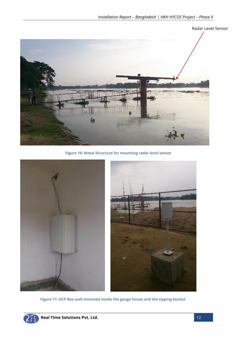
Figure 10: Metal Structure for mounting radar level sensor
Figure 11: DCP Box wall mounted inside the gauge house and the tipping bucket
Radar Level Sensor
Installation Report – Bangladesh | HKH HYCOS Project – Phase II
Real Time Solutions Pvt. Ltd. 13
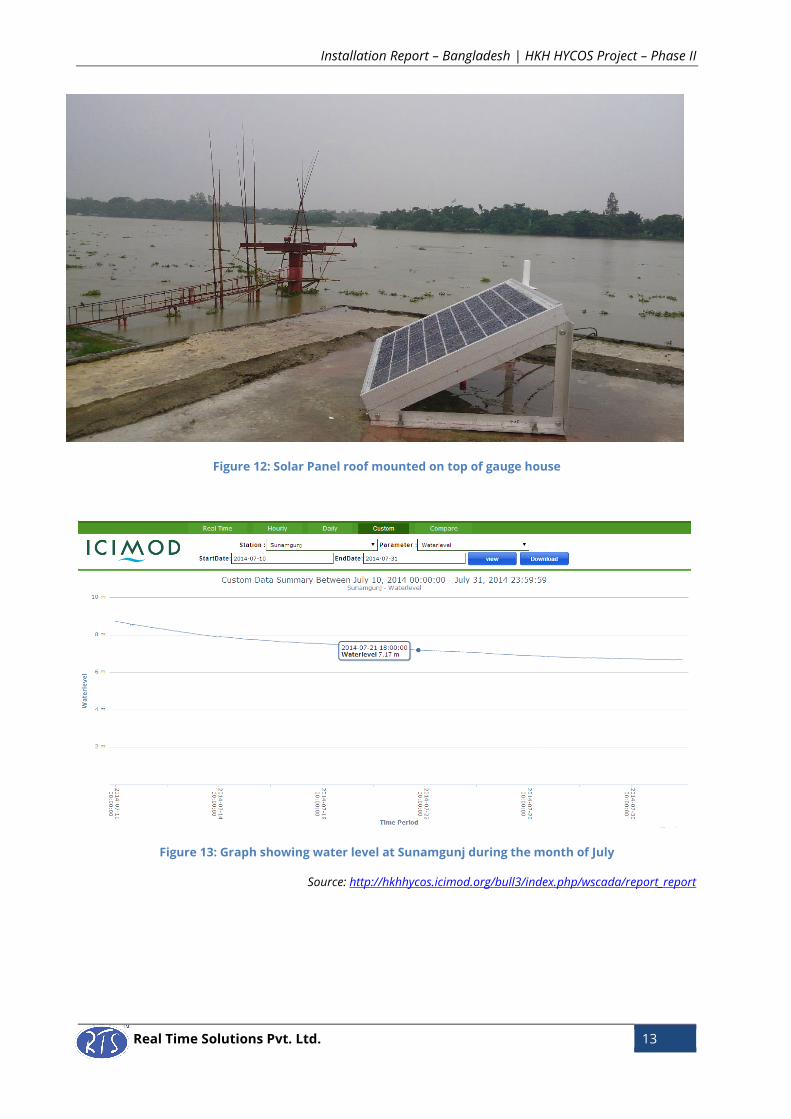
Figure 12: Solar Panel roof mounted on top of gauge house
Figure 13: Graph showing water level at Sunamgunj during the month of July
Source: http://hkhhycos.icimod.org/bull3/index.php/wscada/report_report
Installation Report – Bangladesh | HKH HYCOS Project – Phase II
Real Time Solutions Pvt. Ltd. 14
Chatlaghat
Station Type: Hydrological Station
Installation Date:
River:
11th July, 2014
Sarigeowain
Geographic Information:
Latitude: 24° 21' 46"N
Longitude: 91° 57' 39"E
Altitude: 20 m
Device Information:
Device ID: 8307
Hardware Version: Firmware Version:
Datalogger: Rev 6 Datalogger: Rev 6.5
Communication Module: Rev 7 Communication Module: Rev 6.1
GSM SIM used:
Gramen Phone: 01777756130
Banglalink: 01973245109
Sensors used:
i) Radar Level Sensor
ii) Tipping Bucket
Contact Person:
NA
Installation Details:
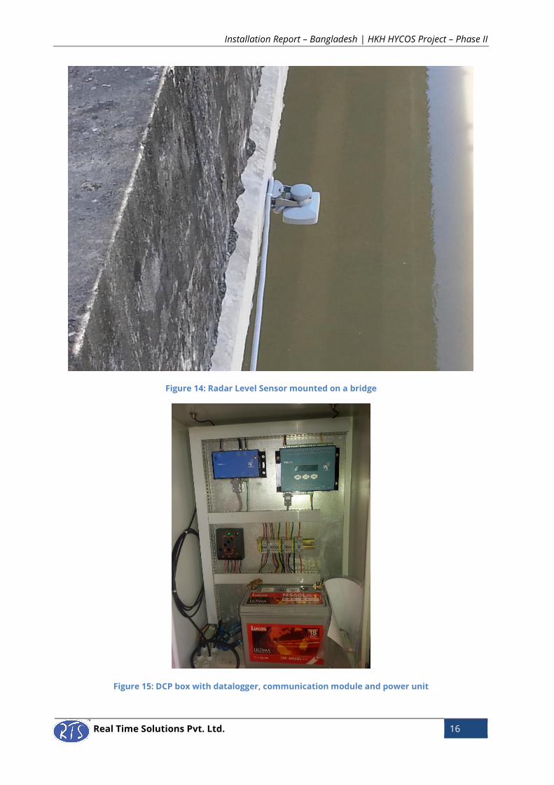
The radar sensor was installed on a bridge. The
DCP box with all the components – datalogger,
communication module, power unit was wall
mounted inside the gauge house which was
about 100 m away from radar location. The
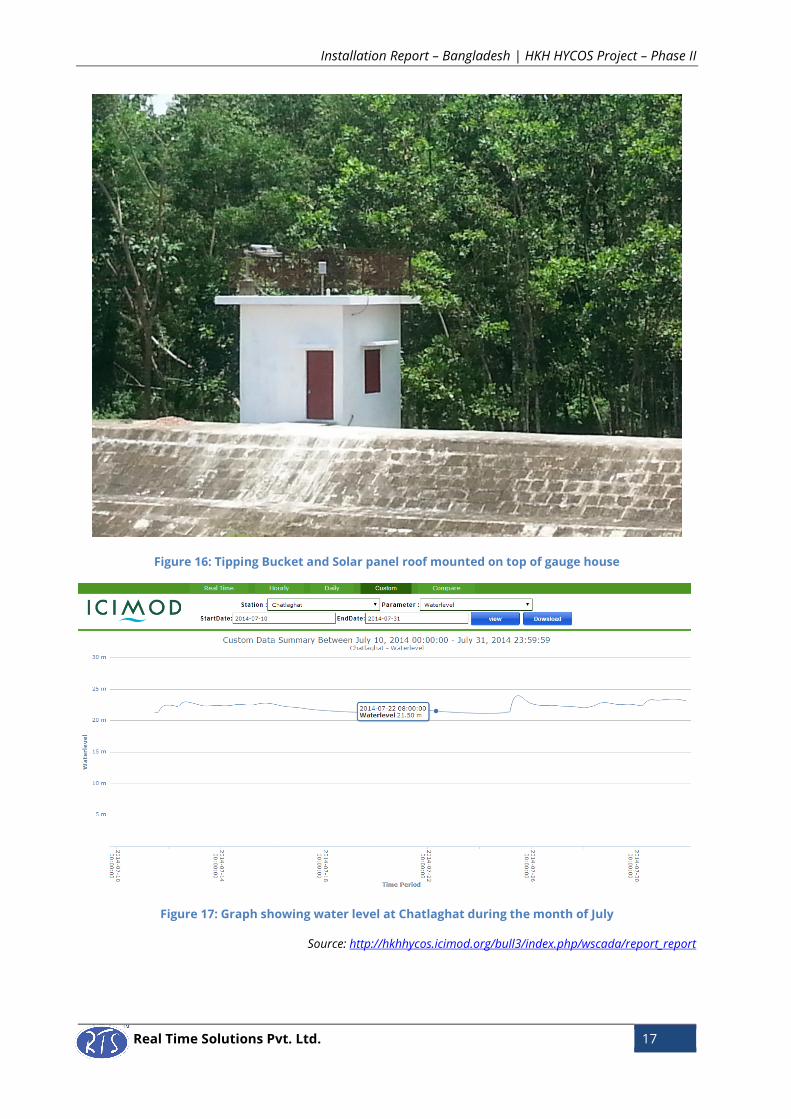
tipping bucket and the solar panel were installed
on the roof of the gauge house.
GSM SIM of Banglalink was used for modem 1
and that of Gramen Phone was used for modem
2.
Modem Settings
Parameters Modem 1 Modem 2
APN BLWEB GPINTERNET
Username BLWEB GPINTERNET
Password BLWEB GPINTERNET
Priority High Medium
Offset Setting for Water level:
Staff gauge reading (x) = 21.259
Initial sensor reading (y) = 7.142
Installation Report – Bangladesh | HKH HYCOS Project – Phase II
Real Time Solutions Pvt. Ltd. 15
List of Equipment
Offset = x + y
= 21.259 + 7.142
= 28.401
People Involved:
Saroj Dhoj Joshi and Uday BC (RTS)
Alamgir Hossain and Akram (BWDB)
SN Model No Description Serial No
1 OTT RLS Radar Level Sensor 308301
2 TB3 Tipping Bucket Rain Gauge 2013-131
3 CC2SDI12 Contact closure to SDI-12 Converter 6-1-201003-47
Data Collection Platform Including:
4 Protection Housing 103137137
5 RTDL-11 Data Logger 1-6-201312-184
6 M2MGGI-11 Communication Unit 2-7-201312-185
7 Iridium Modem
S/N: J02HIM,
IMEI:300234061416800
GSM Antenna
9 Iridium Antenna + Cable 302940
10 Charge controller 13 E24040
11 Solar Panel NF090508C003985
12 Battery
13 Earthing Kit
Installation Report – Bangladesh | HKH HYCOS Project – Phase II
Real Time Solutions Pvt. Ltd. 16
Figure 14: Radar Level Sensor mounted on a bridge
Figure 15: DCP box with datalogger, communication module and power unit
Installation Report – Bangladesh | HKH HYCOS Project – Phase II
Real Time Solutions Pvt. Ltd. 17
Figure 16: Tipping Bucket and Solar panel roof mounted on top of gauge house
Figure 17: Graph showing water level at Chatlaghat during the month of July
Source: http://hkhhycos.icimod.org/bull3/index.php/wscada/report_report