ioc group of experts on the global sea level ob; 9th; the...
TRANSCRIPT

Intergovernmental Oceanographic Commission Reports of Meetings of Experts and Equivalent Bodies
The Group of Experts on the Global Sea Level Observing System (GLOSS)
Ninth Session Paris, France 24 − 25 February 2005 GOOS Report No. 149 GCOS Report No. 99 JCOMM Report No. 36 UNESCO 2005
Electronic copy only
The Group of Experts on the Global Sea Level Observing System (GLOSS)
Ninth Session Paris, France 24 − 25 February 2005 GOOS Report No. 149 GCOS Report No. 99 JCOMM Report No. 36
UNESCO
IOC/GE-GLOSS-IX/3 7 July 2005 English only
(SC-2005/WS/43) Note: this report is published in electronic copy only and is available on UNESDOC, the documents database of UNESCO (http://unesdoc.unesco.org/ulis/)
ABSTRACT This report presents a summary of the topics discussed at theNinth Session of the Group of Experts on the Global SeaLevel Observing System (GLOSS-GE). The GLOSS-GEreviewed the programme and made recommendations on theprogramme implementation. A Communiqué by the Group ofExperts for the Global Sea Level Observing System (GLOSS)concerning the contribution by GLOSS and its core networkof sea level stations to tsunami and multi-hazard warningsystems was also issued.
IOC/GE-GLOSS-IX/3 page (i)
TABLE OF CONTENTS 1. ORGANIZATION OF THE SESSION ...............................................................................................1
1.1 OPENING OF THE SESSION ..............................................................................................1 1.2 PRACTICAL ARRANGEMENTS........................................................................................2 1.3 ADOPTION OF THE AGENDA...........................................................................................2
2. REVIEW OF GLOSS ACTIVITIES AND STATUS OF ACTIONS FROM GE-VIII...................2 3. GLOSS DATA SERVICE, PRODUCTS AND WEB RESOURCES ................................................2 4. UPDATES ON LINKAGES BETWEEN GLOSS AND OTHER PROGRAMMES.......................3
4.1 JCOMM PROGRAMME OBSERVATION AREA ..............................................................3 4.2 OOPC .....................................................................................................................................3 4.3 CLIVAR/GSOP......................................................................................................................3 4.4 COOP .....................................................................................................................................4 4.5 GTOS .....................................................................................................................................4 4.6 CGPS STATIONS AND TIDE-GAUGES ............................................................................4 4.7 JASON SCIENCE WORKING TEAM .................................................................................5 4.8 IHO.........................................................................................................................................5 4.9 ITSU .......................................................................................................................................5
5. DISCUSSION ON ITSU–GLOSS COORDINATION .......................................................................6 6. UPDATES ON REGIONAL SEA LEVEL NETWORK DEVELOPMENTS .................................9
6.1 ESEAS....................................................................................................................................9 6.2 MedGLOSS............................................................................................................................9 6.3 ODINAFRICA .......................................................................................................................9 6.4 SOUTH AMERICA .............................................................................................................10 6.5 NOAA ..................................................................................................................................10 6.6 CARIBBEAN.......................................................................................................................11
7. UPDATES ON NATIONAL SEA LEVEL ACTIVITIES ...............................................................12
7.1 BRAZIL ...............................................................................................................................12 7.2 CANADA.............................................................................................................................12 7.3 CHILE ..................................................................................................................................12 7.4 MEXICO ..............................................................................................................................12 7.5 DENMARK..........................................................................................................................13 7.6 FRANCE ..............................................................................................................................13 7.7 IRELAND ............................................................................................................................13 7.8 ISRAEL................................................................................................................................13 7.9 JAPAN .................................................................................................................................14 7.10 NORWAY............................................................................................................................14 7.11 KENYA................................................................................................................................14 7.12 PORTUGAL.........................................................................................................................14 7.13 PAKISTAN ..........................................................................................................................15 7.14 RUSSIAN FEDERATION...................................................................................................15 7.15 SPAIN ..................................................................................................................................15 7.16 UNITED KINGDOM...........................................................................................................15 7.17 AUSTRALIA .......................................................................................................................16 7.18 UNITED STATES OF AMERICA......................................................................................16
8. GLOSS CAPACITY-BUILDING PLANS FOR 2005–2007 ............................................................17
IOC/GE-GLOSS-IX/3 page (ii) 9. SEA- LEVEL SCIENCE ISSUES ......................................................................................................17
9.1 REPORT FROM THE GLOSS SCIENTIFIC SUB-COMMITTEE....................................17 9.2 A WCRP SEA LEVEL SCIENCE CONFERENCE............................................................17 9.3 REPORT FROM IAPSO COMMISSION ON MEAN SEA LEVEL AND TIDES............18
10. INTERSESSIONAL ACTIONS FOR 2005–2007 ........................................................................18 11. ANY OTHER BUSINESS...............................................................................................................18 12. DATE AND PLACE OF THE NEXT SESSION ..........................................................................18 13. CLOSURE........................................................................................................................................18 ANNEXES I. AGENDA II. LIST OF PARTICIPANTS III. GLOSS PLAN OF ACTIONS 2005–2007 IV. ACRONYMS
IOC/GE-GLOSS-IX/3
1. ORGANIZATION OF THE SESSION 1.1 OPENING OF THE SESSION
The Chairman of the GLOSS Group of Experts, Mark Merrifield, opened the Ninth Session of the IOC Group of Experts on the Global Sea Level Observing System at 09.10 hr on Thursday 24 February 2005.
The Executive Secretary of IOC and Assistant Director-General of UNESCO, Patricio Bernal, welcomed the participants. He recalled that GLOSS was one of the oldest networks organized by IOC to make available data and information on certain ocean processes. It remains IOC's ambition to use GLOSS capabilities as widely as possible. This is especially relevant following the recent tsunami catastrophe in the Indian Ocean. GLOSS has witnessed a long evolution; the technology underlying it has changed. Sensors with very wide broad-band capacity will allow sea-level observing stations to serve wider purposes than was originally foreseen. Data have become more accurate and more precise, and the need for near-real-time capability has grown considerably. So communication aspects have become relatively more important, especially for the main sea-level data-processing centres. Sea-level observing systems can now look at low-frequency phenomena (notably with respect to climate change prediction), as well as high-frequency processes, such as the fast-moving tsunami wave generation and transmission.
The IOC is working to remove the obstacles to the achievement of the required capabilities and capacities and there has been good progress by the IOC International Tsunami Warning System in the Pacific (ITSU). However, there is now clearly a need to develop a global tsunami warning system and this would be a necessary and valuable public service.
The recent tsunami catastrophe (December 2004) revealed a serious collective failure, so IOC must take the lead, especially in the matter of communication between the international scientific and technical community and the political community, so as to get the full and correct message across on the need for such warning systems. It is desirable to convey a message to the International Coordination Meeting for the Development of Tsunami Warning and Mitigation System for the Indian Ocean within a Global Framework (UNESCO Headquarters, France, 3–8 March 2005) on the importance of creating a permanent real-time global sea-level service. Resources are available now to establish six top-rate tide-gauges in the Indian Ocean, particularly on the eastern side where such stations are lacking, but also in other underserved regions in due course. The main difficulties in implementation lie in the great diversity at the national institutional level, in terms of objectives, ambitions, finances and commitments. The funding is often ill-adapted, for such reasons.
Patricio Bernal wished the Group of Experts every success in this, its Ninth Session. In closing, the Executive Secretary acknowledged the financial support for the meeting from the National Aeronautics and Space Administration (NASA).
The Chairman requested the participants to observe a one-minute silence in honour of Dr Christian Le Provost who was elected chair of the GLOSS GE at the GLOSS GE-VIII meeting (13–17 October, 2003, Paris) and who had passed away during the intersessional period.
IOC/GE-GLOSS-IX/3 page 2
1.2 PRACTICAL ARRANGEMENTS
The Technical Secretary for GLOSS, Thorkild Aarup, outlined the practical arrangements for the conduct of the session. 1.3 ADOPTION OF THE AGENDA
The Chairman invited comments on the proposed Agenda. There being none, the Group accepted the Agenda for the present session (Annex I). The list of participants is provided in Annex II. The GLOSS Plan of Actions adopted by the Group following its deliberations at the present session is in Annex III and the list of acronyms is in Annex IV. 2. REVIEW OF GLOSS ACTIVITIES AND STATUS OF ACTIONS FROM GE-VIII
Mark Merrifield and PhilipWoodworth reported on the actions taken in respect of the list of actions agreed at the last [8th] session of the Group held at IOC, Paris, 13, 16–17 October 2003 (GOOS Report No. 141; http://ioc.unesco.org/goos/docs/GOOS_141_GLOSS-8.pdf).
The Group of Experts noted that most of the actions had been addressed. A few actions still ongoing or pending should be incorporated into the list for the forthcoming intersessional period 2005–2007 (Annex III). 3. GLOSS DATA SERVICE, PRODUCTS AND WEB RESOURCES
Lesley Rickards reported relatively slow progress in the harmonization of the work and procedures of the main regional centres: the British Oceanographic Data Centre (BODC) with the Permanent Service for Mean Sea Level (PSMSL) and the University of Hawaii Sea Level Centre (UHSLC). Since BODC's main responsibility is for high-quality non-real-time data products and the UHSLC was primarily responsible for a fast-delivery data service (although they also handle delayed-mode data), their working methods were not always concordant. A draft plan for an improved system is in progress. It is believed that some of the perceived difficulties could also be overcome if the responsibilities of each centre for non-real-time data were clearer and if the UHSLC took overall responsibility for obtaining data from the Pacific and Indian Oceans, and BODC for the Atlantic, Arctic and Southern Oceans. In any case, a special effort must be made to ensure that the two GLOSS data archive centres were kept identical as to their data content, whether in the near-real-time or the delayed mode. It is also a responsibility of data providers to help to ensure this essential compatibility. There is also a need to decide with greater precision than hitherto who should receive and deal with which particular kinds of data. Formats for data delivery should be decided, and should be as few as possible.
Regarding data archaeology for Africa, there has been some progress, but much remains to be done. It is important that links to relevant regional activities must be maintained through the GLOSS web pages.
The GLOSS Handbook has been extensively revised and will be ready in its new version soon.

IOC-/GE-GLOSS-IX/3 page 3
The Chairman stressed that there is still a need to co-ordinate better with TIGA (GPS Tide-gauge Benchmark Monitoring Project); and to overcome the confusion vis-à-vis UHSLC and BODC. 4. UPDATES ON LINKAGES BETWEEN GLOSS AND OTHER PROGRAMMES 4.1 JCOMM PROGRAMME OBSERVATION AREA
Stan Wilson, on behalf of Mike Johnson (Coordinator of the JCOMM POA), briefly reviewed POA work during the 2003–2005 intersessional period. POA priorities are the achievement of: (i) global coverage by in situ networks constituting the Baseline Global Observing System for Oceanography and Marine Meteorology; (ii) system-wide monitoring and performance reporting; and (iii) fund-raising to achieve targets. The oceanic backbone of the system is the Global Climate Observing System (GCOS) Implementation Plan in Support of United Nations Framework Convention on Climate Change, which was adopted by the Global Earth Observation System of Systems (GEOSS). The tide-gauge component is now 58% complete. The aim is to produce standardized base maps for all the observing networks (notably GLOSS, Ship-of-Opportunity/XBT, Data Buoy Co-operation Panel, Climate Variability and Prediction, and Argo). GCOS reference stations could provide real-time tsunami warning. 4.2 OOPC
Albert Fisher of the GOOS Project Office, on behalf of Ed Harrison (Chairman of the Ocean Observations Panel for Climate) briefly reviewed OOPC activities during the intersessional period. The key objectives of OOPC are to: monitor climate; improve climate prediction and marine and weather forecasts; provide ocean forecasts; protect life and property on coasts and at sea; support scientific research. OOPC seeks GLOSS advice on: implementation strategy; technical requirements (especially for time resolution); improving data availability and historical-data availability. 4.3 CLIVAR/GSOP
Mark Merrifield briefly reported on the 1st session of the CLIVAR Global Synthesis and Observation Panel (GSOP; 10–12 November 2004, Boulder, Colorado, USA; http://www.clivar.org/organization/gsop/implementation/GSOP_1.html).
The GSOP feedback on sea level was generally positive. GSOP advocated that products and demonstrations of societal relevance are very much needed. In this regard, coastal sea level is viewed as one of the major contributions. In that context GLOSS could take a more active role in sea-level products in support of climate. A retrospective analysis of previous year's sea level could be such a product.
GSOP had noted that tide-gauge data would be a much more valuable assimilation variable if it is pressure corrected. The CLIVAR office will send GLOSS an official letter asking for sea-level pressure. UHSLC has started to look into the availability of SLP at all of the real-time stations, and will try and add it into the data stream.
The Group of Experts considered that it would, in this case, be necessary to revise the currently applied models, and that much depends also on the application envisaged. It also considered that the intercalibration of tide-gauge and altimetric data should be carried out before

IOC/GE-GLOSS-IX/3 page 4
adjusting the models. There is also a need to determine the sense of the term “timeliness” and the Group called on the Scientific Working Group to address this question. 4.4 COOP
Keith Thompson, member of the Coastal Ocean Observations Panel, briefly reviewed COOP activities during the intersessional period. COOP now has a Design Plan (2003) and the draft Implementation Strategy (2005) is expected to be endorsed by the GOOS governing bodies in the first half of 2005. The Implementation Strategy addresses actions for existing bodies and mechanisms concerning: (i) governance; (ii) measurements; (iii) data management; (iv) modelling and analysis; (v) capacity-building; (vi) pilot projects; and (vii) system performance elements of the coastal observing.
Pilot projects are an important mechanism for developing the coastal module of GOOS. The COOP Implementation Strategy contains a number of suggested pilot projects. The one that may be of particular interest to GLOSS is the suggested “Global Storm Surges and Flooding Risk” project. The idea behind this project is to build a modelling system that can provide short-term forecasts and decadal-scale hindcasts. Examples of products from such a pilot project could be: (i) short-term forecasts of surges for the global coastal ocean; (ii) reanalyses of the global coastal ocean based on best available wind and air pressures for recent decades; (iii) QC of real-time and archived sea-level observations; (iv) spatial maps and trends in flooding risk over recent decades; and (v) projections of flooding risk over the next century under plausible global sea-level rise and climate change scenarios.
The Group of Experts noted that coastal-zone flooding, sedimentation and erosion were not evident in the proposed COOP pilot projects. It recognized that regional models might reduce random effects (in sea-level observations) by as much as 30%. 4.5 GTOS
Thorkild Aarup briefly reviewed the coastal model of the Global Terrestrial Observing System (C-GTOS). Whereas the coastal module of GOOS approaches the subject from the seaward side, that of C-GTOS does so from the landward side. The two modules are, however, interdependent. A GTOS Design Plan was finalized in January 2005. The main objective of the coastal component of GTOS is to establish a regime for observing, assessing and predicting global and large-scale regional changes in, for example: population dimensions; land cover/land use and critical habitat alteration; sediment loss and delivery; water cycle/water quality; effects of sea-level change, storms and flooding. C-GTOS depends on GOOS/COOP/GLOSS for relevant sea-level observations.
There was no discussion. 4.6 CGPS STATIONS AND TIDE-GAUGES
Guy Wöppelmann briefly reviewed developments in the Global Positioning System in relation to tide-gauges during the intersessional period. A GPS@TG survey was completed; it was limited to tide-gauges within ten kilometres of a GPS sensor. 110 such stations are GLOSS stations, of which, 89 have themselves GPS capability; 47 of the GLOSS stations are committed to TIGA. 44 GPS sensors are within a kilometre of a tide-gauge and 99 GLOSS stations have access to GPS data.

IOC-/GE-GLOSS-IX/3 page 5
Tilo Schoene briefly reviewed developments in the IGS, with respect to GLOSS, during the
intersessional period. The International GPS Service (IGS) is running the GPS Tide-gauge Benchmark Monitoring—Pilot Project (TIGA—PP). The main aims are: determining the possible geodetic effects on the vertical stability of tide-gauges; and in situ calibration of satellite altimetry (e.g. TOPEX-Poseidon, Jason), also using continuous GPS (CGPS) monitoring. The aim is to achieve centimetric accuracy for tide-gauge station positions and millimetric accuracy for tide-gauge vertical velocities.
The Group of Experts welcomed the updating provided on the TIGA activities. 4.7 JASON SCIENCE WORKING TEAM
Gary Mitchum briefly reviewed the work of the JASON Team during the intersessional period. The principal concern has been the calibration of sea-level measurements especially with regard to the role of land motion in general and in the vicinity of tide-gauges in particular. The Team is now using GPS in developing the definition of the reference frame for such measurements. The reliability of sea-level data is related to the distance between a gauge and the relevant GPS stations. Agreement of the respective data sets is markedly greater if the sensors are on the same crustal plate.
The Group of Experts noted that the random error in the data is still substantial and that the possible reduction in the GPS–TG distance is a function of the associated random errors. It also noted that atmosphere pressure data are not yet part of the system. 4.8 IHO
Steve Shipman briefly reviewed cooperation during the intersessional period. He welcomed the mutual representation of GLOSS and the Tidal Committee of the International Hydrographic Organization at the meetings of both bodies. The next meeting of the Tidal Committee will be in 2006, probably in Australia.
The Group of Experts welcomed the updating on IHO activities. 4.9 ITSU
François Schindelé briefly reviewed the work of the International Tsunami Warning System in the Pacific during the intersessional period. In the light of the recent tsunami catastrophe in the Indian Ocean, on 26 December 2004, he reminded the Group of Experts that the impact of such a tsunami can differ considerably within a few hundred metres along a given coastline. Also, 95% of the significant tsunamis are due to earthquakes, the remainder being due to such phenomena as landslides, volcanic eruptions etc. While the speed of a tsunami in the ocean may be several hundred kilometres per hour, it is usually only 30–40 km/hour at the coastline. Many GLOSS stations report real-time high-frequency sea-level information to the Pacific Tsunami Warning Centre and several GLOSS stations detected the December-2004 tsunami.
The Group of Experts recalled that, in spite of the detection of the tsunami by several Indian Ocean tide-gauges, no warning had been issued. This was considered to be due to several factors: (i) the lack of a formal Indian Ocean warming system with all the relevant data communication facilities; (ii) the unsuitability of the national tsunami warning centres for prediction purposes,

IOC/GE-GLOSS-IX/3 page 6
sometimes owing to difficulties in making relevant data available; and (iii) the fact that, for useful prediction purposes, a regional approach is necessary.
The Group of Experts welcomed the information from the Technical Secretary that some funding for the development of an Indian Ocean tsunami warning system was available and that the possible modalities for the creation of the system would be discussed at an International Coordination Meeting for the development of Tsunami Warning and Mitigation System for the Indian Ocean within a Global Framework (3–8 March 2005, Paris).
The Group of Experts also welcomed the fact that the UN International Strategy for Disaster was also working towards the development of an Indian Ocean tsunami warning system. 5. DISCUSSION ON ITSU–GLOSS COORDINATION
François Schindelé and Mark Merrifield introduced the discussion. The principal question was whether GLOSS could and should evolve in the direction of providing tsunami and storm-surge warning capabilities, based essentially on existing sea-level monitoring capabilities.
Following a full debate, the Group of Experts considered that the first move should be to develop an Indian Ocean tsunami warning system. The design would however, depend considerably on the socially acceptable delay in warning, which would require some careful technical choices. It would be necessary to decide what the most hazardous areas are, in terms of tsunami and storm-surge impact. The Member States must set their own priorities in this regard; even in the Pacific Ocean, the fears (of tsunami impact), hence the warning requirements, have changed appreciably in the light of the Indian Ocean catastrophe.
The Group of Experts decided that it should take the lead in developing tsunami and storm-surge warning capabilities, based on sea-level measurement, otherwise such systems will be developed at the expense of GLOSS. Tide-gauge stations must evolve to meet a wider range of user needs. The use of pressure sensors to enhance predictive capabilities is reasonable, but there are big differences between mid-ocean and harbour sea-level data acquisition and management. Other major problems to be addressed are: the high cost of high-frequency data, and it would probably be worthwhile considering the installation of duplicate tide-gauges at key stations to reduce down-time, as well as increasing the data rate in the event that a tsunami signal was detected
The Group of Experts also considered that, for tsunami warning system purposes, some re-location of existing stations might be necessary, and the location of new stations would require very careful consideration, especially in terms of the GLOSS Core Network. The location of tsunami warning system sites is currently based largely on geology/geophysical criteria, but this should not be allowed to overshadow the sea-level measurement criteria. The re-location of GLOSS sites, especially if it involves changes in instrumentation, to accommodate tsunami warning system requirements might also compromise the exploitation of historical data series.
Nevertheless, the Group of Experts recognized that the development of tsunami warning capabilities could greatly benefit the development of GLOSS, so long as the technical and financial investment in such capabilities did not overtake that in GLOSS itself. The two main problems were the data retrieval and management rather than the sensors themselves, and the maintenance and/or replacement of instrumentation. GLOSS, whether in a limited or a broad framework, must be based on top-grade stations. Power blackouts and telephone access are the main causes of down-time, so
IOC-/GE-GLOSS-IX/3 page 7
multiple-transmission facilities at GLOSS stations (e.g. satellite/global telecommunication system/ telephone/local PC) are highly desirable.
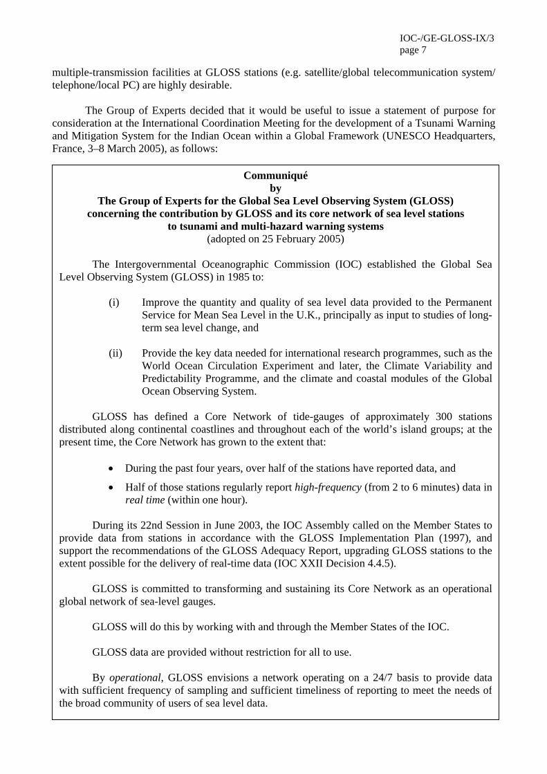
The Group of Experts decided that it would be useful to issue a statement of purpose for consideration at the International Coordination Meeting for the development of a Tsunami Warning and Mitigation System for the Indian Ocean within a Global Framework (UNESCO Headquarters, France, 3–8 March 2005), as follows:
Communiqué by
The Group of Experts for the Global Sea Level Observing System (GLOSS) concerning the contribution by GLOSS and its core network of sea level stations
to tsunami and multi-hazard warning systems (adopted on 25 February 2005)
The Intergovernmental Oceanographic Commission (IOC) established the Global Sea
Level Observing System (GLOSS) in 1985 to:
(i) Improve the quantity and quality of sea level data provided to the PermanentService for Mean Sea Level in the U.K., principally as input to studies of long-term sea level change, and
(ii) Provide the key data needed for international research programmes, such as the
World Ocean Circulation Experiment and later, the Climate Variability andPredictability Programme, and the climate and coastal modules of the GlobalOcean Observing System.
GLOSS has defined a Core Network of tide-gauges of approximately 300 stations
distributed along continental coastlines and throughout each of the world’s island groups; at thepresent time, the Core Network has grown to the extent that:
• During the past four years, over half of the stations have reported data, and
• Half of those stations regularly report high-frequency (from 2 to 6 minutes) data inreal time (within one hour).
During its 22nd Session in June 2003, the IOC Assembly called on the Member States to
provide data from stations in accordance with the GLOSS Implementation Plan (1997), andsupport the recommendations of the GLOSS Adequacy Report, upgrading GLOSS stations to theextent possible for the delivery of real-time data (IOC XXII Decision 4.4.5).
GLOSS is committed to transforming and sustaining its Core Network as an operationalglobal network of sea-level gauges.
GLOSS will do this by working with and through the Member States of the IOC.
GLOSS data are provided without restriction for all to use.
By operational, GLOSS envisions a network operating on a 24/7 basis to provide datawith sufficient frequency of sampling and sufficient timeliness of reporting to meet the needs ofthe broad community of users of sea level data.
IOC/GE-GLOSS-IX/3 page 8
These needs for sea level data include, but are not limited to:
• Estimating global sea level rise
• Establishing datums for topography and bathymetry
• Estimating flow through straits and passages
• Characterizing coastal expressions of phenomena like ENSO
• Supporting coastal engineering needs
• Calibrating satellite altimetry
• Determining tidal components for prediction
• Supporting safe navigation and harbour activities
• Measuring and predicting storm surges
• Supporting tsunami warning
In its effort to complete the Core Network, GLOSS stands ready to work with specificusers to identify observational requirements – such as station location, frequency of sampling,and timeliness of reporting – associated with meeting their needs for sea level data; to theextent that there are additional costs associated with meeting their needs, GLOSS will workwith those users to ensure that the additional funds are secured.
The Communiqué Relating to Support for Tsunami and Multi-Hazard Warning Systemswithin the Context of the Global Earth Observation System of Systems (GEOSS) was adoptedon 16 February 2005 at the Third Earth Observation Summit in Brussels. This Communiquénotes that disaster reduction is a high-priority area that will be addressed in the GEOSS Ten-Year Implementation Plan and within the framework of the International Strategy for DisasterReduction. Given this Communiqué, as well as considering the developing UN InternationalEarly Warning Programme, GLOSS is interested in making the operational capability of itsCore Network available as a basic element of GEOSS, especially to meet the needs for disasterreduction.
In so doing, GLOSS can contribute to the realization of effective tsunami warningsystems in the Indian Ocean, Caribbean and Mediterranean Seas, and other regions of theworld, as an integral part of a multi-hazard aspect of GEOSS. In this context, GLOSS is prepared to work with the International Coordinating Group for the Pacific Tsunami Warning System (ICG/PTWS) and others as appropriate – as the capability for tsunami warning expands to the globe – to define requirements for new GLOSS stations and/or upgrades to existing GLOSS Stations.
IOC-/GE-GLOSS-IX/3 page 9
6. UPDATES ON REGIONAL SEA LEVEL NETWORK DEVELOPMENTS 6.1 ESEAS
Bente Bye briefly reported on developments in ESEAS during the intersessional period. ESEAS now provides a standardized access to most sea-level data available in Europe, offering quality-assured high-level data products from ESEAS tide-gauges and associated GPS and satellite altimetry. Observations from ESEAS stations concerning the Indian Ocean tsunami are also available. Twenty-one countries now participate in ESEAS. The research infrastructure presently covers sea-level variation on inter-annual to secular time-scales, and the assessment of potential future changes in mean sea level. ESEAS is itself a component of the EU–ESA Global Monitoring for Environment and Security (GMES) and a participating body in the ad hoc Group on Earth Observation (GEO). Open issues under consideration by ESEAS are: data quality information; digital object identification; copyright; and data-access policy. Further information is available at www.eseas.org/.
The Group of Experts sought, and received, assurance that the question of copyright was not an obstacle to the free exchange of ESEAS/GLOSS data. To the question as to whether any other related parameters were being measured under ESEAS, the answer was yes, but not in a uniform manner. 6.2 MEDGLOSS
Dov Rosen briefly reported on developments in the CIESM and IOC sponsored Mediterranean and Black Sea sea-level programme (MedGLOSS) during the intersessional period. Highlights of these developments were: (i) software tools for sea-level data gathering, data transmission, preliminary quality assurance and dissemination via the Internet have been developed by IOLR and supplied free to MedGLOSS and are free for the sea-level community to be downloaded from MedGLOSS web site; (ii) a new MedGLOSS web site has been developed with near-real-time data, statistical tools and downloading capabilities (http://medgloss.ocean.org.il/); (iii) a WINDOWS based version of the popular TASK tide harmonic analysis and forecasting DOS software developed at POL, UK, has been developed by IOLR and is available free to the scientific sea-level community; (iv) near-real-time sea-level data from the GAVDOS Consortium (http://www.gavdos.tuc.gr/index.php) will be available on MedGLOSS web site shortly; and (v) near-real-time data from many Italian, Greek and Turkish stations are also expected to be made available through the MedGLOSS web-site later this year.
The Group of Experts welcomed the progress in the evolution of MedGLOSS. 6.3 ODINAFRICA
Charles Magori briefly reported on relevant developments in the Oceanographic Data and Information Network for Africa (ODINAFRICA) during the intersessional period. African States need to develop the capability to acquire and exploit ocean data in their pursuit of sustainable development. The proposed first step is to create a pan-African network of coastal observing stations, with a view to, inter alia, ensuring a healthy coastal environment, preserving human health, detecting and predicting the effects of climate change, and mitigating the impact of extreme events. The four work packages are: (i) management and co-ordination; (ii) development of the coastal ocean observing system; (iii) data and information management; and (iv) product delivery. The overall aim is near-real-time observations of key coastal ocean variables. However, most tide-gauge
IOC/GE-GLOSS-IX/3 page 10
stations in Africa are not fully operational, and at least 15 new stations are needed. For this, ODINAFRICA needs the advice and technical support of GLOSS.
The Group of Experts considered that it was necessary to re-establish benchmarks that are no longer in place (for various reasons). It agreed to provide advice, as appropriate, especially on the selection of new station sites.
6.4 SOUTH AMERICA
Juan Fierro briefly reported on relevant developments in South America during the intersessional period. A GLOSS South American web page has been developed by Juan Fierro and Rodrigo Nuñez of the Servicio Hidrográfico y Oceanográfico de la Armada de Chile. The web page is in Spanish and an English version is under development (see also http://ioc3.unesco.org/gloss-south-america/).
A GLOSS/GRASP/CIIFEN sea-level session is under planning as part of the CLIVAR/OOPC/ARGO Workshop on the South Pacific (10–11 October 2005; Valparaiso, Chile).
The Group of Experts noted that there was good co-operation among tide-gauge station operators at the individual level, there was still a need to improve co-operation at the intergovernmental level in the region. 6.5 NOAA
Stan Wilson briefly reported relevant developments in the U.S. National Oceanographic and Atmospheric Administration (NOAA) with respect to sea-level observations for the Global Climate Observing System (GCOS). An initial set of countries was drawn up based on: data not previously shared in real time; potentially significant, but inaccessible, historical records; local need for timely data (storm surge or tsunamis); significant oceanographic features (e.g. Indonesian Throughflow); lengthy coastline with several stations installed. This initial set comprised Brazil, China, India, Indonesia, New Zealand, The Philippines and the Russian Federation. NOAA/OGP (Mike Johnson) is willing to provide equipment for installation and communications, working through UHSLC, if the host country agrees to (i) support operation and maintenance of the equipment (with UHSLC support available on call and as available); (ii) ensure timely access to data; and (iii) collaborate in the use of the resulting data and concentrate on the installation of just one station (within each country) to demonstrate the viability of this approach.
The present status of negotiations is:
• Brazil – 1st gauge installed at Salvador (Navy); the 2nd underway at Cananeia (University of São Paulo with PSMSL)
• China – verbal agreement with the State Oceanic Administration for Zha Po
• India – verbal agreement with the Department of Science and Technology/SOI for Minicoy Island + access to archival data (but site survey still awaited)
• Indonesia – draft MoU with Bakosurtanal for Bitung (but action delayed by tsunami catastrophe)
• New Zealand – discussions at the ministerial level – cost-recovery is still an issue (but NZ ready to contribute its national tide-gauge station system to tsunami warning)
• Philippines – informal agreement with C&GSD for Davao (Indonesian Throughflow w/Bitung)

IOC-/GE-GLOSS-IX/3 page 11
• Russia – discussions with Roshydromet for Kronstadt + access to 200-year record (but naval defence considerations still an obstacle).
Stan Wilson also drew attention to the sixth session of GEOSS and the third Earth
Observation Summit that were held in Brussels 14–15 February 2005 and now involves 60 countries and 40 organizations. Coastal sea level is being promoted as a near-term action for GEOSS implementation, taking advantage of the political visibility of the Earth Summit/GEOSS process to implement GLOSS, with a view to facilitating resolution of issues of data access, national security, cost recovery, access to historical records, and assisting in securing funding.
The Group of Experts welcomed this updating. To the question of whether national security issues could be generally resolved by requiring only near-real-time or delayed data products, Stan Wilson pointed out that the provision of real-time data was a condition for support or provision of equipment from NOAA, and he considered that it should be so for all international support in this field.
The Group of Experts recognized that initial investment in tide-gauge stations was presently constrained by the associated cost of subsequent maintenance, and that this cost should, at least initially, be included in the investment. It also considered that specific technical training in tide-gauge maintenance, as well as capacity-building in real-time sea-level monitoring through fellowships, was essential, and that a single national agency should, if possible, be assigned sole responsibility for the national tide-gauge station network. 6.6 CARIBBEAN
Doug Wilson reported on relevant developments in the Caribbean during the intersessional period. A detailed sea-level station status evaluation is under way; a preliminary report has been prepared by Joshua Henson (Institute for Marine Remote Sensing, University of South Florida). 61 stations have been identified. They are operated by a wide range of institutions, countries and organizations: Red de Observación del Nivel del Mar para América Central (RONMAC)–3, Central America; Caribbean Planning for Adaptation to Climate Change (CPACC)–18, in Bahamas, Jamaica, the Lesser Antilles, Mexico and Guyana; IOC–1, in Venezuela; IOC–UNEP–4, in Aruba, Cuba, Guyana, Turks & Caicos; Cuba–3; Dominican Republic–2; Finland–1, in Central America; France–2, in Guadeloupe and Martinique; Mexico–3; Netherlands Antilles–1; Panama–1; United Kingdom–2, in Bermuda and Turks & Caicos; Venezuela–2; U.S. NOAA–3, in Yucatán, Cartagena, Bahamas; National Water Level Observing Network (NWLON)–14, mostly U.S. Gulf of Mexico coast and Puerto Rico; Smithsonian Institution–1, in Yucatán. Of these stations, 41 apparently have GOES data-transmission capability. However, the survey suggests that, of the 61 stations initially named: 7 have “disappeared”; 14 are not currently operational; nothing, other than the name, is known of another 14; 9 are operational but without data-transmission capability; and 17 are operational but with such capability. Failures are due to: damage by human activities and storms; removal for construction work without re-installation; mechanical breakdown without maintenance; and transmission downtime. The proposed solutions to these problems are: to build up a multi-purpose ocean observing system to meet a wider range of user needs; ensure the availability of real-time data products locally; capacity-building in relevant data analysis and technical capability; increase local investment to promote a broad-based station ownership; and to seek more robust installations.
The Group of Experts considered that the Member States of the Caribbean region should strongly back the proposed initiative, based on a complete appraisal of the state of existing tide-
IOC/GE-GLOSS-IX/3 page 12
gauge stations and an evaluation of the needs for new ones to complete the proposed multi-purpose system, with special attention to data transmission to suit a specific purpose. It strongly advised the Member States concerned, in the development of a system with tsunami warning system, to ensure the establishment of the necessary technological infrastructure to ensure the sustainability of the system; only with the improved system in place, can the questions of prediction (of tsunamis, storm surges, hurricanes and other extreme coastal-ocean events) be satisfactorily addressed. 7. UPDATES ON NATIONAL SEA LEVEL ACTIVITIES
Several speakers presented brief updates on their respective national sea-level observing systems. Although these are very succinctly reported here, details may be sought on the relevant websites. 7.1 BRAZIL
Marcelo Cavalcante drew attention to two main points: the completion of an Implementation Plan for the Brazilian GLOSS Programme; the organization of a meeting (Rio de Janeiro, 14–16 March 2005) of the Heads of the National Hydrographic Services of Argentina, Brazil and Uruguay, together with some scientists from their respective national institutions to discuss the creation of a GOOS Regional Alliance (GRA) for Operational Oceanography in the Upper Southwest and Tropical Atlantic Ocean. 7.2 CANADA
Robert Keeley reported on this item. MEDS acquires, processes, quality controls, archives and distributes tide and water-level (TWL) data reported on a daily to monthly basis from the DFO Canadian Hydrographic Service (CHS) water-level gauging network. MEDS also operates a Tides and Water Levels Benchmark Database for the Canadian Hydrographic Service where information on the benchmarks from various DFO stations can be found. As Canada's national data centre, MEDS' historical tides and water-level data archives presently hold over 30 million records with the earliest dating back before the turn of the century. Over 70,000 new hourly height observations and other higher resolution data are added on a monthly basis. More information about the Canadian national tide-gauge network, including data, is available at : http://www.meds-sdmm.dfo-mpo.gc.ca/meds/databases/TWL/TWL_e.htm. 7.3 CHILE
Juan Fierro informed the Group of the establishment of a self-contained digital platform at Rada Covadonga in the Graham Land peninsula (Antarctica). A similar platform at Punta Soberanía (also in Antarctica, across the Bransfield Strait) and a tide-gauge station at Diego Ramirez at Cape Horn (replacing one in the nearby Wollaston Islands) are both inoperative. 7.4 MEXICO
Juan Ramirez Miranda briefly reviewed the development of the Mexican Sea Level Network. It comprises four phases: (i) 5 stations with telemetric capability and support from the Centro de Control del Procesamiento de Datos (CECOPROD); (ii) 25 stations without such capability; (iii) the incorporation of these capabilities into the phase-II stations; and (iv) the establishment of 10 Mexican insular stations with telemetric capability.
IOC-/GE-GLOSS-IX/3 page 13
This work is supported by hydrographic surveys and coastal bathymetry and envisages a tsunami warning capability. While tsunami detection has been confirmed, the Mexican Tide-gauge Network is not yet able to provide adequate near-real-time data, so it is still short of the desired tsunami warning capability. Further information is available at www.semar.gob.mx and via [email protected] and [email protected]. 7.5 DENMARK
Per Knudsen reviewed developments. The Danish Meteorological Institute (DMI), with the Coastal Directorate and some harbour authorities, operates 77 tide-gauges in Denmark; the main concern is the impact of throughflow between the North Sea and the Baltic. Eight-day-average sea-level values and 2-day forecasts are available at www.dmi.dk/dmi/index/danmark/vandstand.htm. Presently the DMI is not participating in ESEAS. It is ready to designate some GLOSS stations within the national network. In Greenland, the DMI ended sea-level observations in 2002, but will make the full corresponding data set available in 2005. The Department of Geodesy of the Danish National Space Centre operates a gauge and an associated GPS station in Southern Greenland (reporting data via ESEAS) and plans two more in Northern Greenland. Four other gauges have been proposed for the International Polar Year. 7.6 FRANCE
Guy Wöppelmann briefly described the French Système d’Observation du Niveau des Eaux Littorales (SONEL); it is multi-purpose: an integrated sea-level monitoring system; a sea-level information system covering data from various observing systems; the French international component of GLOSS, ESEAS etc.; and the French national interface with related data bases (e.g. PSMSL, TIGA). SONEL is a long-term commitment, in co-operation with the Service Hydrographique de la Marine (SHOM), the Institut Géographique National (IGN), the Centre Littoral de Géophysique (CLDG, of the Université de La Rochelle), among others. There is an ongoing effort in data archaeology in terms of inventory and digitization. The data are mostly high-/low-water-level observations but they may reveal some sea-level features. 7.7 IRELAND
Jimmy Murphy reviewed the state of the Irish Sea level network. It is still lacking coordination, data management and gauge maintenance at the national level. The two GLOSS gauges (at Malin Head, in the North, and Castletownbere, in the South) are not properly maintained; Malin Head is, however, an important meteorological station and the GLOSS gauge, when upgraded, will be linked to it. Besides the general need for upgrading of tide-gauge stations, their standardization is also imperative. Five new stations have been set up at nationally important sites. Further information is available at www.irishtides.com. 7.8 ISRAEL
Dov Rosen reviewed the situation in Israel. Tide-gauges are operated by the Survey of Israel (SOI) and Israel Oceanographic and Limnological Research Ltd. (IOLR); the latter operates the country's only GLOSS station, in the port of Hadera. In September 2004, within the ESEAS-RI project, IOLR also installed a MedGLOSS type station in Ashdod port; another is at Elat (Gulf of Aqaba). IOLR is therefore operating three near-real-time stations measuring sea level by integrated samples over 0.5-minute intervals. The data are transmitted by IOLR to the Israel Marine Data Center (ISRAMAR maintained by IOLR) which makes near-real-time data on sea level available at
IOC/GE-GLOSS-IX/3 page 14
www.isramar.ocean.org.il; starting 1 March 2005, the hourly digital data will be available for downloading for scientific use directly from the ISRAMAR web site. Historical sea-level data are available from the SOI at www.soi.gov.il/sealevel/graphs. 7.9 JAPAN
Keizo Sakurai presented a brief report. Tide-gauge stations in Japan are operated by the Japan Meteorological Agency (JMA), the Japan Coast Guard (JCG), the Geographical Survey Institute (GSI), and a few other entities. Fourteen of the JMA stations are in the GLOSS Core Network. Twenty-five GSI stations participate in the TIGA Pilot Project.
In addition to the Japan national report, Masahiro Yamamoto described the Japan Tsunami Tidal Data Collection System using Japan’s geostationary meteorological satellite. The System presently comprises seven tide-gauge stations and some bottom pressure sensors. Data are transmitted within 1 minute at intervals of 6, 12 or 15 minutes, depending on requirements. The Japan Meteorological Agency makes data available to the IOC Tsunami Warning System in the Pacific, and to national meteorological services on request. The JMA is willing to extend its services to the Indian Ocean. At present, the data are predominantly meteorological, but a sea-level channel could be added. Detailed information is available from Hiroaki Ota ([email protected]). 7.10 NORWAY
Daniel Hareide reviewed developments. There are presently 23 tide-gauges in the national network; data are automatically transmitted to the Norwegian Hydrographic Service (NHS). There are continuous GPS measurements at 3 sites. Under Spain–Norway co-operation, a comparison is being made of MURIS and Kalesto tide-gauges. At present Norway will become involved in the development of an Indian Ocean tsunami warning system via a Trust Fund contribution to IOC, but the NHS will assist only in tide-gauge station installation. Plans include installation of a radar tide-gauge at Hammerfest (Northern Norway), the development of automatic data quality control, and advanced data management. More information is available at http://vannstand.statkart.no/Engelsk. 7.11 KENYA
Charles Magori reviewed the situation in Kenya. There is a GLOSS station at Mombasa (since 1986) and another at Lamu (since 1996). Three new stations are planned: at Kunga (in the North), at Malindi (Central) and Shimoni (in the South). There is also a GPS station at Malindi; the new tide-gauge station will be linked with it. 7.12 PORTUGAL
Leonor Martins briefly reported. There are currently four GLOSS stations in Portugal Madeira Islands, and two in the Azores), operated by the Portuguese Hydrographic Office. The old site at Cascais became silted up, so a new station (with an acoustic gauge) will be established. The one at Funchal (Madeira Islands) has been re-sited at Caniçal. The old Santa Cruz site in the Azores has been re-sited in Lajes das Flores; the other in the Azores (Punta Delgada) is a tide-gauge provided by U.S. NOAA. An effort to validate old data is ongoing and transmission of relevant data to PSMSL and UHSLC has restarted after a fairly long break. Portugal is participating in ESEAS.
IOC-/GE-GLOSS-IX/3 page 15
7.13 PAKISTAN
Tariq Masood Ali Khan reported developments in the Pakistan Sea Level Network. The National Institute of Oceanography has developed a proposal for a tide-gauge network of six stations including the two GLOSS stations at Karachi and Gwadar. The Pakistan Hydrographic Office (PHO) is trying to re-establish the Karachi tide-gauge station with the assistance of IOC/GLOSS and this station is expected to be re-established in 2006. The Gwadar station is presently not operational, owing to lack of spare parts and adequate funds to run it. Pakistan has no fundamental difficulty with the sharing of tide-gauge information internationally and recognizes the GLOSS conditions in this respect. Nevertheless, there remains a need to open up contacts between the PHO and GLOSS. 7.14 RUSSIAN FEDERATION
Oleg Zilberstein gave a brief update on the Russian Sea Level Network. There are GLOSS stations for the coastal seas of the Federation; they are operated by the Federal Service for Hydrometeorology and Environment Monitoring (ROSHYDROMET). Data are initially transmitted to the All-Russia Research Institute for Hydrometeorological Information–World Data Centre (ARRHI–WDC in Obninsk), for cataloguing and archiving. Relevant data products, for eight stations; are sent, respectively, to PSMSL and to UHSLC; but of these eight, only five are presently operating in near-real-time mode. Five more GLOSS stations in Antarctica have been proposed, but the logistical problems remain to be solved for them (this depends on the Russian Antarctic Expedition); they may be in operation for the International Polar Year (IPY). Another five stations, requested by GLOSS-VIII, are operating but are awaiting federal permission (notably that of the Ministry of Defence) to transmit their data internationally. Such permission is also required to transmit high-frequency data products (even hourly delayed-mode products). Three or more tide-gauge stations in the Far East have tsunami-warning capability. There is also the intention to maintain GPS (or DORIS) capability for key stations, notably in the Bering Sea. 7.15 SPAIN
Begoña Pérez briefly reviewed the Spanish situation. The Spanish Ports Authority (Puertos del Estado) runs 23 tide-gauge stations. There is a move to reduce the time interval for data transmission to ≤ 1 min, notably to improve detection of such phenomena as seiches or tsunamis. The first continuous GPS station has been co-located with the Ibiza tide-gauge station, in the framework of ESEAS. More information is available at www.puertos.es. The Spanish Institute of Oceanography (Instituto Español de Oceanografía) runs 12 stations and is moving towards the adoption of radar gauges. There is one permanent GPS station in the Canary Islands. More information at: http://indamar.ieo.es/mareas/formularios_datos.htm. The National Geographic Institute runs five tide-gauge stations at present. 7.16 UNITED KINGDOM
Philip Woodworth briefly reviewed the present situation. The main component of the UK National Tidal and Sea Level Facility (NTSLF, http://www.pol.ac.uk/ntslf/) is the UK national network which is maintained to GLOSS standards. Real-time data are made available to the UK Met Office, and fully-quality-controlled data are made available in delayed-mode through BODC (accessible via the same web page). Data are also routinely made available to the European Sea Level Service (ESEAS). All 45 gauges in the national network are operational including the 3 nominated GLOSS sites: the latter all have CGPS. Fast data are provided weekly by NTSLF to the

IOC/GE-GLOSS-IX/3 page 16
GLOSS Fast Centre at UHSLC. The NTSLF also has numerical (tide-surge) modelling responsibilities.
A second UK network comprises gauges in the South Atlantic (Ascension Island, Saint Helena Island, Falkland Islands/Port Stanley, Tristan da Cunha Islands), Gibraltar and Antarctica (Vernadsky, in Drake's Passage, and Rothera) which are operated by the Proudman Oceanographic Laboratory (POL). Their existence depends on scientific criteria reviewed every few years; several are now in need of major refurbishment or replacement. The Vernadsky station is no longer maintained by the British Antarctic Survey, so the decision by Chile to establish a new tide-gauge station at Rada Covadonga has been highly welcomed.
A few other gauges are being installed or are operated through bilateral technical assistance agreements (e.g. Brazil, Mozambique).
It is likely that radar systems will be introduced into both UK networks in the near future.
Some of the Atlantic Ocean gauges detected the Indian Ocean tsunami in December 2004, but it is clear that, following this catastrophe, all new gauges and many existing ones will have to be ‘tsunami enabled’. POL and British Geological Survey have been studying how the UK can establish some kind of tsunami warning capability, perhaps in collaboration with neighbouring countries, and how at least a subset of the two main UK networks could be given an effective tsunami detection/warning capability. 7.17 AUSTRALIA
Bill Mitchell reported on the Australian sea-level programme. The principal operator is the National Tidal Centre, through its SEAFRAME programme. Besides sea-level data, supplementary observations are made hourly for atmospheric pressure, wind speed and direction, air and water temperature. Data sets are distinguished for GLOSS, “fast delivery” (to UHSLC); real-time (6-min sea-level observations), and tsunami warning. Some Australian States’ networks were shown (Queensland, Western Australia and New South Wales. Australia intends to replace its baseline network with a view to providing 24/7 telephone data transmission; data will be available to all users (notably Indian Ocean countries, the IOC Tsunami Warning System in the Pacific); although a distributed data and information system, a national centre for it may be established in due course. Australia is not ready to assume the leadership in the development of an Indian Ocean tsunami-warning system, however; first the concerned national data centres should develop their data-exchange capability and remove obstacles to such exchange, for the proposed system to be able to work. However, Australia is providing technical assistance in data analysis in the Indian Ocean and southwest Pacific Ocean regions. 7.18 UNITED STATES OF AMERICA
Michael Szabados reviewed the U.S. National Water Level Observing Network (NWLON) contribution to GLOSS, via the U.S. NOAA National Ocean Service. Plans are being drawn up to upgrade the tide-gauge system to support the U.S. Tsunami-Warning Programme, as well as upgrade the national ocean island stations. Support is also being provided to satellite altimetric missions and the U.S. Climate Change Programme (see www.climatescience.gov). The NOAA/NOS system therefore contributes to the Integrated Ocean Observing System. There are presently 175 NWLON stations fully operational on a long-term basis, including documented calibration and vertical control, routine data quality control and product delivery. Supplementary
IOC-/GE-GLOSS-IX/3 page 17
data are also obtained at NWLON stations (e.g. wind speed and direction, atmospheric pressure, air and water temperature, and water conductivity. Some 16 new stations will be installed in the Pacific Ocean and the Caribbean in 2005–2006. Studies of sea-level variability and anomalies are continuing. More information is available at http://tidesandcurrents.noaa.gov. 8. GLOSS CAPACITY-BUILDING PLANS FOR 2005–2007
Thorkild Aarup reviewed the accomplishments during the 2003–2005 intersessional period and the planning for the 2005–2007 intersessional period. The main activities were, or are planned: the Workshop on New Developments in Sea and Land Level Measurements (2003); a Training Course on Sea-level Observation and Analysis (Malaysia, 2004) with four more under discussion/ planning, probably in Jakarta, Tokyo, the Red Sea region, and for ODINAFRICA; GLOSS technical visits to Iran and to the Red Sea region (in 2004); technical missions to assist in tide-gauge installations (Ghana, Mozambique, Brazil and in the framework of ODINAFRICA); planned development of the tide-gauge network in western South America; the production of a GLOSS training CD by the Proudman Oceanographic Laboratory; and the updating of the GLOSS Sea Level Manual (IOC Manuals No. 14). 9. SEA LEVEL SCIENCE ISSUES 9.1 REPORT FROM THE GLOSS SCIENTIFIC SUB-COMMITTEE
Gary Mitchum reported on the activities of this Sub-Committee in the intersessional period. They were hampered by the unexpected passing of Christian Le Provost and the time taken to elect Mark Merrifield as Chairman of GLOSS. Subsequently, the Chairman of GLOSS and the Chairman of the SSG Chair discussed the most effective model for the SSG. The following suggestions were presented to, and endorsed by, GLOSS. The major SSG activity for the coming year would be to assist the co-chairs John Church, Philip Woodworth and Stan Wilson in the organization of the proposed International Sea Level Change Workshop. The Chairman of the SSG was proposed for the provision of this assistance, and the Chairman of GLOSS agreed to present this option to the Workshop organizers.
It was also decided to reorganize the SSG on the model of GLOSS itself. Rather than a large group of members representing a broad range of expertise, it was decided to base the SSG on a small group of permanent members who would then select ad hoc members as needed to address specific questions, after which, these ad hoc members would be discharged of their obligations. With the agreement of the GLOSS Chairman, the SSG Chairman asked Philip Woodworth, John Church and Keith Thompson to serve. 9.2 A WCRP SEA LEVEL SCIENCE CONFERENCE
Stan Wilson and Philip Woodworth reported on this proposed major Conference on Understanding Sea Level Rise and Variability to be held at IOC, Paris, in late-2005 or early-2006. The main objectives are: identify factors in observed sea-level rise and variability, and future projections; organize a systematic attack on the error budget (sources of uncertainty and their reduction); identify need for new or augmented research and technical development; collection of sustained systematic observations. The main output will be the Conference report, covering not only sea-level rise and variability, but also ocean thermal expansion, non-polar glacial contribution, ice-
IOC/GE-GLOSS-IX/3 page 18
sheet contribution, vertical motion due to glacial isostatic adjustment and tectonics, terrestrial and human water storage contribution, changes in frequency/intensity of extreme events, and changes in sea waves and ocean swell.
The Group of Experts welcomed this initiative; it also noted that Hans Peter Plag has produced a very useful report on this theme, which should be borne in mind in the organization and conduct of the conference. 9.3 REPORT FROM IAPSO COMMISSION ON MEAN SEA LEVEL AND TIDES
Philip Woodworth reported that he had been asked by the IAPSO Secretary-General to oversee the Commission on MSL and Tides until the IAPSO–IAG conference in Australia in mid-2005. At that conference the decision may be taken to continue, wind up or modify the various IAPSO commissions. Philip Woodworth had taken a poll of interested people and general opinion was that the Commission should be continued, with, of course, close links to the GLOSS Scientific Sub Group. The main item on the Commission agenda is the organization of the International Sea Level Change Workshop under WCRP auspices to be held in Paris in approximately 12 months' time. Other items may be added in the near future. 10. INTERSESSIONAL ACTIONS FOR 20005–2007
Mark Merrifield and Thorkild Aarup presented a list of actions to be undertaken during the forthcoming intersessional period, based on the discussions of the present session of the Group of Experts and on any necessary follow-up of actions decided at the previous session. 11. ANY OTHER BUSINESS
No additional items were put forward for discussion. 12. DATE AND PLACE OF THE NEXT SESSION
The Group of Experts decided that its Tenth Session would be held in IOC, UNESCO, in 2007, dates to be decided in due course. The Chairman invited suggestions for a theme for a technical workshop in association with the Group of Experts’ Tenth Session. 13. CLOSURE
The Chairman closed the Ninth Session of the Group of Experts at 16.35 hr on 25 February 2005.

IOC/GE-GLOSS-IX/3 Annex I
ANNEX I
AGENDA 1. ORGANIZATION OF THE SESSION
1.1 OPENING OF THE SESSION (welcome by Patricio Bernal) 1.2 PRACTICAL ARRANGEMENTS (Thorkild Aarup) 1.3 ADOPTION OF THE AGENDA
2. REVIEW OF GLOSS ACTIVITIES AND STATUS FOR ACTIONS FROM GE8
(Mark Merrifield/Philip Woodworth) 3. GLOSS DATA SERVICE, PRODUCTS AND WEB RESOURCES
(Lesley Rickards/Mark Merrifield) Report on coordination efforts between regional centers, BODC/PSMSL and UHSLC
The GLOSS Handbook (Lesley Rickards) 4. UPDATES ON LINKAGES BETWEEN GLOSS AND OTHER PROGRAMMES
JCOMM OBSERVATION PROGRAMME AREA (Mike Johnson) OOPC (TBA) CLIVAR/GSOP (Mark Merrifield) COOP (Keith Thompson) GTOS (Thorkild Aarup) CGPS stations and tide-gauges (Guy Wöppelmann/Tilo Schoene) JASON Science Working Team/Alt-Cal (Gary Mitchum) IHO (Steve Shipman) ITSU (François Schindele)
5. DISCUSSION ON ITSU-GLOSS COORDINATION
(François Schindele/Mark Merrifield) 6. UPDATES ON REGIONAL SEA LEVEL NETWORK DEVELOPMENTS
ESEAS (Bente Bye/Per Knudsen) MedGLOSS (Dov Rosen) ODINAfrica (Angora Aman) South America (Juan Fiero) NOAA activities (Stan Wilson/Mark Merrifield/Mike Johnson)
Caribbean (Doug Wilson) 7. UPDATES ON NATIONAL SEA LEVEL ACTIVITIES 8. GLOSS CAPACITY-BUILDING PLANS FOR 2005-2007 (Thorkild Aarup)
(Review of upcoming training workshops, technical missions, tide-gauge installations, updating of manuals/recommendations)
9. SEA LEVEL SCIENCE ISSUES
9.1 REPORT FROM THE GLOSS SCIENTIFIC SUB-COMMITTEE (Gary Mitchum)

IOC/GE-GLOSS-IX/3 Annex I – page 2
9.2 A WCRP-GLOSS SEA LEVEL SCIENCE CONFERENCE (Gary Mitchum/Stan Wilson/Mark Merrifield)
9.3 REPORT FROM IAPSO COMMISSION ON MEAN SEA LEVEL AND TIDES (Philip Woodworth)
10. INTERSESSIONAL ACTIONS FOR 2005−2007
(Mark Merrifield/Thorkild Aarup) 11. ANY OTHER BUSINESS 12. DATE AND PLACE OF THE NEXT SESSION 13. CLOSURE

IOC/GE-GLOSS-IX/3 Annex II
ANNEX II
LIST OF PARTICIPANTS
BLASI Christoph Federal Institute of Hydrology Am Mainael lot 1 56002 Koblenz GERMANY Tel.: +49 261 13063246 Fax: +49 261 13065280 E-mail: [email protected] BRADSHAW Elizabeth British Oceanographic Data Centre Joseph Proudman Building, 6 Brownlow Street Liverpool L3 5DA UNITED KINGDOM Tel.: +44 151 7954871 Fax: +44 151 7954912 E-mail: [email protected] BYE Bente-Lilja ESEAS Central Bureau c/o Norwegian Mapping Authority Geodetic Institute Kartverksveien 21 N-3511 Hønefoss NORWAY Tel.: +47 321 18100 Fax: +47 321 18101 E-mail: [email protected] [email protected] CAVALCANTE Marcelo Fricks Diretoria de Hidrografia e Navagação Rua Barão de Jaceguay, S/No CEP 24.048-900 Niteroi RJ BRAZIL Tel.: +55 21 26138003/8262 Fax: +55 21 26138063 E-mail: [email protected] [email protected] [email protected]
FIERRO Juan Servicio Hidrográfico y Oceanográfico Armada de Chile Errazuriz 232, Playa Ancha Casilla 324 Valparaiso CHILE Tel.: +56 32 266 670 Fax: +56 32 266 542 E-mail: [email protected] FODEN Peter Proudman Oceanographic Laboratory Joseph Proudman Building 6 Brownlow Street Liverpool L3 5DA UNITED KINGDOM Tel.: +44 151 7954800 Fax: +44 151 7954801 Email: [email protected] GARCIA María Jesús Instituto Español de Oceanografía Corazón de Maria 8 E-28002 Madrid SPAIN Tel.: +34 91 3473616 E-mail: [email protected] GRIFFITHS Ray 14 Parc de Béarn 92210 Saint-Cloud FRANCE Tel.: +33 (0)1 46027155 Fax: +33 (0)1 46023195 E-mail: [email protected] HAREIDE Daniel Norwegian Hydrographic Service P.O. Box 60 4001 Stavanger NORWAY Tel.: +47 51858700 Fax: +47 51858701 E-mail: [email protected]

IOC/GE-GLOSS-IX/3 Annex II – page 2
HENSON Joshua Institute for Marine Remote Sensing College of Marine Science University of South Florida 140 7th Avenue South St. Petersburg, FL 33701 USA Tel.: +1 727 5531186 Fax: +1 727 5531103 E-mail: [email protected] HOLGATE Simon Permanent Service for Mean Sea Level Proudman Oceanographic Laboratory Joseph Proudman Building 6 Brownlow St. Liverpool L3 5DA UNITED KINGDOM Tel.: +44 151 7954900 Fax: +44 151 7954912 E-mail: [email protected] JEVREJEVA Sveta Proudman Oceanographic Laboratory Joseph Proudman Building 6 Brownlow St. Liverpool L3 5DA UNITED KINGDOM Tel.: +44 151 7954800 (switchboard) Fax: +44 151 7954801 E-mail: [email protected] KHAN Tariq Masood Ali National Institute of Oceanography ST-47 Block 1, Clifton Karachi 756000 PAKISTAN Tel.: +92 21 5860028 or 29 Fax: +92 21 5860129 E-mail: [email protected] KEELEY Robert Marine Environmental Data Services 200 Kent St, 12W082 Ottawa, Ontario K1A 0E6 CANADA Tel.: +1 613 9900246 Fax: +1 613 9934658 E-mail: [email protected]
KNUDSEN Per Danish National Space Center Department of Geodesy Juliane Maries Vej 30 DK-2100 Copenhagen DENMARK Tel.: +45 35325700/+45 35325718 (direct) Fax: +45 35362475 E-mail: [email protected] LE ROY Ronan 13 rue du Chatellier 29200 Brest FRANCE Tel.: +33 2 98221589 Fax: +33 2 98220899 E-mail: [email protected] MAGORI Charles Kenya Marine & Fisheries Research Institute PO Box 81651 Mombasa KENYA Tel.: +254 41 475151/7 Fax: +254 41 475157 E-mail: [email protected] MARTINS Leonor Division of Oceanography Instituto Hidrografico Rua das Trinas 49 P-1296 Lisboa Codex PORTUGAL Tel.: +351 210943000 Fax: +351 210943299 E-mail: [email protected] [email protected] MERRIFIELD Mark University of Hawaii Sea Level Center Department of Oceanography University of Hawaii 1000 Pope Road, MSB 307 Honolulu, HI 96822 USA Tel.: +1 808 9566161 Fax: +1 808 9562352 E-mail: [email protected]
IOC-/GE-GLOSS-IX/3 Annex II – page 3
MITCHELL Bill National Tidal Centre Bureau of Meteorology PO Box 421 Kent Town, SA 5067 AUSTRALIA Tel.: +618 (08) 82017525 Fax: +618 (08) 82017523 E-mail: [email protected] MITCHUM Gary College of Marine Science University of South Florida 140 Seventh Avenue St. Petersburg, FL 33701 USA Tel.: +1 727 5533941 Fax: +1 729 5521189 E-mail: [email protected] MURPHY James Hydraulics and Maritime Research Centre Youngline Building, Pouladuff Road University College Cork IRELAND Tel.: +353 21 4902063 Fax: +353 21 4321003 E-mail: [email protected] NAGARAJAN B. Nagarajan Geodetic & Research, Survey of India PO Box 77, 17 EC Road Dehra Dun, 248001 U P INDIA Tel.: +91 0135 24528 Fax: +91 0135 27623 E-mail: [email protected] [email protected] [email protected] Ó MURCHÚ Noel Engineering Division, Dpt of Communications Marine and Natural Resources 3 Greenview Terrace, Princes Quay Tralee, Co. Kerry IRELAND Tel.: +353 66 7127235 Fax: +353 66 7128213 E-mail: noel.o'[email protected]
PÉREZ Begoña C/ Antonio Lopez 81 (CEDEX)] 28026 Madrid SPAIN Tel.: +34 913 357712 Fax: +34 913 357622 E-mail: [email protected] RAMIREZ MIRANDA Juan M. Departamento de Procesamiento y Análisis Mareográfico, Secretaría de Marina Armada de México Eje 2 Ote. Tmo. HENM no. 861 Edificio A-B planta baja MEXICO Tel.: +55 5624 6500 Ext. 7289/6583 Fax: +55 5679 8045 E-mail: [email protected] RICKARDS Lesley British Oceanographic Data Centre Joseph Proudman Building, 6 Brownlow Street Liverpool L3 5DA UNITED KINGDOM Tel.: +44 151 7954897 Fax: +44 151 7954912 E-mail: [email protected] ROSEN Dov Israel Oceanographic and Limnological Research Ltd Tel Shikmona, P.O.B. 8030 Haifa 31080 ISRAEL Tel.: +972 485 15202 Fax: +972 485 11911 E-mail: [email protected] SAKURAI Keizo Office of Marine Prediction Climate and Marine Department Japan Meteorological Agency OTEMACHI 1-3-4 CHIYODAKU TOKYO 100-8122 JAPAN Tel.: +81 3 32128341 Fax: +81 3 32113047 E-mail: [email protected]
IOC/GE-GLOSS-IX/3 Annex II – page 4
SCHINDELE François Département Analyse et Surveillance de l'Environnement Laboratoire de Géophysique B.P. 12 91680 Bruyères-Le-Châtel FRANCE Tel.: +33 1 69265063 Fax: +33 1 69267023 E-mail: [email protected] SHIPMAN Steve International Hydrographic Bureau BP 445, MC 98011 Cedex MONACO Tel.: +377 93108106 Fax: +377 93108140 E-mail: [email protected] SCHOENE Tilo GeoForschungsZentrum Potsdam (GFZ) Telegraphenberg 14473 Potsdam GERMANY Tel.: +49 331 2881739 Fax: +49 331 2881775 E-mail: [email protected] SZABADOS Michael National Ocean Service National Oceanic and Atmospheric Administration HQTR Route: N/OPERATIONS 1335 East–West Highway Silver Spring, MD 20910 USA Tel.: +1 301 7132981 ext 126 Fax: +1 301 7134392 E-mail: [email protected] TESTUT Laurent Laboratoire d'Océanographie et de Géophysique Spatiale GRGS/Observatoire Midi Pyrénées 14, Avenue Edouard Belin 31400 Toulouse FRANCE Tel.: +33 5 61332923 or 902 Fax: +33 5 61253205 E-mail: [email protected]
THOMPSON Keith Department of Oceanography Dalhousie University Halifax, Nova Scotia B3H 4JI CANADA Tel.: +1 902 4943491 Fax: +1 902 4942885 E-mail: [email protected] WILSON Doug NOAA OAR/Chesapeake Bay Office 410 Severn Ave, Suite 107A Annapolis, MD 21403 USA Tel.: +1 410 2675648 Fax: +1 410 2675666 E-mail: [email protected] WILSON Stan NOAA/NESDIS SSME-I Room 8212 1335 East–West Highway Silver Spring, MD 20910 USA Tel.: +1 301 7133389 Fax: +1 301 7131249 E-mail: [email protected] WOODWORTH Philip Proudman Oceanographic Laboratory Joseph Proudman Building, 6 Brownlow Street Liverpool L3 5DA UNITED KINGDOM Tel.: +44 151 7954898 Fax : +44 151 7954801 E-mail : [email protected] WÖPPELMAN Guy Centre Littoral de Géophysique Université de La Rochelle Avenue Michel Crépeau 17042 La Rochelle Cedex 1 FRANCE Tel.: +33 5 46458613 Fax: +33 5 46458249 E-mail: [email protected]
IOC-/GE-GLOSS-IX/3 Annex II – page 5
YAMAMOTO Masahiro Earthquake & Tsunami Observations Division Seismological & Volcanological Department Japan Meteorological Agency (JMA) 1-3-4 Otemachi, Chiyoda-ku Tokyo 100-8122 JAPAN Tel.: +81 3 32128341 Fax: +81 3 32152963 E-mail: [email protected]
ZILBERSTEIN Oleg Hydrometeorological Centre of Russia 11-13, Bol. Predtechensky per 123242 Moscow RUSSIAN FEDERATION Tel.: +7 095 2559307 Fax: +7 095 2559307 E-mail: [email protected]

IOC/GE-GLOSS-IX/3 Annex III
ANNEX III
GLOSS PLAN OF ACTIONS 2005–2007 Actions carried forward from GLOSS GE-VIII 1. Higher-Frequency Delayed-Mode Data Banking at UHSLC and BODC/PSMSL:
(i) Combine UHSLC and BODC/PSMSL delayed-mode data banks into one GLOSS (+CLIVAR) data bank, appearing seamless to outsiders, with same formats and mirror web pages. [Merrifield/Rickards]
(ii) Agree on which parts of the world to be responsible for. Either convey that information to data providers or arrange for data to be sent to a common point and divide QC and data-banking work. This implies agreement on procedures and standards between centres. [Merrifield/Rickards]
(iii) Clarify expectations of data centres to data providers―send Circular Letter. [Chair and others]
(iv) Include other parameters measured at gauges (especially meteorological parameters) in data sets in accordance with the Implementation Plan. Send Circular Letter to remind GLOSS Contacts of requirements. [Chair]. (Note that the GLOSS Handbook contains an information field for meteorological data collected at a nearby meteorological site; this needs to be expanded to include guidance on how to get the data)
2. Update and extend GLOSS Handbook into full GLOSS web resource. [Rickards] 3. Undertake new survey of compliance with the Implementation Plan. [Rickards] Actions from GLOSS GE-IX 1. Higher-Frequency Delayed Mode Data Banking at UH and BODC/PSMSL:
implement combined GLOSS (+CLIVAR) delayed mode data bank [Merrifield/Rickards] 2. SSG issues [Mitchum]:
(i) Form a new panel
(ii) Offer assistance for WCRP sea-level workshop 3. TSG issues [Perez]
(i) Finalize group members
(ii) Provide technical advice as needed 4. Circular letter to Arctic and Antarctic gauge operators asking for continued support of
GLOSS [Chair] 5. COOP Issues:
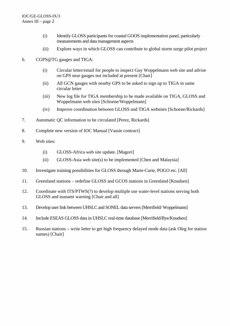
IOC/GE-GLOSS-IX/3 Annex III – page 2
(i) Identify GLOSS participants for coastal GOOS implementation panel, particularly
measurements and data management aspects
(ii) Explore ways in which GLOSS can contribute to global storm surge pilot project 6. CGPS@TG gauges and TIGA:
(i) Circular letter/email for people to inspect Guy Woppelmann web site and advise
on GPS near gauges not included at present [Chair]
(ii) All GCN gauges with nearby GPS to be asked to sign up to TIGA in same circular letter
(iii) New log file for TIGA membership to be made available on TIGA, GLOSS and Woppelmann web sites [Schoene/Woppelmann]
(iv) Improve coordination between GLOSS and TIGA websites [Schoene/Rickards] 7. Automatic QC information to be circulated [Perez, Rickards] 8. Complete new version of IOC Manual [Vassie contract] 9. Web sites:
(i) GLOSS-Africa web site update. [Magori]
(ii) GLOSS-Asia web site(s) to be implemented [Chen and Malaysia] 10. Investigate training possibilities for GLOSS through Marie-Curie, POGO etc. [All] 11. Greenland stations – redefine GLOSS and GCOS stations in Greenland [Knudsen] 12. Coordinate with ITS/PTWS(?) to develop multiple use water-level stations serving both
GLOSS and tsunami warning [Chair and all] 13. Develop user link between UHSLC and SONEL data servers [Merrifield/ Woppelmann] 14. Include ESEAS GLOSS data in UHSLC real-time database [Merrifield/Bye/Knudsen] 15. Russian stations – write letter to get high frequency delayed mode data (ask Oleg for station
names) [Chair]
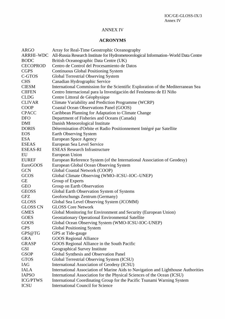
IOC/GE-GLOSS-IX/3 Annex IV
ANNEX IV
ACRONYMS
ARGO Array for Real-Time Geostrophic Oceanography ARRHI–WDC All-Russia Research Institute for Hydrometeorological Information–World Data Centre BODC British Oceanographic Data Centre (UK) CECOPROD Centro de Control del Procesamiento de Datos CGPS Continuous Global Positioning System C-GTOS Global Terrestrial Observing System CHS Canadian Hydrographic Service CIESM International Commission for the Scientific Exploration of the Mediterranean Sea CIIFEN Centro Internacional para la Investigación del Fenómeno de El Niño CLDG Centre Littoral de Géophysique CLIVAR Climate Variability and Prediction Programme (WCRP) COOP Coastal Ocean Observations Panel (GOOS) CPACC Caribbean Planning for Adaptation to Climate Change DFO Department of Fisheries and Oceans (Canada) DMI Danish Meteorological Institute DORIS Détermination d'Orbite et Radio Positionnement Intégré par Satellite EOS Earth Observing System ESA European Space Agency ESEAS European Sea Level Service ESEAS-RI ESEAS Research Infrastructure EU European Union EUREF European Reference System (of the International Association of Geodesy) EuroGOOS European Global Ocean Observing System GCN Global Coastal Network (COOP) GCOS Global Climate Observing (WMO–ICSU–IOC–UNEP) GE Group of Experts GEO Group on Earth Observation GEOSS Global Earth Observation System of Systems GFZ Geoforschungs Zentrum (Germany) GLOSS Global Sea Level Observing System (JCOMM) GLOSS CN GLOSS Core Network GMES Global Monitoring for Environment and Security (European Union) GOES Geostationary Operational Environmental Satellite GOOS Global Ocean Observing System (WMO-ICSU-IOC-UNEP) GPS Global Positioning System GPS@TG GPS at Tide-gauge GRA GOOS Regional Alliance GRASP GOOS Regional Alliance in the South Pacific GSI Geographical Survey Institute GSOP Global Synthesis and Observation Panel GTOS Global Terrestrial Observing System (ICSU) IAG International Association of Geodesy (ICSU) IALA International Association of Marine Aids to Navigation and Lighthouse Authorities IAPSO International Association for the Physical Sciences of the Ocean (ICSU) ICG/PTWS International Coordinating Group for the Pacific Tsunami Warning System ICSU International Council for Science

IOC/GE-GLOSS-IX/3 Annex IV – page 2
IGN Institut Géographique National IGS International GPS Service IHO International Hydrographic Organization IMO International Maritime Organization (UN) IOC Intergovernmental Oceanographic Commission IOLR Israel Oceanographic and Limnological Research Ltd. IPY International Polar Year ISRAMAR Israel Marine Data Center ITSU International Tsunami Warning System in the Pacific JCG Japan Coast Guard JCOMM Joint Commission for Oceanography and Marine Meteorology JMA Japan Meteorological Agency MedGLOSS Mediterranean Programme for the Global Sea-Level Observing System MedGOOS Mediterranean Programme for the Global Ocean Observing System MEDS Marine Environmental Data Service (Canada) MSL Mean sea level MoU Memorandum of Understanding NASA National Aeronautic and Space Administration NHS Norwegian Hydrographic Service NOAA National Oceanic and Atmospheric Administration (USA) NOS National Ocean Service (U.S.) NTSLF National Tidal and Sea Level Facility (UK) NWLON National Water Level Observing Network (U.S.) OC Ocean circulation ODINAFRICA Oceanographic Data and Information Network for Africa OGP Office of Global Programs (NOAA) OOPC Ocean Observations Panel for Climate (GOOS) PHO Pakistan Hydrographic Office POA Programme Observation Area (JCOMM) POGO Partnership for Observing the Global Oceans POL Proudman Oceanography Laboratory (UK) PSMSL Permanent Service for Mean Sea Level QC Quality Control RONMAC Red de Observación del Nivel del Mar para América Latina ROSHYDROMET Federal Service for Hydrometeorology and Environment Monitoring SEAFRAME Sea-Level Fine-Sea Level Fine-Resolution Acoustic Measuring System SHOM Service Hydrographique de la Marine SLP Sea-level pressure SOI Survey of Israel SONEL Système d’Observation du Niveau des Eaux Littorales SSG Science Sub-Group (GLOSS) TASK Tidal Analysis Software Kit (POL) TG Tide gauge TIGA GPS Tide-gauge Benchmark Monitoring Pilot Project TWL Tide and water level UH University of Hawaii UHSLC University of Hawaii Sea Level Center UN United Nations UNEP United Nations Environment Programme UNESCO United Nations Educational, Scientific and Cultural Organization
IOC-/GE-GLOSS-IX/3 Annex IV – page 3
WCRP World Climate Research Programme (WMO–ICSU–IOC) WMO World Meteorological Organization

In this Series, entitled
Reports of Meetings of Experts and Equivalent Bodies, which was initiated in 1984 and which is published in English only, unless otherwise specified, the reports of the following meetings have already been issued:
1. Third Meeting of the Central Editorial Board for the Geological/Geophysical Atlases of the Atlantic and Pacific Oceans
2. Fourth Meeting of the Central Editorial Board for the Geological/Geophysical Atlases of the Atlantic and Pacific Oceans S. Fourth Session of the Joint IOC-WMO-CPPS Working Group on the Investigations of 'El Niño' (Also printed in Spanish)
4. First Session of the IOC-FAO Guiding Group of Experts on the Programme of Ocean Science in Relation to Living Resources
5. First Session of the IOC-UN(OETB) Guiding Group of Experts on the Programme of Ocean Science in Relation to Non-Living Resources
6. First Session of the Editorial Board for the International Bathymetric Chart of the Mediterranean and Overlay Sheets
7. First Session of the Joint CCOP(SOPAC)-IOC Working Group on South Pacific Tectonics and Resources
8. First Session of the IODE Group of Experts on Marine Information Management
9. Tenth Session of the Joint CCOP-IOC Working Group on Post-IDOE Studies in East Asian Tectonics and Resources
10. Sixth Session of the IOC-UNEP Group of Experts on Methods, Standards and Intercalibration
11. First Session of the IOC Consultative Group on Ocean Mapping (Also printed in French and Spanish)
12. Joint 100-WMO Meeting for Implementation of IGOSS XBT Ships-of-Opportunity Programmes
13. Second Session of the Joint CCOP/SOPAC-IOC Working Group on South Pacific Tectonics and Resources
14. Third Session of the Group of Experts on Format Development
15. Eleventh Session of the Joint CCOP-IOC Working Group on Post-IDOE Studies of South-East Asian Tectonics and Resources
16. Second Session of the IOC Editorial Board for the International Bathymetric Chart of the Mediterranean and Overlay Sheets
17. Seventh Session of the IOC-UNEP Group of Experts on Methods, Standards and lntercalibration
18. Second Session of the IOC Group of Experts on Effects of Pollutants
19. Primera Reunión del Comité Editorial de la COI para la Carta Batimétrica lnternacional del Mar Caribe y Parte del Océano Pacífico frente a Centroamérica (Spanish only)
20. Third Session of the Joint CCOP/SOPAC-IOC Working Group on South Pacific Tectonics and Resources
21. Twelfth Session of the Joint CCOP-IOC Working Group on Post-IDOE Studies of South-East Asian Tectonics and Resources
22. Second Session of the IODE Group of Experts on Marine Information Management
23. First Session of the IOC Group of Experts on Marine Geology and Geophysics in the Western Pacific
24. Second Session of the IOC-UN(OETB) Guiding Group of Experts on the Programme of Ocean Science in Relation to Non-Living Resources (Also printed in French and Spanish)
25. Third Session of the IOC Group of Experts on Effects of Pollutants
26. Eighth Session of the IOC-UNEP Group of Experts on Methods, Standards and lntercalibration
27. Eleventh Session of the Joint IOC-IHO Guiding Committee for the General Bathymetric Chart of the Oceans (Also printed in French)
28. Second Session of the IOC-FAO Guiding Group of Experts on the Programme of Ocean Science in Relation to Living Resources
29. First Session of the IOC-IAEA-UNEP Group of Experts on Standards and Reference Materials
30. First Session of the IOCARIBE Group of Experts on Recruitment in Tropical Coastal Demersal Communities (Also printed in Spanish)
31. Second IOC-WMO Meeting for Implementation of IGOSS XBT Ship-of-Opportunity Programmes
32. Thirteenth Session of the Joint CCOP-IOC Working Group on Post-IDOE Studies of East Asia Tectonics and Resources
33. Second Session of the IOC Task Team on the Global Sea-Level Observing System
34. Third Session of the IOC Editorial Board for the International Bathymetric Chart of the Mediterranean and Overlay Sheets
35. Fourth Session of the IOC-UNEP-IMO Group of Experts on Effects of Pollutants
36. First Consultative Meeting on RNODCs and Climate Data Services
37. Second Joint IOC-WMO Meeting of Experts on IGOSS-IODE Data Flow
38. Fourth Session of the Joint CCOP/SOPAC-IOC Working Group on South Pacific Tectonics and Resources
39. Fourth Session of the IODE Group of Experts on Technical Aspects of Data Exchange
40. Fourteenth Session of the Joint CCOP-IOC Working Group on Post-IDOE Studies of East Asian Tectonics and Resources
41. Third Session of the IOC Consultative Group on Ocean Mapping
42. Sixth Session of the Joint IOC-WMO-CCPS Working Group on the Investigations of 'El Niño' (Also printed in Spanish)
43. First Session of the IOC Editorial Board for the International Bathymetric Chart of the Western Indian Ocean
44. Third Session of the IOC-UN(OALOS) Guiding Group of Experts on the Programme of Ocean Science in Relation to Non-Living Resources
45. Ninth Session of the IOC-UNEP Group of Experts on Methods, Standards and lntercalibration
46. Second Session of the IOC Editorial Board for the International Bathymetric Chart of the Caribbean Sea and the Gulf of Mexico
47. Cancelled
48. Twelfth Session of the Joint IOC-IHO Guiding Committee for the General Bathymetric Chart of the Oceans
49. Fifteenth Session of the Joint CCOP-IOC Working Group on Post-IDOE Studies of East Asian Tectonics and Resources
50. Third Joint IOC-WMO Meeting for Implementation of IGOSS XBT Ship-of-Opportunity Programmes
51. First Session of the IOC Group of Experts on the Global Sea-Level Observing System
52. Fourth Session of the IOC Editorial Board for the International Bathymetric Chart of the Mediterranean
53. First Session of the IOC Editorial Board for the International Chart of the Central Eastern Atlantic (Also printed in French)
54. Third Session of the IOC Editorial Board for the International Bathymetric Chart of the Caribbean Sea and the Gulf of Mexico (Also printed in Spanish)
55. Fifth Session of the IOC-UNEP-IMO Group of Experts on Effects of Pollutants
56. Second Session of the IOC Editorial Board for the International Bathymetric Chart of the Western Indian Ocean
57. First Meeting of the IOC ad hoc Group of Experts on Ocean Mapping in the WESTPAC Area
58. Fourth Session of the IOC Consultative Group on Ocean Mapping

2
59. Second Session of the IOC-WMO/IGOSS Group of Experts on Operations and Technical Applications
60. Second Session of the IOC Group of Experts on the Global Sea-Level Observing System
61. UNEP-IOC-WMO Meeting of Experts on Long-Term Global Monitoring System of Coastal and Near-Shore Phenomena Related to Climate Change
62. Third Session of the IOC-FAO Group of Experts on the Programme of Ocean Science in Relation to Living Resources
63. Second Session of the IOC-IAEA-UNEP Group of Experts on Standards and Reference Materials
64. Joint Meeting of the Group of Experts on Pollutants and the Group of Experts on Methods, Standards and Intercalibration
65. First Meeting of the Working Group on Oceanographic Co-operation in the ROPME Sea Area
66. Fifth Session of the Editorial Board for the International Bathymetric and its Geological/Geophysical Series
67. Thirteenth Session of the IOC-IHO Joint Guiding Committee for the General Bathymetric Chart of the Oceans (Also printed in French)
68. International Meeting of Scientific and Technical Experts on Climate Change and Oceans
69. UNEP-IOC-WMO-IUCN Meeting of Experts on a Long-Term Global Monitoring System
70. Fourth Joint IOC-WMO Meeting for Implementation of IGOSS XBT Ship-of-Opportunity Programmes
71. ROPME-IOC Meeting of the Steering Committee on Oceanographic Co-operation in the ROPME Sea Area
72. Seventh Session of the Joint IOC-WMO-CPPS Working Group on the Investigations of 'El Niño' (Spanish only)
73. Fourth Session of the IOC Editorial Board for the International Bathymetric Chart of the Caribbean Sea and the Gulf of Mexico (Also printed in Spanish)
74. UNEP-IOC-ASPEI Global Task Team on the Implications of Climate Change on Coral Reefs
75. Third Session of the IODE Group of Experts on Marine Information Management
76. Fifth Session of the IODE Group of Experts on Technical Aspects of Data Exchange
77. ROPME-IOC Meeting of the Steering Committee for the Integrated Project Plan for the Coastal and Marine Environment of the ROPME Sea Area
78. Third Session of the IOC Group of Experts on the Global Sea-level Observing System
79. Third Session of the IOC-IAEA-UNEP Group of Experts on Standards and Reference Materials
80. Fourteenth Session of the Joint IOC-IHO Guiding Committee for the General Bathymetric Chart of the Oceans
81. Fifth Joint IOG-WMO Meeting for Implementation of IGOSS XBT Ship-of-Opportunity Programmes
82. Second Meeting of the UNEP-IOC-ASPEI Global Task Team on the Implications of climate Change on Coral Reefs
83. Seventh Session of the JSC Ocean Observing System Development Panel
84. Fourth Session of the IODE Group of Experts on Marine Information Management
85. Sixth Session of the IOC Editorial Board for the International Bathymetric chart of the Mediterranean and its Geological/Geophysical Series
86. Fourth Session of the Joint IOC-JGOFS Panel on Carbon Dioxide
87. First Session of the IOC Editorial Board for the International Bathymetric Chart of the Western Pacific
88. Eighth Session of the JSC Ocean Observing System Development Panel
89. Ninth Session of the JSC Ocean Observing System Development Panel
90. Sixth Session of the IODE Group of Experts on Technical Aspects of Data Exchange
91. First Session of the IOC-FAO Group of Experts on OSLR for the IOCINCWIO Region
92. Fifth Session of the Joint IOC-JGOFS CO, Advisory Panel Meeting
93. Tenth Session of the JSC Ocean Observing System Development Panel
94. First Session of the Joint CMM-IGOSS-IODE Sub-group on Ocean Satellites and Remote Sensing
95. Third Session of the IOC Editorial Board for the International Chart of the Western Indian Ocean
96. Fourth Session of the IOC Group of Experts on the Global Sea Level Observing System
97. Joint Meeting of GEMSI and GEEP Core Groups
98. First Session of the Joint Scientific and Technical Committee for Global Ocean Observing System
99. Second International Meeting of Scientific and Technical Experts on Climate Change and the Oceans
100. First Meeting of the Officers of the Editorial Board for the International Bathymetric Chart of the Western Pacific
101. Fifth Session of the IOC Editorial Board for the International Bathymetric Chart of the Caribbean Sea and the Gulf of Mexico
102. Second Session of the Joint Scientific and Technical Committee for Global Ocean Observing System
103. Fifteenth Session of the Joint IOC-IHO Committee for the General Bathymetric Chart of the Oceans
104. Fifth Session of the IOC Consultative Group on Ocean Mapping
105. Fifth Session of the IODE Group of Experts on Marine Information Management
106. IOC-NOAA Ad hoc Consultation on Marine Biodiversity
107. Sixth Joint IOC-WMO Meeting for Implementation of IGOSS XBT Ship-of-Opportunity Programmes
108. Third Session of the Health of the Oceans (HOTO) Panel of the Joint Scientific and Technical Committee for GLOSS
109. Second Session of the Strategy Subcommittee (SSC) of the IOC-WMO-UNEP Intergovernmental Committee for the Global Ocean Observing System
110. Third Session of the Joint Scientific and Technical Committee for Global Ocean Observing System
111. First Session of the Joint GCOS-GOOS-WCRP Ocean Observations Panel for Climate
112. Sixth Session of the Joint IOC-JGOFS C02 Advisory Panel Meeting
113. First Meeting of the IOC/WESTPAC Co-ordinating Committee for the North-East Asian Regional - Global Ocean Observing System (NEAR-GOOS)
114. Eighth Session of the Joint IOC-WMO-CPPS Working Group on the Investigations of "El Niño" (Spanish only)
115. Second Session of the IOC Editorial Board of the International Bathymetric Chart of the Central Eastern Atlantic (Also printed in French)
116. Tenth Session of the Officers Committee for the Joint IOC-IHO General Bathymetric Chart of the Oceans (GEBCO), USA, 1996
117. IOC Group of Experts on the Global Sea Level Observing System (GLOSS), Fifth Session, USA, 1997
118. Joint Scientific Technical Committee for Global Ocean Observing System (J-GOOS), Fourth Session, USA, 1997
199 First Session of the Joint 100-WMO IGOSS Ship-of-Opportunity Programme Implementation Panel, South Africa, 1997
120. Report of Ocean Climate Time-Series Workshop, Joint GCOS-GOOS-WCRP Ocean Observations Panel for Climate, USA, 1997
3
121. IOC/WESTPAC Co-ordinating Committee for the North-East Asian Regional Global Ocean Observing System (NEAR-GOOS), Second Session, Thailand, 1997
122. First Session of the IOC-IUCN-NOAA Ad hoc Consultative Meeting on Large Marine Ecosystems (LME), France, 1997
123. Second Session of the Joint GCOS-GOOS-WCRP Ocean Observations Panel for Climate (OOPC), South Africa, 1997
124. Sixth Session of the IOC Editorial Board for the International Bathymetric Chart of the Caribbean Sea and the Gulf of Mexico, Colombia, 1996 (also printed in Spanish)
125. Seventh Session of the IODE Group of Experts on Technical Aspects of Data Exchange, Ireland, 1997
126. IOC-WMO-UNEP-ICSU Coastal Panel of the Global Ocean Observing System (GOOS), First Session, France, 1997
127. Second Session of the IOC-IUCN-NOAA Consultative Meeting on Large Marine Ecosystems (LME), France, 1998
128. Sixth Session of the IOC Consultative Group on Ocean Mapping (CGOM), Monaco, 1997
129. Sixth Session of the Tropical Atmosphere - Ocean Array (TAO) Implementation Panel, United Kingdom, 1997
130. First Session of the IOC-WMO-UNEP-ICSU Steering Committee of the Global Ocean Observing System (GOOS), France, 1998
131. Fourth Session of the Health of the Oceans (HOTO) Panel of the Global Ocean Observing System (GOOS), Singapore, 1997
132. Sixteenth Session of the Joint IOC-IHO Guiding Committee for the General Bathymetric Chart of the Oceans (GEBCO), United Kingdom, 1997
133. First Session of the IOC-WMO-UNEP-ICSU-FAO Living Marine Resources Panel of the Global Ocean Observing System (GOOS), France, 1998
134. Fourth Session of the IOC Editorial Board for the International Bathymetric Chart of the Western Indian Ocean (IOC/EB-IBCWIO-IW3), South Africa, 1997
135. Third Session of the Joint GCOS-GOOS-WCRP Ocean Observations Panel for Climate (OOPC), France, 1998
136. Seventh Session of the Joint IOC-JGOFS C02 Advisory Panel Meeting, Germany, 1997
137. Implementation of Global Ocean Observations for GOOS/GCOS, First Session, Australia, 1998
138. Implementation of Global Ocean Observations for GOOS/GCOS, Second Session, France, 1998
139. Second Session of the IOC-WMO-UNEP-ICSU Coastal Panel of the Global Ocean Observing System (GOOS), Brazil, 1998
140. Third Session of IOC/WESTPAC Co-ordinating Committee for the North-East Asian Regional - Global Ocean Observing System (NEAR-GOOS), China, 1998
141. Ninth Session of the Joint IOC-WMO-CPPS Working Group on the Investigations of 'El Niño', Ecuador, 1998 (Spanish only)
142. Seventh Session of the IOC Editorial Board for the International Bathymetric Chart of the Mediterranean and its Geological/Geophysical Series, Croatia, 1998
143. Seventh Session of the Tropical Atmosphere-Ocean Array (TAO) Implementation Panel, Abidjan, Côte d'lvoire, 1998
144. Sixth Session of the IODE Group of Experts on Marine Information Management (GEMIM), USA, 1999
145. Second Session of the IOC-WMO-UNEP-ICSU Steering Committee of the Global Ocean Observing System (GOOS), China, 1999
146. Third Session of the IOC-WMO-UNEP-ICSU Coastal Panel of the Global Ocean Observing System (GOOS), Ghana, 1999
147. Fourth Session of the GCOS-GOOS-WCRP Ocean Observations Panel for Climate (OOPC); Fourth Session of the WCRP CLIVAR Upper Ocean Panel (UOP); Special Joint Session of OOPC and UOP, USA, 1999
148. Second Session of the IOC-WMO-UNEP-ICSU-FAO Living Marine Resources Panel of the Global Ocean Observing System (GOOS), France, 1999
149. Eighth Session of the Joint IOC-JGOFS CO2 Advisory Panel Meeting, Japan, 1999
150. Fourth Session of the IOC/WESTPAC Co-ordinating Committee for the North-East Asian Regional – Global Ocean Observing System (NEAR-GOOS), Japan, 1999
151. Seventh Session of the IOC Consultative Group on Ocean Mapping (CGOM), Monaco, 1999
152. Sixth Session of the IOC Group of Experts on the Global Sea level Observing System (GLOSS), France, 1999
153. Seventeenth Session of the Joint IOC-IHO Guiding Committee for the General Bathymetric Chart of the Oceans (GEBCO), Canada, 1999
154. Comité Editorial de la COI para la Carta Batimétrica Internacional del Mar Caribe y el Golfo de Mexico (IBCCA), Septima Reunión, Mexico, 1998
IOC Editorial Board for the International Bathymetric Chart of the Caribbean Sea and the Gulf of Mexico (IBCCA), Seventh Session, Mexico, 1998
155. Initial Global Ocean Observing System (GOOS) Commitments Meeting, IOC-WMO-UNEP-ICSU/Impl-III/3, France, 1999
156. First Session of the ad hoc Advisory Group for IOCARIBE-GOOS, Venezuela, 1999 (also printed in Spanish and French)
157. Fourth Session of the IOC-WMO-UNEP-ICSU Coastal Panel of the Global Ocean Observing System (GOOS), China, 1999
158. Eighth Session of the IOC Editorial Board for the International Bathymetric Chart of the Mediterranean and its Geological/Geophysical Series, Russian Federation, 1999
159. Third Session of the IOC-WMO-UNEP-ICSU-FAO Living Marine Resources Panel of the Global Ocean Observing System (GOOS), Chile, 1999
160. Fourth Session of the IOC-WMO-UNEP-ICSU-FAO Living Marine Resources Panel of the Global Ocean Observing System (GOOS). Hawaii, 2000
161. Eighth Session of the IODE Group of Experts on Technical Aspects of Data Exchange, USA, 2000
162. Third Session of the IOC-IUCN-NOAA Consultative Meeting on Large Marine Ecosystems (LME), France, 2000
163. Fifth Session of the IOC-WMO-UNEP-ICSU Coastal Panel of the Global Ocean Observing System (GOOS), Poland, 2000
164. Third Session of the IOC-WMO-UNEP-ICSU Steering Committee of the Global Ocean Observing System (GOOS), France, 2000
165. Second Session of the ad hoc Advisory Group for IOCARIBE-GOOS, Cuba, 2000 (also printed in Spanish and French)
166. First Session of the Coastal Ocean Observations Panel, Costa Rica, 2000
167. First GOOS Users' Forum, 2000
168. Seventh Session of the Group of Experts on the Global Sea Level Observing System, Honolulu, 2001
169. First Session of the Advisory Body of Experts on the Law of the Sea (ABE-LOS), France, 2001 (also printed in French)
170. Fourth Session of the IOC-WMO-UNEP-ICSU Steering Committee of the Global Ocean Observing System, Chile, 2001
171. First Session of the IOC-SCOR Ocean CO2 Advisory Panel, France, 2000
172. Fifth Session of the GCOS-GOOS-WCRP Ocean Observations Panel for Climate (OOPC), Norway, 2000 (electronic copy only)
173. Third Session of the ad hoc Advisory Group for IOCARIBE-GOOS, USA, 2001 (also printed in Spanish and French)
174. Second Session of the Coastal Ocean Observations Panel and GOOS Users' Forum, Italy, 2001
175. Second Session of the Black Sea GOOS Workshop, Georgia, 2001
176. Fifth Session of the IOC/WESTPAC Co-ordinating Committee for the North-East Asian Regional – Global Ocean Observing System (NEAR-GOOS), Republic of Korea, 2000
4
177. Second Session of the Advisory Body of Experts on the Law of the Sea (IOC/ABE-LOS), Morocco, 2002 (also printed in French)
178. Sixth Session of the Joint GCOS-GOOS-WCRP Ocean Observations Panel for Climate (OOPC), Australia, 2001 (electronic copy only)
179. Cancelled
180. Second Session of the IOC-SCOR Ocean CO2 Advisory Panel, Honolulu, Hawaii, U.S.A, 2002 (electronic copy only)
181. IOC Workshop on the Establishment of SEAGOOS in the Wider Southeast Asian Region, Seoul, Republic of Korea, 2001 (SEAGOOS preparatory workshop) (electronic copy only)
182. First Session of the IODE Steering Group for the Resource Kit, USA, 19–21 March 2001
183. Fourth Session of the IOC-IUCN-NOAA Consultative Meeting on Large Marine Ecosystems (LMEs), France, 2002
184. Seventh Session of the IODE Group of Experts on Marine Information Management (GEMIM), France, 2002 (electronic copy only)
185. Sixth Session of IOC/WESTPAC Coordinating Committee for the North-East Asian Regional - Global Ocean Observing System (NEAR-GOOS), Republic of Korea, 2001 (electronic copy only)
186. First Session of the Global Ocean Observing System (GOOS) Capacity Building Panel, Switzerland, 2002 (electronic copy only)
187. Fourth Session of the ad hoc Advisory Group for IOCARIBE-GOOS, 2002, Mexico (also printed in French and Spanish)
188. Fifth Session of the IOC Editorial Board for the International Bathymetric Chart of the Western Indian Ocean (IBCWIO), Mauritius, 2000
189. Third session of the Editorial Board for the International Bathymetric Chart of the Western Pacific, Chine, 2000
190. Third Session of the Coastal Ocean Observations Panel and GOOS Users' Forum, Vietnam, 2002
191. Eighth Session of the IOC Consultative Group on Ocean Mapping, Russian Federation, 2001
192. Third Session of the Advisory Body of Experts on the Law of the Sea (IOC/ABE-LOS), Lisbon, 2003 (also printed in French)
193. Extraordinary Session of the Joint IOC-WMO-CPPS Working Group on the Investigations of 'El Niño', Chile, 1999 (Spanish only; electronic copy only)
194. Fifth Session of the IOC-WMO-UNEP-ICSU Steering Committee of the Global Ocean Observing System, France, 2002
195. Sixth Session of the IOC-WMO-UNEP-ICSU Steering Committee of the Global Ocean Observing System, South Africa, 2003
196. Fourth Session of the Coastal Ocean Observations Panel, South Africa, 2002 (electronic copy only)
197. First Session of the JCOMM/IODE Expert Team On Data Management Practices, Belgium, 2003 (also JCOMM Meeting Report No. 25)
198. Fifth Session of the IOC-IUCN-NOAA Consultative Meeting on Large Marine Ecosystems (LMEs), Paris, 2003
199. Ninth Session of the IOC Consultative Group on Ocean Mapping, Monaco, 2003 (Recommendations in English, French, Russian and Spanish included)
200. Eighth Session of the IOC Group of Experts on the Global Sea level Observing System (GLOSS), France, 2003 (electronic copy only)
201. Fourth Session of the Advisory Body of Experts on the Law of the Sea (IOC/ABE-LOS), Greece, 2004 (also printed in French)
202. Sixth Session of the IOC-IUCN-NOAA Consultative Meeting on Large Marine Ecosystems (LMEs), Paris, 2004 (electronic copy only)
203. Fifth Session of the Advisory Body of Experts on the Law of the Sea (IOC/ABE-LOS), Argentina, 2005 (also printed in French)
204. Ninth Session of the IOC Group of Experts on the Global Sea level Observing System (GLOSS), France, 2005 (electronic copy only)
12/07/2005 - CORRIGENDUM: IOC/GE-GLOSS-IX/3 summary report Please note that a misprint has slipped in on page 14. The URL www.isramar.ocean.org.il should read http://isramar.ocean.org.il/. Thank you for your understanding. The IOC Secretariat