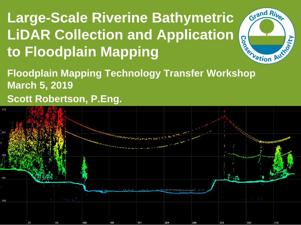
large-scale riverine bathymetric lidar collection and
TRANSCRIPT
1
Large-Scale Riverine Bathymetric
LiDAR Collection and Application
to Floodplain Mapping
Floodplain Mapping Technology Transfer Workshop
March 5, 2019
Scott Robertson, P.Eng.

2
Presentation Overview
1. Introduction to the Project
2. Considerations
3. Trials and Tribulations
4. Initial Results
5. Next Steps
6. Recommendations
3
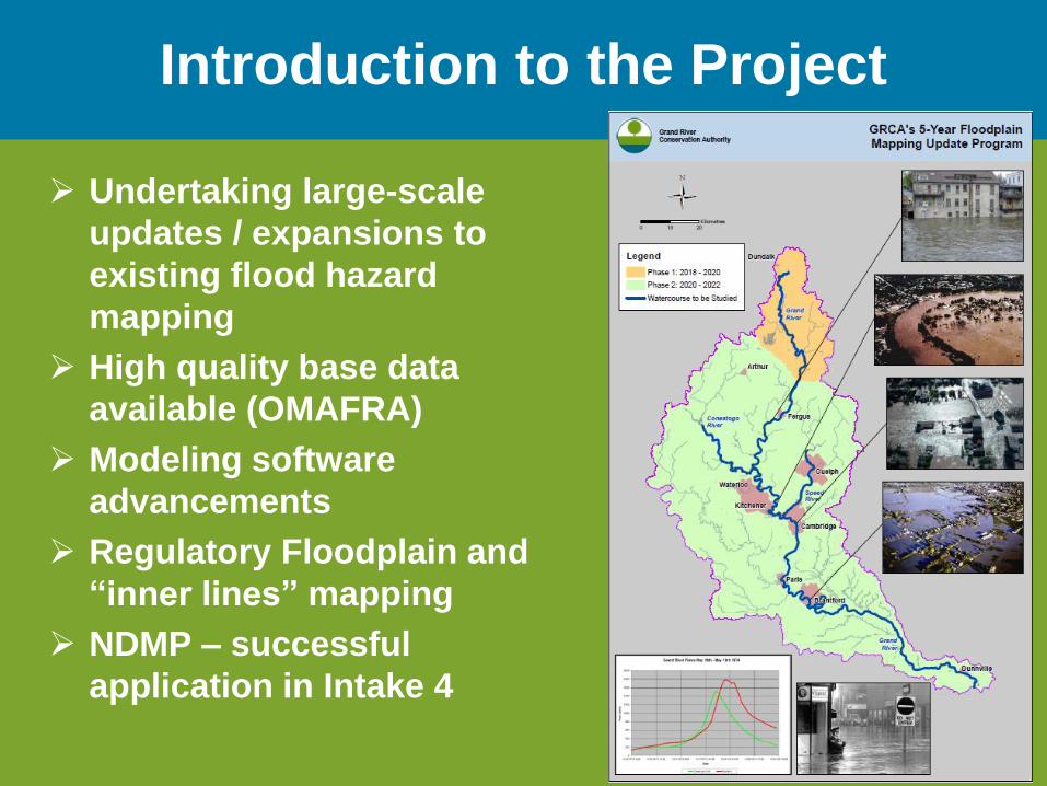
Introduction to the Project
➢ Undertaking large-scale
updates / expansions to
existing flood hazard
mapping
➢ High quality base data
available (OMAFRA)
➢ Modeling software
advancements
➢ Regulatory Floodplain and
“inner lines” mapping
➢ NDMP – successful
application in Intake 4

4
Introduction to the Project
➢ Between-the-banks
data required
➢ Why bathymetric
LiDAR?
➢ Limited information
available re: riverine
applications
➢ Discussions with
experts

5
Considerations
➢ Timing
Season Pros Cons
Winter• Typically lower flows
• Lack of vegetation
• Typically ice covered
• Equipment constraints
Spring • Lack of vegetation • Higher flows
• Higher turbidity
Summer • Typically lower flows • Vegetation - in-water and above
Fall• Typically lower flows
• Lack of vegetation• Finite window

6
Considerations
➢ Timing
➢ Contractor Availability / Willingness
➢ Cost
➢ Clarity / Turbidity
➢ Flow Depths
➢ Vegetation
➢ Physical Obstructions
➢ Permissions

7
Trials & Tribulations
➢ Lack of Bidders
➢ Conflicting Schedules
➢ Uncooperative Weather
➢ Cloud
➢ Snow / Ice
➢ Rain

8
Initial Results - Raw
Grand
River
at Paris
9
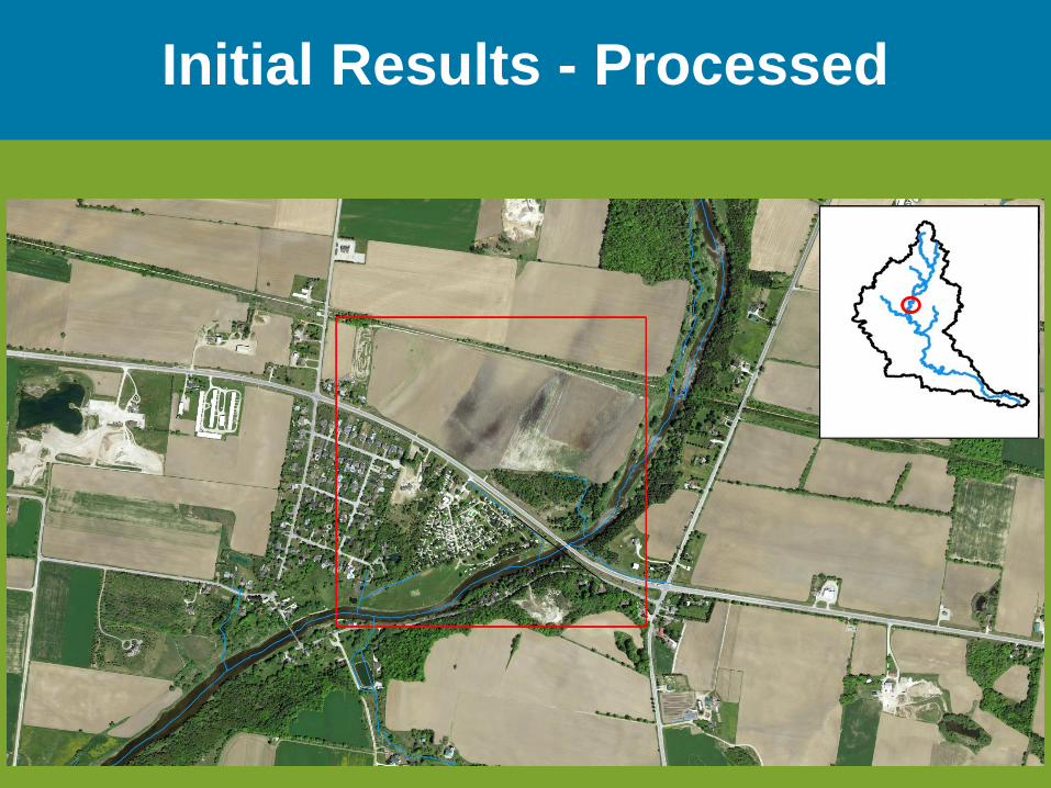
Initial Results - Processed

10
Initial Results - Processed

11
Initial Results - Processed

12
Initial Results - Processed

13
Initial Results

14
Initial Results - Processed
▪283.29
▪285.09

15
Initial Results - Processed

16

17
Initial Results

18
Initial Results - Processed

19
Next Steps
➢ GDS to finish processing operations
➢ Deliverables include:
• Raw data / point clouds
• Surfaces - TINs / DEMs
• RGB aerial imagery
➢ Modelling, modelling, modelling!

20
Recommendations
➢ Know your watercourse characteristics
➢ Pre-consult with providers
➢ Provide quantitative data re: depths, clarity
➢ Plan ahead
➢ Larger-scale acquisition is preferred

21
Questions?