msl 102, lesson 02: map reading ii map reading ii · 2 msl 102, lesson 02: map reading ii revision...
TRANSCRIPT
1
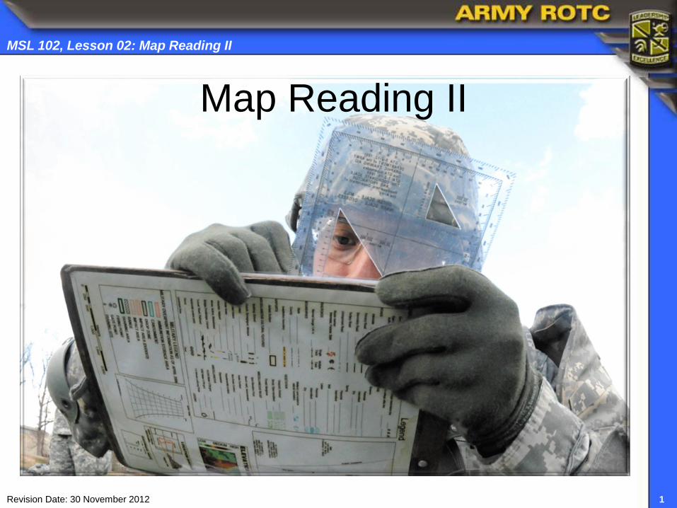
MSL 102, Lesson 02: Map Reading II
Revision Date: 30 November 2012
Map Reading II

2
MSL 102, Lesson 02: Map Reading II
Revision Date: 30 November 2012
Objectives
Apply map reading skills using aspects taken
from marginal information on a military map
Interpret different terrain features based on a
map’s changing topographic contour intervals
Differentiate symbols, colors, and surrounding
natural or man-made objects on a military map
Determine hilltop elevation based on index,
intermediate, and supplementary contour lines
Plot four and six-digit grid coordinates

3
MSL 102, Lesson 02: Map Reading II
Revision Date: 30 November 2012
Marginal Information
Sheet Name
Sheet Number
Adjoining Sheets
Tenino
SHEET 1477 IV SERIES V791 EDITION 7-DMA

4
MSL 102, Lesson 02: Map Reading II
Revision Date: 30 November 2012
Special Notes
Declination Diagram
Marginal Information

5
MSL 102, Lesson 02: Map Reading II
Revision Date: 30 November 2012
Scale
Bar Scales
Contour Interval Notes
Grid Reference Box
Marginal Information

6
MSL 102, Lesson 02: Map Reading II
Revision Date: 30 November 2012
Unit Imprint
Legend
Marginal Information

7
MSL 102, Lesson 02: Map Reading II
Revision Date: 30 November 2012
Topographic Symbols
ACTIVE
INACTIVE
WINDMILL

8
MSL 102, Lesson 02: Map Reading II
Revision Date: 30 November 2012
Military Map Colors
Black: Indicates cultural (man-made) features, such as buildings and roads,
surveyed spot elevations, and all labels.
Red-Brown: The colors red and brown are combined to identify cultural features,
all relief features, non-surveyed spot elevations, and elevation, such as contour
lines on red-light readable maps.
Blue: Identifies hydrograph or water features such as lakes, swamps, rivers, and
drainage.
Green: Identifies vegetation with military significance, such as woods, orchards,
and vineyards.
Brown: Identifies all relief features and elevation, such as contours on older
edition maps, and cultivated land on non red-light readable maps.
Red: Classifies cultural features, such as populated areas, main roads, and
boundaries, on older maps.
Other: Occasionally other colors may be used to show special information. These
are indicated in the marginal information as a rule.

9
MSL 102, Lesson 02: Map Reading II
Revision Date: 30 November 2012
Black - Topographic Symbols

10
MSL 102, Lesson 02: Map Reading II
Revision Date: 30 November 2012
Red-Brown - Topographic Symbols
DIVIDED HIGHWAY SECONDARY ROAD
RED-LIGHT READABLE CONTOUR LINES
LIGHT DUTY

11
MSL 102, Lesson 02: Map Reading II
Revision Date: 30 November 2012
Blue - Topographic Symbols

12
MSL 102, Lesson 02: Map Reading II
Revision Date: 30 November 2012
Green - Topographic Symbols
13
MSL 102, Lesson 02: Map Reading II
Revision Date: 30 November 2012
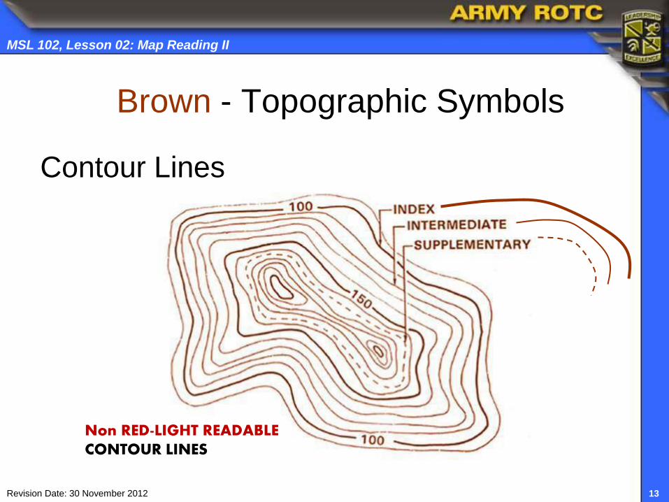
Brown - Topographic Symbols
Contour Lines
Non RED-LIGHT READABLE CONTOUR LINES

14
MSL 102, Lesson 02: Map Reading II
Revision Date: 30 November 2012
Red - Topographic Symbols
Populated Areas (military site/urban area)
Main Roads

15
MSL 102, Lesson 02: Map Reading II
Revision Date: 30 November 2012
Other - Topographic Symbols
Populated Areas (shaded gray)
Important Facilities (yellow/black icon)

16
MSL 102, Lesson 02: Map Reading II
Revision Date: 30 November 2012
Terrain Features: 10 Natural or Man-made
Five Major
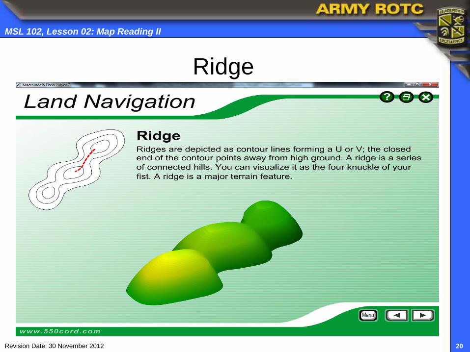
Ridge
Hill
Saddle
Valley
Depression
Three Minor
Spur
Draw
Cliff
Two Supplementary
Cut
Fill
Terrain features are derived from a complex
landmass known as a mountain or ridgeline.

17
MSL 102, Lesson 02: Map Reading II
Revision Date: 30 November 2012
Actual Terrain Five Major
Ridge
Hill
Saddle
Valley
Depression
RIDGE
HILL
DEPRESSION
SADDLE
VALLEY

18
MSL 102, Lesson 02: Map Reading II
Revision Date: 30 November 2012
5 Major Terrain Features

19
MSL 102, Lesson 02: Map Reading II
Revision Date: 30 November 2012
Valley
20
MSL 102, Lesson 02: Map Reading II
Revision Date: 30 November 2012
Ridge

21
MSL 102, Lesson 02: Map Reading II
Revision Date: 30 November 2012
Saddle

22
MSL 102, Lesson 02: Map Reading II
Revision Date: 30 November 2012
Depression

23
MSL 102, Lesson 02: Map Reading II
Revision Date: 30 November 2012
3 Minor Terrain Features

24
MSL 102, Lesson 02: Map Reading II
Revision Date: 30 November 2012
2 Secondary Terrain Features

25
MSL 102, Lesson 02: Map Reading II
Revision Date: 30 November 2012
Contour Lines Show 10 Terrain Features

26
MSL 102, Lesson 02: Map Reading II
Revision Date: 30 November 2012
Sand Run

27
MSL 102, Lesson 02: Map Reading II
Revision Date: 30 November 2012
Describe Map Features
1
2
3
4
5
6
7
8
9
10
11
12
13

28
MSL 102, Lesson 02: Map Reading II
Revision Date: 30 November 2012
Map Symbols and Surroundings
1. ____ 2. ____ 3. _____
4. _____ 5. _____ 6. _____

29
MSL 102, Lesson 02: Map Reading II
Revision Date: 30 November 2012
Determine Hilltop Elevation
To determine the elevation to a hilltop, add one-half the
contour interval to the elevation of the last contour line.
700
800
X
X
700
800
CONTOUR INTERVAL 20 METERS SUPPLEMENTARY COUNTOURS 10 METERS
?
?

30
MSL 102, Lesson 02: Map Reading II
Revision Date: 30 November 2012
Protractor (GTA 5-2-12, 1981)
1:50,000 Scale
360 Degrees
6400 Mils
N
S
E W

31
MSL 102, Lesson 02: Map Reading II
Revision Date: 30 November 2012
Four-Digit Grid Coordinate
The cardinal rule of map reading:
Read RIGHT, then
Read UP
Remember to always orient each grid
square from the lower left-hand corner
Then U
p
78 00
Read RIGHT

32
MSL 102, Lesson 02: Map Reading II
Revision Date: 30 November 2012
Orient Protractor with “0 Mark” on Map
Select the correct scale on the protractor.
Put horizontal scale on the grid line with “0 mark”
at the lower left-hand corner of the grid square.
“0 Mark” “0 Mark”
Orient Protractor on grid square 76 99
Map Scale is 1:50,000
+

33
MSL 102, Lesson 02: Map Reading II
Revision Date: 30 November 2012
Determine Six-Digit Grid Coordinate 1. Place your protractor scale on the Zero-Mark(+)
6
3
The 6 digit grid
coordinate is
786 003
2. Slide the protractor scale along the horizontal axis) 3. Stop as the vertical axis intersects the plot point
4. Read RIGHT
along the horizontal
axis
5. Round to the
nearest whole
number: 6
6. Read UP along
the vertical axis
7. Round to the
nearest whole
number: 3

34
MSL 102, Lesson 02: Map Reading II
Revision Date: 30 November 2012
100,000 Meter Square Identification
EH
EG
EH 03 00
EG 03 99

35
MSL 102, Lesson 02: Map Reading II
Revision Date: 30 November 2012
Practical Exercise: Determine Six-Digit Grid Coordinates
Identify the following major terrain feature or
object at each of the following coordinates:
1. EH 107031 Terrain/Object: ___________
2. EG 145859 Terrain/Object: ___________
3. EH 074017 Terrain/Object: ___________
4. EG 097827 Terrain/Object: ___________

36
MSL 102, Lesson 02: Map Reading II
Revision Date: 30 November 2012
Closing Summary
Questions
Next Lesson: MSL 102, Lesson 03, Introduction to Land Nav.
Read Student Textbook, MSL I, Introduction to Leadership: Tactics & Techniques Section, Introduction to Land Navigation and answer “Critical Thinking” questions; prepare to discuss in class
Review FM 3-25.26 Map Reading and Land Navigation; 18 January 2005 (C1/dated 30 August 2006); (Ch 6, par 6-2 thru 6-9), Ch 10, pp 10-4 and 10-5
Download and review from Blackboard any additional materials such as; Student Handouts, ppt. slides, and/or charts/graphs, etc for the next class