naramata bear hazard assessment 2013 - rdosmaps.bc.ca · and local conservation officer service;...
TRANSCRIPT
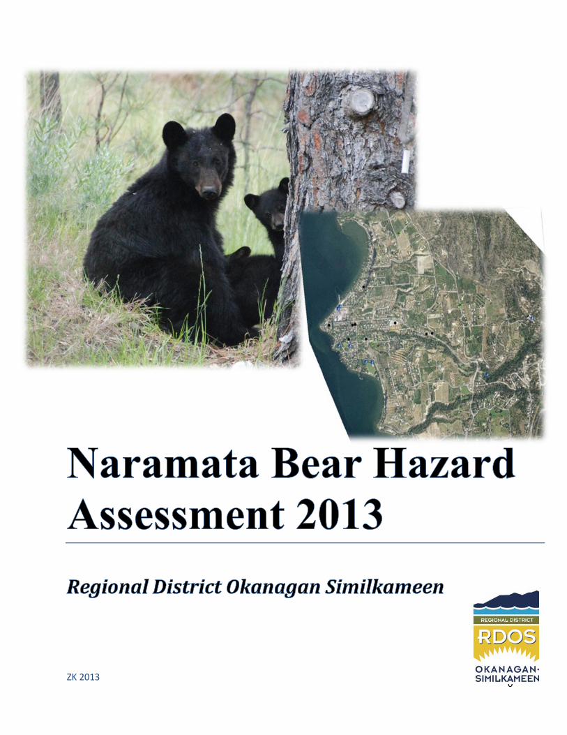
Naramata Bear Hazard Assessment 2013
0
ZK 2013

Naramata Bear Hazard Assessment 2013
1
Contents Acknowledgements................................................................................................................................ 2
Executive Summary ................................................................................................................................ 2
Introduction and Study Area .................................................................................................................. 3
Methods ..................................................................................................................................................... 4
Hazards: ..................................................................................................................................................... 4
Results: as illustrated by mapping: ......................................................................................................... 5
Map 1 - Naramata Village .......................................................................................................................... 5
Map 2 - Showing bear movement corridors and agricultural operations ................................................. 6
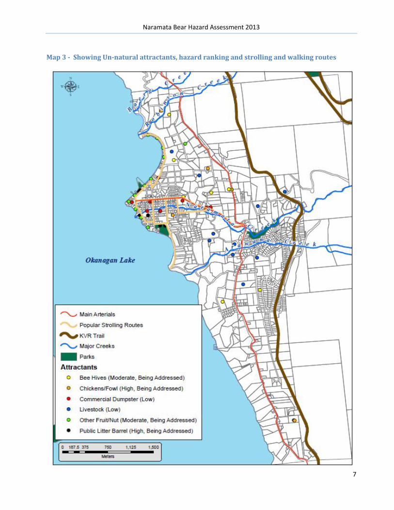
Map 3 - Showing Un-natural attractants, hazard ranking and strolling and walking routes .................... 7
Map 4 –Inset view of un-natural attractants ............................................................................................. 8
Map 5 - Environmentally Sensitive Habitat – shown in orange ................................................................. 9
Recommendations: .............................................................................................................................. 10
Appendix: ............................................................................................................................................ 11
Appendix 1- RAPP Line Calls 2011 & 2012 & 2013 ................................................................................. 11
Appendix 2- Wildlife Alert Reporting Maps to illustrate call history 2012/13......................................... 12

Naramata Bear Hazard Assessment 2013
2
Acknowledgements The site specific Bear Hazard Assessment and Management Plan could not be undertaken without the previous region wide BHA and CMP produced by Alison Peatt, R.P. Bio, Joanne Siderius Ph.D., and Bryn White, SOSCP.
This area specific plan could not have been possible without the assistance from RDOS – GIS services, Don Hamilton, RDOS Solid Waste Facilities Coordinator and Cameron Baughen RDOS Solid Waste Coordinator, and local Conservation Officer Service; Insp. Barb Leslies, Sgt. Jim Beck, Bob Hamilton, Mike Stern, and Min of Environment – WildSafeBC program (WARP mapping system)
Executive Summary Naramata: This Bear Hazard Assessment report describes the features associated with Human-bear conflicts specific to Naramata. Land use, demographics, and attractants that lure bears into the populated village core are illustrated using maps. Two types of mapping form the form the foundation of the assessment. The first, overview aerial maps as is traditional, the second are internet generated maps showing where bears were reported and the attractant identified as the draw. The volume of calls to the RAPP Line has reduced significantly and illustrates the community’s successful efforts to reduce luring bears into the area. Links to both the master Bear Hazard Assessment (BHA) and Bear Conflict Management Plan: http://www.rdosmaps.bc.ca/min_bylaws/PublicWorks/WildSafeBC/Hazard_Assessment_Plan_May_24_with_maps.pdf http://www.rdosmaps.bc.ca/min_bylaws/PublicWorks/WildSafeBC/AppendixTwoConflictMgmtPlanFinal2010.pdf
The site specific to Naramata BHA and BMP have not been adopted by the RDOS as the overall region-wide plan is considered the master document. The RDOS board is aware that Electoral Area E, Naramata is applying for Bear Smart status and these reports will be made available to the board prior to submission to the Ministry of Environment.
Links to both the Naramata Bear Smart Application and Naramata Bear Conflict Management Plan:
http://www.rdosmaps.bc.ca/min_bylaws/PublicWorks/WildSafeBC/BearSmartApplicationSept2013.pdf
http://www.rdosmaps.bc.ca/min_bylaws/PublicWorks/WildSafeBC/NaramataBearMgmtPlan2013.pdf
Naramata Bear Hazard Assessment 2013
3
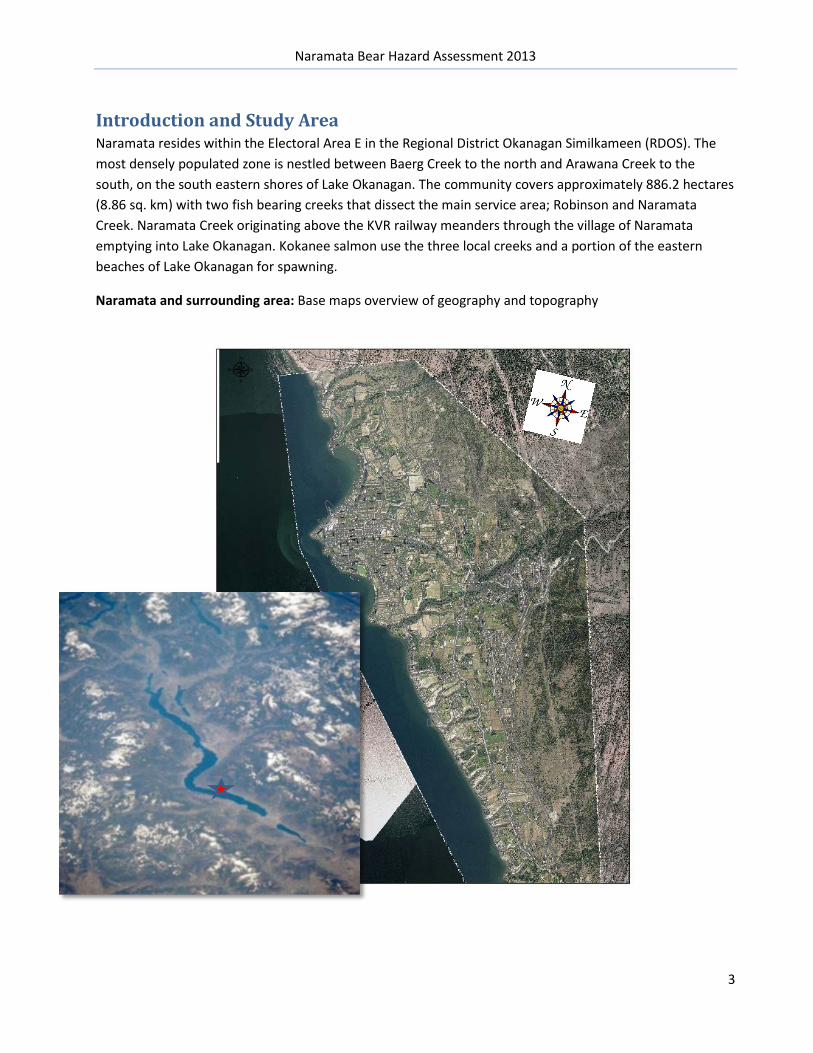
Introduction and Study Area Naramata resides within the Electoral Area E in the Regional District Okanagan Similkameen (RDOS). The most densely populated zone is nestled between Baerg Creek to the north and Arawana Creek to the south, on the south eastern shores of Lake Okanagan. The community covers approximately 886.2 hectares (8.86 sq. km) with two fish bearing creeks that dissect the main service area; Robinson and Naramata Creek. Naramata Creek originating above the KVR railway meanders through the village of Naramata emptying into Lake Okanagan. Kokanee salmon use the three local creeks and a portion of the eastern beaches of Lake Okanagan for spawning.
Naramata and surrounding area: Base maps overview of geography and topography

Naramata Bear Hazard Assessment 2013
4
Methods Building on the works previously undertaken, the author refrained from duplication of mapping. Updates specific to the application have been made using local knowledge and GIS mapping to illustrate study area and prominent features, including agricultural areas under cultivation, and attractants.
Data collected by Bear Aware/WildSafeBC, the CO Service is included where applicable
The author asked residents to supply locations of certain attractants i.e., Bee Hives and orphan fruit trees and for attractant management interventions employed since 2011
Hazards: Maps 2 – 4 illustrate hazards of un-natural food sources and points of potential conflict. Naramata has very few areas ‘outside’ its ability to control.
The hamlet is bordered by Crown Land, of which a significant portion is controlled by the RDOS. The KVR rail bed trail system being a public corridor and part of the Trans Canada Trail, is also controlled by the RDOS through the Naramata section. This section is a pilot project between the RDOS, Provincial and Federal agencies to attempt to solve ‘shared access’ use issues between stakeholder groups. Within the confines of Naramata, transients and boaters are the main ‘out of scope of control’ category.
Naramata Centre is a year round conference facility bringing an average 10,000 people per year into the village. Because of the wide geographical calling area of conference attendees, many are unfamiliar with wildlife (of any nature).
North of Naramata, Okanagan Mountain Park is out of RDOS and Naramata control for predator issues, fire, flood etc.
South of the Naramata boundary is the City of Penticton. Historically, very few bear issues have been noted from the Naramata boundary towards the City of Penticton.
Campbell Mtn. Landfill 12 km south of Naramata village is completely electrified, and poses no risk.

Naramata Bear Hazard Assessment 2013
5
Results: as illustrated by mapping: Map 1 - Naramata Village - illustrating residential core, Elementary School and Naramata Centre

Naramata Bear Hazard Assessment 2013
6
Map 2 - Showing bear movement corridors and agricultural operations
NOTE: Agricultural areas that are actively under cultivation shown on these maps. ALR and non-farmed properties are not shown
Naramata Bear Hazard Assessment 2013
7
Map 3 - Showing Un-natural attractants, hazard ranking and strolling and walking routes

Naramata Bear Hazard Assessment 2013
8
Map 4 –Inset view of un-natural attractants in Naramata Village

Naramata Bear Hazard Assessment 2013
9
Map 5 - Environmentally Sensitive Habitat – shown in orange
This map illustrates areas where an EQP would be generated if development or riparian modification applications were to be received by the RDOS. This map also provides a template to preserve the preferred wildlife corridor linkages in the area.

Naramata Bear Hazard Assessment 2013
10
Recommendations: The following table is excerpted from the RDOS region-wide BHA page 34 -recommendations
Additional recommendations as a result of this site specific BHA:
1. Disseminate information on wildlife mitigation techniques to local agricultural producers a. Living With Wildlife in BC – agricultural focused Best Practices guides developed for both
on the land mitigation and worker safety 2. Encourage remediation to existing deer and agricultural fences to add electrification, and empower
new producers to fence correctly; for species and with wildlife movement considerations 3. Provide education to raise awareness of the need and importance of preserving wildlife corridors
where applicable as per map # 2 4. Empower the RDOS to address orphan trees identified on road allowance and residents to deal
with orphan fruit trees on private lands

Naramata Bear Hazard Assessment 2013
11
Appendix:
Appendix 1- RAPP Line Calls 2011, 2012 & 2013 a
• 18 calls in 2011 • 39 calls in 2012 • 24 calls in 2013 to date
In 2012, one, young, unthrifty bear generated many clustered calls to the RAPP Line (approx. 24 relating to the same unthrifty, sick individual). Conservation Officers and Bear Aware Coordinator encouraged residents to call in sightings of this bear, as attempts to trap the individual were unsuccessful. Calls eventually netted the desired result, and the bear was destroyed humanely. It is interesting to note that after destruction of the bear, only 9 more calls were generated in 2012.
Historically, during the years 2000 to 2010 between 76 and 100 calls per year were received from the Naramata area. This is a stark contrast to the drop now being received post introduction of the Bear Aware program.
To date, in 2013, 24 calls have been reported to the Conservation Officer Reporting Line for bears. Residents called the BACC about a sow and cubs getting into garbage because they were concerned about the bear, and wanted the purveyors of the garbage ticketed. Residents were encouraged by the CO Service to call about a loitering cougar, and it appears the cougar(s) were much larger an issue in Naramata in 2013.
See following page for historical mapping data from the Wildlife Alert Reporting System
0
2
4
6
8
10
12
14
16
2011
2012
2013

Naramata Bear Hazard Assessment 2013
12
Calls to RAPP Line
Dec 2011 to June 2013
Appendix 2- Wildlife Alert Reporting Maps to illustrate call history 2012/13
Magnified image of Naramata Village and RAPP line calls
Dec 2011 to June 2013

Naramata Bear Hazard Assessment 2013
13
Page left intentionally blank