nla insight study
TRANSCRIPT

PU
BL
IC
L
ON
DO
N
NLA Insight Study
Programme sponsors:
Sponsors: Supporters:
Public London
Never Mind the Bollards
Sponsors:
Media partner: Landscape InstituteInspiring great places
Landscape InstituteInspiring great places

This Insight Study is published by New London Architecture (NLA) in April 2015 to accompany NLA’s 10th anniversary exhibition Public London: Ten Years of Transforming Spaces, together with the
Never Mind the Bollards installation in Store Street South Crescent curated by Sarah Gaventa
23 April – 11 July 2015
© New London Architecture (NLA)
ISBN 978-0-9927189-4-7
NLA Insight Study
Ten years of transforming spaces
New London Architecture (NLA)The Building Centre
26 Store StreetLondon WC1E 7BT
www.newlondonarchitecture.org/publiclondon#publiclondon

03NLA Insight study
1Transformation of public space over the last decade 06
1.1 Definitions:whatdowemeanby‘publicspace’ and‘publicrealm’?
1.2 Economic, social and environmental factors1.3 International practice and exemplars1.4 Policy and practice in the UK and London1.5 Successes… and the challenges
2Public space and the evolution of placemaking 28
2.1 Estates: areas in single ownership2.2 London squares2.3 Areas in multiple ownership2.4 Animating the public realm: cultural activity and
temporary uses2.5 Major new regeneration areas
3Public space and the connectivity of the city 54
3.1 Shared streets and spaces3.2 Wayfinding,linkingandidentity3.3 Infrastructure3.4 Green and blue infrastructure
4Ownership, funding and management 72of public space
4.1 Ownership4.2 Funding4.3 Delivery and management
5Measuring the value of public space 80
5.1 Whatbenefitsdoeshigh-qualitypublicspacebring?5.2 Financial and economic value5.3 Social and cultural value
6Future directions: what will happen in the 86 next10years(andmore)?
6.1 HowisLondonchanging?6.2 Infrastructure6.3 Buildings and neighbourhoods6.4 Future funding, delivery and management
7Recommendations 100
References 102Further reading 104Profiles 106
Credits 111Index 112
Introduction 05
CONTENTS

04 05Public London NLA Insight study
It is ten years since New London Architecture opened its doors; ten years since Londonwonthebidtohostthe2012Olympics;30yearssinceRichardRogersfirstpublished plans to create a pedestrian-friendly environment in Trafalgar Square, Parliament Square and along the Victoria Embankment, and 30 years since Stuart Lipton, borrowing from the Rockefeller Center in New York, built Broadgate where the spaces between the buildings were as important as the buildings themselves. And it is over 40 years since public protests halted the massive urban road building programme that prioritised motor vehicles over people. It has been slow going, but we have evolved as a city in our understanding of the public realm; from a city where planners believed our climate unsuited to the sorts of piazzas and plazas found in other cities, where local authorities frowned on cafes whose tables and chairs‘blocked’pavements,toacitythatunderstandsthevalueofgoodpublicspaces and that our streets are places too – not merely polluted corridors for vehicular movement.
Over the past decade NLA has strongly supported this shift though exhibitions, think tanks, debates and seminars. Together with The Building Centre we campaigned to turn the Crescent outside our own building into a pedestrianised space. Over the next few years this area will experience major change with the arrivalofCrossrail,significantimprovementstothegroundplanearoundStGiles’sCircus and the removal of the gyratory of Tottenham Court Road and Gower Street. It is an example of what is happening across London to improve the lot of pedestrians and cyclists, to provide a more equitable distribution of road space and encourage active transportation strategies.
This Insight Study and the accompanying exhibition set out the progress that has been made to date, look at what is planned to take place and alert us to the issues that might slow positive change as a result of increasing cuts in public expenditure, while looking at the role of the private sector in delivering equitable public spaces.
Peter MurrayChairman, New London ArchitectureApril 2015
Left King’s Cross Square by Stanton Williams

06 07Public London NLA Insight study
11. Transformation of public space
over the last decade
Public space is where the daily life of the city is played out – where we meet, sit,relax,eat,play,wander,reflect,dobusinessandawholehostofotheractivities.It provides the essential fabric to our quality of life. Over the last decade there has been an extraordinary transformation in London – a momentous shift in understanding that the spaces in, around and linking buildings are as important, if notmoreso,thanindividualstructuresinacity–theyarenotjustthe‘inbetween’parts. Public space has become a fundamentally important element of making places work for people.
Since 2004 an injection of investment, closer partnership and collaboration between private and public sectors, political ambition, and economic, social and design shifts have combined to drive a revolution in attitudes towards, and delivery of, new and regenerated public space. This is not just in the traditional squares and parks so familiar as part of London’s distinctive urban landscape, but in its streets and high streets, town centres, transport hubs, infrastructure and spaces inside buildings.Whatweperceiveaspublicspacehasexpandedandthedefinitionsbetween public and private are breaking down.
Developers and landowners have come to recognise that public space is anessentialvalue-addingassetbeyondthe‘redline’ofdevelopment,whilethevisibleeffectsofregeneration,especiallyinredevelopedindustriallandssuchas King’s Cross and the Olympic Park, means that society has demanded (and is demanding) more and better-quality public spaces. The private sector’s role in owning, delivering and managing high-quality public space has expanded radically, especiallyinthelastfiveyears,whilethetraditionalfunctionofthepublicsectoras its custodian is shifting. Our understanding of public realm as a fundamental element of placemaking, and placekeeping, is continuously evolving, and attention has now turned to how roads and infrastructure can function as places as well as movement corridors, as the city’s population continues to expand and the use of space becomes ever more pressured.
1.1 Definitions: what do we mean by ‘public space’ and ‘public realm’?
Publicspaceiscommonlydefinedasanyspacethatisfreeandopentoeveryone.TheLondonPlan(2011)describesitas‘thespacebetweenandwithinbuildingsthat is publicly accessible, including streets, squares, forecourts, parks and open spaces.’1
In general terms, types of public space include:— publicly owned streets, carriageways, pathways and rights of ways (and those
that are privately owned but allow free limited or unlimited public access)— urban and suburban squares— parks, publicly accessible gardens and other green spaces— footpaths, footways and walkways— cycleways— bridges— transport hubs, junctions, interchanges and connections (at ground level);
concourses in and around transport hubs, for example major railway stations—publiclyaccessiblewaterfrontsandriversides–andother‘bluespaces’(canals,
lakes and reservoirs) — other spaces inside, between or around buildings, such as atria
‘First life, then spaces, then buildings – the other way around never works.’
Jan Gehl

08 09Public London NLA Insight study
Thecomplexityofdefiningwhatpublicrealmcompriseshasbeenacknowledged in key documents such as the City of Westminster public realm manual (Westminster Way),whichgivestwodefinitions:onethatrefersto‘allthose parts of the built and natural environment that the public can view or visit’, and another that also encompasses privately-owned enclosed spaces such as shopping centres.2
Thatdefinitionsof‘publicspace’and‘publicrealm’arefluidisinitselfareflectionofhowpublicrealmdesignisstill,relativelyspeaking,verymuchanewfield,andalsoofhowourthinkingiscontinuallyexpandingaboutwhatpublicspace actually is. This is particularly apparent in the opening up of enclosed public spaces and the interiors of commercial, retail and cultural buildings – such asground-floorspaces,lobbiesandviewinggalleries,forexampleattheAngel Building and 20 Fenchurch Street – showing that developers and landowners areawarethatopeninguptheirbuildingstothewiderpubliccanbebeneficialindeveloping a better mix of uses and a more inclusive environment.
‘Publicrealm’alsoencompassesawidermeaningincludingthesocialandculturalvalueandcivicidentitythatplaceshaveforpeople,asa‘self-organising’shared resource that individuals and communities use on a daily basis, and which has been the subject of extensive academic discourse and debate – especially with the rise of interdisciplinary studies that have brought geographical, sociological and anthropological viewpoints to bear on urban design and planning. Many public spaces that people use are local ones they visit regularly, often quite banal or ‘untidy’(suchasstreetmarketsandcarbootsales),butwhichneverthelessretainimportant social functions.3
1.2 Economic, social and environmental factors
There is now a remarkable degree of consensus between designers, developers and policymakers that well-designed and well-managed public space is essential to the health of a city in every sense. But this change in attitude is still very recent and has been driven by major shifts in how we live and work. Undoubtedly the biggest change over the past 10 years has been the phenomenally rapid progress in smart technology and Wi-Fi networks, to the extent that public space is now as muchdigitalasphysical.High-qualitypublicspacesnotonlybenefitbusinessinattracting customers, employees and services but also are almost universally used as workspace – whether for meetings or working alone. Spaces for mobile working are especially important for small businesses and start-ups, which make up 99.8 per cent of the private sector in London.4
It is also important to consider London’s pre-eminent position as a global businessandfinancialcentreinthewidercontextofhowpublicrealmhasmovedup the planning agenda. Studies comparing the attractiveness of global cities as a business location, such as the Global Financial Centres Index, consistently rank London at either number 1 or 2 in the world.5 The need to attract and retain talent hasastronginfluenceonthedemandformoreattractive,high-qualityurbanspaces, as well as buildings. Landowners, developers and businesses are therefore increasingly thinking about the spaces outside their buildings to create successful places. Alongside this, the mix of uses needed for 24-hour activity rather than a daytimeofficedistrict–especiallyevidentintheCityofLondon–requiresmoreintensive and creative use of the public realm.
Yet the streets, squares and other spaces of the city still retain a fundamentally important role in supporting social life. Central London especially has seen a resurgence of a pavement culture outside bars and restaurants – the compulsory smoking ban in enclosed public places, introduced in 2007, has no doubt been a
Above Nolli Map (Drawn during peak hours) of the City of London, by Unit 8 at the University of East London under the guidance of Alex Scott-WhitbyLeftColumbiaRoadflowermarket © Agnese Sanvito

10 11Public London NLA Insight study
factor in drawing social life out on to the street, as has perhaps more awareness of continental outdoor life in cities such as Barcelona (partly due to the rise of the city break via low-cost airlines). Shopping has become much more about experience than simple transaction: a recent CBS Outdoor UK study found that 97 per cent of people surveyed extend their London shopping trips to include lunch (72 per cent) and meeting friends (57 per cent women, 40 per cent men).6 This counters the suggestion that mobile technology is making us more socially isolated than before:studiesofpedestriansfilmed30yearsapartinfourpublicspacesinBoston,New York City and Philadelphia showed that over this time groups had increased relative to people who were alone.7 The 2012 Olympics and Paralympics have also had enormous impact in focusing public attention on London’s spaces and their potential.
Green space and green infrastructure have become essential parts of creating aliveablecity,bringingawealthofenvironmentalbenefitssuchasreducingtheurbanheatislandeffect,aircooling,absorbingpollutantsandpromotingbiodiversity. Alongside this, the transfer of public health responsibilities to local authoritiesin2013hasledtoamuchincreasedfocusonthebenefitsofgreenspace, in particular, for both physical and mental health and wellbeing for children and adults.
Left London 2012 Olympic Park, Stratford © LDA Design
Right Examples of Keep Britain Tidy’s poster campaigns © Keep Britain Tidy
12 13Public London NLA Insight study
At the same time the national environmental charity Keep Britain Tidy (allied with Waste Watch from 2010) has expanded its public-facing campaigns from its original anti-litter focus to working with local authorities to encourage people to dispose of their chewing gum responsibly (apparently found on 95 per cent of primary retail and commercial sites in England).8
1.3 International practice and exemplars
International thinking and practice in urban design has made a great contribution to the evolution of public space in London, not least developments in New York and continental Europe. The pioneering work and approaches of William H. Whyte and, later, Jan Gehl refocused the importance of people at the heart of how a city and its spaces should be designed, from the bottom up rather than the top down.
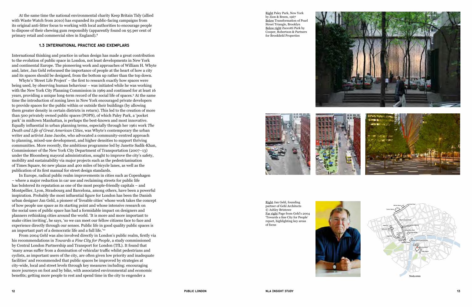
Whyte’s‘StreetLifeProject’–thefirsttoresearchexactlyhowspaceswerebeing used, by observing human behaviour – was initiated while he was working with the New York City Planning Commission in 1969 and continued for at least 16 years, providing a unique long-term record of the social life of spaces.9 At the same time the introduction of zoning laws in New York encouraged private developers to provide spaces for the public within or outside their buildings (by allowing them greater density in certain districts in return). This led to the creation of more than 500 privately owned public spaces (POPS), of which Paley Park,a‘pocketpark’ in midtown Manhattan, is perhaps the best-known and most innovative. Equallyinfluentialinurbanplanningterms,especiallythroughher1961workThe Death and Life of Great American Cities, was Whyte’s contemporary the urban writer and activist Jane Jacobs, who advocated a community-centred approach to planning, mixed-use development, and higher densities to support thriving communities. More recently, the ambitious programme led by Janette Sadik-Khan, Commissioner of the New York City Department of Transportation (2007–13) under the Bloomberg mayoral administration, sought to improve the city’s safety, mobility and sustainability via major projects such as the pedestrianisation of Times Square, 60 new plazas and 400 miles of bicycle lanes, as well as the publicationofitsfirstmanual for street design standards.
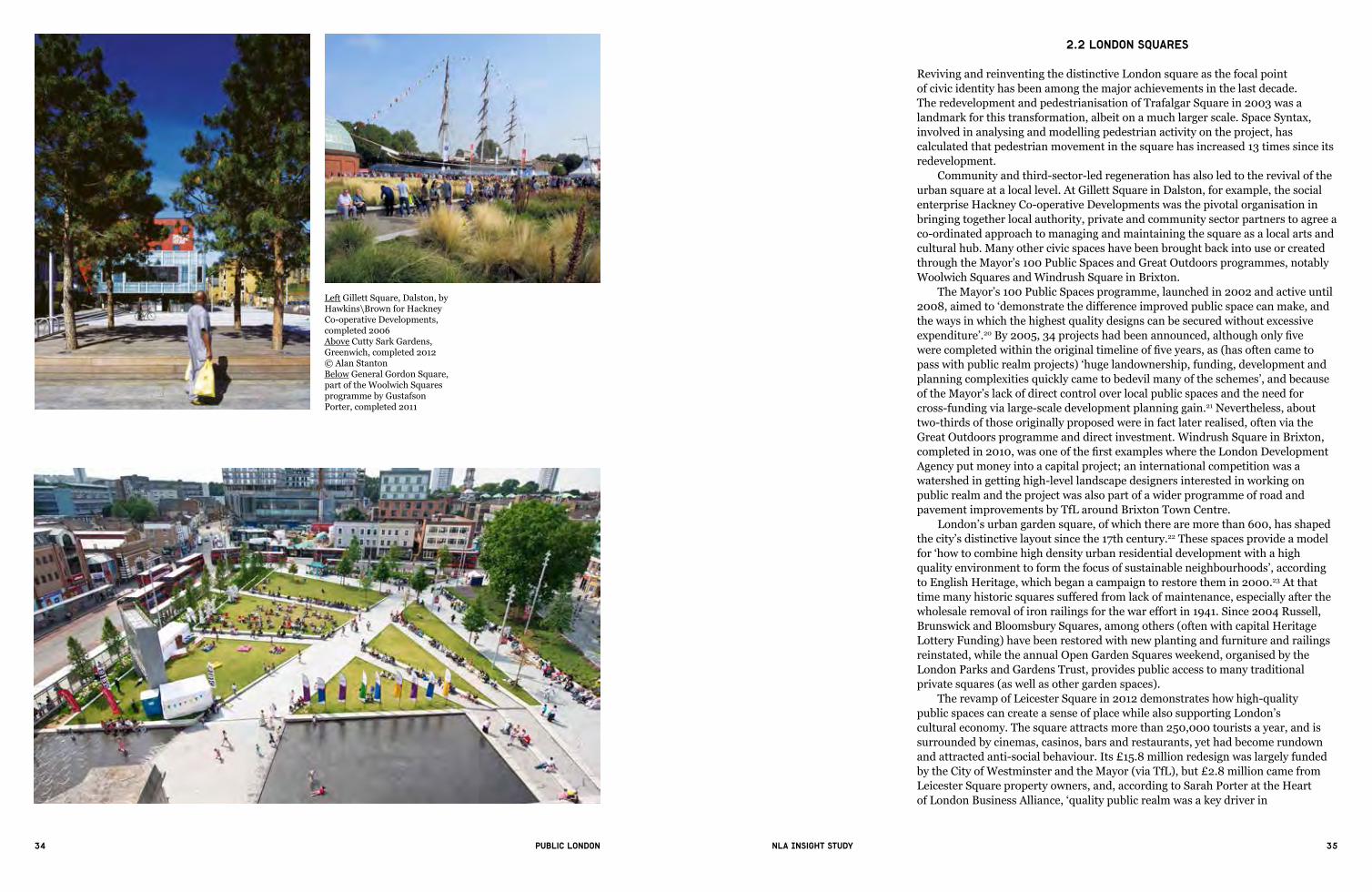
In Europe, radical public realm improvements in cities such as Copenhagen – where a major reduction in car use and reclaiming streets for public life has bolstered its reputation as one of the most people-friendly capitals – and Montpellier, Lyon, Strasbourg and Barcelona, among others, have been a powerful inspiration.ProbablythemostinfluentialfigureforLondonhasbeentheDanishurbandesignerJanGehl,apioneerof‘liveablecities’whoseworktakestheconceptof how people use space as its starting point and whose intensive research on the social uses of public space has had a formidable impact on designers and plannersrethinkingcitiesaroundtheworld.‘Itismoreandmoreimportanttomakecitiesinviting’,hesays,‘sowecanmeetourfellowcitizensfacetofaceandexperience directly through our senses. Public life in good quality public spaces is an important part of a democratic life and a full life.’10
From2004GehlwasalsoinvolveddirectlyinLondon’spublicrealm,firstlyviahis recommendations in Towards a Fine City for People, a study commissioned by Central London Partnership and Transport for London (TfL). It found that ‘manyareassufferfromadominationofvehiculartrafficwhilstpedestriansandcyclists, as important users of the city, are often given low priority and inadequate facilities’ and recommended that public spaces be improved by strategies at city-wide, local and street levels through key measures including: encouraging more journeys on foot and by bike, with associated environmental and economic benefits;gettingmorepeopletorestandspendtimeinthecitytoengendera
Towards a fine City for People - page 2
Disclaimer issued by Transport for London & Central London PartnershipThis study has been undertaken by Gehl Architects acting as consultant onbehalf of Transport for London and Central London Partnership acting asco-clients.
The views expressed and the recommendations set out in the report are those of the consultants and these do not necessarily reflect the views of the clients.
Study areas
Covent Garden
Tottenham Court Road
Victoria Embankment Gardens
British Library
Euston Square
Charing Cross Road
Regent St
Leicester Square
Trafalgar Squarerafafalga
PiccadillyCircus
Oxford St
Regent St
Lower Marsh
HungerfordFootbridge
Euston Road
Waterloo StationS
New Oxford St
This is a summary document of the full reportTowards a fine city for People.
This report sets out the findings, observationsand recommendations of GEHL Architects’ PublicSpaces and Public Life study for London that was commissioned jointly by Transport for London (TfL)and Central London Partnership (CLP).
The study sought ways to upgrade public spacesand improve conditions for walking and publiclife in London based on detailed examination ofconditions at specific locations in central London.
It has followed similar lines to previous studiesconducted by GEHL Architects for other cities and therefore benefits from the experience of bestpractice from around the world.
Towards a fine City for PeoplePublic Spaces and Public Life - London 2004
Right Paley Park, New York by Zion & Breen, 1967Below Transformation of Pearl Street Triangle, BrooklynBelow right Zuccotti Park by Cooper, Robertson & Partners forBrookfieldProperties
Right Jan Gehl, founding partner of Gehl Architects © Ashley BristoweFar right Page from Gehl’s 2004 ‘TowardsafineCityforPeople’report, highlighting key areas of focus

14 15Public London NLA Insight study
more vibrant, interactive public space; safer, better public transport interchanges (especially buses); more accessible streets and town centres; and the revitalisation and regeneration of town centres’.11
Manyofhisrecommendationshavestronglyinfluencedpolicyandpractice,aswill be shown in later sections.
Towards a Fine City for People: Public Spaces and Public Life (Gehl Architects, Central London Partnership and Transport for London, 2004)
“London is a city with many positive assets that include world-class historic and modern architecture, beautiful parks and squares and grand streets.Butagainstthisbackdropmanyareassufferfromadominationofvehiculartrafficwhilstpedestriansandcyclists,asimportantusersofthecity, are often given low priority and inadequate facilities. Public Spaces and Public Life – London 2004 sets out to examine the state of selected traffic,pedestrianandcyclingenvironmentsinmoredetailinorderto findsolutionstothecurrentsituationthroughbuildingontheexistinggood features.
Public spaces - problems and potentialsThere are opportunities to improve the quality of public space in London andaseriesofproblemstobeovercome.Overall,themainfindingsandrecommendations focus on several key areas for action to improve the current situation:
—creatingabetterbalancebetweenvehiculartraffic,pedestriansandcyclists — improving conditions for walking and cycling — improving conditions for resting and simply passing time — upgrading the visual quality of the streetscape — promoting a shift in mind-sets towards a more people-orientated city culture
The success of the whole process relies on changing fundamentally how we think about movement in London.”
1.4 Policy and practice in the UK and London
In London the importance of providing open spaces, especially in residential neighbourhoods, was recognised as early as the 17th century, with the laying out ofthefirstplannedestatesandtheemergenceofthedistinctiveLondongardensquare. Since the 19th century, against the background of intensive urbanisation and industrial growth, the great public spaces for London have traditionally been the Royal Parks. The Crown Lands 1851 Act transferred management (but not ownership) of the parks from the monarch to the government, and the parks were opened up for public recreational use. The framework of many of the parks and open spaces seen today, however, was the result of Sir Patrick Abercrombie’s County of London Plan (1943) and Greater London Plan (1944), advocating open space for recreation and leisure through a network of parks and green spaces
Right Boating on the Serpentine, Hyde Park, courtesy of The Royal Parks © Indusfoto Ltd Middle Cherry Blossoms, Hyde Park, © Greywolf and The Royal Parks Bottom Rollerblading along Serpentine Road, Hyde Park, courtesy of The Royal Parks © Indusfoto Ltd

16 17Public London NLA Insight study
connecting out to the Green Belt. He proposed that for every 1,000 city inhabitants, there should be at least four acres (1.62 ha) of open space available. The most developed parkway of the plan was for the Lee Valley, the managing body of which (the Lee Valley Regional Park Authority) was created by Act of Parliament in 1967.
By the late 20th century, however, many open spaces were moribund and run-down, cluttered, unsafe, dirty and in many cases inaccessible, a result largely of the dominance of the car in urban planning. Even in 2003 the Project for Public Spaces(aUS-basednon-profitorganisationcontinuingWhyte’swork)reportedthat despite the positive impacts of urban regeneration, there were still many areasofconcern.‘BecausethestreetsofLondonhavebeenimmersedintrafficforsolong’,itobserved,‘thecityforgotthisnetworkofpublicspaces,whichisitsmost important asset’, and its newer public buildings had outside spaces that were ‘amongtheworstofanycity’.12
Itwasonlyinthefirstdecadeofthe21stcenturythata‘third’wayemergedthatcatalysed public space improvement – an overall vision for London’s development led strategically by the public sector, in the form of the Mayor of London and LondonAssembly,firstelectedin2000(andoutlinedintheLondonPlan,thefirstspatialdevelopmentstrategyforthecapital),butlargelyimplementedandsignificantlyfundedbytheprivatesector.13 The transformation of London’s public space had already begun under the auspices of John Gummer, then Environment Secretary, who commissioned the World Squares for All study in 1996 that ledtoamasterplantoreconfigurethesymboliccivicheartofLondoninandaroundWhitehallandthePalaceofWestminster.Thefirstpartofit,themajorredevelopment of Trafalgar Square, was completed in 2003.
The London Plan (Mayor of London, March 2015)Policy 7.5 Public Realm
Strategic A: London’s public spaces should be secure, accessible, inclusive, connected, easy to understand and maintain, relate to local context, and incorporate the highest quality design, landscaping, planting, street furniture and surfaces.
Planning decisions B: Development should make the public realm comprehensible at a human scale, using gateways, focal points and landmarks as appropriate tohelppeoplefindtheirway.Landscapetreatment,streetfurnitureandinfrastructure should be of the highest quality, have a clear purpose, maintain uncluttered spaces and should contribute to the easy movement of people through the space. Opportunities for the integration of high quality public art should be considered, and opportunities for greening (such as through planting of trees and other soft landscaping wherever possible) should be maximised. Treatment of the public realm should be informed by the heritage values of the place, where appropriate.
C: Development should incorporate local social infrastructure such as public toilets, drinking water fountains and seating, where appropriate. Development should also reinforce the connection between public spaces and existing local features such as the Blue Ribbon Network and parks and othersthatmaybeofheritagesignificance.
Above World Squares for All masterplan, courtesy of Atkins, highlighting key proposals as:1 – New gateway between World Squares and the West End | 2–Trafficremovedinfrontofthe National Gallery | 3 – Better access to Trafalgar Square | 4 – Whitehall transformed and the Cenotaph respected | 5 – Parliament Square transformed | 6 – Old Palace Yard reinforced as a public square | 7 – Linking Trafalgar Square, Whitehall and beyond | 8 – Improved access
to the River and Hungerford Bridge | 9 – Horse Guards Roadclosedtotraffic|10–New pedestrian route linking the Royal Parks to the River | 11 – Victoria Embankment Gardens and Embankment integrated | 12 – New public access to Whitehall | 13 – Broad Sanctuary improved | 14 – Residential areas in the study area safeguarded from increases inthroughtraffic
Below Trafalgar Square courtesy of Foster + Partners

18 19Public London NLA Insight study
The idea of a design-led urban renaissance, accommodating growth while retaining all the elements that made the city an attractive place to live and work – especially itsopenspaces–begantoflourishwithinbothnationalandLondon-widepolicy.This was driven in particular by the national Urban Task Force established by the then Deputy Prime Minister John Prescott to identify the reasons for urban decline, and chaired by Richard Rogers. Its report Towards an Urban Renaissance (1999)signifiedamajorchangeinthinkingandpracticeinurbanpolicybylayingoutaholisticvisionofsustainableregeneration‘throughmaking[townsand cities] compact, multi-centred, live/work, socially mixed, well designed and connected, and environmentally sustainable’.14 High-quality public realm became a fundamental part of this.
The importance of good design in urban development thus became the key mantra of new agencies such as the national Commission for Architecture and the Built Environment(CABE),andlateritsoffshootCABESpace(nowdissolved),and regionally in the Mayor’s Architecture and Urbanism Unit, chaired by Richard Rogers, which from 2007 metamorphosed into Design for London (later subsumed into the GLA’s Regeneration Unit from 2013). The creation in 2012 of the Mayor’s Design Advisory Group, which provides expert advice and advocacy across mayoral projectsandprogrammes,reaffirmsthiscommitmenttodesignquality.
The aim of Design for London,asastandaloneunitwithintheGLA,was‘todevise a cohesive strategy of tactical urban design for regenerating London’15, as proposedinthefirstdraftLondonPlan(2004),bybringingdesignqualitytotheforeviaresearchandinterventioninspecificareas,oneofwhichwaspublicopenspaces at local level.
Against this background, various initiatives were instigated at a strategic level during the mayoral terms of both Ken Livingstone and Boris Johnson to initiate and supportarangeofnewandimprovedpublicspacesacrossLondon.Mostsignificantamong these were the Mayor’s 100 Public Spaces (2002–8), Mayor’s Great Spaces (2009–10), Mayor’s Regeneration Fund and High Streets Fund, and London’s Great Outdoors strategy (2009–). Since then – following Gehl’s lead – the focus for the public sector has moved from squares and parks to supporting place-based improvements as a means of wider regeneration, including streets, high streets and roads. This can be seen through the Better Streets initiative (2009), Outer London Fund (2011 onwards), and the Roads Modernisation Plan (2014), which builds on the Roads Task Force and Mayor’s Cycling Vision to address the continuing issue of how to sustain London’s liveability alongside economic growth and a vast expected increase in population over the next 30 years.
In 2004, Ken Livingstone announced that he would make London a walkable city by 2015, which resulted in the proposal of Legible London, a London-wide pedestrianwayfindingsystemwhich,since2009,hasbeenrolledoutbyTfL with the aim of encouraging walking by providing consistent mapping and directional information.
The congestion charge,introducedin2003,hasalsodeliveredasignificantreductionintrafficandcongestionbyusingthechargingmechanismasadeterrentto car use. Latest estimates by TfL give an overall reduction in vehicle kilometres in London of 11 per cent between 2000 and 2012, while over the last decade the charge has raised a total of £1.2bn, reinvested in the capital’s transport infrastructure.16 This has resulted in a noticeable shift in, and expansion of, public realm strategies, from apredominanceofdecluttering,makingLondon‘walkingfriendly’andstreetscapeinitiatives through to more intensive placemaking. This has been followed by a more sophisticated approach to public realm design, encompassing a more integrated set of strategies around cycling, pedestrianisation and urban greening to position public realm as a key instrument of wider and more holistic regeneration.
Above left Cover of Towards an Urban Renaissance, 1999, by the Urban Task ForceAbove Cover of CABE Space’s Manifesto for Better Public Spaces, 2003
Left and below Windrush Square in Brixton, designed by Gross Max and completed in 2010 - one of the Mayor’s 100 PublicSpacesandaflagshipproject of the Great Outdoors programme. Image courtesy of TfL

20 21Public London NLA Insight study
Left Brentford’s new look market place, Hounslow, completed 2014 © Philipp Ebeling
Below left Flat Iron Square – a new urban square created in Bankside in 2011, Southwark © Better BanksideBelow Nunhead Green for Southwark Council, completed 2014
Right Legible London monolith © Philip Vile
Right Canary Wharf © Richard Davies

22 23Public London NLA Insight study
Central London Partnership and TfL’s Quality Streets study published in 2003 was one of the earliest to show how businesses, developers and landowners have come to embrace the importance of quality public realm in maintaining and enhancingassetvalue.‘Whileinvestmentintransportwasonceatthetopoftheagendaforthecapital’sbusinessleaders’,itstated,‘theyarenowalsodemandingamoresophisticatedandattractivecityscape[that]…createstherightconditionsfor their customers and employees alike’.17 The momentous increase in the number and variety of new and regenerated public spaces in London has also been the resultofamassiveinjectionofprivate-sectorinnovation,financeandresources,aswellas‘anewaccommodationbetweenmarketandstate’thathasresulted–butonlymostnoticeablywithineventhelastfiveyears–inasharedvisionbetweenprivateandpublicsectorsofthefinancial,social,culturalandenvironmentalbenefitsthatinvestinginpublicspacecanbring.18
London’seconomictransformationasamajorfinancialcentre,followingderegulation in the 1980s, led to large-scale development (at Broadgate and Canary Wharf) that initiated new types of public spaces, including plazas and concourses, often inspired by American and European examples. More recently the much stronger emphasis on, and understanding of, how a high-quality, inclusive outdoor environment contributes to a sense of place has resulted in a much more diverse range and network of spaces, especially in areas of single ownership, that draw on the well-established placemaking traditions of the Great Estates and respond to London’s unique urban fabric.
1.5 Successes … and the challenges
TheLondonPlanassertsthat‘London’spublicspacesshouldbesecure,accessible,inclusive, connected, easy to understand and maintain, relate to local context, and incorporate the highest quality design, landscaping, planting, street furniture and surfaces’ (policy 7.5). There is no single recipe for creating and delivering a‘successful’publicspace(apartfromthefactthatitshouldbeused),becauseeach one has to respond to an extraordinarily varied set of local conditions and requirements,andits‘success’isonlyreallyevidentaftermanyyears,whenitisfully‘adopted’byitsusers.
Nevertheless, over the last decade a number of key principles have emerged, including:
— a clearly articulated, consistent vision that recognises how people use space and that a vast range of stakeholders can support and own – from local residents, businesses, organisations, planners, landowners and developers, highway maintenance, utility companies and all road users, among many others
— effectiveleadershipas the key to implementing change— long-term thinking that recognises transformation is as much delivered throughincrementalimprovements,as‘ownership’isagradualprocess,asbymasterplanning
— balancing strategic thinking with detail – understanding how the space relates to and should be integrated with surrounding areas and the wider city, but responds to local character and distinctiveness; and how all elements of the space, from paving, posts, benches and other street furniture, planting and a vast range of other features, can be coordinated – demanding the skills of what PatriciaBrownhascalled‘visionarytinkerers’
— allowingflexibilityandunpredictability responding to priorities that will change not only through the design and delivery process, but long into the future, recognising the complex layering and interlinking ways public spaces are used
Left Broadgate Circle by Arup for British Land, courtesy of Broadgate EstatesBelow The KERB food market at Granary Square, King’s Cross

24 25Public London NLA Insight study
— partnership and collaboration – recognising the need for multidisciplinary working and understanding the holistic value (economic, social, aesthetic and environmental) of public realm
— simplicityisoftenaseffectiveasmultifacetedschemes–simplyclearingandrationalising clutter can create better spaces
— durability – using high-quality materials, skills and techniques and implementing a long-term plan of proactive management
Anumberofhigh-profileprojectshavebeenparticularlysignificantascatalyststoa much wider understanding of the importance of high-quality public realm. The earliest among these was undoubtedly the transformation of Trafalgar Square, perhaps London’s best-known and busiest public space, revitalised by turning an inhospitableandpollutedareadominatedbytrafficintoanaccessible,pleasantenvironment for pedestrians and other users. King’s Cross and the Olympic Park exemplify a new approach that emerged to put public space at the heart of masterplanning, and, respectively, the heritage- and landscape-led creation of newplacesandneighbourhoodsonbrownfieldindustriallands.Oxford Circus, Kensington High Street and Exhibition Road have shown how decluttering the accretion of signs, railings and other street features, and introducing the concept of‘sharedspaces’fortraffic,pedestriansandcyclistscantransformtheexperienceof some of London’s busiest roads.
These and many other projects show what can be achieved on a major scale with political support, ambition, resources, and successful collaboration between publicandprivatesectors(and,inthecaseoftheOlympicPark,afixeddeadline).There remain, however, major challenges in delivering and funding public realm projects, and not least the time that it takes to achieve them because of the approval and agreement needed from a highly complex network of stakeholders with often competing aims and interests. There are a number of prominent sites where strategic interventions, particularly in terms of pedestrianisation, have been proposed but never implemented, including Victoria Embankment and Sloane Square.Probablythemostsignificantoftheseis Parliament Square in Westminster. Its redevelopment was originally proposed as part of the World Squares for All project and later revisited, but mayoral support was withdrawn in 2008,apparentlyowingtoconcernaboutcosts,thepotentialimpactontrafficandthe loss of green space. This has left the actual and symbolic heart of the British system of parliamentary democracy (and part of a wider UNESCO World Heritage Site)as,whattheHansardSocietyhascalled,‘anationaldisgrace’,abastionofinaccessibility and high-level security measures.19
Incremental change across London, especially in opening up and decluttering streets,hasbeenmoresignificantinsomewaysthanthemajorsignatureprojects.Public space improvements over the last decade have not only supported London’s economicgrowthbutalsoenhanceditscharacterasa‘permeable’city–throughunlocking inaccessible courtyards and alleyways, creating new routes and connections, and overhauling rundown, unattractive, crime-ridden and derelict spaces. As space in London is ever more at a premium, and public realm will have to become ever more multi-functional and adaptable, the challenge in a continuing age of austerity will be to continue to fund, develop and upgrade these existing smaller or hidden areas. If this can be done, collectively this will lead to another great improvement in London public realm quality overall. While London has undoubtedly undergone a civic renaissance through many transformative public realm projects in the last decade, there are also still many barriers to delivery, and some of these complexities and challenges as well as successes will be explored in the following chapters.
Right Kensington High Street improvements, courtesy of RB Kensington and ChelseaBelow Trafalgar Square, before and after pedestrianisation, courtesy of Atkins
Left Proposal for Victoria Embankment – prohibiting trafficfromdominatingtheriverside, moving it to a new below-grade highway – Richard Rogers, 1986

26 27Public London NLA Insight study
Granary Square, King’s Cross

28 29Public London NLA Insight study
22. Public space and the evolution of placemaking
London is widely described as a collectively planned city, having grown incrementally in a piecemeal fashion. It thus has a rich heritage of spaces in between and around buildings: its distinctive historic squares, modernist plazas and piazzas, and traditional town centres and high streets that act as local focal points for communities. The last decade has been marked by the rise of design-leddevelopmentwithanewemphasisonpublicrealmasameansofdefiningorreinforcing‘place’andenhancingoverallqualityoflife,reiteratedbytheFarrellReview’scallfor‘anewunderstandingofplace-baseddesignandplanning’andto‘makingtheordinarybetter’.Ineconomicterms,thiscansafeguardlong-terminvestment,stimulatebusinessgrowth,andsupportLondon’spositionasa‘worldcity’ in the face of growing international competition. On a social level it can bring back into use often obsolete or neglected spaces or districts, revitalising them for community, cultural and commercial use.
2.1 Estates: areas in single ownership
Since the 17th century, London’s Great Estates – Grosvenor, Cadogan, Howard de Walden, Bedford and Portman, among others – have proved highly successful at creating and maintaining high-quality, vibrant places and public spaces. Their approach to stewardship represents a commitment to the long-term future of an area by carefully investing in, maintaining and managing economic and social uses alongsidephysicalassetsoveradefinedareaofownership.Investinginpublicrealm improvement is regarded as essential to sustaining the success of an area, and of London as a whole against international competition.
Leasehold reform legislation from the 1960s to the 1990s led to many estates selling freeholds; while this disrupted the integrity of land ownership it also released funds. Estates began to develop public realm strategies in order to maximise the value of the remaining assets, but these involved extensive negotiation with local authorities, as the streets and many open spaces are now in public ownership. For example, in 2005/6 Grosvenor commissioned Gehl Architects to review the quality of the public realm in its two main London estates, Mayfair and Belgravia. The resulting report Places for People recommended trafficreductionmeasuresandimprovementstothepedestriannetwork(forexample through providing dedicated crossings, introducing shared spaces and widening pavements), as well as enhancing the visual environment of each estate by reducing clutter, improving maintenance, and using high-quality, coordinated materials for surfaces, lighting and street furniture. A 20-year strategy and public realm handbook outlining design standards were then developed and improvements implemented across the estate, most notably in Mount Street, Elizabeth Street, Brown Hart Gardens, and Grosvenor Hill.
Many of the other large older estates have also carefully analysed the tenant mix, balance of uses and distribution of public space within their ownership and have made strategic interventions to enhance the estate as a whole while integrating it further into the surrounding urban fabric: Howard de Walden’s Marylebone High Street and Cadogan’s Duke of York’s Square are among the many earlier examples. In central areas dominated by listed buildings and conservation areas, optimising every space available is essential. Among The Crown Estate’s £500 million investment in St James’s, for example, is the transformation of a run-downbackstreetserviceyardandtaxi‘rat-run’intoanew10,000squarefootpedestrian square for business, shopping and dining uses. Much of the strategy has beentoopenupbackstreetstocreatenew‘frontdoors’forbusiness.
“Architecture is about public space held by buildings”
Richard Rogers

30 31Public London NLA Insight study
Above Brown Hart Gardens by BDP for Grosvenor, 2007Above right Elizabeth Street by BDP for GrosvenorRight Mount Street by BDP for Grosvenor
Right Covent Garden Market, courtesy of CapcoBelow More London, London Bridge, by Foster + Partners
Above left Air Street by Atkins for The Crown EstateLeft Duke of York Square, King’s Road, by Paul Davis + Partners for The Cadogan EstateAbove Marylebone High Street, courtesy the Howard de Walden Estate

32 33Public London NLA Insight study
The distinctively holistic, long-term approach to managing that the traditional estatesfosteredhasbeenhighlyinfluentialintheemergenceofnewerestatesandareas in single ownership from More London, Broadgate, Paddington Central, King’s Cross and Covent Garden to emerging neighbourhoods at Earls Court andElephantandCastle.Themostimportantdifferencebetweenolderandnewer estates is that the latter tend to retain ownership of public spaces. But the same principles apply: majority or total ownership in an area has given the landowner greater opportunity to maintain high standards of quality of design and managementforthebenefitofalloccupiers,visitorsandusers.
The older estates recognised that the long-term success of an area was (and remains) dependent on setting out and maintaining the right masterplan – creating frameworks of appropriate scale, density and legibility so that the estate overall anditsspacesareflexibleenoughtoaccommodatenewusesaccordingtochangingmarket demands and social trends – and it is this approach that has informed the creation of newer estates. Strategic vision and masterplanning must also be combined with a local adaptable management approach to maintain the quality of the public realm and the integrity of the estate as a distinctive place. In a highly competitive commercial market both nationally and internationally this has led to the rise of place-branding and destination marketing – Portman Village, Seven Dials and Carnaby are just a few examples – to emphasise the particular qualities, heritage and character of a place and its cultural and retail as well as commercial andresidentialoffer.Thisprincipleisnowbeingadoptedbyculturalinstitutionssuch as the Barbican, and retailers such as Selfridges, which have seen that high-quality public space and district-wide strategies (leading to the creation of cultural quarters) are vital in connecting the institution to the wider city and thereby sustaining visitor numbers.
Left Barbican © Agnese Sanvito
Right Carnaby Street, courtesy of Shaftesbury
34 35Public London NLA Insight study
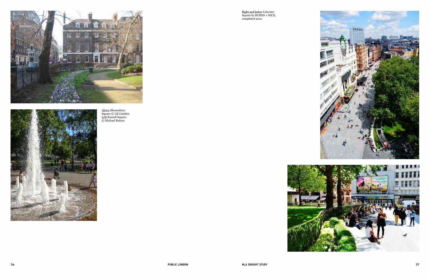
2.2 London squares
Reviving and reinventing the distinctive London square as the focal point of civic identity has been among the major achievements in the last decade. The redevelopment and pedestrianisation of Trafalgar Square in 2003 was a landmark for this transformation, albeit on a much larger scale. Space Syntax, involved in analysing and modelling pedestrian activity on the project, has calculated that pedestrian movement in the square has increased 13 times since its redevelopment.
Community and third-sector-led regeneration has also led to the revival of the urban square at a local level. At Gillett Square in Dalston, for example, the social enterprise Hackney Co-operative Developments was the pivotal organisation in bringing together local authority, private and community sector partners to agree a co-ordinated approach to managing and maintaining the square as a local arts and cultural hub. Many other civic spaces have been brought back into use or created through the Mayor’s 100 Public Spaces and Great Outdoors programmes, notably Woolwich Squares and Windrush Square in Brixton.
The Mayor’s 100 Public Spaces programme, launched in 2002 and active until 2008,aimedto‘demonstratethedifferenceimprovedpublicspacecanmake,andthe ways in which the highest quality designs can be secured without excessive expenditure’.20By2005,34projectshadbeenannounced,althoughonlyfivewerecompletedwithintheoriginaltimelineoffiveyears,as(hasoftencametopasswithpublicrealmprojects)‘hugelandownership,funding,developmentandplanning complexities quickly came to bedevil many of the schemes’, and because of the Mayor’s lack of direct control over local public spaces and the need for cross-funding via large-scale development planning gain.21 Nevertheless, about two-thirds of those originally proposed were in fact later realised, often via the Great Outdoors programme and direct investment. Windrush Square in Brixton, completedin2010,wasoneofthefirstexampleswheretheLondonDevelopmentAgency put money into a capital project; an international competition was a watershed in getting high-level landscape designers interested in working on public realm and the project was also part of a wider programme of road and pavement improvements by TfL around Brixton Town Centre.
London’s urban garden square, of which there are more than 600, has shaped the city’s distinctive layout since the 17th century.22 These spaces provide a model for‘howtocombinehighdensityurbanresidentialdevelopmentwithahighquality environment to form the focus of sustainable neighbourhoods’, according to English Heritage, which began a campaign to restore them in 2000.23 At that timemanyhistoricsquaressufferedfromlackofmaintenance,especiallyafterthewholesaleremovalofironrailingsforthewareffortin1941.Since2004Russell, Brunswick and Bloomsbury Squares, among others (often with capital Heritage Lottery Funding) have been restored with new planting and furniture and railings reinstated, while the annual Open Garden Squares weekend, organised by the London Parks and Gardens Trust, provides public access to many traditional private squares (as well as other garden spaces).
The revamp of Leicester Square in 2012 demonstrates how high-quality public spaces can create a sense of place while also supporting London’s cultural economy. The square attracts more than 250,000 tourists a year, and is surrounded by cinemas, casinos, bars and restaurants, yet had become rundown and attracted anti-social behaviour. Its £15.8 million redesign was largely funded by the City of Westminster and the Mayor (via TfL), but £2.8 million came from Leicester Square property owners, and, according to Sarah Porter at the Heart ofLondonBusinessAlliance,‘qualitypublicrealmwasakeydriverin
Left Gillett Square, Dalston, by Hawkins\Brown for Hackney Co-operative Developments, completed 2006Above Cutty Sark Gardens, Greenwich, completed 2012 © Alan StantonBelow General Gordon Square, part of the Woolwich Squares programme by Gustafson Porter, completed 2011
36 37Public London NLA Insight study
Right and below Leicester Square by BURNS + NICE, completed 2012
Above Bloomsbury Square © LB CamdenLeft Russell Square, © Michael Button

38 39Public London NLA Insight study
attracting and assuring quality tenants’ such as the luxury W London hotel.24 Much redevelopment is now taking place around the square as a result of the public realm works. A 10-year management plan, outlining roles and responsibilities of the council, funding property owners, Heart of London and Metropolitan Police, has been put in place to provide a clear accountability mechanism to keep the square well maintained and thriving.
In large-scale commercial developments an emphasis on high-quality public realmhasbecomeavitalpartofdefininganewplacetoattractandtokeepmajorbusiness occupiers and their employees in a highly competitive global economic climate. These public spaces are generally characterised by hard landscaping combined with a range of planting features, public art, innovative lighting and other elements – and have also been at the forefront of introducing cultural, leisure and sporting activities and other events programmes to animate the space and draw in visitors.
Here the private sector has played a pivotal role in creating new typologies of the London square. The use of a gigantic steel frame rather than the more conventional concrete core at The Leadenhall Building has freed up 275 square metres of space underneath the 52-storey tower that opens out on to Leadenhall Street and will be integrated with the neighbouring redesigned St Helen’s Square, providing the largest new public space in the City of London. Granary Square at King’s Cross, animated with more than 1,000 fountains, one of the largest water features in Europe, utilises the character of the 19th-century railway lands to create a new pivotal point for people crossing over the canal from King’s Cross station, whilethedevelopmentasawholewilloffer26acresofavarietyofparks,squaresand open space.
Above Proposals for St Helen’s Square, City of London by Gillespies
Above Visitors enjoying the fountains at Granary Square, King’s CrossRight Public realm at ground level of The Leadenhall Building, by Rogers Stirk Harbour + Partners

40 41Public London NLA Insight study
2.3 Areas in multiple ownership
Areas in multiple ownership, such as town centres, streets and high streets, present amuchmoredifficultchallengeintermsofpublicrealmimprovements,notleastbecauseoftheneedforgreatercoordinationamongdifferentlandowners.However, progress in this area has been particularly visible over the last decade owing to the emergence of Business Improvement Districts (BIDs), boroughs developing public realm strategies, and funding and support at a London-wide level from a variety of mayoral initiatives including the Mayor’s Regeneration Fund, Outer London Fund, High Streets Fund and via Transport for London.
BIDshaveonlybeenpresentinLondonsince2005,whenKingstonfirst(thefirstBIDintheUK)wasfounded.OriginatinginTorontointhe1960s,BIDsare local organisations that collect a compulsory levy from businesses (subject toaballotandforfixed,multi-yearterms)inadefinedgeographicalarea.Theyrepresent the interests of the business community and deliver services and improvements to enhance the trading environment, including place promotion, above and beyond support from the public sector.
Therearenowover40BIDsinLondon,allofwhichhavedifferingobjectivesbut broadly share the aim of raising standards of management and maintenance of the public realm. At its core, a BID’s function is to ensure that its area is safe, clean and well-maintained. In many places, especially those with the highest footfall – in the West End and around major transport hubs – BIDs have put in place additional service provision that can include deep street cleaning, ‘streetambassadors’ (whose role is to patrol and monitor streets on a daily basis, as well as to greet and help visitors), and smaller interventions including improved paving and street furniture. Larger BIDs, especially those in central London – Baker Street BID and Team London Bridge are just two examples – have begun to work in partnership with boroughs, TfL and larger estates to develop and implement large-scale capital projects and to develop area-wide strategies, in order to deliver an environment that remains welcoming, attractive and functional – and thereby sustains commercial activity. Some BIDs have also directly taken over commercial functions,includingKingstonfirst,whichnowmanagesKingston Market. All the boroughs surveyed as part of a 2013 review for the GLA of London BIDs reported thatanimprovedpublicrealmandcleanerenvironmentwasthemainbenefitthatBIDs delivered.25
Some (but by no means all) boroughs – following the lead of Westminster and the City of London – have also taken on board the importance of a coordinated yet flexibleapproach,puttinginplacepublicrealmdesign,deliveryandmanagementframeworks and quality standards to help underpin future investment and sustain a high quality of life for local residents. LB Hackney’s approach, for example, adoptsthefocuson‘stewardship’ofplacesforcommunities,pullingtogetherinvestment from a variety of sources, and providing guidance on public realm designthatshouldutilise‘theprinciplesofreducingvisualandphysicalclutterin the borough’s streets and public spaces, setting out principles for better urban design and allowing the borough’s distinctive character to speak for itself…’.26
Much attention has also been given to the importance of local streets and high streets as not only economic and retail centres but also places for meeting, working and socialising, and as a focus for civic identity – the street as a microcosm of the city. London has more than 600 high streets, with two-thirds of itsinhabitantslivingwithinafive-minutewalkofone.27 The high street has faced fiercechallengesintheeconomicdownturn,withhighrentsandrates,competitionfrom larger shopping centres and online retail leading to more than 3,400 empty shops reported in 2012 (the numbers are higher in outer London).28 In 2011 the
Above Proposals for St Thomas Street, Southwark by Team London BridgeRight Activities at Kingston Market Place by Tonkin Liu © Phillipp EbelingBelow inmidtown street ambassadors, located at Bloomsbury, Holborn and St Giles

42 43Public London NLA Insight study
government commissioned retail consultant Mary Portas to lead an independent review into the state of the country’s high streets and town centres and suggest ways that they could be made more competitive, resulting in 28 recommendations and the instigation of pilot projects, including three in London funded by the Mayor (in Lambeth, Lewisham and Tower Hamlets), to explore how community partnerships can be engaged in initiating high street improvements. In Portas’s words,‘onceweinvestinandcreatesocialcapitalintheheartofourcommunities,the economic capital will follow’.29
Alongside extensive investment by the private sector, especially the estates, the GLA and its partnerships have injected more than £200 million across a number of funds to support improvement across more than 70 high streets, working with local authorities, residents, traders and others, to deliver both permanent schemes and temporary imaginative interventions that underpin long-term stewardship and ownership and support wider regeneration. Barking Town Centre is just one of many examples showcased in the GLA’s Learning from London’s High Streets (2014), where a public realm code setting out principles for design quality and consistency, and a strong focus on interdepartmental working by the regeneration team,werefactorsforsuccessindeliveringsignificantimprovements.Otherimprovements are relatively simple – such as shopfront repainting and relighting in Nunhead Village to help rebrand and promote new trade, while animating the public realm with pop-up cinemas, street markets, and festivals has also been encouragedbyinitiativessuchasthe‘Summer of High Streets’ (2014), to celebrate the completion of projects. It has been estimated that up to 180,000 square metres (44 acres) of public realm will be created or improved through these mayoral initiatives. Perhaps the most ambitious scheme was High Street 2012, a project joining the City of London with the Olympic Park in Stratford and involving a coordinated design framework to improve and expand green spaces while also providing seating areas, upgrading cycling and pedestrian infrastructure and localisedinterventionsreflectingthediversecommunitiesalongthewholeroute.
Left High Streets of London, by Design for London
Top High Street 2012 vision by FluidAbove left Barking Town Centre by AHMM and muf architecture/art, completed 2010Above Nunhead Village, Southwark
CategoryMasterplanning & Public Realm
ClientTower Hamlets Council, Newham Council, London Development Agency, TfL, LTGDC and English Heritage
Dates 2008 - present
LocationA11 corridor, from Aldgate to Stratford* Please see location map ( below right )
Contract valueOver £36.5 million funding has supported the delivery of High Street 2012 to-date
High Street 2012 is an ambitious project to improve and celebrate one of London’s great collection of high streets. This ribbon of London life is both everyday and remarkable. It is historic and modern, and constantly evolving. The masterplan aims to reconnect places and communities, making this high street a place locals and Londoners can share and thrive in. While the street runs through some of the most disadvantaged neighbourhoods in the capital and is dominated by heavy traffic, it also passes through some of the most culturally diverse and historically rich areas of London, with a wonderful range of existing buildings, streets, markets, waterways and many parks and green routes. The Vision builds on the strengths of this street, transform perceptions of the area, encourages positive change and stimulates investment.
Objectives
01 | To create a thriving high street by reinforcing the distinctive character of the places along the route, by creating places for people to slow down, stop and socialize as well as pass through and by balancing the needs of road users and pedestrians.
02 | To create a connected street by enhancing natural flows along and across the street, removing barriers to make it easier for everyone using the street to move around and find their way. To create a safer, cleaner and more attractive environment.
03 | To create a healthy street by increasing opportunities for walking and cycling, by forming green oases and active spaces along the way, improving links to sport and leisure facilities and encouraging options for healthy living.
04 | To celebrate the street and reveal its social and cultural richness by enhancing historic buildings and spaces, and supporting active social projects and events to bring the street to life. The objectives are realised through a combination of overall street actions that apply to the whole street and eight area-based initiatives, which have for the most part been delivered.
High Street 2012
Board | 01
Architect | Fluid
A new park at Braham Street. An improved, more accessible, well lit Altab Ali Park, revealing the history of the area with increased opportunities for play. Restored historic buildings opposite the refurbished Whitechapel Gallery. A new sculpture by Rachel Whiteread on the façade of the Whitechapel Gallery. Better pedestrian links to Brick Lane and the start of the Cycle Superhighway.
Improved footways, lighting and crossings. Public Art at Groves Bridge and the DLR station. Catenary Lighting on the High Street. Improved connections between the DLR station and the Olympic Park and new shopping areas.
Refurbished facades to historic buildings. Improvements to Whitechapel Market with new lighting, drainage and refuse collection. Removal of railings and street clutter. Improved pedestrian routes and crossings, including north-south links connecting the Royal London Hospital with the future Crossrail Station.
Refurbished Wickhams department store and other historic buildings and shop fronts, with new awnings and improved signage. High quality shared surface between the Waste and the buildings creating better parking and walking routes.
Improved access via special paved areas. Safer and more open entrance to Mile End Park. The green bridge replanted with thousands of young saplings. Integrate new Queen Mary University of London developments. Long-term redevelopment of station quarter destination.
A floating towpath along the canal and a new foot / cycle bridge.Improvements to the landscape of the Bow roundabout and a public art commission. Pedestrian safe links crossings across the roundabout and long term removal of flyover to extend the high street between Bow and Stratford. Refurbished facades to historic buildings. Improved feature lighting at the Bow Arts Centre.
Improved access to the canal and waterside development. Enhanced lighting and pedestrian crossing. Removal of railings & clutter. Restore sense of Lea Valley Crossingthrough trees, plantingand other measures.
An improved and enlarged linear green space that provides better connections to the High Street and also enhanced privacy to the residential courtyards on the Ocean Estate. New seating, planting and lighting.
ALDGATE: A FITTING GATEWAY TO HIGH STREET 2012
OCEAN GREEN: A PLACE WHERE PEOPLE CAN PAUSE, REST AND PLAY
STRATFORD HIGH STREET: TOWARDS A 21ST CENTURY HIGH STREET
WHITECHAPEL: A HISTORIC AREA OF IMMENSE DIVERSITY AND INTENSE ACTIVITY
MILE END WASTE: A WELCOME GREEN OASIS, THE FORMER EDGE OF A HISTORIC COMMON
MILE END INTERSECTION + PARK: LANDSCAPED ACCESS TO THE PARK & CANAL
BOW AND THE FLY-OVER: IMPROVED PEDESTRIAN ENVIRONMENT AND LINKS TO WATERWAYS
GREENWAY: REVEAL AND CELEBRATE THE LEA VALLEY AND EASY ACCESS TO THE WATERWAYS
ALDGATE
CENTRALLONDON
OXFORD STREET
STRATFORD
ROMFORD
CITY
OLYMPICS
HIGH STREET 2012 High Street 2012 is an ambitious project to improve and celebrate one of London’s great high streets. This ribbon of London life is both everyday and remarkable. It is historic and modern, and constantly evolving. The project aims to reconnect places and communities, making this high street a place Londoners can share with the world during the Olympics and beyond.
The high street connects the City to Stratford and is part of the Olympic and Paralympic marathon route. While it runs through some of the most disadvantaged neighbourhoods in the capital and is dominated by heavy traffic, it also passes through some of the most culturally diverse and historically rich areas of London, with a wonderful range of existing buildings, streets, markets, waterways and many parks and green routes.
We want to build on the strengths of this street, transform perceptions of the area, encourage positive change and stimulate investment.
VISIONOur vision is to create a thriving high street of which London can be proud, and which the world will admire; where there is a balance between pedestrians and other road users, where people and places are connected, where locals and visitors want to be, and where there is a sense of history, diversity, community, fun and well being.
OBJECTIVES1_To create a thriving high street by reinforcing the distinctive character of the places along the route, by creating places for people to slow down, stop and socialise as well as pass through and by balancing the needs of road users and pedestrians.
2_To create a connected street by enhancing natural flows along and across the street,
removing barriers to make it easier for everyone using the street to move around and find their way. To create a safer, cleaner more attractive environment.
3_To create a healthy street by increasing opportunities for walking and cycling, by forming green oases and active spaces along the way, improving links to sport and leisure facilities and encourag-ing options for healthy living.
4_To celebrate the street and reveal its social and cultural richness by enhancing historic buildings and spaces, and supporting active social projects and events to bring the street to life before, during and after the Olympic and Paralympics games.
These objectives will be real-ised through a combination of overall street actions that can apply to the whole street and eight area based initiatives.
High Street 2012 is part of a continuous spine running through London from Oxford Street to Romford. It passes through two of London’s Opportunity Areas. These have been recognised as places where deprivation can be tackled and sustainable development achieved. Between them, they should accommodate up to 130,000 jobs and to at least 35,000 new homes.
Location mapA 6 Km High Street connecting the City to Stratford
High Street 2012 Vision
ALDGATE | BRAHAM STREET PARK WHITECHAPEL | HISTORIC BUILDINGS
MILE END WASTE | HISTORIC BUILDINGS MILE END WASTE | WICKHAMS OCEAN GREEN
ALDGATE | ALTAB ALI PARK
STRATFORD HIGH STREET
WHITECHAPEL | MARKETALDGATE | GATEWAY
MILE END PARK
OVERALLSTREET ACTIONS
Nice dream van
44 45Public London NLA Insight study
2.4 Animating the public realm: cultural activity and temporary uses
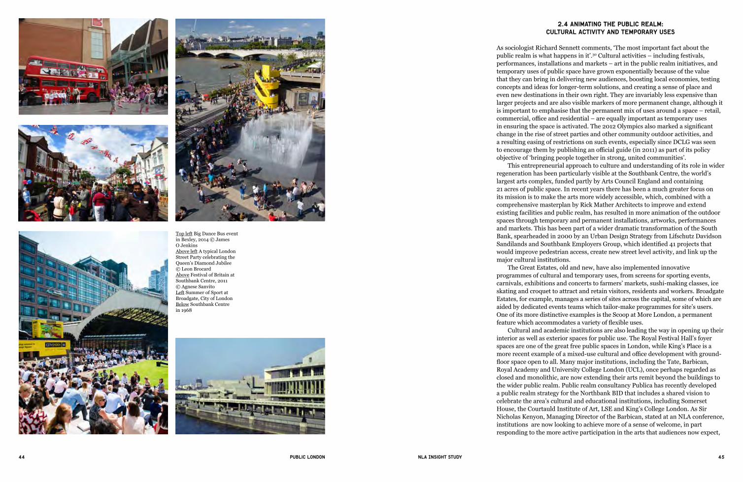
AssociologistRichardSennettcomments,‘Themostimportantfactaboutthepublic realm is what happens in it’.30 Cultural activities – including festivals, performances, installations and markets – art in the public realm initiatives, and temporary uses of public space have grown exponentially because of the value that they can bring in delivering new audiences, boosting local economies, testing concepts and ideas for longer-term solutions, and creating a sense of place and even new destinations in their own right. They are invariably less expensive than larger projects and are also visible markers of more permanent change, although it is important to emphasise that the permanent mix of uses around a space – retail, commercial,officeandresidential–areequallyimportantastemporaryusesinensuringthespaceisactivated.The2012Olympicsalsomarkedasignificantchange in the rise of street parties and other community outdoor activities, and a resulting easing of restrictions on such events, especially since DCLG was seen toencouragethembypublishinganofficialguide(in2011)aspartofitspolicyobjectiveof‘bringingpeopletogetherinstrong,unitedcommunities’.
This entrepreneurial approach to culture and understanding of its role in wider regeneration has been particularly visible at the Southbank Centre, the world’s largest arts complex, funded partly by Arts Council England and containing 21 acres of public space. In recent years there has been a much greater focus on its mission is to make the arts more widely accessible, which, combined with a comprehensive masterplan by Rick Mather Architects to improve and extend existing facilities and public realm, has resulted in more animation of the outdoor spaces through temporary and permanent installations, artworks, performances and markets. This has been part of a wider dramatic transformation of the South Bank, spearheaded in 2000 by an Urban Design Strategy from Lifschutz Davidson SandilandsandSouthbankEmployersGroup,whichidentified41projectsthatwould improve pedestrian access, create new street level activity, and link up the major cultural institutions.
The Great Estates, old and new, have also implemented innovative programmes of cultural and temporary uses, from screens for sporting events, carnivals, exhibitions and concerts to farmers’ markets, sushi-making classes, ice skating and croquet to attract and retain visitors, residents and workers. Broadgate Estates, for example, manages a series of sites across the capital, some of which are aided by dedicated events teams which tailor-make programmes for site’s users. One of its more distinctive examples is the Scoop at More London, a permanent featurewhichaccommodatesavarietyofflexibleuses.
Cultural and academic institutions are also leading the way in opening up their interior as well as exterior spaces for public use. The Royal Festival Hall’s foyer spaces are one of the great free public spaces in London, while King’s Place is a morerecentexampleofamixed-useculturalandofficedevelopmentwithground-floorspaceopentoall.Manymajorinstitutions,includingtheTate, Barbican, Royal Academy and University College London (UCL), once perhaps regarded as closed and monolithic, are now extending their arts remit beyond the buildings to the wider public realm. Public realm consultancy Publica has recently developed a public realm strategy for the Northbank BID that includes a shared vision to celebrate the area’s cultural and educational institutions, including Somerset House, the Courtauld Institute of Art, LSE and King’s College London. As Sir Nicholas Kenyon, Managing Director of the Barbican, stated at an NLA conference, institutions are now looking to achieve more of a sense of welcome, in part responding to the more active participation in the arts that audiences now expect,
Top left Big Dance Bus event in Bexley, 2014 © James O JenkinsAbove left A typical London Street Party celebrating the Queen’s Diamond Jubilee © Leon BrocardAbove Festival of Britain at Southbank Centre, 2011 © Agnese SanvitoLeft Summer of Sport at Broadgate, City of LondonBelow Southbank Centre in 1968

46 47Public London NLA Insight study
and (echoed by Jude Kelly, Artistic Director of the Southbank Centre) that the public realm in its widest sense must make it possible for people to feel involved.
Both public and private sectors now acknowledge that the arts contribute to creating a more distinctive and welcoming environment, and to establishing a sense of place for spaces that lack identity – as well as being an accessible, inclusive and often provocative vehicle for building better community cohesion. Better Bankside’s Colourful Crossings, for example, will work with artists to transform four pedestrian crossings on Southwark Street, part of a wider Avenue of Art programme to generate more visitor footfall away from the riverside and along this parallel east-west route. At New Addington Central Parade, a partnership led by a local residents’ group delivered a programme of cultural events as a testbed for more permanent interventions such as a timber performance stage to help reduce anti-social behaviour. Temporary uses such as markets, which haveimportantbutinformalsocialvalue,havealsobeensignificantindrivingpermanentregeneration,forexampleatSpitalfields,wheretwonewpublicspaces,Bishops Square and Crispin Place, were also opened in 2005.
The‘pop-up’shopandincubatororacceleratorworkspaceisanotherphenomenon of the last decade. Now contributing more than £2.1bn to the UK retail economy, temporary shops, outdoor stalls or brand experiences have become a key way for emerging entrepreneurs to get ideas on the street, and for others to trial new ones, while also reviving the high street by occupying vacant spaces.31 Theyalsoreflectandrespondtotheexperientialratherthanservice-orientatednature of retail.
BIDs,asindependentlyfundedorganisations,havebeeninfluentialinsupporting pop-ups: Camden Town Unlimited, for example extended its start-up workspace in a renovated warehouse, Collective Hub, into the high street, turning vacantunitsintotemporary,flexiblespacesforartistsanddesigners,upgradingthem and creating high demand from long-term leaseholders. It also found that on average start-ups of one or two employees contribute at least £70 a week each to the high street economy.32 The pop-up turns public space into a marketing tool for‘of-the-moment’trends,andhasbeenfurtherextendedintotransporthubsand other spaces through partnerships with TfL, for example at Old Street station where more than 100 companies have trialled ideas since April 2014, resulting in a 80-90 per cent increase in rental income.33
2.5 Major new regeneration areas
‘Highquality…publicspacesareanessentialfeatureofsuccessfulneighbourhoods’, advocated CABE Space’s Manifesto for Better Public Spaces backin2004:‘Publicspacesarethe“glue”thatholdssocietytogether.’Publicrealm – as the embodiment of civic and community identity – has now become anintegralpartofcreatingnewneighbourhoodsandintegrated‘piecesofthecity’ via a swathe of major regeneration projects, both proposed and underway, acrossLondon.Amongthemosthigh-profileofthesehasbeenthetransformationsince 2012 of the Olympic Park in east London under the auspices of the London Legacy Development Corporation (LLDC), which (as the freehold owner) sought to promote high-quality design in order to sustain long-term value and investment,anapproachstronglyinfluencedbytheolderGreatEstates.Fivenewneighbourhoods will be created with up to 8,000 new homes, along with essential amenities including schools, health centres, playgrounds and local retail, and not least252acresofopenspace(thefirsttoopenwillbeChobhamManor).
Without a traditional pattern of historic streets as a framework, the hierarchical provision of local open spaces and squares alongside the Queen
Left One of the proposals for the Royal Academy by EPR Architects with Rick Wheal, Kate Malone and James UlphBelow left Proposals for University College London’s Bloomsbury campus by Lifschutz Davidson SandilandsBelow King’s Place by Dixon Jones, King’s Cross, completed 2008 © Keith Paisley
Above right A vision for Strand — potential public realm improvements could provide the setting for festivals and events connected to neighbouring cultural and educational institutions © Publica 2015 Right Tate Modern, Bankside, Southwark, courtesy of Tate

48 49Public London NLA Insight study
Above left Front of C159, Camden High Street by Camden Town UnlimitedAbove Tumbling Bay Play area, Queen Elizabeth Olympic Park, by LUCBelow Candle Maze event at East Village, Stratford, courtesy of Broadgate Estates
Top Proposals for Elephant Park, Make for Lend Lease in partnership with Southwark CouncilAbove New Addington Central Parade, Croydon, completed 2013 by AssembleAbove right Bishop’s Square, Bishopsgate © Foster + Partners

50 51Public London NLA Insight study
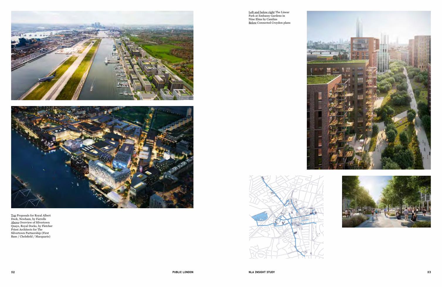
Elizabeth Olympic Park, and the strategic placement of local services and orientation of housing towards existing neighbourhoods, are considered essential in establishing local identity and ensuring new development becomes enmeshed over time with surrounding districts. A similar approach to incorporating a variety of spaces within a new business (rather than predominantly residential) district is being taken in the £1bn Royal Albert Dock scheme, where there will be eight new public squares, around 1km of waterfront open to public access and green links through the site, with north-south routes as well as a main east-west one. At Silvertown in the Royal Docks, a series of linked public open spaces situated at ground level, with smaller private and semi-public open spaces on podiums and roof terraces, will set the framework for a new 27 hectare area led by Chelsfield,FirstBaseandMacquarieCapital,includingcommercialbuildingsforinternational brands, more than 3,000 homes, major visitor attractions, higher education institutions and a series of community facilities.
Theredevelopmentofbrownfieldlandwithsignificantcapacityfornewhousing, commercial and other development linked to existing or potential improvementstopublictransport–theOpportunityAreasidentifiedintheLondon Plan – will play a major role in opening up new public spaces across Londonforthefirsttime.ExamplesincludeEarlsCourtandWestKensingtonandOld Oak Common, especially with the proposed High Speed 2 (HS2) and Crossrail stations proposed for the latter by 2026. Again, legibility and connectivity in the public realm – especially in an area that crosses three boroughs – and its critical role in placemaking around major infrastructure development, have beenidentifiedasessentialinensuringthattheredevelopedareawillfunctioneffectivelyasabusiness,industrialandresidentialdistrict.
Amongthemostsignificantareasofbrownfieldlandbeingtransformedintonew open space are those in Nine Elms on the South Bank, where public space has becomeakeyfactorintheneedtointegratedifferentdevelopmentsinthismajornew business, residential and cultural quarter, and acted as a key component of the GLA’s Opportunity Area Planning Framework for the area. At the centre of a proposed network of parks, public squares, footpaths, cycle lanes and outdoor recreation spaces is a linear park linking Battersea Park and Vauxhall Cross, which will be delivered in stages as sites are redeveloped. The complexity of creating new publicrealmisreflectedinthePublicRealmDesignGuideforthearea(putouttoconsultation in February 2015), which stresses the need not only for overarching principlesthathelptorepositionthedistrictasa‘town’ratherthanapost-industriallandscape,butalso‘characterareas’thathelptoestablishlocalcontexton a scale which people can relate to and understand.
Opportunity Areas are intended to address London’s critical housing shortage by providing (in most cases) at least 2,500 new homes, along with other supporting facilities and infrastructure, while a £400 million programme announced by the Mayor (and jointly funded by government) in February 2015 will create 20 Housing Zones across London, delivering 50,000 new homes over the next decade in areas including Thamesmead, Hounslow, Southall and Tottenham. Increasing densities will place additional pressure on the public realm, while new and redeveloped neighbourhoods also require a thriving street and public life. Connected Croydon is one example of an initiative which aims to deliver a coordinated programme of public works to improve streets, squares and open spaces, in an area which is seeing rapid transformation.
Above Aerial view of Queen Elizabeth Olympic Park © LLDC
52 53Public London NLA Insight study
Top Proposals for Royal Albert Dock, Newham, by FarrellsAbove Overview of Silvertown Quays, Royal Docks, by Fletcher Priest Architects for The Silvertown Partnership (First Base/Chelsfield/Macquarie)
Left and below right The Linear Park at Embassy Gardens in Nine Elms by CamlinsBelow Connected Croydon plans
GEORGE STREET
GEORGE STREET
NO
RTH
END
POPLAR WALK
WELLESLEY RO
AD
DIN
GW
ALL ROAD
LANSDOWNE ROAD
COLLEGE GREEN
PARK HILL
QUEEN’S GARDENS
SURREY STREET
LONDON ROAD
BARCLAY ROAD
CH
ERR
Y OR
CH
ARD
RO
AD
HIG
H S
TRE
ET
WANDLE PARK
ROM
AN WAY
SOU
TH EN
D
SELSDON ROAD
CROHAM ROAD
BARTLETT STREET
BR
IGH
TON
RO
AD
COOMBE ROAD
LOWER COOMBE STREET
ST JAMES’S ROAD
SUMNER ROAD
FRITH ROAD
CHURCH STREET
CLARENDON ROAD
SYDENHAM ROAD
BEDFORD PARK
CH
ATS
WO
RTH
RO
AD
OLD
PAL
ACE
RO
AD
THE CROYDON FLYOVER
ABERDEEN ROAD
SOUTHBRIDGE ROAD
BENSHAM LANE
LONDO
N ROAD
OAK
FIEL
D RO
AD
WEST
CROYDON
EAST
CROYDON

54 55Public London NLA Insight study
3. Public space and the connectivity of the city
‘Streetsareplacesforpeople’,affirmsTransportforLondon’sdraftrevisedStreetscapeGuidance(2015).‘Raisingtheambitionforstreetswithacollaborative,design-led approach is key … in recognising the fundamental role our streets and places play in improving the public realm and providing an enhanced quality of life’.35 Even more than the acceptance of the power of placemaking, thisrepresentsarevolutioninambitionandthinkingaboutthevalueof‘linking’spaces in sustaining liveable cities, driven by the enormous pressure on London’s infrastructure, a population boom and the need to stimulate wider economic growth. These linking spaces have therefore been recast – especially since the establishmentin2012oftheRoadsTaskForcetoundertakethe‘firstmajorstrategic review of London’s road network for a generation’ – not simply as corridorsformovementofpeopleandtraffic,butasdistinctplacesthatprovideafocalpointtoneighbourhoodsandsupportthesimultaneousneedsofdifferentusers, especially cyclists and pedestrians.
3.1 Shared streets and spaces
AmongJanGehl’sfivemainrecommendationsinhis2004reportonLondonwerethe need to encourage walking and cycling, and to make streets more accessible. Hisguidance,andtheideasoftheDutchtrafficengineerHans Monderman, have inspiredtheevolutionof‘sharedspaces’andtheextensivedeclutteringofLondon’sstreets. At the heart of this concept is the idea that pedestrians, cyclists and vehicles can intuitively share the same road space without barriers, kerbs or other street features to separate them. (Monderman’s favourite way of demonstrating the viability of this concept was apparently to walk backwards and with eyes closed into an intersection, where invariably cars and bikes would slow down and divert around him; it was the increased perception of risk, he argued, that automatically induced safe behaviour.)
But equally important at the start of the decade was the persuasive advocacy and leadership of Daniel Moylan, then Deputy Leader of RB Kensington and Chelsea,whohassaid:‘Themoreclutteryouputintoaplace,thelessyouwillmaintain it’. He pushed through major projects at Kensington High Street to removebollards,postsandotherstreetclutter(now‘easilycomparabletothebestexamples on the continent’, according to Richard Rogers) and, later, at Exhibition Road,turningitinto‘theworld’smostaccessibleculturaldestination’usingakerb-free, single surface with no street barriers or clutter, among other interventions.
Thisshiftawayfromtrafficengineeringsolutionstomoreradicalredesignofthe streetscape, and redressing of the balance away from vehicles is perhaps most visible at Oxford Circus, one of the world’s busiest intersections, crossed by more than 80 million pedestrians each year. Atkins’ redesign allows people to walk acrossdiagonallyforthefirsttime,anddramaticallyincreasedfootwayspace,as well as removing street clutter. The project was also a model for partnership working, being jointly funded by The Crown Estate, Westminster City Council and a TfL allocation, and supported by the New West End Company. It was followed by similar improvements to Piccadilly Circus. Other innovative solutions, most notably at Venn Street in Clapham, Monmouth Street and Seven Dials, Leonard Circus and Hackbridge have shown how these principles can be applied to local streets and town centres.
The City of London’s Street Scene Challenge has also been one of the most successful examples of public/private partnership, with landowners contributing financiallytoasignificantnumberofprojectstoimprovethepublicrealm.Inthe
3“Streets are places for people” Transport for London

56 57Public London NLA Insight study
Left Shared spaces in Drachten, The Netherlands © FietsberaadBelow Exhibition Road, seen from South Kensington, by Dixon Jones, completed 2011 © RB Kensington and Chelsea
Below left Venn Street, Clapham, by Urban Movement for LB Lambeth, completed 2011Below Streetscape of Monmouth Street, Covent Garden © Garry Knight
Right Oxford Circus diagonal crossings, by Atkins, completed 2009Below Piccadilly Circus, by AtkinsBelow right Shared space at Leonard Circus by LB Hackney, completed 2014

58 59Public London NLA Insight study
1990s,followingtheIRAbombings,theintroductionoftheCity’s‘RingofSteel’todetertrafficledtoopportunitiestoclosestreets,widenpavementsandcreatemore pedestrian-friendly areas. Since then, over 150 projects have been delivered, including Devonshire Square in 2005 which was joint funded by the Corporation and AXA, and Aldermanbury Square, funded by Scottish Widows plc.
The Mayor’s Road Modernisation Plan, launched at the end of 2014, is the most dramatic evolution of these earlier projects, injecting £4bn until 2021, the biggest investment in a generation, into upgrading London’s roads and streets to make them safer, less congested and more pleasant. It estimates that roads and streets represent 80 per cent of the public space in London, a fact that in itself signifiesastepchangehasoccurredinunderstandingwhatconstitutes‘publicspace’.Prominentinitsvisionistheobjectiveto‘enhanceurbanrealmtoimprovethe quality of life in London’. The plan outlines a multi-layered approach that showshowhighwayimprovementsandchangestotrafficlayout–includingtheredesign of junctions, roundabouts, crossings and cycle lanes, and the removal of gyratories – will be fully integrated with the creation of new public space, for example at Elephant and Castle and at Aldgate in the City. Some of the most significantareasofregenerationsitaroundtheinnerringroad,withintensivetraffic,andsothereisarequirementtobalance‘place’and‘movement’functions.
Reducingtheimpactof1960strafficengineeringsolutionswhichfocusedprimarilyonthemovementoftraffichasalsobecomeamajorfocusforroadimprovement. At Vauxhall, for example, a new regeneration scheme (scheduled for further consultation in late 2015) improving the gyratory system seeks to maintain interchanges between transport modes while also improving the area for pedestrians and cyclists and creating a new local district centre, while Camden’s West End project, responding to expected massive increase in visitors with the arrival of Crossrail, will transform one-way, congested streets into two-way tree-lined streets, with protected cycle lanes and new public spaces.
The Roads Modernisation Plan emerged as a response to the Roads Task Force (RTF), set up by the Mayor in 2012 to consider how to tackle the major challenges faced by London’s roads and streets, and the Mayor’s Cycling Vision, to make cycling fully integrated into the transport network. Underlying these is a balancingoftheneedbetween‘place’and‘movement’;theRTF’s‘familyofstreettypes’, intended to inform decisions on management and investment at a local level,recognisesthevarietyofrolesthatstreetsandroadsplayandhowdifferentuses and services can be managed within them. A bolder approach to risk and experimentation – as well as wider-ranging collaboration with boroughs, BIDs, consultanciesandnon-profitorganisations–isevidentinprojectsliketheFutureStreets Incubator, a £1.8m programme to support on-street trials of concepts such as a flexiblelaneinBromleyusing‘intelligent’roadstudsanddynamicsignstoswitch the road between loading bays, parking and a bus lane throughout the day.
Promoting walking and cycling have also become key priorities in transport policy,takingpressureoffthepublictransportsystemanddecreasingvehiculartraffic,aswellasresultinginsafer,morepleasantandmoreenvironmentallysustainablespaces,anddeliveringimmediatebenefitstohealth.TheUSapproach of ‘CompleteStreets’hasbeenparticularlyinfluentialinemphasisingtheimportanceofsafeaccessforallusersandthebenefitsthatthiscanbringin terms of improved social, health, economic, and environmental outcomes. A similarapproachisnowmanifestedviathe‘wholestreet’approachadvocatedin TfL’s transport action plan to improve public health in particular. Measures such as widened footways, high-quality street furniture, lighting and landscaping, decluttering, improving crossings and cycle storage can in combination bring aboutsignificantbenefits,whiletheuseofdifferenthigh-qualitypavingmaterials
Above Monument, as seen from the top, by Bere Architects for City of London CorporationAbove middle Grant Quay, North Bank, by Bere Architects for City of London CorporationAbove right Watling Street (West), St Paul’s, by Elizabeth Associates for City of London Corporation
Right Moor House, London Wall, for City of London CorporationBelow Devonshire Square, Bishopsgate, by Bennetts Associates Architects for City of London Corporation

60 61Public London NLA Insight study
Clean air
Peop
le fe
el re
laxed
and do
walk and cycle
Shade and shelter
Easy to cross
Pedestrians from
Thngs to see
People feel safeNot too noisy
People choose to
Plac
es to
sto
p
all walks of life
Left Before: The Aldgate gyratorysystem,withsignificantbarriers to pedestrian and cyclist movementBelow left After: The revitalised Aldgate area with two-way streets and two new public spaces, for City of London Corporation
Right and below right Proposal for creating more usable land byintroducinga‘flyunder’inLondon, demonstrated here by changes to the Hammersmith Gyratory (before and after)
Above Proposals for Faraday Garden, a new public space in Elephant and Castle created by removing the gyratory, by Witherford Watson Mann Architects for TfLAbove right Example of the USA initiative Complete Streets © Laura SandtRight Road Task Force Healthy Streets diagram, courtesy of TfL
Above Proposals to remove the one-way system in place in Tottenham Court Road and Gower Street, creating many new public areas – such as here at Princes Circus in the West End © DSDHALeft Proposals for Tottenham Court Road, once the new two-way system is implemented, courtesy of LB Camden

62 63Public London NLA Insight study
suchasYorkstonecanbeaprimarymeansofdemarcatingareasfordifferentusers.Implementation of the Cycling Vision, actively promoting behaviour change,
will involve the creation of four new Cycle Superhighways, Quietways, the Central LondonGridand‘mini-Hollands’. The last is a £100 million scheme to be piloted inKingston,EnfieldandWalthamForest,tohelpmakethemascycle-friendly(aswell as pedestrian-friendly) as Dutch towns. This represents an aim to encourage cycling in outer London as well as inner London, because, as Ben Plowden, DirectorofSurfaceStrategy&PlanningatTfLhassaid,‘thatiswherewewillgetpotentialabilitytomovepeoplefromshortcarjourneystothebicycle…[bymaking] local town centres, and the journeys to and from them from the local residential areas … safe and attractive and convenient’.36
3.2 Wayfinding, linking and identity
NewpedestrianwayfindingschemeshavebecomeanoticeableadditiontoLondon’s roads, streets and public spaces over the last decade, especially in central areas. Their primary function is to improve the experience of an area for visitors (as well as employees and residents), but, in encouraging people to take differentroutesbywalking,theycanalsoservewidersocial,economicandcivicfunctions: improving public health and wellbeing, dispersing pedestrian footfall and opening up access to new public spaces, encouraging repeat visits through a senseof‘discovery’,andthusoverallcontributingtoboostingeconomicactivitythroughawiderarea.Oneoftheearlyprojectswas‘Walk this Way’ – a series of guides promoted by the Cross River Partnership and South Bank Employers Group offeringtrailsdescribingthearchitectureandotherfeaturesalongandneartotheThames. More importantly, by bringing visible clarity and legibility to the street and road network – alongside decluttering schemes and a well-considered palette ofhigh-qualitymaterials,wayfindingschemescanplayamajorroleinestablishingacoherentidentity(andintegrated‘brand’)foraplace.Championingwayfindingschemes has therefore become a particular element of the placemaking work of BIDs, such as inmidtown, in creating and promoting new visitor and business destinations, especially in advance of the arrival of Crossrail.
ByfarthemostprominentdevelopmentinwayfindinghasbeenLegible London,thefirstinitiativetoimplementaconsistent,user-friendlyandcoordinated system of signage, maps and directional information across London. An impetus for its creation was Ken Livingstone’s declared ambition in 2004 of making London the most walking friendly city by 2015. Central London Partnership, led by Patricia Brown, then commissioned Legible London: A Wayfinding Study(2006),whichdemonstratedthat32differentpedestrianwayfindingschemeswerepresentinthecentralCongestionChargingZoneandthere was little London-wide coordination. This resulted in the development of a prototype design installed in the Bond Street area, the success of which led to the project being formally adopted by TfL and three pilot programmes in 2009, followed by a wider rollout across both inner and outer London. Key to thesuccessoftheschemeistheideaof‘progressivedisclosure’,givingrealistictimesforwalkingtoplaceswithinfiveand15minutes,andclearlyindicatinglocal landmarks and places of interest, as well as bus stops, tube stations and accessibility information which will, in Patricia Brown’s words, give people ‘theconfidencetogetlost’secureintheknowledgetheycaneasilyreorientatethemselves. TfL’s ambition is to implement 3,000 street signs by 2021, mainly delivered through borough funding.
3.3 Infrastructure
As London seeks to maintain its status as global city, massive investment in new infrastructure for rail, tube, tunnels and bridges is becoming a key driver of public realm transformation. The quality of the public realm and ground-level connectivity around new and improved transport hubs/modes is now widely regarded as an important (and the most immediately visible) catalyst for inward investment,newdevelopmentandintensificationofuses.Leadingthewaywastheredevelopment of St Pancras station, transformed into a new retail destination with the arrival of the Channel Tunnel Rail Link in late 2007, and its neighbour King’s Cross station, with a new concourse covered by the largest single-span structure in Europe, the uncovering of the original façade and the opening of King’s Cross Square in front of the station.
Top Proposed Mini-Hollands scheme, at Ruckholt Road/York Road, Waltham ForestLeft One of the many Quietways of London, at Long Acre, City of Westminster, courtesy of TfLBelow Designs for London’s new Cycle Superhighway at Blackfriars Junction, courtesy of TfL
Above Legible London findermapping
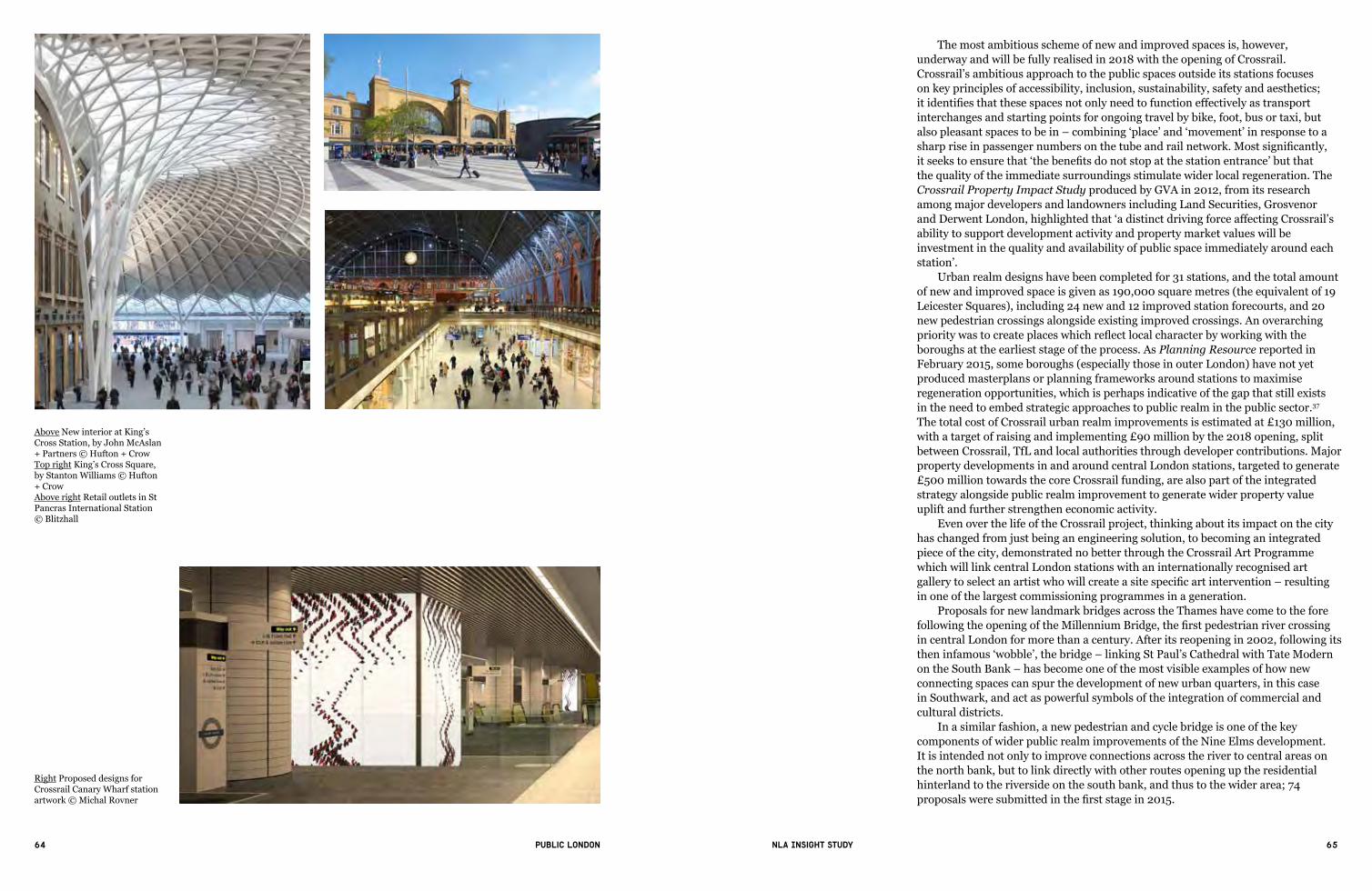
64 65Public London NLA Insight study
The most ambitious scheme of new and improved spaces is, however, underway and will be fully realised in 2018 with the opening of Crossrail. Crossrail’s ambitious approach to the public spaces outside its stations focuses on key principles of accessibility, inclusion, sustainability, safety and aesthetics; itidentifiesthatthesespacesnotonlyneedtofunctioneffectivelyastransportinterchanges and starting points for ongoing travel by bike, foot, bus or taxi, but alsopleasantspacestobein–combining‘place’and‘movement’inresponsetoasharpriseinpassengernumbersonthetubeandrailnetwork.Mostsignificantly,itseekstoensurethat‘thebenefitsdonotstopatthestationentrance’butthatthe quality of the immediate surroundings stimulate wider local regeneration. The Crossrail Property Impact Study produced by GVA in 2012, from its research among major developers and landowners including Land Securities, Grosvenor andDerwentLondon,highlightedthat‘adistinctdrivingforceaffectingCrossrail’sability to support development activity and property market values will be investment in the quality and availability of public space immediately around each station’.
Urban realm designs have been completed for 31 stations, and the total amount of new and improved space is given as 190,000 square metres (the equivalent of 19 Leicester Squares), including 24 new and 12 improved station forecourts, and 20 new pedestrian crossings alongside existing improved crossings. An overarching prioritywastocreateplaceswhichreflectlocalcharacterbyworkingwiththeboroughs at the earliest stage of the process. As Planning Resource reported in February 2015, some boroughs (especially those in outer London) have not yet produced masterplans or planning frameworks around stations to maximise regeneration opportunities, which is perhaps indicative of the gap that still exists in the need to embed strategic approaches to public realm in the public sector.37 The total cost of Crossrail urban realm improvements is estimated at £130 million, with a target of raising and implementing £90 million by the 2018 opening, split between Crossrail, TfL and local authorities through developer contributions. Major property developments in and around central London stations, targeted to generate £500 million towards the core Crossrail funding, are also part of the integrated strategy alongside public realm improvement to generate wider property value uplift and further strengthen economic activity.
Even over the life of the Crossrail project, thinking about its impact on the city has changed from just being an engineering solution, to becoming an integrated piece of the city, demonstrated no better through the Crossrail Art Programme which will link central London stations with an internationally recognised art gallerytoselectanartistwhowillcreateasitespecificartintervention–resultingin one of the largest commissioning programmes in a generation.
Proposals for new landmark bridges across the Thames have come to the fore following the opening of the Millennium Bridge,thefirstpedestrianrivercrossingin central London for more than a century. After its reopening in 2002, following its theninfamous‘wobble’,thebridge–linkingStPaul’sCathedralwithTateModernon the South Bank – has become one of the most visible examples of how new connecting spaces can spur the development of new urban quarters, in this case in Southwark, and act as powerful symbols of the integration of commercial and cultural districts.
In a similar fashion, a new pedestrian and cycle bridge is one of the key components of wider public realm improvements of the Nine Elms development. It is intended not only to improve connections across the river to central areas on the north bank, but to link directly with other routes opening up the residential hinterland to the riverside on the south bank, and thus to the wider area; 74 proposalsweresubmittedinthefirststagein2015.
Right Proposed designs for Crossrail Canary Wharf station artwork © Michal Rovner
Above New interior at King’s Cross Station, by John McAslan + Partners © Hufton + CrowTop right King’s Cross Square, by Stanton Williams © Hufton + Crow Above right Retail outlets in St Pancras International Station © Blitzhall

66 67Public London NLA Insight study
Top Overhead view of the designs for Crossrail Tottenham Court Road Top right Future vision of Paddington Station, once Crossrail has completedAbove New public realm created at Abbey Wood Crossrail Station, the south-eastern terminus of Crossrail
Right The Millennium Bridge, linking Bankside with the City of LondonBelow Proposals for the Garden Bridge, linking Temple and the South Bank, by Thomas Heatherwick and Arup

68 69Public London NLA Insight study
Themosthigh-profileprojectis,however,theproposedGarden Bridge, designed by Thomas Heatherwick, working with Arup, as a highly innovative public garden and pedestrian crossing linking Temple station with the South Bank. Approximately £60 million of the estimated £175 million cost will be provided jointly by the Mayor and Treasury, with the remainder from private funds, and the project is also unusual in being managed by a registered charity (the Garden Bridge Trust). The trust’s stated intention to explore the possibility of using private fundraising events to generate ongoing income for maintenance and repair (the annual estimate for which has been quoted at £3.5m) – which may involve temporary closure – together with the lack of cycle space, has played a part in the wider debate about access to public space.
3.4 Green and blue infrastructure
London is the greenest city (of its size) in the world.38 About 47 per cent of London isgreenspace–ourmostclearlydefinedassetintermsofpublicspace–and 2.5 per cent blue space (rivers, canals, reservoirs).39 Of these the Royal Parks, 5,000 acres of historic parkland across Hyde Park and seven other parks in inner and outer London, are some of London’s biggest green spaces (although they also include 32 miles of road network) and are actually part of the Crown lands but managed by a government agency. With more than 77 million visitors in 2014, a careful balance has to be struck between the primary objective of conserving Grade I listed landscapes and facilitating access and leisure activities. London’s other great open space is the Lee Valley Regional Park, which stretches 26 miles from the River Thames, through inner London and Essex to Hertfordshire, and the management of which, via its statutory body, the Lee Valley Regional Park Authority, is partially funded via a council tax levy on Greater London, Essex and Hertfordshire at the current sum of £0.98 per person per year.40
The Thames and its banks and foreshore are (strictly speaking) London’s largest public space, but it still has major issues in terms of access, although significantprogresshasbeenmadeinthecentre,especiallyalongtheSouthBank.
LeftDaffodilsalongside the Serpentine, Hyde Park, courtesy of The Royal Parks © Indusfoto Ltd
Right The Lee Valley Regional ParkBelow Cycling through the Queen Elizabeth Olympic Park, courtesy of LDA Design © Robin Forster
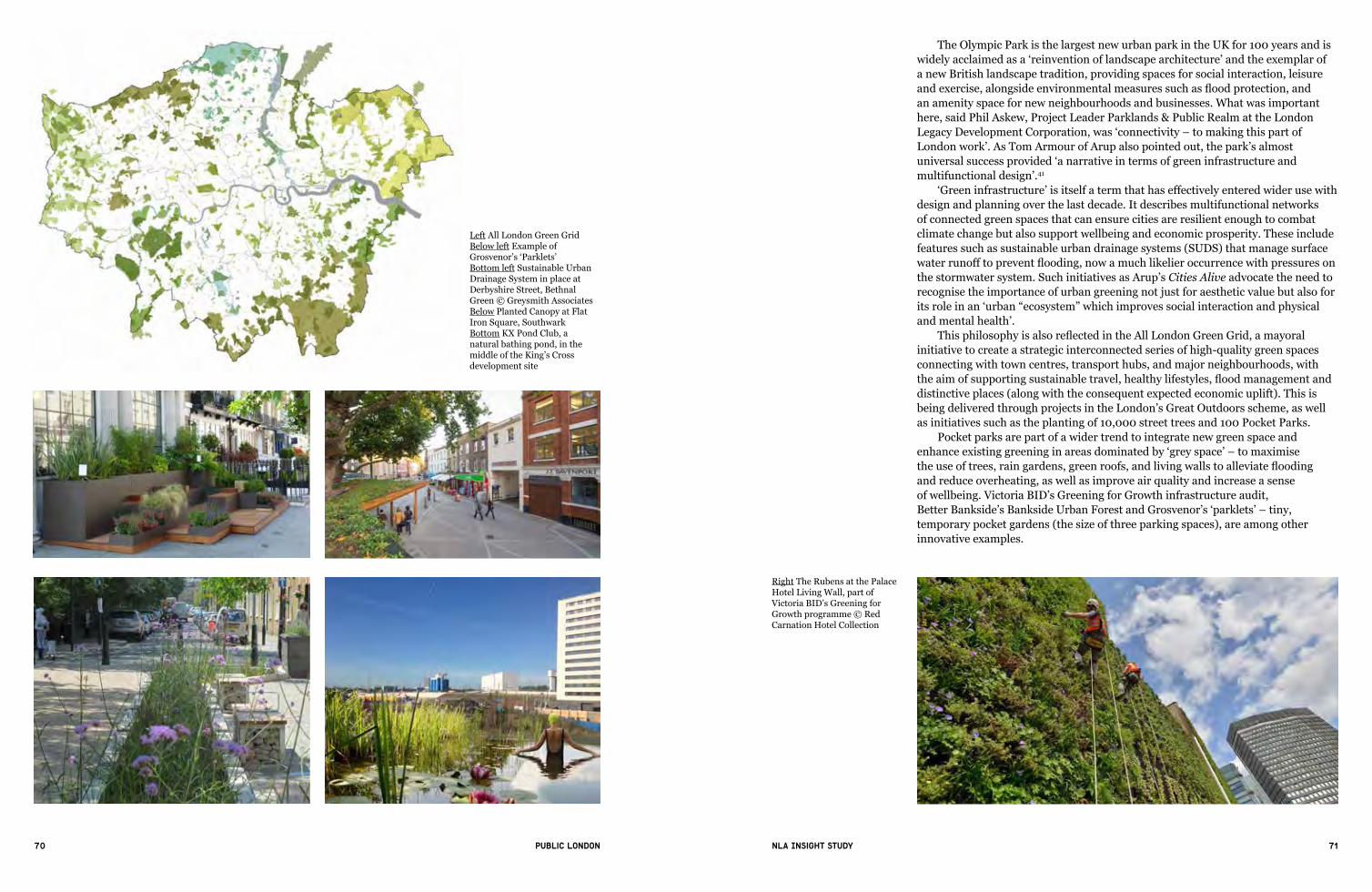
70 71Public London NLA Insight study
The Olympic Park is the largest new urban park in the UK for 100 years and is widelyacclaimedasa‘reinventionoflandscapearchitecture’andtheexemplarof a new British landscape tradition, providing spaces for social interaction, leisure andexercise,alongsideenvironmentalmeasuressuchasfloodprotection,and an amenity space for new neighbourhoods and businesses. What was important here, said Phil Askew, Project Leader Parklands & Public Realm at the London LegacyDevelopmentCorporation,was‘connectivity–tomakingthispartofLondon work’. As Tom Armour of Arup also pointed out, the park’s almost universalsuccessprovided‘anarrativeintermsofgreeninfrastructureandmultifunctional design’.41
‘Greeninfrastructure’isitselfatermthathaseffectivelyenteredwiderusewithdesign and planning over the last decade. It describes multifunctional networks of connected green spaces that can ensure cities are resilient enough to combat climate change but also support wellbeing and economic prosperity. These include features such as sustainable urban drainage systems (SUDS) that manage surface waterrunofftopreventflooding,nowamuchlikelieroccurrencewithpressuresonthe stormwater system. Such initiatives as Arup’s Cities Alive advocate the need to recognise the importance of urban greening not just for aesthetic value but also for itsroleinan‘urban“ecosystem”whichimprovessocialinteractionandphysicaland mental health’.
ThisphilosophyisalsoreflectedintheAll London Green Grid, a mayoral initiative to create a strategic interconnected series of high-quality green spaces connecting with town centres, transport hubs, and major neighbourhoods, with theaimofsupportingsustainabletravel,healthylifestyles,floodmanagementanddistinctive places (along with the consequent expected economic uplift). This is being delivered through projects in the London’s Great Outdoors scheme, as well as initiatives such as the planting of 10,000 street trees and 100 Pocket Parks.
Pocket parks are part of a wider trend to integrate new green space and enhanceexistinggreeninginareasdominatedby‘greyspace’–tomaximise theuseoftrees,raingardens,greenroofs,andlivingwallstoalleviateflooding and reduce overheating, as well as improve air quality and increase a sense of wellbeing. Victoria BID’s Greening for Growth infrastructure audit, Better Bankside’s Bankside Urban Forest and Grosvenor’s‘parklets’ – tiny, temporary pocket gardens (the size of three parking spaces), are among other innovative examples.
Right The Rubens at the Palace Hotel Living Wall, part of Victoria BID’s Greening for Growth programme © Red Carnation Hotel Collection
Left All London Green GridBelow left Example of Grosvenor’s‘Parklets’Bottom left Sustainable Urban Drainage System in place at Derbyshire Street, Bethnal Green © Greysmith AssociatesBelow Planted Canopy at Flat Iron Square, SouthwarkBottom KX Pond Club, a natural bathing pond, in the middle of the King’s Cross development site

72 73Public London NLA Insight study
4. Ownership, funding and management of public space
Public space in London has been shaped by a highly complex series of processes and relationships that involve a much larger range of stakeholder groups than those for individual buildings or developments, and these vary hugely depending on the type, location and origin of the project. With the reduction in public sector funding, the private sector has found a much more prominent role in instigating, leading and delivering many projects in recent years, a consequence also of London’s characteristic tradition of light-touch regulation and control rather than a dominant, singular public vision.42
Thepublicsectorstillplaysasignificantrole,however;boroughsareresponsible for governance, regulation (via byelaws), representing the interests ofthespace’scurrentorpotentialusers,andsupportingandshapingeffectivepartnershipsanddeliverymechanisms.Theyarealsotakingonamoresignificantcoordination role through developing public realm strategies and design guides, often in collaboration with consultants. Perhaps the most decisive factor in the last decade has been the explosion in the growth of BIDs, and the role that they have played as independently funded bodies in shaping places and initiating and managing public realm projects.
4.1 Ownership
Thequestionof‘whoownspublicspace?’hasrisentothetopoftheagendainthepublic debate around how public space in London is used and, most importantly, how it is managed. While Land Registry data gives an incomplete picture, and detailed datasets are unavailable, private ownership of public space in London has almostcertainlygrownoverthelastdecade.However,much‘traditional’publicspace where public access is well established, that we might think is publicly owned, is actually private – in particular the squares of the Great Estates and churchyards such as St Paul’s in Covent Garden.Theboundariesof‘ownership’initswidestsensearenotveryclear–evenlocalauthorityauditsof‘openspace’donot always distinguish between publicly and privately owned land, or even whether there is public access.
Much public realm improvement has been paid for by developers and landowners via S106 contributions but is maintained by local authorities; at the same time those creating new developments and parts of the city are now more clearly engaged in delivering high-quality public realm as a key part of placemaking: the FAQ on the Royal Albert Dock development states, for example, thataswellasopeningup1kmofthewaterfront,‘improvingtheexistingpublicrealm is also integral to the vision’.43 The drastic cut in public sector funding means that the private sector has also had to take over much of the responsibility for maintaining spaces and streets that would normally be managed by the local authority.
The complexity of this issue – and a perception that access to privately owned land is being restricted – has generated an increasingly vocal debate aboutif,howandwhypublicspaceshouldbe‘public’ineverysense.In2011theLondon Assembly Planning and Housing Committee investigated the matter, and concludedthat‘Whileprivateownershipormanagementofpublicspaceisnot,initself, a cause for concern … problems can arise with spaces in which commercial interests prevail over public access’. Its report recommended that the Mayor ensure that appropriate management regimes are negotiated between the public and private sectors at the outset of a project to ensure unrestricted access.44
The writer Anna Minton argues that restrictive management processes – and
4“There are many guardians involved in making the streets of our cities”
Peter Vernon, Grosvenor

74 75Public London NLA Insight study
standards of acceptable/unacceptable behaviour in privately owned public spaces (especially the right to protest), are causing a serious withdrawal of public life and civic engagement that threatens democracy.45 Others have cited overzealous and heavy-handedsecuritystaff(orpolice)preventingpeoplefromtakingphotographsor from cycling, obtrusive CCTV and signs listing prohibited action, barriers and gates – a consequence partly of more restraining anti-terrorism laws brought in the aftermath of 9/11 (including the Serious Organised Crime and Police Act 2005, which restricted the right to demonstrate in and around Parliament Square).
However, it is important to acknowledge that publicly owned space is also equallyregulatedbylocalbyelaws–themodelsetofbyelaws‘forpleasuregrounds, public walks and open spaces’ published by DCLG in 2013 gives local authorities the option to regulate more than 53 categories of activity, from the moreunusual‘interferencewithlifesavingequipment’toarcheryandkite-flying.46 Matthew Carmona at UCL’s The Bartlett points out that the public space of the city is not becoming exclusionary, but that such spaces have always been present in London, and – echoing the recommendation of the London Assembly committee – that a charter for public space could clarify and protect both public and private interests when a project is submitted for planning approval.47 Gated communities without public right of way are more of an issue as visible gates and barriers mean thattheyarebothphysicallyandsociallyclosedofffromtherestofthecity.
Example Charter of Public Space Rights and Responsibilities, proposed by Matthew Carmona, UCL
All public space users have the right to:— roam freely— rest and relax— associate with others— use public space in a lawful manner without the imposition of local controls,unlessstrictlyjustified,forexampleondrinking,smoking,safecycling, skating and dog walking
— collect for registered charities — take photographs— trade (if granted a public licence)— demonstrate peacefully and campaign politically— busk or otherwise perform (in non residential locations)
Public space users have a responsibility to:— respect the rights of others to conduct their business without let or hindrance— respect public and private property— act in a civil and safe manner at all times— avoid littering— keep the peace
Owners and managers of public space have a responsibility to:— respect and protect the rights of all users, including to privacy— treat all users in an equitable and inclusive manner— keep spaces safe within the context of the actions of any reasonable person— keep spaces clean and well maintained— keep spaces open and unrestricted at all times (or otherwise in line with
regulatory stipulations)
Below left Visitors enjoying The Scoop at More London, by Foster + PartnersBelow Stalwart campaigner Brian Haw, Parliament Square, 2010 © Ben Sutherland
Left Berkeley Square, Mayfair, owned by The Berkeley Square EstateBelow left St Paul’s Churchyard, by Townshend Landscape Architects for City of London Corporation

76 77Public London NLA Insight study
Thematerialityofthepublicrealm,influencinghowweexperienceandusepublicspace, plays an essential role in determining character and a sense of place. Historically, the streets of the capital (and other major towns in the UK) were paved with Yorkstone, hewn from the Pennine grits of northern England, and still a preferred paving material in conservation areas and adjacent to listed buildings (e.g. in the City of London). However, over recent decades imported stones such as granites from Brazil and China have become more predominant; they are generally less expensive and easier to maintain, as Yorkstone is porous and can stain more easily. Alteration of a pavement material along a street or other open space can convey (intentionally or unintentionally) a shift in use or a change in ownership and control, and granite, it has been argued, being used more frequently in corporate spaces, is associated more with areas in private ownership.
4.2 Funding
Section 106 agreements, brought in nationally in the Town and Country Planning Act (1990), have traditionally been seen as a major source of capital funding for public realm projects. In these the developer and the council will agree a proportion of the anticipated increase in land value (planning gain) to be diverted to the public sector, to secure the infrastructure needed for the development and/or to mitigate the anticipated impact of it.
In 2008 (the latest information available) a report by the London Assembly Planning and Spatial Development Committee found that 24 per cent of S106 monies in London were being spent on public realm, including streetscape andopenspace.Itacknowledgedthat‘developersgenerallysupporthavingtocontributeto“mitigate”theeffectsoftheirproposals.Buttheyalsoneedtobeclear what is likely to be expected of them at an early stage of the process – and even before they apply for planning permission – to calculate whether their development can be viable.’48 Despite the invaluable contribution that S106 paymentshavemadetopublicrealmenhancement,theyaretiedtospecificlocalities (and boroughs) and this type of investment is therefore quite fragmented; and it remains to be seen whether a potential devolution of planning powers to the Mayor proposed in February 2015 will support a more strategic coordination of S106 contributions.
In 2008 the Community Infrastructure Levy (CIL) was introduced, and can be levied by local authorities on a wider range of developments according to a publishedtariffschedule–alongsidetheMayor’sownCILtoprovide£300milliontowards Crossrail. Although CIL is intended to help boroughs with a better picture of anticipated income, and developers with expenditure, it originally raised concerns (by London Councils in particular) that contributions from developers to fund local infrastructure would be reduced, and consequently that this would have an adverse impact on the delivery of public realm improvements locally.49 By January 2015, 17 of the London boroughs had CIL charging schedules adopted.50
Some boroughs have developed new approaches: the City of Westminster’s Public Realm Credits scheme, adopted in 2011, encourages developers and landowners to invest in the council’s priority projects in return for a public realm creditthatcanbeusedtooffsetafutureplanningobligationrequirement.TheMayor’s Regeneration Fund, High Streets Fund and Outer London Fund have also contributed substantially to supporting targeted interventions in response to specificareasofneed,ashavetheHeritageLotteryFundandlocalandnationalcharitable trusts, especially for parks and green spaces.
As budgets become much tighter, however, more complex funding streams are likelytoemerge,witheachstageofaschemefinancedseparately.BIDshaveplayed
Above Kingly Street, Soho (left), and Portman Square, near Bond Street (right) – both projects fully-funded by the City of Westminster’s Public Realm Credits schemeLeft Public realm beneath The Shard, landscaped by Townshend Architects, funded by Section 106 payments to LB Southwark © Agnese SanvitoBelow Camden Lock © Oleg Brovko

78 79Public London NLA Insight study
a major role in generating seed funding from local businesses that can leverage and be matched by public and other private funding sources. Camden Town Unlimited, for example, led preparation of a £10m long-term public realm plan called Camden Town First, which informed major upgrades at Camden High Street North, and raised a further £3.35m toward further works.
Nevertheless, a major concern is the need to provide revenue funding to support high-quality maintenance and management, beyond the capital funding for new projects. Crowdfunding, levies, and licensing commercial activities – the Royal Parks now gains more than £12m of self-generated income, compared to £6m 10 years ago, for example – are among several options being explored (see also Section 6). LB Camden announced in January 2015 that it was investigating the possibility of following continental European cities such as Paris in setting a visitor levy of £1 per night per bed for hotel stays in central London. This was intendedspecificallytoraise£5mperyearforextrastreetcleaninginpopulartourist areas, including Camden Lock, and other public realm improvements.
4.3 Delivery and management
Whether a space is owned and managed privately, publicly, by a community or viaamixedmodel,theneedforawidelysharedvision,effectivepartnerships,maintaining or creating character and identity, high-quality maintenance and management, and balancing diverse interests and uses remain all important in the success of its design, delivery and operation. Getting public realm projects delivered can be an exceptionally complex and time-consuming operation, as a multitude of professions and organisations can be involved, from architects, developersandlandscapedesigners,totrafficengineers,highwaysdepartmentsand utility companies, as well as boroughs and other statutory bodies; this is then overlaid with the need to engage not only the landowner but more importantly a diverse range of users from pedestrians and cyclists to private car owners, taxis, bus and van drivers, and freight operations. The public realm is everyone’s responsibility but at the same time no-one’s responsibility – to do it well, in the wordsofPeterHeathatAtkins,youneedtobean‘urbandesigndiplomat’.
Alongside good design, active management of public space has become essential to its sustained use and adoption – well-used sites attract interest from passers-by and can become self-policing. The balance between simple design that isstraightforwardtomaintainandmanageandavoidsbeing‘sanitised’whilealsoclean,safeandattractivetousersatdifferenttimesthroughouttheday,weekandyearisanexceptionallydifficultonetostrike.Successfulpublicrealmprojectsaremore complex and time-consuming than any other form of development, because thestakeholdersaresovaried,soconsiderationofaneffectivemanagementscheme, as well as design, has to be integrated right at the start of the project.
Four types of management models have emerged: public (e.g. borough), especially for parks and green spaces; private (e.g. through a service delivery contract or development agreement); community organisation or charity, especially on smaller sites, often directed or supported by a wide volunteer base; and public/private mix: either a BID or a publicly owned site where management or service tasks are contracted out.
It is widely acknowledged that privately owned estates have played an important role in demanding and driving up quality standards, especially in maintenance. This goes far beyond ensuring that the streets and spaces are safe and clean – many privately owned and managed estates and BID districts have implemented changing events programmes tailored to both occupiers and wider public interest to support activity throughout the day, with early evening now
equally as important as lunchtime. More London, for example, is estimated to have 10 million visitors a year. Refreshing events and temporary uses – for example via seasonal theming – are also essential in terms of attracting new visitors to the space while also retaining the interest and engagement of existing users.
There is much greater understanding within local authorities of the importance of BIDs in particular as catalysts changing the culture of management, facilitators initiating district-wide strategies, and in maintaining places that can attract and retain business and residents. The Heart of London BID, established in 2005, for example, delivers services in street cleaning, street safety and marketing in addition to the existing services provided by the City of Westminster through a joint Service Level Agreement.
Management plans have to incorporate strategic approaches and visions that support the ambitions for that particular place, as well as clearly articulated divisions of responsibility. At King’s Cross, for example, the Section 106 agreement states that LB Camden could adopt the streets and public areas, but in any case, unrestricted public access to the area would be protected. A Public Realm Strategy and an Access and Inclusivity Statement set out the objectives and standards for the management of the public spaces, including maintenance standards, principles forinclusivedesignanddefinedpermittedclosures.51
Below Granite used in the More London development, by Foster + PartnersBelow right Yorkstone at New Street, Bishopsgate, from Marshalls for City of London CorporationBottom Festival at Hyde Park, June 2010 © John WrightBottom right Crowds watching the World Cup in Exchange Square, Broadgate, City of London

80 81Public London NLA Insight study
5. Measuring the value of public space
‘Themeasureofacity’sgreatnessistobefoundinthequalityofitspublicspaces,its parks and squares’, wrote John Ruskin in the 19th century. One of the most significantoutcomesofthevastexpansionofpublicrealmimprovementacrossLondon is that policymakers, the property industry and the public agree that public space plays a vital role in making a liveable, successful and economically thriving city. But even though it appears that everyone wants to improve the environment, this has not always translated easily into investment.
Much of the focus for both private and public sectors has been on developing thebusinesscaseforpublicrealmimprovementinordertoattractfinancing. While better public space has been linked to increased property values, better social relations, and improved public health, there is still relatively little robust evaluation of new and improved public spaces and their long-term potentialbenefits.
This is probably in part owing to the length of time needed to deliver projects, their variety of size, type and scale, and the exceptionally complex and variable patterns of use that they generate, unique to each locale. As well as more rigorous evidence to support the case for investment, we also need a greater understanding thatpublicspacesareconstantlyinastateoffluxandflow,andneedtoberevisitedfor regular evaluation and monitoring.
5.1 What benefits does high-quality public space bring?
In 1987 the Brundtland Report52famouslyestablishedadefinitionof‘sustainabledevelopment’ as the intersection of economic, social and environmental goals. Since then, with rapid urbanisation happening around the world, high-quality public space is widely accepted as being an essential component in achieving a rangeofbenefitsthataresynonymouswithsustainableurbandevelopment, such as:
Economic: direct and indirect employment; inward investment and business location; attraction for workforce; uplift in property and rental values; visitor, worker and resident spending; amenity space for the growing SME sector
Environmental: improving air quality; reducing pollution; cooling urban heat islands; increased biodiversity; wildlife habitats; supporting/providing infrastructure for greening measures/green energy generation; reuse of redundant and derelict spaces; food growing
Social and cultural:confidenceandgreatersenseofplace;greatersocialandcultural use/capital; community cohesion; improved health and wellbeing; crime reduction and increased safety; increased accessibility; fewer accidents; increased opportunities for learning, skills development and volunteering; places for play for children and young people
Theroleofpublicspaceinintegratingthesebenefitshasbeenwidelyembeddedinpolicymakingandplanning,especiallysincethecreationofthefirstdraftLondonPlan in 2004. On a practical, delivery level, however, Jan Gehl’s advocacy of a ‘people-centred’approachthatstartswithunderstandinghowpeopleusepublicspacehasbeenequallyinfluentialinchangingattitudes,andmanyofhisideascanbe traced through completed projects.
5“Shared public space is the essence of London being a city for all”
Dame Tessa Jowell

82 83Public London NLA Insight study
5.2. Financial and economic value
Investing in public realm is often measured in terms of community contributions through planning – British Land’s total investment in this area, for example, in 2013/14 was £6 million, a more than doubling of its spend in each of the two previousfinancialyears.53 Presenting the best business case for investment in the publicrealm,however,meansdemonstratingtheadditionalfinancialvaluethathigh-quality public realm can generate over a lower-quality one and how it can also unlock further funding. This is not a quick win, but often a longer-term strategy – something in which the Great Estates have led the way not simply through massivefinancialcontributions,butthroughdevelopinglong-termconstructivepartnerships with local authorities and communities. These lessons are being taken on by newer developers and housebuilders. According to Stanhope, the creationoftemporaryandpermanentlandscapingwas‘themostcriticalpieceofthe jigsaw’, in the creation of Ruskin Square in Croydon, a mixed-use development ofoffices,retailandresidential.Heremufarchitecture/arthavecreatedpedestrianroutes to a new station entrance, commercial break out and leisure spaces, private residentialgardens,anddefinedstreetedgesthatconnectwiththesurroundingstreetscape. The space also includes provision of cricket nets, a wilderness garden, multi-use games area and a program of events.
Thefinancialvalueofpublicrealmimprovementremainsanunderdevelopedarea of research partly because the scale of interventions varies from small, local improvementstolarge-scaleregenerationprojectsandthusithasbeendifficulttocompare data (of which only a limited amount is publicly available) on a like-for-like basis. However, CABE Space’s Paved with Goldreportin2007wasinfluentialinshowinghowinvestmentingoodstreetscapedesigngeneratesfinancialreturnsaswellaswiderpublicbenefits,using10casestudyhighstreetsacrossLondon, from North Finchley to Clapham. It used the pedestrian environment review system (PERS), a tool developed by the Transport Research Laboratory for measuring the quality of a particular high street from the pedestrian’s point of view. By linking the PERS results with data on house prices and retail rents, the study showed that achievable improvement in street design quality can add an average of 5.2 per cent to residential prices and an average of 4.9 per cent to retail rents. This system has been extended into the Urban Design Tool Kit – Valuing Urban Realm created by TfL from extensive research between 2004 and 2011 to enable boroughs and developers to quantify the value of certain public realm attributes.
Evidence does exist that suggests public realm and streetscape improvements have a positive impact on retail footfall, turnover, property values and rental yields,particularlyforwell-designedprojects.Nevertheless,itisalsodifficulttomeasure the exact gains that an improved public realm can add, especially because these are so often closely intertwined with wider regeneration initiatives and other interventions relating to wider social, economic and environmental measures in health, jobs, skills, business growth incentives, sustainability, community outreach,andeducation,andbecausedevelopers,occupiers,long-termfinanciers,local authorities and communities all have complex vested interests. British Land gained a 15.5 per cent valuation uplift of its Regent’s Place campus in 2013/14, of which its high-quality and well-managed public realm and diverse food and leisure offerundoubtedlyhaveaparttoplayalongsidebroaderplacemakingfactorssuchas a diverse occupier mix and strong transport links.
The picture is more complicated as regards wider or indirect economic benefitsandthecorrelationbetweenbetterpublicspacesandratesofjobcreationfor local people and increased numbers of business start ups.54 More rigorous
Paved with goldThe real value of good street design
Design better streets
Right East Village, StratfordMiddle right Designs for Ruskin Square, Croydon, landscaped by muf architecture/art for StanhopeBottom right Market at Regent’s Place, Euston Road, owned by British Land, managed by Broadgate EstatesBelowCoverof‘PavedWithGold – The real value of good street design’, CABE Space, 2007
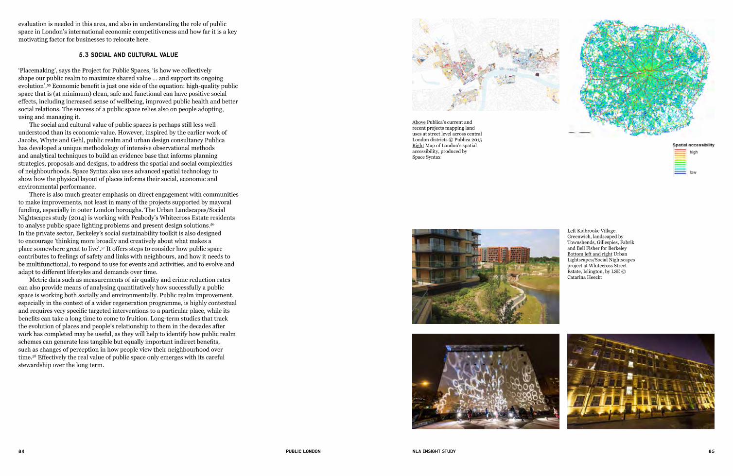
84 85Public London NLA Insight study
evaluation is needed in this area, and also in understanding the role of public space in London’s international economic competitiveness and how far it is a key motivating factor for businesses to relocate here.
5.3 Social and cultural value
‘Placemaking’,saystheProjectforPublicSpaces,‘ishowwecollectivelyshape our public realm to maximize shared value … and support its ongoing evolution’.55Economicbenefitisjustonesideoftheequation:high-qualitypublicspace that is (at minimum) clean, safe and functional can have positive social effects,includingincreasedsenseofwellbeing,improvedpublichealthandbettersocial relations. The success of a public space relies also on people adopting, using and managing it.
The social and cultural value of public spaces is perhaps still less well understood than its economic value. However, inspired by the earlier work of Jacobs, Whyte and Gehl, public realm and urban design consultancy Publica has developed a unique methodology of intensive observational methods and analytical techniques to build an evidence base that informs planning strategies, proposals and designs, to address the spatial and social complexities of neighbourhoods. Space Syntax also uses advanced spatial technology to show how the physical layout of places informs their social, economic and environmental performance.
There is also much greater emphasis on direct engagement with communities to make improvements, not least in many of the projects supported by mayoral funding, especially in outer London boroughs. The Urban Landscapes/Social Nightscapes study (2014) is working with Peabody’s Whitecross Estate residents to analyse public space lighting problems and present design solutions.56 In the private sector, Berkeley’s social sustainability toolkit is also designed toencourage‘thinkingmorebroadlyandcreativelyaboutwhatmakesaplace somewhere great to live’.57Itoffersstepstoconsiderhowpublicspacecontributes to feelings of safety and links with neighbours, and how it needs to be multifunctional, to respond to use for events and activities, and to evolve and adapttodifferentlifestylesanddemandsovertime.
Metric data such as measurements of air quality and crime reduction rates can also provide means of analysing quantitatively how successfully a public space is working both socially and environmentally. Public realm improvement, especially in the context of a wider regeneration programme, is highly contextual andrequiresveryspecifictargetedinterventionstoaparticularplace,whileitsbenefitscantakealongtimetocometofruition.Long-termstudiesthattrackthe evolution of places and people’s relationship to them in the decades after work has completed may be useful, as they will help to identify how public realm schemescangeneratelesstangiblebutequallyimportantindirectbenefits,such as changes of perception in how people view their neighbourhood over time.58Effectivelytherealvalueofpublicspaceonlyemergeswithitscarefulstewardship over the long term.
Above Publica’s current and recent projects mapping land uses at street level across central London districts © Publica 2015 Right Map of London’s spatial accessibility, produced by Space Syntax
Left Kidbrooke Village, Greenwich, landscaped by Townshends, Gillespies, Fabrik and Bell Fisher for Berkeley Bottom left and right Urban Lightscapes/Social Nightscapes project at Whitecross Street Estate, Islington, by LSE © Catarina Heeckt

86 87Public London NLA Insight study
6. Future directions: what will happen in the next 10 years (and more)?
In the coming decades London’s public realm will be subject to intense pressures, owing to the rapid growth and changing demographics of the city’s population, the challenges of climate change, and not least the continuing infrastructure investment and upgrade to maintain London’s quality of life alongside its status as a leading world city and economic centre. Future public realm projects, and those currentlyindevelopment,willbeshapedsignificantlybytheneedforincreasingdensification,includingthecompletionofmoretallbuildings.Allpublicspacewill need to ’work harder’ to serve more users and support urban resilience. Over the coming decades we will see the realisation of a vast range of new and improved public spaces, particularly those focused around infrastructure, with the completion of the Crossrail urban realm schemes as well as those forming part of the Roads Modernisation Plan, but also in areas of major urban regeneration and the emergence of new neighbourhoods. It will be interesting to see if and how the emphasis on connectivity and use of public realm improvement as a means of stimulatingwiderregenerationtranslatesintotangiblebenefits.
Alongside this, projects such as the Thames Baths, Garden Bridge and Nine Elms-to-Pimlico Bridge (under scrutiny from Westminster Councillors because of its impact on Pimlico’s public space by the river) will again underscore the importance of the river and its banks as one of London’s great public spaces.
6.1 How is London changing?
London is forecast to undergo an extraordinary population boom to 11.3 million by 2050, adding an additional 3 million people from a current total of 8.3 million.59 Total London jobs are projected to increase to 6.3 million in 2050, from 4.9 million in 2011. More people therefore mean much more intensive pressure not just on the roads and pavements but on housing, public services, water and energy supplies, and digital infrastructure, as well as increased congestion on roads and public transport. London has an increasingly ageing population – the number of people over 65 is expected to more than double – but also a baby boom with an increasing birthrate. Identifying and integrating the needs of both the oldest and the youngest Londoners must therefore be a higher priority for the development and management of public realm. There may also be radical changes in where and how we use public space as technological innovation continues: if the concept of driverlesscars(currentlybeingtrialledinLBGreenwich)takesoff,forexample,theideaof‘sharedspace’willmovetoanotherlevel,andtheamountofparkingspace needed could drastically reduce.60
6.2 Infrastructure
The London 2050 Infrastructure Plan, published in 2014, sets out the Mayor’s ambitions to deliver the infrastructure required for a growing population, including an additional 9,000 hectares of accessible green space across London to support leisure, health and amenity uses as well as economic and environmental ones, alongside a 50 per cent increase in public transport capacity.61 The wider scope of urban built public space is, however, not directly addressed, but the question of how it (as well as green space) will deal with more intensive use is nevertheless an essential one.
For roads and transport hubs, the focus will continue to be on the need to findmuchmorecreative,innovativeandflexiblewaystoensurethatpublicrealm
6“We must strengthen the critical contribution of landscape, urban design
and public art in making great places” Sir Terry Farrell

88 89Public London NLA Insight study
Top left Designs for the south landing point of the Garden Bridge, by Thomas Heatherwick and Arup Left Proposals for Thames Baths, view west from Victoria Embankment © Picture Plane & Studio Octopi
Above Designs for new public space at Wood Wharf, Isle of Dogs, by Allies and MorrisonRight Example of TfL’s draft design guidance for uses outside stations © Grimshaw and TfL

90 91Public London NLA Insight study
providesasenseofplaceaswellasfacilitatingefficientmovementthroughthecity.TfL’s public realm design guidance for bus, tube, rail, tram and river stations aims to complement the work of the Roads Task Force (see Section 3) and Crossrail in identifying how public space within and around tube stations can be unlocked accordingtoitsspecificoperationalandcommunityneeds,aswellasofferingopportunities to tap into commercial value and the local economy.62 In reality this means understanding in more detail how patterns of use change throughout the dayandweek,andinvestigatinghowspacescanbeadapted–or‘hacked’–fortemporary community and retail uses, such as educational classes and markets, in stationsatoff-peaktimes,whichwouldprobablynothavebeenconsideredevenfiveyearsago.
Because of the pressures on land use, generating more new public space will mean fundamentally rethinking how we use existing infrastructure. The Thames Tideway Tunnel(or‘supersewer’)hasoutlinedproposalstocreatefivenewpublicspaces along the riverside, including jetties that hide shafts connecting to the main sewer.TheKing’sCrossredevelopmentinparticularhasshownhowbrownfieldland around major transport hubs can be transformed into new public realm on a large scale, but smaller projects such as PTE’s Arundel Square in Islington (2011), which doubled the available open space in the square by decking over an adjacent railway cutting and building new homes, demonstrates how bolder approaches can be implemented. The mayoral announcement in February 2015 of more than 70locationsacrossthecapitalwheretheintroductionoftunnels,fly-undersanddeckingcoulddeliverbenefitsinlinewithRoadsTaskForcerecommendationscould also have profound implications for opening up completely new public spaces.
6.3 Buildings and neighbourhoods
The Leadenhall Building, with its seven-storey public space at ground level linking to St Helen’s Square, has already shown how landmark tall buildings in London are generating new public realm that is integrated into the wider city context. Here theSection106agreementincludeddetailedandspecificprovisionsforpublicaccess recognising that while this public space remains private land, even during the holding of private and public events no less than 70 per cent of the space, and the north-south pedestrian route underneath the building, must remain open for the public to pass through freely. The S106 agreement for 20 Fenchurch Street (the Walkie Talkie) is equally detailed, addressing free public access to and minimum opening hours and capacity of the Sky Garden, the provision of which was also stipulated as a planning obligation (although the visitor management plan is not yetapproved).AsAnnieHampsonandGwynRichards,ChiefPlanningOfficerandHead of Design at the City of London Corporation respectively, point out in a New London Quarterly interview, using the upper storeys of tall buildings for public benefitis‘verymuchpartofthatwiderdebateoftakingpressureoffthepavementsand a vision for the City as a three-dimensional environment’.63
Successfully accommodating more intensive use of public realm in a more densely populated city will mean re-examining how we use all types of buildings. What is most important to consider is how the building operates successfully both at ground level and in relation to the urban fabric around it. At South Quay, for example, Maccreanor Lavington, commissioned by LB Tower Hamlets, have produced a draft masterplan that outlines some design principles which will be used to help deliver a high quality and more coordinated public realm among severaltallresidentialtowersplannedbydifferentdevelopers.
More innovative and better quality mixed-use development may be the key to increasing density while retaining high-quality and actively used public
Above llustration of how Arundel Square, Islington, was completed, by decking over a railway cutting to double the public green space, by Pollard Thomas EdwardsLeft Two examples of the public spaces provided by the Thames Tideway Tunnel, at Blackfriars Bridge and Victoria Embankment

92 93Public London NLA Insight study
spaces (especially streets and high streets), particularly in town centres in outer London. Maccreanor Lavington’s report on Accommodating Growth in Town Centres for the GLA (2014) argues for a more intelligent balance of residential and commercial uses that, for example, encourages developers to invest in ground-floorusesbypartiallyfittingoutsuchspacesandprovidinganopportunityforSMEs, thus keeping the street activated, rather than leaving blank frontages and an unwelcomingenvironment.Theyalsopointoutthaturbancentrescontain‘morefragmented areas of space, sometimes considered residual, which are also due attention’–indeed,withgreaterintensificationitisthesesmallerspacesthatwillbecomeessentialincreating‘necessarybreaks’fortheresident,workerorvisitor.64
Ensuring proper collaboration and consultation with local communities will be ever more important as public spaces are used more intensively and the city seessignificantchange.PeckhamSquareisanexampleofa‘co-design’project,commissioned by Southwark Council working with Carl Turner Architects to help shape the future for Peckham Square in collaboration with the community, using local knowledge to develop a structured plan for the space.
Designers,developersandplannerswillalsoneedto‘capitaliseonspilloutspaces activating edges of public spaces’. This dissolution of the building fabric and the public realm has already become embedded in the way we use public space, especiallyincentralLondon.Urban‘oases’–spacesoff(butoftenvisiblefrom)thestreet but publicly accessible outside buildings, especially courtyards – will become even more important as places to sit, meet and take a pause. Cultural institutions have led the way in this regard, in particular the Royal Academy, Somerset House, the British Museum and, to a lesser extent, the Victoria and Albert Museum.
Onamuchwiderscale,thisactivationofthe‘edges’couldbeextended,morecontroversially,toare-evaluationoftheouterboundariesofgreenfieldland(theGreen Belt)currentlyprotectedbylegislationandconsideredasa‘sacrosanctpatchworkofmedievalfields’(evenbytheLondonInfrastructurePlan).65 Yet, as theLondonSocietyargues,‘ourtownsandcitieswilleachneed,atsomelevel,tointegrate with their green belts; whether through the release of parcels on the city fringe, expansion of existing satellite towns or development of new settlements elsewhere’. Careful positioning of localised development around new infrastructure in outer London could provide an opportunity for sustainable, high-density places to emerge that are fully integrated with existing green space.
6.4 Future funding, delivery and management
Alongside more intense pressure on the use of public space will be the exacting challenge of continuing to fund, deliver and manage high-quality projects in order tobuildonthesuccessesofthepastdecade.Fundingwillbeanespeciallydifficultobstacle owing to the drastic cuts in local authority budgets, and the private sector willplayanevenmoresignificantroleasservicesareoutsourced.Thismaypresenta quandary as well as an opportunity for BIDs, whose aim has been to provide business-funded additional enhancements to public spaces above and beyond local authority service provision (such as street cleaning). Being funded by levy income, BIDsthemselvesarealsovulnerabletofluctuationsintheeconomy.
TheemergenceofpropertyownerBIDs,thefirstbeingvotedonintheHeart of London BID in summer 2015, signals a positive step in moving forward with more strategic, longer-term views on public realm strategies than many (especially smaller) occupier BIDs can currently achieve. Similarly, as local and national government control reduces, subregional and placemaking partnerships, such as the Cross River and the West End Partnerships, could become more important as delivery and management mechanisms and help to resolve approaches that are
19
VISION MAP
South Dock
Mill
wal
l Inn
er D
ock
Figure V1 Vision Map
Podium (1-2 storeys)
Plinth (3-10 storeys)
Taller element (10+ storeys)
Existing building / development unlikely
Non-residential active frontage
Dockside access
Improved dockside walking & cycling route
New / improved walking & cycling route
Destinations
Principal public open space
Left Public realm at ground level of The Leadenhall Building, by Rogers Stirk Harbour + PartnersMiddle The Sky Gardens at 20 Fenchurch Street, courtesy of Land Securities and Canary Wharf GroupBottom LB Tower Hamlets and Maccreanor Lavington’s masterplan for South Quay

94 95Public London NLA Insight study
currently fragmented. Green space is not usually seen as economically productive – but in fact
it can often link to a wider range of funding sources (especially European) in termsofenvironmentalbenefitsofgreening.Muchattentionisbeinggiventoexploring broader partnerships and more innovative ways to support the ongoing managementofparksandgreenspacesinparticular.‘Greenprescribing’–GPsformally recommending walking for health physical activities in green spaces – is one option if public health funds can be diverted towards them, as well as endowments, living legacies and community land trusts. LB Camden, for example, isworkingwithNesta’sRethinkingParksscheme(2014–15)on‘Bloomsbury Squared’, which will test new business models exploring how friends’ groups, academic institutions and resident and business associations could contribute financiallytomaintainingtheirlocalparksandsquares.66‘Park Hack’, by Groundwork London, LB Hackney and Gensler will investigate how new services (suchaspop-upmeetingspaces)canbeofferedtolocalbusinesses,withoutreducing the accessibility of Hackney parks to the wider public. Crowdfunding for capital projects has also risen up the agenda, inspired by international projects such as the Luchtsingel, a wooden pedestrian bridge in Rotterdam made of 17,000 individually sponsored planks, and the 123rd Street Garden in Harlem, New York.67 In London, The Line successfully raised over £140,000 via crowdfunding in less than eight weeks, enabling a permanent outdoor world-class sculpture walk to open in east London this Spring.
Even though so much has been achieved, we will need to sustain innovation as well as investment. There are still many challenges for smaller landowners and developers in funding public realm projects, and in improving land with much lower value. There is still huge potential in upgrading atypical spaces, underground and on top of buildings, railway arches (as is being proposed at London Bridge) andotherstructures,andoninfillsites:‘frackingLondonforspace’,asGilesCharlton of Spacehub describes it. At the same time – with the loss of expertise and skills especially in the public sector – there will be a much greater need for even further far-reaching interaction and collaboration to devise public space solutions that deliver meaningful places that work. This also applies on the macro-levelas‘shatterzones’areoftenapparentbetweenLondonboroughboundariesand quality public realm often falls through the gaps. Above all we need to ensure that public realm remains at the top of the agenda – to focus on a key question that LucyMusgraveofPublicaandothershaveraised:‘whoischampioningthecivic?’Visioning,aneffective‘place-based’approach,strategicthinkingandleadershipare vital for the sustained success of London’s places and spaces.
Left Example of the co-design work occurring at Peckham Square, with Carl Turner ArchitectsBottom left Interior of the British Museum © William WarbyBottom right The Edmond J. Safra Fountain Court, Somerset House © Richard Bryant

96 97Public London NLA Insight study
Above Example of Park Hack, in Hackney © Gensler and Groundwork LondonBelow The 123rd Street Garden, Harlem, New York
This page Examples of the sculptures likely to be found along the path of The Line, east London: Abigail Fallis, DNA DL90, courtesy of Pangolin London and the artist | Thomas J Price, Network, courtesy of Hales Gallery, London © ThomasJPrice|PiotrUklański,Untitled (The Thing), courtesy of the artist and Gagosian Gallery | Eduardo Paolozzi, Vulcan, courtesy of Pangolin London and the artist’s estate

98 99Public London NLA Insight study
Olympic Park, courtesy of LDA Design

100 101Public London NLA Insight study
7. Recommendations
1) London needs a code of practice to ensure public space is public for allOver the last few years there has been considerable debate about the accessibility and use of privately owned public space (POPS). London’s historic, complex patchwork of land and property ownerships indicates that what matters, is not who owns the space, but how it is managed and maintained.
New London Architecture supports the creation of clear guidelines about the use of all public spaces, regardless of ownership. The London Assembly report ‘PublicLifeinPrivateHands’of2011calledforclearguidanceonhowboroughscould approach the provision and design of public realm and how subsequent management responsibilities can be negotiated between boroughs and developers.
Matthew Carmona, Professor of Planning and Urban Design at the Bartlett School of Planning at UCL has proposed a form of words that could be used by local authorities to ensure greater clarity around the provision and management ofallnewpublicspacesatplanningstage.Carmonaproposesthat:‘Withoutletor hindrance all public space users have the right to roam freely, rest and relax, associate with others, use public space in a lawful manner without the imposition oflocalcontrolsunlessstrictlyjustified,forexampleondrinking,smoking,safecycling, skating, and dog walking, collect for registered charities, take photographs, trade (if granted a public licence), demonstrate peacefully and campaign politically, busk or otherwise perform (in appropriate non residential locations).’
2)Londonneedsmoreexpertisein‘placemaking’Publicrealmisdeliveredbyamyriadofdifferentstakeholdersfromarchitectstolandscape architects, highways engineers to businesses organisations, creating a complex set of negotiations and interests. But who is championing the quality andidentityofplace?AshasbeenadvocatedbytheFarrellReview,thebuiltenvironmentindustryneedstodevelopmoreexpertisein‘placemaking’.Publicrealm, when considered at the start of a project, can be a key driver in stimulating wider placemaking activity and generating civic identity.
As expertise in public realm and urban design is being lost in the public sector due to funding cuts, skills in this area must also be developed and shared togiveplanningauthoritiesconfidenceinenablinghigh-qualitydevelopmentandinvestment in public realm and embedding a strategic approach.
3)Utilitycompaniesshouldnotbeallowedto‘wreck’thepublicrealmAlltoooften,London’sstreetsareduguporclosedoffbyutilitiescompanies,causing disruption and lower-quality replacement works. London needs to develop more strategic city-wide coordination of work by utilities companies. Business Improvement Districts (BIDs) should be given more powers to coordinate and ensureahigherqualityfinishorreplacement.
4) More innovative solutions are needed to deliver better public space in low-cost areasWhile major regeneration areas of London and central investment zones continue to see investment going into public realm, more innovation is needed in generating and combining funding streams to ensure adequate investment in lower-cost areas of the capital. This is equally important to support long-term maintenance and management. As London continues to grow, there is still huge potential in upgrading atypical spaces, underground and on top of buildings, railway arches, andoninfillsites.
7
102 103Public London NLA Insight study
1. The London Plan, March 2015: Annex Six: Glossary.
2. Westminster Way: A Public Realm Manual for the City (City of Westminster, 2003 and later editions), glossary.
3. The Social Value of Public Spaces (Joseph Rowntree Foundation, 2007).
4. Kit Malthouse, SMEs in London’s Economy (GLA Intelligence Unit,2014?);presentationavailableathttp://www.london.gov.uk/moderngov/documents/s22201/SMEs%20in%20Londons%20Economy.pdf (accessed 10 March 2015).
5. The Global Financial Centres Index is published every six months; see http://www.zyen.com/research/gfci.html (accessed 10 March 2015).
6. ‘London’s“EntertainmentEconomy”keepspeoplespendinginthecapital’ , CBS Outdoor; http://www.outdoormediacentre.org.uk/outdoor_advertising_info/news/Latest_News/item/3974 (accessed 10 March 2015).
7. KeithNHampton,‘Peoplearemorelikelytospendtimetogetherin public spaces than they were 30 years ago’, London School of Economics and Political Science (LSE) daily blog on American politics and policy; http://blogs.lse.ac.uk/usappblog/2014/07/11/people-are-more-likely-to-spend-time-together-in-public-spaces-than-they-were-30-years-ago/ (accessed 10 March 2015).
8. Keep Britain Tidy, Local Environmental Quality Survey report of England (2013/14).
9. ‘WilliamH.Whyte’,biographyatProjectforPublicSpaces:http://www.pps.org/reference/wwhyte/ (accessed 10 March 2015).
10.‘JanGehl’,biographyatProjectforPublicSpaces:http://www.pps.org/reference/jgehl/ (accessed 10 March 2015).
11. Towards a Fine City for People: Public Spaces and Public Life (Gehl Architects, Central London Partnership and Transport for London, 2004), summary.
12.FredKent,‘CityCommentary:London’,1Sept2003,ProjectforPublic Spaces; http://www.pps.org/blog/london/ (accessed 10 March 2015).
13. Matthew Carmona and Filipa Matos Wunderlich, Capital Spaces: The Multiple Complex Public Spaces of a Global City (Routledge, 2012), p 39.
14. Richard Rogers, speech to The Observer conference on regeneration, 2002, quoted at http://www.theguardian.com/society/2002/jul/21/regeneration.comment (accessed 10 March 2015).
15. Design for London online archive at UCL Bartlett website: https://www.bartlett.ucl.ac.uk/architecture/research/projects/design-for-london (accessed 10 March 2015).
16. ‘PublicandStakeholderConsultationonaVariationOrdertoModifythe Congestion Charging scheme: Impact Assessment’ (Transport for London, January 2014).
17 Quality Streets: Why Good Walking Environments Matter for London’s Economy (Central London Partnership, 2006), p 2.
18. Carmona and Matos Wunderlich, Capital Spaces (2012).
19. A Place for People: Proposals for Enhancing Visitor Engagement with Parliament’s Environs (Hansard Society, 2011), p 7.
20. http://legacy.london.gov.uk/mayor/auu/100_public_spaces.jsp (accessed 10 March 2015).
21. Carmona and Matos Wunderlich, Capital Spaces (2012), p 42.
22. More than 400 London squares are protected by law under the London Squares Preservation Act 1931.
23. A Campaign for London Squares (English Heritage, 2000), p. 3.
24. Information from Sarah Porter HOLBA, February 2015.
25. London’s Business Improvement Districts (Report for GLA by Shared Intelligence and the Association of Town & City Management, 2013).
26. Hackney Council, Public Realm Strategy (Local Development Framework Supplementary Planning Document (2012).
27. Action for High Streets (Mayor of London/GLA, 2014).
28. Learning from London’s High Streets (Mayor of London/GLA, 2014), p 9.
29. The Portas Review: An Independent Review into the Future of our High Streets (2011), p 6.
30.RichardSennett,‘ThePublicRealm’,http://www.richardsennett.com/site/senn/templates/general2.aspx?pageid=16&cc=gb (accessed 10 March 2015).
31. Britain’s Pop-Up Retail Economy (Centre for Economics and Business Research, 2014).
32. Information from Camden Town Unlimited, February 2015.
33.PresentationbyRossBaileyofAppearHereatNLA‘London’sTownCentres and High Streets’ conference, 11 December 2014.
34.BenDerbyshire,‘Superbia:IntensifyingtheSuburbs’,Planning in London (July – Sept 2014), p 47.
35 Streetscape Guidance – Consultation Draft (Transport for London, 2015), introduction.
36. London Cycling Campaign interview (Ben Plowden), 2013.
37.SusieSell,‘HowLondon’sPlannersareSeekingtoTakeAdvantageofCrossrail’s Regenerative Potential’, Planning Resource, 13 Feb 2015.
38.‘LondonKeyFacts’,LondonCouncils,http://www.londoncouncils.gov.uk/londonfacts/default.htm?category=8 (accessed 10 March 2015).
39.‘KeyLondonFigures’,GreenspaceInformationforGreaterLondonhttp://www.gigl.org.uk/our-data-holdings/keyfigures/ (accessed 10 March 2015).
40.‘HowisLeeValleyRegionalParkAuthorityFunded?’,LeeValleyRegional Park Authority, http://www.leevalleypark.org.uk/en/content/cms/corporate/business-finance/finance/ (accessed 10 March 2015).
41. ‘HowDidDesigningtheOlympicParkInfluenceLandscapePractice?’,LandscapeInstitute/BuildingCentreevent,22Jan2015.
42. Carmona and Matos Wunderlich, Capital Spaces (2012).
References
43. Royal Albert Dock, website FAQs, http://www.royal-albert-dock.com/faq/ (accessed 10 March 2015).
44. Public Life in Private Hands: Managing London’s Public Space (London Assembly Planning and Housing Committee, 2011), p 11.
45. Anna Minton, Ground Control: Fear and Happiness in the Twenty-First Century City (Penguin, 2009, rev edn 2012), p 199.
46. Model byelaw for local authorities to regulate public walks, pleasure grounds, open spaces and burial grounds, Department for Communities and Local Government, 8 Feb 2013.
47.MatthewCarmona,‘Neo-liberalpublicspaceinLondon(andbeyond)’, UCL urban design blog, 5 Feb 2014: http://www.bartlett.ucl.ac.uk/cross-faculty-initiatives/urban-design/urban-design-matters/urban-design-matters-41-neo-liberal-space (accessed 10 March 2015).
48. Who Gains? The Operation of Section 106 Planning Agreements in London (London Assembly Planning and Spatial Development Committee, March 2008), p 9.
49. London Councils’ response to DCLG proposals and draft regulations for the introduction of the Community Infrastructure Levy (October 2009).
50.‘CILWatch:Who’sChargingWhat?’,PlanningResource,http://www.planningresource.co.uk/article/1121218/cil-watch-whos-charging-what (accessed 10 March 2015).
51. Public Life in Private Hands (2011), p 30.
52. Our Common Future, The United Nations World Commission on Environment and Development (1987); commonly known as the Brundtland Report after the Chair of the Commission, Gro Harlem Brundtland.
53. British Land, Corporate Responsibility Full Data Report, 2014.
54. The Pedestrian Pound: The Business Case for Better Streets and Places (Living Streets, 2013).
55.‘WhatisPlacemaking?’,ProjectforPublicSpaces,http://www.pps.org/reference/what_is_placemaking/ (accessed 10 March 2015).
56. Urban Landscapes/Social Nightscapes: http://socialnightscapes.org/ (accessed 10 March 2015).
57. Creating Successful Places: A Toolkit (Berkeley Group, 2014).
58. Culture and Regeneration – What Evidence is There of a Link and How Can It Be Measured? (GLA Economics, Working Paper 48, 2011).
59. GLA Intelligence Unit, Population And Employment Projections to Support the London Infrastructure Plan 2050 (Nov 2013).
60. http://www.dezeen.com/2014/12/19/audi-engineer-thomas-muller-interview-concept-rs-7-driverless-car-cities-years-away/ (accessed 10 March 2015).
61. London Infrastructure Plan 2050: A Consultation (2014) .
62. Transport for London, draft Station Public Realm Design Guidance, to be published 2015. Information from Gareth Sumner at TfL.
63.PeterMurray,‘AnEndtotheIcon?’[interviewwithAnnieHampsonand Gwyn Richards], New London Quarterly, issue 22 (2015), pp 35–38.
64. Accommodating Growth in Town Centres: Achieving Successful Housing Intensification and High Street Diversification (Maccreanor Lavington, Peter Brett Associates, 2014), pp 170, 206.
65. London Society Press Release, 19 October 2014: http://www.londonsociety.org.uk/londons-green-belt/ (accessed 10 March 2015).
66.‘RethinkingParks’,Nesta,http://www.nesta.org.uk/blog/11-projects-are-rethinking-parks#sthash.Xgp3qMkc.dpuf (accessed 10 March 2015).
67.‘WeBuiltThisCity:TheSmartestUrbanCrowdfundingProjects’,The Guardian online, 28 April 2014, http://www.theguardian.com/cities/gallery/2014/apr/28/crowdfunding-we-built-this-city-the-smartest-urban-projects-in-pictures (accessed 10 March 2015).
Special thanks to:
Steve Alderson; Will Bax; Peter Bishop; Nadia Broccardo; Pat Brown; Robin Buckle; Colin Buttery; Matthew Carmona; Shane Clarke; Chrissy Cullen; Rachel Fleming-Mulford, Rob Fox; Elaine Frazer; Sarah Gaventa; Julie Grail; Simon Green; Paul Harper; Peter Heath; Nigel Hughes; Tina Jadav; Annelise Johns; Florence Lam; Paul Lincoln; Angela McConville; Craig McWilliam; Anna Minton; Sam Monck; Sam Monger; Lucy Musgrave; Mailys Pineau; Simon Pitkeathley; Ben Plowden; Sarah Porter; Tim Rettler; Sam Richards; David Rowe; Joanna Rowelle; Lucy Saunders; Anna Strongman; Gareth Sumner; Louise Trodden, Ken Trew; Charles Walford; George Weeks

104 105Public London NLA Insight study
FURTHER READING
Accommodating Growth in Town Centres: Achieving Successful Housing Intensification and High Street Diversification (Maccreanor Lavington, Peter Brett Associates, 2014)
Action for High Streets (Mayor of London/GLA, 2014)
Active by Design: Designing Places for Healthy Lives (Design Council, 2014)
Baker Street Quarter Partnership: Annual Report 2013–14 (2014)
Bob Allies and Diane Haigh, eds, The Fabric of Place (AlliesandMorrison/Artifice,2014)
Better Streets Delivered: Learning from Completed Schemes (Transport for London and Urban Design London, 2013)
Marco Bevolo and Tapio Rosenius, Create the Liveable City (AJ Publishing, 2014)
The Brent Placemaking Guide: Achieving Excellence in the Design of the Public Realm (Brent Council and Urban Design Skills Ltd, 2011)
A Campaign for London Squares (English Heritage, 2000)
Matthew Carmona and Filipa Matos Wunderlich, Capital Spaces: The Multiple Complex Public Spaces of a Global City (Routledge, 2012)
Central London’s Business Improvement Districts (GVA Grimley, 2010)
The Changing Face of the High Street: Decline and Revival (Allies and Morrison Urban Practitioners/English Heritage, 2013)
Cities Alive: Rethinking Green Infrastructure (Arup, 2014)
Cultural Metropolis: The Mayor’s Cultural Strategy (Mayor of London/GLA, 2010, rev edn 2014)
Culture and Regeneration – What Evidence is There of a Link and How Can It Be Measured? (GLA Economics, Working Paper 48, 2011)
Culture on the High Street (Mayor of London/GLA, 2013)
The Farrell Review of Architecture and the Built Environment (2014)
Eric Firley and Katharina Grön, The Urban Masterplanning Handbook (John Wiley & Sons Ltd, 2013)
Future of Rail 2050 (Arup, 2014)
Jan Gehl, Cities for People (Island Press, 2010)
Green Spaces: The Benefits for London (Report for the City of London Corporation by BOP Consulting, 2013)
Hackney Council, Public Realm Strategy (Local Development Framework Supplementary Planning Document (2012)
Improving the Health of Londoners: Transport Action Plan (Mayor of London and Transport for London, 2014)
Learning from London’s High Streets (Mayor of London/GLA, 2014)
Legible London: A Wayfinding Study (Central London Partnership and AIG, 2006)
London’s Business Improvement Districts (Report for GLA by Shared Intelligence and the Association of Town & City Management, 2013)
London’s Great Outdoors: A Manifesto for Public Space (MayorofLondon,2009)[incorporatingBetter Green and Water Spaces and Better Streets]
Manifesto for Better Public Spaces (CABE Space, 2003)
Charles Montgomery, Happy City: Transforming Our Lives through Urban Design (Farrar Straus Giroux, 2013)
Anna Minton, Ground Control: Fear and Happiness in the Twenty-First Century City (Penguin, 2009, rev edn 2012)
Open Space Strategies: Best Practice Guidance (CABE Space and Mayor of London/GLA, 2009)
Oxford Street, Regent Street and Bond Street: An Action Plan for the Retail Streets (City of Westminster, Transport for London and New West End Company, 2007)
Park Land: How Open Data Can Improve Our Urban Green Spaces (Policy Exchange, 2013)
Paved with Gold: The Real Value of Good Street Design (CABE/CABE Space, 2007)
The Pedestrian Pound: The Business Case for Better Streets and Places (Living Streets, 2013)
Places and Spaces: Urban Realm on the Crossrail Route (Crossrail, 2014)
Profitable Places: Why Housebuilders Invest in Landscape (Landscape Institute, 2014)
Public Health and Landscape: Creating Healthy Places (Landscape Institute, 2013)
Public Life in Private Hands: Managing London’s Public Space (London Assembly Planning and Housing Committee, 2011)
Public Spaces, Social Relations and Well-Being in East London (Joseph Rowntree Foundation, 2006)
Quality Streets: Why Good Walking Environments Matter for London’s Economy (Central London Partnership, 2006)
Re-imagining Urban Spaces to Help Revitalise Our High Streets (DCLG, 2012)
The Social Value of Public Spaces (Joseph Rowntree Foundation, 2007)
State of UK Public Parks 2014 (Heritage Lottery Fund, 2014)
Streets Ahead? Putting High Streets at the Heart of Local Economic Growth (London Councils, 2013)
Streetscape Guidance – Consultation Draft (Transport for London, 2015)
Supporting Places of Work: Incubators, Accelerators and Co-Working Spaces (URS, Gort Scott, Ramidus Consulting and #1 Seed for GLA, 2014)
Taking Forward the All London Green Grid (Mayor of London, 2012)
Towards a Fine City for People: Public Spaces and Public Life (Gehl Architects, Central London Partnership and Transport for London, 2004)
The Value of Public Space (CABE Space, 2004)
The Vision and Direction for London’s Streets and Roads (Roads Task Force) (Transport for London, 2013)
Westminster Way: A Public Realm Manual for the City (City of Westminster, 2003 and later editions)
Who Gains? The Operation of Section 106 Planning Agreements in London (London Assembly Planning and Spatial Development Committee, 2008)
Why Invest in Landscape? (Landscape Institute, 2011)

106 107Public London NLA Insight study
SPONSORSProgramme SPONSOR
Portman House2 Portman Street, London W1H 6DUwww.cluttons.com020 7408 1010@cluttons
Arup is the creative force at the heart of many of the world’s most prominent projectsinthebuiltenvironmentandacrossindustry.Theyofferabroadrangeofprofessionalservicesthatcombinetomakearealdifferencetotheirclientsandthecommunities in which they work.
From90officesin38countriesArup’s11,000planners,designers,engineersandconsultants deliver innovative projects across the world with creativity and passion.
Founded in 1946 with an enduring set of values, Arup’s unique trust ownership fosters a distinctive culture and an intellectual independence that encourages collaborativeworking.Thisisreflectedineverythingthecompanydoes,allowingthem to develop meaningful ideas, help shape agendas and deliver results that frequently surpass the expectations of their clients.
We shape a better world.
Atkins has been instrumental in the delivery of multiple award-winning public realm projects across London in the past decade. From World Squares to the Queen Elizabeth Olympic Park, it has worked with BIDs, landowners, developers and local authorities to improve the public spaces of the city. For example, working in partnership with The Crown Estate on the Regent Street corridor, they have transformed a number of streets, providing exciting new spaces with areas to eat, drink and relax as well as enhancing the retail environment to provide more space for the millions of that visit the area each year.
Cluttons is one of the UK’s leading residential estate management businesses, operatingacrossmanyofLondon’sestatesonbehalfofhighprofileestateclients,charities, property companies and private individuals. The expertise is built upon in-depth knowledge and understanding of trends within the property market.
Cluttonsdiffersfromothercompaniesbecausetheyofferatrulypartner-ledservice. Each client assignment is led by a partner who has a vested interest in delivering sound advice that clients can trust.
Thecompanyemployover700staffworldwideandhasafast-growinginternational presence, serving a wide range of corporate clients in over 50 countriesacrossEurope,theMiddleEast,AfricaandAsiaPacific.
13 Fitzroy Street, London, W1T 4BQ [email protected]@arupgroup020 7636 1531
Euston Tower, 286 Euston RoadLondon NW1 3AT www.atkinsglobal.com020 7121 2000@atkinsglobal
Broadgate Estates is a market-leading property management company. They have developed a reputation for managing many of London’s most iconic buildings, mixed-use developments and enlivening public realm. Today, the business spans over 21 million square feet of commercial, residential, retail and public realm space, which is carefully managed by its professional people.
Alongside property management, Broadgate Estates’ core services include public realm management, asset management, design for management, consultancy, lease administration, rent collection, environmental and sustainability along with otherspecialistservices.Theirrangeofserviceshasbeenspecificallydesignedtohelp each owner add value to their building and surrounding public realm space and enhance the occupier experience.
Broadgate Estates’ philosophy is based on a simple principle: a personal and tailored approach to everything they do. They understand that a dedicated team combined with innovative thinking is central to the success of the buildings and public realm they manage. By making remarkable places perform, the company can deliver real returns.
7th Floor, 338 Euston Road, Regent’s Place, London, NW1 3BGwww.broadgateestates.co.uk020 7505 4000@BroadgateE

108 109Public London NLA Insight study
SPONSORS
70 Grosvenor StreetLondon W1K 3JPwww.grosvenor.com020 7408 0988
Crossrail Limited is delivering a new railway for London and the south-east. Europe’s largest infrastructure project, it is building 42km of tunnels, 10 new stationsandupgrading30more.ThefinishedrailwaywillbeanaccessibleroutefromReadingandHeathrowinthewest,throughcentralLondontoShenfieldandAbbey Wood in the east. Crossrail will change the way people travel - it will add 10 per cent to central London’s rail capacity, reduce journey times and increase choice. Crossrail Ltd is a wholly owned subsidiary of Transport for London, jointly sponsored by the Department for Transport and Transport for London.
Fletcher Priest Architects are a cosmopolitan, award-winning practice with around 100peopleworkingonsignificanturbandesign,architectural,interior,graphicdesign and research projects. They work at all scales for clients in many sectors. Their portfolio in the UK, whilst concentrated in London and the South-East, also includes major projects in cities such as Manchester. Outside of the UK they are working in Germany, the Baltic, and Brazil amongst others.
Current projects include the recently completed 6 Bevis Marks and Carmelite Riverside, both in the City; One New Ludgate, and 20 Eastbourne Terrace, both due to complete this year; One Angel Court due to complete in 2016 and the masterplans for Silvertown Quays and Waterbeach.
Grosvenor Britain & Ireland (GBI) is part of the Grosvenor Group, a privately owned property company active in some of the world’s most dynamic cities.
GBI’s primary purpose is to create and sustain inspiring places and neighbourhoods to live, work and visit, to deliver long term, sustainable value for its customers, shareholders and co-investors.
It owns and manages a diverse property portfolio across Britain and Ireland including its London estate – 300 acres of Mayfair and Belgravia in the capital – and developments elsewhere in London, Edinburgh, Liverpool, Oxford, Cambridge and Southampton. As at 31 December 2013, GBI had £5bn of assets under management.
Crossrail Limited25 Canada SquareCanary WharfLondon E14 5LQ www.crossrail.co.uk020 3229 9100@Crossrail
Middlesex House34/42 Cleveland StreetLondon W1T 4JEwww.fletcherpriest.com020 7034 2200@fletcherpriest
123 Camden High StreetLondon NW1 7JRwww.rickmather.com020 7284 1727@RickMatherArch
King’s Cross Central Limited Partnership is the single landowner at King’s Cross, enabling an unparalleled level of continuity and commitment.
The partnership is comprised of: Argent King’s Cross Limited Partnership: Backed by Argent, one of the UK’s best respected property developers, and Hermes Real Estate on behalf of the BT Pension Scheme. Argent is the asset manager for King’s Cross.
London & Continental Railways Limited: A UK Government-owned property company whose primary focus is the regeneration projects at King’s Cross and The International Quarter, Stratford City.
DHL Supply Chain: A world-class provider of supply-chain solutions. Owned by Deutsche Post.
LDA Design is an independent design, environment and sustainability consultancy. They work at every scale, developing smart and creative solutions that are shaped around economic, environmental and social objectives. LDA’s work includes public realm design city, visions, regeneration strategies, green infrastructure, development and strategic masterplans, best practice guidance and sustainability studies.
Thecompany’saimistounderstandtheplace,todeliverspecificrequirementsof the client and meet the needs of the community. Selected London projects include The London 2012 Olympic Park, Battersea Power Station redevelopment, Meridian Water masterplan, Burgess Park regeneration. Small scale public spaces include: Arnold Circus and West Hackney Rec renewals.
Rick Mather Architects has built a reputation for delivering intelligent and innovative solutions in highly complex and challenging sites, shaping and making new pieces of city. In all projects, from masterplanning to individual buildings, the spaces in between are considered of equal importance to the internal volumes. Every incremental phase, building or addition is generous to its context and seeks to improve the setting, legibility and public realm of its neighbours. This is combined with a recognised and innovative expertise in the intelligent re-interpretation of existing, often listed structures and in sustainable low energy building.
Western Transit Shed4 Stable StreetLondon N1C 4ABwww.kingscross.co.uk020 3664 0200@kingscrossN1C
14-17 Wells MewsLondon W1T 3HFwww.lda-design.co.uk020 7467 1470@LDADesign
110 111Public London NLA Insight study
This Insight Study was published by New London Architecture in April 2015. ItaccompaniestheNLAexhibition‘PublicLondon:TenYearsofTransformingSpaces’,outdoorinstallation‘NeverMindtheBollards’curatedbySarahGaventa,and events programme, taking place from April to July 2015.
CuratorPeter Murray
Assistant curatorCatherine Staniland
Exhibition co-ordinatorJenine Hudson
Research and textSarah Yates
DesignNiten PatelMartin Page
PR and communicationsCaro Communications
New London Architecture (NLA) was founded in 2005 to provide an independent information resource and a forum for discussion and debate about London’s built environment for professionals, the public and politicians. Since that time ithassuccessfullyestablisheditselfasaninfluentiallocusfordiscussionaboutarchitecture, planning, development and construction in the capital with a year-round programme of events, research and exhibitions, and a core mission – bringing people together to shape a better city.
www.newlondonarchitecture.org @nlalondon
NLA team:PeterMurray(Chairman);NickMcKeogh(Chiefexecutive);DebbieWhitfield(Director); Anna Cassidy (Commercial director); Catherine Staniland (Programme director); Danielle Rowland (Event director); Bill Young (Financial controller); Laura Bushby (Account manager); Janette Murphy (Account manager): Sarah Johnson (Membership manager); Jessame Cronin (Programme manager); Lucie Murray (Programme co-ordinator); Jenine Hudson (Exhibition and awards co-ordinator); Lauren Bennett (Events manager); Michelle Haywood (Marketing manager); Molly Nicholson (Events and marketing co-ordinator)
SPONSORS
Media Partner
Spacehub is a London based studio designing exceptional open spaces at every scale. Their approach combines a thorough understanding of culture, context and people with a highly creative response. Established by Giles Charlton in 2010, and joined by Tom Smith in 2013, Spacehub is a team of passionate and experienced landscape architects and designers. Collaborative in attitude, Spacehub regularly partner with other disciplines to deliver some of the most diverse and challenging projects in London – from West End nightclubs to Shoreditch Goodsyards. Spacehub harnesses a wide range of creative and analytical skills essential to navigatethechallengesfacing‘PublicLondon’.
Stanhope are developers with 30 years’ experience and have worked on more than £20 billion of projects. Their successful track-record includes landmark projects such as Broadgate, Chiswick Park and Television Centre, White City.
Stanhope are a team of development entrepreneurs from professional property and construction backgrounds. Uniquely, most of the executive team have worked together for over 15 years.
Thisprovidestheirpartnerswithasignificantdepthofexperienceandexpertise,applied to each project at all stages of development.
Stanhope is majority owned by its management. Through shareholders, the company has access to capital to co-invest in new opportunities, creating new places that support a range of uses.
The Landscape Institute is the Royal Chartered institute for landscape architects. As a professional body and educational charity, it works to protect, conserve and enhancethenaturalandbuiltenvironmentforthepublicbenefit.TheLandscapeInstitute champions landscape and the landscape profession, through advocacy and support to its members, in order to inspire great places where people want to live, work and visit. It works with government to improve the planning, design and management of urban and rural landscape. The Landscape Institute accredits university courses and promotes professional development to ensure that landscape architects deliver the highest standards of practice.
Grimsby Street Studio20A Grimsby StreetLondon E2 6ESwww.spacehubdesign.com020 7739 6699
Norfolk House31 St. James’s SquareLondon SW1Y [email protected] 7170 1700
Charles Darwin House12 Roger StreetLondon WC1N 2JUwww.landscapeinstitute.org020 7685 2640@talklandscape
Landscape InstituteInspiring great places

112 113Public London NLA Insight study
AAbbey Wood – 66 Abercrombie, Sir Patrick – 14 Accommodating Growth in Town Centres – 93Act of Parliament – 17 Air Street – 30 Aldermanbury Square – 58 Aldgate – 58, 60 All London Green Grid – 70, 71 Allies and Morrison – 89 Angel Building – 09 Anti-social behaviour – 35, 47, 75 Armour, Tom – 71 Art – 17, 35, 38, 45, 47, 65 Arts Council England – 45 Arundel Square – 90, 91 Arup – 22, 67, 68, 70, 71, 88Askew, Phil – 71 Atkins – 16, 25, 30, 55, 57, 78Avenue of Art – 47 AXA – 58
BBaker Street BID – 40 Bankside Urban Forest – 71 Barbican – 32, 33, 45Barcelona – 11, 12 Barking Town Centre – 42, 43The Bartlett – 75, 101 Battersea Park – 51 BDP – 30Belgravia – 29Bennetts Associates Architects – 59 Bere Architects – 59 Berkeley – 84, 85 Berkeley Square – 74 The Berkeley Square Estate – 74Bethnal Green – 70 Better Bankside – 47 Bexley – 44 Blackfriars Junction – 62 Bloomberg Mayoral administration (NYC) – 12 Bloomsbury Square – 35, 36 Bloomsbury Squared – 95 Blue Ribbon Network – 17 Bicycle lanes – 12, 62Big Dance Bus – 44
Bishops Square – 47, 48 Bishopsgate – 48, 59, 79Bond Street – 63 Boston – 11 Brazil – 76 British Land – 82 British Museum – 93, 94 Brixton – 19, 35Broadgate – 05, 23, 33, 44, 45, 79Broadgate Circle - 22Broadgate Estates – 22, 45, 49 Bromley – 58 BrookfieldProperties–13Brown Hart Gardens – 29, 30Brown, Patricia – 23, 63 Brownfieldland–24,51,91Brundtland Report – 81 Brunswick Square – 35 Business Improvement District (BID) – 40, 45, 47, 58, 63, 71, 73, 76, 78, 93, 101
CCABE (see Commission for Architecture and the Built Environment) CABE Space – 18, 47, 82 Cadogan – 29, 30Camden High Street North – 78 Camden Lock – 77, 78Camden Town First – 78 Camden Town Unlimited – 47, 49, 78 Camlins – 53 Canary Wharf – 21, 23, 64Canary Wharf Group – 92 Capco – 31 Carl Turner Architects – 93, 94 Carmona, Matthew – 75, 101 Carnaby Street – 33 CBS Outdoor UK – 11 CCTV – 75 Central London Grid - 62Central London Partnership (CLP) – 12, 14, 23, 63 Channel Tunnel Rail Link – 63 Charlton, Giles – 95 Chelsfield–51China – 76 Chobham Manor – 47 Cities Alive – 71 City of London – 08, 09, 38, 40, 42, 44, 45, 55, 59, 67, 76, 91 City of London Corporation – 58, 59, 74, 91
City of London Street Scene Challenge – 55 City of Westminster – 09, 35, 79, 24, 35, 40, 55, 76 , 79 City of Westminster’s Public Realm Credits scheme – 76, 77 Clapham – 55, 57, 82 Collective Hub – 47 Colourful Crossings – 47 ColumbiaRoadflowermarket–08Commission for Architecture and the Built Environment (CABE) – 18Community Infrastructure Levy (CIL) – 76, 101Complete Streets – 58, 61 Congestion charge – 18 Congestion Charging Zone – 63 Connected Croydon – 51, 53 Cooper, Robertson & Partners – 13 Copenhagen – 12 Council tax levy – 68 County of London Plan (1943) – 14 Covent Garden – 31, 33, 57, 73Crime – 24, 81, 84Crispin Place – 47 Cross River Partnership – 63, 93Crossrail – 05, 51, 58, 63, 64, 65, 66, 76, 87, 91Crossrail Public Art Programme – 65 Crossrail Property Impact Study – 65 Crowdfunding – 78, 95 Croydon – 48, 82Cutty Sark Gardens – 34 Cycle Superhighways – 62 Cyclist – 05, 12, 14, 24, 55, 58, 60, 78
DDalston – 34, 35Density – 12, 33, 35, 91, 93Department for Communities and Local Government (DCLG) – 45, 75 Derbyshire Street – 70 Derwent London – 65 Design for London (DfL) – 18, 42 Destination marketing – 33 Devonshire Square – 58, 59 Digital infrastructure – 87 Drachten (NE) – 56 Driverless cars – 87 DSDHA – 60 Duke of York Square – 29, 30
EEarls Court – 33, 51Economic value – 07, 23, 29, 42, 65, 71, 81, 82, 84Elephant and Castle – 33, 58, 61 Elephant Park – 48 Elizabeth Associates – 59 Elizabeth Street – 29, 30Embassy Gardens – 53 Enfield–62English Heritage – 35 Environment Secretary – 17 Essex – 68 Exchange Square – 79 Exhibition Road – 24, 55, 56
FFaraday Garden – 61 Farrell Review – 29, 101 Farrell, Sir Terry – 86 20 Fenchurch Street – 09, 91, 92 Festival – 42, 44, 79First Base – 51 Flat Iron Square – 20 Fletcher Priest Architects – 52 Fluid – 43 Fly-under – 91 Foster + Partners – 16, 31, 48, 74, 79Future Streets Incubator – 58
GGarden Bridge – 67, 68, 87, 89 Garden Bridge Trust – 68 Garden square – 14, 35 Gardens Trust – 35 Gated communities – 75 Gehl Architects – 13, 14, 29Gehl, Jan – 06, 12, 13, 18, 55, 81, 84General Gordon Square – 34 Gensler – 95, 96 GLA Regeneration Unit – 18, Global Financial Centres Index – 09 Gillett Square – 34, 35Granary Square – 22, 26, 38, 39Granite – 76, 79Grant Quay – 59
Great Estates – 14, 23, 29, 33, 45, 47, 73, 82Greater London Authority (GLA) – 18, 40, 42, 51, 93Greater London Plan (1944) – 14 Green Belt – 17, 93Green infrastructure – 11, 71, 81Green prescribing – 95 Greening for Growth – 71 Groundwork London – 95, 96 Grosvenor – 29, 30, 65, 71, 72Grosvenor Hill – 29, Grosvenor parkletsGummer, John – 17 Gustafson Porter – 34 GVA – 65 Gyratory – 05, 58, 61
HHackbridge – 55 Hackney Co-operative Developments – 34, 35Hampson, Annie – 91 Hansard Society – 24 Harlem, New York – 95, 96 Haw, Brian – 74 Hawkins\Brown – 34 Healthy Streets – 61 Heart of London Business Improvement District Alliance – 35, 79, 93Heath, Peter – 78 Heatherwick, Thomas – 67, 68, 88Heritage – 17, 24, 29, 33, Heritage Lottery Fund – 35, 76 Hertfordshire – 68 High Speed 2 (HS2) – 51 High Street 2012 – 42, 43High streets – 07, 18, 24, 29, 40, 42, 47, 55, 82, 93 Hounslow – 20, 51Housing Zones – 51 Howard de Walden Estate – 29, 30 Hyde Park – 15, 68, 79
IIndustrial land – 07, 24, 51Inmidtown – 41, 63IRA bombings – 58 Islington – 85, 90, 91
JJacobs, Jane – 12 Johnson, Boris – 18 Jowell, Dame Tessa – 80
KKelly, Dame Jude – 45 Kensington High Street – 24, 25, 55Kenyon, Sir Nicholas – 45 KERB food market – 22 Kidbrooke Village – 85 King’s College London – 45 King’s Cross – 07, 22, 24, 26, 33, 38, 70, 79, 91King’s Cross Station – 38, 63, 64 King’s Cross Square – 04, 63, 64 King’s Place – 45, 46King’s Road – 30 Kingly Street – 77 Kingston – 62 Kingstonfirst–40Kingston Market – 40 KX Pond Club – 70
LLambeth – 42 Land Registry data – 73 Land Securities – 65, 92 LB Camden – 36, 58, 60, 78, 79, 95LB Hackney – 40, 57, 95LB Greenwich – 87 LB Southwark – 57, 77LB Tower Hamlets – 91, 92LDA Design – 10, 69The Leadenhall Building – 38, 39, 91, 92 Leadenhall Street – 38 Learning from London’s High Streets (2014) – 42 Leasehold reform legislation – 29 Lee Valley Regional Park – 17, 68, 69 Lee Valley Regional Park Authority – 17, 68 Legible London – 18, 20, 63 Legible London: A Wayfinding Study (2006) – 63 Leicester Square – 35, 37, 65
INDEX

114 115Public London NLA Insight study
Lend Lease – 48 Leonard Circus – 55, 57Lewisham – 42 Levy income – 76, 78, 93 The Life and Death of Great American Cities – 12 Lifschutz Davidson Sandilands – 45, 46 The Line – 95, 97 Linear park – 51, 53 Lipton, Stuart – 05 Livingstone, Ken – 18, 63 London 2050 Infrastructure Plan (2014) – 87 London Assembly – 17, 75, 76, 101 London Bridge – 31, 95London Councils – 76London Development Agency (LDA) – 35London Legacy Development Corporation (LLDC) – 47, 71London Parks – 35 The London Plan – 07, 17, 18, 23, 51, 81London School of Economics (LSE) – 45, 85London Society – 93 Long Acre – 62 Low-cost airlines – 11 LUC – 49 Luchtsingel – 95 Lyon (FR) – 12
MMaccreanor Lavington – 91, 92, 93 Macquarie Capital – 51 Manhattan (NYC) – 12 Manifesto for Better Public Spaces (2004) – 19, 47Manual for Street Design Standards (NYC) – 12 Markets – 09, 42, 45, 47, 91Marshalls – 79 Marylebone High Street – 29, 30 Mayfair – 29, 74Mayor of London – 17, 18, 42, 51, 68, 73, 87 - Architecture and Urbanism Unit – 18 - Better Streets – 18 - Cycling Vision – 18, 58, 62 - Design Advisory Group – 18 - Great Spaces – 18,- High Streets Fund – 18, 40, 76- London’s Great Outdoors – 18, 35, 71
- Outer London Fund – 18, 40, 76- 100 Public Spaces – 18, 35- Regeneration Fund – 18, 40, 76- Roads Modernisation Plan – 18, 58, 87Metropolitan Police – 38 Millennium Bridge – 65, 67Mini-Hollands – 62 Minton, Anna – 73 Monderman, Hans – 55 Monmouth Street – 55, 57 Montpellier (FR) – 12 Monument – 59 Moor House – 59 More London – 31, 33, 45, 74, 79Mount Street – 29, 30Moylan, Daniel – 55 muf architecture/art – 43, 82Murray, Peter – 05 Musgrave, Lucy – 95
NNesta – 95 New Addington Central Parade – 47, 48New London Architecture (NLA) – 05, 45 New London Quarterly – 91 New West End Company BID – 55New York City – 05, 11, 12- Department of Transportation – 12 - Planning Commission – 12 Nine Elms-to-Pimlico Bridge – 87 Nine Elms on the South Bank – 51, 65, 87Nolli Map – 08 North Finchley – 82 Nunhead Green – 20 Nunhead Village – 42
OOld Oak Common – 51 Old Street Station – 47 2012 Olympics and Paralympic Games – 05, 11, 45Olympic Park – 07, 10, 24, 42, 47, 49, 50, 51, 69, 71 Open Garden Squares – 35 Opportunity Areas – 51 Opportunity Area Planning Framework – 51
Oxford Circus – 24, 55, 57
PPaddington Central – 33Paddington Station – 66 Park Hack – 95, 96 Paley Park (NYC) – 12 Palace of Westminster – 17 Parliament Square – 05, 16, 24, 74Paris – 78 Paved with Gold – 82 Paul Davis + Partners – 30 Peabody – 84 Peckham Square – 93, 94 Pedestrian – 05, 11, 12, 14, 18, 24, 29, 35, 42, 45, 47, 55, 58, 62, 63, 65, 68, 78, 82, 91, 95Pedestrian Environment Review System (PERS) – 82 Performances – 45 Philadelphia – 11 Piccadilly Circus – 55, 57Place-branding – 33 Places for People (2006) – 29 Planning Resource – 65 Plowden, Ben – 62 Pocket Parks – 71 Pollard Thomas Edwards (PTE) – 90 Portas, Mary – 42 Porter, Sarah – 35 Portman Estate – 29 Portman Village – 33 Pop-up – 42, 47, 95 Prescott, John – 18 Princess Circus – 60 Privately-owned space – 07, 09, 12, 17, 23, 24, 35, 38, 42, 47, 51, 55, 73, 75, 76, 78, 81, 91, 93, 101 Privately-owned public spaces (POPS) – 12, 101 Project for Public Spaces (2003) – 17 Public Life in Private Hands (2011) – 101 Public Realm Design Guide – 51 Public Realm Strategy and an Access and Inclusivity Statement – 79 Publica – 45, 46, 84, 85, 95
QQuality Streets (2003) – 23 Queen Elizabeth Olympic Park – 49, 51, 69 Quietways – 62
RRailings – 24, 35 RB Kensington and Chelsea – 55, 56 Regent’s Place – 82 Rethinking Parks – 95 Richards, Gwyn – 91 Rick Mather Architects – 45 River Thames – 63, 65, 68Roads Task Force – 18, 55, 58, 91 Rockefeller Centre – 05 Rogers, Richard – 05, 18, 25, 28, 55 Rogers Stirk Harbour + Partners – 39, 92 Rotterdam – 95 Royal Academy – 45, 46, 93Royal Albert Dock – 51, 52, 73 Royal Docks – 51 Royal Festival Hall – 45 Royal Parks – 14, 68, 78Ruskin, John – 81 Ruskin Square – 82, 83 Russell Square – 35, 36
SSadik-Khan, Janette – 12 The Scoop at More London – 45, 74Scott-Whitby, Alex – 08 Scottish Widows plc – 58 Section 106 – 76, 79, 91, 101 Selfridges – 33 Sennett, Richard – 45 Serious Organised Crime and Police Act 2005 – 75 Serpentine – 15, 68Service Level Agreement – 79 Seven Dials – 33 Shaftesbury – 33 The Shard – 77 Shared spaces – 24, 29, 55, 56, 87 Shopping – 09, 11, 29, 40
Sloane Square – 24 Silvertown – 51, 52 Sky Garden – 91, 92 Small and Medium-sized Enterprises (SME) – 81, 93 Smart technology – 09 Smoking ban – 09 Somerset House – 45South Bank – 65, 67, 68 South Quay – 91, 92 Southall – 51 Southbank Centre – 44, 47 Southbank Employers Group – 63 Southwark – 20, 41, 43, 65, 77, 93 Southwark Street – 47 Spacehub – 95 Space Syntax – 35, 84Spitalfields–47St Helen’s Square – 38, 91 St James’s – 29St Pancras International Station – 63, 64St Paul’s Cathedral – 65, 74St Thomas Street – 41 Stanhope – 82 Stanton Williams – 04, 64Strand – 46 Strasbourg – 12 Stratford – 10, 42, 49, 83 Street ambassadors – 40, 41 Street cleaning, – 40, 78, 93Street furniture – 17, 23, 29, 40, 58 123rd Street Garden, Harlem – 95, 96 Street Life Project – 12 Street parties – 44 Streetscape Guidance (2015) – 55 Studio Octopi – 89 Summer of High Streets (2014) – 42 Sustainable Urban Drainage Systems (SUDS) – 71
TTate – 45 Tate Modern – 46, 65 Team London Bridge – 40, 41Temple station – 67, 68Thames (see River Thames)Thames Bath – 87 Thames Tideway Tunnel – 90, 91 Thamesmead – 51 The Crown Estate – 29, 30, 55The Crown Lands 1851 Act – 14 Times Square (NYC) – 12
Tonkin Liu – 41 Toronto – 40 Tottenham – 51 Tottenham Court Road – 05, 60, 66 Towards a Fine City for People (2004) – 12, 14Towards an Urban Renaissance (1999) – 18, 19 Tower Hamlets – 42Town and Country Planning Act (1990) – 76 Town centres – 07, 14, 29, 40, 42, 55, 62, 71, 93Townshend Landscape Architects – 74 Trafalgar Square – 05, 16, 17, 24Transport for London (TfL) – 12, 14, 18, 23, 35, 40, 47, 55, 58, 62, 63, 65, 82, 89, 91Transport Research Laboratory – 82 Treasury – 68 Trees – 17, 71
UUNESCO World Heritage Site – 24 University College London (UCL) – 45, 75, 101University of East London – 08 Urban Design Strategy – 45 Urban Design Tool Kit – Valuing Urban Realm – 82 Urban Landscapes/Social Nightscapes study (2014) – 84, 85Urban Movement – 57 Urban Task Force – 18
VVauxhall – 58 Vauxhall Cross – 51 Venn Street – 55, 57Vernon, Peter – 72 Victoria and Albert Museum – 93 Victoria BID – 71 Victoria Embankment – 05, 24, 89
INDEX

116 PBPublic London
WW London Hotel – 38 Walk this Way – 63 The Walkie Talkie (see 20 Fenchurch Street)Waltham Forest – 62 Watling Street – 59 Wayfinding–18,63West End – 40, 60 West End Partnership – 93 West End project – 58 West Kensington – 51 Westminster Way – 09 Whitecross Estate – 84 Whitehall – 17 Whyte, William H. – 12, 17, 84Wi-Fi networks – 09 Windrush Square – 19, 35 Witherford Watson Mann Architects – 61 Wood Wharf – 89 Woolwich Squares – 34, 35 World Squares for All – 16, 17, 24
X-
YYorkstone – 62, 76, 79
ZZion & Breen – 13 Zoning laws – 12 Zuccotti Park (NYC) – 13