nwcg geospatial sub committee giss webinar wednesday february 18, 2015 1:00 pm eastern 12:00 noon...
TRANSCRIPT
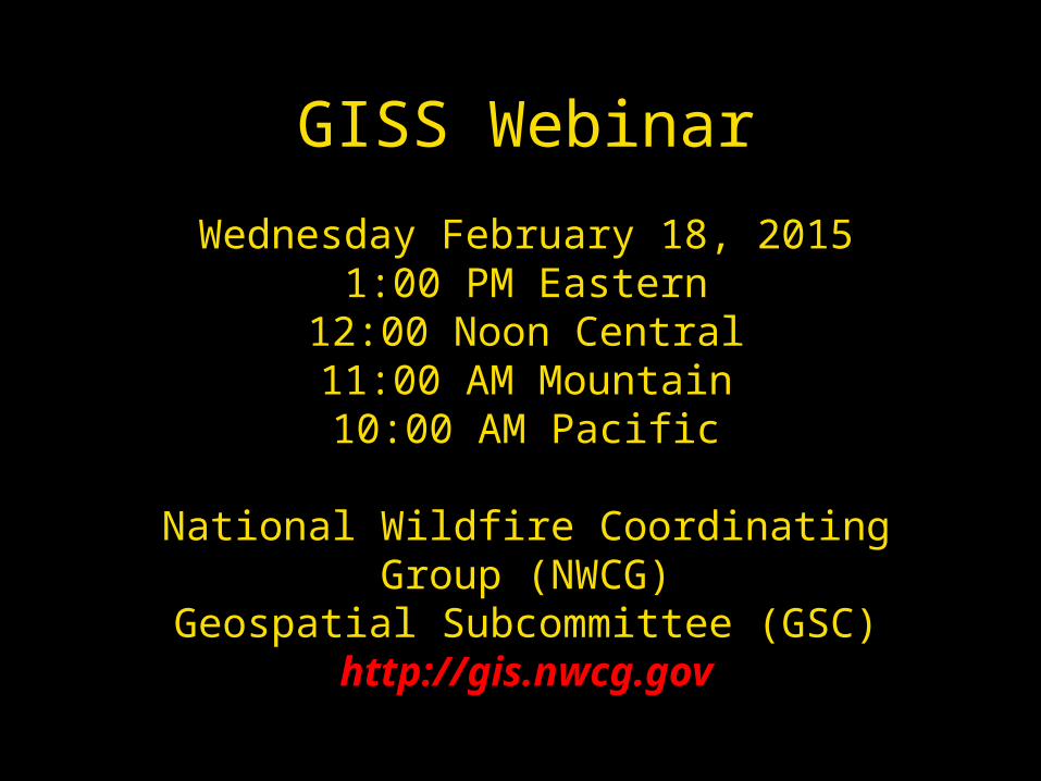
NWCGGeospatial Sub CommitteeGISS Webinar
Wednesday February 18, 20151:00 PM Eastern
12:00 Noon Central11:00 AM Mountain
10:00 AM Pacific
National Wildfire Coordinating Group (NWCG)Geospatial Subcommittee (GSC)
http://gis.nwcg.gov
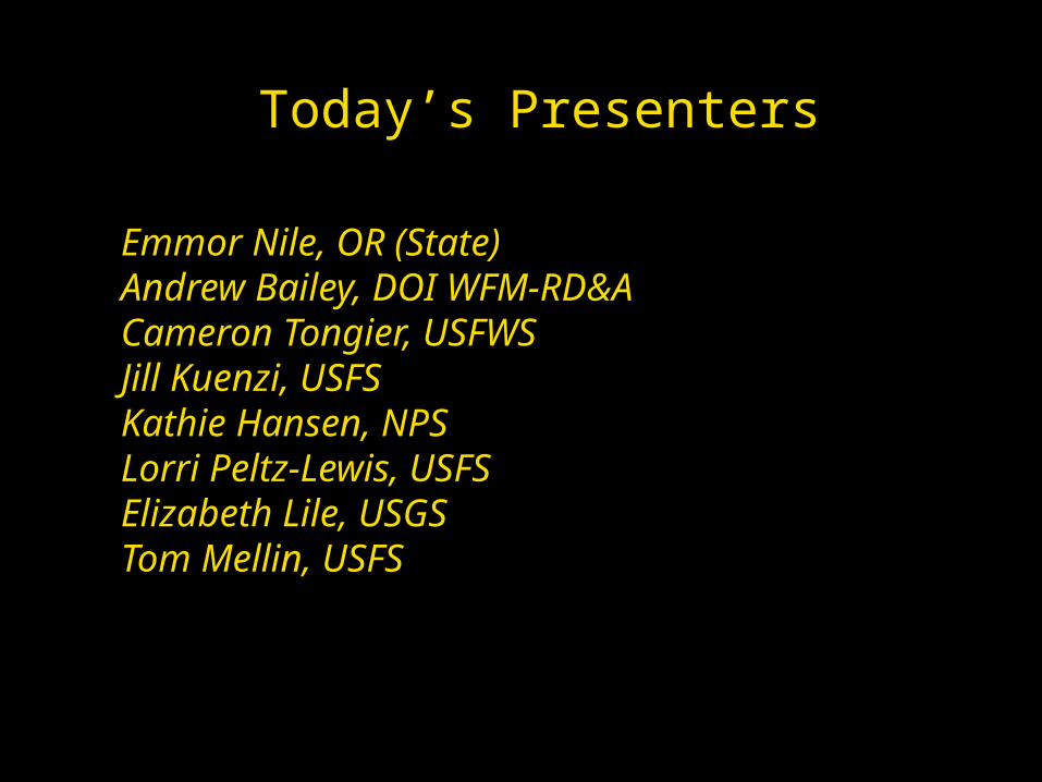
Today’s Presenters
Emmor Nile, OR (State)Andrew Bailey, DOI WFM-RD&ACameron Tongier, USFWSJill Kuenzi, USFSKathie Hansen, NPSLorri Peltz-Lewis, USFSElizabeth Lile, USGSTom Mellin, USFS
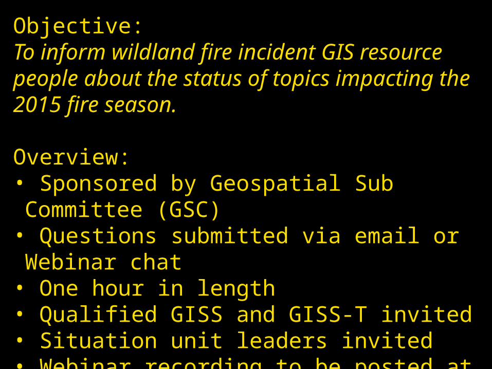
Objective:To inform wildland fire incident GIS resource people about the status of topics impacting the 2015 fire season.
Overview:• Sponsored by Geospatial Sub Committee (GSC) • Questions submitted via email or Webinar chat• One hour in length• Qualified GISS and GISS-T invited• Situation unit leaders invited• Webinar recording to be posted at gis.nwcg.gov
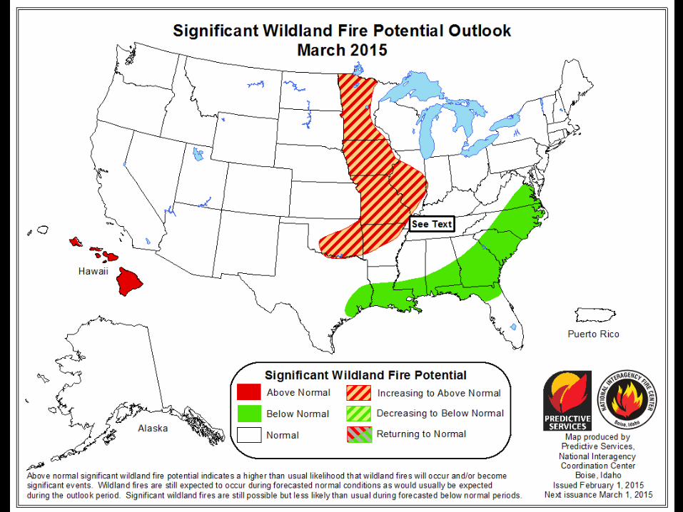
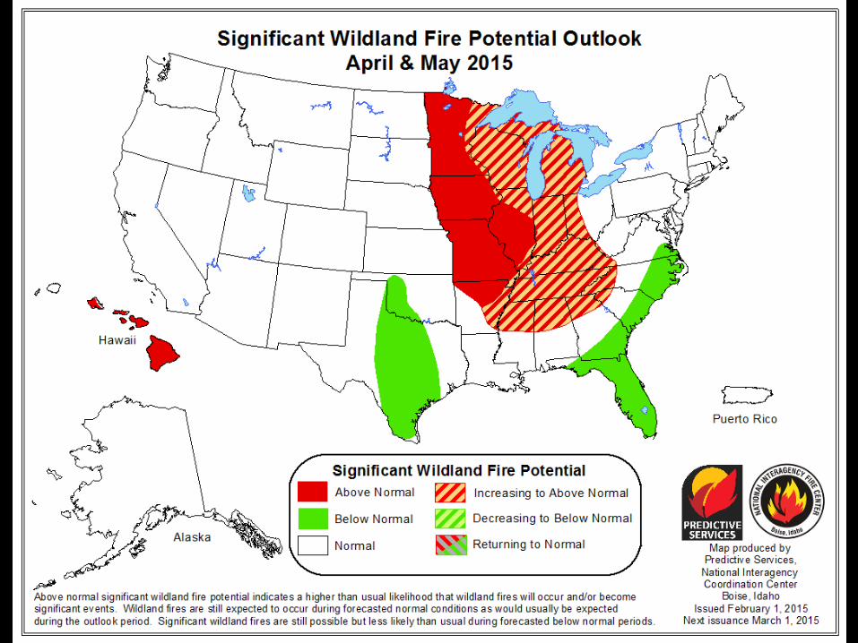
(Fire outlook graphics)
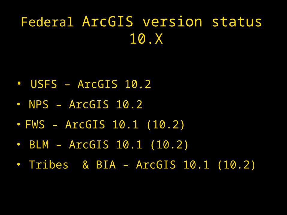
Federal ArcGIS version status 10.X
• USFS – ArcGIS 10.2
• NPS – ArcGIS 10.2
• FWS – ArcGIS 10.1 (10.2)
• BLM – ArcGIS 10.1 (10.2)
• Tribes & BIA – ArcGIS 10.1 (10.2)

States’ ArcGIS Status
10.3 – RI
10.2 – AK, AL, AZ, CA, CO, CT, DE, GA, KS, KY,
LA, MA, MI, MN, MS, NE, NM, NV, NY, OK, OR,
PA, SD, VA
10.1 – ID, MD, ME, MT, NC, NH, OH, TN, TX,
UT, WA, WV
10.0 – FL, HI, MO, SC, WI
9.2 – AR
Unknown – IA, IL, IN, ND, VT, WY
ArcGIS in 2015Poll
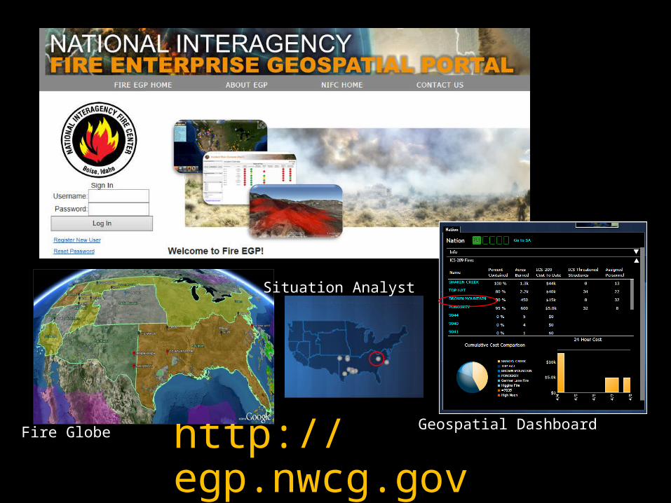
http://egp.nwcg.gov
Situation Analyst
Fire Globe Geospatial Dashboard
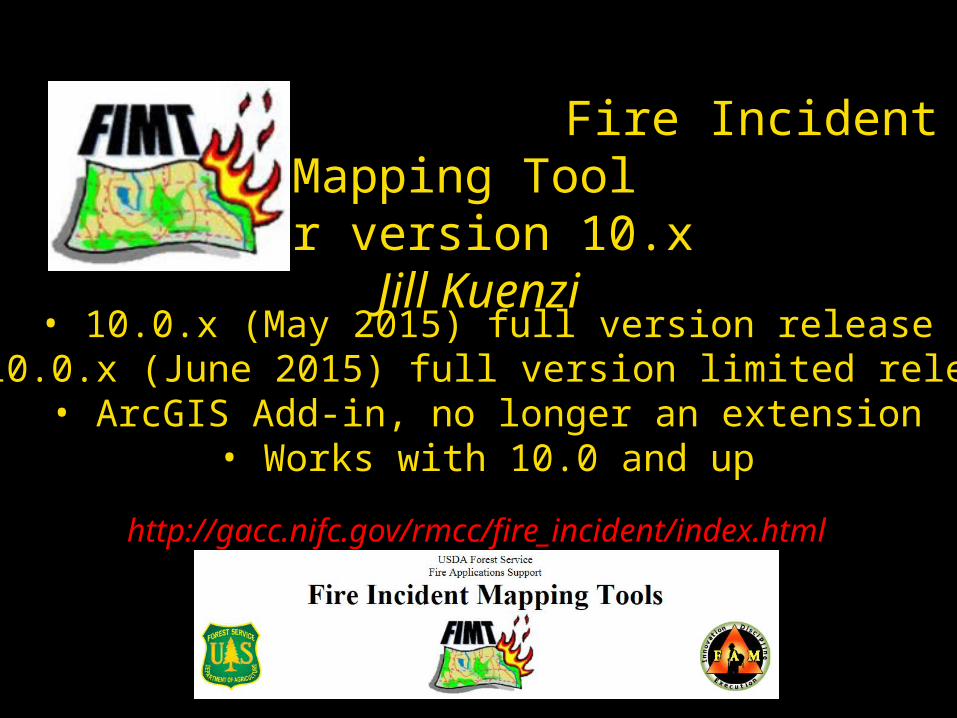
Fire Incident Mapping Tool for version 10.x
Jill Kuenzi
• 10.0.x (May 2015) full version release• 10.0.x (June 2015) full version limited release• ArcGIS Add-in, no longer an extension
• Works with 10.0 and up
http://gacc.nifc.gov/rmcc/fire_incident/index.html
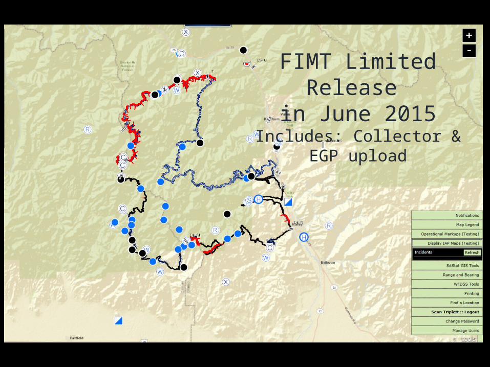
FIMT Limited Release in June 2015
Includes: Collector & EGP upload
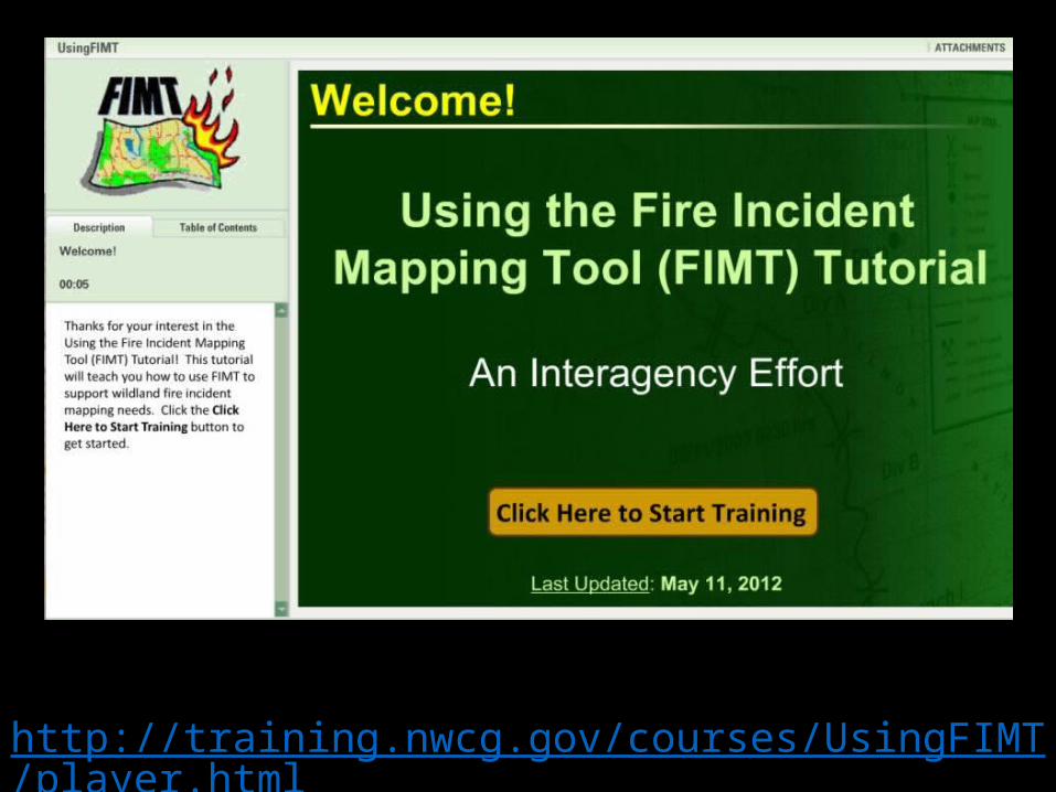
http://training.nwcg.gov/courses/UsingFIMT/player.html
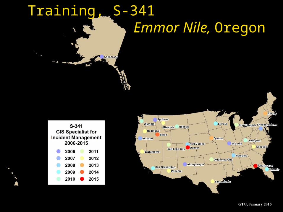
Training, S-341 Emmor Nile, Oregon
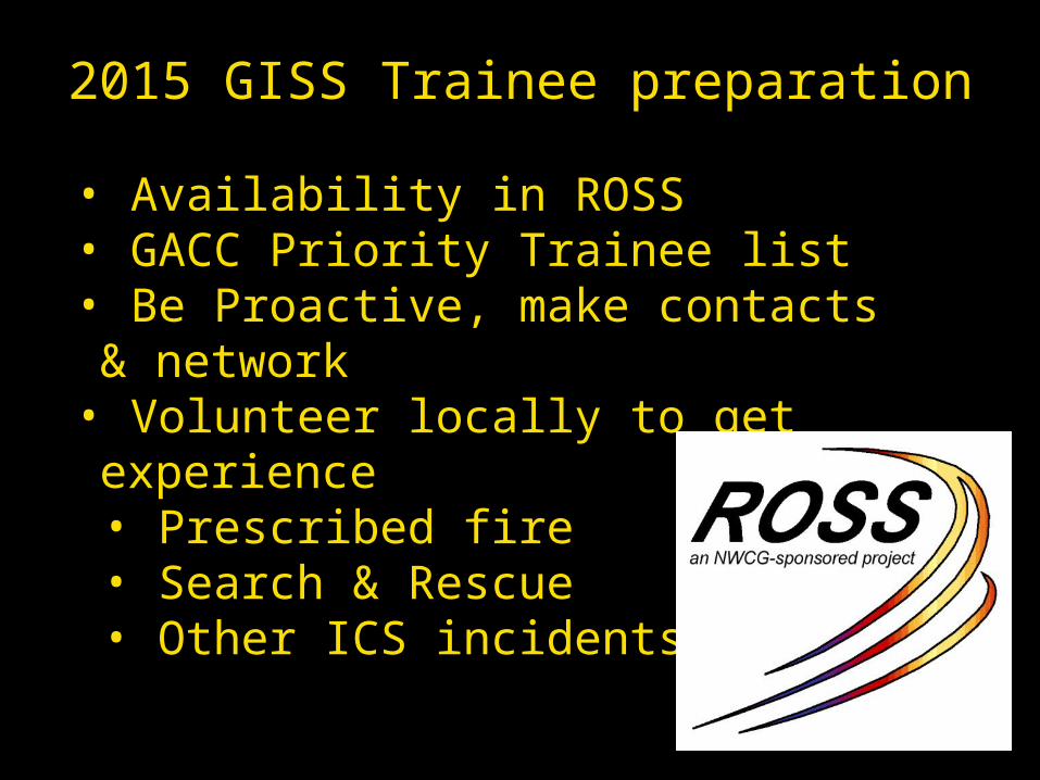
2015 GISS Trainee preparation
• Availability in ROSS• GACC Priority Trainee list• Be Proactive, make contacts & network• Volunteer locally to get experience• Prescribed fire• Search & Rescue• Other ICS incidents
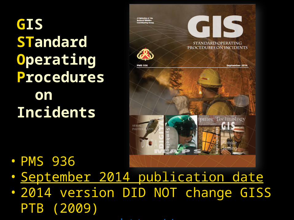
GIS STandard Operating Procedures
on Incidents
• PMS 936• September 2014 publication date• 2014 version DID NOT change GISS PTB (2009)
http://www.nwcg.gov/pms/pubs/gstop.pdf
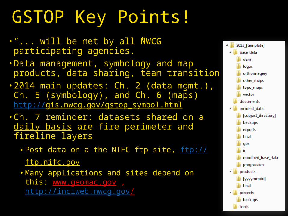
GSTOP Key Points!• “... will be met by all NWCG participating
agencies.” • Data management, symbology and map
products, data sharing, team transition• 2014 main updates: Ch. 2 (data mgmt.),
Ch. 5 (symbology), and Ch. 6 (maps) http://gis.nwcg.gov/gstop_symbol.html
• Ch. 7 reminder: datasets shared on a daily basis are fire perimeter and fireline layers• Post data on a the NIFC ftp site, ftp://
ftp.nifc.gov • Many applications and sites depend on this:
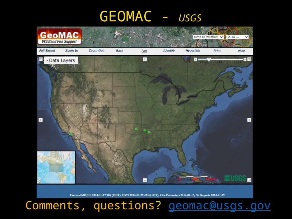
www.geomac.gov , http://inciweb.nwcg.gov/
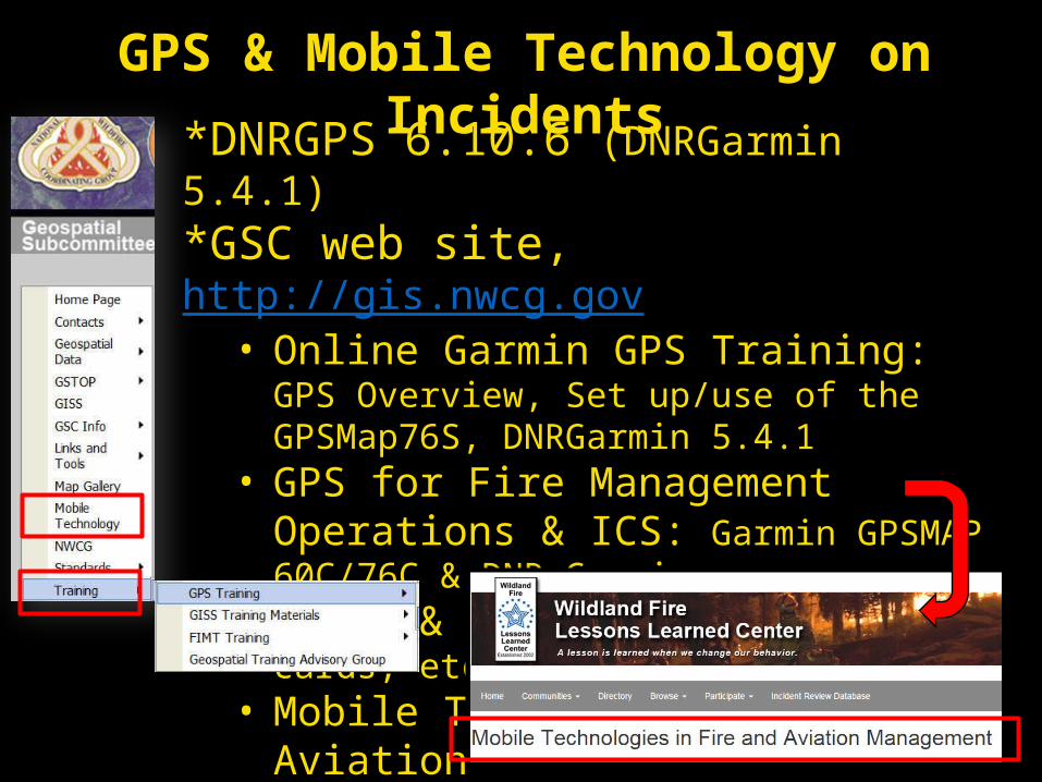
GPS & Mobile Technology on Incidents
*DNRGPS 6.10.6 (DNRGarmin 5.4.1)*GSC web site, http://gis.nwcg.gov • Online Garmin GPS Training: GPS Overview,
Set up/use of the GPSMap76S, DNRGarmin 5.4.1 • GPS for Fire Management Operations &
ICS: Garmin GPSMAP 60C/76C & DNR Garmin• Tools & Job Aides: Garmin Pocket cards, etc.• Mobile Technology in Fire & Aviation
http://www.wildfirelessons.net
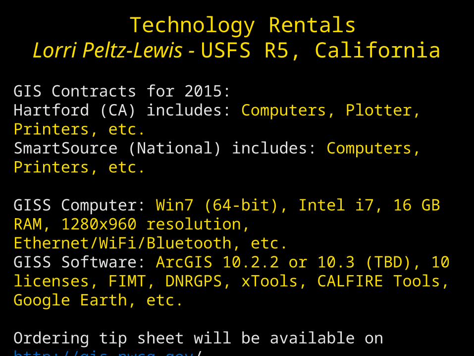
Technology RentalsLorri Peltz-Lewis - USFS R5, California
GIS Contracts for 2015:Hartford (CA) includes: Computers, Plotter, Printers, etc.SmartSource (National) includes: Computers, Printers, etc.
GISS Computer: Win7 (64-bit), Intel i7, 16 GB RAM, 1280x960 resolution, Ethernet/WiFi/Bluetooth, etc.GISS Software: ArcGIS 10.2.2 or 10.3 (TBD), 10 licenses, FIMT, DNRGPS, xTools, CALFIRE Tools, Google Earth, etc.
Ordering tip sheet will be available on http://gis.nwcg.gov/
Full list of specifications – [email protected], (916) 995-3107
GIS software not working contact Lorri ASAP!
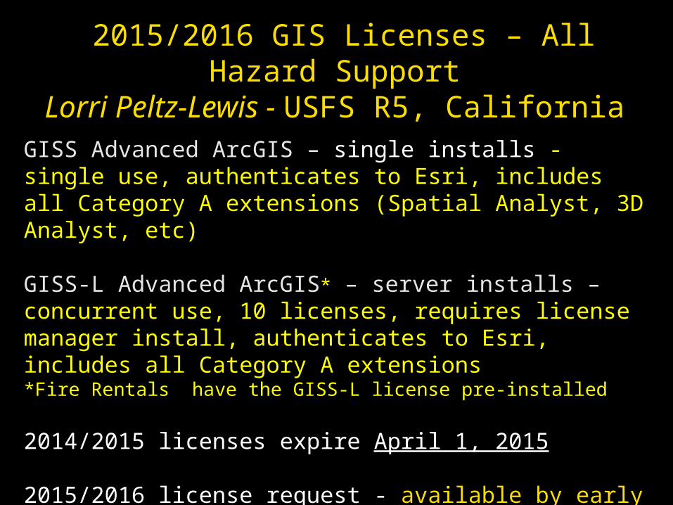
2015/2016 GIS Licenses – All Hazard SupportLorri Peltz-Lewis - USFS R5, California
GISS Advanced ArcGIS – single installs - single use, authenticates to Esri, includes all Category A extensions (Spatial Analyst, 3D Analyst, etc)
GISS-L Advanced ArcGIS* – server installs – concurrent use, 10 licenses, requires license manager install, authenticates to Esri, includes all Category A extensions *Fire Rentals have the GISS-L license pre-installed
2014/2015 licenses expire April 1, 2015
2015/2016 license request - available by early March 2015
Need a license? Contact – [email protected] (916) 995-3107
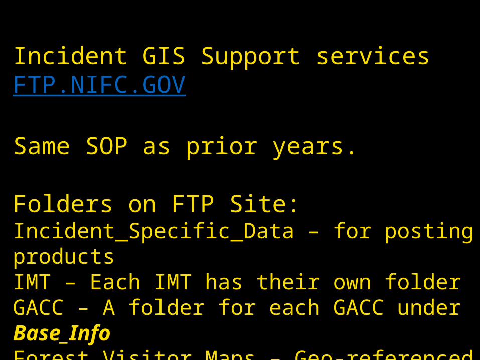
Incident GIS Support services FTP.NIFC.GOV
Same SOP as prior years.
Folders on FTP Site:Incident_Specific_Data – for posting productsIMT – Each IMT has their own folderGACC – A folder for each GACC under Base_InfoForest Visitor Maps – Geo-referenced for mobile useNPS – New folder for the Park ServiceWFIT –Wildland Fire Information Technology
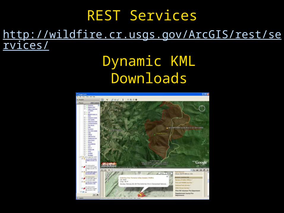
REST Serviceshttp://wildfire.cr.usgs.gov/ArcGIS/rest/services/
Dynamic KMLDownloads
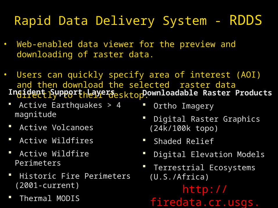
Rapid Data Delivery System - RDDS
• Web-enabled data viewer for the preview and downloading of raster data.
• Users can quickly specify area of interest (AOI) and then download the selected raster data directly to their desktop.
Incident Support Layers
Active Earthquakes > 4 magnitude
Active Volcanoes
Active Wildfires
Active Wildfire Perimeters
Historic Fire Perimeters (2001-current)
Thermal MODIS
Remote Automated Weather Stations
Downloadable Raster Products
Ortho Imagery
Digital Raster Graphics (24k/100k topo)
Shaded Relief
Digital Elevation Models
Terrestrial Ecosystems (U.S./Africa)
http://firedata.cr.usgs.gov
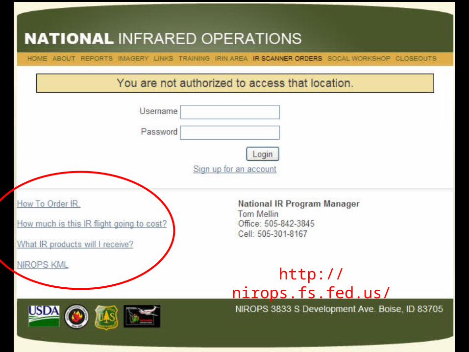
http://nirops.fs.fed.us/
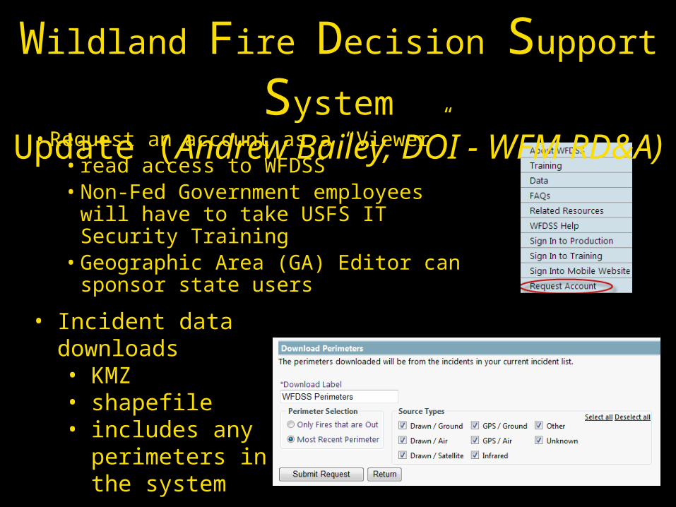
• Request an account as a “Viewer”• read access to WFDSS • Non-Fed Government employees will
have to take USFS IT Security Training • Geographic Area (GA) Editor can
sponsor state users
• Incident data downloads• KMZ • shapefile • includes any
perimeters in the system
Wildland Fire Decision Support System Update (Andrew Bailey, DOI - WFM RD&A)
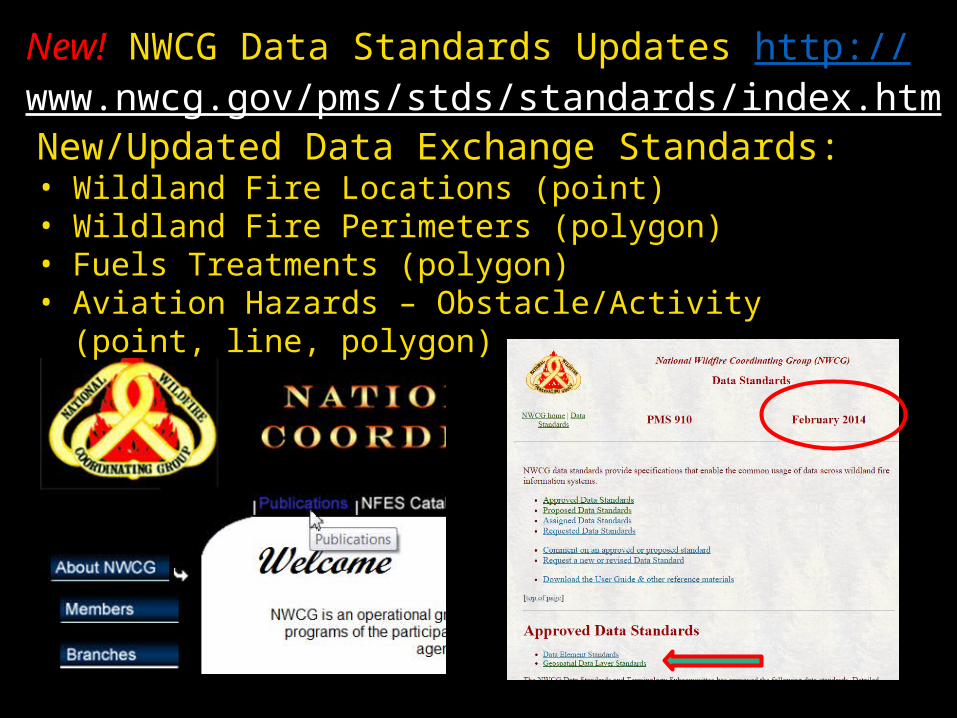
New! NWCG Data Standards Updates http://www.nwcg.gov/pms/stds/standards/index.htm
New/Updated Data Exchange Standards:• Wildland Fire Locations (point)• Wildland Fire Perimeters (polygon)• Fuels Treatments (polygon)• Aviation Hazards – Obstacle/Activity (point, line, polygon)
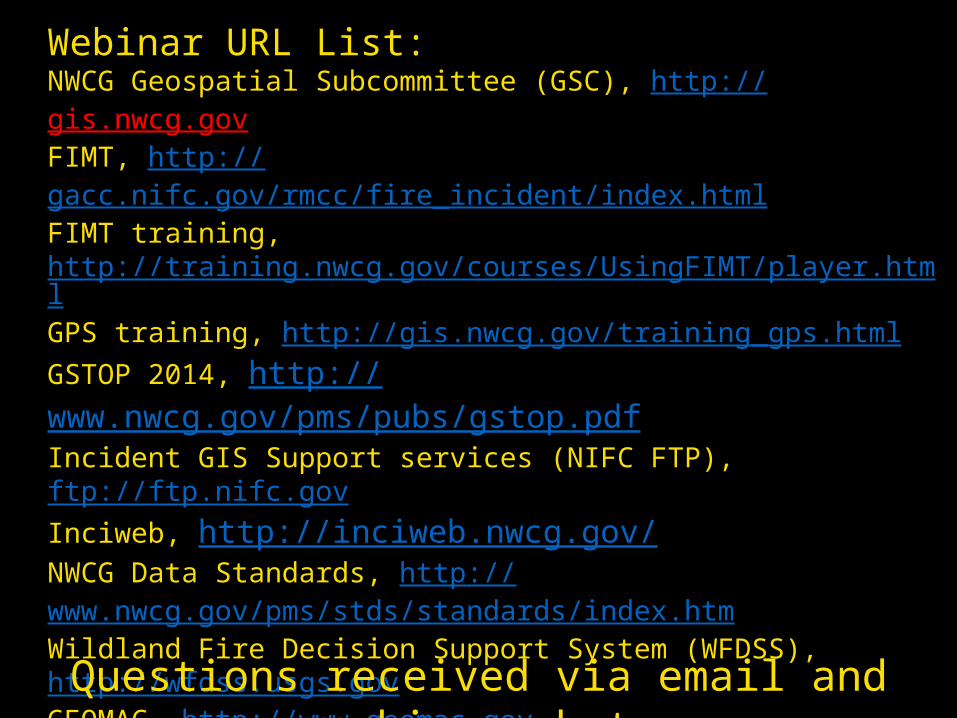
Webinar URL List:NWCG Geospatial Subcommittee (GSC), http://gis.nwcg.gov FIMT, http://gacc.nifc.gov/rmcc/fire_incident/index.htmlFIMT training, http://training.nwcg.gov/courses/UsingFIMT/player.htmlGPS training, http://gis.nwcg.gov/training_gps.htmlGSTOP 2014, http://www.nwcg.gov/pms/pubs/gstop.pdfIncident GIS Support services (NIFC FTP), ftp://ftp.nifc.govInciweb, http://inciweb.nwcg.gov/ NWCG Data Standards, http://www.nwcg.gov/pms/stds/standards/index.htmWildland Fire Decision Support System (WFDSS), http://wfdss.usgs.govGEOMAC, http://www.geomac.govGEOMAC REST Services, http://wildfire.cr.usgs.gov/ArcGIS/rest/services/Rapid Data Delivery System – RDDS, http://firedata.cr.usgs.govS-341 Training (GISS), http://www.odf.state.or.us/gis/gtu/g2.htmlNational Infrared Operations, http://nirops.fs.fed.us/Wildfire Lessons Learned Center, http://www.wildfirelessons.net
Questions received via email and webinar chat
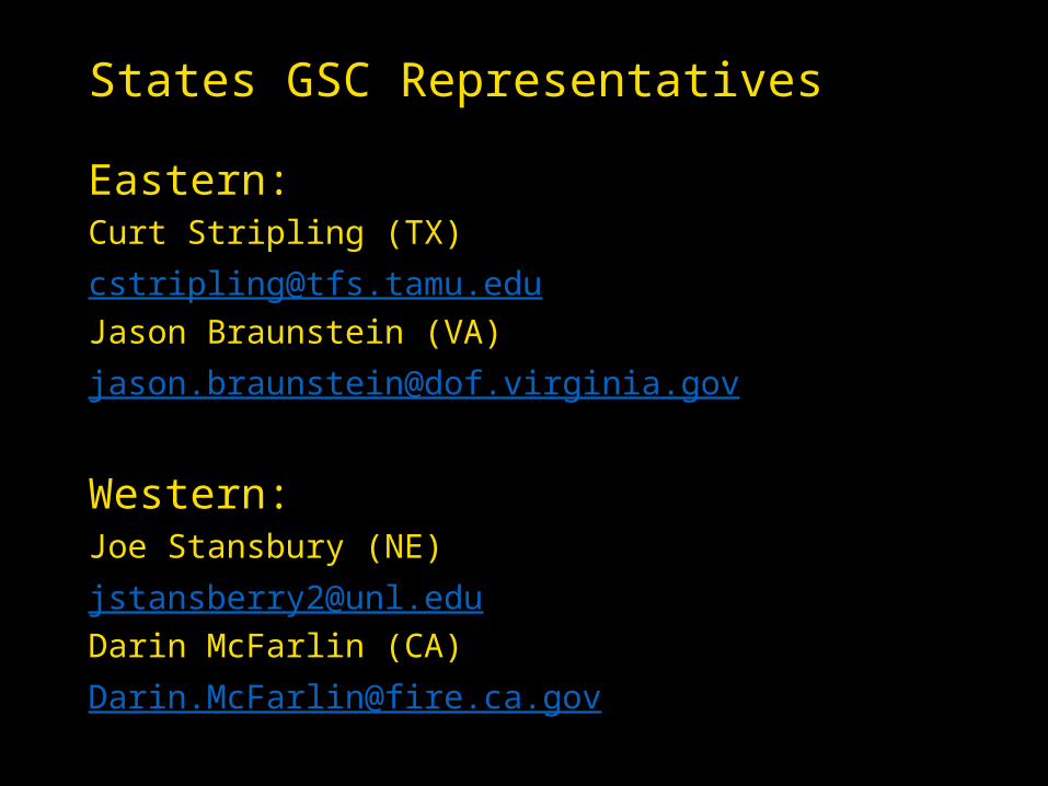
States GSC Representatives
Eastern:Curt Stripling (TX)[email protected] Braunstein (VA)[email protected]
Western:Joe Stansbury (NE)[email protected] McFarlin (CA)[email protected]
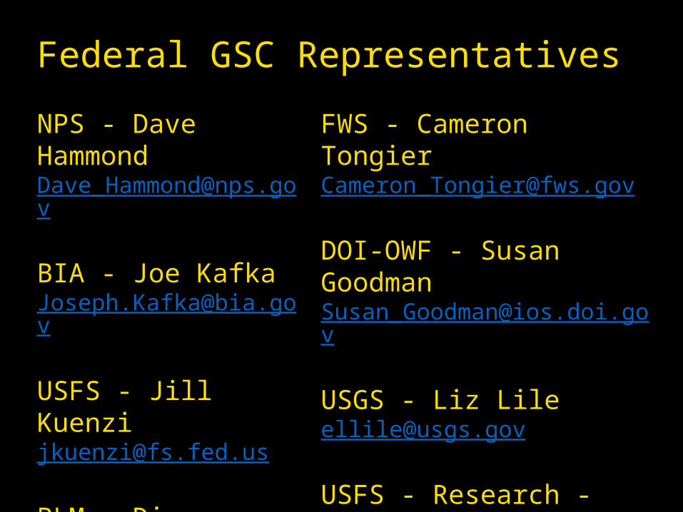
Federal GSC Representatives
NPS - Dave Hammond [email protected]
BIA - Joe [email protected]
USFS - Jill [email protected]
BLM - Dianna Sampson [email protected]
FWS - Cameron Tongier [email protected]
DOI-OWF - Susan [email protected]
USGS - Liz [email protected]
USFS - Research - Andrew [email protected]