pbo futures workshop - unavco · application of the plate boundary observatory to the evaluation of...
TRANSCRIPT

home register public meetings 2014 pbof
home register public meetings 2014 pbof
PBO Futures WorkshopPBO Futures WorkshopWorkshop Abstract ListingWorkshop Abstract Listing
Registrant/Title/AuthorRegistrant/Title/Author AbstractAbstract
Duncan Agnew IGPP/Scripps/UCSD
PBO Longbase Strainmeters:Results and Lessons Learned
Duncan Carr Agnew and FrankK. Wyatt IGPP/SIO/UCSD LaJolla CA
The longbase strainmeter (LSM) element of PBO has produced, nearly 50 instrument-years of data fromsix instruments at four locations: an unprecedented set of long-term measurements. Two locations(Cholame, or CHL, and Durmid Hill, or DHL) are within a few km of the San Andreas fault (SAF): CHL, atthe N end of the segment that ruptured in 1857, and DHL at the end of the "most-overdue" segment,that ruptured about 1700. Two instruments at Salton City (SCS) are within 15 km of the active SanJacinto fault zone, and a single instrument in Los Angeles is close to the San Gabriel thrust. Oneimportant result from these installations is that LSM's measure secular rates of strain accumulationconsistent with geodetic data from continuous GPS. The PBO LSM records, with those from four otherLSM's in California, appear to be the only strainmeter data in the world for which this is true; that is,the only ones in which the long-term tectonic signal is larger than any site-related drift. This resultcould not have been obtained without anchoring the strainmeter end points, with this anchoring, it istrue for geological settings from slightly weathered granite to lake-bed clay sediments. The strainmeterlengths (400 to 600 m) and the anchoring depth (25 m) thus provide useful data over the full temporalrange of strain, from 1 Hz seismic waves to changes over months and years; at periods of months andless, the LSM noise level is far below that obtained by estimating strains from GPS networks. The LSM'ssurface location also makes them much less affected by local elastic distortion than buried systems,eliminating calibration issues and providing accurate measurements of strain tides and seismic waves.Both LSM sites close to the SAF have shown large secular strains, with fluctuations in strain rate overperiods of months and longer of up to 20 percent of the long-term average. These SAF sites have alsoobserved aseismic strains over hours to days, with magnitudes up to 100 nanostrain. These short-termsignals have been observed on independent systems, and also (at CHL) on borehole strainmetersnearby. Modeling suggests that they occur at depths of a few km, probably from episodic creep. Incontrast, aseismic signals on the non-PBO systems at Pinon Flat Observatory, near the Anza segment ofthe San Jacinto fault, seem to nearer the seismogenic zone. Some PBO LSM's have also played a usefulrole in ruling out possible strains associated with earthquake swarms near the southern SAF, possiblestrains associated with deep tremor in Cholame, and coseismic offsets observed on nearby boreholestrainmeters. The full-spectrum deformation data from the LSM's confirm how important patience andpersistence are for learning about the Earth: only an ongoing multiyear program can capture interestingsignals and properly characterize the Earth's behavior. The challenge of doing this into the future is alarge one.
Long Term Strain Data from LSMs
Donald Argus The Plate Boundary Observatory provides an excellent opportunity to evaluate the availability of water

Donald Argus Jet Propulsion Laboratory
Application of the PlateBoundary Observatory to theEvaluation of California WaterResources
Donald Argus, Yuning Fu, FelixLanderer
The Plate Boundary Observatory provides an excellent opportunity to evaluate the availability of waterresources. The PBO has already been demonstrated to finely record seasonal water changes acrossCalifornia [Argus Fu Landerer GRL 2014]. A second study is being prepared that demonstrates thecapability of the PBO to evaluate changes in water during California's 2011–Present drought [Argus etal., abstract submitted to AGU]. I wish to advocate that the Plate Boundary Observatory be advanced sothat it can be used in near real time by water managers to evaluate water resources. The PBO arrayalready established provides extremely valuable information on water resources and must remainoperational. Background. Changes in total water thickness in most of California are being estimatedusing GPS measurements of vertical ground displacement from the Plate Boundary Observatory. TheSierra Nevada each year subsides about 12 mm in the fall and winter due to the load of rain and snow,then rises about the same amount in the spring and summer when the snow melts, water runs off, andsoil moisture evaporates. Earth's elastic response to a surface load is well known (except at thicksedimentary basins). Changes in equivalent water thickness can thus be inferred [Argus Fu Landerer2014]. The average seasonal change in total water thickness is 0.5 meters in the Sierra Nevada andKlamath Mountains and 0.1 m in the Great Basin. The average seasonal change in the Sierra NevadaMountains estimated with GPS is 35 Gigatons. GPS vertical ground displacements are furthermore beingused to estimate changes in water in consecutive years of either drought or heavy precipitation.Changes in the sum of snow and soil moisture during the drought from June 2011 to June 2014 areestimated from GPS in this study. Changes in water in California's massive reservoirs are well knownand removed, yielding an estimate of change in the thickness of snow plus soil moisture. Water loss isfound to be largest in the near the center of the southern Sierra Nevada (0.8 m equivalent waterthickness) and smaller in the northern Sierra Nevada and southern Klamath Mountains (0.3 m). The GPSestimates of changes in the sum of snow and soil moisture complement GRACE observations of waterchange in the Sacramento–San Joaquin River basin. Whereas GPS provides estimates of water change athigh spatial resolution in California's mountains, GRACE is sensitive to changes in groundwater in theCentral Valley. We will further compare and contrast the GPS and GRACE measurements, and alsoevaluate the hypothesis of Amos et al. [2014] that groundwater loss in the southern Central Valley(Tulare Basin) is causing the mountains on either side to rise at 1 to 3 mm/yr.
Photo
N/A
Ken Austin UNAVCO
Real-Time GPS in Cascadia, aModel for the Entire PBONetwork
Ken Austin
As the Project Manager for the EarthScope Plate Boundary Observatory (PBO) in the North West, I havehad the task of upgrading and maintaining the majority of the RT-GPS stations in the PBO network.PBO, through a NSF-ARRA supplement, has enhanced the geophysical infrastructure in in the PacificNorthwest by upgrading a total of 282 PBO GPS stations to allow the collection and distribution of high-rate (1 Hz), low-latency (<1 s) data streams (RT-GPS). The addition of the new RT-GPS sites in thePacific Northwest should spur new volcano and earthquake research opportunities in an area of greatscientific interest and high geophysical hazard. Streaming RT-GPS data will enable researchers to detectand investigate strong ground motion during large geophysical events, including a possible plate-interface earthquake, which has implications for earthquake hazard mitigation. An additional 22meteorological instruments have also been added. This large RT-GPS network, spanning the CascadiaSubduction Zone Is well on its way to being a banner geophysical monitoring network. It is my hopethat the community takes this start and continues with upgrades of receiver/antennas for full GNSScapabilities combined with meteorological equipment, as well as co-located seismic sensors in order to

capabilities combined with meteorological equipment, as well as co-located seismic sensors in order tosupport a full range multiple cross cutting research and societal issues.
Photo
N/A
Ken Bays Oregon DOT GeometronicsUnit
Abstract requested to beevalutated as an invitedparticipant in the September22-24 Community Workshop:The Future of PBO in the GAGEFacility (2013-2018) and afterEarthscope.
Ken Bays, Oregon DOT,[email protected],503-508-0282
The Oregon DOT is a stakeholder for use of the Earthscope PBO cGPS stations in Oregon andsurrounding states. I would like to be considered as an invited participant in the September 22-24Community Workshop: The Future of PBO in the GAGE Facility (2013-2018) and after Earthscope. Since2005, I have been the Lead Geodetic Surveyor for the Oregon Dept. of Transportation (ODOT) and, assuch, the technical manager of the Oregon Real-time GPS Network (ORGN), www.TheORGN.net whichODOT established in 2006. Since 2005, the Oregon DOT has had an exceptionally good relationshipwith the NW Region of PBO. We have facilitated PBO permits on ODOT properties and have alsofacilitated working with our IT department to split out raw GPS data streams from PBO cGPS stations atour ODOT facilities to enable the real-time GPS streaming back to the PBO. We have also helped thePBO NW region repair cGPS sites in Oregon when we could easily travel to those sites but it was a longtrip from PBO NW HQ in central Washington. I believe my knowledge of the PBO cGPS monumentationand installations, awareness of the permitting and environmental assessments required for many sites,and the IT structure behind RINEX data storage and NTRIP real-time GPS data streams will help educateparticipants at the Workshop. The tax payers of Oregon have harvested immense benefits from theOregon DOT use of PBO cGPS sites in the ORGN. The Oregon Real-time GPS Network uses real-timedata streams and RINEX products from many PBO sites: thirty-three of the one hundred cGPS sites inthe Oregon Real-time GPS Network are operated by PBO. As a conference participant, I can attest toPBO’s excellent stewardship of their cGPS sites in the Pacific Northwest and to the great public benefitof the PBO installations in addition to their original Earthscope mission. The ORGN is used for landsurveying, engineering, precision agriculture, natural resource management, environmental studies, andother uses. Hopefully this information about the value of PBO sites from many PBO stakeholders willhelp policy makers decide whether to continue Earthscope PBO funding beyond 2018. I am a registeredprofessional land surveyor in the states of Alaska and Oregon and a member of the Professional LandSurveyors of Oregon, the National Society of Professional Land Surveyors, the Oregon GPS Users Group,and the recently formed NGS Western Regional Height Modernization Group. I am also the Governor ofOregon’s appointed representative from the State of Oregon on the U.S. State and Local GovernmentSubcommittee of the federal Civil GPS Service Interface Committee. The CGSIC was established toexchange information about GPS with the civil GPS user community and respond to the needs of civilGPS users. My access to these professional groups can be useful to educate other vested parties on theimpending changes at Earthscope and how their voices can best be heard by policy makers. Thank youfor considering my application. Ken Bays, Oregon DOT, [email protected], 503-508-0282

Ken Bays, Oregon DOT
Rebecca Bendick University of Montana
Thoughts on the future of PBO
Rebecca Bendick
I am committed to exploring both the utility of the PBO network for basic science and for a morediverse set of applications. In the former case, though others are better positioned than I to commenton future scientific innovations, I am especially interested in the ability of the PBO backbone to revealgeodetic signals in surprising locations. My current location, Montana, has very poorly characterizedseismic hazard and tectonic activity, so we rely heavily on PBO to improve this situation. The same iscertainly true for most parts of the continental U.S. outside of the west coast and perhaps Nevada. Inthe latter case, I am interested in how the most diverse possible set of users can share a common datastream for applications from basic surveying to meteorology to hazard warning and mitigation. Themore stakeholders, the better.
Photo
N/A
Michael Bevis Ohio State University
Looking forward: challengesand questions for the future
Michael Bevis
PBO as a project will formally terminate in 2018, but what about the PBO GPS network? Clearly it ishighly undesirable for the largest, high-quality GPS network in North America to collapse and largelydisappear. But what steps must be taken to avoid such a disaster? This talk will focus on distinguishingbetween the PBO GPS network and the associated strain meter network, since the former is much morea multiple-use system than the latter, and needs to be justified on broader grounds. Much emphasiswill be placed on multiple use, and the need to better integrate PBO with other GPS networks. It iscrucial to promote multiple-use in the scientific and in the broader engineering sense. I will drawanalogies with the way in which the astronomy and astrophysics community maintain their diverse anddistributed instrumental infrastructure. I will also stress the need to avoid nominalism and a 'build itand they will come' mentality, and to pursue concrete steps designed to raise multiple use from a goal

and they will come' mentality, and to pursue concrete steps designed to raise multiple use from a goalto a vibrant reality. This will require the active participation of all stakeholders, including NSF and othergovernment agencies.
Frederick Blume UNAVCO
The Contribution ofTechnological Developmentand Testing to the Future ofthe Plate BoundaryObservatory
Dr. Frederick Blume, Sr.Project Manager, UNAVCO
As manager of the GAGE Facility’s Development and Testing group, I am responsible for the evaluationand development of new and existing technologies used by the UNAVCO Community at large, includingthe Plate Boundary Observatory. Critical systems used by PBO stations that my staff and I have beenevaluating include GNSS receivers (hardware and firmware), GNSS antennas, data communicationssystems, (including radios, cellular, and satellite devices), monumentation cost and stability, and powersystems. We are also actively investigating how permanent GNSS stations will perform duringseismically-induced shaking, including the accuracy of real-time positions and susceptibility of GNSSand other systems to failure during an earthquake. Our work encompasses all aspects of PBO’stechnologies, and is being conducted with a focus on reducing the costs of PBO’s operations whilemaximizing the scientific utility of the network. We are in the process of answering many questions thatwill inform the process of planning for PBO’s future, including how to optimize power system healthand monitoring in order to eliminate costly battery replacements, whether and when to invest in newGNSS-capable systems or to keep existing GPS-only receivers operating for as long as possible, andwhether it is possible for UNAVCO and its community to develop our own low-cost GNSS receiversrather than relying on expensive commercial products. My role in the PBO Futures workshop will be tohelp lead the discussions on instrumentation and technical upgrade needs, and to answer detailedquestions about the potential cost-savings that may be realized by the use and development of newtechnologies in the coming years. My 10-1/2 years of UNAVCO experience includes the design andmanagement of the PBO Nucleus project, which upgraded and integrated existing GPS stations from sixindependent networks such as SCIGN and PANGA, a process which included site selection andoptimization and integration of new technologies under tight budgetary constraints and could parallel

optimization and integration of new technologies under tight budgetary constraints and could parallelthat of a post-2018 redesign of PBO. From both a scientific and technological standpoint I believe it isboth important and possible to operate and maintain PBO at its current size in the years following2018. Development and Testing of lower cost data communications and power systems can reduce per-station operating costs as well as expenses related to hardware replacement and upgrades.Optimization of real-time positioning and data communications will help PBO contribute to thedeveloping GNSS contribution to Earthquake Early Warning systems and commercial surveying andmonitoring applications and open the door for new funding sources to supplement our current NationalScience Foundation sponsorship. I look forward to participating in the workshop to help begin theplanning process, and to better understand the challenges that my staff and I can help address in thecoming years to increase the effectiveness and resiliency of PBO.
Photo
N/A
Yehuda Bock Scripps Institution ofOceanography
The case for long-termoperations of real-time PBOnetwork: science, hazardsmitigation, public service
Yehuda Bock
I will argue that the long-term maintenance and operations of the PBO network, especially its currentreal-time component with additional enhancements, is an essential asset for geophysical andatmospheric sciences, hazards mitigation, and public outreach and service. As director of the ScrippsOrbit and Permanent Array Center (SOPAC) and California Spatial Reference Center (CSRC), and PI onseveral related NASA and NSF grants, I can attest that PBO is an integral part of geodetic infrastructurefor North America, especially the seismically-active areas of its western region, encompassing theWestern U.S., Canada and Alaska. Examples of projects that depend on the PBO network include theReal-Time Earthquake Analysis for Disaster mItigation (READI) network for research on prototypeearthquake and tsunami early warning and rapid response systems, the California Real Time Network(CRTN) serving the surveying and engineering communities with data for RTK surveys, and the CaliforniaSpatial Reference Center (CSRC) that maintains the state's spatial reference system composed ofhundreds of continuous GPS stations. Furthermore, SOPAC is working with UNAVCO to implement andtest seismogeodetic upgrades to existing PBO and other real-time stations in the region that include theSIO Geodetic Module and MEMS accelerometer package. Work by SOPAC and other research groups havedemonstrated the significant advantages of seismogeodetic monitoring compared to geophysical andmeteorological sciences and natural hazards compared to traditional seismic and geodetic monitoring.As part of CSRC/CRTN activities, I will present our experience with cost-recovery models as a way togenerate continued funding for PBO network operations and maintenance.
Photo

Photo
N/A
Adrian Borsa UCSD, Scripps Institution ofOceanography
Ongoing drought-induceduplift in the Western UnitedStates as observed by thePlate Boundary ObservatoryGPS network
Adrian Borsa, Duncan Agnew,Dan Cayan
The western United States has been experiencing severe drought since 2013. The solid earth responseto the accompanying loss of surface and near-surface water mass is uplift whose spatial distributionreflects the varying impact of the drought across the region. We use 771 seasonally-adjusted timeseries from continuously operating GPS stations in the Plate Boundary Observatory to measure thisuplift, which we invert to estimate mass loss. The median uplift is 4 mm, with values up to 15 mm inCalifornia’s Coast Ranges and Sierra Nevada. The associated pattern of mass loss, which ranges up to50 cm of water equivalent, is consistent with observed decreases in precipitation and streamflow. Weestimate the total deficit to be about 240 Gt, equivalent to a 10 cm layer of water over the entireregion, or the annual mass loss from the Greenland Ice Sheet. Interannual changes in hydrologicalloading in the western USA are primarily driven by changes in cool-season precipitation, which causevariations in surface water, snowpack, soil moisture, and groundwater. We demonstrate that GPS can beused to recover these loading changes under both wet and dry climate patterns, which suggests a newrole for GPS networks such as that of the Plate Boundary Observatory. Furthermore, the exceptionalstability of the GPS monumentation means that this network is also capable of monitoring the long-term effects of regional climate change. Surface displacement observations from GPS have the potentialto dramatically expand the capabilities of the current hydrological observing network, and continuedoperation of these instruments will provide significant value in understanding current and futurehydrological changes, with obvious social and economic benefits.
Photo
N/A
Ellie Boyce UNAVCO - PBO Alaska
Considering future directionsfor the Plate BoundaryObservatory network in Alaska
The PBO Alaska network consists of 139 GPS, 12 tiltmeter, and 41 communications sites. These arespread across a huge territory with many remote helicopter-access stations. GPS data recovery is 95-99%, and 95% of stations are currently online. All PBO-AK GPS sites have telemetry which, whenfunctional, allows for remote monitoring and downloads. 4 stations have real-time streaming enabled.As of 1/1/2014, each standard daily file collected from PBO-AK had been downloaded an average 17.6times. The many users downloading PBO-AK data include NSF-funded (and other) researchers,

Observatory network in Alaska
Ellie Boyce
times. The many users downloading PBO-AK data include NSF-funded (and other) researchers,local/state/federal agencies, NOAA hydrographers, and commercial surveyors. Under the GAGE awardPBO-AK is operated and maintained year-round by UNAVCO’s team of Alaska –based staff, whichconsists of a project manager / engineer, two field engineers and one permitting / logistics-supportperson. I became interim AK project manager in June 2014, near the start of our busy summer fieldseason during which the team conducts the majority of our maintenance across the network. Despiterecent staffing transitions, operations continue to run smoothly and as of late July we have >95% ofstations online and healthy. Through the GAGE award and beyond, I see my role as PBO-AK projectmanager should be to build on the successful and efficient operational model we have developed,taking the outcomes of this workshop and refocusing our priorities as appropriate to better supportongoing research and hazard-monitoring efforts in Alaska. Here are some key areas that I feel shouldbe considered for future direction: 1) To maintain current levels of operationality and user support withdecreased funding, we have developed and strengthened relationships with partner institutions who areinvolved in natural hazard monitoring in Alaska. Joint efforts have been largely successful and haveresulted in cost savings for multiple parties. Through the remainder of the GAGE award and into thepost-2018 future of PBO-AK, increased coordination of operations, in particular with IRIS-TA, could becritical to reducing costs. We should also look to our partners for lessons to be learned regarding bestways to maintain infrastructure with limited resources. 2) PBO-AK operates 50% of the NGS CORSstations in Alaska. We should work with local/state/federal agencies and commercial users to developalternate funding models for continued operation of these stations. 3) Since the GAGE award was madewe have seen increasing requests for high-rate GPS data, as well as interest in the feasibility and costof upgrading some/all AK stations to real-time. Streamed data would be essential to any GPS-basedearthquake/tsunami warning system. Enhancing the PBO-AK network from its current form, to allowincreased capability for real-time data streaming and high-rate data collection, should be among thedecisions made by the scientific community. 4) To prioritize UNAVCO resources it will be necessary toanalyze the cost-benefit of all PBO-AK stations. An observing system model may be helpful forrigorously quantifying the relative value of individual stations to the overall observatory. This could beused in combination with other cost-per-station and data-use analysis to guide decisions on stationremoval.
Photo
N/A
Ben Brooks US Geological Survey
Ideas on PBO's Future
Ben Brooks
I am a current member of UNAVCO’s GI-AC and the liaison to the TIGWIG sub-committee and a formermember of the PBO-AC. Previously, as the head of the University of Hawaii’s Pacific GPS Facility I was PIon a number of CGPS projects in South America and the Hawaiian Islands that are heavily collaborativewith UNAVCO. In my new position with the USGS I am working on Mobile Laser Scanning andEarthquake Early Warning (EEW), both of which are newer geodetic research directions and both ofwhich will rely heavily on PBO infrastructure in the future. I have had intensive collaboration withUNAVCO over the years on cutting edge projects such as the Mauna Loa CGPS network and the rapidresponse to the Maule earthquake. I feel that as a USGS scientist and former academic scientist andcurrent GI-AC member I have a broad perspective that will be very useful to the general discussions ofthe future of PBO. In addition to the well-known deformation process goals that originally motivatedPBO’s funding, part of the value of a long-term monitoring network are the unanticipated discoveries

PBO’s funding, part of the value of a long-term monitoring network are the unanticipated discoveriesthat will occur simply by continuing to make detailed observations and the unanticipated new directionsand users that the network will attract. Accordingly, I envision a future PBO where the surveying, LiDAR,and EEW communities are more actively engaged. This, in turn, could generate a broader and moresustainable potential funding base.
Photo
N/A
Roland Bürgmann University of California,Berkeley
Thoughts about the future ofPBO
Roland Bürgmann, Departmentof Earth and Planetary Scienceand Berkeley SeismologicalLaboratory, UC Berkeley
Support for PBO maintenance, operation and science by the EarthScope award will soon run out. Indiscussions with colleagues it is clear that the need and scientific rationale for continued operation ofPBO are very strong. While PBO might once have been envisioned in large part to be a tool to capturelonger-term tectonic and earthquake cycle deformation, it has since evolved into a multi-disciplinaryobservatory, studying atmospheric processes, snow and soil moisture, aquifers and hydrocarbonreservoirs, hydrological loads, tidal response of a visco-elastic lithosphere and high-rate seismicwaveforms. These data are of scientific and practical value for purposes ranging from water storagemonitoring and weather forecasting to earthquake early warning and snow-depth assessment. Improvedhardware, GNSS constellations, real-time telemetry and high-rate processing, and software promise tofurther what can be done with continuous GNSS networks. Non-PBO continuous GNSS stations installedfor other purposes proliferate and promise to further enhance the overall network. I see this workshopas an opportunity to brainstorm with the community to find ways to continue and enhance PBO as atool for science, while finding a model that secures the needed financial support to maintain andimprove the network. This might include multi-agency support (USGS, NASA, NSF, DOE, EPA, NOAA,state and regional agencies) for a multidisciplinary tool. In such a model, the UNAVCO GAGE Facilitymight still be tasked with maintaining the network. Another model would be to hold on to a smallercore network focused on NSF supportable science, while transferring stations to various other entitiesthat will continue to make data fully and freely available to the broader research community.
Photo

Photo
N/A
Enrique Cabral-Cano Universidad NacionalAutonoma de Mexico, Institutode Geofis
TLALOCNet, a GPS-Metnetwork in Mexico: Advancingtowards a federated networkof geodetic networks in theAmericas.
Enrique Cabral-Cano
As PBO is poised to become a nucleus for a hemispheric-scale, federated network of geodetic networks,activities to support and develop on this goal are currently underway. TLALOCNet is a combinedatmospheric and tectonic cGPS-Met network in Mexico for the interrogation of climate, atmosphericprocesses, the earthquake cycle, and tectonic processes. TLALOCNet will link existing GPS infrastructurein North America in one hand and Central America, the Caribbean and northern South America on theother hand to create a continuous, federated network of networks spanning from Alaska to SouthAmerica. NSF and Mexican funds are being used to build 38 cGPS-Met sites that will serve as theTlalocNet backbone and will operate to the high standard of the EarthScope Plate Boundary Observatory(PBO). The first 3 stations are operational since mid July 2014, while the rest of them are scheduled forinstallation in the next 24 months. Data from TLALOCNet is already available through UNAVCO'sarchive. Furthermore, by the end of 2014 TlalocNet's data along with complementary data from otherMexican regional cGPS networks will also be openly available through a Mexican-based data archive.Development of a continental-scale federation of GPS-Met networks in the Americas should be basednot only on the success and strengths from current PBO, COCONet and TLALOCNet operations, but alsoon newer applications of geodetic techniques, opportunities to create national networks throughout theAmericas, creativity to envision future lines of research that may have yet to reach maturity, andtechnological developments in the last decade. To advance this, several lines of actions may beconsidered: a) Scientific. New developments of satellite geodesy technology in hydrogeodesy andatmospheric applications dictate a network coverage that may not necessarily be subduction zone-centric. Based on past experiences, the discovery of geological process such as episodic tremor and slipin subduction zones, could have not been foreseen without the benefit of a large and dense GPSnetwork coverage. In a similar fashion new geologic and atmospheric processes may be awaitingdiscovery on areas with poor GPS-Met station coverage. b) Logistical. Development of national orregional mirrored GPS data archives based on PBO-derived common standards and protocols fostersdata exchange and use outside the scientific community. Leverage from large GPS hardware purchasesis very helpful for standardization and allow community purchases at much better prices. The NorthAmerican GPS user community that has enjoyed this situation should help to broaden the scope of theGPS hardware community purchases to include Central and South American countries. c) Collaborative.COCONet and TLALOCNet have successfully proven that multinational GPS networks with standardizeddeployment and operations are feasible and at the same time are building and broadening internationalcooperation and a geodetic user community throughout the Americas. Community efforts to strengthenthe collaboration with geodetic communities outside the footprint of TLALOCNet and COCONet shouldbe pursued to advance the federated geodetic network concept in the rest of South America.
Photo

Photo
N/A
Donna Charlevoix UNAVCO
PBO Beyond the Science:Continuation of the Education,Outreach and Broader Impactsof the PBO Network
Donna Charlevoix
From the initial planning stages of EarthScope, Education and Outreach (E&O) was considered to play acentral role in its scientific, educational, and societal impact. This is reflected in efforts of the NationalOffice, and the IRIS and UNAVCO facilities. UNAVCO’s E&O efforts related to the Plate BoundaryObservatory (PBO) have furthered the EarthScope E&O mission: “To use EarthScope data, products, andresults to create a measurable and lasting change on the way that Earth science is taught and perceivedin the United States.” UNAVCO’s E&O activities ranged from engaging interns in the constructionprocess and in PBO scientific research (through the RESESS program), to developing materials for formaland informal E&O use among teachers, university faculty and other educators. More recently, focus onthe use of role of PBO in helping to understand natural hazards with the installation of a museumexhibit along the Oregon coast, the development of educational videos of the benefit of GPS inearthquake early warning, and professional development and training of teachers, park interpreters andemergency management educators. As PBO matures and moves into the next phase of existence, it iscritical that the underlying E&O support be intentional, strategic, and integrated into planning from thestart.
Photo
N/A
Herb Dragert Pacific Geoscience Centre
Some West Coast CrustalDynamics Studies at the PacificGeoscience Centre thatConnect to PBO
Herb Dragert GeologicalSurvey of Canada, Sidney, BC.
For over 30 years, scientists at the Pacific Geoscience Centre of the Geological Survey of Canada havecarried out research in crustal dynamics along British Columbia's west coast, the most active seismicregion in Canada. During the 1990's, labor intensive and time consuming levelling, precise gravity, andlaser ranging surveys gave way to continuous GPS monitoring of crustal motions along the Cascadiamargin via the fledgling GPS networks: the Western Canada Deformation Array (WCDA) and the PacificNorthwest Geodetic Array (PANGA). With its completion in 2008, the Plate Boundary Observatoryestablished an unprecedented capability for the study of Cascadia subduction zone dynamics. Althoughthe discovery of Episodic Tremor and Slip (ETS) preceded the establishment of PBO, our future researchof this previously unknown plate boundary behavior now depends critically on the continued GPS,expanded GNSS, and the borehole strain meter data collected by PBO. Outstanding scientific questionsconcerning ETS include: What are the physical /mechanical processes involved in tremor and plate-slip?What controls the kinematics of individual ETS episodes? Is the updip/downdip propagation of slip thesame as along-strike? Are ETS recurrence intervals constant in a given region and are they related toseismic hazard? Is the interslip strain accumulation rate constant? linear? What are the relationships ofETS with large earthquakes (megathrust, crustal, and in-slab) and general seismicity? High-rate GPS andborehole strain data collected by PBO is seeing increased use in our studies of larger (>M6)earthquakes. Recent examples include the 2012 M7.8 Haida Gwaii earthquake and the 2014 M6.6Nootka Fault earthquake where rupture model constraints were provided by the surface deformationdata. Precise measurement of co-seismic offsets and post-seismic transient signals are key to a betterunderstanding of the brittle rupture, the transfer of stress, and any aseismic response to theearthquake. High-rate (preferably 5Hz) GPS monitoring should be continued, especially in areas wherelarger earthquakes are expected. A third area of study at PGC which is strongly dependent on the

larger earthquakes are expected. A third area of study at PGC which is strongly dependent on thecontinued operation of PBO is our investigation of real-time GPS for use in Earthquake and TsunamiEarly Warning Systems. We process high-rate GNSS data in real-time to monitor and report motionsrelated to large earthquakes in coastal British Columbia and Washington State. Given the tectonic settingof Canada’s west coast, specific goals for our real-time regional geodetic monitoring are: (1) thecollection of GNSS data with adequate station density to identify the deformation field for regionalearthquakes with M>7.3; (2) the robust, continuous real-time analyses of GNSS data with a precision of1-2 cm and a latency of less than 10s; and (3) the display of results with attending automated alarmsand estimations of earthquake parameters. Megathrust earthquakes (M>8) are the primary targets forimmediate identification, since the tsunamis they generate will strike the coast within 15 to 20 min.However, large (M6.0 to M7.5) normal or strike-slip earthquakes when occurring within the ocean plateoffshore could be mistakenly identified as large-scale tsunamigenic events and need to bediscriminated from subduction thrust ruptures in order to avoid tsunami “false alarms” and unwarrantedmitigation responses.
Photo
N/A
Julie Elliott Purdue University
Assessing Needs and Meansfor a Future Geodetic Network
Julie Elliott
As part of several different projects concerning tectonic, volcanic, and ice load related deformation, Iam currently utilizing data from continuous GPS sites operated by PBO and other organizations inAfrica, South America, the northeast U.S., Alaska, and western Canada. In each of these regions, the sitedistribution, quality, and infrastructure are quite different. Working with these data is teaching me whatkind of scientific objectives can be achieved given the strengths and shortcomings of each networksituation. It has also informed decisions about how to supplement (either through additional cGPS orepisodic measurements) the existing networks to provide a useful dataset. Unless there is a dramaticchange in the funding environment, the network that evolves out of PBO is going to have fewer sitesand there will have to be strategic decisions about location and site configuration to make the datavaluable to a wide range of users. The network may also have to rely on other agencies, institutions,and individuals to assume responsibilities for maintenance and upgrades at stations. For this to bemost effective, users and potential users outside the core community need to be engaged aboutpossible network changes. I’ve talked with a number of people who currently use PBO data or areinterested in doing so in the future and view PBO as a permanent resource they can rely upon.Changing this idea could lead to new stakeholders who are willing to invest in a continued high qualitynetwork.
Photo

Photo
N/A
Karl Feaux UNAVCO, Inc
Karl Feaux: Introduction andJustification for Attendance
Karl Feaux
My name is Karl Feaux. I have been involved in the GPS component of the Plate Boundary Observatory(PBO) since the EarthScope project began in 2003. In my role as the GPS Operations Manager for PBO, Iwas responsible for the management of the GPS Operations Group during both the construction and theoperations and maintenance phases of the project. For the past eleven years, I have been responsiblefor PBO reconnaissance, permitting, installation, operations, and maintenance of the 891 new GPSstations. I also coordinated the transfer of 209 Nucleus stations into the PBO. During the PBOconstruction phase, I managed a team of 15+ UNAVCO staff members and oversaw the GPS componentof the 5-year, $67M PBO-GPS Operations budget. During the construction phase of the project, Iworked with key project stakeholders as a liaison to the various PBO siting committees. Given myhistory of working with PBO, I have an interest in the future of the network. I have quite a bit ofinstitutional knowledge of the logistics and costs required for continued operations and maintenance ofthe PBO network. I routinely prepare yearly budgets and work plans associated with the operation of thenetwork. I am familiar with the unique challenges associated with each region of the network. With thebudget constraints facing the project, it is important to identify the key stations from a scienceperspective as well as to estimate the costs associated with operating the network on a per-stationbasis. I fully support the idea of the PBO as a centrally managed, standardized geodetic network. Astandardized network continues to provide consistency in the data produced with an added benefit ofreducing costs. I also believe that a National geodetic network like PBO, providing scientific data to anumber of user communities, is in the best interest of our country. It is in the interest of PBO toleverage these communities to provide funding to continue to operate the network. I hope that thistopic of discussion will be part of the agenda of the workshop. The Plate Boundary Observatory is aspecial National resource that would be much more expensive if constructed today or some day in thefuture. For that reason, we should try to keep as many stations operational as possible, but recognizethe need to upgrade the network to be fully GNSS capable with the ability to provide high-rate, low-latency data streams. The PBO network should not be viewed as 1100 GPS stations. It really should beviewed as a platform for various types instrumentation, including meteorological sensors, seismometers,accelerometers, or other scientific instruments. By increasing the number of sensors located at eachstation, the PBO network could enhance the scientific value of the network and encourage other usercommunities to support the operation of the network in the future. I want to thank the organizingcommittee for considering me to be part of this workshop.
Photo
Photo
N/A
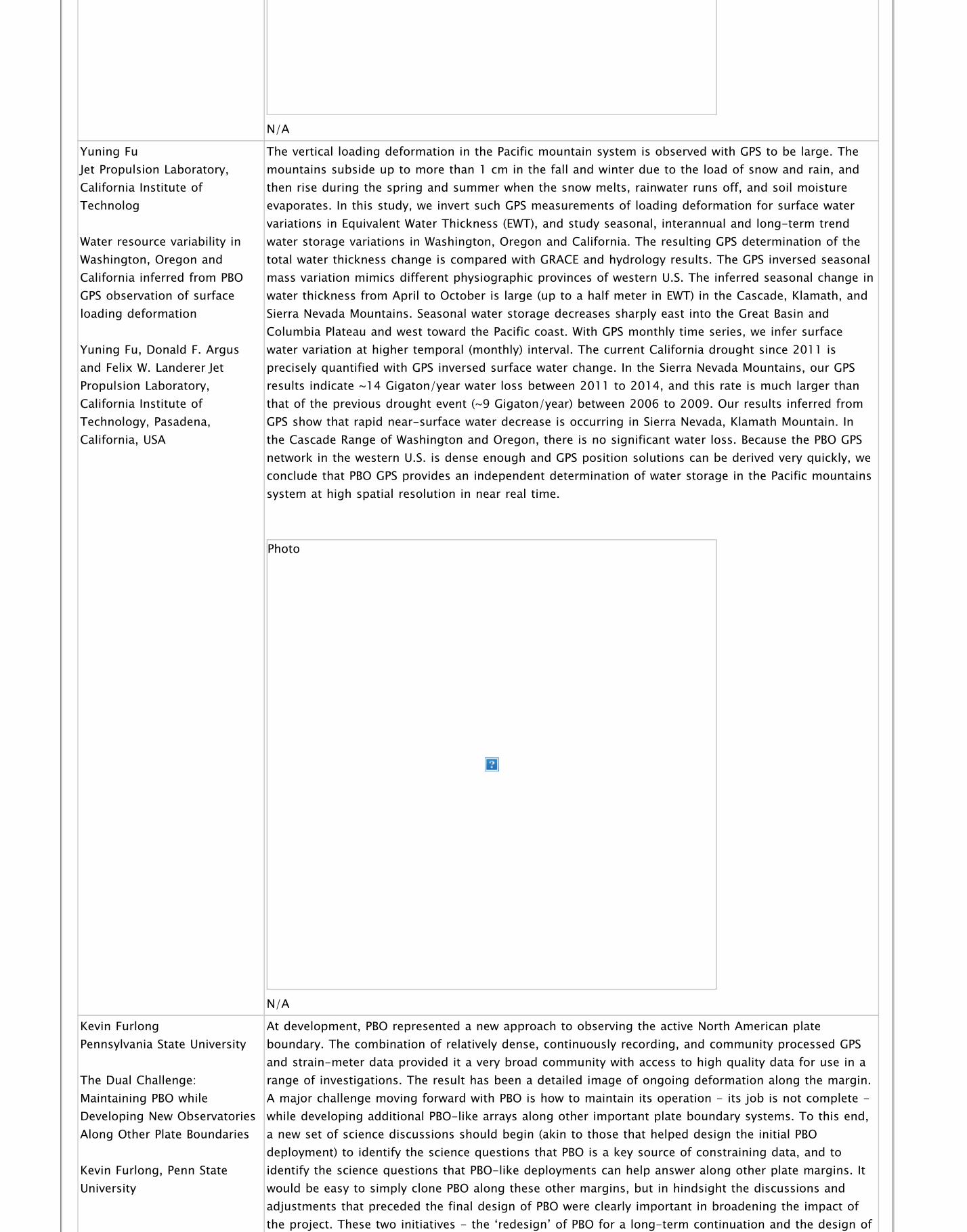
Yuning Fu Jet Propulsion Laboratory,California Institute ofTechnolog
Water resource variability inWashington, Oregon andCalifornia inferred from PBOGPS observation of surfaceloading deformation
Yuning Fu, Donald F. Argusand Felix W. Landerer JetPropulsion Laboratory,California Institute ofTechnology, Pasadena,California, USA
The vertical loading deformation in the Pacific mountain system is observed with GPS to be large. Themountains subside up to more than 1 cm in the fall and winter due to the load of snow and rain, andthen rise during the spring and summer when the snow melts, rainwater runs off, and soil moistureevaporates. In this study, we invert such GPS measurements of loading deformation for surface watervariations in Equivalent Water Thickness (EWT), and study seasonal, interannual and long-term trendwater storage variations in Washington, Oregon and California. The resulting GPS determination of thetotal water thickness change is compared with GRACE and hydrology results. The GPS inversed seasonalmass variation mimics different physiographic provinces of western U.S. The inferred seasonal change inwater thickness from April to October is large (up to a half meter in EWT) in the Cascade, Klamath, andSierra Nevada Mountains. Seasonal water storage decreases sharply east into the Great Basin andColumbia Plateau and west toward the Pacific coast. With GPS monthly time series, we infer surfacewater variation at higher temporal (monthly) interval. The current California drought since 2011 isprecisely quantified with GPS inversed surface water change. In the Sierra Nevada Mountains, our GPSresults indicate ~14 Gigaton/year water loss between 2011 to 2014, and this rate is much larger thanthat of the previous drought event (~9 Gigaton/year) between 2006 to 2009. Our results inferred fromGPS show that rapid near-surface water decrease is occurring in Sierra Nevada, Klamath Mountain. Inthe Cascade Range of Washington and Oregon, there is no significant water loss. Because the PBO GPSnetwork in the western U.S. is dense enough and GPS position solutions can be derived very quickly, weconclude that PBO GPS provides an independent determination of water storage in the Pacific mountainssystem at high spatial resolution in near real time.
Photo
N/A
Kevin Furlong Pennsylvania State University
The Dual Challenge:Maintaining PBO whileDeveloping New ObservatoriesAlong Other Plate Boundaries
Kevin Furlong, Penn StateUniversity
At development, PBO represented a new approach to observing the active North American plateboundary. The combination of relatively dense, continuously recording, and community processed GPSand strain-meter data provided it a very broad community with access to high quality data for use in arange of investigations. The result has been a detailed image of ongoing deformation along the margin.A major challenge moving forward with PBO is how to maintain its operation - its job is not complete -while developing additional PBO-like arrays along other important plate boundary systems. To this end,a new set of science discussions should begin (akin to those that helped design the initial PBOdeployment) to identify the science questions that PBO is a key source of constraining data, and toidentify the science questions that PBO-like deployments can help answer along other plate margins. Itwould be easy to simply clone PBO along these other margins, but in hindsight the discussions andadjustments that preceded the final design of PBO were clearly important in broadening the impact ofthe project. These two initiatives - the ‘redesign’ of PBO for a long-term continuation and the design of

the project. These two initiatives - the ‘redesign’ of PBO for a long-term continuation and the design ofnew PBOs based on an in-depth assessment of the capabilities and impacts of PBO all need time, broadcommunity engagement, and some vision. The success of PBO can be a one-off event, or it canrepresent a new mode of geodesy and solid earth geophysics research.
Photo
N/A
Michael Gottlieb UNAVCO
Planning the Future of the PBOStrainmeter Network
Mike Gottlieb
I am a project manager responsible for the operations and maintenance of the PBO borehole strain andseismic network. My group plans and executes all fieldwork associated with these 80 stations, as wellas the installation of any new borehole instrumentation. This currently amounts to an average of 350field days per year. Other responsibilities include producing reporting for the NSF, creating budgets,managing inventory and spending. My contribution to this workshop would be my intimate knowledgeof the operations and maintenance of the BSM network. As funding limitations will dictate the extent towhich we can keep these stations running in perpetuity, I can provide insight on how we can get themost value out of a limited budget. Being present at this workshop would also help me to understandwhat the community’s science priorities will be as we move forward, which will help inform how wewrite our proposals for the network post-GAGE. I have created a model that allows manipulation ofbudgetary parameters and scientific priorities to predict possible scenarios for future BSM operations.Running this kind of model is necessary to have an informed conversation about what the future ofthese networks will look like. The PBO strainmeter network has different challenges than the GPSnetwork, and so the strategy for these stations should be adjusted accordingly. My personal vision forthe best way to handle a severely reduced BSM O&M budget (during or post-GAGE) would be as follows:- Achieve primary costs savings by reducing total site visits rather than removing stations. - If have toremove stations, prioritize by scientific interest and data quality, rather than cost of individual stations.- Prioritize response time to outages at remaining stations with respect to data quality and interest.Focus efforts on keeping best stations running at 100%. - Reduce low priority stations to minimal levelsof maintenance rather than remove them. Removing BSM stations does not recover sensors forredeployment; turning off stations only saves operational costs. The borehole strainmeter networkneeds engineering representation if we want to intelligently discuss scope and budgetary planningmoving forward, and I can bring that experience.
Photo

Photo
N/A
Ronni Grapenthin New Mexico Tech
Operational Real-time GPS-enhanced Earthquake EarlyWarning
Ronni Grapenthin, IngridJohanson, Richard M Allen
Moment magnitudes for large earthquakes (M$_{w}\geq 7.0$) derived in real-time from near fieldseismic data can be underestimated due to instrument limitations, ground tilting, and saturation offrequency/amplitude-magnitude relationships. Real-time high-rate GPS resolves the build-up of staticsurface displacements with the S-Wave arrival, thus enabling the estimation of slip on a finite fault andthe event's geodetic moment. Recently, a range of high-rate GPS strategies has been demonstrated onoff-line data. Here, we present the first operational system for real-time GPS-enhanced earthquakeearly warning as implemented at the Berkeley Seismological Laboratory (BSL) and currently analyzingreal-time data for Northern California. The BSL generates real-time position estimates operationallyusing data from 62 GPS stations in Northern California. A fully triangulated network defines 170+station pairs processed with the software trackRT. The BSL uses G-larmS, the Geodetic Alarm System, toanalyze these positioning time series, and determine static offsets and pre-event quality parameters. G-larmS derives and broadcasts finite fault and magnitude information through least-squares inversion ofthe static offsets for slip based on a-priori fault orientation and location information. This systemtightly integrates seismic alarm systems (CISN-ShakeAlert, ElarmS-2) as it uses their P-wave detectionsto trigger its processing; quality control runs continuously. We use a synthetic Hayward Faultearthquake scenario on real-time streams to demonstrate recovery of slip and magnitude. Re-analysisof the M$_w$7.2 El Mayor-Cucapah earthquake tests the impact of dynamic motions on offsetestimation. Using these test cases, we explore sensitivities to disturbances of a-priori constraints (origintime, location, fault strike/dip).
Real Time GPS network for EEW in the SF Bay Area
Bill Hammond University of Nevada, Reno
The Future of the NSFEarthScope Plate BoundaryObservatory
The NSF EarthScope Plate Boundary Observatory (PBO) is primarily a crustal deformation observatory thatserves as a resource and community focal point for multiple Earth science disciplines. We recentlydemonstrated a link between hydrologic and solid Earth science using PBO data to show thatgroundwater pumping in the southern California Great Valley effectively causes an anthropogenic upliftof the surrounding Sierra Nevada and Coast Ranges. In this case seasonal signals were key to plausiblyestablishing the relationship between mass unloading from Great Valley agricultural pumping and theelastic response that effects microseismicity rates on the San Andreas fault. This example (recently

Bill Hammond, Geoff Blewitt,Corné Kreemer
elastic response that effects microseismicity rates on the San Andreas fault. This example (recentlypublished by Amos et al. in Nature) shows that continuous time series are needed to identify the sourceof these signals. Other recent studies of ours have relied on the temporal coverage and long duration ofobservation at PBO stations to lower the detection threshold for tectonic strain rates, to rule outepisodic modes of continental deformation, and to measure the impact of large earthquakes (e.g. 2010El Mayor-Cucapah) on our active NSF EarthScope program funded experiments in the Great Basin andColorado Plateau. Despite over a decade of work on PBO, we continue to make new discoveries aboutwestern US crustal deformation processes, and find new significant information in small signals that aredifficult to detect, requiring accumulation of longer time series. These include slow tectonicdeformation, step discontinuities, seasonal changes from hydrology, rate changes associated with theseismic cycle, vertical motions attributable to mountain uplift, and fault mechanics along bends in theSan Andreas Fault. We operate a regional complement to PBO, the Mobile Array of GPS for NevadaTranstension (MAGNET), supplementing geographic coverage to 20 km spacing across the western GreatBasin. MAGNET has 386 stations in 5 western states, uses a limited number of receivers in a semi-continuous observation approach. It was installed assuming the presence of PBO, which justified thesacrifice of temporal resolution in exchange for geographic coverage. Thus we rely on PBO to providetemporal resolution in our studies of the causes and modes of deformation of the continentallithosphere. The Nevada Geodetic Laboratory has forged an active symbiosis with UNAVCO to supportPBO, providing processing and quality assurance products for all PBO data, and participating incommunity governance as a member institution. Collectively our group has decades of scientific andleadership experience that has spanned the design, planning, construction and active research phasesof PBO. We have a keen interest in the continued existence, vigor and geographic representation of PBOand welcome the opportunity to participate in the workshop.
Distribution of the MAGNET (red) and PBO (blue) GPS stations looking northeast from above offshoreCalifornia. Foreground shows coverage in the California Great Valley, San Andreas Fault system, middleground shows coverage in western Great Basin and Colorado Plateau.
Jessica Hawthorne Caltech
PBO Workshop Abstract
Jessica Hawthorne
One important aspect of investigating earthquakes and fault slip is to be able to observe both the large,long-timescale features that provide regional context and help us understand the large-scale behavior,as well as smaller, short-timescale features that can help us understand the physics of frictional sliding.Both of these observations may help constrain earthquake hazard. And both benefit from long-termobservations. Large-scale slip can change on annual and decadal scales, and it is easiest to comparerepeated short-timescale events when they are recorded on a consistent geodetic network. For instance,in my work in northern CA, I have benefited from consistent recording of postseismic strain from about1000 small earthquakes over 30 years. Most of my research concerns slow slip events and aseismic slipassociated with earthquakes. I use borehole strain data to investigate complexity in slow slip inCascadia. I also work with seismic data and on frictional modeling of earthquakes and slow slip events.This combination of project types helps motivate me to think carefully about the uses of existing andfuture geodetic data.
Photo

Photo
N/A
Thomas Heaton Caltech
The Future of PBO in the GAGEFacility after Earthscope
Thomas H Heaton Director ofthe Earthquake EngineeringResearch Laboratory Caltech
GAGE/PBO operates the primary US geodetic network. While its origin is in the solid earth scienceresearch community, the data is becoming ever more important in applied science and inmeteorological science. This is as it should be; the US should not operate multiple redundant networksthat cater to different communities. Furthermore, UNAVCO has done a very good job of documentingthe data and providing easy access. The GAGE/PBO system should continue to have the highest prioritywhen it comes to financial support. That said, the cost of shared infrastructure facilities must notexceed a reasonable fraction of the total cost of other activities. It seems unlikely that Federal supportfor solid earth tectonics will significantly increase and that means that new opportunities will involvenew funding sources. For example, it seems likely that automated earthquake and tsunami warningsystems will be deployed within the next decade. GAGE will have a role to play and we must begin nowto develop the management structure to coordinate between regional seismic networks and GAGE.Earthquake warning will impact all of society and the information from GAGE will be also becomeimportant to emergency management, earthquake engineering, financial and insurance institutions,transportation, etc. Although the role of GAGE will expand beyond its current research role, its role inNSF will also change. In particular GAGE will become important to NSF’s Engineering Directorate andalso to the Computer and Information Science part of NSF. These other directorates have very differentgoals and priorities than EAR does. This will present new opportunities and it will also presentchallenges; GAGE advisory committees will have members with widely divergent backgrounds who willhave to chart a path forward that meets divergent needs. While this is a challenge, it’s actually a goodthing. Earth Science could benefit greatly from the advanced mechanical analysis that has beendeveloped to simulate the dynamic deformation of yielding buildings and machines. Crowd-sourcedgeodetic and seismic data also promise to provide thousands (and perhaps millions) of newobservations in large earthquakes. Managing crowd-sourced data will require development of apps, databases, and data mining techniques. These activities may be appropriate for the UNAVCO Data Center.
Photo
N/A
Greg Helmer CSRC & RBF Consulting
The Geospatial market is noteworthy for a rapidly expanding, technology-driven global demand. The USDepartment of Labor noted: “Because the uses for geospatial technology are so widespread and diverse,the market is growing at an annual rate of almost 35 percent, with the commercial subsection of the

GEOSPATIAL SERVICES, TIES TOGEPHYSICAL SCIENCE
Gregory A. Helmer, PLS
the market is growing at an annual rate of almost 35 percent, with the commercial subsection of themarket expanding at the rate of 100 percent each year.” Knowing where things are and when they arewith ever increasing accuracy and certainty is an all but insatiable need for many of today’s disruptiveinnovations. Professional surveyors and geospatial professionals bring valuable expertise to thisdemand, and continuous GNSS data is necessary infrastructure to support this expertise. From the veryfirst continuous site installations, to build out of the Plate Boundary Observatory, surveyors have takenfar more out in the form of valuable data than they have input in the form of money. However, thecontributions in the form of public and political support, practical user experience, and site permittingassistance have hardly been trivial. As UNAVCO builds the strategic plans for continuation andexpansion of geodetic networks, it will be important to understand and recognize the successes of this25 years of synergistic relationship. The likelihood of professional surveyors delivering significantfunding opportunities is no more probable than it has ever been, but collectively scientists andconsultants are well positioned to make meaningful contributions to modern society’s increasingdemand for highly accurate and timely geospatial information. Curriculum Vitae Mr. Helmer is aProfessional Land Surveyor in four states with over thirty years of experience in geodetic control,surveying Geomatics and GIS. As a Senior Vice President with the firm of Michael Baker International, heserves as a practice manager for Geospatial Information Technology. He is nationally recognized for hiscontributions to GNSS surveying and high-precision geodesy. Mr. Helmer is a contributing author to theNational Height Modernization Program for NOAA, a Fellow in the Institute for the Advancement ofEngineering, and a founding member and past Chairperson of the California Spatial Reference Center atScripps Institution of Oceanography.
Photo
N/A
Kathleen Hodgkinson UNAVCO
Recording the CompleteSpectrum of Plate BoundaryDeformation Processes
Hodgkinson, Mencin, Phillips,Gottlieb, Fox, Gallaher,Henderson, Johnson, Pyatt,Van Boskirk, Mattioli andMeertens.
I am the UNAVCO Data Engineer responsible for generating Level 2 Data Products for PBO’s 75-borehole strainmeter (BSM) network. This includes processing the data, producing site corrections suchas earth tide models and calibration matrices for each installation, assessing the data quality andoverseeing archiving. I work with PBO BSM engineers to identify and solve issues related to hardware,software, and communications. My role also includes informing the community on how to access andanalyze the strainmeter data; to accomplish this I organize and co-teach Strainmeter and Short Courses.Recently, I have started to work in PBO’s real time GPS group. In my role as Data Engineer I work withthe PBO field engineers, with IRIS and NCEDC Data Center staff to distribute data products, with expertsin the community to develop the best processing routines and give guidance to researchers on how towork with the data. This has given me some perspective on what is needed to attain high quality datafrom the BSM network, which sites have the lowest noise levels, what is required for smooth data flowand data product distribution and, through the Short Courses, what the research community hopes todiscover through this data set. My contribution to this workshop would be to share some of the insightI have gained on these topics. A fundamental goal of PBO was to enable investigation of the role small,short-term strain transients play in the release of accumulated stress along plate boundaries. Goingforward, strainmeters are still the only instrument with the sensitivity to resolve transients on the orderof nanostrain over periods of minutes to days. As it becomes increasingly evident that slow-slipphenomena contribute significantly to the release of accumulated stress in fault zones I thinkstrainmeters will form an essential part of any network that is being used to research the earthquake

strainmeters will form an essential part of any network that is being used to research the earthquakecycle. It is the simultaneous analyses of GPS, seismic and strain data though that offers the mostpotential in terms of monitoring slow-slip transients, assessing the evolution of the stress field alongfaults and rapid focal mechanism determination. I think PBO can play a vital role in developing the nextgeneration of fully integrated seismic, strain and GPS networks by building on the network and dataflow systems already in place. This should include the real time flow of processed strain and GPS datain a format that is compatible with seismic data. Collecting and generating these data sets is only oneaspect of the research task; data analyses and visualization tools will become increasingly important asthe data volumes grow and the detection of more elusive signals becomes possible. I think developmentof such tools is essential to fully mine these data sets.
Photo
N/A
William Holt Stony Brook University
Estimating Time-DependentDeformation within the PlateBoundary Zone Using PBOcGPS Data
William Holt, GinaShcherbenko, Meredith Kraner
We have developed a cGPS network-processing tool for detection of anomalous strain transients withinthe Plate Boundary Observatory network in southern California and the broader plate boundary zone.Position estimates from cGPS are interpolated (through a joint inversion of strains and positionestimates) to provide a model solution for the horizontal displacement gradient tensor field as afunction of time. Regularization of the solution is achieved by adjusting a single isotropic strainvariance parameter until the reduced chi-squared misfit between model and observed displacementapproaches 1.0. Additional constraints are provided by a priori information on fault style andorientation, along with the application of Pacific-North America displacement boundary conditions. Ageodetic reference solution is subtracted from the epoch solution and the significance of residualstrains is tested using a t-statistic. Tests using synthetic cGPS observations, generated in the SCEC IVTransient Detection Exercise, show that anomalous strains associated with slow-slip over 6-8 week timeframes, totaling less than 1 cm, can be detected with high confidence (assuming uncertainties in dailypositions estimates of ± 3 mm). Analysis of PBO cGPS time series since July 2010 shows a complex fieldof significant anomalous strain, primarily associated with post-seismic processes, but all slow slipevents in Cascadia are typically captured and numerous other transient phenomenon have beendetected. Using anomalous strain transient signals we also determine stress change history and usingrate-state theory we estimate seismicity rates over time. Current models of post El Mayor provideaccurate spatial estimates of seismicity rates, which can be explained by the stress changes (both co-seismic and post-seismic evolution). Using PBO observatory observations, the entire plate boundaryzone can be monitored with continuous updates for strain, stress, and expected seismicity rateevolution.

Predicted seismicity rates (events larger than M 1.4), obtained using Coulomb stress change estimatesand rate and state theory. Anomalous strains from the cGPS analysis are used to estimate stresschanges that act on existing structures. This estimate is for the period between May-June, 2010.
Ingrid Johanson Berkeley Seismological Lab
High-rate GPS and EarthquakeEarly Warning: Two FertileAreas for PBO Science.
Ingrid Johanson
From many perspectives, the Plate Boundary Observatory has been a complete success, generatingpublications addressing all the science goals of the original EarthScope proposal and more. Onemeasure of its success is the extent to which the scientific community has come to rely on it. The datahas been reliably available, good quality, and represented a giant leap in spatial density over what wasavailable previously. Given the technological advancement that PBO represent, it should not besurprising that science results are still forthcoming, even ten year later; the dataset has by no meansbeen fully mined. Given the reality that downsizing PBO will be necessary, a solution that can preservethe size, availability and reliability of the dataset will be most valuable to the scientific community. Twoareas where the full PBO network can still provide interesting science results are spatially dense GPS-seismograms from large earthquakes and geodetic earthquake early warning (EEW). An example of theformer comes from the March 10, 2014 Mw6.8 earthquake near Ferndale, CA, in the Mendicino triplejunction. This earthquake generated large Love waves all along the Northern California coast. Theselong period waves are generally observed/measured at broadband seismic stations; which in NorthernCalifornia have a much sparser spatial density that GPS stations (which are predominantly PBO). TheGPS-seismograms derived from high-rate (1 hz and 5 hz) data, reveal amplified shaking in a confinedarea of the San Joaquin Delta region, and could be used to determine crustal structure throughoutNorthern California. This result is unique and could not be duplicated with other existing instruments.Earthquake early warning is an emerging field that will also benefit immensely from a dense andreliable GPS network. Including geodetic data in EEW has been stated as a priority of the CISNShakeAlert group. While spatial density is important, the type and quality of data is unknown. Partneringwith EEW groups would be an opportunity to preserve high quality instruments and monumentation,such that the data generated from EEW projects continues to be useful for a wide variety of sciencegoals. Likewise the funding status of EEW is also unknown, such that while there may be clear interest,there are not yet committed funds for adopting GPS stations. Nonetheless, while many consider the coreactivities of EEW to be operational, it stimulates interesting science. In particular, geodetic earthquakeearly warning generally involves quickly characterizing the finite fault properties of large earthquakes, aproblem that immediately asks for more inquiry into the physics of large earthquakes. These benefits toboth current and future scientific inquiry, using a network that has already been heavily invested in,should make preserving (and promoting) the usefulness of PBO for EEW a priority.

Peak dynamic displacements (colors) for transverse (A and B) and radial (C and D) components ofmotion. Left and right sides have been bandpass filtered to the limits shown. NCSS moment tensor isplotted at earthquake epicenter.
Dave Kasmer UNAVCO
PBO East Region, Present andFuture
Dave Kasmer
Registrant Dave Kasmer PBO Engineer II, East Region I was asked to attend the Future of PBO Workshopin place of the East Region manager, Tim Dittmann, who will not be able to attend. I will give a briefhistory of my time with PBO, my current role in PBO O&M, and finally some thoughts on the future anda vision for the East Region GPS network. I have an innate knowledge of the PBO network as a result ofbeing present for much of the project. I began working for UNAVCO PBO as the Rocky Mountain regionengineer in May 2005, spending much of that first year focused on reconnaissance, permitting, andconstruction of the Yellowstone GPS and communications network. Mid-way through constructionphase, my role expanded to include the Basin and Range region as well as Eastern U.S. backbone sites.At the conclusion of the construction phase in 2008, I moved from Boulder HQ to the Reno, NV area toestablish a satellite home office for the operations and maintenance of the E. Sierra and Nevada sub-region of the East Region. In 2011 (to present) I relocated back to HQ in Boulder, while still holding theE. Sierra / NV sub-region network responsibility, but also assisting with O&M and upgrade activitiesthroughout the massive East Region (E. Sierra to East Coast). Current East Region O&M activities aremuch the same as the rest of the PBO network. Trouble-shooting / fixing issues as they arise,hardening power systems, upgrading GPS equipment (receivers / antennas) and communications (cellmodems, radio networks, VSAT systems, etc.). We are successful keeping the East Region network ‘up’(online, no data loss) consistently for 95-97% of our 270 stations. A vision for the future of the PBOEast Region under possible funding constraints is to focus on only the scientifically most relevantstations, leaving many ‘backbone’ stations to simply run to failure. For the stations determined to bemost relevant and best ‘bang-for-the-buck’, we should continue to focus on upgradingcommunications / radio networks, lowering latency rates, bringing as many stations to real-time statusas is feasible. We should also focus on GNSS upgrades as well as creating more multi-sensor (met,camera, seismic) stations to support as broad a community as possible. I also think we should focus onbringing in support from other communities such as USGS, NASA, university graduate students, etc. toassist, under UNAVCO guidance, with field work, upgrades, and maintenance visits to stations.
Photo

Photo
N/A
Attila Komjathy NASA JPL
Towards Routine Detection ofNatural Hazards Using TECPerturbations Observed by GPS
Attila Komjathy, Yu-MingYang, Xing Meng, OlgaVerhoglyadova and RichardLangley Jet PropulsionLaboratory, California Instituteof Technology, Pasadena, CAUniversity of New Brunswick,Fredericton, NB. Canada
Natural hazards, including earthquakes, volcanic eruptions, and tsunamis, have been significant threatsto humans throughout recorded history. The Global Positioning System satellites have become primarysensors to measure signatures associated with such natural hazards. These signatures typically includeGPS-derived seismic deformation measurements, co-seismic vertical displacements, and real-time GPS-derived ocean buoy positioning estimates. Another way to use GPS observables is to compute theionospheric total electron content (TEC) to measure and monitor post-seismic ionospheric disturbancescaused by earthquakes, volcanic eruptions, and tsunamis. Research at the University of New Brunswick(UNB) laid the foundations to model the three-dimensional ionosphere at NASA’s Jet PropulsionLaboratory by ingesting ground- and space-based GPS measurements into the state-of-the-art GlobalAssimilative Ionosphere Modeling (GAIM) software. As an outcome of the UNB and NASA research, newand innovative GPS applications have been invented including the use of ionospheric measurements todetect tiny fluctuations in the GPS signals between the spacecraft and GPS receivers caused by naturalhazards occurring on or near the Earth’s surface. This continuing research is expected to provide earlywarning for tsunamis, earthquakes, volcanic eruptions, and meteor impacts, for example, using GPSfrom global and regional networks. We will demonstrate new and upcoming applications includingrecent natural and accidental hazards that generated TEC perturbations to perform state-of-the-artimaging and modeling of earthquakes, tsunamis and meteor impacts. By studying the propagationproperties of ionospheric perturbations generated by natural hazards along with applying sophisticatedfirst-principles physics-based modeling, we are on track to develop new technologies that canpotentially save human lives and minimize property damage.
Chelyabinsk Meteor Generated TEC Perturbations Observed by GPS
Anthony Lowry Utah State University
GPS Transients and InSARBasin Tilt in the Basin andRange Province: Related?
Anthony R. Lowry1, FalkAmelung2, Ashutosh Chamoli31Utah State University2University of Miami 3IIT-Roorkie
GPS and InSAR measurements of the northernmost Nevada Basin and Range, from ~38.5–41°N, haveproduced a pair of very puzzling observations. GPS position time series from the original BARGENnetwork (now maintained by PBO) show evidence of at least three regionally-coherent transientdisplacement events between ~1996 and 2006, with steady-state motion since. In the same generalregion, InSAR imaging from 1992-2000 shows a broad band of uplift that has been partly ascribed topostseismic rebound following the 1915 Pleasant Valley earthquake, but that is contiguous with upliftfurther east and west with unknown origin. Slightly south of the InSAR uplift feature, a curious eastwardtilting of basin surfaces is observed. Modeling of NASA GLDAS hydrologic fields to estimate massloading suggests no strong relationship of loading displacements to timing of the GPS transient events,suggesting a potentially tectonic origin. Previous studies inferred the GPS displacements representedslow slip on a megadetachment at the Moho, but this would require stress- and strain-coupling of theupper mantle to upper-crustal deformation by a strong lower crust. Preliminary analysis of Basin andRange rheological behavior from combined EarthScope USArray imaging and isostatic strength analysisindicates instead that the Basin and Range lower crust is warm, wet, quartz-rich and consequently tooweak to couple upper-crustal and upper-mantle deformation. Consequently we hypothesize thattransients are instead a result of slow slip events on (possibly discontiguous) detachments in the mid-crust. This interpretation also has its perils, however. Although the north component of GPS transientdisplacement is consistent in subsequent events, the east component switches sign between 2000.4 and2004.4 events. It is difficult to understand how this might happen in a frictional slip environment unless

2004.4 events. It is difficult to understand how this might happen in a frictional slip environment unlessa large scale stress forcing is applied and/or slip is extremely sensitive to small perturbations in stress.We suggest here that the nature of Basin and Range transient deformation (and perhaps deformationtransients in general) might be clarified by a careful combination of GPS and InSAR measurements overa longer timescale, and by well-designed dynamical modeling to test possible explanations for theresulting observations.
Photo
N/A
Charles Mandeville U.S. Geological Survey,Volcano Hazards Program
The Volcano Hazards Programand the Future of NetworkGeodesy
Charles Mandeville, VolcanoHazards Program Coordinator,U.S. Geological Survey, Reston,Virginia; Peter Cervelli,Volcano Science Center,Associate Director for Scienceand Technology, U.S.Geological Survey, Menlo Park,California
The mission of USGS Volcano Hazards Program (VHP) is to protect the public from the harmful impactsof volcanic activity by providing advanced warnings and forecasts of hazardous activity, performingplace-based and process-based research that advances fundamental knowledge and educatingcommunities at risk from volcanic hazards to help them prepare well in advance of hazardous events.The Volcano Hazards Program operates five volcano observatories in cooperation with Federal, state,and university partners – including UNAVCO – that monitors, with ground-based instrumentation, 88 ofthe nation’s 169 potentially active volcanoes as part of the National Volcano Early Warning System(NVEWS), which is only approximately 30% complete. The ultimate goal of NVEWS is that all U.S.volcanoes are monitored at levels commensurate with their threat. In addition to our primary network ofUSGS-owned instrumentation, the VHP also relies on almost 200 PBO stations, each of which lies within20 km of an active or potentially active volcano. Many of the PBO stations are multi-parametric,containing in addition to GPS receivers, strainmeters, tiltmeters, and borehole seismometers. The VHP,therefore, has a significant interest in how these instruments, and the GAGE facility that supports them,will fare over the long term. At the upcoming Community Workshop, representatives from the VHP willcommunicate with other stakeholders, identify shared objectives and concerns, and work to createpartnerships that together can forge a strategy for the continued existence of the Nation’s geodeticinfrastructure in a post-Earthscope era.

Field Engineer, Marc Biundo tends to new USGS Cinder Hill seismic and continuous Global PositioningSystem (GPS) station at Newberry Volcano, Oregon. Photo Courtesy of USGS
Scott Martin California Department ofTransportation
Sustaining PBO resources inCalifornia through supportfrom the geodetic surveyingcommunity
Scott P. Martin
As Chief of Geodetic Control and GPS Surveys for the Caltrans Office of Land Surveys, I serve as atechnical expert to Caltrans surveying staff and consultants to establish or update geodetic surveycontrol for transportation projects statewide. These control projects often include the incorporation ofNGS CORS stations as primary control. In California, approximately 72% of the NGS CORS stations areowned and operated by UNAVCO/PBO. Therefore, there is a tremendous reliance on UNAVCO resourcesfor almost all primary and secondary control projects. I have a direct understanding of the criticalimportance of the UNAVCO resources to the geodetic surveying community in California and the risksassociated with the loss thereof. In my position with a leading surveying organization in California, Ialso serve key roles in several other geodetic control related groups. I am currently the Vice Chair ofthe Executive Committee for the California Spatial Reference Center (CSRC) located at the ScrippsInstitute of Oceanography, University of California at San Diego. The CSRC operates the California RealTime Network (CRTN) providing the only statewide real time services in California. Currently,approximately 60% of the stations in CRTN are UNAVCO owned stations. The loss or disruption of thesestations to any significant degree would be devastating to the operation of CRTN. I also serve as Chairfor the California Geodetic Control Work Group, chartered by the California GIS Council to determinewhat infrastructure, stewardship, governance, and standards are required to support the geodeticcontrol layer, one of seven core framework layers, of the California GIS. The group is working towardsdelivering Strategic and Business Plans to the Council in the first half of 2015 that will include preferredrecommendations for what the State of California should be funding and otherwise resourcing insupport of the Cal GIS regarding geodetic control. Although preliminary, these recommendations willcertainly include a “backbone” of continuously operating GPS stations (CGPS) distributed atapproximately 75 kilometer spacing across California. Simply based on statistics (approximately 74% ofall CGPS stations in California are UNAVCO/PBO stations), the majority of the stations eventuallyincluded in this recommendation will be UNAVCO/PBO stations. Therefore, if accepted and implementedat the State level, these recommendations would necessitate the development of a State/UNAVCOrelationship in the form of a partnership, contract, ownership transfer, or other mechanism to sustainoperations of these critical stations. As Chair of this group, I have been in active discussions withUNAVCO/PBO staff for the past year to gather information, develop a reasonable understanding ofassociated costs, and to start the process of envisioning how this future partnership may evolve. I alsoserve as the ad hoc chair for the recently formed Western Region Height Modernization group,consisting of members from 11 western states, all of which having some level of reliance onUNAVCO/PBO resources. UNAVCO/PBO staff participate in this group and one of the primary objectivesof the group is to work on developing mechanisms to partner with UNAVCO to save these criticalresources in the Western Region. As a leader on several fronts in the geodetic community in California, Ibelieve I can provide valuable representation and input to this workshop for the state that currentlybenefits from more than 600 of UNAVCO/PBO's 1,100 CGPS stations being within its borders.

Timothy Melbourne Central Washington University
Comprehensive seismicmonitoring of the Cascadiamegathrust with real-time GPS
Timothy Melbourne1, WalterSzeliga1, Marcelo Santillan1,Craig Scrivner1, Frank Webb2
We have developed a comprehensive real-time GPS-based seismic monitoring system for the Cascadiasubduction zone based on 1- second point position estimates computed within the ITRF08 referenceframe. This network depends heavily on the PBO array and, if expanded to the rest of the western US,will rely almost uniquely on the continued existence of PBO, whose receivers span the M9 megathrust,M7 crustal faults beneath population centers, several active Cascades volcanoes, and a host of otherhazard sources. In our system, a Kalman filter stream editor that uses a non-standard combination ofphase and range observables to speed convergence while also producing independent estimation ofcarrier phase biases and ionosphere delay pre-cleans raw satellite measurements. These are thenanalyzed with GIPSY-OASIS using satellite clock and orbit corrections streamed continuously from theInternational GNSS Service (IGS) and the German Aerospace Center (DLR). The resulting RMS positionscatter is less than 3 cm, and typical latencies are under 2 seconds. Currently 91 coastal Washington,Oregon, and northern California stations from the combined PANGA and PBO networks are analyzed. Weare now ramping up to include all of the remaining 400+ stations currently operating throughout theCascadia subduction zone, all of which are high-rate and telemetered in real-time to CWU.
Photo
N/A
Dave Mencin UNAVCO
The Future of High FrequencyGeodetic Products.
David Mencin - note abstractin format advised byG.Mattiolli
I am the senior project manager that oversees the borehole geophysics group (including strain, seismic,tilt, met and port) as well as the RT-GPS group that manages real-time, high-rate GNSS data flow andprocessing. This represents all the high frequency geodetic products within GAGE. My role directlybridges scientific, sponsor and operation needs of these elements of GAGE infrastructure. It’s clear thatin order to move beyond 2018 with the GAGE infrastructure we will have to define a new and cross-cutting vision for it’s scientific use as well as a better understanding of it’s current utility to otheragencies and sectors, public and private. My primary contribution to the workshop will be intimateknowledge of these elements of GAGE and their relationship to our scientific community. RT-GNSS dataand data products represents one of the interesting future elements of GAGE, the bulk of GAGE GNSSassets can be easily modified to provide high-rate and real-time GNSS data and data products. Withsome focused effort GAGE could make these streams of data “archival” quality reducing redundant dataflow systems and increase state-of-health monitoring capabilities that drive down operations andmaintenance costs. In that effort I would argue for some investment in RT-GNSS capabilities to positionGAGE for 2018: - Develop a system that accommodates any future receiver at a reasonable cost. Ourcurrent investment in PIVOT has some barriers for other manufacturers. - Develop a system thatprovides “archival” quality streams. Allowing for a single stream download with all user products deriveddownstream. This is much like transitions made in the seismic community years ago that had provencost savings. - Develop a robust and well-defined processing sandbox, not necessarily within UNAVCObut well managed so that these data are freely comparable and useable. - Address the multi-agency

but well managed so that these data are freely comparable and useable. - Address the multi-agencyuse of this capability. Borehole Geophysics is currently enjoying strong community support with activeinternational projects and a national project funded outside the NSF (DOE). UNAVCO/GAGE alsocurrently represents the national repository of strainmeter instruments and knowledge, includingconstruction with the recent retirement of the CIW shop, in the US. Key areas that need to beaddressed: - How to fund the development and maintenance of borehole strainmeter instruments. Thecommunity has made significant investments in this technology in the last ten years and it should beused and protected. - Transition to real-time and integration with the seismic community. - Strongcommunity outreach, the data is not easy to use and difficult to interpret. - Continued development inthe international community. - Address the seismic data community. This data set is heavily subscribedbut underrepresented in this venue. Overall GAGE and UNAVCO should be forward thinking in its rolewithin the community. If the future is big science we should look at other communities that have madesimilar transitions like physics and astronomy, where facilities have string roles in both science andservice allowing for endeavors not possible otherwise. PBO was a great success for this community.
Photo
N/A
Jessica Murray USGS
Use of Plate BoundaryObservatory data by the USGSEarthquake Hazards Program
Jessica R. Murray
As a past member of the PBO Transform Siting Working Group and the Education and OutreachStanding Committee, as a current member of the Geodetic Data Services Advisory Committee and liaisonbetween the GDS-AC and the PBO Working Group, and as the Geodesy Coordinator for the U.S.Geological Survey’s Earthquake Hazards Program (EHP) I bring several perspectives to the discussion ofthe future of PBO. As a workshop participant I would speak particularly to the USGS EHP’s use of PBOdata. The EHP routinely draws upon data from PBO instruments for hazard assessment, earthquakeresponse, monitoring, and research. For example, the precise velocities and broad spatial coverage ofPBO GNSS sites supports recent and future efforts to incorporate geodetically-constrained deformationmodels more directly into probabilistic seismic hazard assessment. Augmentation of seismic-basedearthquake early warning (EEW) with real-time high-rate GNSS positioning is an area of active research.As we move toward operational implementation of West Coast EEW, PBO sites in key locations couldbecome important sources of GNSS data for this application. Throughout the western U.S. and Alaska,PBO GNSS and borehole strainmeters (BSMs) provide data for monitoring postseismic and other transientdeformation events as they occur. In the Pacific Northwest these data have provided invaluableobservations that continue to contribute to improved understanding of slow slip events and their role inthe earthquake cycle. With further research and implementation of reliable transient detectionalgorithms, data from spatially dense, continuously recording geodetic networks have the potential toimprove the forecasting of changes in earthquake likelihood due to earthquakes and slow slip. As theseexamples demonstrate, the collection, archiving, and distribution of PBO data plays an important role inwork that is central to the USGS EHP mission of reducing losses due to earthquakes. However, thefinancial realities faced by government agencies will almost certainly necessitate directing resources tomaintaining a subset of PBO. Highest priority sites from the USGS EHP perspective are those whichensure robust access to real-time high-rate GNSS data in areas where these observations couldcontribute usefully to EEW and those which provide continuous GNSS and BSM data where theseobservations might have applications for earthquake likelihood forecasting.

Photo
N/A
Susan Owen Jet Propulsion Laboratory
Plate Boundary Observatory:Critical Network for CuttingEdge Science and HazardResponse
Susan Owen
The Plate Boundary Observatory Network has proven to be a critical network for tectonics research, andthere are several groups who have demonstrated its usefulness for real-time hazard monitoring andresponse. The network has been used in simulated earthquake early warning, rapid earthquakeresponse, and tsunami warning exercises, showing how the inclusion of GPS observations improves oncurrent state-of-the-art techniques. Precipitable water vapor estimates have been demonstrated in realtime weather forecasting in San Diego County, enabling an accurate and timely flash flood forecast withits greater temporal and spatial resolution. Many stations in the PBO network contribute significantvolcano monitoring capability as well as our soil moisture, snow depth and vegetation index monitoringcapability. The ground-based observations from continuous GNSS networks have also providedimportant science results through their integration with remote sensing data (e.g., studies combiningGPS and GRACE). Even when observing the same parameters as space-based satellites, PBO observationsprovide higher temporal resolution and necessary ground truth for calibrating and validating remotesensing observations. These are some of the research and applications that we have developed so far –the last 30 years of GNSS research have provided a steady stream of new capabilities, with no signs ofthis ending any time in the near future (e.g., new work on using GPS for monitoring volcanic plumes).As a project lead for a group at JPL and Caltech that uses geodetic data for hazards, and a projectmember for several projects that use the data for deformation and atmospheric studies, my hope forthe future of the network is that it can be supported by the diverse science and applicationscommunities that benefit from this network. In a region with significant seismic hazard, maintaining thebulk of the PBO network has to be considered part of the national infrastructure needed for earthquakehazards resiliency. As a science facility, there are new frontiers in earth science to be explored as thetime series matures and we learn about deformation observed on longer time periods than ever before.There are also new frontiers to explore on the other end of the temporal spectrum – as internationalconstellations are launched, if the network can be upgraded, we will also increase our resolution forhigh-rate observations – both for surface deformation and atmospheric parameters.
Photo

Photo
N/A
David Phillips UNAVCO
PBO Data Products
David Phillips, C. Meertens, G.Mattioli, F. Boler, K.Hodgkinson, C. Puskas, T.Herring, T. Melbourne, M.Murray
The Plate Boundary Observatory (PBO) is the geodetic component of EarthScope, operated UNAVCO andfunded by the National Science Foundation. Data products originate from the PBO instrument networkconsisting of 1100+ continuous GPS stations, 75 borehole strainmeters, 79 borehole seismometers, 25shallow borehole tiltmeters, 23 borehole pore pressure sensors, 6 long baseline laser strainmeters and145 meteorological stations. Higher level data products are generated by UNAVCO and UNAVCOsupported analysis centers at MIT, CWU, NMT and UCSD. Higher level data products are also generatedand provided by community members at the University of Colorado and UCAR (measuring local soilmoisture, snowpack, and vegetation growth based on reflected GPS signals) and at the University ofNevada, Reno (GPS data quality). Since PBO’s inception, UNAVCO has archived ~62 TB of data anddistributed 163+ TB of data to the community. Cyberinfrastructure supporting PBO data flow, accessand analysis includes web services, time series plotters, the Geodesy Seamless Archive (GSAC), andactivities in support of EarthCube. UNAVCO also integrates data from complimentary projects to providesynergistic data products. For example, the GAGE GPS Analysis Centers now process 1,800+ stationsincluding all PBO sites as well as stations from the Continuously Operating Caribbean GPS ObservationalNetwork (COCONet), the Southern California Integrated GPS Network (SCIGN), the Scripps Orbit andPermanent Array Center (SOPAC), and 500+ stations from the NGS CORS network. Individually andcollectively, PBO data products and services facilitate research in tectonic and volcanic signals, dynamicand static earthquake ground motions, post-seismic deformation, reference frame determinations,glacial-isostatic adjustments, atmospheric phenomena, and hydrologic processes. PBO data products area precious resource designed and specifically generated to help the NSF research community advancethe understanding of Earth structure and processes. Any changes to the PBO instrument network willimpact data products. Conversely, data product requirements, quality and user demand can help guidethe immediate and long-term future of the PBO network.
Plot showing cumulative PBO data volume delivered to users from September 2004 through June 2014.
Christine Puskas UNAVCO
Evaluating PBO GPS stationquality
C. M. Puskas T. A. Herring T.Melbourne M. H. Murray D. A.Phillips C. M. Meertens G.Blewitt C. Walls
As the Plate Boundary Observatory (PBO) reached its 10th year, the 1100-station permanent GPSnetwork has recorded an unparalleled data set, documenting deformation across the western UnitedStates and Alaska. Station time series contain instances of coseismic offset, postseismic deformation,slow slip events, volcanic inflation/deflation, and hydrologic signals from ground and surface waterchanges. Furthermore, community members have expanded GPS applications to study the troposphereand ionosphere through refraction and dispersion of the two GPS frequencies, and to study local siteconditions based on interference of reflected signals. It continues to be the goal of PBO to providehigh-quality, useful data to the geodetic community to meet current and future scientific goals. To helpimprove current operations, and to inform review and possible refocusing of EarthScope PBO resources,we have undertaken an evaluation of the quality of the GPS stations in the network. Station quality willbe determined through multiple methods. GPS instrument health can be diagnosed through parameterssuch as signal-to-noise and multipath values as determined by pre-processing by TEQC. Additional

such as signal-to-noise and multipath values as determined by pre-processing by TEQC. Additionalanalysis is possible from examination of processed time series and crustal velocity field from the PBOAnalysis Centers, and statistical quality parameters contributed by community members at the Universityof Nevada-Reno. Site stability can be characterized by noise analysis to determine levels of white andcolored noise. Studying data gaps due to outages and position time series spikes due to snow/iceaccumulation can contribute to assessment of sites in remote and harsh environments. Field engineerscan offer corroboration of non-geophysical events such as tree growth or construction near sites. Thesequality assessments will contribute to the technical evaluation of the GPS stations that, balanced witheach station’s scientific value, will form the basis for the prioritization of GPS resources in the future.
Photo
N/A
Evelyn Roeloffs U.S. Geological Survey
PBO strainmeter observationsof slow slip events in theCascadia subduction zone:Assessing their implicationsfor time-varying earthquakeprobability
Evelyn Roeloffs and NickBeeler, U.S. Geological Survey,1300 SE Cardinal Court,Vancouver, WA 98683
Slow slip events (SSEs) preceding great subduction megathrust earthquakes have been identifiedretrospectively in Japan and in Chile. In Cascadia, the subduction zone remains seismically quiet at themagnitude 5 level, but Plate Boundary Observatory (PBO) GPS and borehole strainmeter (BSM) networkshave detected numerous SSEs since 2003. Against this background of aseismic transients, how could weprospectively distinguish an SSE that indicates an impending Cascadia megathrust earthquake? CascadiaSSEs recorded to date can be modeled as a few cm of slip on the subduction interface, in the directionof plate convergence, over a period of days or weeks. SSEs recur along the length of the forearc, but,like accompanying tectonic tremor, slip appears limited to a depth range down-dip from the lockedzone expected to rupture in the next Cascadia subduction earthquake. During an SSE, shear stressborne in this SSE depth range is transferred up-dip at an above-background loading rate. If lockedzone rupture occurs at a failure threshold stress, the daily probability of dynamic rupture is elevatedduring an SSE. Alternatively, rate-weakening locked-zone rheology could delay rupture until after theSSE ends, and brief SSEs may have negligible effect. But in all conceptual models, an SSE with greaternet slip and/or shallower up-dip extent is plausibly more capable of destabilizing the locked zone. Todate, Cascadia SSEs have differed somewhat in length and propagation speed, but not greatly in up-dipextent or net slip. Tide gauge and leveling data from 1925 to 2006 indicate incomplete locking of aCascadia "transition zone" extending 10-15 km up-dip from the shallow limit of tremor to the base ofthe fully locked zone. SSEs recorded so far with PBO strainmeters have been limited to below thistransition zone. In contrast, SSEs preceding the 1944 and 1946 Nankai M8 earthquakes, the 1960 M9Chile earthquake, and the 2011 M9 Tohoku earthquake involved slip adjoining their hypocentralregions. Potentially significant transition-zone slip might not be accompanied by tectonic tremor if theeffective stress is too high. However, PBO BSMs near the coast in northern Oregon and northernmostCascadia are well-positioned to detect transition-zone slip. Numerical simulations illustrate howsequences of successive SSEs could slip to increasingly shallower depths, eventually encountering highereffective stress where shear heating can destabilize slip and lead to dynamic rupture. Other models alsopredict systematic evolution of SSE behavior as a great earthquake approaches, such as decreasingintervals between SSEs, more extensive along-strike propagation, and/or higher slip speed. PBO BSMdata could allow an SSE of greater net slip, shallower up-dip extent, or unusual propagation pattern tobe identified, possibly allowing identification of developing pre-seismic conditions.
Photo

Photo
N/A
Paul Rosen Jet Propulsion Laboratory
PBO Providing Wide-AreaCalibration/Validation Servicesfor future InSAR Missions
Paul A. Rosen
The broad and relatively dense spatial distribution of PBO GPS instruments provides a flexible and richdata set for the phase calibration of interferometric data such as interferograms and gradient maps, andfor the validation of scientific products such as deformation time series. A growing number of SARsatellites are producing interferometric data in unprecedented quantities, and observing strategies areincreasingly moving to broad-area mapping. With the ability to overlay InSAR time series on top of abase of GPS surface motion and GPS-derived water-vapor estimates derived from PBO over these areas,it is possible to examine the interferometric phase variability in any given interferogram at the 50 kmscale to calibrate systematic phase signatures from the radar instrument or data processing. Further,structure function calculations of the interferogram can be compared to similar products from PBO-derived water vapor estimates to characterize any unexpected signals at shorter spatial scales, possiblyattributable to the SAR instrument or mission system. Similar estimates of ionospheric path delay at L-band would be very helpful for any long-wavelength mission. For missions such as the proposed NASA-ISRO SAR Mission, a prime science product is wide-area (e.g. western US) velocity maps at 1 kmresolution. PBO would be an essential wide-area network to validate the InSAR-derived products. Othermissions with similar objectives could take advantage of these capabilities as well. PBO could providecustom products for each mission, tailored to their specific sampling and accuracy needs, and possiblyparticipate as mission partners in the cal/val phase of the missions.
Proposed NASA-ISRO SAR Mission
Natasha Ruppert University of Alaska Fairbanks
Regional Seismic MonitoringNetwork in Alaska
Natalia Ruppert
Alaska is the most seismically active state of the United States. Tectonic regimes include strike-slipplate boundary in southeast Alaska, convergent plate boundary in southern Alaska and Aleutian Islands,diffuse plate boundary in western and northern Alaska and multiple crustal faults of various orientationsand faulting characteristics throughout the state. To monitor seismic activity associated with thesetectonic features regional seismic network has been established in late 1960's - early 1970's. Atpresent, this network is operated by a number of partner agencies and includes over 400 seismicmonitoring stations. Alaska Earthquake Center (AEC) is a major contributor to seismic monitoring in thestate. AEC reports on the order of 30,000 earthquakes per year. In recent years AEC has been

state. AEC reports on the order of 30,000 earthquakes per year. In recent years AEC has beencollaborating with PBO in the area of field site installations and maintenance. AEC and PBO sharefacilities at a number of sites throughout the state. AEC also started work towards incorporating realtime high rate GPS data into its earthquake processing, specifically for detection and sourcecharacterization of large earthquakes. Going forward, the Earthquake Center would like to continue andexpand its collaborations with PBO.
Alaska Regional Seismic Network
Jeanne Sauber-Rosenberg NASA Goddard Space FlightCenter
Measuring and modelingCryosphere-Geosphereinteraction with southernAlaska PBO data
Jeanne Sauber
Two aspects of the observational capabilities of EarthScope/PBO that I have used in my own southernAlaska research are measuring and modeling Cryosphere-Geosphere interaction and using PBO data ascomplementary information to broad-scale GRACE & other NASA measurements. Unraveling the variousgeophysical signals within continuous GPS data has required acquiring geodetic constraints on changesin the cryosphere and the geosphere from satellite, aircraft, and other in situ data as well as numericalmodeling of the response of the solid Earth to these changes. Additionally we are using PBO data withGRACE and MODIS to estimate the timing of snow melt onset/refreeze & GRACE-derived cryosphericmass loss/gain. For the future of PBO data, it is essential to maintain the high-quality GPS time series,to explore the use of PBO data in interdisciplinary studies and to integrate the PBO data with Earthsystem science satellite and sub-orbital data.
Photo
N/A
David Schmidt University of Washington
Recent devastating megathrust earthquakes off Sumatra, Chile and Japan have illustrated the hazardposed by subduction zones and raised awareness for a comparable earthquake along the coast of the

University of Washington
New Frontiers in CrustalDeformation: The Potential forOffshore Deformation on theCas-cadia Subduction Zone
David A. Schmidt and WilliamS. D. Wilcock, University ofWashington
posed by subduction zones and raised awareness for a comparable earthquake along the coast of thePacific Northwest. Because subduction zones span the coastline and continental shelf, geophysicalinvestigations of subduction zone processes are optimally supported by terrestrial and seafloorobserving networks. With the terrestrial network al-ready established in Cascadia, significant recentefforts have been devoted to extending earthquake monitoring offshore. Both the NEPTUNE Canada andOcean Observatory Initia-tive regional cabled observatories include broadband seismometers, and theCascadia Initi-ative is supporting a four-year deployment of 70 autonomous ocean bottomseismometers. While these efforts will bolster the seismological observations, there is a growing needfor complementary offshore geodetic observations to better understand the basic science and hazardsof the Cascadia subduction zone. Seafloor geodetic measurements of long-term vertical and/orhorizontal deformation above the shallow slab are necessary to constrain the updip extent of lockingwith im-portant implications for the size and tsunamigenic potential of a megathrust earthquake.Onshore observations of crustal deformation provide no constraint on the degree or extent of lockingon the outer accretionary prism. Recent observations in Japan, New Zealand, and Costa Rica suggestthat slow slip and tremor can exist relatively shallow (<20 km depth) on the subduction system. InJapan, transient slip events have been detected offshore, beneath the outer accretionary prism.Currently, there is inadequate instrumentation offshore Cas-cadia to detect aseismic slip transients, letalone characterize their behavior, recurrence, and magnitude. Slow slip events nearest the trench wouldalso further constrain the up-dip extent of the locked zone. We present a series of elastic half spacemodels that elucidate the observational require-ments for steady-state interseismic deformation inCascadia and for shallow slow slip events. Convergence rates are ~3 cm/yr off Oregon and ~4 cm/yr offWashington. On the seafloor near the updip limit of the locked zone, the models predict maximumlinear strain rates of <1 microstrain per year, maximum differential uplift rates of ~1 cm/yr and maxi-mum shear strain rates of ~0.2 microstrain per year. Measurements of horizontal and ver-tical motionsmay eventually require strike-perpendicular spacings as small as 20 km and 10 km, respectively, tofully constrain the locked zone. The expected maximum horizontal and vertical signals associated withslow slip events with moment magnitudes between 6 and 7, range from a few millimeters to a fewcentimeters. Presently, there are nascent efforts in Cascadia to initiate offshore geodetic observations,but their scale is dwarfed by efforts in Japan. In order to characterize the locked zone and its variationalong strike, multiple geodetic profiles must be occupied in Cascadia. Offshore geodesy will bechallenging with the expected signals hovering near the expected noise lev-el of many techniques. Fieldcampaigns should be accompanied by continued efforts to de-velop new technologies including thosewith significant power requirements that are best supported by cabled deployments.
Photo
N/A
Gavin Schrock Washington State ReferenceNetwork
Downstream Benefits of thePBO Array for WashingtonState
The installed GPS reference array of PBO/EarthScope has served far larger end-user constituencies thanoriginally envisioned, and has become a defacto public amenity. The expanding direct end-usecommunity, plus hidden yet vast community of downstream beneficiaries have come to rely on thisamenity – and not enough effort has gone towards promoting and publicizing the benefits beyond theoriginally chartered scientific uses. Washington State has realized tremendous direct and indirectbenefits from the PBO array. A dozen PBO stations contribute observation data to the full network of105 CORS of the Washington State Reference Network (WSRN) real-time GNSS network. In turn, all of theCORS in the WSRN are included in the Pacific Northwest Geodetic Array (PANGA) hosted by CWU. These

Gavin SchrockCORS in the WSRN are included in the Pacific Northwest Geodetic Array (PANGA) hosted by CWU. Theseinterdependent networks feed scientific entities: IGS, JPL, BKG, NOAA, USGS and others. The WSRN is acooperative public private network providing static data and real-time GNSS correctors for surveying,mapping, precision agriculture, machine control, robotic guidance, construction, asset and resourcemanagement, atmospheric and space-weather study, and structural integrity monitoring. Many entitiesrely on this “utility” and have changed workflows and budgets accordingly – the economic impact of adegradation of service should the PBO array would be significant. But it is another defacto role of PBOand the interdependent networks that is much more profound – as an essential element of the regionaland national geodetic reference framework. PBO stations are included in the national CORS of theNational Geodetic Survey (NOAA NGS), as are CORS of regional networks like the WSRN and PANGA –these are the “active control” component of the National Spatial Reference System (NSRS). The CORS arethe primary component of the NSRS as the maintenance of the many millions of passive control markshas become completely impractical (and underfunded)). Sates are pretty much on their own; having tomaintain regional CORS networks. The planned transition from NAD83 to ITRF/IGS for the NSRS by theNGS (2022-2025) will be a nightmare for states and localities without complete CORS active controlnetworks An old public-science-funding conundrum comes to mind; when a house committee memberwould ask “what else can you do with that super-collider?” Often the response is a technically valid andotherwise compelling outline of the specific scientific questions examined, but not necessarilysomething the representative could explain to their constituents. Another old saying is that an engineercan send a rocket to the moon but can’t tell you how they did it. Our challenge as engineers andscientists is in characterizing the downstream uses, especially those that have grown ‘organically’ aslateral benefit, as being just as important as the pure science being pursued. Disaster amnesia sets invery quickly – remember how the pundits and “news” channels used some proposed funding for volcanostudies as a whipping post? We can do better to emphasize the broader benefits.
Counteracting Disaster Amnesia to Maintian Funding
Eric Small CU Boulder
PBO H2O: Using GPS to studythe terrestrial water cycle
Eric Small Kristine Larson
PBO H2O (http://xenon.colorado.edu/portal) is a NSF & NASA funded effort to estimate water cycleparameters (soil moisture, snow, and vegetation water content) from PBO GPS data. It now encompasses~400 of the 1100 PBO sites. We anticipate increasing this number to 550 this fall. The soil moisturedata are particularly valuable for validating satellite sensors such as NASA SMAP. However, as an L-bandsensor they could also be used to validate future NASA inSAR missions such as NISAR. The snow datacan be used by NOAA and NASA as ground truth or to predict/mitigate drought and flooding. The PBOH2O vegetation data provide a unique record for studying drought. NSF currently funds PBO H2Othrough Earthscope and Hydrologic Sciences. We have requested a three year renewal from AGS ClimateSciences and EAR Hydrologic Sciences. Regardless of the value of these GPS sites for studying thedeformation of the Pacific North American plate boundary, we have demonstrated that they have valuefor hydrologic studies. Because we produce them in near-real-time, they can be used for weatherforecasting and hazard mitigation as well as climate studies. The value of the PBO H2O time series onlyincreases with time, as a climatological record is created. At the Future of PBO in the GAGE Facilitymeeting, I will outline the scientific value of PBO H2O to hydrologic sciences and to other governmentagencies (NASA, NOAA).
Photo

Photo
N/A
Y. Tony Song JPL
Great Potentials of UpdatingPBO Stations for Tsunami EarlyWarnings
Y. Tony Song
The key to successful tsunami prediction, for saving lives and property during tsunami emergencies, isthe early detection or quantification of tsunami source (scales) within few minutes after a largeearthquake. Recently, we have demonstrated the use of coastal Global Positioning System (GPS) stationsto infer the seafloor displacements due to large earthquakes and from these displacements successfullydetermine a tsunami’s power (scale) for issuing warnings before the tsunami reaches coastal areas[Song, 2007]. This innovative method has been successfully tested in a NASA pilot program—the GPS-aided Real-Time Earthquake and Tsunami (GREAT) Alert System, during the events of the 2010 ChileanM8.8 earthquake and the 2011 Japanese M9.0 earthquake and associated tsunamis [Song et al., 2012].Our method estimates the energy an undersea earthquake transfers to the ocean to generate a tsunamibecause a tsunami’s power has to be proportional to the source energy. It relies on data from coastalGPS stations near an epicenter, along with information about the continental slope. Since seafloormotions are the only source of a tsunami, their estimation directly relates to the mechanism thatgenerates tsunamis; therefore, it is a proper way of identifying earthquakes that are capable oftriggering tsunamis, while being able to discriminate those particular earthquakes from false alarms [Xuand Song, 2013]. However, the lack of real-time GPS receivers along U.S. west coast and Alaska, wherelarge subduction earthquakes had occurred frequently, is an obstacle to a successfully tsunami earlywarning system. In this talk, I will present results from the joint NASA/NOAA Alaska Shield exercise, inwhich we had assumed existing PBO stations could provide high-rate data and examined their roles fortsunami early warnings. Our study demonstrated the great potentials of updating the PBO stations tohigh-rate GPS receivers for a successfully tsunami early warning system. 1. Song, Y. T., 2007: Detectingtsunami genesis and scales directly from coastal GPS stations, Geophys. Res. Lett., 34, L19602,doi:10.1029/2007GL031681. 2. Song, Y. T., I. Fukumori, C. K. Shum, and Y. Yi (2012), Mergingtsunamis of the 2011 Tohoku-Oki earthquake detected over the open ocean, Geophys. Res. Lett.,doi:10.1029/2011GL050767 (Nature Highlights, March 8, 2012). 3. Xu, Z. and Y. T. Song (2013),Combining the all-source Green’s functions and the GPS-derived source for fast tsunami prediction –illustrated by the March 2011 Japan tsunami, J. Atmos. Oceanic Tech.,http://dx.doi.org/10.1175/JTECH-D-12-00201.1.

Demonstrating PBO GPS stations for deriving tsunami source.
Chris Walls UNAVCO
A Leaner and Modernized PBOSouthwest Region
Chris Walls, Doerte Mann,Andre Basset, Ryan Turner
O&M Experience: The Southwest Region of the PBO network operates 480 GPS stations (450 official PBOand ~30 PBO-hosted and commercially-funded sites). Network uptime is consistently 96-99% withgreater than 99% data return and regional staff have an understanding of the effort, equipment andexpenditures required to operate at a high level. Of the 480 Southwest Region stations there areenhancements or co-located equipment as follows: 82 real-time, 47 metpack, 9 borehole strainmeter,49 SCRIPPS or landowner autonomous real-time, 11 accelerometer. During O&M the SW team hasenhanced capabilities and expanded the geodetic network through O&M efforts in addition to multiplecontracts that collectively have brought in >$2M. To some degree these expansion and improvementprojects have been leveraged to guarantee the longevity of a subset of stations but more can be doneto extend the benefit to communications and dataflow systems. Future projects should not simply fill ina gap and address a particular goal but ought to be budgeted to enhance systems that improvenetwork performance (i.e. dedicated FTE for O&M, dataflow, data archiving and real-time support).Prospects on the horizon: Modernizing the network to GNSS capabilities and upgrading systems(hardware and software) to handle high rate and/or real-time data is required for the network to remainviable. We need to determine a path to simultaneously decrease unfunded liabilities (i.e. permitting),increase the value of the network to a broader base of users, obtain more sources of funding andperhaps trim a percentage of the stations. Preliminary discussions with the State of California showpromise that a subset of stations could be funded beyond 2018. Cities, Counties and agenciesperiodically approach UNAVCO/PBO for expansion and enhancement projects. These providepossibilities for modernization of at least a portion of the network and supporting O&M. Other effortscould involve capitalizing on existing permits and telemetry systems to augment sites with othergeophysical or atmospheric monitoring equipment. Future project budgets ought to have line items forpermitting costs, enhancements to dataflow systems and have a minimum of 5 years O&M. High ratedata requests that are not from NSF sponsored researchers or landowners could potentially have anassociated cost to offset data handling and O&M. Moving Forward: A prioritized list of stations could becreated based upon stakeholder preference (results from survey), network/telemetry requirementsprovided by engineer staff, and permit renewal timelines (or other criteria). Stations determined to beless important could have a lower level of O&M requirements, telemetry minimized, be funded byanother agency or perhaps transferred to another group. New low cost radios dramatically improvebandwidth and capabilities for real-time and high rate data downloads. High value stations and theirrespective telemetry should be targeted for improvements and GNSS upgrades. Furthermore, it shouldbe considered that project development, elements of permitting, and more thorough outreach ought tobe handled by those in their respective fields of expertise.
Photo
N/A
Guoquan Wang University of Houston
A methodology to deriveprecise landslide displacement
Over the past 15 years, Global Positioning System (GPS) has been frequently used as a scientific tool todetect potential earth mass movements and to track creeping landslides. In this study, we investigatedfour-years of continuous GPS data (September 2006-July 2010) recorded at a landslide site in Alaska.This GPS station (AC55) was installed on an un-identified creeping site by the Plate BoundaryObservatory (PBO) project, which was funded by the U.S. National Science Foundation. The landslide
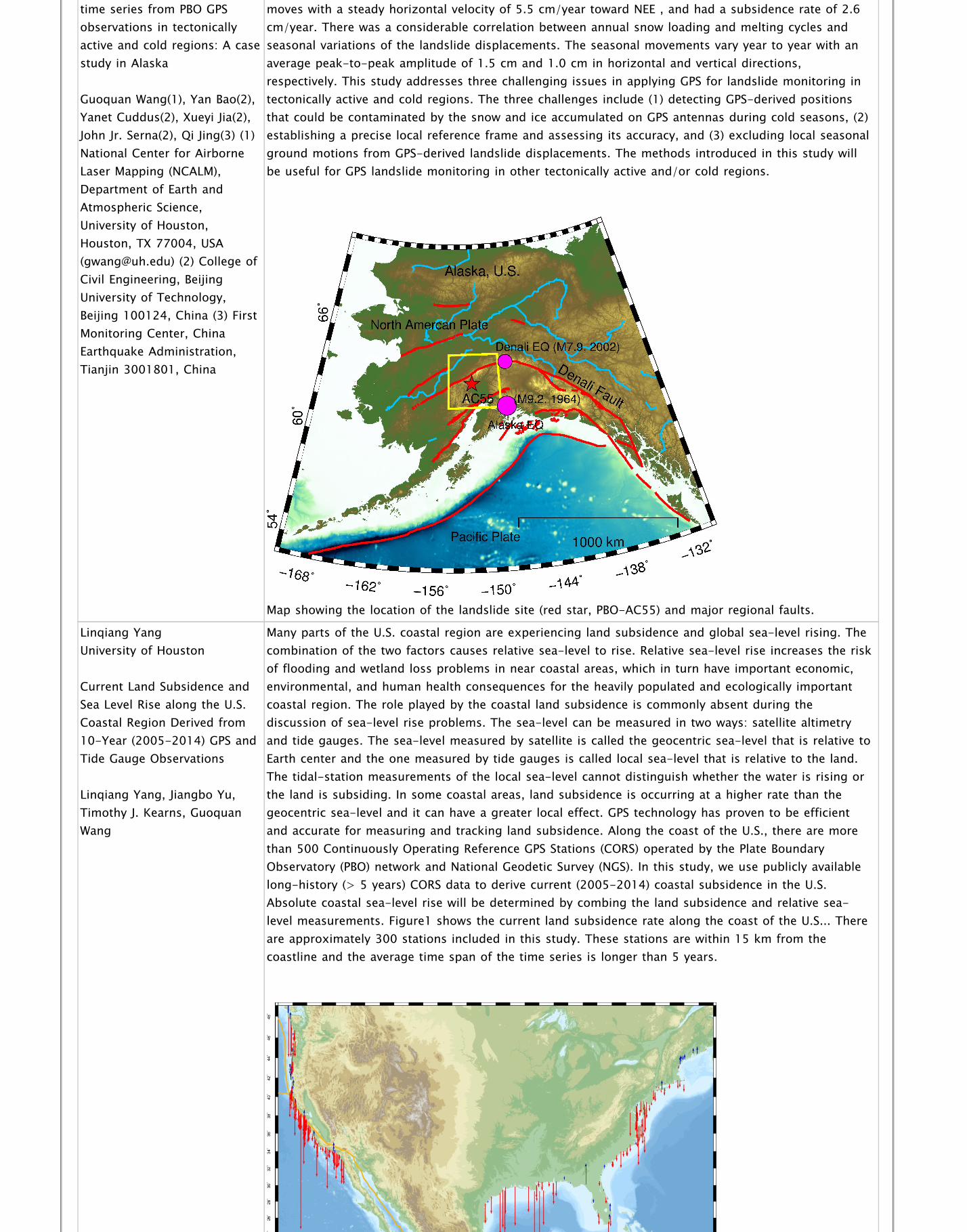
precise landslide displacementtime series from PBO GPSobservations in tectonicallyactive and cold regions: A casestudy in Alaska
Guoquan Wang(1), Yan Bao(2),Yanet Cuddus(2), Xueyi Jia(2),John Jr. Serna(2), Qi Jing(3) (1)National Center for AirborneLaser Mapping (NCALM),Department of Earth andAtmospheric Science,University of Houston,Houston, TX 77004, USA([email protected]) (2) College ofCivil Engineering, BeijingUniversity of Technology,Beijing 100124, China (3) FirstMonitoring Center, ChinaEarthquake Administration,Tianjin 3001801, China
Observatory (PBO) project, which was funded by the U.S. National Science Foundation. The landslidemoves with a steady horizontal velocity of 5.5 cm/year toward NEE , and had a subsidence rate of 2.6cm/year. There was a considerable correlation between annual snow loading and melting cycles andseasonal variations of the landslide displacements. The seasonal movements vary year to year with anaverage peak-to-peak amplitude of 1.5 cm and 1.0 cm in horizontal and vertical directions,respectively. This study addresses three challenging issues in applying GPS for landslide monitoring intectonically active and cold regions. The three challenges include (1) detecting GPS-derived positionsthat could be contaminated by the snow and ice accumulated on GPS antennas during cold seasons, (2)establishing a precise local reference frame and assessing its accuracy, and (3) excluding local seasonalground motions from GPS-derived landslide displacements. The methods introduced in this study willbe useful for GPS landslide monitoring in other tectonically active and/or cold regions.
Map showing the location of the landslide site (red star, PBO-AC55) and major regional faults.
Linqiang Yang University of Houston
Current Land Subsidence andSea Level Rise along the U.S.Coastal Region Derived from10-Year (2005-2014) GPS andTide Gauge Observations
Linqiang Yang, Jiangbo Yu,Timothy J. Kearns, GuoquanWang
Many parts of the U.S. coastal region are experiencing land subsidence and global sea-level rising. Thecombination of the two factors causes relative sea-level to rise. Relative sea-level rise increases the riskof flooding and wetland loss problems in near coastal areas, which in turn have important economic,environmental, and human health consequences for the heavily populated and ecologically importantcoastal region. The role played by the coastal land subsidence is commonly absent during thediscussion of sea-level rise problems. The sea-level can be measured in two ways: satellite altimetryand tide gauges. The sea-level measured by satellite is called the geocentric sea-level that is relative toEarth center and the one measured by tide gauges is called local sea-level that is relative to the land.The tidal-station measurements of the local sea-level cannot distinguish whether the water is rising orthe land is subsiding. In some coastal areas, land subsidence is occurring at a higher rate than thegeocentric sea-level and it can have a greater local effect. GPS technology has proven to be efficientand accurate for measuring and tracking land subsidence. Along the coast of the U.S., there are morethan 500 Continuously Operating Reference GPS Stations (CORS) operated by the Plate BoundaryObservatory (PBO) network and National Geodetic Survey (NGS). In this study, we use publicly availablelong-history (> 5 years) CORS data to derive current (2005-2014) coastal subsidence in the U.S.Absolute coastal sea-level rise will be determined by combing the land subsidence and relative sea-level measurements. Figure1 shows the current land subsidence rate along the coast of the U.S... Thereare approximately 300 stations included in this study. These stations are within 15 km from thecoastline and the average time span of the time series is longer than 5 years.

Current (2005-2014) coastal subsidence derived from CORS
Jiangbo Yu University of Houston
A Stable Reference Frame forGround Deformation Studyalong the Coastal Region ofthe Gulf of Mexico
Jiangbo Yu, Guoquan Wang,Timothy J. Kearns
The increasing population and booming oil and gas industry make the Gulf of Mexico coastal areahighly vulnerable to local-scale and regional-scale ground deformation and relative sea-level rise.Regional- and local-scale ground movements associated with salt dome uplift, faulting, and subsidencehave caused substantial infrastructure damage and flooding problems in many urban and industrialareas along the Gulf Coast. In addition, coastal subsidence and sea-level rise have increased the rate ofcoastal erosion and wetland loss. A common geodetic reference frame is essential y for studying regionalsubsidence and sea-level issues. More than 300 Continuously Operating Reference GPS Stations (CORS)have been installed along the coast of Gulf of Mexico during the past decade by geodesy and surveyingcommunities during the past decade. More than 100 GPS stations have a history of five years or greater.These long-term GPS stations have made it possible to establish a stable regional reference frame forprecisely delineating regional ground motion and absolute sea-level changes. In this project, weestablished a precise stable regional geodetic reference frame, the Stable Gulf of Mexico ReferenceFrame (SGOMRF). Thus, geodetic measurements obtained from different areas, research groups, duringvarious periods, and using different instruments can all be aligned to a unified reference frame.SGOMRF was realized by 20 CORS (each with a history of eight years or greater) distributed along thecoast of Gulf of Mexico using a reference transformation technique. Horizontal and vertical groundmotions that occurred within SGOMRF during the past ten years (2005-2014) were investigated in thisstudy.
Figure 1. Recent horizontal (left) and vertical (right) ground deformation velocity vectors in the Gulf ofMexico area within SGOMRF.