presentation for the 4th citizens advisory group
TRANSCRIPT
Citizens Advisory Group
Meeting No. 4
December 15, 2015

Agenda
1. Project Overview
– Timeline
– Fall Public Outreach
2. Alternatives Analysis & Draft Preferred
Alternative
3. Next Steps
Purpose of Tonight’s Meeting
• Provide feedback on the Draft Preferred
Alternative.
– Are there any improvements that should be
added?
– Are there any improvements that should be
removed?
PROJECT OVERVIEW

Study Area
Primary Study Area
• 16th Street NW from H Street to
Arkansas Avenue
Secondary Study Area
• Bounded by 14th Street, 18th
Street, Taylor Street and H
Street
Arkansas Avenue NW
H Street NW
16
th S
tree
t N
W
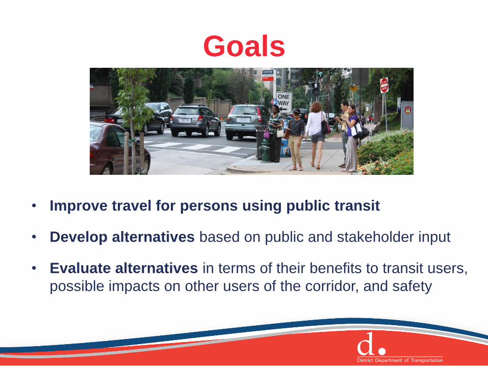
Goals
• Improve travel for persons using public transit
• Develop alternatives based on public and stakeholder input
• Evaluate alternatives in terms of their benefits to transit users,
possible impacts on other users of the corridor, and safety

Objectives
• Improve transit reliability and travel
times
• Prioritize transit while maintaining multi-
modal operations
• Improve passenger comfort and safety
• Accommodate unmet demand
• Develop an implementation plan
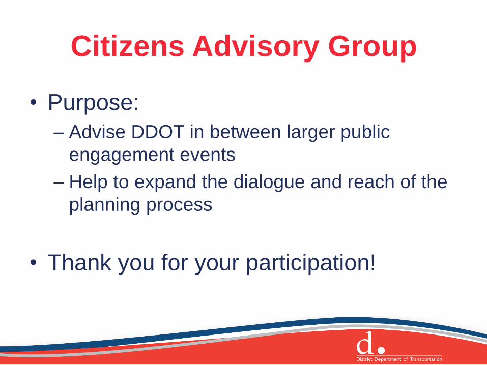
Citizens Advisory Group
• Purpose:
– Advise DDOT in between larger public
engagement events
– Help to expand the dialogue and reach of the
planning process
• Thank you for your participation!

Project Timeline
Project Kickoff Data Collection
& Analysis Alternatives
Development Model
Alternatives
Selection of Preferred
Alternative
January 2015 January 2016
March: Kick-Off Mtg.
May: CAG #1
August: CAG #2
Sept./Oct.: CAG #3 + Community Engagement Events
Dec.: CAG #4
January: Public Meeting

Fall Meetings and Events
• September 30: Citizens Advisory Group Meeting
• October: Four “pop-up” style events along the corridor
– 500 flyers or rack cards distributed
– Nearly 80 surveys completed
• Presentations at 4A, 4C, 1C, and 2B ANC October
meetings
• Public comments received through October 21
– Approximately 150 comments received via email

What We Heard
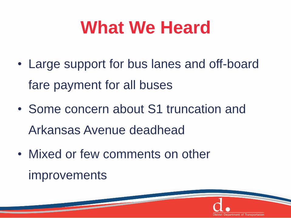
What We Heard
• Large support for bus lanes and off-board
fare payment for all buses
• Some concern about S1 truncation and
Arkansas Avenue deadhead
• Mixed or few comments on other
improvements
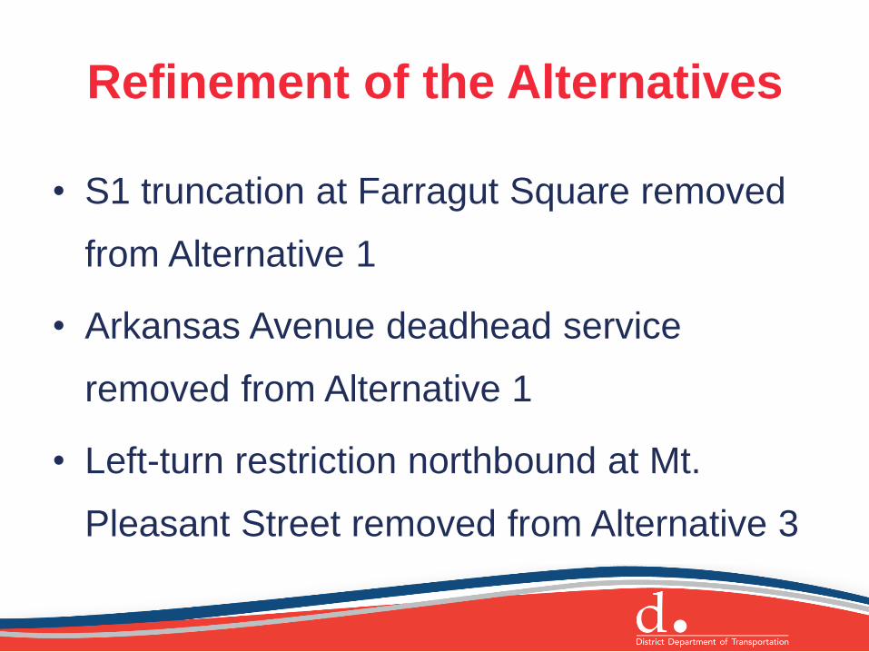
Refinement of the Alternatives
• S1 truncation at Farragut Square removed
from Alternative 1
• Arkansas Avenue deadhead service
removed from Alternative 1
• Left-turn restriction northbound at Mt.
Pleasant Street removed from Alternative 3
ALTERNATIVES ANALYSIS
& DRAFT PREFERRED
ALTERNATIVE
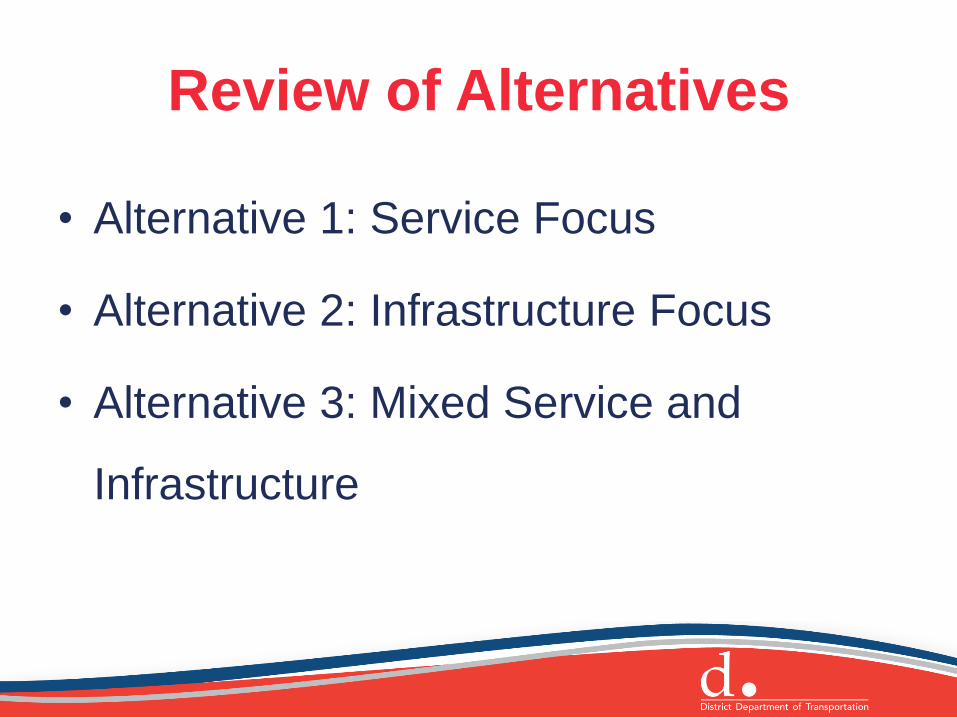
Review of Alternatives
• Alternative 1: Service Focus
• Alternative 2: Infrastructure Focus
• Alternative 3: Mixed Service and
Infrastructure

Analysis
• Multi-modal VISSIM model
• Transit dwell and travel time estimations
• Verification of physical space needs and
feasibility - ongoing
• Capital and operating cost estimates and
implementation strategy - ongoing
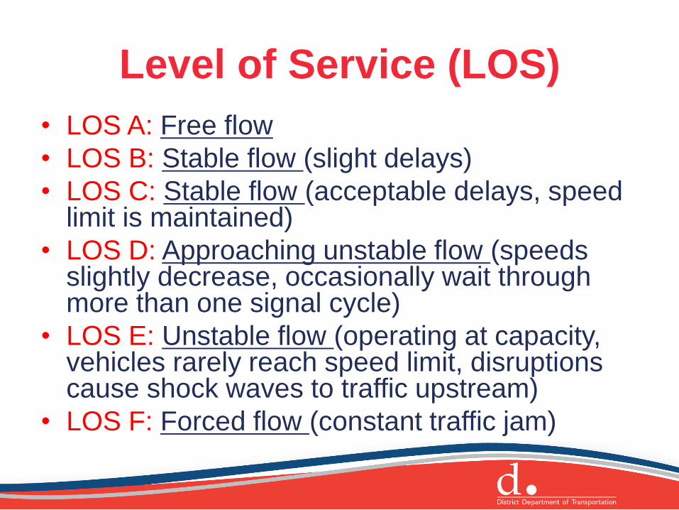
Level of Service (LOS)
• LOS A: Free flow
• LOS B: Stable flow (slight delays)
• LOS C: Stable flow (acceptable delays, speed limit is maintained)
• LOS D: Approaching unstable flow (speeds slightly decrease, occasionally wait through more than one signal cycle)
• LOS E: Unstable flow (operating at capacity, vehicles rarely reach speed limit, disruptions cause shock waves to traffic upstream)
• LOS F: Forced flow (constant traffic jam)
NEXT STEPS
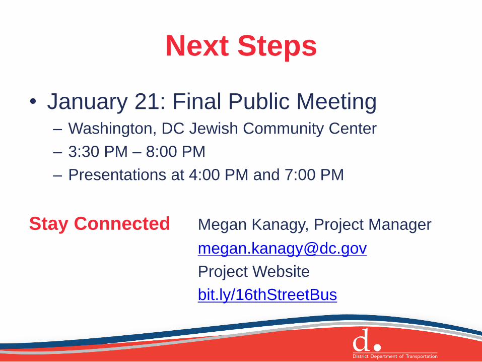
Next Steps
• January 21: Final Public Meeting – Washington, DC Jewish Community Center
– 3:30 PM – 8:00 PM
– Presentations at 4:00 PM and 7:00 PM
Stay Connected Megan Kanagy, Project Manager
Project Website
bit.ly/16thStreetBus
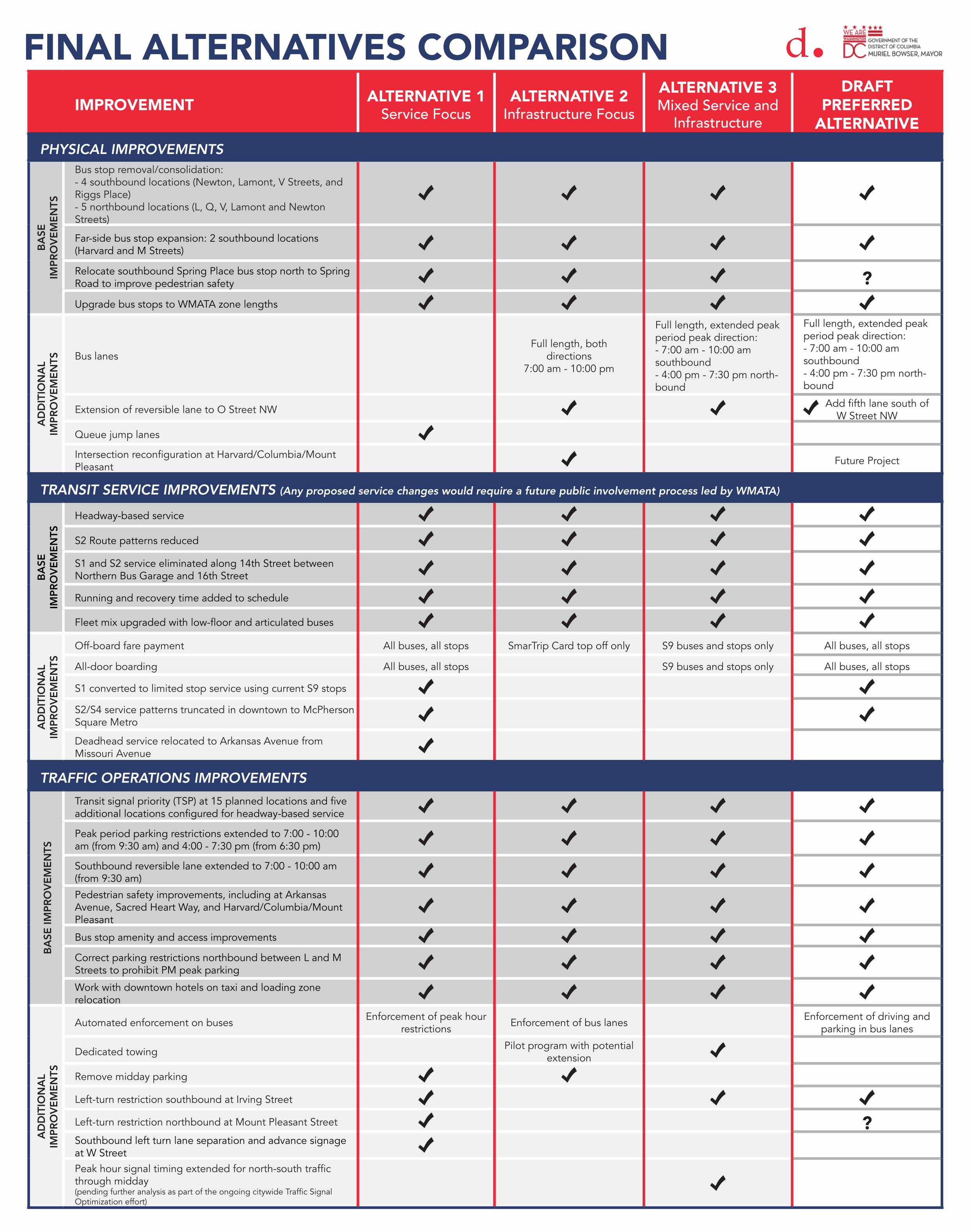
IMPROVEMENT ALTERNATIVE 1 Service Focus
ALTERNATIVE 2Infrastructure Focus
ALTERNATIVE 3Mixed Service and
Infrastructure
DRAFT PREFERRED
ALTERNATIVEPHYSICAL IMPROVEMENTS
BASE
IM
PRO
VEM
ENTS
Bus stop removal/consolidation: - 4 southbound locations (Newton, Lamont, V Streets, and Riggs Place) - 5 northbound locations (L, Q, V, Lamont and Newton Streets)
Far-side bus stop expansion: 2 southbound locations (Harvard and M Streets)
Relocate southbound Spring Place bus stop north to Spring Road to improve pedestrian safety ?Upgrade bus stops to WMATA zone lengths
AD
DIT
ION
AL
IMPR
OVE
MEN
TS Bus lanesFull length, both
directions7:00 am - 10:00 pm
Full length, extended peak period peak direction:- 7:00 am - 10:00 am southbound- 4:00 pm - 7:30 pm north-bound
Full length, extended peak period peak direction:- 7:00 am - 10:00 am southbound- 4:00 pm - 7:30 pm north-bound
Extension of reversible lane to O Street NW Add fifth lane south of W Street NW
Queue jump lanes
Intersection reconfiguration at Harvard/Columbia/Mount Pleasant Future Project
TRANSIT SERVICE IMPROVEMENTS (Any proposed service changes would require a future public involvement process led by WMATA)
BASE
IM
PRO
VEM
ENTS
Headway-based service
S2 Route patterns reduced
S1 and S2 service eliminated along 14th Street between Northern Bus Garage and 16th Street
Running and recovery time added to schedule
Fleet mix upgraded with low-floor and articulated buses
AD
DIT
ION
AL
IMPR
OVE
MEN
TS
Off-board fare payment All buses, all stops SmarTrip Card top off only S9 buses and stops only All buses, all stops
All-door boarding All buses, all stops S9 buses and stops only All buses, all stops
S1 converted to limited stop service using current S9 stops
S2/S4 service patterns truncated in downtown to McPherson Square Metro
Deadhead service relocated to Arkansas Avenue from Missouri Avenue
TRAFFIC OPERATIONS IMPROVEMENTS
BASE
IMPR
OVE
MEN
TS
Transit signal priority (TSP) at 15 planned locations and five additional locations configured for headway-based service
Peak period parking restrictions extended to 7:00 - 10:00 am (from 9:30 am) and 4:00 - 7:30 pm (from 6:30 pm)
Southbound reversible lane extended to 7:00 - 10:00 am (from 9:30 am)
Pedestrian safety improvements, including at Arkansas Avenue, Sacred Heart Way, and Harvard/Columbia/Mount Pleasant
Bus stop amenity and access improvements
Correct parking restrictions northbound between L and M Streets to prohibit PM peak parking
Work with downtown hotels on taxi and loading zone relocation
AD
DIT
ION
AL
IMPR
OVE
MEN
TS
Automated enforcement on buses Enforcement of peak hour restrictions Enforcement of bus lanes Enforcement of driving and
parking in bus lanes
Dedicated towing Pilot program with potential extension
Remove midday parking
Left-turn restriction southbound at Irving Street
Left-turn restriction northbound at Mount Pleasant Street ?Southbound left turn lane separation and advance signage at W StreetPeak hour signal timing extended for north-south traffic through midday (pending further analysis as part of the ongoing citywide Traffic Signal Optimization effort)
FINAL ALTERNATIVES COMPARISON
1
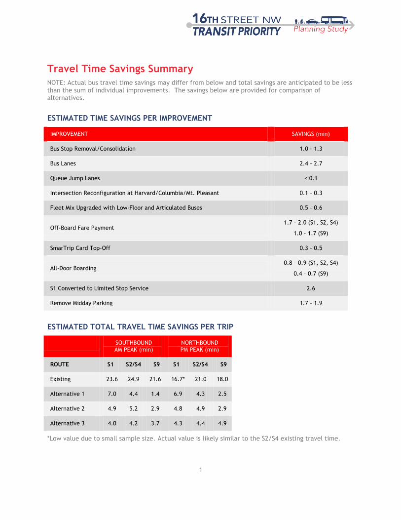
Travel Time Savings Summary
NOTE: Actual bus travel time savings may differ from below and total savings are anticipated to be less than the sum of individual improvements. The savings below are provided for comparison of alternatives.
ESTIMATED TIME SAVINGS PER IMPROVEMENT
IMPROVEMENT SAVINGS (min)
Bus Stop Removal/Consolidation 1.0 - 1.3
Bus Lanes 2.4 - 2.7
Queue Jump Lanes < 0.1
Intersection Reconfiguration at Harvard/Columbia/Mt. Pleasant 0.1 – 0.3
Fleet Mix Upgraded with Low-Floor and Articulated Buses 0.5 – 0.6
Off-Board Fare Payment 1.7 – 2.0 (S1, S2, S4)
1.0 - 1.7 (S9)
SmarTrip Card Top-Off 0.3 - 0.5
All-Door Boarding 0.8 – 0.9 (S1, S2, S4)
0.4 – 0.7 (S9)
S1 Converted to Limited Stop Service 2.6
Remove Midday Parking 1.7 – 1.9
ESTIMATED TOTAL TRAVEL TIME SAVINGS PER TRIP
SOUTHBOUND AM PEAK (min)
NORTHBOUND PM PEAK (min)
ROUTE S1 S2/S4 S9 S1 S2/S4 S9
Existing 23.6 24.9 21.6 16.7* 21.0 18.0
Alternative 1 7.0 4.4 1.4 6.9 4.3 2.5
Alternative 2 4.9 5.2 2.9 4.8 4.9 2.9
Alternative 3 4.0 4.2 3.7 4.3 4.4 4.9
*Low value due to small sample size. Actual value is likely similar to the S2/S4 existing travel time.
2
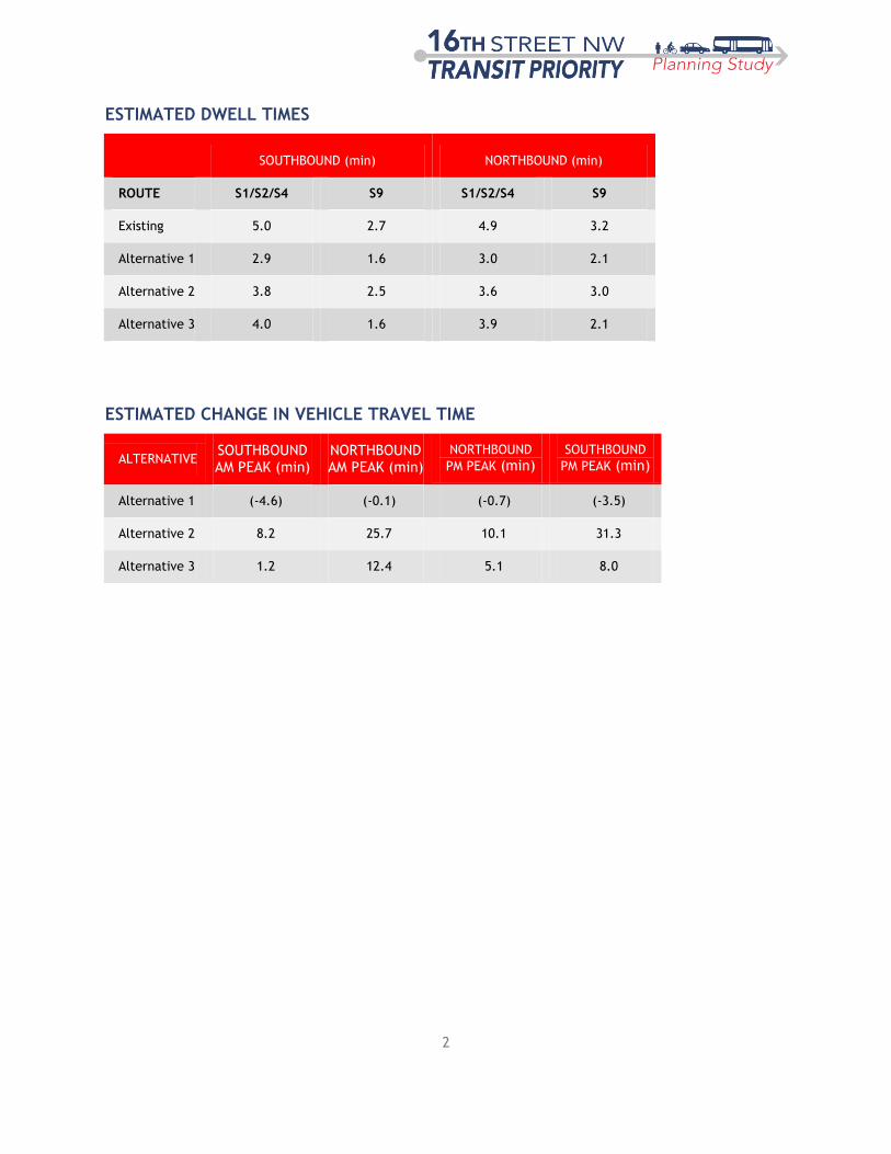
ESTIMATED DWELL TIMES
SOUTHBOUND (min) NORTHBOUND (min)
ROUTE S1/S2/S4 S9 S1/S2/S4 S9
Existing 5.0 2.7 4.9 3.2
Alternative 1 2.9 1.6 3.0 2.1
Alternative 2 3.8 2.5 3.6 3.0
Alternative 3 4.0 1.6 3.9 2.1
ESTIMATED CHANGE IN VEHICLE TRAVEL TIME
ALTERNATIVE SOUTHBOUND AM PEAK (min)
NORTHBOUND AM PEAK (min)
NORTHBOUND
PM PEAK (min) SOUTHBOUND
PM PEAK (min)
Alternative 1 (-4.6) (-0.1) (-0.7) (-3.5)
Alternative 2 8.2 25.7 10.1 31.3
Alternative 3 1.2 12.4 5.1 8.0

INTERSECTIONS & APPROACHES WITH LOS E/F
INTERSECTIONSAM-PEAK
OVERALLAM-PEAK SB AM-PEAK NB
PM-PEAK
OVERALLPM-PEAK SB PM-PEAK NB MIDDAY OVERALL MIDDAY SB MIDDAY NB
I Street ●
L Street ●
W Street ●
Irving Street ●
Total 0 1 1 0 1 1 0 0 0
Total 0 0 0 0 0 0 0 0 0
I Street ●
K Street ●
M Street ●
R Street ●
S Street ●
T Street ●
U Street and New Hampshire Avenue ● ●
V Street ●
W Street ● ●
Crescent Place ● ●
Euclid Street ● ● ● ●
Fuller Street ● ● ● ● ●
Harvard Street ● ● ● ●
Mt. Pleasant Street ●
Irving Street ● ●
Lamont Street ● ● ● ●
Park Road ● ●
Monroe Street ● ●
Newton Street ● ●
Oak Street ● ●
Spring Road ●
Arkansas Avenue ● ● ● ●
Total 5 5 8 10 11 5 0 1 1
I Street ●
M Street
P Street ●
Q Street ●
U Street and New Hampshire Avenue ●
W Street ● ●
Crescent Place ●
Euclid Street ●
Fuller Street ●
Harvard Street ●
Total 0 0 4 1 5 0 0 0 0
ALTERNATIVE 3
EXISTING CONDITIONS
ALTERNATIVE 1
ALTERNATIVE 2
Seeking to improve with addition of center
reversible lane.
Examining options for improving operations at W