presented to - general bathymetric chart of the oceans · 1988 first vessel lost during hurricane...
TRANSCRIPT

Presented to:
November 15, 2017Antonio Williams

Presentation Outline

By Connormah - Own work, CC BY-SA 3.0,
https://commons.wikimedia.org/w/index.php?curid=8993917
Population: 2,881,000
Area: 10,991km2
1655 – 1962 Jamaica was a
British Colony

Joint Surveys with Canadian HydrographicOffice to train Jamaican Surveyors in Basic Hydrographic Surveying
Two Hydrgraphic Survey Launches donated by Canada to Jamaica
Hydrographic Surveys using
Lead Line by British Directorate
of Surveys
Independence from England
1962

1962 Independence from England
Hydrographic work by Survey Department
1988 First vessel lost during Hurricane Gilbert
1995 Second vessel decommissioned due to high repair costs
2001 National Land Agency (NLA)– HydrographicSection
2006 National Hydrographic Committee formed

International Hydrographic Organization (IHO) in April
2000
Responsibilities are set out in:
United Nations Convention on the Safety of Life at
Sea (SOLAS)
United Nations Convention on the Law of the Sea
(UNCLOS)

Exploitation of resources within its EEZ

Coastal Engineering
Tourism and Recreation

Oil and Gas Exploration

Management of protected areas

Location of the Hydrographic Survey Section

Hydrographic Staff Compliment:
Survey Technician (vacant)
Coxswain (vacant)
Boatman (vacant)
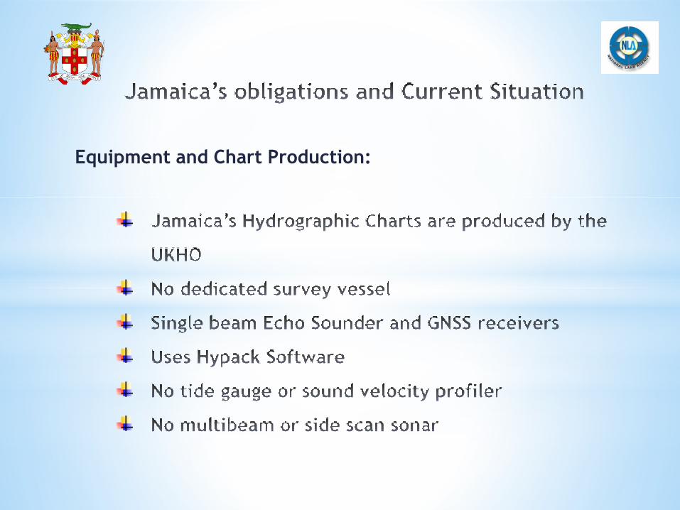
Equipment and Chart Production:


Falmouth Harbour
October 2015
Port Antonio Harbour
September 2015
Portland Bight
January 2018
Kingston Harbour
November 2017

Hydrography can be done in a sustainable way when:
