rapideye – multi-temporal imagery a key resource in...
TRANSCRIPT
DIN EN ISO 9001 certifiedRapidEye proprietary information
RapidEye – Multi-Temporal Imagery A Key Resource In Agricultural Monitoring
Dr. Frederik Jung-RothenhäuslerMARS-Conference-2008 Session T1 / Ljubljana / 2008-12-03
DIN EN ISO 9001 certifiedRapidEye proprietary information
Overview
> History and achievements to date
> RapidEye satellite system, imaging concepts and calibration
> RapidEye data products and ortho-rectification
> RapidEye service partnership
> Imagery
DIN EN ISO 9001 certifiedRapidEye proprietary information
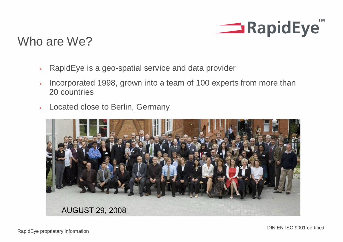
Who are We?
> RapidEye is a geo-spatial service and data provider
> Incorporated 1998, grown into a team of 100 experts from more than 20 countries
> Located close to Berlin, Germany
DIN EN ISO 9001 certifiedRapidEye proprietary information
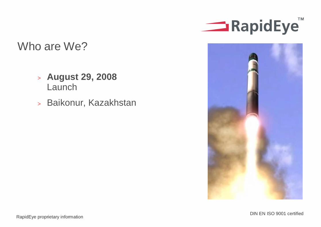
Who are We?
> August 29, 2008Launch
> Baikonur, Kazakhstan
DIN EN ISO 9001 certifiedRapidEye proprietary information
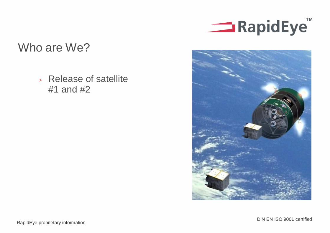
Who are We?
> Release of satellite#1 and #2
DIN EN ISO 9001 certifiedRapidEye proprietary information
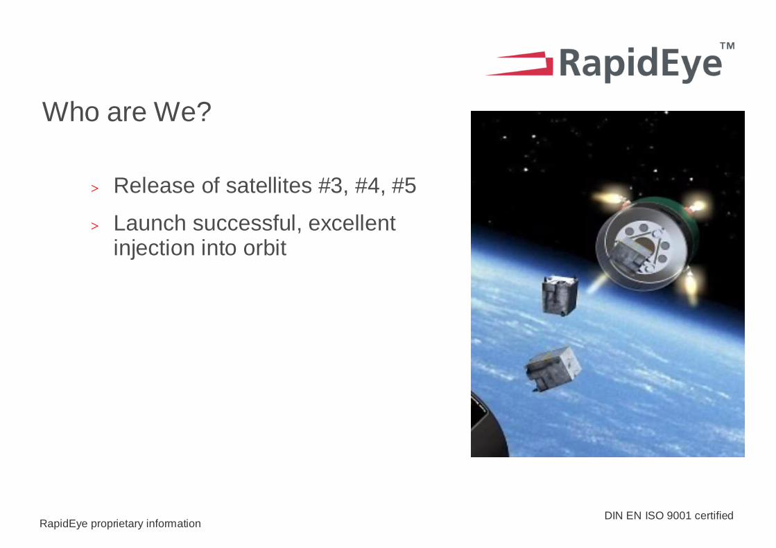
Who are We?
> Release of satellites #3, #4, #5
> Launch successful, excellent injection into orbit
DIN EN ISO 9001 certified
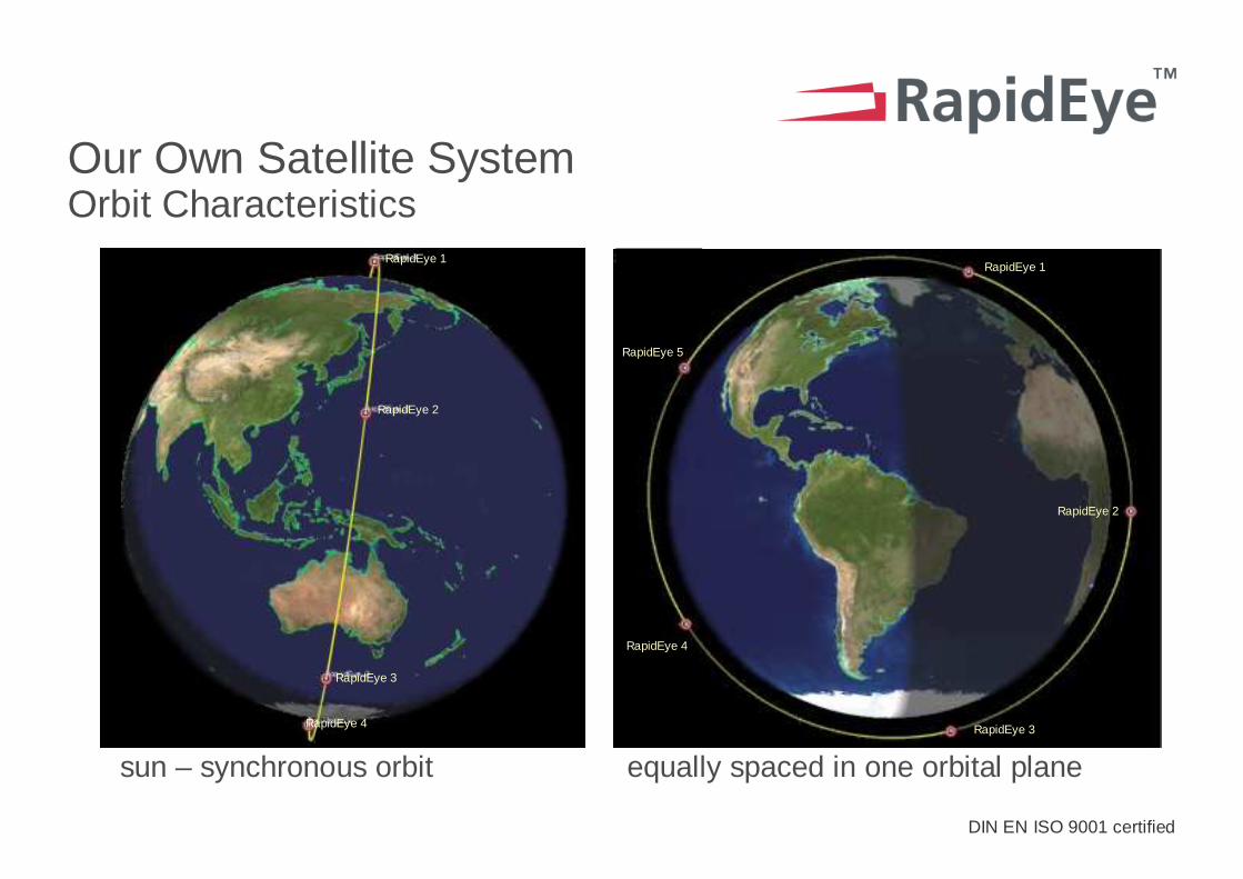
sun – synchronous orbit equally spaced in one orbital plane
Our Own Satellite System Orbit Characteristics
RapidEye 1
RapidEye 2
RapidEye 3
RapidEye 4
RapidEye 2
RapidEye 4
RapidEye 3
RapidEye 5
RapidEye 1RapidEye 1
RapidEye 2
RapidEye 3
RapidEye 4
RapidEye 5
DIN EN ISO 9001 certifiedRapidEye proprietary information
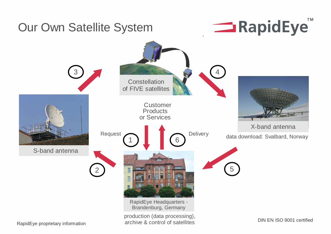
Customer Products
or Services
Our Own Satellite System
data download: Svalbard, Norway
Constellationof FIVE satellites
S-band antenna
3
1
4
2 5
6Request Delivery
production (data processing), archive & control of satellites
RapidEye Headquarters -Brandenburg, Germany
X-band antenna

DIN EN ISO 9001 certifiedRapidEye proprietary information
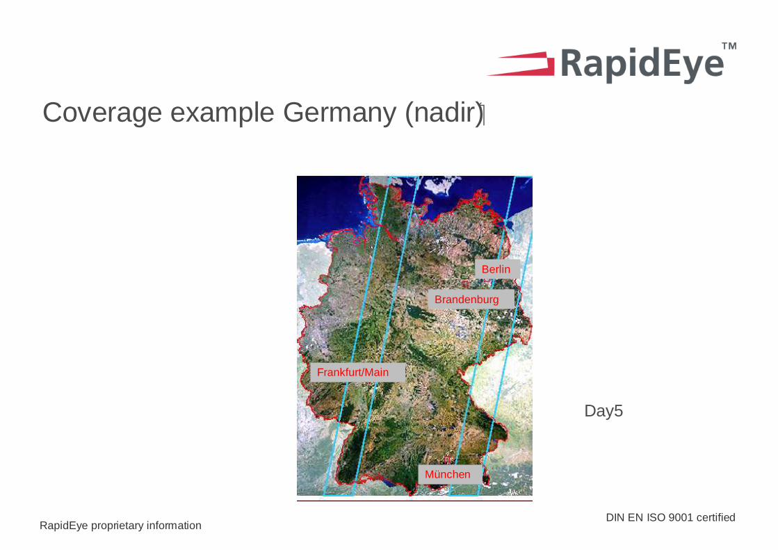
Berlin
Brandenburg
Frankfurt/Main
München
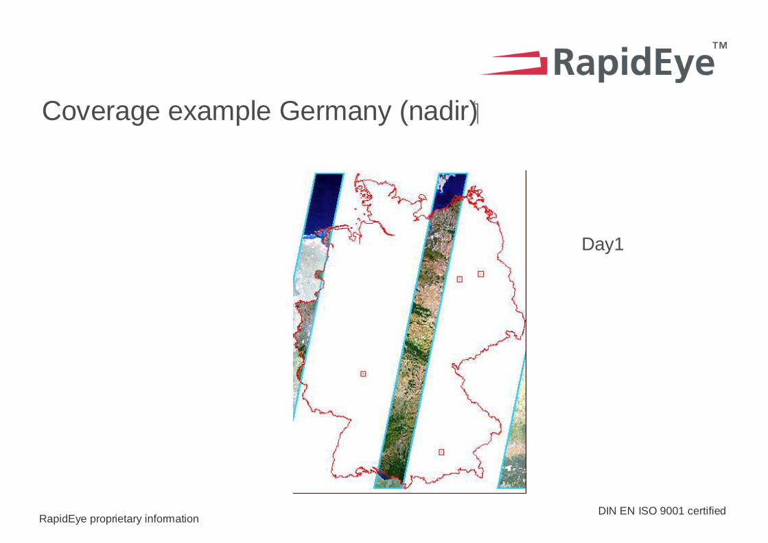
Coverage example Germany (nadir)�
DIN EN ISO 9001 certifiedRapidEye proprietary information
Coverage example Germany (nadir)�
Day1
DIN EN ISO 9001 certifiedRapidEye proprietary information
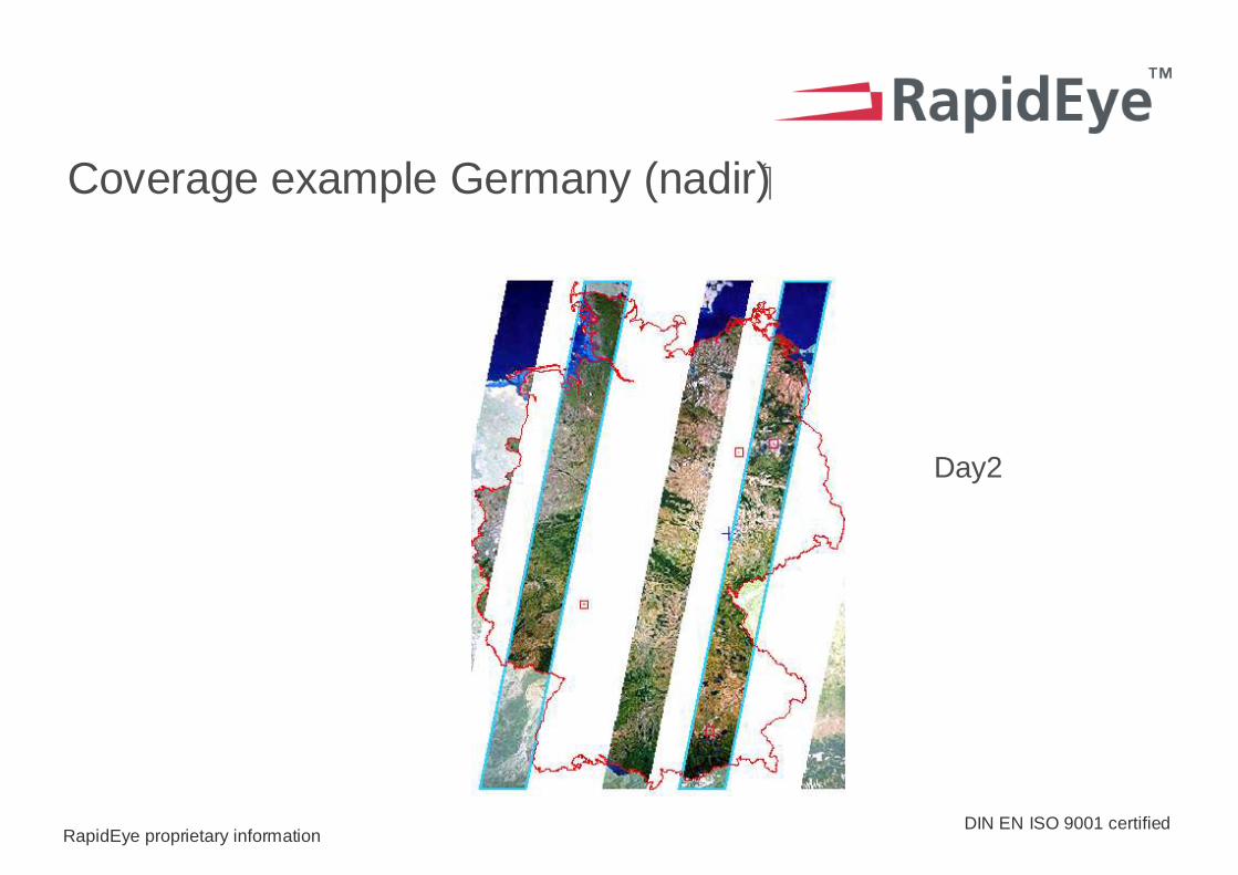
Coverage example Germany (nadir)�
Day2

DIN EN ISO 9001 certifiedRapidEye proprietary information
Coverage example Germany (nadir)�
Day3
DIN EN ISO 9001 certifiedRapidEye proprietary information
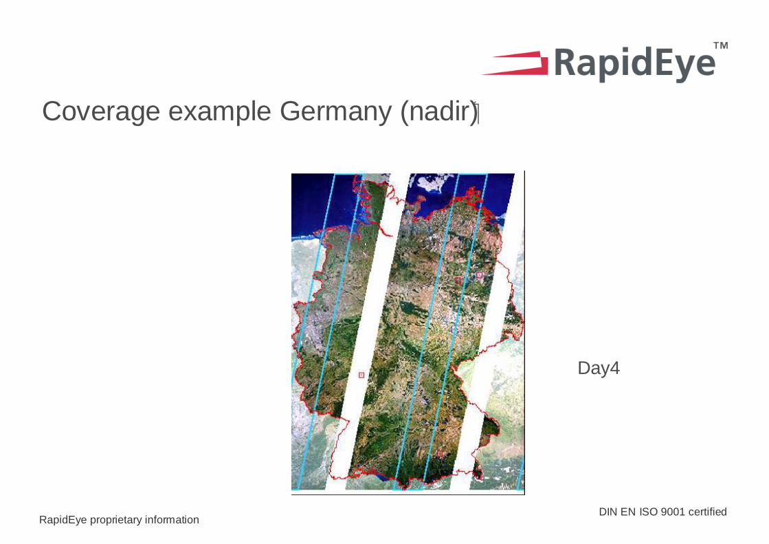
Coverage example Germany (nadir)�
Day4
DIN EN ISO 9001 certifiedRapidEye proprietary information
Day5
Berlin
Brandenburg
Frankfurt/Main
München
Coverage example Germany (nadir)�
DIN EN ISO 9001 certifiedRapidEye proprietary information
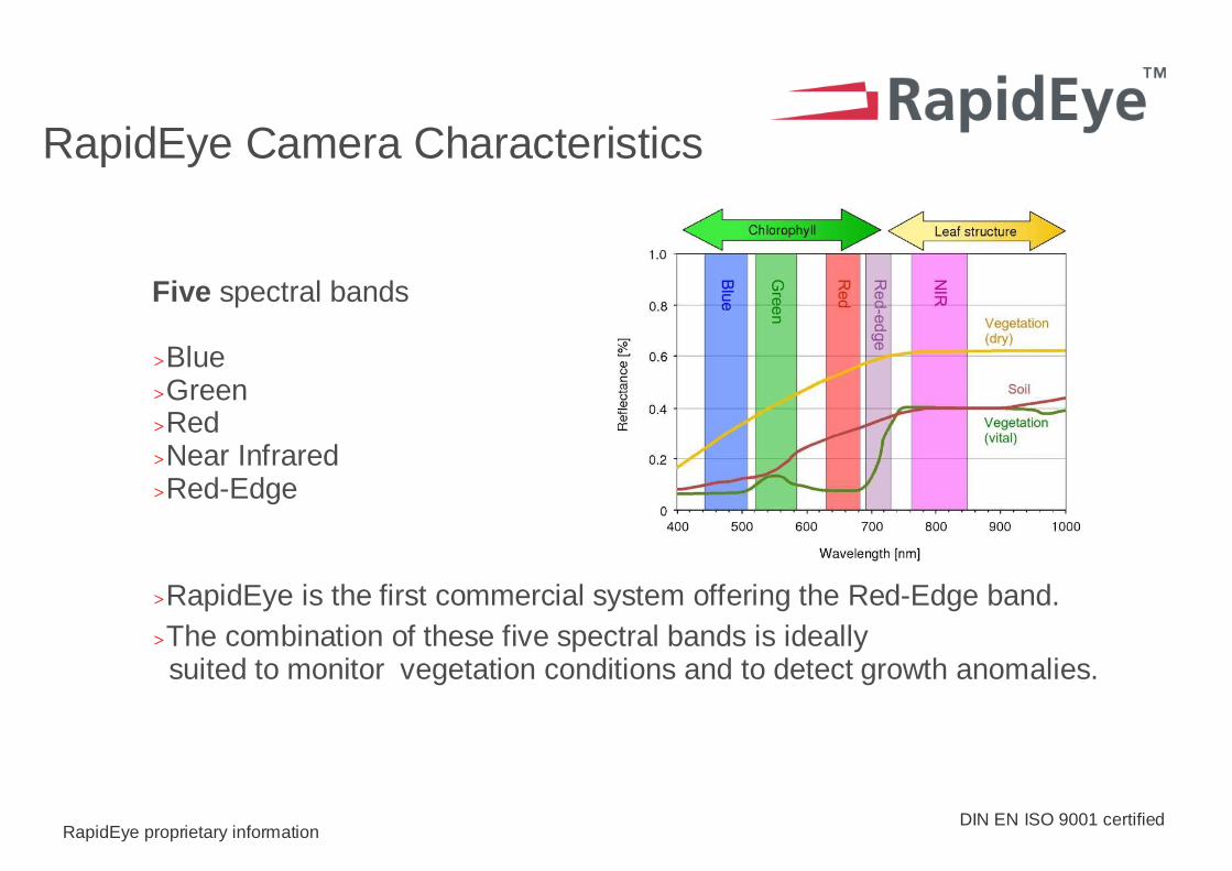
Five spectral bands
>Blue>Green>Red>Near Infrared>Red-Edge
>RapidEye is the first commercial system offering the Red-Edge band. >The combination of these five spectral bands is ideally
suited to monitor vegetation conditions and to detect growth anomalies.
RapidEye Camera Characteristics
DIN EN ISO 9001 certifiedRapidEye proprietary information
The Calibration and Validation Concept
> Calibration establishes a physical relationship between the signal from the ground and the digital output of the satellite sensor.
> Geometrical component
> Radiometrical component
> Validation assesses the long term stability of
> Geometric accuracy
> Radiometric accuracy
DIN EN ISO 9001 certifiedRapidEye proprietary information
Operational Calibration and Validation
> Is based on:
> Repeated vicarious calibration campaigns
> Statistical sampling of all image data in order to detect anomalies quickly
> Is performed by:
> The RapidEye operations team as part of their regular routines
> The RapidEye calibration engineers who work with scientific partners to ensure long term stability of entire system
DIN EN ISO 9001 certifiedRapidEye proprietary information
RE Data Products
> Raw data
> Level 0
> Level 1B RE-BASIC
> Level 3A RE-ORTHO
DIN EN ISO 9001 certifiedRapidEye proprietary information
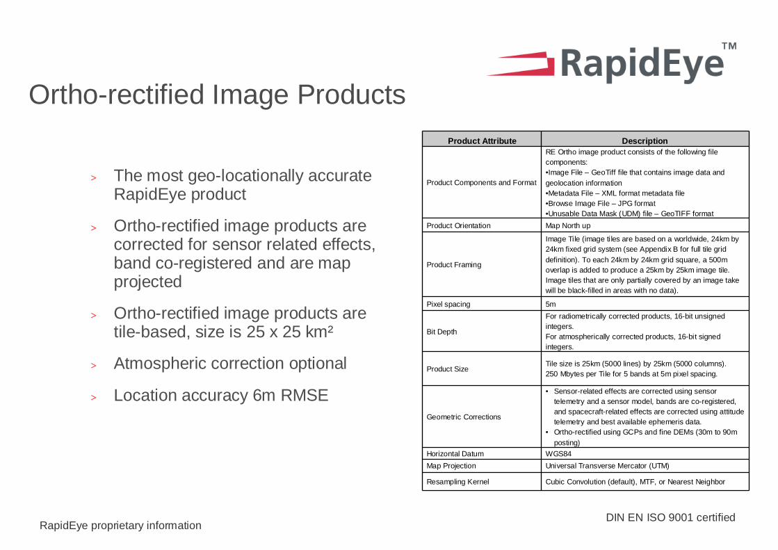
Ortho-rectified Image Products
> The most geo-locationally accurate RapidEye product
> Ortho-rectified image products are corrected for sensor related effects, band co-registered and are map projected
> Ortho-rectified image products are tile-based, size is 25 x 25 km²
> Atmospheric correction optional
> Location accuracy 6m RMSE
Product Attribute Description
Product Components and Format
RE Ortho image product consists of the following file components:•Image File – GeoTiff file that contains image data and geolocation information•Metadata File – XML format metadata file•Browse Image File – JPG format•Unusable Data Mask (UDM) file – GeoTIFF format
Product Orientation Map North up
Product Framing
Image Tile (image tiles are based on a worldwide, 24km by 24km fixed grid system (see Appendix B for full tile grid definition). To each 24km by 24km grid square, a 500m overlap is added to produce a 25km by 25km image tile. Image tiles that are only partially covered by an image take will be black-filled in areas with no data).
Pixel spacing 5m
Bit Depth
For radiometrically corrected products, 16-bit unsigned integers.For atmospherically corrected products, 16-bit signed integers.
Product SizeTile size is 25km (5000 lines) by 25km (5000 columns). 250 Mbytes per Tile for 5 bands at 5m pixel spacing.
Geometric Corrections
• Sensor-related effects are corrected using sensor telemetry and a sensor model, bands are co-registered, and spacecraft-related effects are corrected using attitude telemetry and best available ephemeris data.
• Ortho-rectified using GCPs and fine DEMs (30m to 90m posting)
Horizontal Datum WGS84
Map Projection Universal Transverse Mercator (UTM)
Resampling Kernel Cubic Convolution (default), MTF, or Nearest Neighbor
DIN EN ISO 9001 certifiedRapidEye proprietary information
Ortho-Image Product Generation
> The ortho-rectification process is performed within the RapidEye Ground Segment (GS) – Data Processing Subsegment (DPS)�
> The ortho-rectification process is based on GCPs stored within a RapidEye Global GCP database inside the GS, and on DEMs also stored inside the GS
> All ortho-images generated are cataloged and archived by the Archive Management system (AMS)�
> GCP Marking is a fully automated process performed already during the initial raw image cataloging, it automatically request operator interaction in case the pre-calculated accuracy will be not sufficient for the product requirements
DIN EN ISO 9001 certifiedRapidEye proprietary information
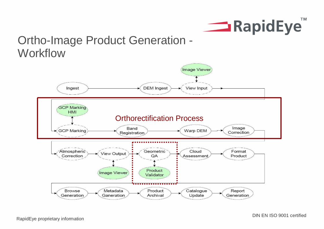
Ortho-Image Product Generation -Workflow
Orthorectification Process
DIN EN ISO 9001 certifiedRapidEye proprietary information
Output Quality and Accuracy
> There are several checks within the automated processing chain to ensure quality and accuracy.
> In addition to these checks, RapidEye will screen all products coming out of the system to ensure the highest quality of product is achieved.
> More information on the RE Ortho product at: www.rapideye.de/home/products

DIN EN ISO 9001 certifiedRapidEye proprietary information
RapidEye Service Partnerships with the Value Adding Industry
> RapidEye provides Business-to-Business solutions globally
> RapidEye customizes core solutions for our business partners
> RapidEye solutions are attractively priced
> RapidEye delivers reliably and fast
DIN EN ISO 9001 certifiedRapidEye proprietary information
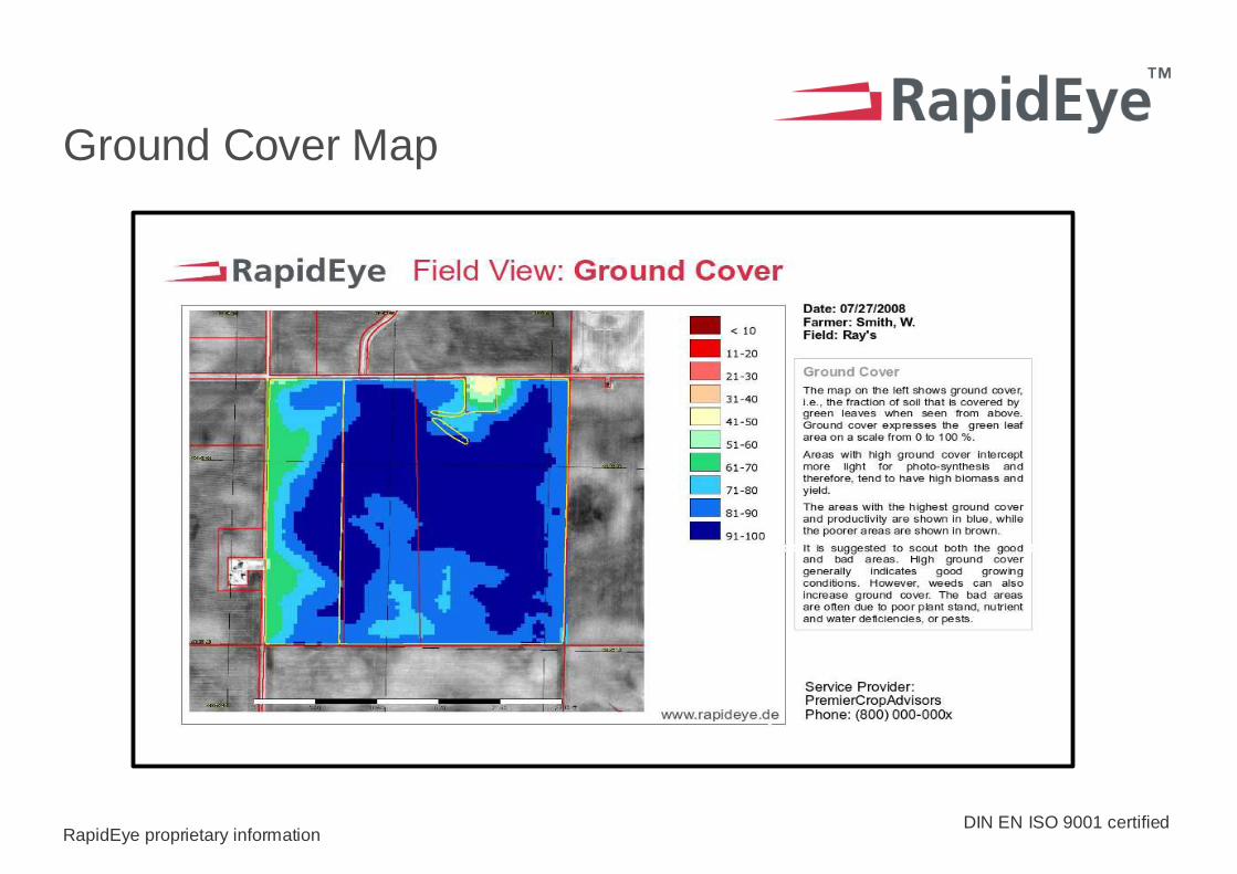
Ground Cover Map
DIN EN ISO 9001 certifiedRapidEye proprietary information
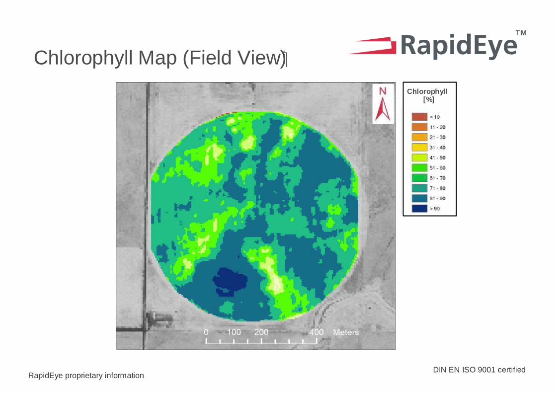
Chlorophyll Map (Field View)�
Chlorophyll[%]
DIN EN ISO 9001 certifiedRapidEye proprietary information
Summary
> RapidEye is open for business now
> We operate on a global basis
> The five satellites, the processing system are now in final calibration phase
> We are working with customers to define their specific solutions now
DIN EN ISO 9001 certifiedRapidEye proprietary information
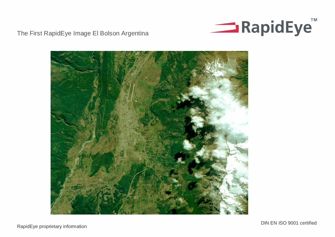
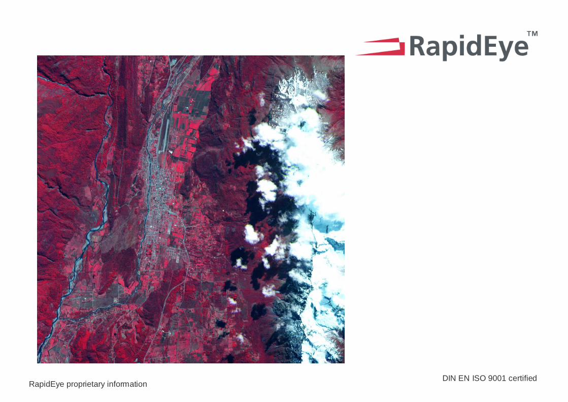
The First RapidEye Image El Bolson Argentina
DIN EN ISO 9001 certifiedRapidEye proprietary information