san diego, californiamaps.uky.edu/esri-uc/esri_uc_2k12/files/360.pdf · · 2012-08-22within a...
TRANSCRIPT

Technical Workshops |
Esri International User Conference San Diego, California
ArcGIS Data Reviewer An Introduction
Jay Cary & Michelle Johnson
July 26, 2012

Workshop Overview
• Importance of Data Quality
• What is ArcGIS Data Reviewer • Automated Data Review • Batch Data Review • Visual Data Review
• Managing Errors and Reporting Data Quality
• Summary/Resources

Ensuring Data Quality with ArcGIS Data Reviewer

Data Quality Matters
• Cost of poor quality can be extreme - $$ to fix - Impacts customers - Reputation
• Consider - Do you publish a doc without spell checking? - Do you operate a PC without a virus scanner?

Defining Quality
• Technical Perspective - Positional Accuracy - Attribute Accuracy - Completeness - Logical Consistency - Lineage
• Business Perspective - Intended purpose and
use - Client requirements - Technical
specifications - Industry standards
A

Defining Quality Control
• Quality Assurance Plan - Defines desired level of data quality - Specifies acceptable and unacceptable levels of error - Identifies how quality control will be performed
• Quality Control - The tasks required to ensure data quality - Methods to assess and evaluate data
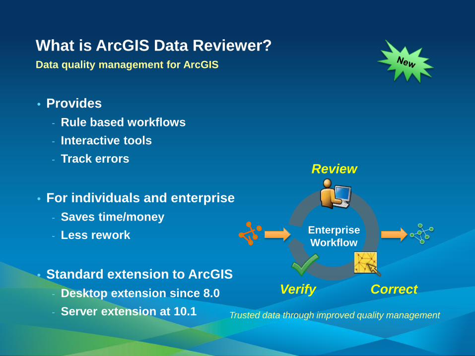
• Provides - Rule based workflows - Interactive tools - Track errors
• For individuals and enterprise - Saves time/money - Less rework
• Standard extension to ArcGIS - Desktop extension since 8.0 - Server extension at 10.1
What is ArcGIS Data Reviewer? Data quality management for ArcGIS
Trusted data through improved quality management
Enterprise Workflow
Review
Correct Verify

REVIEW
Find & Record Errors
CORRECT
Perform Edits or
Note Exceptions
VERIFY
Acceptable or
Unacceptable
Managing Quality Control Scalable framework for managing QC lifecycle
A

The Reviewer Table
• Heart of the Data Reviewer
• Tracks all anomalies/errors from review
• Interactive table
Review Data & Identify Errors
• Automated Checks
• Batch Data Review
• Visual Review
Reviewer Session
• Similar to an edit session
• Allows data interaction for QC purposes
Reviewer Workspace
• Stores spatial & attribute information about errors
• Personal, File, or Enterprise Geodatabase
• Feature class & tables created automatically
Report Quality Information
• Summarize quality control results
• Interpret data error
• Report data accuracy
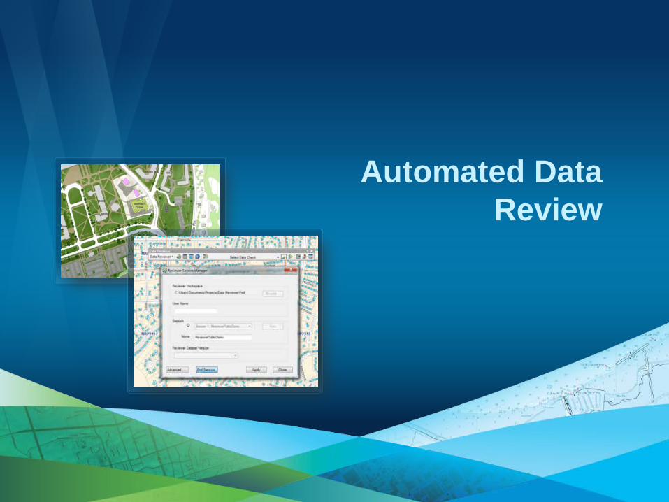
An Introduction to Data Reviewer Components The Quality Control Process with Data Reviewer
A

Ensuring Data Quality with ArcGIS Data
Reviewer

Performing Quality Control Automated Data Review

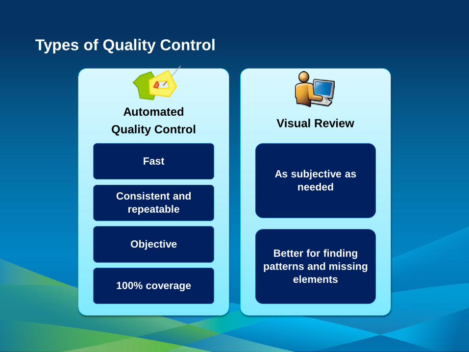
Types of Quality Control
Fast
Consistent and repeatable
Objective
100% coverage
As subjective as needed
Better for finding patterns and missing
elements
Automated Quality Control Visual Review

Understanding Data Reviewer Checks
• Over 40 data checks • Grouped into 11 categories • Configurable • Additive/Scriptable
www.esri.com/datareviewer

Table Checks
Mains installed after 1 January 2000, should only be Cast Iron, Ductile Iron, or PVC
A

Feature on Feature Checks
Travel Routes coincident with road features must be coded as road route.
A

Combine Multiple Rules for Batch Check
• Encapsulate workflow / process • Designed once and executed many times • Complete spec check
Subject Matter Experts
Industry Standards /
Specifications
Training & Experience
Quality Assurance Plans
Configure as Rule-based
Checks
Build Batch Job
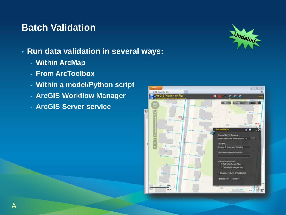
Batch Validation
• Run data validation in several ways: - Within ArcMap - From ArcToolbox - Within a model/Python script - ArcGIS Workflow Manager - ArcGIS Server service
A

ArcGIS Server
New Capabilities for 10.1 Server-based Data Validation
• Automated quality control for the enterprise
- Scheduled and on-demand data validation
- Frees data editors from running checks
Data Validation GP Service
Batch Validation
Production Workspace
Reviewer Results Workspace
Business Rules
Error Results • Spatial extent • Properties
- Scalable data validation capability based on ArcGIS Server

Enhancements for 10.1 Automated Data Validation
• Check Enhancements - Geometry on Geometry - Intersection on Geometry
• Performance improvements
- Increase batch validation performance
10.1
Version Records Written Time 10.0 19,000 15:37
10.1 19,000 1:54
Automated Data Review

Performing Quality Control Visual Data Review
Types of Quality Control
Fast
Consistent and repeatable
Objective
100% coverage
As subjective as needed
Better for finding patterns and missing
elements
Automated Quality Control Visual Review

An Introduction to Visual Data Review
• Visual inspection of the data - Level of judgment/discretion - Compare between data sources - Requires strong knowledge of the data & ability to make
consistent decisions
• Simplify visual review with Data Reviewer - Organize and structure the visual review process - Manage error information in the Data Reviewer table

Working with the Reviewer Overview Window
• Structure review by geographic extent • Navigate to cells & track review progress

Sampling Data
• Determine a subset of features
• Fixed number of features
• Percentage of features
• Statistically significant sample
• By polygon grid

Submitting Results during Visual Review
• Commit to Reviewer Table - Features selected interactively - Results of automated processes
• Flag Missing Features/Notepad - Capture x,y location or geometry - Identify type of missing feature

Quality Feedback via the Web Expanding the dialog on quality data management
• Extending quality control workflows into other communities
- QC review across ArcGIS platform
- Simple to use tools for error identification
- Deployed via intranet or Internet

Visual Data Review
Measuring and Reporting Data Quality
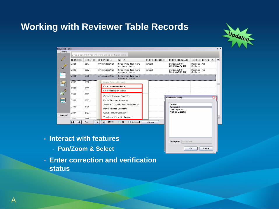
Working with Reviewer Table Records
• Interact with features - Pan/Zoom & Select
• Enter correction and verification status
A

Summarizing Information
• Sort and group by table fields • Summarize quality control information
- Identify most common data errors - View progress of quality control

Reporting
• Automated reporting of quality control results
• Available Reports - Automated Check by Origin Table
- Automated Check by Subtype
- Automated Check by Group
- Total Record Count
- Sampling

Dashboard Reporting Enabling transparency in data quality
• Better decision making by communicating data quality across stakeholders
- Open quality reporting
- Shared across ArcGIS system
- New tools and methods to communicate quality

Measuring and Reporting Data
Quality

ArcGIS Data Reviewer Automate, Simplify, and Improve your Quality Control Process
• Extension to Desktop/Server • Supports complete QC process • Provides
- Rule based workflows - Interactive tools - Track errors
• For individuals and enterprise - Saves time/money - Less rework
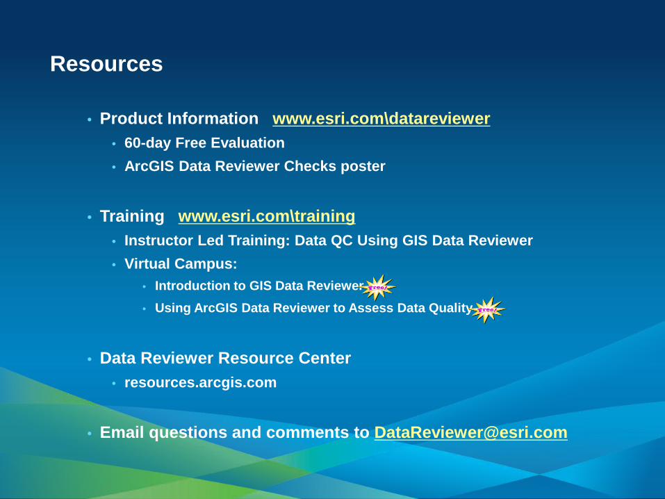
Resources
• Product Information www.esri.com\datareviewer • 60-day Free Evaluation • ArcGIS Data Reviewer Checks poster
• Training www.esri.com\training
• Instructor Led Training: Data QC Using GIS Data Reviewer • Virtual Campus:
• Introduction to GIS Data Reviewer • Using ArcGIS Data Reviewer to Assess Data Quality
• Data Reviewer Resource Center
• resources.arcgis.com
• Email questions and comments to [email protected]

Other Data Reviewer Sessions Day and Description Type Time Location
Tuesday July 24
Validating Data on the Web Using ArcGIS Data Reviewer Demo Theater 11:00 – 12:00 AM Web & Server GIS Theater
Using ArcGIS Data Reviewer to validate the quality of your Community Maps content Demo Theater 1:30 – 2:00 PM Online GIS
Theater
Extending the ArcGIS Data Reviewer validation framework Demo Theater 3:00 – 3:30 PM Geodatabase Mgmt Theater
Wednesday July 25
Using ArcGIS Data Reviewer to validate the quality of your Community Maps content Demo Theater 9:30 – 10:00 AM Online GIS
Theater
Assessing positional accuracy using ArcGIS Data Reviewer Demo Theater 10:00 – 10:30 AM Geodatabase Mgmt Theater
Validating Data on the Web Using ArcGIS Data Reviewer Demo Theater 12:00 – 1:00 PM Web & Server GIS Theater
Validating item metadata with ArcGIS Data Reviewer Demo Theater 2:00 – 2:30 PM Geodatabase Mgmt Theater
Integrating ArcGIS Data Reviewer & ArcGIS Workflow Manager to automate data quality control workflows Demo Theater 2:30 – 3:00 PM Geodatabase
Mgmt Theater
Thursday July 14
Leveraging Geoprocessing for data validation within ArcGIS Data Reviewer Demo Theater 1:00 – 1:30 PM Analysis and GP
Theater
ArcGIS Data Reviewer: An Introduction Technical Workshop 1:30 – 2:45 PM Ballroom 6C

Steps to evaluate UC sessions
• My UC Homepage > “Evaluate Sessions”
• Choose session from planner OR
• Search for session
www.esri.com/ucsessionsurveys

• Thank you for attending
• Have fun at UC2012
• Open for Questions
• Please fill out the evaluation:
www.esri.com/ucsessionsurveys
First Offering ID: 602
Second Offering ID: 859
