team 01 (muchtar salam solle & sayed faheem eqbali)
TRANSCRIPT
ANALISIS POTENSI BAHAYA LONGSORAN DI DAS JENEBERANG
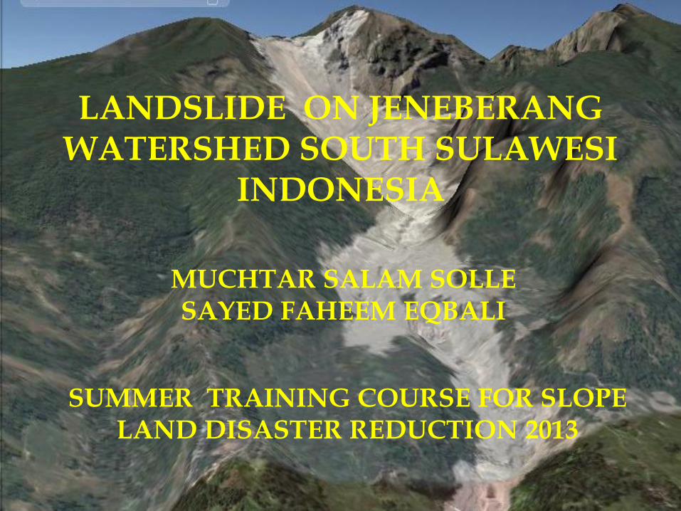
LANDSLIDE ON JENEBERANG WATERSHED SOUTH SULAWESI
INDONESIA
MUCHTAR SALAM SOLLE SAYED FAHEEM EQBALI
SUMMER TRAINING COURSE FOR SLOPE LAND DISASTER REDUCTION 2013
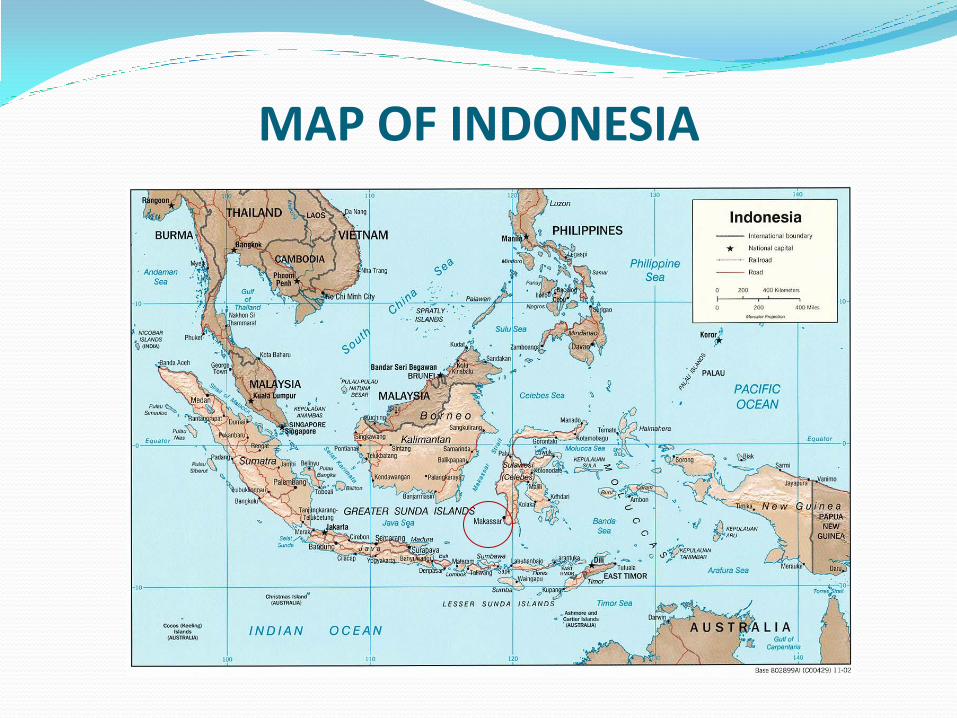
MAP OF INDONESIA
STUDY AREA Jeneberang Watershed having comparatively complex
ecological characteristics, particularly in terms of geology and landform, river systems, plant species. In addition, a considerable number of activities occur within the catchment including forestry, intensive agriculture and horticulture, rice field,
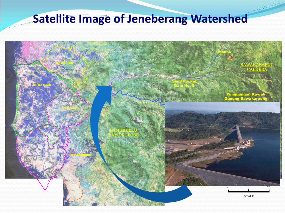
Satellite Image of Jeneberang Watershed
KOTA
MAKASSAR
Sungai
Jeneberang
Sungai Jenelata
Sungai Malino
Lengkese
Sunggminasa
Dam Bili-Bili
BAWAKARAENG
CALDERA
Punggungan Kawah
Gunung Bawakaraeng
Sand Pocket
Dam No. 5
PAMUKULLU
DAM PROPOSE
Malino
DI Bili-Bili
DI Kampili
DI Bissua
DI Pamukulu
Makassar City
Kendari
Palu
Menad
o
N
PROJECT AREA
Sulawesi Island
SCALE
0
10 Km
5
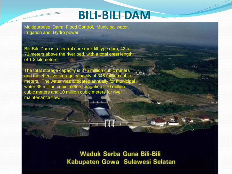
BILI-BILI DAM Multipurpose Dam: Flood Control, Municipal water,
Irrigation and Hydro power
Bili-Bili Dam is a central core rock fill type dam, 42 to
73 meters above the river bed, with a total crest length
of 1.8 kilometers .
The total storage capacity is 375 million cubic meters
and the effective storage capacity of 346 million cubic
meters. The water was allocated annually for municipal
water 35 million cubic meters, irrigation 270 million
cubic meters and 10 million cubic meters for river
maintenance flow.
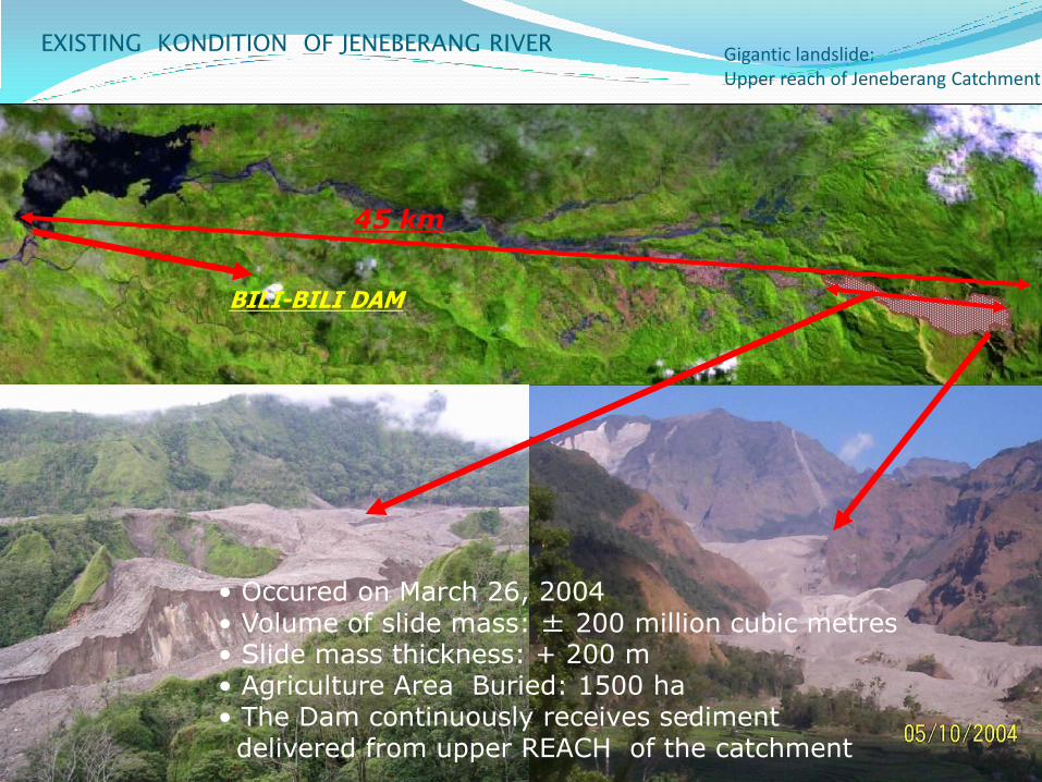
Gigantic landslide: Upper reach of Jeneberang Catchment
• Occured on March 26, 2004 • Volume of slide mass: ± 200 million cubic metres • Slide mass thickness: + 200 m • Agriculture Area Buried: 1500 ha • The Dam continuously receives sediment delivered from upper REACH of the catchment
45 km
EXISTING KONDITION OF JENEBERANG RIVER
BILI-BILI DAM
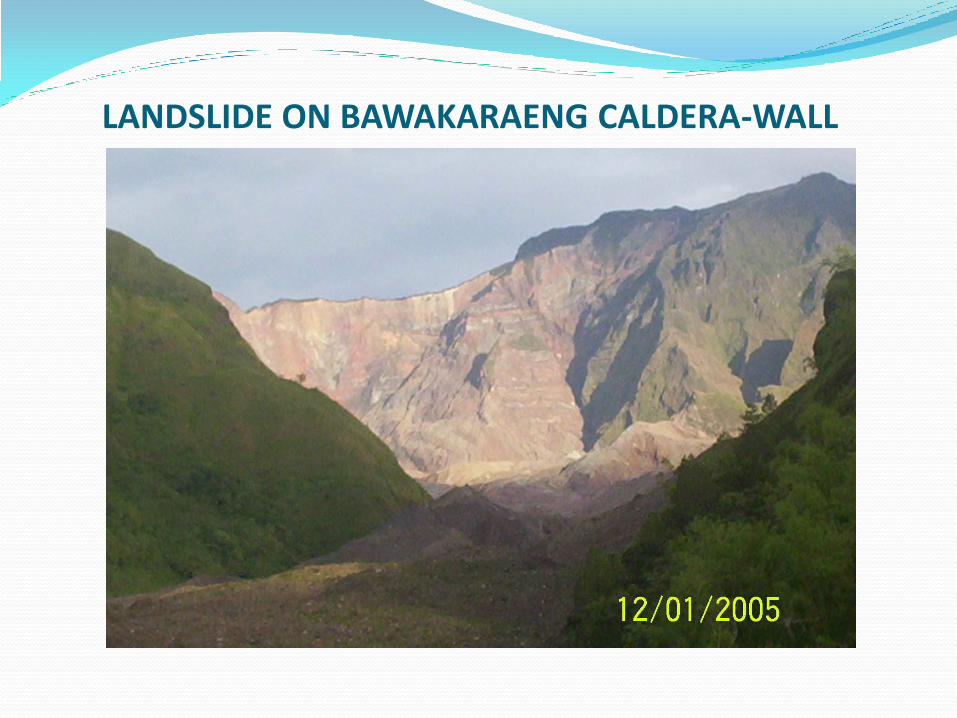
LANDSLIDE ON BAWAKARAENG CALDERA-WALL
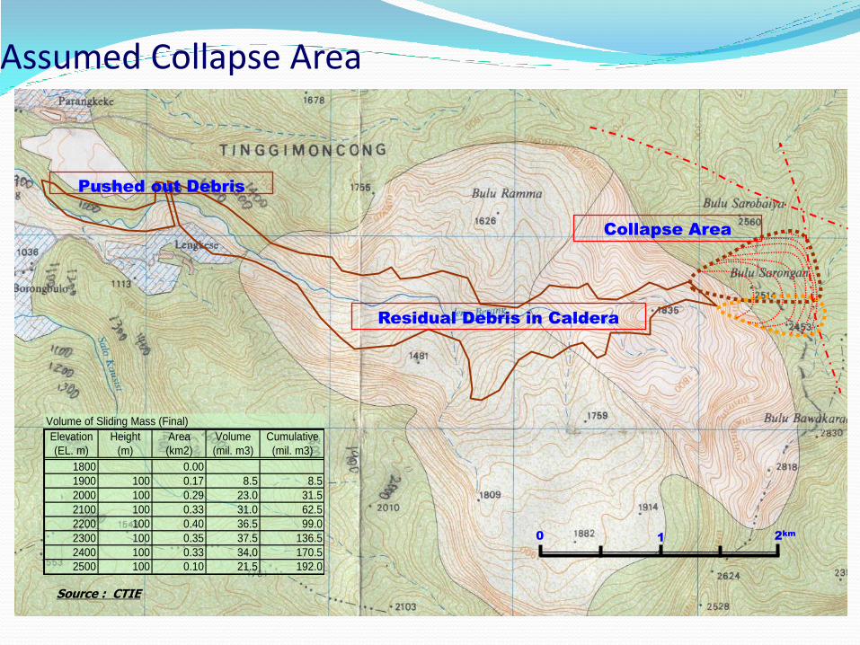
Pushed out Debris
Collapse Area
Residual Debris in Caldera
Volume of Sliding Mass (Final)
Elevation Height Area Volume Cumulative
(EL. m) (m) (km2) (mil. m3) (mil. m3)
1800 0.00
1900 100 0.17 8.5 8.5
2000 100 0.29 23.0 31.5
2100 100 0.33 31.0 62.5
2200 100 0.40 36.5 99.0
2300 100 0.35 37.5 136.5
2400 100 0.33 34.0 170.5
2500 100 0.10 21.5 192.0
0 1 2km
Assumed Collapse Area
Source : CTIE

LANDSLIDE MASS 7 km
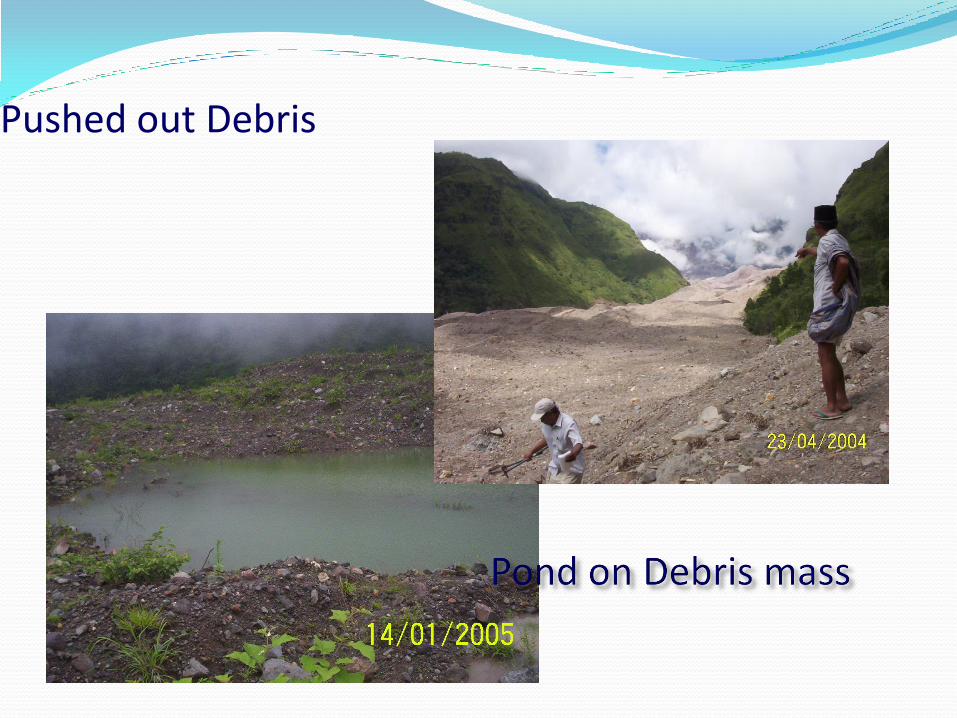
Pushed out Debris
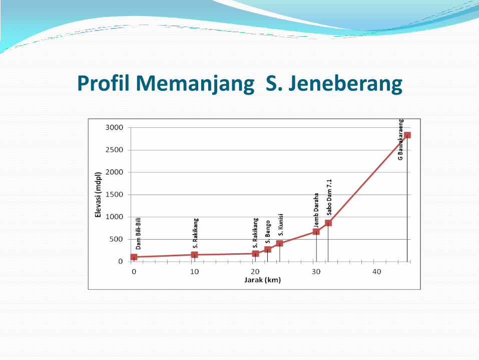
Profil Memanjang S. Jeneberang

INFRASTRUCTURE DAMAGE

10 causalities, 8 injured and 22 missing (as of 7 April 2004, source Posko Pattiro).
10 houses and one elementary school were buried in debris.
Area (paddy field and residential) buried in debris is estimated at 1,500 ha.
635 cows die near the site after the Disaster.
All village people had evacuated immediately after the disaster to Pattiro and Sicini.
Damage caused by the disaster amounts to Rp. 22.14 billion.
DAMAGES
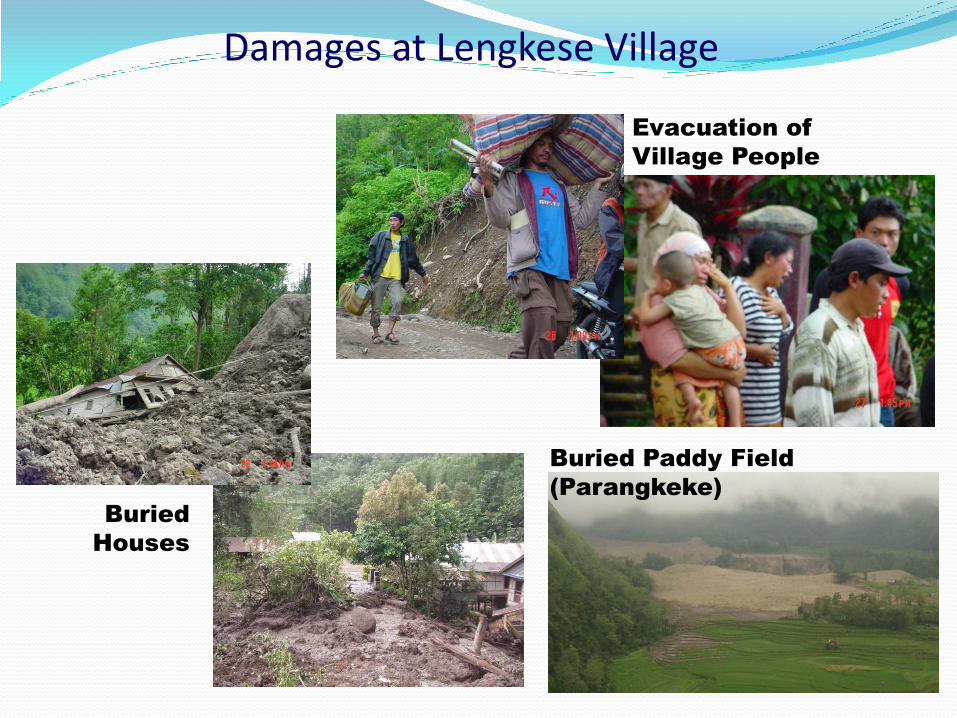
Damages at Lengkese Village
Evacuation of
Village People
Buried
Houses
Buried Paddy Field
(Parangkeke)
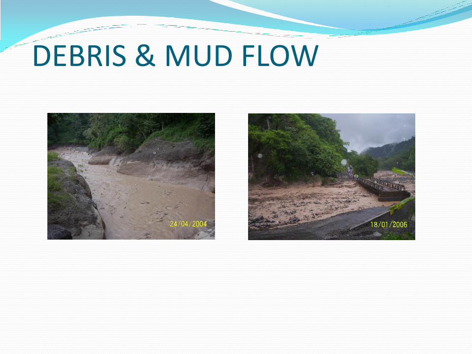
DEBRIS & MUD FLOW
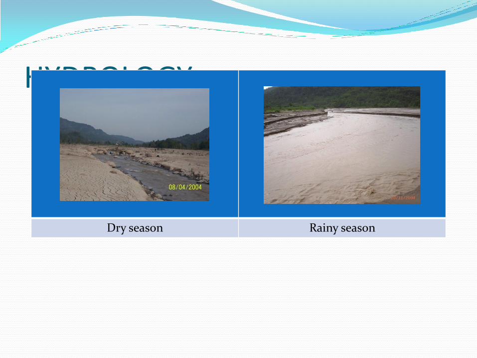
HYDROLOGY
Dry season Rainy season
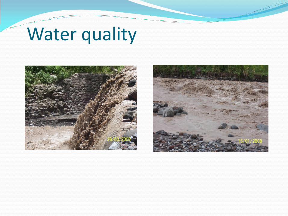
Water quality
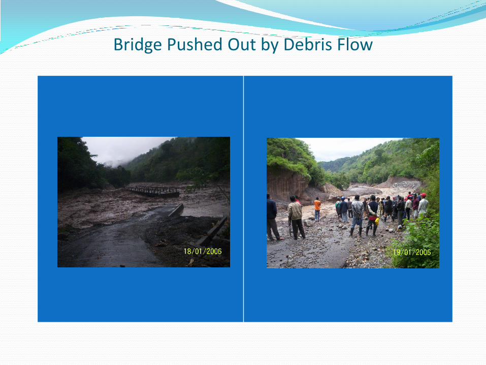
Bridge Pushed Out by Debris Flow
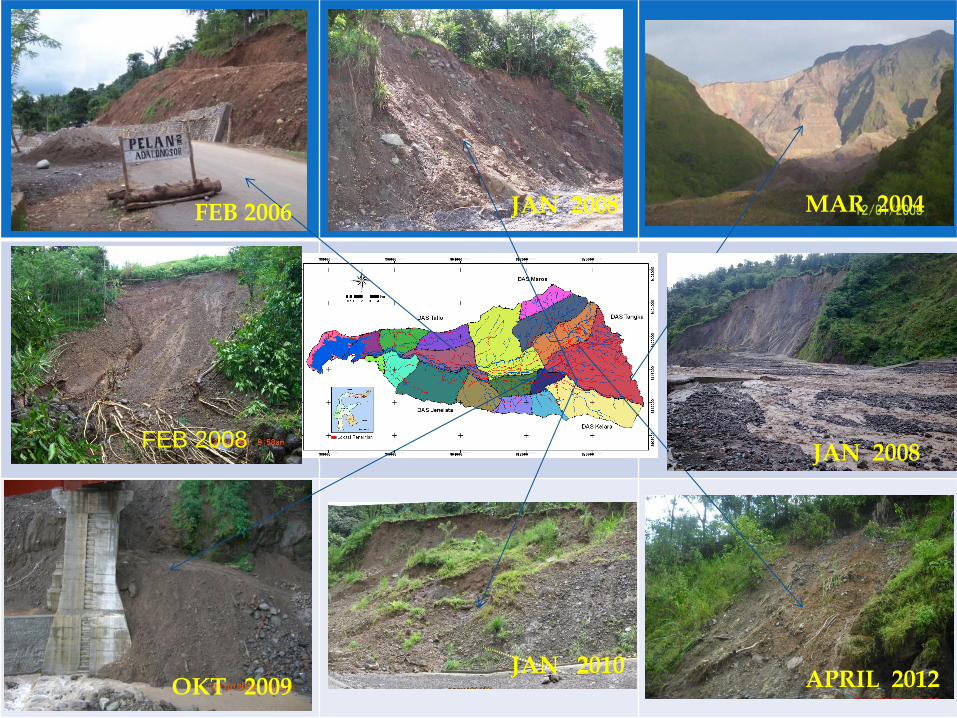
FEB 2006 JAN 2008 MAR 2004
OKT 2009 JAN 2010
APRIL 2012
FEB 2008 JAN 2008
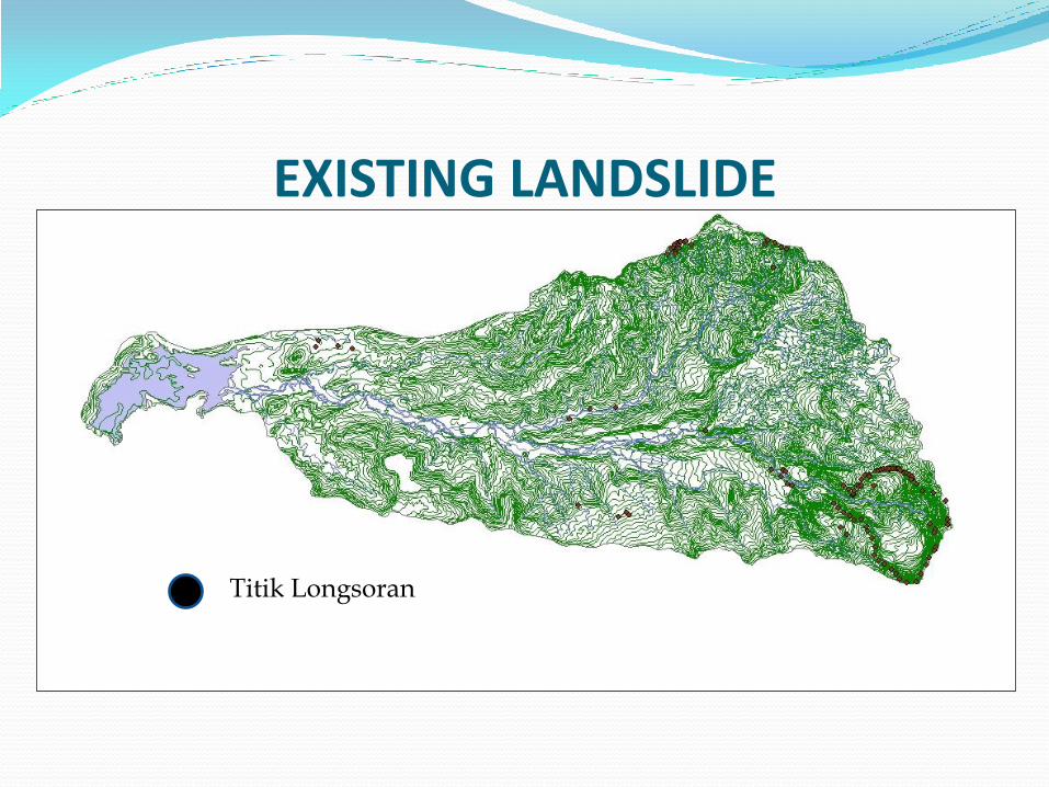
EXISTING LANDSLIDE
Titik Longsoran
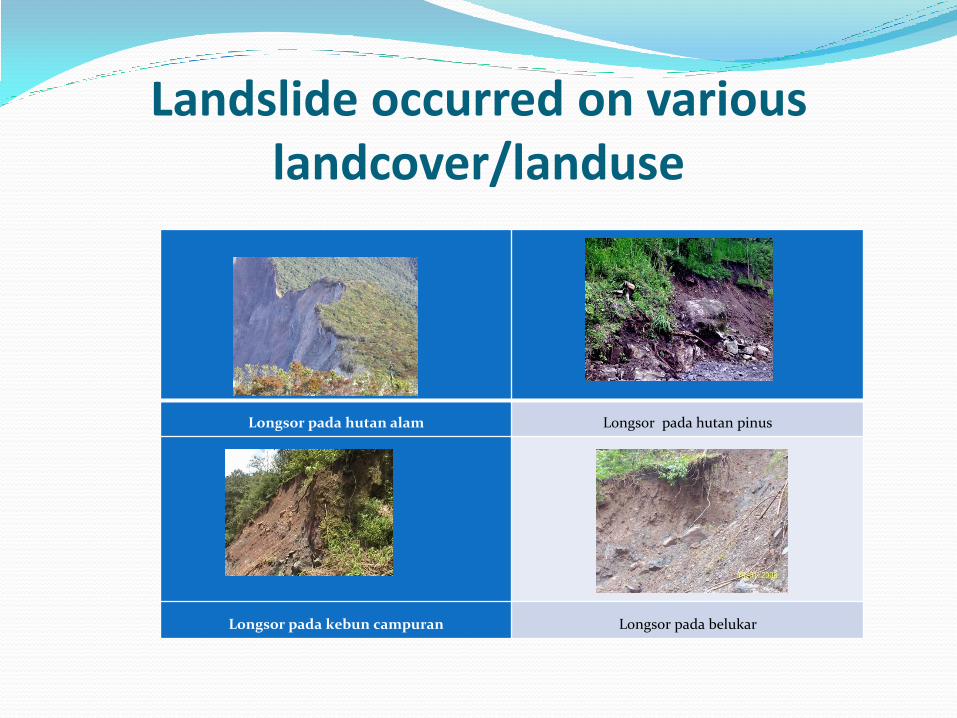
Landslide occurred on various landcover/landuse
Longsor pada hutan alam Longsor pada hutan pinus
Longsor pada kebun campuran Longsor pada belukar
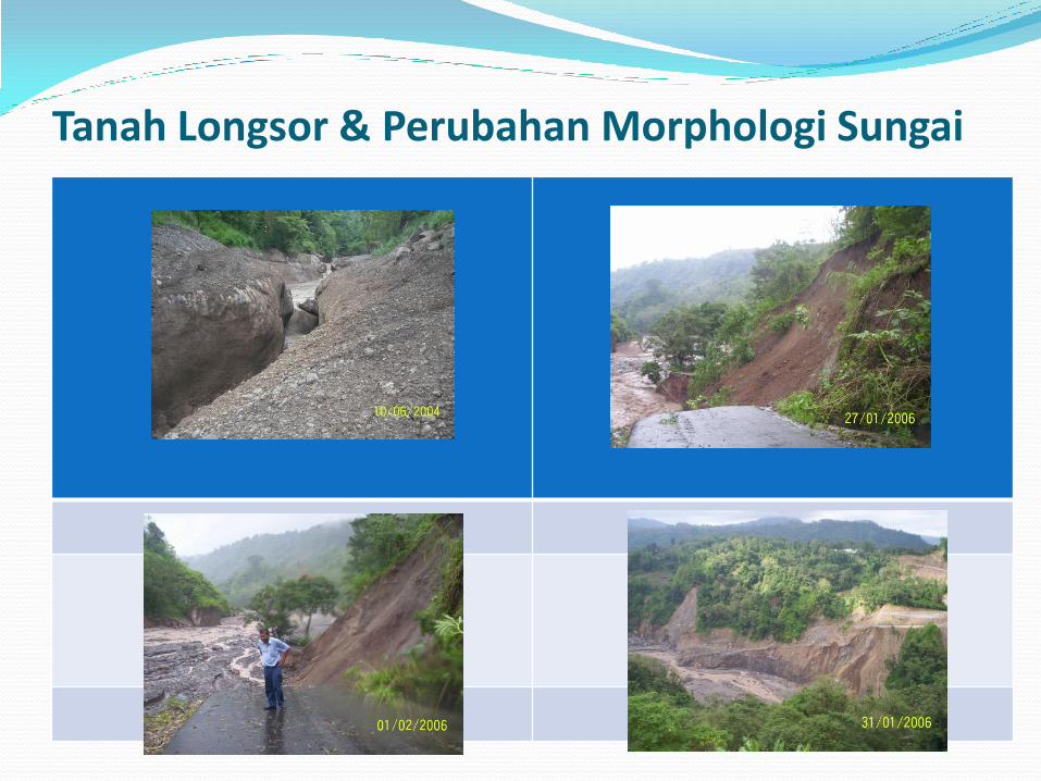
Tanah Longsor & Perubahan Morphologi Sungai

Coping challenges to community
1. No central mitigation from Government
1. Lack of resource
2. Geographical extend
2. Residents have always known they can not rely on government, Central or Local
1. Local Government 70Km away from site of disaster
2. Dirt road, difficult access before disaster
Possible solutions to challenges
1. Use of education to enhance communities coping capacity
1. Community based risk mapping
2. Capacity building exercise
3. Evacuation drill
4. School curriculum inclusion for natural hazard
2. Susceptibility mapping
1. Hazard zonation
2. Risk assessment
3. Spatial and land-use planning (to avoid agricultural activity along the river bank)
3. Communication
1. No activity is good activity if not transferred to a language and format community
can understand
The End