terms of reference #5 and #7 overview/relation to management deirdre boelke, nefmc staff, scallop...
TRANSCRIPT

Review of Sea Scallop Survey MethodologiesTerms of Reference #5 and #7
Overview/Relation to Management
Deirdre Boelke, NEFMC Staff, Scallop PDT Chair
March 17-19, 2015

Background
Eight regional Councils charged with developing fishery management plans; each makes recommendations to NOAA
The New England Fishery Management Council (NEFMC) is responsible for seven overall plans including the Sea Scallop Fishery Management Plan (FMP)
Major management milestones 1982 – FMP Implemented 1994 – Limited entry with gear, crew and effort
limits (Days-At-Sea (DAS)) 2004 – Area rotation system fully implemented 2011 – Annual catch limits with accountability
measures2

3
Evolution of Area
Rotation• 1994 - large areas closed to
fishing on GB• By late 1990s scallop fishery in
major decline• 1999 –scallop fishery access• Council develops large-scale area
rotation program
• Current program - Areas surveyed annually - Beds of small scallops closed for 2-3 years - Vessels allowed controlled access to reduce bycatch and mortality
3
Source: NEFSC Scallop assessment 2007
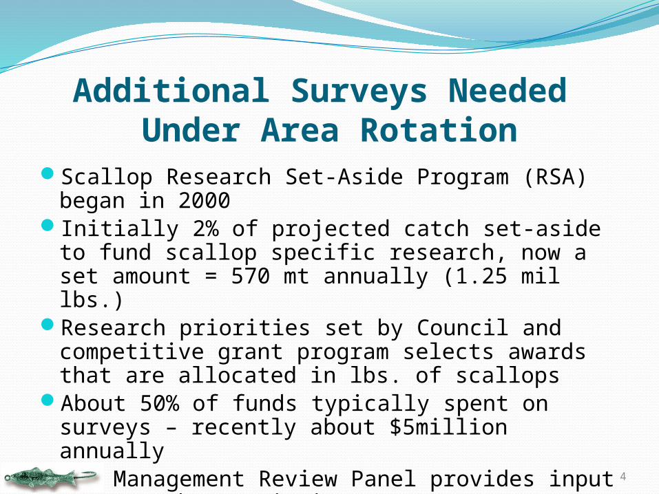
Additional Surveys Needed Under Area Rotation
Scallop Research Set-Aside Program (RSA) began in 2000
Initially 2% of projected catch set-aside to fund scallop specific research, now a set amount = 570 mt annually (1.25 mil lbs.)
Research priorities set by Council and competitive grant program selects awards that are allocated in lbs. of scallops
About 50% of funds typically spent on surveys – recently about $5million annually
RSA Management Review Panel provides input to NMFS about priority areas to survey each year
4

General Timeline of Scallop Surveys and Management Process
Surveys generally conducted in the late Spring – Summer
Early August is target deadline for survey results to Scallop Plan Development Team(PDT)
In recent years all survey results have been timely; no extensions, combined estimates ready in late August
Federal survey seems to have less flexibility, which can in some cases cause timing issues, but process has not been delayed
Early fall - PDT presents updated catch limits to Science and Statistical Committee (SSC) and Council
Late Fall – Council makes final recommendation for fishery specifications based on PDT, industry, and public input
5

Major Uses of scallop surveys in fisheries management
1. Set fishery specifications – catch limits, DAS, access area allocation
2. Identify new areas with small scallops to protect
3. Other
6

Examples of Survey Results – 2014 Season
7
Dredge Surveys – VIMS in Mid-Atlantic and NEFSC on GB

Video Surveys – 2014 Season
8
SMAST – Broadscale GB and MA and CA1 sliver – intensiveHabcam – Both Version 4 (NEFSC) and Version 2 (Habcam Group)
NEFSC V4 – BlackHabcam Grp V2 - Blue

Preliminary Combined Survey Estimates
9
DREDGE SMAST HABCAM TOTALSArea Bms SE Ebms Bms SE Ebms Bms SE Bms SE EbmsDelmarva 4707 778 2080 9626 1093 3935 10598 3665 8310 2253 3488Elephant Trunk 16392 3426 8067 24799 2909 12938 36154 3469 25782 3278 13147HCS 5805 1206 3044 7381 1021 3143 18041 5050 10409 3055 4884Virginia 279 79 3 NS NS NS 279 79 3NYB 6822 1656 4140 3609 495 2119 12756 613 10618 1059 6371Long Island 11966 816 8438 10269 950 6402 14305 508 12950 780 8643NYB Ext 1766 332 757 6900 867 4013 * * *Block Island 939 206 535 1372 671 521 * * *Mid-Atlantic Total 48676 4167 27064 63956 3612 33071 91854 20577 68348 5186 36536
CL-I NA 2163 649 1854 5115 3004 3091 21378 5917 9984 3850 6783CL-1 Acc 333 59 246 962 375 190 * * *CL-2 NA 8989 3190 7061 5550 2054 4191 7087 524 7209 2211 5579CL-2 Acc 7848 2462 3642 8197 2570 929 9835 95 8627 2055 2458NLS-NA 2240 1142 675 5211 4650 677 3726 3386 676NLS-Acc 1637 327 854 30052 6534 3091 3231 626 11640 3794 1449GSch 17689 1875 9485 11134 7849 4949 15994 4870 14939 5442 7481SEP 15434 9833 2862 7026 1359 2476 16038 1223 12833 5775 3050NEP 7752 9302 3837 5863 1483 2259 4330 394 5982 5443 2678Georges Bank Total 64085 14311 30516 79110 12246 21853 77893 19008 74938 11294 30154
TOTALS 112761 14906 57580 143066 12767 54924 159149 28013 143286 12428 66690
* Included in other areas
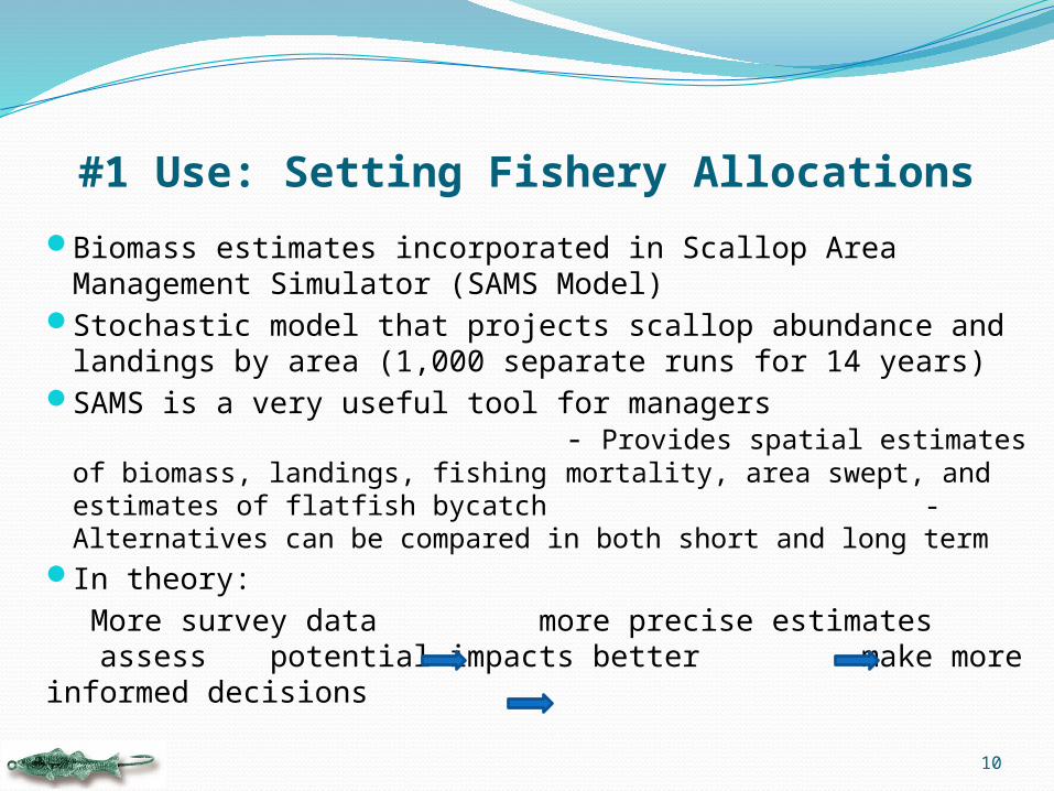
#1 Use: Setting Fishery Allocations
Biomass estimates incorporated in Scallop Area Management Simulator (SAMS Model)
Stochastic model that projects scallop abundance and landings by area (1,000 separate runs for 14 years)
SAMS is a very useful tool for managers - Provides spatial estimates of biomass, landings, fishing
mortality, area swept, and estimates of flatfish bycatch - Alternatives can be compared in both short and long term
In theory:More survey data more precise estimates
assess potential impacts better make more informed decisions
10

#2 Use: Identify new areas to protect
11
VIMS 2014 Dredge Survey

#3 Uses: Other
Gear performance – size selectivityShell height : meat weight relationshipsProduct quality / diseaseBycatch estimation Genetic dataSubstrate and benthos maps – “SASI” Model –
Swept Area Seabed Impact model Evaluate fishery impacts on environment
12

Scallop Survey Results used in NEFMC Actions
13
ActionFishing
YearNEFSC Dredge
VIMS Dredge
SMASTNEFSC
HabcamIndustry Habcam
Framework 11 1999 (*) (*)Framework 12 2000 *Framework 13 2000 * *
Frameowrk 142001 2002 * *
Framework 15 2003 * *
Framework 162004 2005 * *
Framework 182006 2007 * * *
Framework 192008 2009 * * *
Framework 21 2010 * * *
Framework 222011 2012 * * *
Framework 24 2013 * * * * *Framework 25 2014 * * * * *
Framework 26 2015 * * * * *Amendment 10 2004 * * *Amendment 15 2011 * * *EFH Omnibus A1 1999 *
EFH Omnibus A2 2016 * * * * *(*) The first cooperative survey was a dredge survey on six commercial vessels
Survey Methods
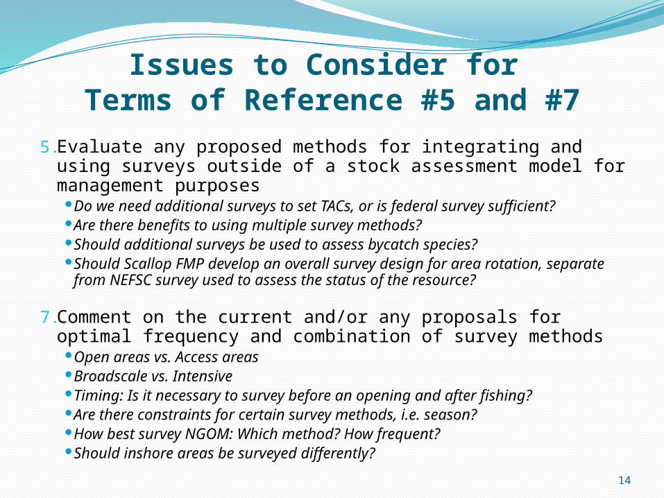
Issues to Consider for Terms of Reference #5 and #7
5. Evaluate any proposed methods for integrating and using surveys outside of a stock assessment model for management purposes
Do we need additional surveys to set TACs, or is federal survey sufficient?
Are there benefits to using multiple survey methods? Should additional surveys be used to assess bycatch species? Should Scallop FMP develop an overall survey design for area rotation,
separate from NEFSC survey used to assess the status of the resource?
7. Comment on the current and/or any proposals for optimal frequency and combination of survey methods
Open areas vs. Access areas Broadscale vs. Intensive Timing: Is it necessary to survey before an opening and after fishing? Are there constraints for certain survey methods, i.e. season? How best survey NGOM: Which method? How frequent? Should inshore areas be surveyed differently?
14