the splendor of iphone app "geographica"
TRANSCRIPT

The Splendor of iPhone App "Geographica"
Shungo FUJIOKA
March 31, 2015
This slide is a translation by the addition of some of the revisions to the original that was published in Japanese.

What is "Geographica"?● "Map Caching Offline GPS
App" for iPhone.
●Can be downloaded for free from the App Store.
●Offerd In-App Purchases. But most of the functionality is free.

Here is amazing of "Geographica"!
●Can be used even on No SIM iPhone.
This means that you can also use outside of the mobile network !
●For mountaineering, fishing and hunting.
You can record the point. You can confirm the location.
●The track can be recorded. As a GPS logger.
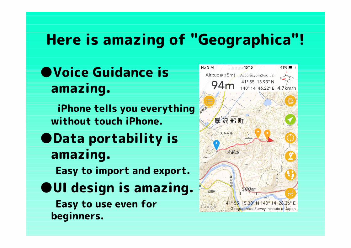
Here is amazing of "Geographica"!
●Voice Guidance is amazing.
iPhone tells you everything without touch iPhone.
●Data portability is amazing.
Easy to import and export.
●UI design is amazing. Easy to use even for
beginners.
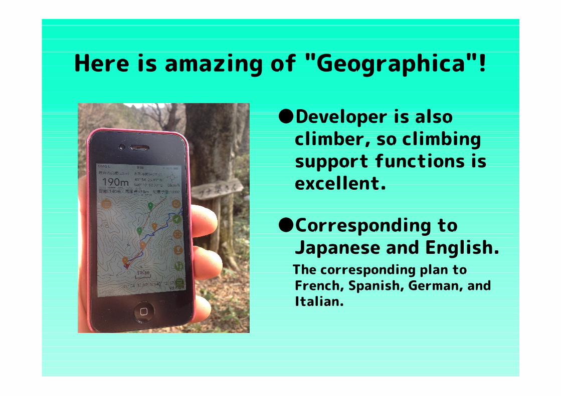
Here is amazing of "Geographica"!
●Developer is also climber, so climbing support functions is excellent.
●Corresponding to Japanese and English.
The corresponding plan to French, Spanish, German, and Italian.

The Mechanism of "Geographica"
●GPS of iPhone have anywhere possible positioning around the world if can be received radio waves from satellites.
●On the internet (Wi-Fi / 3G / 4G), the maps are saved in advance as Cache, and the current location by GPS positioning is displayed .
Normal Map Apps can not display the map without internet.

Contents of AnnouncementEEEExplainedxplainedxplainedxplained●Introduction of "Geographica"
●Main Screen Description●Map and Overlay●Cache and Chunked Cache●Marker Creating●Track Record (GPS logging)
●Navigation (Route Guidance)
●Data Portability●Challenges and Countermeasures●Summary
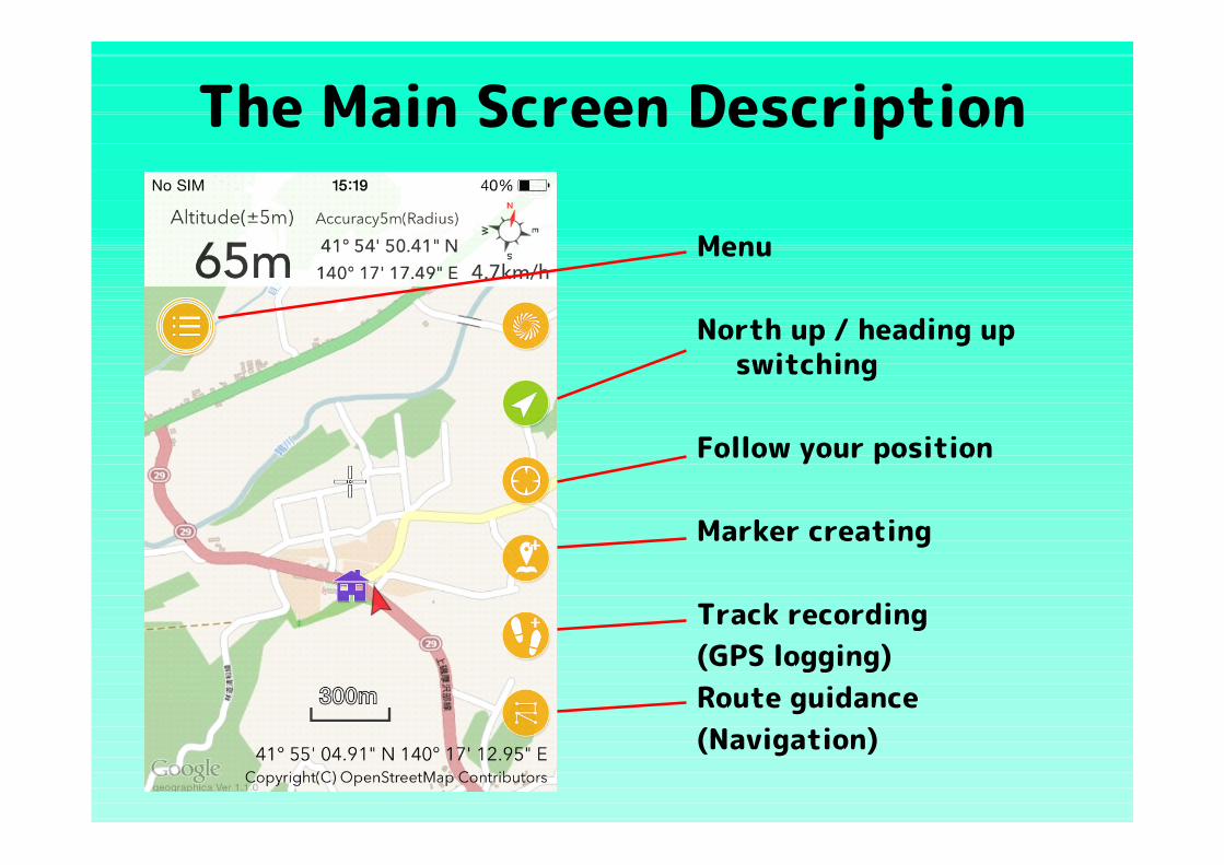
The Main Screen Description
Menu
North up / heading up switching
Follow your position
Marker creating
Track recording(GPS logging)Route guidance(Navigation)

The Main Screen Description
Route Creation and Measurement, etc.
GSI / OSM switching
Overlay selection
File management
Various settings
Easy-to-understand help

Maps that can be Displayed
GlS maps (JP) The map of the Geographical
Survey Institute of Japan.
OpenStreetMap Free maps that can be used only
by credit. Also OpenCycleMap, OpenTopoMap usable.

Map that can be Displayed
●Also corresponds to the display of Google Maps.
However, it can not be cached by the convention, so can not be used offline.

Map Overlay
Marine Traffic From OpenSeaMap.
Shaded Relief The shadow of the terrain
all over the world.
Hypsometric Tints Data of the Geographical Survey Institute of Japan.

Cache and Chunked Cache
●Maps is downloaded in App as Cache by displaying.
●Chunked Cache is run by specifying the range.
●Cache and Chunked Cache are managed separately.

Marker Creating
●The marker can be created at the cursor position.
●Select from 30 types.
●Altitude acquired automatically.
(When net connection)
●Also useful to OSM mapping.

Track Record (GPS logging)
●To record walking tracks in real time.
●Recording interval can be change.
●Recorded tracks can be displayed with graph.
Easy to understand is the slope of the mountain trail.
Track (GPX file) those downloaded from Yamareko-climbing record.(http://www.yamareco.com/modules/yamareco/detail-555459.html)

Navigation (Route Guidance)
●Route created while making a climbing plan.
Maps are cached in this work.
●Wonderful Navigation Tells you the information to the next
marker automatically.
●Convenient Voice Guidance (Interval Speech & Shake'n Speech)
No need to take out the iPhone.
Track (GPX files) I have edited those downloaded from Yamareko-climbing record. (http://www.yamareco.com/modules/yamareco/detail-555459.html)
Please see the movie of the Navigation and Track Recording.
(About 3.5 minutes)
https://youtu.be/YIfg3VSnwvQ
Sorry in poor English . Please turn on the subtitles/CC .

Data Portability
ImportDownload the GPX file to
"Geographica" via Dropbox.
Export Copy to Dropbox,
etc., Also can view the track in Google Earth.
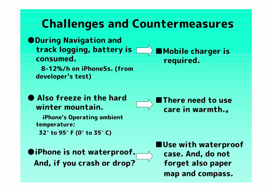
Challenges and Countermeasures●During Navigation and
track logging, battery is consumed.
8-12%/h on iPhone5s. (from developer's test)
● Also freeze in the hard winter mountain.
iPhone's Operating ambient temperature:
32° to 95° F (0° to 35° C)
●iPhone is not waterproof. And, if you crash or drop?
■Mobile charger is required.
■There need to use care in warmth.。
■Use with waterproof case. And, do not forget also paper map and compass.
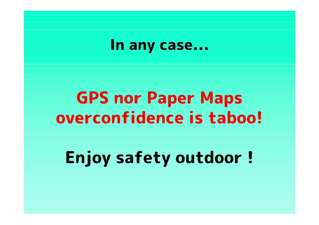
In any case...
GPS nor Paper Maps overconfidence is taboo!
Enjoy safety outdoor !

Conclusion
● "Geographica" is the world's best GPS App for mountaineering.
●This App will contribute to reduce "lost in the mountains".
●Let's support the developer! If you like, remove the function restriction (In-App Purchace)! Write your impressions to Reviews, Facebook, Twitter!

2015 summer, Android OS2015 summer, Android OS version appeared soon! version appeared soon!
Image is quoted from "Geographica" facebook page. (https://www.facebook.com/geographica.iphone/photos/a.745529435539751.1073741829.736255643133797/843303452429015/?type=1&theater )

The following are "Geographica" official sites.
■ iTunes's App Store https://itunes.apple.com/en/app/id887734855?mt=8■ Website http://geographica.biz/■ Facebook page https://www.facebook.com/geographica.iphone
Thank you.