the ultimate in onboard navigation solutions€¦ · vision ™ sdcards ......
TRANSCRIPT
G A RM I N I N T E R N AT I O N A L , I N C .
1200 East 151st Street, Olathe, KS 66062
t 913.397.8200
f 913.397.8282
© 2010 Garmin Ltd. or its subsidiaries M00-00107-00 1209
www. g a rm i n . c om /ma r i n e
F o l l ow t h e l e a d e r.
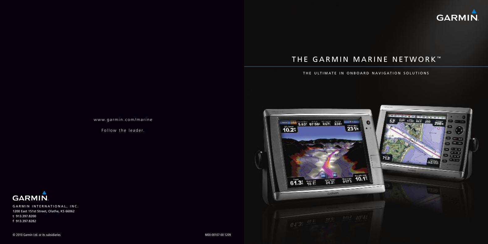
THE GARM IN MAR INE NETWORK™
TH E U LT I M AT E I N O N B O A R D N AV I G AT I O N S O L U T I O N S

TA B L E O F C O N T E N T S
4 wa t e r i n a who l e new l i g h t
6 p l ug and p l a y t e c hno l og y
8 ne two r k d i s p l a y s
10 GPSMAP ® 7 0 0 0 S e r i e s
12 GPSMAP ® 6 0 0 0 S e r i e s
14 GPSMAP ® 5 0 0 0 S e r i e s
16 GPSMAP ® 4 0 0 0 S e r i e s
18 VHF ma r i n e r ad i o s
20 A I S t r a f f i c mon i t o r i n g
22 d i g i t a l ma r i n e i n s t r umen t s
24 mar i n e r ada r
26 s a t e l l i t e wea t h e r
28 r emo t e s ona r
30 mar i n e au t o p i l o t s
32 mar i n e ne two r k c onne c t i o n s & s en s o r s
36 c ompa r i s o n c h a r t
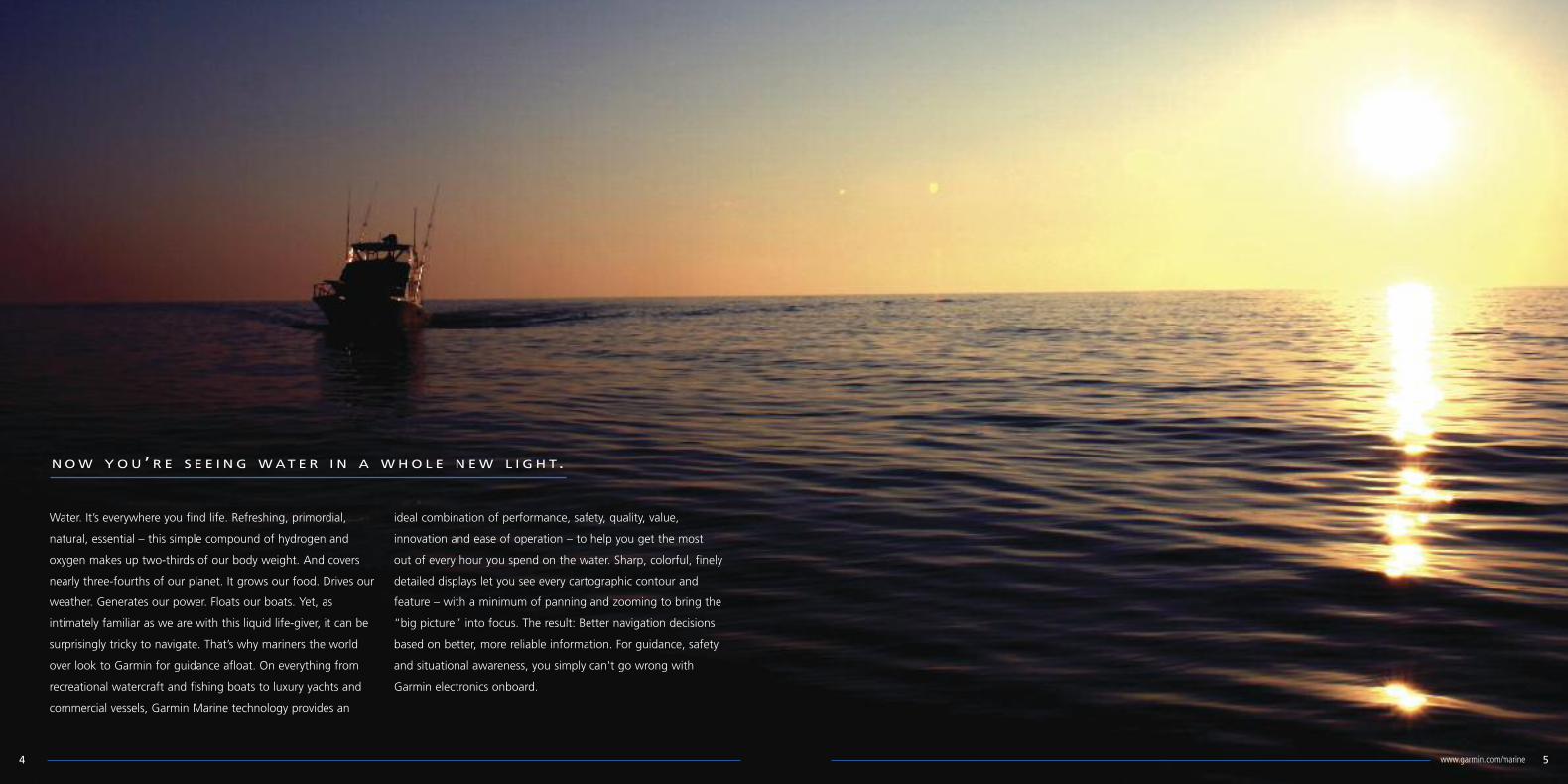
NOW YOU ’ R E S E E I N G WAT E R I N A WHO L E N EW L I G H T.
Water. It’s everywhere you find life. Refreshing, primordial,
natural, essential – this simple compound of hydrogen and
oxygen makes up two-thirds of our body weight. And covers
nearly three-fourths of our planet. It grows our food. Drives our
weather. Generates our power. Floats our boats. Yet, as
intimately familiar as we are with this liquid life-giver, it can be
surprisingly tricky to navigate. That’s why mariners the world
over look to Garmin for guidance afloat. On everything from
recreational watercraft and fishing boats to luxury yachts and
commercial vessels, Garmin Marine technology provides an
ideal combination of performance, safety, quality, value,
innovation and ease of operation – to help you get the most
out of every hour you spend on the water. Sharp, colorful, finely
detailed displays let you see every cartographic contour and
feature – with a minimum of panning and zooming to bring the
“big picture” into focus. The result: Better navigation decisions
based on better, more reliable information. For guidance, safety
and situational awareness, you simply can't go wrong with
Garmin electronics onboard.
54 www.garmin.com/marine

P L U G - A N D - P L AY T E C H N O L O G Y MA K E S N E TWO R K I N G S I M P L E
It’s so easy to connect with the future of nautical navigation:
Just plug into the Garmin Marine Network™.
Reliable. Waterproof. Simple to install. This proprietary
high-speed data system seamlessly connects multiple
“plug-and-play” components – allowing you to access GPS
position reference, detailed 3D-view charts, radar, sonar,
XM™ WX Satellite Weather (subscription required) and/or
other selected inputs, right from your chartplotter screen.
You don’t need high-tech expertise. Or advanced
programming skills. Fact is, if you can plug in a cable
connector, you can build a shipwide Garmin network –
or expand the one you’ve started.
The Ethernet-fast (100-megabit) Garmin data system is
anchored by compatible GPSMAP® chartplotters with built-in
network links. These multifunction displays (MFDs)
automatically detect any and all peripherals once they’re
connected. And the same network cabling is used for both
unit-to-unit and unit-to-network connections. So it’s easy to
connect any combination of sensors and displays – using the
optional Garmin GMS™10 Port Expander as the “nerve center”
for your network. By utilizing the network port expander, you
can avoid “daisy-chaining” of connections – thereby
enhancing redundancy and reliability system-wide. Each
networked MFD can be configured independently, with
customizable page fields for “big picture” navigation. What’s
more, by installing multiple MFDs, you can easily access the
network from anywhere on your boat.
That’s the power of the Garmin Marine Network. It’s all
about making great connections. So you’ll have all the
data at your fingertips to make faster/safer/smarter
navigation decisions.
P L U G
P L AY
76 www.garmin.com/marine

Total systems integration: That’s the focus of Garmin’s
newest generation of network-capable chartplotters.
Upgraded with new Series 5.0 software, these high-speed,
high-resolution multifunction displays (MFDs) offer expanded
access to onboard sensors with NMEA 2000 compatibility –
as well as full Garmin Marine Network™ connectivity. Thus,
it’s easy to select and control a whole array of remote
sensors and data inputs from any compatible plotter on your
boat. Simple menu-driven operation makes for fast, intuitive
control/display of all your network options: Everything from
autopilot and engine sensors to VHF radios, satellite weather,
onboard radar, digital sonar, AIS traffic monitoring, and
more. To pinpoint your position anywhere in the world, these
robust units feature extra-precise WAAS/EGNOS-enabled GPS
receivers. And their built-in worldwide basemap provides
useful visual reference – which can be enhanced with
optional BlueChart® g2 cards (sold separately) for basic
digital cartography that matches the look of paper charts;
or with premium BlueChart® g2 Vision™ cards (also sold
separately) for vividly detailed 3D MarinerEye or underwater
FishEye graphical displays. BlueChart® g2 Vision™ is clearly
some of the most realistic marine mapping you’ve ever seen
on a chartplotter screen. And that’s just the beginning. Other
BlueChart g2 Vision features include “real picture” aerial
photos of harbors, marinas and other visual landmarks –
plus Auto Guidance technology that scans and evaluates
relevant chart data to suggest the best passageways. For
innovation to keep you solidly on course, Garmin has the
waterfront covered.
N E TWO R K D I S P L AY S : T R U E I N N O VAT I O N I N I N T E G R AT I O N
Series 5.0 Software Update: Adding new features and functionality toyour Garmin network chartplotter, this upgrade provides faster redraws ofthe chart display and a more intuitive user experience. It also adds acompass rose overlay option, plus a “flat 3D” perspective display for userswho do not have BlueChart® g2 Vision card enhancement.
98 www.garmin.com/marine

GPSMAP ® 7 2 1 5 / 7 2 1 2
Garmin’s top-of-the-line chartplotter technology has moved
even further upscale with the introduction of the GPSMAP®
7000 series. Featuring XGA-resolution touchscreen displays
and new high-speed processors, these multifunction network
systems take onscreen maneuverability to a whole new level.
The enhanced digital design with super-fast Garmin G Motion™
technology nearly doubles the map-drawing performance of
earlier GPSMAP plotters – yielding ultra-smooth panning and
zooming with virtually seamless graphical updating in all
dimensions. An external high-sensitivity GPS receiver improves
signal acquisition and tracking. Plus, there’s expanded “plug-
and-play” access to onboard sensors, via both NMEA 2000 and
Garmin Marine Network connectivity. So, everything from
autopilot and engine sensors to VHF radios, onboard radar,
digital sonar, XM WX™ satellite weather (subscription required),
live-cam video, and more can be accessed directly from your
chartplotter screen. Sleek 12.1 or 15-inch diagonal formats are
available. And each is compatible with an optional wireless
remote and/or wireless mouse (both sold separately). In
addition, the big 15-inch unit even has PC monitor input, so you
can use it for display of digital programs, internet browsers, or
applications from a separate computer input. All GPSMAP 7000
series plotters feature a built-in worldwide basemap, which is
augmented on the 7212 and 7215 models with preloaded
marine charts for U.S. coastal waters, including Alaska and
Hawaii plus the Bahamas. What’s more, an optional BlueChart®
g2 Vision® card (sold separately), lets you access such premium
features as true 3D MarinerEye and FishEye map perspective,
plus Auto Guidance and “real picture” aerial photo reference
with marine points-of-interest (POI) location data.
Exclusive Garmin G Motion™:
Bringing faster and smoother
maneuverability to your onscreen
chartplotter graphics, this advanced
technology nearly doubles the map-
drawing performance of earlier
GPSMAP® plotters for virtually
seamless updating in all dimensions.
7000 Series Network Chartplotters feature:
• Menu-driven touchscreen interface for fast, easy
network operation
• Exclusive Garmin G Motion™ for liquid-smooth screen graphics
• NMEA 2000 support for engine monitoring and more
• Auto Guidance searches chart data to suggest best passage
when using BlueChart g2 Vision SD cards*
• MarinerEye 3D view for topside 3 dimensional mapping*
• FishEye 3D view for underwater 3 dimensional mapping*
• PC monitor input on GPSMAP® 7215 model
• Includes NMEA 2000 high-sensitivity GPS antenna
*Requires optional Bluechart g2 Vision cards
1110 www.garmin.com/marine

GPSMAP ® 6 2 1 2 / 6 2 0 8
For boat owners who prefer traditional pushbutton and
thumbwheel mechanical controls, the Garmin GPSMAP® 6000
series offers a premium combination of mapping, sensor and
data options for your onboard network. Featuring high-speed
digital processors that nearly double the map-drawing speed of
their predecessors, these new multifunction displays with
enhanced Garmin G Motion™ technology offer a significant
increase in onscreen maneuverability – for ultra-smooth panning
and zooming with virtually seamless graphical updating of all
moving-map graphics. A high-sensitivity GPS receiver provides
faster signal acquisition and improved satellite tracking. Plus,
easy “plug-and-play” connectivity via both NMEA 2000 and
Garmin Marine Network protocols lets you access everything
from autopilot and engine sensors to VHF radios, onboard radar,
digital sonar, XM WX™ satellite weather*, video cameras, and
more – right from your chartplotter screen. The GPSMAP 6000
series displays are available in two sizes: (1) an XGA-resolution
12.1-inch diagonal screen configuration (1024 x 768 pixels), or
(2) a more compact 8.4-inch model with VGA screen resolution
(640 x 480 pixels). Both sizes are compatible with an optional
wireless remote (sold separately). And detailed U.S. coastal
charts, with coverage for Alaska and Hawaii plus the Bahamas,
come preloaded on the GPSMAP 6212 and 6208. You can add
additional map regions with optional BlueChart® g2 cards (sold
separately) that provide basic 2D digital cartography. Or, for
added capability, optional BlueChart® g2 Vision cards make it
easy to access high-level features such as true 3D perspective
map display (both above and below the waterline), plus Auto
Guidance to suggest the best passages, and “real picture” aerial
photos for visual reference with marine points-of-interest (POI)
location data.
Garmin G Motion™Technology:
Bringing liquid-smooth maneuverability
and virtually seamless updating to your
chartplotter graphics, this exclusive
Garmin technology nearly doubles the
map-drawing performance of earlier
GPSMAP® plotters. It’s the ultimate in
onscreen speed and mobility.
6000 Series Network Chartplotters feature:
• Traditional softkey interface for menu-driven network operation
• Exclusive Garmin G Motion™ for liquid-smooth screen graphics
• NMEA 2000 support for engine monitoring and more
• Auto Guidance searches chart data to suggest best
passage when using BlueChart g2 Vision SD cards**
• MarinerEye 3D view for topside 3 dimensional mapping**
• FishEye 3D view for underwater 3 dimensional mapping**
• Includes NMEA 2000 high-sensitivity GPS antenna
*Subscription required**Requires optional Bluechart g2 Vision cards
Satellite imagery: Garmin’s built-in
worldwide basemap is augmented with
preloaded mapping coverage on the
GPSMAP® 6212 and 6208. Optional plug-in
BlueChart® g2 Vision® card (sold seperately)
technology supports high-resolution
satellite imagery with 3D perspective for
even more realistic views of land and water.
1312 www.garmin.com/marine

GPSMAP ® 5 2 1 5 / 5 2 1 2 / 5 2 0 8Bringing touchscreen control to shipwide connectivity, Garmin’s
GPSMAP® 5000 series is where value and technology converge.
With hi-res displays sized from 8 to 15 inches, these versatile
multifunction displays (MFDs) are the ideal “command centers”
for your Garmin Marine Network. Each is available with
preloaded U.S. marine charts incorporating the latest BlueChart®
g2 data: tides and currents, coastal roads, marine services, and
more. Plus, the plotters’ revolutionary menu-driven interface has
been upgraded with new Series 5.0 software for faster chart
redraws, silky smooth panning and zooming, and more
responsive control inputs. So now, operating your entire
network as simple as pointing with your finger. The larger-
format GPSMAP® 5215 features a sleek 15-inch XGA display
with 1024 x 768 pixels of resolution. Or you can opt for the
same XGA resolution in the 12.1-inch GPSMAP® 5212 – or go
with the slightly smaller GPSMAP® 5208, which comes with an
8.4-inch diagonal VGA screen. Each of the three models comes
preloaded with detailed U.S. coastal charts, providing offshore
coverage for Alaska and Hawaii plus the Bahamas. You can add
additional map regions with optional BlueChart® g2 cards (sold
separately) that provide basic 2D digital cartography. Or you can
upgrade to higher-capability BlueChart® g2 Vision™ cards
(also sold separately) that let you access such premium
features as true 3D MarinerEye or underwater FishEye map
perspective – plus “real picture” aerial photo reference and
Auto Guidance technology to suggest the best passageways
on your charts.
Aerial reference photos: “Real picture”
aerial photos, available with BlueChart®
g2 Vision™ software options, give
mariners a visual overview of harbors,
marinas, waterways and other
navigation features – while a built-in
POI (points-of-interest) database offers
more information.
5000 Series Network Chartplotters feature:
• Menu-driven touchscreen interface for fast, easy
network operation
• NMEA 2000 support for engine monitoring and more
• New Series 5.0 software update
• Auto Guidance searches chart data to suggest
best passage when using BlueChart g2 Vision cards*
• MarinerEye 3D view for topside 3 dimensional mapping*
• FishEye 3D view for underwater 3 dimensional mapping*
• Includes NMEA 2000 high sensitivity GPS antenna
*Requires optional Bluechart g2 Vision cards
Menu-driven interface: With fewer
operational steps to navigate, Garmin’s
simplified menu format makes it easy for
users to see and select the data they want
to access onscreen.
1514 www.garmin.com/marine

GPSMAP ® 4 2 1 2 / 4 2 1 0 / 4 2 0 8
More choices. More sizes. More value and capability for the
money. That’s the beauty of Garmin’s GPSMAP® 4000 series.
Combining brilliant video-quality screens with conventional
pushbutton interface and the latest in mapping, sensor and data
options – these versatile displays are the perfect fit for your
Garmin Marine Network. Each features the new Series 5.0
software upgrade for faster chart redraws, ultra-smooth
panning and zooming between range levels, and other
enhancements. The big GPSMAP® 4212 offers a 12.1-inch XGA
display and alphanumeric keypad. It’s available with optional
remote control for easy access to menus and functions. A
10-inch midsize addition to the lineup, the GPSMAP® 4210 gives
you the alphanumeric keypad and most other 4212 features in a
slightly more compact unit. And then, for the smaller nav
station, there’s the GPSMAP® 4208. It’s designed with an 8.4-
inch diagonal VGA screen and does not have the alphanumeric
keypad. All of these units come fully preloaded with detailed
BlueChart® g2 marine maps with U.S. coastal coverage that
includes Alaska, Hawaii and the Bahamas. You can add
additional map regions with optional BlueChart® g2 cards (sold
separately) that provide basic 2D digital cartography. Or, for
maximum graphical sophistication, optional BlueChart® g2
Vision™ SD cards (sold separately) offer access to such premium
features as true 3D MarinerEye and underwater FishEye views,
plus Auto Guidance technology and “real picture” aerial photo
reference with marine points-of-interest (POI) data.
4000 Series Network Chartplotters feature:
• Traditional softkey interface for menu-driven
network operation
• NMEA 2000 support for engine monitoring and more
• New Series 5.0 software update
• Auto Guidance searches chart data to suggest
best passage when using BlueChart g2 Vision cards*
• MarinerEye 3D view for topside 3 dimensional mapping*
• FishEye 3D view for underwater 3 dimensional mapping*
• Includes NMEA 2000 high sensitivity GPS antenna
*Requires optional Bluechart g2 Vision cards
Network versatility: Compatible with
both NMEA 2000 and Garmin Marine
Network data formats, the Garmin 4000
series can readily serve as your central
“nerve center” for onboard radar, sonar,
satellite weather, and a variety of other
safety and sensor inputs.
1716 www.garmin.com/marine

VHF 100 / 2 0 0 / 3 0 0 MAR INE RAD IOS
When you’re counting on a VHF radio to be your communications
lifeline offshore, trust is priority #1. That’s why Garmin’s VHF 100,
200 and 300 are worth every cent. Reliable? No question. Plus,
these rugged, submersible (IPX7) marine transceivers pack a
surprising array of high-end features and capabilities into their
compact designs. The remotely mounted VHF 300 series radios are
the flagship products of Garmin’s marine communications line.
These network-capable “black box” transceivers offer multi-station
support, plus NMEA 2000 network connection for easy integration
with compatible Garmin chartplotters. A handy voicemail feature,
unique to Garmin, lets you record a message for continuous
re-broadcast until another marine radio responds. Similarly, the VHF
100 and 200 come loaded with safety features in a more traditional
fixed-mount radio. Removable front caps allow the units to be
easily flush-mounted in cockpit consoles or cabin bulkheads.
And the extra-large 3.2-inch diagonal displays make for great
visibility, with crisp oversized channel numbers and easy-to-read
screen graphics. All three Garmin radios offer excellent noise
suppression and selectable transmit power (1-watt and 25-watt
output), so you can count on clear, far-reaching communications
on the water. And full Class D digital select calling with built-in dual
DSC receivers will enable you to instantly send distress calls at the
push of a button – with mayday signaling and digital broadcast of
your boat’s position (when interfaced with a compatible GPS
chartplotter). You can even send MMSI call numbers directly to the
radio from your compatible Garmin chartplotter via NMEA 2000. In
addition, a unique Position Tracking feature lets you use DSC
polling capability to keep tabs on up to three other fellow mariners
– with their boats’ locations indicated on your chartplotter display.
• Class D DSC capable
• Position polling
• 25 watts transmit power
• 16/9 distress calling
• NOAA Weather Alert (1050 Hz tone)
• Supports ATIS identification
• Supports wired/wireless remote mic
• Loud hailer/fog function
• NMEA 2000 connectivity
• Mic relocation capability
• Multi-lingual user interface
• Audio playback feature (last 90 sec. received)
• Voicemail feature – continuous re-broadcast
VHF 100 VHF 200 VHF 300
•
•
•
•
•
•
•
•
•
•
•
•
•
20W
•
•
•
•
•
•
•
•
•
•
30W
•
•
•
•
•
1918 www.garmin.com/marine
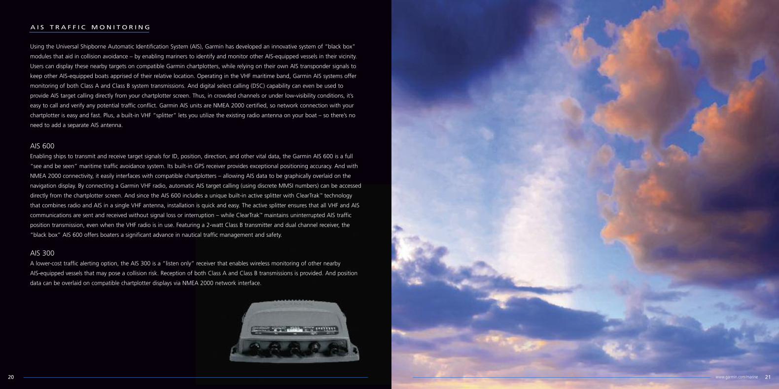
AIS 600Enabling ships to transmit and receive target signals for ID, position, direction, and other vital data, the Garmin AIS 600 is a full
“see and be seen” maritime traffic avoidance system. Its built-in GPS receiver provides exceptional positioning accuracy. And with
NMEA 2000 connectivity, it easily interfaces with compatible chartplotters – allowing AIS data to be graphically overlaid on the
navigation display. By connecting a Garmin VHF radio, automatic AIS target calling (using discrete MMSI numbers) can be accessed
directly from the chartplotter screen. And since the AIS 600 includes a unique built-in active splitter with ClearTrak™ technology
that combines radio and AIS in a single VHF antenna, installation is quick and easy. The active splitter ensures that all VHF and AIS
communications are sent and received without signal loss or interruption – while ClearTrak™ maintains uninterrupted AIS traffic
position transmission, even when the VHF radio is in use. Featuring a 2-watt Class B transmitter and dual channel receiver, the
“black box” AIS 600 offers boaters a significant advance in nautical traffic management and safety.
Using the Universal Shipborne Automatic Identification System (AIS), Garmin has developed an innovative system of “black box”
modules that aid in collision avoidance – by enabling mariners to identify and monitor other AIS-equipped vessels in their vicinity.
Users can display these nearby targets on compatible Garmin chartplotters, while relying on their own AIS transponder signals to
keep other AIS-equipped boats apprised of their relative location. Operating in the VHF maritime band, Garmin AIS systems offer
monitoring of both Class A and Class B system transmissions. And digital select calling (DSC) capability can even be used to
provide AIS target calling directly from your chartplotter screen. Thus, in crowded channels or under low-visibility conditions, it’s
easy to call and verify any potential traffic conflict. Garmin AIS units are NMEA 2000 certified, so network connection with your
chartplotter is easy and fast. Plus, a built-in VHF “splitter” lets you utilize the existing radio antenna on your boat – so there’s no
need to add a separate AIS antenna.
A I S T R A F F I C MO N I T O R I N G
AIS 300A lower-cost traffic alerting option, the AIS 300 is a “listen only” receiver that enables wireless monitoring of other nearby
AIS-equipped vessels that may pose a collision risk. Reception of both Class A and Class B transmissions is provided. And position
data can be overlaid on compatible chartplotter displays via NMEA 2000 network interface.
2120 www.garmin.com/marine

D I G I TA L M A R I N E I N S T R UM E N T S
In the past, most standard marine instruments were
single-function units – with each remote sensor having a
dedicated display. Now, with the new multifunction Garmin
GMI™ 10 displays, mariners can do and see more with less.
Our digital design gives installers the flexibility to customize and
streamline cockpit configurations – using fewer instruments to
display sensor data from multiple inputs. The GMI 10 makes it
easy to monitor navigation, heading and certain environmental
data – everything from basic depth, speed, winds and water
temperatures to detailed GPS readouts, fuel flows, engine
data, RPMs, trip odometer, user alarms and more. Featuring
big, bright 3.5-inch QVGA screens in a sleek 4-inch flush-mount
bezel, the system connects via any of Garmin’s new line of
intelligent transducers or others that use the NMEA 2000 or
NMEA 0183 formats.
Garmin Intelligent Transducers
These versatile transom-mount or thru-hull sensors provide depth and water temperature data for Garmin’s digital marine
instrument displays and chartplotters. Available in both NMEA 2000 and NMEA 0183 configurations, the units can track bottom
depths to 600 feet. Two thru-hull sensor models are offered to accommodate a full range of hull deadrise angles.
GFS™ 10 Fuel Sensor
Providing fuel flow and fuel used measurements to your Garmin
chartplotter or GMI 10 instrument display, the GFS 10 sensor
helps optimize performance while taking the worry out fuel
management. Works with most gasoline-powered inboard, I/O
and outboard engines via your NMEA 2000® network.
GWS™ 10 Wind Sensor
For sailors who want more power, speed and control on the water, Garmin’s GWS™ 10 is the answer. Easily installed, the mast-top
integrated sensing unit provides wind speed and direction measurements to your cockpit display via NMEA 2000 cable and bus
(which also powers the unit). It’s designed to interface with Garmin’s GMI™ 10 universal marine instrument display or any
manufacturer’s NMEA 2000-enabled chartplotter/display. And unlike traditional wind sensors, this “smart” transducer also provides
barometric pressure and air temperature data – to give you a virtual mini weather station.
NMEA 2000 analog adapters
The perfect upgrade solution to bring any helm into the digital
age: These affordable, easy-to-install Garmin adapters take
signals generated by your traditional gauges* and sensors – and
then convert that data into NMEA 2000 output. This enables
the data to be channeled through your vessel’s NMEA 2000
network for digital display on Garmin’s all-purpose GMI™10
multifunction instrument.
2322 www.garmin.com/marine
*Intended for use with most single or dual coil analog gauges.
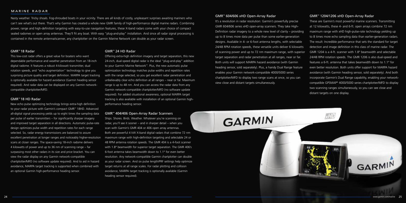
MA R I N E R A D A R
GMR™ 604/606 xHD Open-Array Radar
It’s a revolution in radar resolution: Garmin’s powerfully precise
GMR 604/606 series xHD open-array scanners. They take High-
Definition radar imagery to a whole new level of clarity – providing
up to 8 times more data per pulse than some earlier-generation
designs. Available in 4- or 6-foot antenna lengths, with selectable
24/48 RPM rotation speeds, these versatile units deliver 6 kilowatts
of scanning power and up to 72 nm maximum range, with superior
target separation and radar penetration at all ranges, near or far.
Both units will support MARPA hazard avoidance (with Garmin
heading sensor, sold separately). Plus, a handy Dual Range feature
enables your Garmin network-compatible 4000/5000 series
chartplotter/MFD to display two range scans at once, so you can
view close and distant targets simultaneously.
GMR™ 1204/1206 xHD Open-Array Radar
These are Garmin’s most powerful marine scanners. Transmitting
at 12 kilowatts, these 4- and 6-ft. open arrays combine 72 nm
maximum range with xHD high-pulse-rate technology yielding up
to 8 times more echo sampling data than earlier-generation radars.
The result: Incredible performance that sets the standard for target
detection and image definition in this class of marine radar. The
GMR 1204 is a 4-ft. scanner with 1.8° beamwidth and selectable
24/48 RPM rotation speeds. The GMR 1206 is also dual-speed and
features a 6-ft. antenna that takes beamwidth down to 1.1° for
even better resolution. Both units offer support for MARPA hazard
avoidance (with Garmin heading sensor, sold separately). And both
incorporate Garmin’s Dual Range capability, enabling your network-
compatible GPSMAP® 4000/5000 series chartplotter/MFD to display
two scanning ranges simultaneously, so you can see close and
distant targets on one display.
Nasty weather. Tricky shoals. Fog-shrouded boats in your vicinity. There are all kinds of costly, unpleasant surprises awaiting mariners who
can’t see what’s out there. That’s why Garmin has created a whole new GMR family of high-performance digital marine radars. Combining
power, range and high-definition targeting with easy-to-use navigation features, these X-band radars come with your choice of compact
sealed radomes or open array antennas. They’ll fit any boat. With easy “plug-and-play” installation. And since all radar signal processing is
contained in the remote antenna/scanner, any chartplotter on the Garmin Marine Network can double as your radar screen.
GMR™18 RadarThis low-cost radar offers a great value for boaters who want
dependable performance and weather penetration from an 18-inch
digital radome. It features a robust 4-kilowatt transmitter, dual
rotation speeds, and “echo augmentation” technology to give you
surprising picture quality and target definition. MARPA target tracking
is optionally available for hazard avoidance (Garmin heading sensor
required). And radar data can be displayed on any Garmin network-
compatible chartplotter/MFD.
GMR™18 HD RadarNew echo pulse optimizing technology brings extra-high definition
to your radar picture with Garmin’s compact GMR™ 18HD. Advanced
all-digital signal processing yields up to eight times the sampling data
per pulse of earlier transmitters – for significantly sharper imagery
and improved target separation in all directions. Automatic pulse-rate
design optimizes pulse width and repetition rates for each range
selected. So, radar energy transmissions are balanced to assure
excellent penetration at longer ranges and noticeably higher-resolution
scans at closer ranges. The space-saving 18-inch radome delivers
4 kilowatts of power and up to 36 nm of scanning range – far
surpassing most other radars in its size and price bracket. You can
view the radar display on any Garmin network-compatible
chartplotter/MFD (no software update required). And to aid in hazard
avoidance, MARPA target tracking is supported when combined with
an optional Garmin high-performance heading sensor.
GMR™ 24 HD RadarOffering extra-high definition imagery and target separation, this new
24-inch, dual-speed digital radar is the ideal “plug-and-play” addition
to your Garmin Marine Network™. Plus, the new automatic pulse
optimization technology matches pulse widths and repetition rates
with the range selected, so you get excellent radar penetration and
unbelievably clear echo definition at all ranges – near or far. Maximum
range is up to 48 nm. And you can access the radar data from any
Garmin network-compatible chartplotter/MFD (no software update
required). For added situational awareness, optional MARPA target
tracking is also available with installation of an optional Garmin high-
performance heading sensor.
GMR™ 404/406 Open-Array Radar ScannersShips. Shores. Birds. Weather. Whatever you’re scanning on
radar, you’ll see it sooner – and in sharper detail – when you
scan with Garmin’s GMR 404 or 406 open array antennas.
Both are powerful 4 kW X-band digital radars that combine 72 nm
maximum range with high-definition targeting and selectable 24 or
48 RPM antenna rotation speeds. The GMR 404 is a 4-foot scanner
with 1.8° beamwidth for superior target separation. The GMR 406’s
6-foot antenna takes beamwidth down to 1.1° for even better
resolution. Any network-compatible Garmin chartplotter can double
as your radar screen. And six pulse length/PRF settings help optimize
target returns at all range scales. For radar plotting and collision
avoidance, MARPA target tracking is optionally available (Garmin
heading sensor required).
2524 www.garmin.com/marine

GXM™ 51 External Receiver/AntennaDelivering U.S. graphical weather data directly to your compatible Garmin chartplotter, this sleek, watertight XM satellite
receiver/antenna offers easy plug-and-play installation with NMEA 2000 network connectivity. The integrated all-in-one design
means there’s no remote “black box” to install. And since the GXM 51 can be powered directly through the NMEA 2000 bus,
there’s no separate power connection required. In addition to conventional pole- or flush surface mounting, the unit can also be
installed on the underside of many fiberglass decks, using the included under-deck mount. Over 20 different types of weather
information – including NEXRAD, lightning, wave heights, water temps, wind data, and more – can be accessed from your
chartplotter screen (depending on the XM WX package selected). Plus, you can even use the GXM 51 to enjoy over 170 channels
of quality audio entertainment via XM Satellite Radio (subscription required).
Available XM WX Satellite Weather
delivers location-specific, animated
weather data directly to your network-
compatible chartplotter display. Over 20
different types of weather information
can be overlaid (depending on XM WX
package selected.)
GXM™ 51 highlights:
• Waterproof to IPX7 standards
• Easy plug-and-play installation
• Powered through NMEA 2000 bus
• Integrated design; no “black box” to connect
• Pole-mount, flush-mount, or under-deck installation
Keep listening: In addition to satellite
weather, XM subscribers also have the
option of adding over 170 channels of
audio news, sports, music and
entertainment via XM Satellite Radio.
Audio interface is provided for the boater’s
onboard stereo system.
Offshore weather can be scary enough without letting it sneak
up on you. That’s why storm-wary mariners say “Thanks,
Garmin” for being the first to offer XM™ WX Satellite Weather
technology (subscription required). By plugging a GXM™ 51
weather data receiver/antenna into your NMEA 2000 Network,
you can easily access the most comprehensive array of satellite
weather data and analysis ever offered to the U.S. civil marine
market. XM’s powerful geostationary satellites provide extensive
coverage throughout the U.S. and parts of Canada, enabling live
animated graphical weather data to be accessed directly on
Garmin GPSMAP® network-compatible chartplotters – with data
overlaid on the chart to show your position in proximity to the
weather. Featuring many of the same high-resolution NEXRAD
graphics you see on TV, the XM WX service continuously
transmits up to 20 different types of nautical weather analysis,
including forecasts, current conditions, wind data, wave data,
buoy data, lightning, county warnings, and so on (depending on
the XM subscription package selected). To keep things even
more interesting, you can add over 170 channels of high-quality
XM Satellite Radio audio programming – music, sports, news,
talk and more – for an additional monthly fee.
S AT E L L I T E W E AT H E R
2726 www.garmin.com/marine
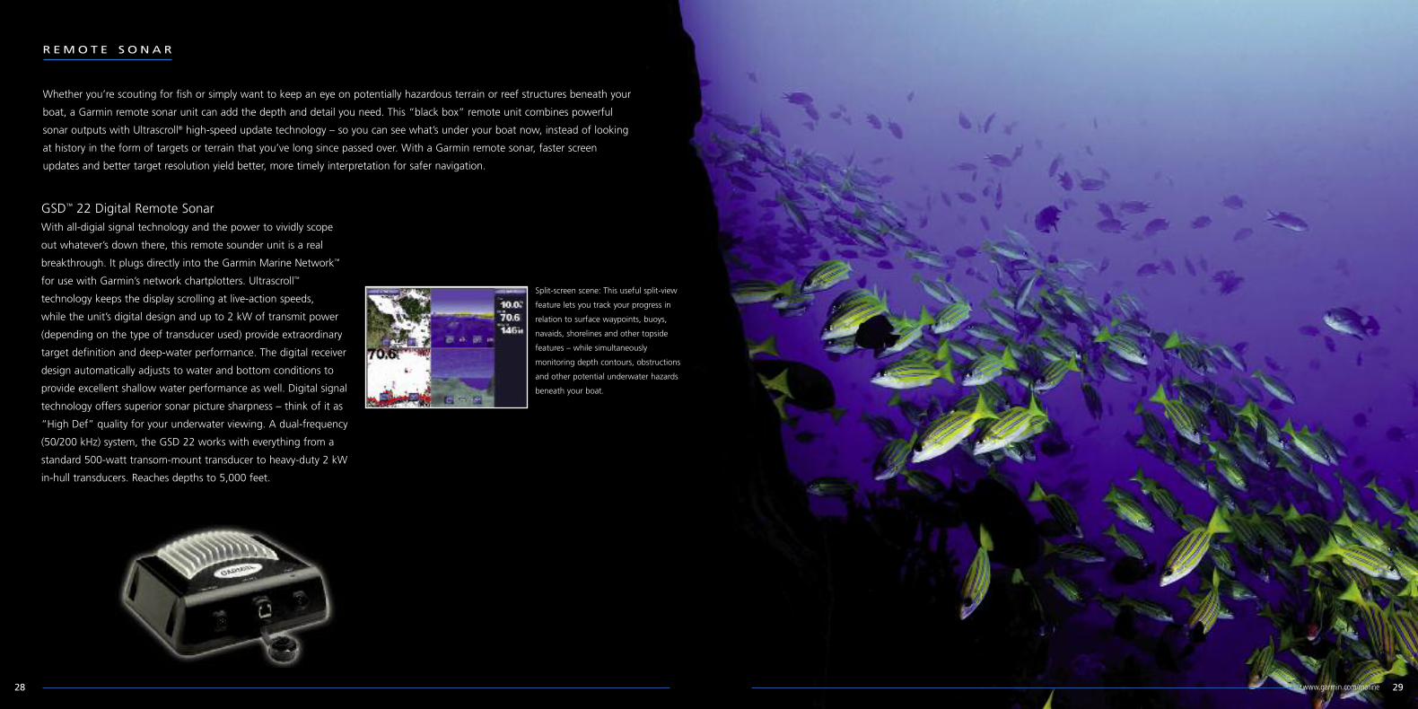
R EMO T E S O N A R
GSD™ 22 Digital Remote SonarWith all-digial signal technology and the power to vividly scope
out whatever’s down there, this remote sounder unit is a real
breakthrough. It plugs directly into the Garmin Marine Network™
for use with Garmin’s network chartplotters. Ultrascroll™
technology keeps the display scrolling at live-action speeds,
while the unit’s digital design and up to 2 kW of transmit power
(depending on the type of transducer used) provide extraordinary
target definition and deep-water performance. The digital receiver
design automatically adjusts to water and bottom conditions to
provide excellent shallow water performance as well. Digital signal
technology offers superior sonar picture sharpness – think of it as
“High Def” quality for your underwater viewing. A dual-frequency
(50/200 kHz) system, the GSD 22 works with everything from a
standard 500-watt transom-mount transducer to heavy-duty 2 kW
in-hull transducers. Reaches depths to 5,000 feet.
Whether you’re scouting for fish or simply want to keep an eye on potentially hazardous terrain or reef structures beneath your
boat, a Garmin remote sonar unit can add the depth and detail you need. This “black box” remote unit combines powerful
sonar outputs with Ultrascroll® high-speed update technology – so you can see what’s under your boat now, instead of looking
at history in the form of targets or terrain that you’ve long since passed over. With a Garmin remote sonar, faster screen
updates and better target resolution yield better, more timely interpretation for safer navigation.
Split-screen scene: This useful split-view
feature lets you track your progress in
relation to surface waypoints, buoys,
navaids, shorelines and other topside
features – while simultaneously
monitoring depth contours, obstructions
and other potential underwater hazards
beneath your boat.
2928 www.garmin.com/marine

MA R I N E A U T O P I L O T
For powerboat captains who want the ultimate in control,
Garmin’s GHP™ 10 helm pilot system is a real breakthrough.
Known for its aerospace-derived control surface technology
and intuitive, no-nonsense operation, the GHP 10 system
brings an amazing new level of performance, reliability and
hands-free control to all types of hydraulically steered boats –
inboards, outboards, stern drives, or diesels. The GHP 10 can
interface with your Garmin GPS or NMEA 0183 compatible
chartplotter for auto-guided navigation to selected waypoints
or routes. And, better still, NMEA 2000 connectivity now
allows the autopilot to be engaged directly from your Garmin
network chartplotter. Patented Shadow Drive™ technology
lets you take the wheel, at any time, to make manual course
changes on the fly, without disengaging or “wrestling” the
system for control. The advanced Shadow Drive sensor will
automatically send a command to the course computer when
it senses your hand-steering inputs. (This is one autopilot that
knows when to let go!) Then, once you’ve steered the boat
onto its new course, just release the helm and the autopilot
will automatically resume navigation. A high-speed digital
microprocessor calculates rudder rate commands – so you get
none of the installation and maintenance worries that go with
remote rudder-angle transducers. Also, a wide array of pre-
programmed steering patterns makes for easy automation of
holding, trolling and search procedures. G-limited turn control
offer smooth response at virtually any speed. What’s more,
you can easily set the unit to hold position against wind,
waves and currents – or even steer in reverse.
Freedom at your fingertips: Optional GHC 10 Wireless Remoteoffers on-the-move steering and mode control at distances up to45 feet from the primary helm unit – giving you total freedom tomove about the boat without being tethered to a cord.
3130 www.garmin.com/marine

GMS™10 Network Port ExpanderThis is the "nerve center" of the Garmin Marine Network: A
robust 100-megabit switch that allows users to connect multiple
sensors and MFDs to their onboard network and gain the
benefit of Ethernet-like data transfer speeds up to 10 times
faster than some competitive systems. By eliminating the need
for “daisy-chain” connections from one unit through another,
the GMS 10 provides a higher level of system redundancy and
reliability. It’s ruggedized for operation in corrosive marine
environments. All connections are totally waterproof, and sealed
covers keep harmful moisture away from unused data ports.
Individual line status is annunciated by LED indicators. And the
system’s plug-and-play design means that all peripherals are
automatically detected and readily accessible once they’re
connected to the network. Likewise, owners can easily expand
their systems by using the same standard data cable to plug
additional units and displays into the GMS 10 network ports.
From cabling to connectors to plug-in port expanders, everything to tie your Garmin Marine Network together has been made easy
to access – and virtually foolproof to install. What’s more, the whole process of keeping your network software up-to-date has been
made equally “flub-proof” as well. You simply go online to the Garmin website to download all the latest software updates. Then,
just copy this data from your PC onto a standard SD card or Garmin data card and insert it into the MFD. Follow the screen cues,
and – Voila! – you’re quickly updated and good to go.
N E TWO R K C O N N E C T I O N S A N D S E N S O R S
Garmin GPS 17x High Sensitivity Receiver/AntennaOffering high-sensitivity reception and pinpoint GPS accuracy to
Garmin’s newest marine instruments, autopilots and
multifunction displays (MFDs), the GPS 17x is a robust, easy-to-
mount sensor that’s built to perform under harsh conditions.
Packaged in a low-profile waterproof housing, this versatile
receiver/antenna combination allows for continuous tracking of
all visible GPS satellites and delivers position accuracy within 3
meters on average. In addition to conventional pole- or flush
surface mounting, the GPS 17x can also be attached to the
underside of many fiberglass decks, thanks to its high sensitivity.
(An under-deck mount kit is included.) Two versions of the
GPS 17x – NMEA 2000 only and NMEA 0183/serial – make
system configuration simple. And with both versions, a
connector right on the bottom housing of the unit takes the
hassle out of setup and installation.
MA R I N E N E TWO R K
3332 www.garmin.com/marine

GC™10 Marine CameraWhether you’re backing out of a busy marina or simply keeping
tabs on the engine room or other watch-worthy areas, the
Garmin GC 10 can provide the added security of an “extra set
of eyes” on your vessel. Video feeds from the GC 10 can be
viewed on standard flat-screen monitors or on any compatible
network chartplotter/MFD. Durable and waterproof, the
unobtrusive GC 10 camera works inside or outside – and it’s
easy to mount virtually anywhere on your boat.
Marine Heading SensorDesigned to complement Garmin’s marine network lineup of chartplotter/MFDs and radars, this three-axis heading sensor uses high-
precision rate gyros, accelerometer and compass sensors to maintain an exceptional 2° heading accuracy under a full range of
dynamic conditions, with up to 30° of pitch and roll. The unit will support either NMEA 2000 or NMEA 0183 data output to fit any
installation – providing mariners with unparalleled radar overlay accuracy, as well as extra-precise MARPA target tracking..
HomePort™ marine planning softwareA great voyage starts with a smart plan. And now, with the
introduction of HomePort™ planning software, Garmin gives
you the tools to more easily plan and review all of your offshore
adventures. This PC desktop application works with the existing
BlueChart® cartography data from your preloaded chartplotter
or preprogrammed data card to help you plan and manage
trips, routes, tracks and waypoints – and then transfer them
between your computer and your chartplotter. In addition, the
HomePort application can help you predict fuel usage, tides,
depth profiles, and more. Once your chart data is uploaded to
HomePort, you can use it to plot a course that avoids hidden
underwater hazards and keeps your vessel at a safe distance
from shallow or rocky shorelines. HomePort also enables you to
measure distance and bearing between waypoints, and it will
even help calculate your estimated travel time for each leg of
the voyage. You can save your PC planning files and trip profiles
for future use. And once you’ve planned your route, it’s easy to
transfer the data from the computer back to your chartplotter
via plug-in micro SD™/SD™ data card. For mariners who make
trip planning a real priority, there’s nothing like having the
HomePort advantage.
3534 www.garmin.com/marine

394.9
231.1 295
307.13
143.928.2
140.5
Network Chartplotters
3736
GPSMAP® 5215 GPSMAP® 5208 GPSMAP® 4212 GPSMAP® 4208GPSMAP® 4210
Waterproof:
Dimensions:
Receiver:
InterfaceInputs/Outputs:
Cartography:
Marine charts:
Resolution:
Screen Size:
Mount:
Display Type:
GPSMAP® 5212
IPX7—submersible
15.5”W x 11.7” H x 5.7” D
NMEA 2000; High sensitivity12 channel with WAAS
3 built-in network ports, 4 NMEA input(for NMEA 0183, NMEA 2000),2 NMEA output, 2 video inputs foronboard cameras, 1 XGA resolution
PC monitor video output
Preloaded U.S. coastal marinecharts including Explorer charts
for the Bahamas
*BlueChart® g2 Vision®
1024 x 768
15.0” diag. (38.1 cm)
flush
XGA Touchscreen display
IPX7—submersible
13”W x 9.5” H x 4.7” D
NMEA 2000; High sensitivity12 channel with WAAS
3 built-in network ports, 4 NMEA input(for NMEA 0183, NMEA 2000),2 NMEA output, 2 video inputs foronboard cameras, 1 XGA resolution
PC monitor video output
Preloaded U.S. coastal marinecharts including Explorer charts
for the Bahamas
*BlueChart® g2 Vision®
1024 x 768
12.1” diag. (30.7 cm)
flush or tilt bail mount
XGA Touchscreen display
IPX7—submersible
10.1”W x 6.8” H x 4.2” D
NMEA 2000; High sensitivity12 channel with WAAS
3 built-in network ports, 4 NMEA input(for NMEA 0183, NMEA 2000),2 NMEA output, 2 video inputs foronboard cameras, 1 XGA resolution
PC monitor video output
Preloaded U.S. coastal marinecharts including Explorer charts
for the Bahamas
*BlueChart® g2 Vision®
640 x 480
8.4” diag. (21.3 cm)
flush or tilt bail mount
VGA Touchscreen display
IPX7—submersible
14.8”W x 9.5” H x 4.6” D
NMEA 2000; High sensitivity12 channel with WAAS
3 built-in network ports, 4 NMEA input(for NMEA 0183, NMEA 2000),2 NMEA output, 2 video inputs foronboard cameras, 1 XGA resolution
PC monitor video output
Preloaded U.S. coastal marinecharts including Explorer charts
for the Bahamas
*BlueChart® g2 Vision®
1024 x 768
12.1” diag. (30.7 cm)
flush or tilt bail mount
XGA display
IPX7—submersible
13.4”W x 8.9” H x 4.2” D
NMEA 2000; High sensitivity12 channel with WAAS
3 built-in network ports, 4 NMEA input(for NMEA 0183, NMEA 2000),2 NMEA output, 2 video inputs foronboard cameras, 1 XGA resolution
PC monitor video output
Preloaded U.S. coastal marinecharts including Explorer charts
for the Bahamas
*BlueChart® g2 Vision®
800 x 600
10.4” diag. (26.4 cm)
flush or tilt bail mount
SVGA display
IPX7—submersible
11.2”W x 7.0” H x 4.6” D
NMEA 2000; High sensitivity12 channel with WAAS
3 built-in network ports, 4 NMEA input(for NMEA 0183, NMEA 2000),2 NMEA output, 2 video inputs foronboard cameras, 1 XGA resolution
PC monitor video output
Preloaded U.S. coastal marinecharts including Explorer charts
for the Bahamas
*BlueChart® g2 Vision®
640 x 480
8.4” diag. (21.3 cm)
flush or tilt bail mount
VGA display
371.9
330.0
240.5258.4
48.2
104.6
116.7
59.6
138.2
371.9330.0
116.7104.6
48.2
258.4240.5
138.2
59.6
329.3
284.4
60.0
113.3
58.2
176.9
196.6
106.1
108.2
113.3
58.2
176.9
106.1
196.6 108.2
60.0
329.3284.4
384.015.12
340.413.40
123.14.85
1.0426.4
4.15105.5
251.69.91
123.1105.5
26.4
251.6
384.0340.4
411.3
375.0
48.2
240.5258.4
117.2
105.2
138.2
60.0
411.3375.0
117.2
48.2
240.5
105.2
258.4
138.2
60.0
302.3
256.9
196.6
108.2
60.0
121.7
58.2
176.9
106.1
302.3256.9
121.7106.1
58.2
196.6176.9
108.2
60.0
GPSMAP® 6208
IPX7—submersible
11.5”W x 7.4” H x 5.9” D
NMEA 2000; High sensitivity12 channel with WAAS
4 NMEA input (for NMEA 0183,NMEA 2000), 2 NMEA output,
2 video inputs for onboard cameras,1 XGA resolution PC monitor video output
Preloaded U.S. coastal marinecharts including Explorer charts
for the Bahamas
*BlueChart® g2 Vision®
640 x 480
8.4” diag. (21.3 cm)
flush or tilt bail mount
VGA display
GPSMAP® 7215
IPX7—submersible
15.5”W x 11.8” H x 5.9” D
NMEA 2000; High sensitivity12 channel with WAAS
4 NMEA input (for NMEA 0183,NMEA 2000), 2 NMEA output,
4 video inputs for onboard cameras,1 XGA resolution PC monitor video output,
1 PC monitor input
Preloaded U.S. coastal marinecharts including Explorer charts
for the Bahamas
*BlueChart® g2 Vision®
1024 x 768
15.0” diag. (38.1 cm)
flush
XGA Touchscreen display
GPSMAP® 6212
IPX7—submersible
15.0”W x 9.9” H x 5.9” D
NMEA 2000; High sensitivity12 channel with WAAS
4 NMEA input (for NMEA 0183,NMEA 2000), 2 NMEA output,
2 video inputs for onboard cameras,1 XGA resolution PC monitor video output
Preloaded U.S. coastal marinecharts including Explorer charts
for the Bahamas
*BlueChart® g2 Vision®
1024 x 768
12.1” diag. (30.7 cm)
flush or tilt bail mount
XGA display
GPSMAP® 7212
IPX7—submersible
13.3”W x 9.9” H x 5.8” D
NMEA 2000; High sensitivity12 channel with WAAS
4 NMEA input (for NMEA 0183,NMEA 2000), 2 NMEA output,
2 video inputs for onboard cameras,1 XGA resolution PC monitor video output
Preloaded U.S. coastal marinecharts including Explorer charts
for the Bahamas
*BlueChart® g2 Vision®
1024 x 768
12.1” diag. (30.7 cm)
flush or tilt bail mount
XGA Touchscreen display
OVERALL WIDTH
329.4/ [12.97]
292.3/ [11.51]
173.9/ [6.85]LCD ACTIVE AREA
DISP. WIDTH
131.3/ [5.17]LCD ACTIVE AREA
DISP. HEIGHT
UNIT WIDTH
2.0/ [0.08]
122.4/ [4.82]FLUSH MOUNT
MAX DEPTH
145.0/ [5.71]FLUSH MOUNTMIN REQUIRED
CLEARANCE
148.2/ [5.84]OVERALL UNIT
DEPTH
227.0/ [8.94]MAX OVERALL
HEIGHT
187.6/ [7.38]UNIT
HEIGHT
FLUSH MOUNTGASKET THICKNESS
184.3/ [7.26]DISPLAY HEIGHT
245.8/ [9.68]DISPLAY WIDTH
413.4/ [16.28]OVERALL WIDTH
381.7/ [15.03]UNIT WIDTH
2.0/ [0.08]FLUSH MOUNT
GASKET THICKNESS
149.2/ [5.88]FLUSH MOUNT
MIN CLEARANCE DEPTH
251.2/ [9.89]UNIT HEIGHT
148.7/ [5.86]UNIT DEPTH
257.8/ [10.15]OVERALL HEIGHT
374 [14.7]OVERALL WIDTH
337 [13.3]OVERALL WIDTH
UNIT ONLY
244 [9.6]DISPLAY WIDTH
185 [7.3]DISPLAY HEIGHT
251 [9.9]OVERALL HEIGHT
UNIT ONLY
146 [5.8]OVERALL DEPTH
UNIT ONLY123 [4.9]
DEPTH BEHINDMOUNTING PLANE
UNIT ONLY
265 [10.4]OVERALL HEIGHT
170 [6.7]OVERALL DEPTHUNIT + RIGHT
ANGLE CONNECTOR
147 [5.8] DEPTH BEHINDMOUNTING PLANE
UNIT + RIGHTANGLE CONNECTOR
FLUSH MOUNTINGPLANE
135/ [5.3]DEPTH BEHIND MOUNTING PLANE
UNIT + RIGHT-ANGLE CONNECTORS
160/ [6.3]OVERALL DEPTH
UNIT + RIGHT-ANGLE CONNECTORS
148/ [5.8]OVERALL DEPTH
UNIT ONLY
123/ [4.8]DEPTH BEHIND MOUNTING PLANE
UNIT ONLY
395/ [15.5]OVERALL WIDTH
301/ [11.8]OVERALL HEIGHT
*Bluechart g2 Vision card sold seperately

You’ve found the ideal way to integrate your weather and navigation information. But even so, you know your system is not
complete without one more important feature: Support. Whether you need operational assistance as you work through those
new-owner jitters, installation help from one of our worldwide authorized dealers, or maybe there’s an interface question you want
to bounce off our technical support pros – whatever the need, you can count on Garmin to back you up and keep you on track.
After all, standing behind our products and our customers is what continues to keep us out in front.
Because our goal is to make you the most worry-free link in the whole Garmin Marine Network.
A WO R L D O F S U P P O R T F O R Y O U R G A RM I N MA R I N E N E TWO R K ™
3938 www.garmin.com/marine
GMR™
18 / HDGMR™
24 / HDGMR™
404 / 406GMR™
604 / 606 xHD
Radome diameter:18”
Transmit power:4 kW
Horizontal beamwidth:5°
Presentation Modes:North up,Course up,Heading up
Max. Range:36 nm
Zoom Mode*:2x, 4x
Waterproof:IPX7—submersible
Features:Dual rotation speed;
Garmin Marine Network™ compatible;radar/chart overlay mode;
supports MARPA (with optionalheading sensor)
Power input:10.5-35 Vdc, 33.5W
Radome diameter:24”
Transmit power:4 kW
Horizontal beamwidth:3.6°
Presentation Modes:North up,Course up,Heading up
Max. Range:48 nm
Zoom Mode*:2x, 4x
Waterproof:IPX7—submersible
Features:Dual rotation speed;
Garmin Marine Network™ compatible;radar/chart overlay mode;
supports MARPA (with optionalheading sensor)
Power input:10.5-35 Vdc, 33.5W
Antenna size:4-ft. or 6-ft. open arrays
Transmit power:4 kW
Horizontal beamwidth:1.8° (404); 1.1° (406)
Presentation Modes:North up,Course up,Heading up
Max. Range:72 nm
Zoom Mode*:2x, 4x
Waterproof:IPX7—submersible
Features:Dual rotation speed;
Garmin Marine Network™ compatible;radar/chart overlay mode;
supports MARPA (with optionalheading sensor)
Power input:10.5-38 Vdc, 45W typical
Antenna size:4-ft. or 6-ft. open arrays
Transmit power:6 kW
Horizontal beamwidth:1.8° (404); 1.1° (406)
Presentation Modes:North up,Course up,Heading up
Max. Range:72 nm
Zoom Mode*:2x, 4x
Waterproof:IPX7—submersible
Features:Dual rotation speed;
Garmin Marine Network™ compatible;radar/chart overlay mode;
supports MARPA (with optionalheading sensor); dual range
Power input:10.5-38 Vdc, 45W typical
Antenna size:4-ft. or 6-ft. open arrays
Transmit power:12 kW
Horizontal beamwidth:1.8° (404); 1.1° (406)
Presentation Modes:North up,Course up,Heading up
Max. Range:72 nm
Zoom Mode*:2x, 4x
Waterproof:IPX7—submersible
Features:Dual rotation speed;
Garmin Marine Network™ compatible;radar/chart overlay mode;
supports MARPA (with optionalheading sensor); dual range
Power input:10.5-38 Vdc, 45W typical
Radars
236.2
243.59 9
16 "
91.2313.5
116.4
438.5
326.8
1320.5 (GMR404)1933.5 (GMR406)
6.0
116.5
141.5
457
233.0
27.5
Ø 609.624"
141.55 9
16 "
233.09 3
16 "
114.041
2 "
150.0
100.0
70.0
50.0
125.0 25.0
159.8
13.34 PLACES
* May depend on MFD capabilities. Dimensions are shown in millimeters.
236.2
116.5
233.0
27.5141.5
243.5916
9
114.024ӯ609.6
4 21
233.0916
3
141.5516
9
Ø1320.5 (GMR404)Ø1933.5 (GMR406)
438.5
313.5 6.0 326.8 91.2
50.025.0
100.070.0159.8
Ø 13.34 PLACES
125.0150.0
116.4
GMR™
1204 / 1206 XHD