united states department of the interior bureau of land ...€¦ · united states department of the...
TRANSCRIPT

United States Department of the Interior Bureau of Land Management
Determination of NEPA Adequacy
DOI-BLM-CO-S010-2017-0001-DNA
October 2016
February 2017 Oil and Gas Lease Sale Location: Two parcels comprising 1,276.44 acres in Dolores County, Colorado
Tres Rios Field Office 29211 Highway 184 Dolores, CO 81323
Phone: (970) 882-7296 FAX: (970) 882-6841

1
Worksheet
Determination of NEPA Adequacy
U.S. Department of the Interior Colorado Bureau of Land Management
OFFICE: Tres Rios Field Office
TRACKING NUMBER: DOI-BLM-CO-S010-2017-0001-DNA CASEFILE/PROJECT NUMBER: Parcels 6715 and 7371
PROPOSED ACTION TITLE/TYPE: February 2017 Competitive Oil and Gas Lease Sale
LOCATION/LEGAL DESCRIPTION: See Attachments B and C for full legal descriptions A. Description of Proposed Action The Bureau of Land Management (BLM) proposes to offer two parcels, totaling approximately 1276.44 acres of federal mineral estate within the Tres Rios Field Office, for lease in the upcoming February 2017 Competitive Oil and Gas Lease Sale. The proposed sale parcels are located in Dolores County, Colorado. The BLM’s Colorado State Office conducts quarterly competitive sales to lease available oil and gas parcels. A Notice of Competitive Lease Sale (Sale Notice), which lists parcels to be offered at the Lease Sale auction, is published by the Colorado State Office at least 45 days before the auction is held. Lease stipulations applicable to each parcel are specified in the Sale Notice. The decision as to which public lands and minerals are open for leasing and what leasing stipulations may be necessary, based on information available at the time, is made during the land use planning process. Constraints on leasing and on any future development of parcels with surface managed by other Federal agencies are determined by the BLM in consultation with the appropriate surface management agency. The nominated parcels were posted online for a 30-day public scoping period. This posting also includes the appropriate stipulations as identified in the relevant Resource Management Plan (RMP). The BLM prepares documentation consistent with the National Environmental Policy Act (NEPA). Comments received from the public during scoping are reviewed and considered as applicable. The BLM considered whether offering the parcels would be consistent with the oil and gas availability decisions and lease stipulations adopted in the Tres Rios Field Office Record of Decision and Approved Resource Management Plan (2015) (TRFO ROD/RMP). The TRFO

ROD/RMP meets the requirements and regulations for implementing the Federal Land Policy and Management Act of 1976 (Title 43 CFR, part 1600). In accordance with the TRFO ROD/RMP, all parcels have several stipulations, including No Surface Occupancy (NSO), Timing Limitation (TL), and Controlled Surface Use (CSU) stipulations, and Lease Notices. A map depicting the two proposed parcels is contained in Attachment A, and legal descriptions of the parcels are in Attachment B. Legal descriptions and stipulations for the two parcels recommended for lease are in Attachment C, and full descriptions of the stipulations applied to each parcel are in Attachment D. If the parcels are not leased at the upcoming February 2017 sale they would remain available to be leased for a period of up to two years to any qualified lessee. Parcels obtained in this way may be re-parceled by combining or deleting other previously offered lands. Mineral estate that is not leased after an initial offering, and is not leased within a two year period, must go through a competitive lease sale process again before being considered for leasing in a future sale. Leasing does not authorize any development or use of the surface of lease lands without further application by the operator and approval by the BLM. After a parcel is leased, the BLM may receive an Application for Permit to Drill (APD). BLM would perform additional site-specific NEPA analysis before approving an APD or other surface-disturbing activity. B. Land Use Plan (LUP) Conformance Plan: Tres Rios Field Office Record of Decision and Approved Resource Management Plan (TRFO ROD/RMP) Date Approved: February 2015 The proposed action is in conformance with the applicable LUP because it is specifically provided for in the following RMP decisions: Decision Language: This program emphasizes the orderly and environmentally responsible development of oil and gas (natural gas and CO2) deposits (page II-111). The TRFO ROD/RMP identifies areas open for oil and gas leasing (pages II-113 through II-121), and specifies stipulations that would apply to leases (Appendix H). The proposed lease parcels are within the areas identified as open to leasing. Based on the TRFO ROD/RMP, specific stipulations have been attached to each of the proposed lease parcels. C. Identify the applicable National Environmental Policy Act (NEPA) documents and other related documents that cover the proposed action. The BLM Tres Rios Field Office Record of Decision and Approved Resource Management Plan (TRFO ROD/RMP) (February 2015), San Juan National Forest Land and Resource Management Plan Final Environmental Impact Statement (RMP FEIS) (September 2013).

D. NEPA Adequacy Criteria 1. Is the new proposed action a feature of, or essentially similar to, an alternative analyzed in the existing NEPA document(s)? Is the project within the same analysis area, or if the project location is different, are the geographic and resource conditions sufficiently similar to those analyzed in the existing NEPA document(s)? If there are differences, can you explain why they are not substantial?
Yes. The proposed action is included in an alternative analyzed in the RMP/FEIS. The proposed lease parcels are within the area analyzed by the RMP/FEIS, and leasing and subsequent development of oil and gas resources on the parcels was specifically analyzed throughout the RMP/FEIS (see chapters 3 and 4). Section 3.19 of the RMP/FEIS describes the acres of currently leased and unleased federal minerals, under BLM, U.S. Forest Service, and split-estate surface ownership. The RMP/FEIS analyzes the types of stipulations which should be applied for resource protection and mitigation, and explains that stipulations, conditions of approval, and other existing laws can mitigate resource concerns during development. The RMP/FEIS also describes average acres of disturbance for development of well pads, roads, pipelines, and other facilities. Other resource sections within the RMP/FEIS describe the type and qualitative impacts of development on the various resources addressed in the RMP/FEIS.
2. Is the range of alternatives analyzed in the existing NEPA document(s) appropriate with respect to the new proposed action (or existing proposed action), given current environmental concerns, interests, and resource values?
Yes. Five alternatives, covering a full range of oil and gas leasing options, were addressed in the RMP/FEIS (see Section 2.4.6 of that document). The alternatives ranged from the most restrictive, a No Leasing Alternative, to the least restrictive, which made 78% of lands Available for Lease and had No Surface Occupancy (NSO) stipulations on only 38% of those lands. Alternative B, with modifications, was the selected alternative which makes 88% of the BLM mineral estate Available for Lease and NSO stipulations apply to 44% of those lands. Other alternatives were considered but eliminated from full analysis in the RMP/FEIS due to being contrary to law or valid existing rights, or similar to analyzed alternatives. These alternatives are appropriate for the proposed action.
3. Is existing analysis adequate in light of any new information or circumstances (such as, rangeland health standards assessment; recent endangered species listings, updated list of BLM sensitive species)? Can you reasonably conclude that new information and new circumstances would not substantially change the analysis of the new proposed action?
Yes, the existing TRFO RMP/FEIS is sufficient. We are not aware of any new information or circumstances that would require modification of the analysis.
4. Are the direct, indirect, and cumulative effects that would result from implementation of the new proposed action similar (both quantitatively and qualitatively) to those analyzed in the existing NEPA document?

Yes. The foreseeable impacts of oil and gas developments, as well as other resource management actions, were addressed in the RMP/FEIS based on a reasonable foreseeable development (RFD) scenario of approximately 2900 new wells in the next 15 years. Since the TRFO ROD/RMP was signed in February 2015, only six new wells have been approved. This equals about 0.3 new wells per month since the RMP was approved, which is less than two-percent of the RFD’s predicted average of 16.1 wells per month. Thus, the impacts, to date, from oil and gas development are much lower than those anticipated under the approved plan, and are within the range of alternatives analyzed in the RMP/FEIS.
5. Are the public involvement and interagency review associated with existing NEPA document(s) adequate for the current proposed action?
Yes. Full public review occurred during the RMP/FEIS process, which encompassed the lands under consideration for leasing. In addition, a public scoping period for these parcels was held from May 11 - June 10, 2015, and a courtesy notice for that public scoping period was posted on the BLM web site. Additionally, surface owners of the proposed parcels were notified of the proposed leasing action by mail on May 12, 2016, and were provided the opportunity bring any issues of concern to BLM’s attention.
An initial draft of this DNA was posted from May 12 - June 13, 2016 for public review and comment. Surface owners of the proposed parcels were again notified of the proposed leasing action and initiation of the public comment period by mail and/or e-mail on May 12, 2016.
In addition, a notice of the competitive lease sale is being posted at least forty-five (45) days prior to the sale on the BLM web site: http://www.blm.gov/co/st/en/BLM_Programs/oilandgas/oil_and_gas_lease.html .
E. Persons/Agencies/BLM Staff Consulted:
Name Title Resource Represented Robert Garrigues Natural Resource Specialist Project Manager Justin Abernathy Assistant Field Manager NEPA Chad Meister Natural Resource Specialist Air Bruce Bourcy Archaeologist Cultural Resources
Marietta Eaton Manager, Canyons of the Ancients National Monument
Native American Religious Concerns
Brad Pietruszka Fire Management Specialist Fuels, Fire
Nathaniel West Wildlife Biologist
Wildlife; Migratory Birds; Special Status Animal Species; Threatened, Endangered or Candidate Animal Species; Wetlands; Water Resources
Mike Jensen Botanist
Invasive Species/Noxious Weeds; Rangeland; Special Status Plant Species; Threatened, Endangered or Candidate Plant Species;

Vegetation
Martin Hensley Economist Environmental Justice; Socio-Economics
Harrison Griffin Realty Specialist Lands/Access
Jeff Christenson Outdoor Recreation Planner
Lands with Wilderness Characteristics; Recreation; Visual; Wild and Scenic Rivers; Wilderness/Wilderness Study Areas
John Pecor Petroleum Engineer Mineral Resources; Waste Jamie Blair Paleontology Coordinator Paleontology
In addition, the list of preparers, cooperating agencies, and tribes participating in the original RMP/FEIS is available in the FEIS, Chapter 4. Remarks: CULTURAL RESOURCES (National Historic Preservation Act of 1966 (NHPA), P.L. 89-665 as amended by P.L. 94-422, P.L. 94-458, and P.L. 96-515):
The leasing of federal mineral rights for potential oil and gas exploration and production is an undertaking under section 106 of the NHPA, 16 U.S.C. § 470f. The TRFO RMP FEIS process was conducted in accordance with the requirements of the NHPA and compliance with section 106 of the NHPA for the subject lease sale was completed on June 30, 2016.
Tribal consultation specifically for the proposed leasing action addressed here was initiated on November 6, 2015. The Tribes were asked to provide any information that they are aware of regarding cultural resource values, including historic properties that are listed on or eligible for listing on the National Register of Historic Places (NRHP), traditional cultural properties and other sacred sites, that may be impacted by the proposed lease parcels. Tribal consultation for the subject lease sale is complete.
There will be no direct impacts to cultural resource values, including historic properties, solely as a result of leasing the two subject parcels. However, the act of leasing the parcels may have indirect impacts to cultural resource values. Leasing allows for the future development of oil and gas resources from the parcels, subject to the lease terms, the stipulations attached to the leases, and the applicable laws and regulations. Oil and gas exploration and development has the potential to impact the setting for cultural resource sites and it may provide for more public access (authorized or unauthorized) in the areas where development occurs. The density of any future oil and gas development and the potential for increased public access could contribute to direct, indirect, or cumulative effects on historic properties, which might include illegal artifact collection and vandalism.
Any oil and gas exploration and/or development proposed in the future for the leases would be subject to additional site-specific cultural resources reviews and analysis in accordance with section 106 of the NHPA, including cultural resources inventories, effects assessments, Tribal consultation, and if necessary, actions to resolve potentially adverse effects. This requirement is

outlined in controlled surface use (CSU) stipulation CO-39, which is attached to each of the proposed lease parcels.
CONCLUSION
Plan Conformance:
X This proposal conforms to the applicable land use plan.
This proposal does not conform to the applicable land use plan
Determination of NEPA Adequacy
X Based on the review documented above, I conclude that this proposal conforms to the applicable land use plan and that the NEPA documentation fully covers the proposed action and constitutes BLM’s compliance with the requirements of the NEPA.
The existing NEPA documentation does not fully cover the proposed action. Additional NEPA documentation is needed if the project is to be further considered.
___________________________________________ ______________________ Signature of Project Lead Date ___________________________________________ ______________________ Signature of NEPA Coordinator Date _________________________________________ ______________________ Signature of the Responsible Official Date Note: The signed Conclusion on this Worksheet is part of an interim step in the BLM’s internal decision process and does not constitute an appealable decision. However, the lease, permit, or other authorization based on this DNA is subject to protest or appeal under 43 CFR Part 4 and the program-specific regulations. ATTACHMENTS: Attachment A: Map Attachment B: Legal Descriptions of Proposed Parcels Attachment C: Parcels Recommended for Lease with Applied Stipulations Attachment D: Stipulation Descriptions Attachment E: Responses to Public Comments

ATTACHMENT A: Map


Attachment B: Legal Descriptions of Proposed Parcels

Attachment B: Legal Descriptions of Proposed Parcels
THE FOLLOWING PUBLIC DOMAIN LANDS ARE SUBJECT TO FILINGS IN THE MANNER SPECIFIED IN THE APPLICABLE PORTIONS OF THE REGULATIONS IN 43 CFR, SUBPART 3120. PARCEL ID: 6715 T.0400N., R.0130W., NMPM Section 19: Lot 1,2; Section 19: E2W2; Dolores County Colorado 196.440 Acres PVT/BLM; COS:TRFO PARCEL ID: 7371 T.0400N., R.0150W., NMPM Section 27: E2E2,E2W2,SWNW,W2SW; Section 34: ALL; Dolores County Colorado 1080.000 Acres PVT/BLM; COS:TRFO
PARCEL ID: 7372 – Deferred entirely T.0410N., R.0130W., NMPM Section 3: Lot 1-4; Section 3: S2N2,S2; Section 4: Lot 1-4; Section 4: S2NE,NWSW,NESE,S2S2; Section 5: Lot 1; Section 5: SENE,S2; Dolores County Colorado 1519.900 Acres PVT/BLM; COS:TRFO

PARCEL ID: 7373 – Deferred entirely T.0410N., R.0130W., NMPM Section 6: Lot 2-7; Section 6: SWNE,SENW; Section 6: NESW,N2SE,SESE; Dolores County Colorado 503.640 Acres PVT/BLM; COS:TRFO
PARCEL ID: 7390 – Deferred entirely T.0420N., R.0130W., NMPM Section 31: Lot 3,4; Section 31: N2NE,SENE,NENW; Section 31: E2SW,SWSE; Section 32: N2,N2SW,SESW,SE; Section 33: ALL; Dolores County Colorado 1612.350 Acres PVT/BLM; COS:TRFO

ATTACHMENT C: Parcels Recommended for Lease with Applied Stipulations

ATTACHMENT C: Parcels Recommended for Lease with Applied Stipulations THE FOLLOWING PUBLIC DOMAIN LANDS ARE SUBJECT TO FILINGS IN THE MANNER SPECIFIED IN THE APPLICABLE PORTIONS OF THE REGULATIONS IN 43 CFR, SUBPART 3120. Stipulations are No Surface Occupancy (NSO), Timing Limitation (TL), Controlled Surface Use (CSU), or Lease Notice. PARCEL ID: 6715 T.0400N., R.0130W., NMPM Section 19: Lot 1,2; Section 19: E2W2; Dolores County Colorado 196.440 Acres All lands are subject to Exhibit 1.4.1 (NSO) to protect ephemeral streams. All lands are subject to Exhibit 1.4.2 (CSU) to protect ephemeral streams. All lands are subject to Exhibit 1.6.1 (CSU) to protect shallow groundwater resources. All lands are subject to Exhibit 1.6.2 (CSU) to protect groundwater resources during hydraulic fracturing. All lands are subject to Exhibit 1.8.1 (Lease Notice) to protect against radioactive materials. All lands are subject to Exhibit 1.10.1 (CSU) to protect 25-35% slopes and shale soils. All lands are subject to Exhibit 1.11.1 (NSO) to protect lands prone to mass movement. All lands are subject to Exhibit 1.13.1 (CSU) to protect biological soil crusts. All lands are subject to Exhibit 2.1.1 (NSO) to protect threatened, endangered, proposed and candidate plants. All lands are subject to Exhibit 2.2.1 (CSU) to protect sensitive plants. All lands are subject to Exhibit 3.2.1 (CSU) to protect lynx habitat. All lands are subject to Exhibit 3.8.1 (Lease Notice) to protect migratory birds. All lands are subject to Exhibit 3.9.1 (NSO) to protect raptors. All lands are subject to Exhibit 3.9.2 (TL) to protect raptors. All lands are subject to Exhibit 3.10.1 (TL) to protect big game parturition areas. All lands are subject to Exhibit 3.10.2 (CSU) to protect big game winter range and production areas. All lands are subject to Exhibit CO-29 to alert lessee of PFYC 4 and 5 paleontological area inventory requirement. All lands are subject to Exhibit CO-34 to alert lessee of potential habitat for a threatened, endangered, candidate, or other special status plant or animal All lands are subject to Exhibit CO-39 to protect cultural resources. All lands are subject to Exhibit CO-56 (Lease Notice) to alert lessees of potential supplementary air analysis. PVT/BLM; COS:TRFO

PARCEL ID: 7371 T.0400N., R.0150W., NMPM Section 27: E2E2,E2W2,SWNW,W2SW; Section 34: ALL; Dolores County Colorado 1080.000 Acres All lands are subject to Exhibit 1.4.1 (NSO) to protect ephemeral streams. All lands are subject to Exhibit 1.4.2 (CSU) to protect ephemeral streams. All lands are subject to Exhibit 1.6.1 (CSU) to protect shallow groundwater resources. All lands are subject to Exhibit 1.6.2 (CSU) to protect groundwater resources during hydraulic fracturing. All lands are subject to Exhibit 1.8.1 (Lease Notice) to protect against radioactive materials. All lands are subject to Exhibit 1.10.1 (CSU) to protect 25-35% slopes and shale soils. All lands are subject to Exhibit 1.13.1 (CSU) to protect biological soil crusts. All lands are subject to Exhibit 2.1.1 (NSO) to protect threatened, endangered, proposed and candidate plants. All lands are subject to Exhibit 2.2.1 (CSU) to protect sensitive plants. All lands are subject to Exhibit 3.8.1 (Lease Notice) to protect migratory birds. All lands are subject to Exhibit 3.9.1 (NSO) to protect raptors. All lands are subject to Exhibit 3.9.2 (TL) to protect raptors. All lands are subject to Exhibit CO-29 to alert lessee of PFYC 4 and 5 paleontological area inventory requirement. All lands are subject to Exhibit CO-34 to alert lessee of potential habitat for a threatened, endangered, candidate, or other special status plant or animal All lands are subject to Exhibit CO-39 to protect cultural resources. All lands are subject to Exhibit CO-56 (Lease Notice) to alert lessees of potential supplementary air analysis. The following lands are subject to Exhibit 1.3.1 (NSO) to protect perennial water bodies: T.0400N., R.0150W., NMPM Section 27: E2E2, E2NW, SWNW, E2SW, SWSW; Section 34: NE, N2SE, SESE, SW, E2NW; The following lands are subject to Exhibit 1.3.2 (CSU) to protect perennial water bodies: T.0400N., R.0150W., NMPM Section 27: E2E2, E2NW, SWNW, E2SW, SWSW; Section 34: SW, SESE; The following lands are subject to Exhibit 1.9.1 (NSO) to protect greater than 35% slopes: T.0400N., R.0150W., NMPM Section 27: SWNW, SW; Section 34: SWNE, NW, N2SW, NWSE;

The following lands are subject to Exhibit 1.11.1 (NSO) to protect lands prone to mass movement: T.0400N., R.0150W., NMPM Section 27: E2E2, NENW, SWNW, W2SW, SESW; Section 34: ALL; The following lands are subject to Exhibit 3.11.1 (CSU) to protect Gunnison prairie dog: Section 34: S2SW; The following lands are subject to Exhibit 4.9.1 (NSO) to protect visual resources: Section 27: E2NE, NESE; Section 34: SWNE, NWSE; PVT/BLM; COS:TRFO

ATTACHMENT D: Stipulation Descriptions

EXHIBIT 1.3.1 Lease Number: Parcel 7371
NO SURFACE OCCUPANCY STIPULATION
Perennial Streams, Water Bodies, Riparian Areas, and Fens This stipulation applies to the lands identified for special stipulations in Attachment C: Parcels Recommended for Lease with Applied Stipulations. No surface occupancy or use is allowed subject to the following special operating constraints: Prohibit surface occupancy and surface-disturbing activities within a minimum buffer distance of 325 horizontal feet for all perennial waters. For perennial streams, the buffer would be measured from the ordinary high water mark (bankfull stage), whereas for wetland features, the buffer would be measured from the edge of the mapped extent (Table H.1). For unmapped wetlands, the vegetative boundary (from which the buffer originates) would be determined in the field. Where the riparian zone extends beyond 325 feet, the NSO stipulation would be extended to include the entire riparian zone.
* Wetland buffer dimensions may be averaged to accommodate variability in terrain or development plans. Up-gradient distances should be maintained (i.e., up- gradient buffer distances of 325 feet), while down-gradient buffers may be reduced to no less than 100 feet. The buffer averaging must, however, not adversely affect wetland functions and values, and a minimum buffer distance of 100 feet from the wetland edge is maintained. The buffer’s intent is to protect the water source area of the wetland, which is more important than the down-gradient portion of the wetland. For the purpose of: Maintaining the proper functioning condition, including the vegetative, hydrologic and geomorphic functionality of the perennial water body. Protecting water quality, fish habitat,

aquatic habitat, and providing a clean, reliable source of water for downstream users. Buffers are expected to indirectly benefit migratory birds, wildlife habitat, amphibians, and other species. Justification: Wetlands, floodplains, riparian areas, water influence zones, and fens represent important ecological components and functions, such as storing water, stabilizing valley floors, enhancing water quality, and providing recreation and aesthetic values, biological diversity, and wildlife species with habitat, water, food, cover, and travel routes. They are easily disturbed by ground-disturbing activities that can cause soil erosion, soil compaction, and adverse changes to the hydrologic function that is important to maintaining the hydrologic and ecological integrity of these lands. Exceptions, modifications, and waivers The following waiver, exception, and modification criteria would apply to all stipulations: Exception: The Authorized Officer may grant an exception to a stipulation if it is determined that the factors leading to its inclusion in the lease have changed sufficiently such that 1) the protection provided by the stipulation is no longer justified or necessary to meet resource objectives established in the LRMP, or 2) proposed operations would not cause unacceptable impacts. The Authorized Officer may require additional plans of development, surveys, mitigation proposals, or environmental analysis, and may consult with other government agencies and/or the public in order to make this determination. Modification: The Authorized Officer may modify a stipulation or the area subject to the stipulation if it is determined that the factors leading to its inclusion in the lease have changed sufficiently. The Authorized Officer may modify a stipulation as a result of new information if 1) the protection provided by the stipulation is no longer justified or necessary to meet resource objectives established in the LRMP, 2) the protection provided by the stipulation is no longer sufficient to meet resource objectives established in the LRMP, or 3) proposed operations would not cause unacceptable impacts. The Authorized Officer may require additional plans of development, surveys, mitigation proposals, or environmental analysis, and may consult with other government agencies and/or the public in order to make this determination. Waiver: The Authorized Officer may waive a stipulation if it is determined that the factors leading to its inclusion in the lease no longer exist. The Authorized Officer may require additional plans of development, surveys, mitigation proposals, or environmental analysis, and may consult with other government agencies and/or the public in order to make this determination.

EXHIBIT 1.3.2 Lease Number: Parcel 7371
CONTROLLED SURFACE USE STIPULATION
Perennial Streams, Water Bodies, Riparian Areas, and Fens This stipulation applies to the lands identified for special stipulations in Attachment C: Parcels Recommended for Lease with Applied Stipulations. Surface occupancy or use is subject to the following special operating constraints: From 325 to 500 horizontal feet from the perennial water body, Controlled Surface Use (CSU) restrictions would apply. Surface-disturbing activities may require special engineering design, construction and implementation measures, including re-location of operations beyond 656 feet (200 meters) to protect water resources within the 325 foot No Surface Occupancy (NSO) buffer. For perennial streams, the buffer would be measured from ordinary high water mark (bankfull stage), whereas for wetland features, the buffer would be measured from the edge of the mapped extent (Table H.2). For unmapped wetlands, the vegetative boundary (from which the buffer originates) would be determined in the field.
For the purpose of: Maintaining the proper functioning condition, including the vegetative, hydrologic, and geomorphic functionality of the perennial water body, to protect water quality, fish habitat, and aquatic habitat and provide a clean, reliable source of water for downstream users. Buffers are expected to indirectly benefit migratory birds, wildlife habitat, amphibians, and other species. Justification: Minimizing potential deterioration of water quality; maintaining natural hydrologic function and condition of stream channels, banks, floodplains, and riparian communities; and preserving wildlife habitat. The buffers are sized to accommodate the rivers’ larger floodplains and wider riparian zones. Exceptions, modifications, and waivers
The following waiver, exception, and modification criteria would apply to all stipulations: Exception: The Authorized Officer may grant an exception to a stipulation if it is determined that the factors leading to its inclusion in the lease have changed sufficiently such that 1) the protection provided by the stipulation is no longer justified or necessary to meet resource objectives established in the LRMP, or 2) proposed operations would not cause unacceptable impacts. The Authorized Officer may require additional plans of development, surveys, mitigation proposals, or environmental analysis, and may consult with other government agencies and/or the public in order to make this determination. Modification: The Authorized Officer may modify a stipulation or the area subject to the stipulation if it is determined that the factors leading to its inclusion in the lease have changed sufficiently. The Authorized Officer may modify a stipulation as a result of new information if 1) the protection provided by the stipulation is no longer justified or necessary to meet resource objectives established in the LRMP, 2) the protection provided by the stipulation is no longer sufficient to meet resource objectives established in the LRMP, or 3) proposed operations would not cause unacceptable impacts. The Authorized Officer may require additional plans of development, surveys, mitigation proposals, or environmental analysis, and may consult with other government agencies and/or the public in order to make this determination. Waiver: The Authorized Officer may waive a stipulation if it is determined that the factors leading to its inclusion in the lease no longer exist. The Authorized Officer may require additional plans of development, surveys, mitigation proposals, or environmental analysis, and may consult with other government agencies and/or the public in order to make this determination.

EXHIBIT 1.4.1 Lease Number: Parcels 6715 and 7371
NO SURFACE OCCUPANCY STIPULATION
Intermittent and Ephemeral Streams This stipulation applies to the lands identified for special stipulations in Attachment C: Parcels Recommended for Lease with Applied Stipulations. No surface occupancy or use is allowed subject to the following special operating constraints: No Surface Occupancy (NSO) of 50 horizontal feet as measured from the top of the stream bank for all intermittent or ephemeral streams (see diagram). If riparian vegetation extends beyond the top of the stream bank, the buffer would be measured from the extent of the riparian vegetation.
For the purpose of: Maintaining and protecting water quality, stream stability, aquatic health, seasonal use and downstream fisheries, and sediment processes downstream. Justification: Minimizing potential deterioration of water quality and maintaining natural hydrologic function and condition of stream channels, banks, floodplains, and riparian communities. Exceptions, modifications, and waivers The following waiver, exception, and modification criteria would apply to all stipulations: Exception: The Authorized Officer may grant an exception to a stipulation if it is determined that the factors leading to its inclusion in the lease have changed sufficiently such that 1) the
protection provided by the stipulation is no longer justified or necessary to meet resource objectives established in the LRMP, or 2) proposed operations would not cause unacceptable impacts. The Authorized Officer may require additional plans of development, surveys, mitigation proposals, or environmental analysis, and may consult with other government agencies and/or the public in order to make this determination. Modification: The Authorized Officer may modify a stipulation or the area subject to the stipulation if it is determined that the factors leading to its inclusion in the lease have changed sufficiently. The Authorized Officer may modify a stipulation as a result of new information if 1) the protection provided by the stipulation is no longer justified or necessary to meet resource objectives established in the LRMP, 2) the protection provided by the stipulation is no longer sufficient to meet resource objectives established in the LRMP, or 3) proposed operations would not cause unacceptable impacts. The Authorized Officer may require additional plans of development, surveys, mitigation proposals, or environmental analysis, and may consult with other government agencies and/or the public in order to make this determination. Waiver: The Authorized Officer may waive a stipulation if it is determined that the factors leading to its inclusion in the lease no longer exist. The Authorized Officer may require additional plans of development, surveys, mitigation proposals, or environmental analysis, and may consult with other government agencies and/or the public in order to make this determination.

EXHIBIT 1.4.2 Lease Number: Parcels 6715 and 7371
CONTROLLED SURFACE USE STIPULATION
Intermittent and Ephemeral Streams This stipulation applies to the lands identified for special stipulations in Attachment C: Parcels Recommended for Lease with Applied Stipulations. Surface occupancy or use is subject to the following special operating constraints: Controlled Surface Use (CSU) from the edge of the No Surface Occupancy (NSO) buffer to 100 horizontal feet. Avoid locating roads, stream crossings, and facilities within this zone, because activities within this area can potentially affect streams and water quality. Adequate professional design and engineering of activities in this zone is necessary to prevent storm-water runoff and sedimentation. Measurement is from the top of the stream bank, although if wetland vegetation exists, then the measurement is from the vegetation’s edge. For the purpose of: Minimizing the risk of sedimentation, spills, and other contaminants reaching intermittent and/or ephemeral streams to protect water quality, stream function, and aquatic habitat. Justification: CSU in this zone would minimize potential deterioration of water quality, maintain natural hydrologic function and condition of stream channels, banks, floodplains, and riparian communities. Exceptions, modifications, and waivers The following waiver, exception, and modification criteria would apply to all stipulations: Exception: The Authorized Officer may grant an exception to a stipulation if it is determined that the factors leading to its inclusion in the lease have changed sufficiently such that 1) the protection provided by the stipulation is no longer justified or necessary to meet resource objectives established in the LRMP, or 2) proposed operations would not cause unacceptable impacts. The Authorized Officer may require additional plans of development, surveys, mitigation proposals, or environmental analysis, and may consult with other government agencies and/or the public in order to make this determination. Modification: The Authorized Officer may modify a stipulation or the area subject to the stipulation if it is determined that the factors leading to its inclusion in the lease have changed sufficiently. The Authorized Officer may modify a stipulation as a result of new information if 1) the protection provided by the stipulation is no longer justified or necessary to meet resource objectives established in the LRMP, 2) the protection provided by the stipulation is no longer sufficient to meet resource objectives established in the LRMP, or 3) proposed operations would not cause unacceptable impacts. The Authorized Officer may require additional plans of

development, surveys, mitigation proposals, or environmental analysis, and may consult with other government agencies and/or the public in order to make this determination. Waiver: The Authorized Officer may waive a stipulation if it is determined that the factors leading to its inclusion in the lease no longer exist. The Authorized Officer may require additional plans of development, surveys, mitigation proposals, or environmental analysis, and may consult with other government agencies and/or the public in order to make this determination.

EXHIBIT 1.6.1 Lease Number: Parcels 6715 and 7371
CONTROLLED SURFACE USE STIPULATION
Groundwater Resources (Shallow) This stipulation applies to the lands identified for special stipulations in Attachment C: Parcels Recommended for Lease with Applied Stipulations. Surface occupancy or use is subject to the following special operating constraints: Oil and gas surface operations over shallow (<2,000 feet) potentially usable groundwater (<10,000 total dissolved solids) shall use the following protection measures:
• Pitless, self-contained drilling systems. • In the completion of an oil, gas, injection, disposal, or service well, where acidizing or
fracture processes are used, no deleterious substances shall be permitted to pollute subsurface water.
• Flowback and stimulation fluids would be contained within tanks that are placed on a well pad or in a lined, bermed area.
• Fluids, additives, and other materials used for drilling and completion operations must be protective of public health and the environment in the areas where they are used.
• For well where a multi-stage high volume hydraulic fracturing is anticipated, the operators shall indicate the method used to handle, transport, and dispose of the recovered fluids.
For the purpose of: Minimizing the risk of spills and other contaminants reaching potentially usable groundwater with a water table up to 2,000 feet that is near the surface. Justification: Controlled Surface Use (CSU) would minimize the risk of water quality contamination and maintain the integrity of potentially usable groundwater resources for present and future uses. Exceptions, modifications, and waivers The following waiver, exception, and modification criteria would apply to all stipulations: Exception: The Authorized Officer may grant an exception to a stipulation if it is determined that the factors leading to its inclusion in the lease have changed sufficiently such that 1) the protection provided by the stipulation is no longer justified or necessary to meet resource objectives established in the LRMP, or 2) proposed operations would not cause unacceptable impacts. The Authorized Officer may require additional plans of development, surveys, mitigation proposals, or environmental analysis, and may consult with other government agencies and/or the public in order to make this determination.

Modification: The Authorized Officer may modify a stipulation or the area subject to the stipulation if it is determined that the factors leading to its inclusion in the lease have changed sufficiently. The Authorized Officer may modify a stipulation as a result of new information if 1) the protection provided by the stipulation is no longer justified or necessary to meet resource objectives established in the LRMP, 2) the protection provided by the stipulation is no longer sufficient to meet resource objectives established in the LRMP, or 3) proposed operations would not cause unacceptable impacts. The Authorized Officer may require additional plans of development, surveys, mitigation proposals, or environmental analysis, and may consult with other government agencies and/or the public in order to make this determination. Waiver: The Authorized Officer may waive a stipulation if it is determined that the factors leading to its inclusion in the lease no longer exist. The Authorized Officer may require additional plans of development, surveys, mitigation proposals, or environmental analysis, and may consult with other government agencies and/or the public in order to make this determination.

EXHIBIT 1.6.2 Lease Number: Parcels 6715 and 7371
CONTROLLED SURFACE USE STIPULATION
Groundwater Resources This stipulation applies to the lands identified for special stipulations in Attachment C: Parcels Recommended for Lease with Applied Stipulations. Surface occupancy or use is subject to the following special operating constraints. Oil and gas operations using multi-stage hydraulic fracturing shall use the following measures to protect potentially usable water bearing intervals:
• The placement of all stimulation fluids shall be confined to the objective formation to the extent practicable.
• In all directions a minimum of 2,500 feet of buffer distance (or greater if deemed necessary by BLM) between the well bore (production string) and the lower extent of shallow (<2,000 feet), potentially usable groundwater (<10,000 total dissolved solids) aquifer, shall be maintained so that fractures from the hydraulic fracturing process do not intersect shallow aquifers.
• A continuous column of cement shall extend from the surface casing shoe back to ground level. If cement is not circulated to surface, then a remedial cement job shall be performed to ensure complete cement coverage.
• A cement bond log shall be required in the surface string. • Surface casing set depth shall be at least 50 feet below any potentially usable water
bearing interval. • Pitless, self-contained drilling systems. • In the completion of an oil, gas, injection, disposal, or service well, where acidizing or
fracture processes are used, no deleterious substances shall be permitted to pollute subsurface water.
• Fluids, additives, and other materials used for drilling and completion operations must be protective of public health and the environment in the areas where they are used.
• Operators shall indicate the method used to handle, transport, and dispose of the recovered fluids.
• Upon request of the BLM, operators shall provide reports that disclose the complete chemical makeup of all materials used in the proposed and actual drilling and stimulation fluids without regard to original source additive.
For the purpose of: Protecting potentially usable groundwater. Justification: Controlled Surface Use (CSU) would minimize the risk of groundwater contamination and maintain the integrity of potentially usable water bearing intervals for present and future uses.
Exceptions, modifications, and waivers The following waiver, exception, and modification criteria would apply to all stipulations: Exception: The Authorized Officer may grant an exception to a stipulation if it is determined that the factors leading to its inclusion in the lease have changed sufficiently such that 1) the protection provided by the stipulation is no longer justified or necessary to meet resource objectives established in the LRMP, or 2) proposed operations would not cause unacceptable impacts. The Authorized Officer may require additional plans of development, surveys, mitigation proposals, or environmental analysis, and may consult with other government agencies and/or the public in order to make this determination. Modification: The Authorized Officer may modify a stipulation or the area subject to the stipulation if it is determined that the factors leading to its inclusion in the lease have changed sufficiently. The Authorized Officer may modify a stipulation as a result of new information if 1) the protection provided by the stipulation is no longer justified or necessary to meet resource objectives established in the LRMP, 2) the protection provided by the stipulation is no longer sufficient to meet resource objectives established in the LRMP, or 3) proposed operations would not cause unacceptable impacts. The Authorized Officer may require additional plans of development, surveys, mitigation proposals, or environmental analysis, and may consult with other government agencies and/or the public in order to make this determination. Waiver: The Authorized Officer may waive a stipulation if it is determined that the factors leading to its inclusion in the lease no longer exist. The Authorized Officer may require additional plans of development, surveys, mitigation proposals, or environmental analysis, and may consult with other government agencies and/or the public in order to make this determination.

EXHIBIT 1.8.1 Lease Number: Parcels 6715 and 7371
LEASE NOTICE
Technologically Enhanced Naturally Occurring Radioactive Materials This stipulation applies to the lands identified for special stipulations in Attachment C: Parcels Recommended for Lease with Applied Stipulations. Oil and gas operations targeting shale formations have the potential to bring to the surface, and concentrate, naturally occurring radioactive materials. These operations can lead to the spread of radioactive contamination and potential human health risks. Wells targeting shale gas plays are subject to the following special sampling requirements:
• All exploratory wells targeting shale gas formations shall obtain a representative sample of cuttings from the targeted formation and complete analysis in accordance with General Provision 3.1.6 of the Colorado Department of Public Health and the Environment (CDPHE) Interim Policy and Guidance Pending Rulemaking for Control and Disposition if Technologically-Enhanced Naturally Occurring Radioactive Materials in Colorado, or the equivalent provisions of any future rulemaking decision. The results shall be provided to the San Juan National Forest and Tres Rios Field Office.
• During the first multi-stage hydraulic fracturing of a well targeting shale gas in any given section, representative samples of cuttings, flowback fluids, produced waters, and sludge shall be analyzed in accordance with General Provision 3.1.6 of the CDPHE Interim Policy and Guidance Pending Rulemaking for Control and Disposition if Technologically-Enhanced Naturally Occurring Radioactive Materials in Colorado, or the equivalent provisions of any future rulemaking decision. The results shall be provided to the San Juan National Forest and Tres Rios Field Office.

EXHIBIT 1.9.1 Lease Number: Parcel 7371
NO SURFACE OCCUPANCY STIPULATION
Lands with Slopes Greater Than 35 Percent This stipulation applies to the lands identified for special stipulations in Attachment C: Parcels Recommended for Lease with Applied Stipulations. No surface occupancy or use is allowed subject to the following special operating constraints: Lands with slopes greater than 35 percent. For the purpose of: Preventing mass movement and the associated loss of soil productivity, preventing damage to structures and equipment, and protecting riparian areas, wetlands, and aquatic ecosystems from sedimentation and for safety reasons. Justification: Slopes greater than 35 percent have high to very high potential for mass movement and excessive sheet erosion especially when they are impacted by ground-disturbing management activities. These lands are also very difficult to reclaim following disturbance. Exceptions, modifications, and waivers The following waiver, exception, and modification criteria would apply to all stipulations: Exception: The Authorized Officer may grant an exception to a stipulation if it is determined that the factors leading to its inclusion in the lease have changed sufficiently such that 1) the protection provided by the stipulation is no longer justified or necessary to meet resource objectives established in the LRMP, or 2) proposed operations would not cause unacceptable impacts. The Authorized Officer may require additional plans of development, surveys, mitigation proposals, or environmental analysis, and may consult with other government agencies and/or the public in order to make this determination. Modification: The Authorized Officer may modify a stipulation or the area subject to the stipulation if it is determined that the factors leading to its inclusion in the lease have changed sufficiently. The Authorized Officer may modify a stipulation as a result of new information if 1) the protection provided by the stipulation is no longer justified or necessary to meet resource objectives established in the LRMP, 2) the protection provided by the stipulation is no longer sufficient to meet resource objectives established in the LRMP, or 3) proposed operations would not cause unacceptable impacts. The Authorized Officer may require additional plans of development, surveys, mitigation proposals, or environmental analysis, and may consult with other government agencies and/or the public in order to make this determination.

Waiver: The Authorized Officer may waive a stipulation if it is determined that the factors leading to its inclusion in the lease no longer exist. The Authorized Officer may require additional plans of development, surveys, mitigation proposals, or environmental analysis, and may consult with other government agencies and/or the public in order to make this determination.
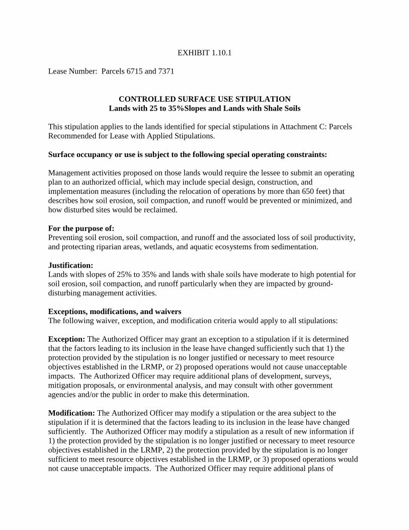
EXHIBIT 1.10.1 Lease Number: Parcels 6715 and 7371
CONTROLLED SURFACE USE STIPULATION
Lands with 25 to 35%Slopes and Lands with Shale Soils This stipulation applies to the lands identified for special stipulations in Attachment C: Parcels Recommended for Lease with Applied Stipulations. Surface occupancy or use is subject to the following special operating constraints: Management activities proposed on those lands would require the lessee to submit an operating plan to an authorized official, which may include special design, construction, and implementation measures (including the relocation of operations by more than 650 feet) that describes how soil erosion, soil compaction, and runoff would be prevented or minimized, and how disturbed sites would be reclaimed. For the purpose of: Preventing soil erosion, soil compaction, and runoff and the associated loss of soil productivity, and protecting riparian areas, wetlands, and aquatic ecosystems from sedimentation. Justification: Lands with slopes of 25% to 35% and lands with shale soils have moderate to high potential for soil erosion, soil compaction, and runoff particularly when they are impacted by ground-disturbing management activities.
Exceptions, modifications, and waivers The following waiver, exception, and modification criteria would apply to all stipulations: Exception: The Authorized Officer may grant an exception to a stipulation if it is determined that the factors leading to its inclusion in the lease have changed sufficiently such that 1) the protection provided by the stipulation is no longer justified or necessary to meet resource objectives established in the LRMP, or 2) proposed operations would not cause unacceptable impacts. The Authorized Officer may require additional plans of development, surveys, mitigation proposals, or environmental analysis, and may consult with other government agencies and/or the public in order to make this determination. Modification: The Authorized Officer may modify a stipulation or the area subject to the stipulation if it is determined that the factors leading to its inclusion in the lease have changed sufficiently. The Authorized Officer may modify a stipulation as a result of new information if 1) the protection provided by the stipulation is no longer justified or necessary to meet resource objectives established in the LRMP, 2) the protection provided by the stipulation is no longer sufficient to meet resource objectives established in the LRMP, or 3) proposed operations would not cause unacceptable impacts. The Authorized Officer may require additional plans of

development, surveys, mitigation proposals, or environmental analysis, and may consult with other government agencies and/or the public in order to make this determination. Waiver: The Authorized Officer may waive a stipulation if it is determined that the factors leading to its inclusion in the lease no longer exist. The Authorized Officer may require additional plans of development, surveys, mitigation proposals, or environmental analysis, and may consult with other government agencies and/or the public in order to make this determination.

EXHIBIT 1.11.1 Lease Number: Parcels 6715 and 7371
NO SURFACE OCCUPANCY STIPULATION
Lands Prone to Mass Movement This stipulation applies to the lands identified for special stipulations in Attachment C: Parcels Recommended for Lease with Applied Stipulations. No surface occupancy or use is allowed subject to the following special operating constraints: Lands prone to mass movement and lands within a 100-foot buffer around those lands. Lands prone to mass movement include canyon escarpments, hill/mountain dip-slopes, lands with unstable geologic formations (including the Morrison, Mancos Shale, Lewis Shale, and Fruitland Formations on the SJNF and TRFO), lands that display evidence of past mass movement (including land slides, land-flows, and land-slumps), lands lacking vegetation (badlands and burned areas), lands with slopes greater than 35%, and lands associated with map units that have high or very high potential for mass movement (including soil survey map units 254, 386, 606, 720, 926, 20511D, 30506D, 34301D, 34306D, 34506D, 50803D, 50806D, 70806D, 70807D, 74803D, 80604D, 80803D, and 80804D). For the purpose of: Preventing mass movement and the associated loss of soil productivity, as well as damage to structures and equipment, and for safety reasons. Justification: The potential for mass movement and its adverse affects is high to very high for lands prone to mass movement especially when those lands are impacted by ground-disturbing activities. Mass movement could cause ruptured pipelines, water/oil/condensate spills, gas explosions, and damaged storage tanks, and could cause injury to people. Those lands are also very difficult to reclaim. Exceptions, modifications, and waivers The following waiver, exception, and modification criteria would apply to all stipulations: Exception: The Authorized Officer may grant an exception to a stipulation if it is determined that the factors leading to its inclusion in the lease have changed sufficiently such that 1) the protection provided by the stipulation is no longer justified or necessary to meet resource objectives established in the LRMP, or 2) proposed operations would not cause unacceptable impacts. The Authorized Officer may require additional plans of development, surveys, mitigation proposals, or environmental analysis, and may consult with other government agencies and/or the public in order to make this determination.
Modification: The Authorized Officer may modify a stipulation or the area subject to the stipulation if it is determined that the factors leading to its inclusion in the lease have changed sufficiently. The Authorized Officer may modify a stipulation as a result of new information if 1) the protection provided by the stipulation is no longer justified or necessary to meet resource objectives established in the LRMP, 2) the protection provided by the stipulation is no longer sufficient to meet resource objectives established in the LRMP, or 3) proposed operations would not cause unacceptable impacts. The Authorized Officer may require additional plans of development, surveys, mitigation proposals, or environmental analysis, and may consult with other government agencies and/or the public in order to make this determination. Waiver: The Authorized Officer may waive a stipulation if it is determined that the factors leading to its inclusion in the lease no longer exist. The Authorized Officer may require additional plans of development, surveys, mitigation proposals, or environmental analysis, and may consult with other government agencies and/or the public in order to make this determination.

EXHIBIT 1.13.1 Lease Number: Parcels 6715and 7371
CONTROLLED SURFACE USE STIPULATION
Lands with Biological Soil Crusts This stipulation applies to the lands identified for special stipulations in Attachment C: Parcels Recommended for Lease with Applied Stipulations. Surface occupancy or use is subject to the following special operating constraints: On lands with biological soil crusts exhibiting a Level of Darkness class of 4 or above on the soil surface (see Belnap et al. 2008). Management activities proposed on those lands would require the lessee to submit an operating plan to an authorized BLM or USFS official, which may include special design, construction, and implementation measures (including the relocation of operations by more than 650 feet) that describes how impacts to biological soil crusts would be prevented or minimized, and how disturbed sites would be reclaimed. For the purpose of: Protecting biological soil crusts and the important ecosystems in which they occur. Justification: Biological soil crusts (also known as microbiotic or cryptogamic crusts) are unique components of biodiversity and important components of the semi-desert shrublands, semi-desert grasslands, sagebrush shrublands, and pinyon-juniper woodlands on the SJNF and TRFO. They play an important role in ecosystem restoration, they are very sensitive to disturbances, and they are very slow to recover from disturbances (Bowker 2007). Ground-disturbing activities could cause direct effects to biological soil crusts including mortality and could cause soil erosion and soil compaction to the associated soils, which could adversely affect the crusts habitat. Exceptions, modifications, and waivers The following waiver, exception, and modification criteria would apply to all stipulations: Exception: The Authorized Officer may grant an exception to a stipulation if it is determined that the factors leading to its inclusion in the lease have changed sufficiently such that 1) the protection provided by the stipulation is no longer justified or necessary to meet resource objectives established in the LRMP, or 2) proposed operations would not cause unacceptable impacts. The Authorized Officer may require additional plans of development, surveys, mitigation proposals, or environmental analysis, and may consult with other government agencies and/or the public in order to make this determination. Modification: The Authorized Officer may modify a stipulation or the area subject to the stipulation if it is determined that the factors leading to its inclusion in the lease have changed sufficiently. The Authorized Officer may modify a stipulation as a result of new information if

1) the protection provided by the stipulation is no longer justified or necessary to meet resource objectives established in the LRMP, 2) the protection provided by the stipulation is no longer sufficient to meet resource objectives established in the LRMP, or 3) proposed operations would not cause unacceptable impacts. The Authorized Officer may require additional plans of development, surveys, mitigation proposals, or environmental analysis, and may consult with other government agencies and/or the public in order to make this determination. Waiver: The Authorized Officer may waive a stipulation if it is determined that the factors leading to its inclusion in the lease no longer exist. The Authorized Officer may require additional plans of development, surveys, mitigation proposals, or environmental analysis, and may consult with other government agencies and/or the public in order to make this determination.

EXHIBIT 2.1.1 Lease Number: Parcels 6715 and 7371
NO SURFACE OCCUPANCY STIPULATION
Threatened or Endangered Plants, Plants Proposed for Federal Listing, or Candidate Plants for Federal Listing
This stipulation applies to the lands identified for special stipulations in Attachment C: Parcels Recommended for Lease with Applied Stipulations. No surface occupancy or use is allowed subject to the following special operating constraints: Lands occupied by plant species that are federally listed (threatened or endangered), proposed for federal listing, or candidates for federal listing; lands designated as critical habitat for federally listed species; and lands within a 650 foot (i.e., 200 meter) buffer around all those lands. For the purpose of: To protect rare plant species and their critical habitat from direct and indirect impacts associated with management actions that could adversely affect their viability and could lead to their extinction. Justification: Management actions on the Tres Rios Field Office and San Juan National Forest could affect federally listed plant species (threatened or endangered), plant species proposed for federal listing, and plant species that are candidates for federal listing; and could affect the critical habitat for those species, which could adversely affect the viability of those species and could lead to their extinction. Exceptions, modifications, and waivers The following waiver, exception, and modification criteria would apply to all stipulations: Exception: The Authorized Officer may grant an exception to a stipulation if it is determined that the factors leading to its inclusion in the lease have changed sufficiently such that 1) the protection provided by the stipulation is no longer justified or necessary to meet resource objectives established in the LRMP, or 2) proposed operations would not cause unacceptable impacts. The Authorized Officer may require additional plans of development, surveys, mitigation proposals, or environmental analysis, and may consult with other government agencies and/or the public in order to make this determination. Modification: The Authorized Officer may modify a stipulation or the area subject to the stipulation if it is determined that the factors leading to its inclusion in the lease have changed sufficiently. The Authorized Officer may modify a stipulation as a result of new information if 1) the protection provided by the stipulation is no longer justified or necessary to meet resource

objectives established in the LRMP, 2) the protection provided by the stipulation is no longer sufficient to meet resource objectives established in the LRMP, or 3) proposed operations would not cause unacceptable impacts. The Authorized Officer may require additional plans of development, surveys, mitigation proposals, or environmental analysis, and may consult with other government agencies and/or the public in order to make this determination. Waiver: The Authorized Officer may waive a stipulation if it is determined that the factors leading to its inclusion in the lease no longer exist. The Authorized Officer may require additional plans of development, surveys, mitigation proposals, or environmental analysis, and may consult with other government agencies and/or the public in order to make this determination.

EXHIBIT 2.2.1 Lease Number: Parcels 6715 and 7371
CONTROLLED SURFACE USE STIPULATION
Colorado Bureau of Land Management State Director’s Sensitive Plants and Region 2 Regional Forester’s Sensitive Plants
This stipulation applies to the lands identified for special stipulations in Attachment C: Parcels Recommended for Lease with Applied Stipulations. Surface occupancy or use is subject to the following special operating constraints: Lands occupied by Colorado BLM State Director’s Sensitive Plant Species, Region 2 Regional Forester’s Sensitive Plant Species, and on lands within a 325-foot buffer around lands occupied by those plant species. Management activities proposed on those lands would require the lessee to submit an operating plan to a BLM Authorized Official, which may include special design, construction, and implementation measures (including the relocation of operations by more than 650 feet) that describes how impacts to BLM State Director’s Sensitive Plant Species and Region 2 Regional Forester’s Sensitive Plant Species would be prevented or minimized and how disturbed sites would be reclaimed. For the purpose of: Protecting rare plant species and their habitat from direct and indirect impacts associated with management actions that could adversely affect those rare plants. Justification: Management actions on the Tres Rios Field Office and the San Juan National Forest could affect Colorado BLM State Director’s Sensitive Plant Species, Region 2 Regional Forester’s Sensitive Plant Species, and their habitat, which could adversely affect the viability of those species and could lead to a trend to federal listing under the Endangered Species Act. Exceptions, modifications, and waivers The following waiver, exception, and modification criteria would apply to all stipulations: Exception: The Authorized Officer may grant an exception to a stipulation if it is determined that the factors leading to its inclusion in the lease have changed sufficiently such that 1) the protection provided by the stipulation is no longer justified or necessary to meet resource objectives established in the LRMP, or 2) proposed operations would not cause unacceptable impacts. The Authorized Officer may require additional plans of development, surveys, mitigation proposals, or environmental analysis, and may consult with other government agencies and/or the public in order to make this determination. Modification: The Authorized Officer may modify a stipulation or the area subject to the stipulation if it is determined that the factors leading to its inclusion in the lease have changed

sufficiently. The Authorized Officer may modify a stipulation as a result of new information if 1) the protection provided by the stipulation is no longer justified or necessary to meet resource objectives established in the LRMP, 2) the protection provided by the stipulation is no longer sufficient to meet resource objectives established in the LRMP, or 3) proposed operations would not cause unacceptable impacts. The Authorized Officer may require additional plans of development, surveys, mitigation proposals, or environmental analysis, and may consult with other government agencies and/or the public in order to make this determination. Waiver: The Authorized Officer may waive a stipulation if it is determined that the factors leading to its inclusion in the lease no longer exist. The Authorized Officer may require additional plans of development, surveys, mitigation proposals, or environmental analysis, and may consult with other government agencies and/or the public in order to make this determination.
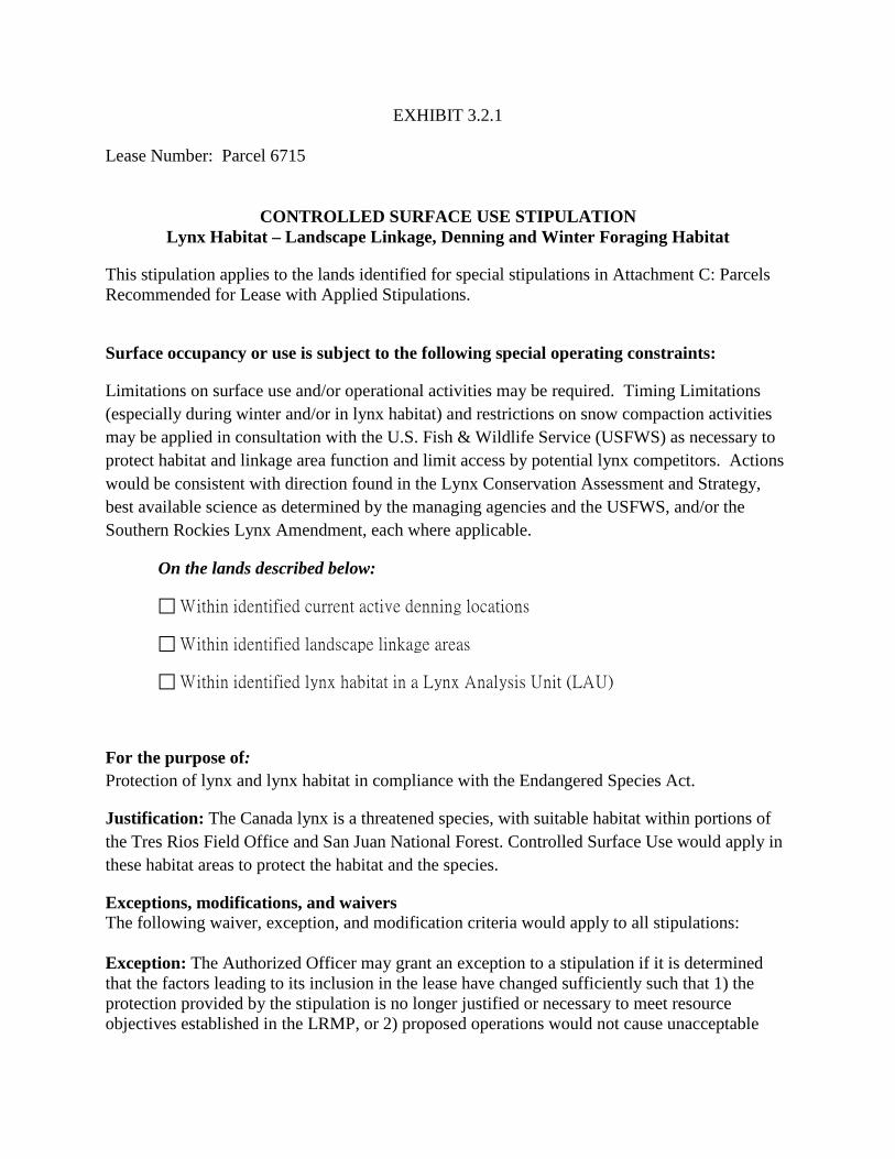
EXHIBIT 3.2.1 Lease Number: Parcel 6715
CONTROLLED SURFACE USE STIPULATION
Lynx Habitat – Landscape Linkage, Denning and Winter Foraging Habitat
This stipulation applies to the lands identified for special stipulations in Attachment C: Parcels Recommended for Lease with Applied Stipulations.
Surface occupancy or use is subject to the following special operating constraints:
Limitations on surface use and/or operational activities may be required. Timing Limitations (especially during winter and/or in lynx habitat) and restrictions on snow compaction activities may be applied in consultation with the U.S. Fish & Wildlife Service (USFWS) as necessary to protect habitat and linkage area function and limit access by potential lynx competitors. Actions would be consistent with direction found in the Lynx Conservation Assessment and Strategy, best available science as determined by the managing agencies and the USFWS, and/or the Southern Rockies Lynx Amendment, each where applicable.
On the lands described below:
Within identified current active denning locations
Within identified landscape linkage areas
Within identified lynx habitat in a Lynx Analysis Unit (LAU)
For the purpose of: Protection of lynx and lynx habitat in compliance with the Endangered Species Act.
Justification: The Canada lynx is a threatened species, with suitable habitat within portions of the Tres Rios Field Office and San Juan National Forest. Controlled Surface Use would apply in these habitat areas to protect the habitat and the species.
Exceptions, modifications, and waivers The following waiver, exception, and modification criteria would apply to all stipulations: Exception: The Authorized Officer may grant an exception to a stipulation if it is determined that the factors leading to its inclusion in the lease have changed sufficiently such that 1) the protection provided by the stipulation is no longer justified or necessary to meet resource objectives established in the LRMP, or 2) proposed operations would not cause unacceptable

impacts. The Authorized Officer may require additional plans of development, surveys, mitigation proposals, or environmental analysis, and may consult with other government agencies and/or the public in order to make this determination. Modification: The Authorized Officer may modify a stipulation or the area subject to the stipulation if it is determined that the factors leading to its inclusion in the lease have changed sufficiently. The Authorized Officer may modify a stipulation as a result of new information if 1) the protection provided by the stipulation is no longer justified or necessary to meet resource objectives established in the LRMP, 2) the protection provided by the stipulation is no longer sufficient to meet resource objectives established in the LRMP, or 3) proposed operations would not cause unacceptable impacts. The Authorized Officer may require additional plans of development, surveys, mitigation proposals, or environmental analysis, and may consult with other government agencies and/or the public in order to make this determination. Waiver: The Authorized Officer may waive a stipulation if it is determined that the factors leading to its inclusion in the lease no longer exist. The Authorized Officer may require additional plans of development, surveys, mitigation proposals, or environmental analysis, and may consult with other government agencies and/or the public in order to make this determination.
EXHIBIT 3.8.1 Lease Number: Parcels 6715 and 7371
LEASE NOTICE Migratory Birds
This stipulation applies to the lands identified for special stipulations in Attachment C: Parcels Recommended for Lease with Applied Stipulations. Avoid or minimize disruption of migratory bird nesting activity by siting or prioritizing vegetation clearing, facility construction, and concentrated operational activities (e.g., drilling, completion, utility installation) to avoid the involvement of higher value migratory bird habitats, particularly during the core migratory bird nesting season (April 1–July 15).

EXHIBIT 3.9.1 Lease Number: Parcels 6715 and 7371
NO SURFACE OCCUPANCY STIPULATION
Eagles, All Accipiters, Falcons, Buteos, and Owls This stipulation applies to the lands identified for special stipulations in Attachment C: Parcels Recommended for Lease with Applied Stipulations. No surface occupancy or use is allowed subject to the following special operating constraints: Within specified distance from nest and communal winter roost sites, No Surface Occupancy (NSO) would be allowed. Distances are listed in Table H.3. For the purpose of: Providing adequate nesting and roost sites to support species populations. Justification: These raptor species are known to have failed reproduction and abandon nests and communal winter roost sites when human activity occurs within the specified buffer distances from these sites. To increase the likelihood of successful reproduction and recruitment of these species, and to provide adequate roost sites for utilization of their habitat, NSO would be permitted within the specified buffer distances from nest and roost sites (see Table H.3). Exceptions, modifications, and waivers The following waiver, exception, and modification criteria would apply to all stipulations: Exception: The Authorized Officer may grant an exception to a stipulation if it is determined that the factors leading to its inclusion in the lease have changed sufficiently such that 1) the protection provided by the stipulation is no longer justified or necessary to meet resource objectives established in the LRMP, or 2) proposed operations would not cause unacceptable impacts. The Authorized Officer may require additional plans of development, surveys, mitigation proposals, or environmental analysis, and may consult with other government agencies and/or the public in order to make this determination. Modification: The Authorized Officer may modify a stipulation or the area subject to the stipulation if it is determined that the factors leading to its inclusion in the lease have changed sufficiently. The Authorized Officer may modify a stipulation as a result of new information if 1) the protection provided by the stipulation is no longer justified or necessary to meet resource objectives established in the LRMP, 2) the protection provided by the stipulation is no longer sufficient to meet resource objectives established in the LRMP, or 3) proposed operations would not cause unacceptable impacts. The Authorized Officer may require additional plans of

development, surveys, mitigation proposals, or environmental analysis, and may consult with other government agencies and/or the public in order to make this determination. Waiver: The Authorized Officer may waive a stipulation if it is determined that the factors leading to its inclusion in the lease no longer exist. The Authorized Officer may require additional plans of development, surveys, mitigation proposals, or environmental analysis, and may consult with other government agencies and/or the public in order to make this determination.


EXHIBIT 3.9.2 Lease Number: Parcels 6715 and 7371
TIMING LIMITATION STIPULATION
Eagles, All Accipiters, Falcons, Buteos, and Owls This stipulation applies to the lands identified for special stipulations in Attachment C: Parcels Recommended for Lease with Applied Stipulations. No surface use is allowed during the following time period(s): A Timing Limitation (TL) would be applied to lease activities, if surface occupancy is allowed. The TL would apply to all development activities (construction, drilling, workovers, operation, and maintenance). The duration of the timing limitation is species-dependent, and the timing limitations subject to this stipulation are shown in Table H.3. For the Purpose of: To protect raptor nests and roost sites. Justifications: These raptor species are known to have failed reproduction and abandon nests and communal winter roost sites when human activity occurs within the specified buffer distances from these sites. To increase the likelihood of successful reproduction and recruitment of these species, and to provide adequate roost sites for utilization of their habitat, No Surface Occupancy (NSO) would be permitted within the specified buffer distances from nest and roost sites (see Table H.3). Exceptions, modifications, and waivers The following waiver, exception, and modification criteria would apply to all stipulations: Exception: The Authorized Officer may grant an exception to a stipulation if it is determined that the factors leading to its inclusion in the lease have changed sufficiently such that 1) the protection provided by the stipulation is no longer justified or necessary to meet resource objectives established in the LRMP, or 2) proposed operations would not cause unacceptable impacts. The Authorized Officer may require additional plans of development, surveys, mitigation proposals, or environmental analysis, and may consult with other government agencies and/or the public in order to make this determination. Modification: The Authorized Officer may modify a stipulation or the area subject to the stipulation if it is determined that the factors leading to its inclusion in the lease have changed sufficiently. The Authorized Officer may modify a stipulation as a result of new information if 1) the protection provided by the stipulation is no longer justified or necessary to meet resource objectives established in the LRMP, 2) the protection provided by the stipulation is no longer sufficient to meet resource objectives established in the LRMP, or 3) proposed operations would not cause unacceptable impacts. The Authorized Officer may require additional plans of

development, surveys, mitigation proposals, or environmental analysis, and may consult with other government agencies and/or the public in order to make this determination. Waiver: The Authorized Officer may waive a stipulation if it is determined that the factors leading to its inclusion in the lease no longer exist. The Authorized Officer may require additional plans of development, surveys, mitigation proposals, or environmental analysis, and may consult with other government agencies and/or the public in order to make this determination.


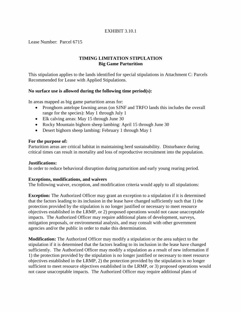
EXHIBIT 3.10.1 Lease Number: Parcel 6715
TIMING LIMITATION STIPULATION
Big Game Parturition This stipulation applies to the lands identified for special stipulations in Attachment C: Parcels Recommended for Lease with Applied Stipulations. No surface use is allowed during the following time period(s): In areas mapped as big game parturition areas for:
• Pronghorn antelope fawning areas (on SJNF and TRFO lands this includes the overall range for the species): May 1 through July 1
• Elk calving areas: May 15 through June 30 • Rocky Mountain bighorn sheep lambing: April 15 through June 30 • Desert bighorn sheep lambing: February 1 through May 1
For the purpose of: Parturition areas are critical habitat in maintaining herd sustainability. Disturbance during critical times can result in mortality and loss of reproductive recruitment into the population. Justifications: In order to reduce behavioral disruption during parturition and early young rearing period. Exceptions, modifications, and waivers The following waiver, exception, and modification criteria would apply to all stipulations: Exception: The Authorized Officer may grant an exception to a stipulation if it is determined that the factors leading to its inclusion in the lease have changed sufficiently such that 1) the protection provided by the stipulation is no longer justified or necessary to meet resource objectives established in the LRMP, or 2) proposed operations would not cause unacceptable impacts. The Authorized Officer may require additional plans of development, surveys, mitigation proposals, or environmental analysis, and may consult with other government agencies and/or the public in order to make this determination. Modification: The Authorized Officer may modify a stipulation or the area subject to the stipulation if it is determined that the factors leading to its inclusion in the lease have changed sufficiently. The Authorized Officer may modify a stipulation as a result of new information if 1) the protection provided by the stipulation is no longer justified or necessary to meet resource objectives established in the LRMP, 2) the protection provided by the stipulation is no longer sufficient to meet resource objectives established in the LRMP, or 3) proposed operations would not cause unacceptable impacts. The Authorized Officer may require additional plans of

development, surveys, mitigation proposals, or environmental analysis, and may consult with other government agencies and/or the public in order to make this determination. Waiver: The Authorized Officer may waive a stipulation if it is determined that the factors leading to its inclusion in the lease no longer exist. The Authorized Officer may require additional plans of development, surveys, mitigation proposals, or environmental analysis, and may consult with other government agencies and/or the public in order to make this determination.
EXHIBIT 3.10.2 Lease Number: Parcel 6715
CONTROLLED SURFACE USE STIPULATION
Severe Winter Range, Winter Concentration and Mule Deer Critical Winter Range and Big Game Production Areas
This stipulation applies to the lands identified for special stipulations in Attachment C: Parcels Recommended for Lease with Applied Stipulations. Surface occupancy or use is subject to the following special operating constraints: In order to provide for healthy ungulate populations capable of meeting state population objectives, anthropomorphic activity and improvements should be designed to maintain and continue to provide effective habitat components that support critical life functions. This includes components of size and quality on the landscape providing connectivity to seasonal habitats (wildlife travel corridors), production areas, severe winter range, and winter concentration areas, along with other habitat components necessary to support herd viability. For the purpose of: Protecting priority habitats such as winter concentration areas for big game in order to prevent abandonment of critical habitat, and to maintain reproductive success, recruitment, and survival. Justification: There is a growing body of evidence that Timing Limitation stipulations on oil and gas development activities are not adequate to protect critical winter habitat and migratory corridors for big game. Managing the concentration and development such as drilling, construction, and the density of surface facilities may be necessary to maintain big game populations in developing areas. Examples may include surface disturbance caps, collocation of facilities, and central gathering facilities, noise reduction, and efforts to minimize traffic and road densities. Routine production activities would be allowed, however workover activities should be handled on a case by case basis. Exceptions, modifications, and waivers The following waiver, exception, and modification criteria would apply to all stipulations: Exception: The Authorized Officer may grant an exception to a stipulation if it is determined that the factors leading to its inclusion in the lease have changed sufficiently such that 1) the protection provided by the stipulation is no longer justified or necessary to meet resource objectives established in the LRMP, or 2) proposed operations would not cause unacceptable impacts. The Authorized Officer may require additional plans of development, surveys, mitigation proposals, or environmental analysis, and may consult with other government agencies and/or the public in order to make this determination.

Modification: The Authorized Officer may modify a stipulation or the area subject to the stipulation if it is determined that the factors leading to its inclusion in the lease have changed sufficiently. The Authorized Officer may modify a stipulation as a result of new information if 1) the protection provided by the stipulation is no longer justified or necessary to meet resource objectives established in the LRMP, 2) the protection provided by the stipulation is no longer sufficient to meet resource objectives established in the LRMP, or 3) proposed operations would not cause unacceptable impacts. The Authorized Officer may require additional plans of development, surveys, mitigation proposals, or environmental analysis, and may consult with other government agencies and/or the public in order to make this determination. Waiver: The Authorized Officer may waive a stipulation if it is determined that the factors leading to its inclusion in the lease no longer exist. The Authorized Officer may require additional plans of development, surveys, mitigation proposals, or environmental analysis, and may consult with other government agencies and/or the public in order to make this determination.
EXHIBIT 3.11.1 Lease Number: Parcel 7371
CONTROLLED SURFACE USE STIPULATION
Gunnison Prairie Dog This stipulation applies to the lands identified for special stipulations in Attachment C: Parcels Recommended for Lease with Applied Stipulations. Surface occupancy or use is subject to the following special operating constraints: A survey of the lease area may be required to determine occupation of Gunnison prairie dog. Development of lease parcels that include prairie dog towns would require one or more of the following conservation measures prior to and during lease development:
• Develop a surface use plan of operations with the managing agencies that integrates and coordinates long-term lease development with measures necessary to minimize adverse impacts to prairie dog populations or their habitat.
• Abide by special daily and seasonal restrictions on construction, drilling, product transport, and service activities during the reproductive period (March 1–June 15).
• Incorporate special modifications to facility siting, design, construction, and operation, or No Surface Occupancy to minimize involvement of prairie dog burrow systems.
For the purpose of: Maintaining the integrity and extent of prairie dog complexes, and protecting high value wildlife habitat and recreation values associated with designated state wildlife areas. Justification: Gunnison prairie dog is a designated sensitive species by the managing agencies and a keystone species for the ecosystem. Exceptions, modifications, and waivers The following waiver, exception, and modification criteria would apply to all stipulations: Exception: The Authorized Officer may grant an exception to a stipulation if it is determined that the factors leading to its inclusion in the lease have changed sufficiently such that 1) the protection provided by the stipulation is no longer justified or necessary to meet resource objectives established in the LRMP, or 2) proposed operations would not cause unacceptable impacts. The Authorized Officer may require additional plans of development, surveys, mitigation proposals, or environmental analysis, and may consult with other government agencies and/or the public in order to make this determination. Modification: The Authorized Officer may modify a stipulation or the area subject to the stipulation if it is determined that the factors leading to its inclusion in the lease have changed sufficiently. The Authorized Officer may modify a stipulation as a result of new information if

1) the protection provided by the stipulation is no longer justified or necessary to meet resource objectives established in the LRMP, 2) the protection provided by the stipulation is no longer sufficient to meet resource objectives established in the LRMP, or 3) proposed operations would not cause unacceptable impacts. The Authorized Officer may require additional plans of development, surveys, mitigation proposals, or environmental analysis, and may consult with other government agencies and/or the public in order to make this determination. Waiver: The Authorized Officer may waive a stipulation if it is determined that the factors leading to its inclusion in the lease no longer exist. The Authorized Officer may require additional plans of development, surveys, mitigation proposals, or environmental analysis, and may consult with other government agencies and/or the public in order to make this determination.

EXHIBIT 4.9.1 Lease Number: Parcel 7371
NO SURFACE OCCUPANCY STIPULATION
High Scenic Integrity Objective and Visual Resource Management Class II Areas This stipulation applies to the lands identified for special stipulations in Attachment C: Parcels Recommended for Lease with Applied Stipulations. No surface occupancy or use is allowed on the lands described below: Foreground areas with a high scenic integrity objective or Visual Resource Management (VRM) Class II (Note: very high scenic integrity objective and VRM Class I are all within wilderness, recommended wilderness, and wilderness study areas and are therefore not available for lease). For the purpose of: Protecting the scenic values of these areas. Justification: These are the areas where viewers have an expectation for high scenic integrity within the foreground viewshed, and where the landscape is to be managed for an overall high scenic integrity objective. Oil and gas exploration and production is typically incompatible with the maintenance of a high scenic integrity and generally inconsistent with protection of valued cultural viewsheds. Oil and gas development introduces industrial facilities and ground disturbance which contrast with natural features. Exceptions, modifications, and waivers The following waiver, exception, and modification criteria would apply to all stipulations: Exception: The Authorized Officer may grant an exception to a stipulation if it is determined that the factors leading to its inclusion in the lease have changed sufficiently such that 1) the protection provided by the stipulation is no longer justified or necessary to meet resource objectives established in the LRMP, or 2) proposed operations would not cause unacceptable impacts. The Authorized Officer may require additional plans of development, surveys, mitigation proposals, or environmental analysis, and may consult with other government agencies and/or the public in order to make this determination. Modification: The Authorized Officer may modify a stipulation or the area subject to the stipulation if it is determined that the factors leading to its inclusion in the lease have changed sufficiently. The Authorized Officer may modify a stipulation as a result of new information if 1) the protection provided by the stipulation is no longer justified or necessary to meet resource objectives established in the LRMP, 2) the protection provided by the stipulation is no longer sufficient to meet resource objectives established in the LRMP, or 3) proposed operations would not cause unacceptable impacts. The Authorized Officer may require additional plans of

development, surveys, mitigation proposals, or environmental analysis, and may consult with other government agencies and/or the public in order to make this determination. Waiver: The Authorized Officer may waive a stipulation if it is determined that the factors leading to its inclusion in the lease no longer exist. The Authorized Officer may require additional plans of development, surveys, mitigation proposals, or environmental analysis, and may consult with other government agencies and/or the public in order to make this determination.

EXHIBIT CO-29 Lease Number: All Leases
Paleontological Resources This stipulation applies to the lands identified for special stipulations in Attachment C: Parcels Recommended for Lease with Applied Stipulations . The lessee is hereby notified that prior to any surface disturbing activities, an inventory of paleontological resources (fossils) may be required. Mitigation may be required such as monitoring in any area of Probable Fossil Yield Classification (PFYC) 4 or 5 and also upon the discovery of any vertebrate fossil or other scientifically important paleontological resource. Mitigation of scientifically important paleontological resources may include avoidance, monitoring, collection, excavation, or sampling. Mitigation of discovered scientifically important paleontological resources may require the relocation of the surface disturbance activity over 200 meters. Inventory and any subsequent mitigation shall be conducted by a BLM permitted paleontologist.

EXHIBIT CO-34 Lease Number: All Leases
Endangered Species Act Section 7 Consultation Stipulation This stipulation applies to the lands identified for special stipulations in Attachment C: Parcels Recommended for Lease with Applied Stipulations. The lease area may now or hereafter contain plants, animals, or their habitats determined to be threatened, endangered, or other special status species. BLM may recommend modifications to exploration and development proposals to further its conservation and management objective to avoid BLM-approved activity that will contribute to a need to list such a species or their habitat. BLM may require modifications to or disapprove proposed activity that is likely to result in jeopardy to the continued existence of a proposed or listed threatened or endangered species or result in the destruction or adverse modification of a designated or proposed critical habitat. BLM will not approve any ground-disturbing activity that may affect any such species or critical habitat until it completes its obligations under applicable requirements of the Endangered Species Act as amended, 16 U.S.C. § 1531 et seq., including completion of any required procedure for conference or consultation.

EXHIBIT CO-39 Lease Number: All Leases
CONTROLLED SURFACE USE STIPULATION Cultural Resources
This stipulation applies to the lands identified for special stipulations in Attachment C: Parcels Recommended for Lease with Applied Stipulations. Surface occupancy or use is subject to the following special operating constraints: This lease may be found to contain historic properties and/or resources protected under the National Historic Preservation Act (NHPA), American Indian Religious Freedom Act, Native American Graves Protection and Repatriation Act, E.O.13007, or other statutes and executive orders. The BLM will not approve any ground disturbing activities that may affect any such properties or resources until it completes its obligations under applicable requirements of the NHPA and other authorities. The BLM may require modification to exploration or development proposals to protect such properties, or disapprove any activity that is likely to result in adverse effects that cannot be successfully avoided, minimized or mitigated. For the purpose of: Assuring protection of historic properties and/or resources protected under the National Historic Preservation Act (NHPA), American Indian Religious Freedom Act, Native American Graves Protection and Repatriation Act, E.O.13007, or other statutes and executive orders. Justification: Historic properties and/or resources must be protected under the above referenced acts. Exceptions, modifications, and waivers The following waiver, exception, and modification criteria would apply to all stipulations: Exception: The Authorized Officer may grant an exception to a stipulation if it is determined that the factors leading to its inclusion in the lease have changed sufficiently such that 1) the protection provided by the stipulation is no longer justified or necessary to meet resource objectives established in the LRMP, or 2) proposed operations would not cause unacceptable impacts. The Authorized Officer may require additional plans of development, surveys, mitigation proposals, or environmental analysis, and may consult with other government agencies and/or the public in order to make this determination. Modification: The Authorized Officer may modify a stipulation or the area subject to the stipulation if it is determined that the factors leading to its inclusion in the lease have changed sufficiently. The Authorized Officer may modify a stipulation as a result of new information if
1) the protection provided by the stipulation is no longer justified or necessary to meet resource objectives established in the LRMP, 2) the protection provided by the stipulation is no longer sufficient to meet resource objectives established in the LRMP, or 3) proposed operations would not cause unacceptable impacts. The Authorized Officer may require additional plans of development, surveys, mitigation proposals, or environmental analysis, and may consult with other government agencies and/or the public in order to make this determination. Waiver: The Authorized Officer may waive a stipulation if it is determined that the factors leading to its inclusion in the lease no longer exist. The Authorized Officer may require additional plans of development, surveys, mitigation proposals, or environmental analysis, and may consult with other government agencies and/or the public in order to make this determination.

EXHIBIT CO-56
Lease Number: All Leases
LEASE NOTICE Air Quality
This stipulation applies to the lands identified for special stipulations in Attachment C: Parcels Recommended for Lease with Applied Stipulations. Due to potential air quality concerns, supplementary air quality analysis may be required for any proposed development of this lease. This may include preparing a comprehensive emissions inventory, performing air quality modeling, and initiating interagency consultation with affected land managers and air quality regulators to determine potential mitigation options for any predicted significant impacts from the proposed development. Potential mitigation may include limiting the time, place, and pace of any proposed development, as well as providing for the best air quality control technology and/or management practices necessary to achieve area-wide air resource protection objectives. Mitigation measures would be analyzed through the appropriate level of NEPA analysis to determine effectiveness, and will be required or implemented as a permit condition of approval (COA). At a minimum, all projects and permitted uses implemented under this lease will comply with all applicable National Ambient Air Quality Standards and ensure Air Quality Related Values are protected in nearby Class I or Sensitive Class II areas that are afforded additional air quality protection under the Clean Air Act (CAA).

ATTACHMENT E: Responses to Public Comments

Tres Rios Field Office, Dolores, Colorado Reponses to Comments February 2017 Lease Sale (Originally received for November 2016 Lease Sale) BLM received comments from 3,646 individuals and/or organizations about the Tres Rios Field Office (TRFO) Determination of NEPA Adequacy (DNA) for the proposed November 2016 oil and gas lease sale. The comment period was from May 12 through June 13, 2016. Parcels 6715 and 7371 were part of the five parcels being considered for the November 2016 lease sale. Therefore, the comments below cover these two parcels for the February 2017 sale. The public comments are summarized below along with the TRFO responses.
Comments Related to Hydraulic Fracturing and Injection
General Concerns about Hydraulic Fracturing 1. Summary: Nearly100-percent of the commenters expressed concerns about the negative
effects of hydraulic fracturing “fracking” on the environment in general. They expressed general fear of “fracking”, the perceived consequences to health and the environment, and the assumption that all leases lead to “fracking” rather than specific concerns. For example, the statement, “Bureau of Land Management plans to auction off more than 50,000 acres of public lands for fracking at oil and gas lease sales in Colorado, Montana, and Utah this October and November”. One common theme of the fears expressed was contamination of water resources.
a. TRFO Response: At the lease-sale stage BLM does not yet know the specific location and operating procedures, such as hydraulic fracturing, for any oil and gas development that may be proposed on the lease. Because of this uncertainty, it is not feasible to analyze detailed, sit-specific effects of hydraulic fracturing prior to the lease sale.
b. The Tres Rios Field Office Resource Management Plan/Final Environmental Impact Statement (TRFO RMP/FEIS) analyzed the potential for contamination of ground- and surface-water resources, caused by hydraulic fracturing, in Section 3.6 – Affected Environment and Environmental Consequences – Water Resources - Impacts Related to Fluid Minerals Development (pages 275 – 278) of the FEIS.
2. Summary: One commenter said, “Unconventional extraction techniques and underground wastewater disposal pose seismic risks.” The commenter also provided extensive discussion about the risks of seismic activity caused by oil and gas activities and requested that extensive geologic analyses be conducted to analyze every conceivable aspect of the potential effects of oil-and-gas-caused seismic activity on human health and the environment (the list below is copied from the comment letter).

'
a. “The analysis should assess the following issues based on guidance from the scientific literature, the National Research Counci1, and the Department of Energy:
i. whether existing oil and gas wells and wastewater injection wells in the area covered by the RMP have induced seismic activity, using earthquake catalogs (which provide an inventory of earthquakes of differing magnitudes) and fluid extraction and injection data collected by industry;
ii. the region's fault environment by identifying and characterizing all faults in these areas based on sources including but not limited to the USGS Quaternary Fault and Fold database and the most recent Colorado Geological Survey Fault Activity Map GIS layer. In its analysis, BLM should assess its ability to identify all faults in these areas, including strike-slip faults and deep faults that can be difficult to detect;
iii. the background seismicity of oil· and gas-bearing lands including the history of earthquake size and frequency, fault structure (including orientation of faults), seismicity rates, failure mechanisms, and state of stress of faults;
iv. the geology of oil- and gas-bearing lands including pore pressure, formation permeability, and hydrological connectivity to deeper faults;
v. the hazards to human communities and infrastructure from induced seismic activity; a n d
vi. the current state of knowledge on important questions related to the risk and hazards of induced seismicity from oil and gas development activities, including:
1. how the distance from ·a well to a fault affects seismic risk (i.e., locating wells in close proximity to faults can increase the risk of inducing earthquakes);
2. how fluid injection and extraction volumes. rates, and pressures affect seismic risk;
3. how the density of wells affects seismic risk (i.e., a greater density of wells affects a greater volume of the subsurface and potentially contacts more areas of a single fault or a greater number of faults);
4. the time period following the initiation of injection or extraction activities over which earthquakes can be induced (i.e., studies indicate that induced seismicity often occurs within months of initiation of extraction or injection although there are cases demonstrating multi-year delays);
5. how stopping extraction or injection activities affects induced seismicity (i.e., can induced seismicity be turned off by stopping extraction and injection and over what period, since studies indicate that there are often delays-sometimes more than a year-between the termination of extraction and injection activities and the cessation of induced earthquake activity);
6. the largest earthquake that could be induced by unconventional oil and gas development activities in areas

covered by the RMP, including earthquakes caused by wastewater injection; and
7. whether active and abandoned· wells are safe from damage from earthquake activity over the short and long-term.”
TRFO Response: At this time, BLM does not know if any injection wells will be proposed for any of the lease parcels nor does it know if hydraulic fracturing techniques will be proposed for any of the parcels. Analyzing the potential impacts/risks of specific oil and gas development proposals, including those involving hydraulic fracturing and injection wells, is exactly what the site-specific NEPA analysis (typically EAs) at the APD stage is designed to do. Attempting to analyze specific impacts of future hydraulic fracturing and injections wells, without specific knowledge of the number, and nature of the wells and other appurtenances that might be proposed would be too speculative to provide useful information to the decision-maker.
Comments Related to Wildlife and Sensitive-Species
3. Summary: Impacts to sensitive species of plants and wildlife – The commenter provided extensive discussion about the following terrestrial-and aquatic-species related topics:
a. Habitat loss b. Water depletion c. Contamination from wastewater causing harm and mortality d. Invasive species e. Climate change f. Population-level impacts
TRFO Response to points a. through f., above: The FEIS, upon which the DNA is based, addressed the above topics. If any oil and gas development is proposed on any of the proposed lease parcels, the analyses in the FEIS would be augmented with site- and project-specific NEPA analysis. at the APD stage. Analyzing potential impacts/risks of oil and gas actions to all aspects of the environment within specific locales is exactly what the NEPA analysis (typically EAs) at the APD stage is designed to do. Attempting to analyze specific impacts of oil and gas operations on environmental resources without specific knowledge of the number of and nature of the wells and appurtenances that might be proposed for the parcel would be too speculative to contribute to a well-informed leasing decision.
g. Endangered, threatened, and sensitive species i. “BLM must analyze the lease sale’s impacts on recovery of Gunnison
sage-grouse.”
TRFO Response: The nearest Gunnison sage-grouse (GuSG) critical habitat (as defined by USFWS) to any of the proposed parcels is located about 22 mile to the west of parcel 6715 on the west side of T.40N., R. 17W. Given this distance, GuSG are not anticipated to be impacted by the proposed leasing action.

ii. “BLM must analyze the impacts of new drilling on the endangered fish” based on water depletions from water used for drilling and completions of wells.
TRFO Response: There are no endangered fish species or habitat near any of the proposed lease parcels. BLM has a well-established procedure for analyzing water depletions as part of the NEPA analysis for APDs. Also see the response for 2.v. – about stream depletions. This comment does not contribute any new information that warrants additional analysis.
h. Metrics – “BLM should conduct a full assessment of the direct and indirect impacts of unconventional oil and gas development activities on wildlife and ecosystems through a suite of comprehensive studies on all species and ecosystems that could be affected.” “The studies should address the following: 1) habitat loss, degradation, and fragmentation, including the edge effects; 2) water depletion; 3) air and water contamination; 4) introduction of invasive species; 5) climate change impacts; 6) health and behavioral effects such as increased stress and changes in life history behaviors; 7) changes in demographic rates such as reproductive success and survival; and potential for population-level impacts such as declines and extirpations. These studies should consider these harms individually and cumulatively.
TRFO Response: The FEIS, upon which the DNA is based, addressed the above topics and if any oil and gas development is ever proposed on any of the proposed lease parcels, the EIS analyses would be followed up and augmented with site- and project-specific analyses. Analyzing potential impacts/risks of oil and gas actions to wildlife and associated ecosystems within specific locales is exactly what the NEPA analysis (typically EAs) at the APD stage is designed to do. Attempting to analyze specific impacts of oil and gas operations on these resources without specific knowledge of the number of and nature of the wells and appurtenances that might be proposed for the parcel would be too speculative and to contribute to a well-informed leasing decision.
Comments related to Climate Change, Global Warming, and Green-House Gases
4. Summary: Actual emissions of greenhouse gases (GHGs), including from oil and gas use, must be analyzed for lease sales.
TRFO Response: Determining actual GHG emissions for a specific project, their relationship to global climatic patterns, and the resulting impacts is still an ongoing and developing scientific process. Increasing concentrations of GHGs are likely to accelerate the rate of climate change. Accordingly, the BLM believes that an assessment under NEPA must address, in an appropriate way, the GHG emissions from a proposed action and the effects of those emissions on the environment.

While the issuance of oil and gas leases for the proposed lease parcels, by itself, would not authorize any surface-disturbing or GHG emitting oil and gas operations, it is assumed that leasing the parcels would lead to some type of exploration and/or development actions that would have indirect effects on global climate through GHG emissions. However, specific information as to the number and location of future drilling sites, if any, and operating procedures that might be utilized is not currently available. Moreover, it is unknown, at this time, whether the parcels possess economically recoverable fluid minerals resources and, if so, whether those resources are gas, oil, or a combination thereof. Without this information, a quantitative analysis of “actual” GHG emissions and the associated net impacts to climate that might result would be highly speculative and, therefore, would have little value to the decision maker.
Instead, it is appropriate for a NEPA document to quantify potential GHG emissions from oil and gas leasing actions, and utilize a qualitative analysis, to describe the potential climate impacts from such emissions.
The TRFO RMP/FEIS estimates GHG emissions for the Paradox Leasing Analysis Area (PLAA), which includes the project-area, and discusses climate change at a landscape level. The RMP/FEIS also discloses GHG emissions for “typical” oil and gas wells in the PLAA.
The TRFO RMP/FEIS includes a qualitative discussion on the correlation between oil and gas operations, GHG emissions, and climate change in Sections 3.12 - Air Quality; 3.12.2 - Affected Environment, Greenhouse Gas Emissions and Climate Change, pages 364 and 365 and under numerous discussion topics in Section 3.12, pages 364 – 378. This discussion appropriately and adequately addresses the reasonably foreseeable impacts that leasing lands within the planning area, including the parcels proposed for inclusion in the February 2017 lease sale, might have on GHG emissions and climate change. If oil and gas operations are proposed for any of the subject lease parcels, BLM will complete a site-specific NEPA analysis of the proposal(s) utilizing the best available and most current data. That NEPA analysis may include an estimate of quantifiable GHG emissions and the best available science on climate change. This site-specific NEPA analysis will, in turn, guide the BLM’s decision to either: approve; not approve; or approve with conditions the proposed oil and gas operations. Any potential future emissions resulting from an approval of any APD(s) are not anticipated to change the predictions made in the TRFO RMP/FEIS describing the impacts of climate change, due to the cumulative and global scale of the issue.
5. Summary: The oil & gas industry contributes to climate change.
TRFO Response: See response to comment summary #4, above.
6. Summary: The social cost of carbon must be analyzed prior to leasing. One commenter said that the social cost of carbon has been ignored and made the following specific comments.
“The high costs to society from the leasing and subsequent burning of public lands fossil fuels must be properly analyzed and presented to the public and agency decision makers. Historically, BLM has ignored the costs of fossil fuel leasing on public lands, especially the costs to society that result from global warming.” “Global Warming is responsible for extreme costs to society already, and it will only get worse in the future.” “BLM decision makers must consider the social costs of carbon from all proposed land management projects.” “The social costs of carbon will be significant whenever fossil fuel leasing, or mining, or drilling is proposed.”
TRFO Response: The current TRFO RMP/FEIS estimates green-house gas (GHG) emissions for project-area counties, and briefly discusses Climate Change in general. The TRFO RMP/FEIS also discloses GHG emissions for “typical” oil and gas wells.
As discussed in the response to comment summary #4 above, at this time specific information on the location and number of drilling sites and methods for oil and gas development operations that may be proposed on the subject lease parcels is not known. Additionally, the development potential of the oil and gas resource in the area of the leases is under considerable uncertainty. It is also unknown whether the fluid mineral resources specific to these parcels, if present, are gas, oil or a combination thereof. Without this information, a quantitative analysis of GHG emissions and the associated net impacts to climate that might result would be highly speculative and therefore would have little value to the decision maker. BLM has, instead, qualitatively addressed the potential for GHG emissions and climate impacts from oil and gas operations in the area where the proposed parcel are located in the TRFO RMP/FEIS.
The BLM acknowledges that climate change is happening and that it is affected by human activity. The TRFO RMP/FEIS analysis presents a qualitative discussion of the environmental effects of climate change and their socioeconomic consequences. Consistent with the revised CEQ draft guidance from December 2014, the BLM has used estimated GHG emissions associated with the proposed action as a reasonable proxy for the effects of climate change and has placed those emissions in the context of relevant state emissions. In addition, the BLM has considered and disclosed the projected effects of climate change on the resources within the project areas area. Specifically, the TRFO RMP/FEIS states that oil and gas development would occur
on both existing and future leases, and that the analysis considered both current and future development (FEIS Ch. 3 pg. 63). The FEIS also provided for an accounting of the direct GHG emissions for the estimated cumulative development for each analyzed scenario (FEIS Tables 3.12.21 & 3.12.32). The BLM also has acknowledged that climate science does not allow a precise connection between project-specific GHG emissions and specific environmental effects of climate change. As for addressing potential costs to society from GHG emissions:
• The CEQ’s 2014 Draft Guidance explains (at page 16): “Monetizing costs and benefits is appropriate in some, but not all, cases…”
• Highlighting the transformative nature of climate change impacts assessment, such as social costs of carbon (SCC)1 estimates, the CEQ’s 2014 Draft Guidance instructs agencies (at page 16): “When using the Federal social cost of carbon, the agency should disclose the fact that these estimates vary over time, are associated with different discount rates and risks, and are intended to be updated as scientific and economic understanding improves.”`
• As the statements, above, demonstrate, there remain uncertainties involved with estimating the SCC for GHG emissions. While we agree that some level of uncertainty is unavoidable in assessing impacts from complex environmental systems, in this case that uncertainty is compounded by basing any potential SCC estimates on speculative GHG emissions.
BLM-CO has concluded that preparing a monetary estimate of the Social Cost of Carbon (SCC) for the proposed TRFO February 2017 oil and gas lease sale, which is not a rulemaking, would not be useful. No case law or existing guidance requires the inclusion of SCC in the NEPA context. A federal Interagency Working Group on the Social Cost of Carbon (IWG), convened by the Office of Management and Budget, developed an SCC protocol for use in the context of federal agency rulemaking. The IWG issued estimates of the SCC, which reflect the monetary cost incurred by the emission of one additional metric ton of carbon dioxide (CO2). Estimating SCC is challenging because it is intended to model effects on the welfare of future generations at a global scale caused by additional carbon emissions occurring in the present. For this project, there are several challenges involved in attempting to apply SCC to the analysis. For example:
1 BLM policy does not require the agency to engage in speculative analysis under NEPA. The BLM’s NEPA Handbook (H- 1790-1, January 2008) at page 59 states, “…you are not required to speculate about future actions. Reasonably foreseeable future actions are those for which there are existing decisions, funding, formal proposals, or which are highly probable, based on known opportunities or trends.”

• Given the global nature of climate change, estimating SCC of an individual project requires assessing the impact of the project on the global market for the commodity in question.
• Monetizing only certain benefits or costs can lead to an unbalanced assessment. A regional economic impact analysis is often used to estimate impacts on economic activity, expressed as projected changes in employment, personal income, or economic output. Such estimates are not benefits or costs, and are not part of a benefit cost analysis.
The SCC estimates developed by the IWG can only be applied to CO2 emissions, not other GHG emissions such as methane. Again, monetizing only certain effects can lead to an unbalanced assessment.
Given the confusion that the wide range of uncertainties introduces, we find that it is prudent for the BLM to avoid quantifying and analyzing specific estimates of GHG emissions from possible exploration or development of the lease parcels in the February 2017 oil and gas lease sale. If it is later determined to be necessary and appropriate, quantified analysis of GHG emissions and SCC would be less speculative once the BLM receives a proposal to conduct actual operations on the leases, if issued, from the February 2017 Sale.
Comments Related to the NEPA Process
7. Summary: One commenter said, “BLM again fails to follow the Council on Environmental Quality Guidance on Climate Change and NEPA”. The commenter continued with the following statements.
“Well before these documents were completed, a December 2014 release of the Council on Environmental Quality’s (“CEQ”) “Revised Draft Guidance for Greenhouse Gas Emissions and Climate Change Impacts” (“CEQ Guidance”) has been provided to BLM. Ex. 2. Despite the intervening time, BLM Colorado continues to ignore most of the requirements set forth in the guidance.” “A programmatic EIS is necessary” -- “The (CEQ) Guidance suggests that for ‘long-range energy’ actions, ‘it would be useful and efficient to provide an aggregate analysis of the [greenhouse gas] emissions or climate change effects in a programmatic analysis and then incorporate by reference that analysis into future NEPA review.’ CEQ Guidance at 29”.
TRFO Response: The question whether LBM should prepare a programmatic analysis of GHG emissions and climate change impacts from federal fluid mineral leasing and development is outside the scope of the February 2017 leasing decision. Further, the BLM is under no obligation to implement analysis for “draft guidance”. As such, the BLM will not specifically respond to those points raised concerning the guidance. CEQ received a large number of comments on the second draft of the guidance. Therefore, the guidance may change again before it becomes final.
Consistent with existing guidance the TRFO RMP/FEIS provides for an adequate analysis of emissions and climate change using known information and given the uncertainties associated with leasing in terms of timing and intensity for any potential future development.
8. Summary: BLM must produce an Environmental Analysis or Environmental Impact Statement to Comply with NEPA
TRFO Response: The BLM considered the impacts of oil and gas leasing and development in the project area for the February 2017 lease sale in the TRFO RMP/FEIS. The TRFO RMP/FEIS explained that oil and gas development would occur on both existing and future leases, and the analysis considered both current and future development (FEIS Ch. 3 pg. 63). The TRFO RMP/FEIS also provided for an accounting of the direct GHG emissions for the estimated cumulative development for each analyzed scenario (FEIS tables 3.12.21 & 3.12.32). Throughout several sections of the FEIS, natural resource specialists provided state-of-the-science discussions of the anticipated effects of climate change on resources. No new information has become available that would render the FEIS analysis insufficient for leasing purposes.
9. Summary: BLM’s determination of NEPA adequacy is erroneous. Because: a. “BLM’s Determination of NEPA Adequacy improperly tiers to the Tres Rios
Resource Management Plan Environmental Impact Statement (RMP EIS or EIS) for environmental analysis of various impacts that the RMP EIS does not address. For example:”
i. The EIS does not quantify or discuss mitigation of methane leakage from pipelines and other fugitive sources of greenhouse gases.
TRFO Response: The TRFO RMP/FEIS includes a qualitative discussion on the correlation between oil and gas operations, GHG emissions, and climate change in Sections 3.12 - Air Quality; 3.12.2 - Affected Environment, Greenhouse Gas Emissions and Climate Change, pages 364 and 365 and under numerous discussion topics in Section 3.12, pages 364 – 378. This discussion appropriately and adequately addresses the reasonably foreseeable impacts that oil and gas leasing within the planning area might have on GHG emissions and climate change. It is impossible to quantify, with accuracy, methane leakage from pipelines and other fugitive sources of greenhouse gases when it is unknown what facilities might be associated with future production, if any. No new data was presented with this comment that would warrant additional analysis. If oil and gas operations are proposed for any of the subject lease parcels, BLM will complete a site-specific NEPA analysis of the proposal(s) utilizing the best available and most current data. That NEPA analysis may include an estimate of quantifiable GHG emissions and the best

available science on climate change. This site-specific NEPA analysis will, in turn, guide the BLM’s decision to either: approve; not approve; or approve with conditions the proposed oil and gas operations. Any potential future emissions resulting from an approval of any APD(s) are not anticipated to change the predictions made in the TRFO RMP/FEIS describing the impacts of climate change.
See also the response to item 13.b., below. ii. The EIS “fails to quantify GHG emissions from construction, venting,
flaring, transportation, refining, and end-user combustion”.
TRFO Response: See the response to Item 13.b., below. iii. The EIS “does not provide an analysis of the ‘social cost of carbon’.”
TRFO Response: See the response to Item 13.b., below. iv. “NSOs to protect streams and other water bodies are inadequate.”
“According to the Grand Junction RMP EIS, COGCC studies indicate that ‘surface and groundwater contamination, due to oil and gas development … occurred between 1,000 and 1,800 feet from drilling’.”
TRFO Response: The above referenced information is part of the Grand Junction FO response to criticism that the stream and water-body buffers were too large. In their response they were justifying the buffer set-backs of 0.25 mile (1,320-ft) from municipal water supplies, source-water protection areas, and major rivers. Since there are no major rivers or municipal water supplies in either of the two parcels proposed for the February 2017 TRFO lease sale, the example provided is not applicable to the specific environmental conditions of the two proposed TRFO lease parcels. The NSO buffers provided for streams, water-bodies, and riparian areas were analyzed in the TRFO RMP-EIS, and will provide adequate environmental protections for the types of streams and water bodies in the two proposed parcels. The buffers also conform to the state-wide stream and water-body buffers established as part of the BLM-wide leasing reform. No new data was presented with this comment that would warrant additional analysis.
v. BLM has failed to analyze the potential for depletion of streams in the lease parcels (including direct or indirect effects through depletion of interconnected ground water).
TRFO Response: Depletion of streams via depletion of interconnected ground water could only occur if the water sources for drilling and completion activities was a tributary aquifer (meaning the aquifer is connected to the surface water resources) in or near the lease parcel. Ground-water uses are strictly regulated by the Colorado Division of Water Resources (DWR) and any major change in the beneficial use of ground-water resources would have to be approved by DWR. Beneficial uses of tributary aquifers are particularly scrutinized precisely because

changes in the beneficial use can have major effects on surface water supplies. The DWR publication, Water Sources and Demand for the Hydraulic Fracturing of Oil and Gas Wells in Colorado from 2010 through 2015 contains and excellent explanation of this. (See at: http://water.state.co.us/DWRIPub/CGWC%20Meetings%20and%20Process%20Documents/Oil%20and%20Gas%20Water%20Sources%20Fact%20Sheet%20-%20Final.pdf). BLM does not have any authority, in Colorado, to grant changes in water-right uses and therefore always specifies in oil and gas-related NEPA documents that water for drilling and/or completion would be obtained from legal water rights.
vi. “The Tres Rios RMP EIS did not address cumulative impacts within specific locales.
TRFO Response: The Tres Rios RMP/FEIS has addressed cumulative impacts within the planning area based upon what is reasonably foreseeable. Attempting to analyze specific cumulative impacts of oil and gas operations without specific knowledge of the nature of the wells and appurtenances that might be proposed for a parcel would be too speculative to provide useful information to the decision-maker. Such analysis is more appropriate at the site-specific APD stage.
vii. “Stipulations to protect sensitive plant species, including the ‘globally critically impaired’ cushion bladderpod and Lone Mesa snakeweed, are subject to exceptions, waivers, and modifications without any specific criteria for how these exceptions will be applied.” “There is no reason to believe that BLM will objectively apply protective measures to areas where they are needed, and no assurance that impacts to sensitive plant species will be mitigated. The same goes for numerous other stipulations attached to the lease parcels.” “An EIS must reveal the impact of the failure to fully apply lease stipulations to the parcels at issue, including impacts to streams and other surface waters, groundwater, soil, lynx habitat, big game, raptors, state wildlife areas, and visual resources. BLM’s environmental review must also address what alternative mitigation measures would be required where exceptions to lease stipulations are granted.”
TRFO Response: The lease stipulations applied to each parcel were specifically designed and chosen based on analysis in the TRFO RMP-EIS to protect the resources that occur or may occur in the parcels. Variance language is included in the stipulations to provide flexibility so that resource protections can be applied based upon the actual resources that are present and requiring protection. The criteria for granting an exception, modification, or waiver to a stipulation, applied to the subject TRFO lease parcels, is provided in Appendix H – Oil and Gas Leasing Stipulations (at pp. H6 – H7) of the approved TRFO RMP. No new data was presented with this comment that would warrant further analysis.

10. Summary: BLM must prepare an Environmental Impact Statement (EIS). The
commenter included a long, extensive discussion of the alleged legal reasons that EISs are required for all oil and gas lease sales. The main discussion topics are:
a. “The effects on the human environment will be highly controversial.” b. “The lease sale presents highly uncertain or unknown risks.” c. “The lease sale poses threats to public health and safety.” d. “The lease sale action will adversely affect candidate and agency sensitive species
and their habitat.
TRFO Response: The DNA for this lease sale tiers to the FEIS that analyzed the above-mentioned topics. Therefore an EIS has already been completed, and no new information warrants additional analysis at this time.
11. Summary: One commenter stated that, “BLM ignores the Department of Interior’s October 2015 Landscape-scale mitigation policy, 600 DM 6”. They explain: that as follows:
“The new Departmental Landscape-Scale Mitigation policy applies to BLM. 600 DM 6.2. Its purpose is to “avoid, minimize, and compensate for impacts to Department-managed resources.” 600 DM 6.1. The BLM is required to apply a “no net loss” policy to agency resources, including those impacted by oil and gas leasing and development. 600 DM 6.5. BLM is empowered to decline authorization of projects where mitigation and compensation cannot be achieved. 600 DM 6.6. Specifically, BLM is required to “[i]dentify and promote mitigation measures that help address the effects of climate change” and to consider “greenhouse gas emissions in design, analysis, and development of alternatives.” Id. These policies and principles should be employed “when developing and approving strategies and plans, reviewing projects, and issuing permits.” 600 DM 6.8.
BLM has not undertaken to implement any aspect of this policy in the project at hand.”
TRFO Response: The BLM has the discretion to modify surface operations to change or add specific mitigation measures when supported by scientific analysis. The BLM has the ability to require these mitigation measures associated with oil and gas activities as Conditions of Approval (COAs). All mitigation/ conservation measures not already required as stipulations would be analyzed in a site-specific NEPA document, and be incorporated, as appropriate, into COAs in the permit, plan of development, and/or other use authorizations. In discussing surface use rights, 43 CFR 3101.1-2 states that the lessee has the right “to use so much of the leased lands as is necessary to explore for, drill for, mine, extract, remove and dispose of all the leased resource” but lessees are still subject to lease stipulations, nondiscretionary statutes, and “such reasonable measures as may be required by the authorized officer to minimize adverse impacts to other resource values, land uses or users not addressed in the lease stipulations at the time operations are proposed”. Lessees are also required to conduct operations in a manner that not only “results in maximum ultimate economic recovery of oil and gas with minimum waste” but also “protects other natural resources and environmental quality” (43 CFR 3162.1). While it would

not be consistent with lease rights granted to preclude any development of the lease, the BLM may require relocation of proposed operations by more than 200 meters and may prohibit surface disturbing operations for more than 60 days when such action has been deemed necessary, through a site-specific NEPA analysis, to minimize adverse impacts to other resource values, land uses, or users.
Comments Related to the Economy and Property Values
12. Summary: One commenter expressed concerns about the negative effects of oil & gas development on property values and said, “We currently have a small cabin under construction there. Construction was halted there after receiving your letter dated May 11, 2015.” [Letter to property owners for the Feb 2016 Lease Sale.]
TRFO Response: An extensive analysis of the economics of oil and gas development for a five-county analysis area, including Dolores County, is presented in section 3.29 –Economics - of the TRFO RMP/FEIS, pages 578 – 608.
Comments Related to Ending All Oil and Gas Leasing Nation-Wide
13. Summary: The following statement was used in 3,641 comment letters. “It’s time to keep our fossil fuels in the ground. To this end, I’m calling on you to reject leasing any more oil and gas throughout the U.S. and to abandon your upcoming plans to lease in Colorado, Montana, and Utah.”
Another commenter made the following points about the same subject.
BLM must end all new fossil fuel leasing and hydraulic fracturing. a. To reduce green-house gas (GHG) emissions and the resulting effects of climate
change. “Halting all new leasing is necessary to preserve any reasonable chance of averting catastrophic climate disruption.” Halting all new leasing on BLM managed lands, including those managed by the Tres Rios Field Office, “would represent a significant opportunity to lock away millions of tons of greenhouse gas emissions” (by keeping gas reserves in the ground).
b. At a minimum, BLM must suspend all leasing until it has evaluated the potential greenhouse gas impacts of its leasing program.” Before allowing additional oil and gas extraction, BLM must do the following:
i. “[C]omprehensively analyze the total greenhouse gas emissions which result from fossil fuel leasing and other activities on BLM land”,
ii. “[C]onsider their cumulative significance in the context of global climate change, carbon budgets, and other greenhouse gas pollution sources outside the planning area”, and
iii. “[F]ormulate measures that avoid or limit their climate change effects.”

TRFO Response Regarding Item 13 and 13.a., above: The question whether BLM should prepare a programmatic analysis of GHG emissions and climate change impacts from federal fluid mineral leasing and development is outside the scope of the February 2017 leasing decision. The GHG and climate change impact analysis discussed in response # 4, above.
Comments Related to Water Resources and Air Quality
14. Summary: All oil and gas operations pose risks to water resources. a. Hydraulic fracturing and other unconventional stimulation methods – “While
much remains to be learned about fracking, it is clear that the practice poses major dangers to water resources. Such as:
i. Surface-water contamination ii. Ground-water contamination
b. More intensive oil and gas development will increase storm-water runoff c. Fossil fuel development depletes enormous amounts of water d. Oil and gas developments harm aquatic life and habitat e. Harm to wetlands
TRFO Response: Analyzing potential impacts/risks of oil and gas actions to water resources within specific locales is among the purposes of the NEPA analysis (typically EAs) at the APD stage. Attempting to analyze specific impacts of oil and gas operations on water resources without specific knowledge of the number of and nature of the wells and appurtenances that might be proposed for the parcel would be too speculative to contribute to a well-informed leasing decision. Also, see TRFO responses to 9.a.iv and 9.a.v, above.
15. Oil and gas operations harm air quality-- CBD provides extensive discussion about the following air-quality-related topics:
f. Types of air emissions g. Sources of air emissions h. Impacts of increased air pollution i. Air Modeling – “BLM should use air modeling to understand what areas and
communities will most likely be affected by air pollution.
TRFO Response: Section 3.12 of the TRFO RMP/FEIS contains a robust analysis of potential air-quality impacts from oil and gas operations. The CALPUFF air-quality modeling method used is described in detail as are the three air emissions inventories that were developed for the analysis.
More detailed air-quality analyses for the specific lease sale parcels would require speculation about the possible development that might occur if the parcels are leased. As has been pointed out before, analyzing potential impacts/risks of oil and gas actions to all aspects of the environment within specific locales is exactly what the NEPA analysis (typically EAs) at the APD stage is designed to do. Attempting to analyze specific impacts of oil and gas operations on air-quality without specific knowledge of the number of and nature of the wells and appurtenances that might be

proposed for the parcel would be too speculative to contribute to a well-informed leasing decision.
Comments Related to Visual Resources and Preserving Pristine Environment
16. Summary: Fossil fuel development will impact land use. “Increased oil and gas extraction and production have the potential to dramatically and permanently change the landscape of the areas for lease, which are relatively pristine and are unspoiled by oil and gas development.”… “Given BLM’s failure to ensure full reclamation of idle wells and the difficulty of restoring sites to their original condition, scenic resources may be permanently impaired.”
TRFO Response: All human activity impacts land use and the environment at some level. Few, if anyone, would dispute that it has long been acknowledged that oil and gas activities impact land use and visual resources. Across human history, many human activities have caused devastating environmental effects that were mostly ignored for decades – especially through the “industrial revolution”. However, thankfully, through the monumental efforts of concerned citizens and environmental activists, a vast array of environmental regulations have been developed to curb the unbridled development and associated environmental devastation of the past. As an example, Section 3.15.1 of the TRFO RMP/FEIS quotes the Federal Land Policy and Management Act of 1976 (FLPMA) thus, “…public lands will be managed in a manner which will protect the quality of the scenic (visual) values of these lands.” Reclamation of oil and gas development projects is an effective tool for mitigating and minimizing oil and gas development impacts on the landscape and on numerous environmental resources. BLM relies heavily on interim and final reclamation as a primary mitigation tool. For example, environmental analyses in the TRFO RMP/FEIS for visual resources, rangeland resources, soil resources, vegetation, wildlife habitat, surface-water-quality protection, among others identify interim and final reclamation as a major mitigation measure. Many excellent best management practices (BMPs) have been developed to prevent undue disturbance and mitigate the unavoidable disturbance that occurs with oil and gas development. The following BMPs, among others, are routinely required by the TRFO, through project design features or conditions of approval, to facilitate the best possible reclamation results over the long term.
• Advanced planning at the APD stage to place well, pads, and facilities in locations and orientations that will reduce the initial disturbance and will facilitate easier reclamation
• Minimizing original pad size • Maximizing the interim reclaimed area to bring the production pad to as
small as possible • Preserving or taking advantage of visual screens such as vegetation and
topography to reduce visual impacts.

• Re-contouring the disturbed areas – both during interim and final reclamation to bring the landscape back to as close to the original topography as possible
• Re-establishment of native vegetation during interim and final reclamation • Storm-water and erosion control through the re-contouring and establishment
of native vegetation to protect soils and surface-water resources • On-going control of invasive and noxious weeds throughout the life of the well
Visual resource BMPs are also required in combination with reclamation BMPs to further reduce visual impacts during the production phase of wells. This comment does not contribute any new information that warrants additional analysis.
Comments Related to FLPMA and MLA
17. BLM must ensure that the Federal Land Policy and Management Act and the Mineral Leasing Act are not violated. “The Mineral Leasing Act (“MLA”) requires BLM to demand lessees take all reasonable measures to prevent the waste of natural gas.” The commenter included references to various court cases which it says support the following conclusions. Given that, “…oil and gas operations emit significant amounts of natural gas, including methane and carbon dioxide, which can be easily prevented.” And, “In addition to being harmful to human health and the environment, the emissions from oils and gas operations are also an undue and unnecessary waste and degradation of public lands. Consequently, BLM’s proposed gas and oil lease sale violates FLPMA. See 43 U.S.C. § 1732(b).”
TRFO Response: The proposed leasing of the subject parcels for oil and gas development is consistent with BLM’s responsibilities under section 102 of the Federal Land Policy and Management Act (FLPMA) which directs BLM to manage the public lands for “multiple uses” and in a manner “which recognizes the Nation’s need for domestic sources of minerals” (43 U.S.C. § 1701). Any oil and gas leases that are issued for the proposed parcels would be issued subject to the standard lease terms contained in BLM Form 3100-11 (October 2008) and the protective stipulations required for each parcel, as described in the DNA that has been prepared for the February 2017, competitive oil and gas lease sale. The lease rights granted are subject to adherence with the applicable federal statutes and regulations, which includes FLPMA and the MLA. Section 4 of the standard lease terms requires that the lessee exercise reasonable diligence in order to, “prevent unnecessary damage to, loss of, or waste of leased resources.” Section 6 of the standard lease terms provides that the lessee conduct operations in a manner that minimizes adverse impacts to the land, air, and water, to cultural, biological, visual, and other resources, and to other land uses or users.” The stipulations applied to each parcel have been developed through the Tres Rios Field Office FEIS and Approved RMP in order to adequately protect other resources that may be present and that have not been specifically addressed through the standard lease terms. The application of the standard lease terms and protective stipulations to any leases issued for the proposed parcels will help to ensure that any future oil and gas development on the parcels complies with FLPMA and the MLA, as well as other applicable statutes and regulations.
Comments Related to the Lease Sale Process
18. Summary: a. One commenter expressed complete support of “robust” lease sales but also made
the following comment criticizing the lease sale process. i. “Since leasing policy changes enacted in 2010, BLM has not been holding
statewide sales each quarter, as envisioned by Congress in the Mineral Leasing Act. Rather, field offices participate in only one quarterly sale per year, greatly extending the time span from nomination to sale, as companies must wait until the one yearly sale designated for the planning area where their parcels of interest are located−a sale which has often been postponed or canceled.”
TRFO Response: This comment is out of scope for the analysis presented.
ii. “Because of this needless restriction, parcels in the Tres Rios Field Office have not been offered for sale since February 2013. As such, we wish to emphasize the need to conduct a robust November 2016 sale of all identified parcels, with no deferrals. Interested companies rely upon regular lease sales in order to evaluate their future development plans, and unnecessary, years-long delays only further discourage oil and natural gas development on federal lands. Blm has only analyzed five parcels totaling 4,912.33 acres for sale in November, and we urge BLM not to defer any acreage prior to the lease sale”
TRFO Response: Thank you for your comment.
iii. “[W]e suggest that BLM take advantage of the online auction option for the November 2016 sale. Congress has authorized online auctions in lieu of in-person sales, and this approach will allow BLM to fulfill its statutory obligations without the threat of disruption. Online auctions also have added cost-savings benefits as venues and security personnel do not have to be enlisted to handle potentially unruly crowds.”
TRFO Response: Thank you for your comment.