us dot dynamic mobility application (dma) call for … · in miami-dade county, ... this dma...
TRANSCRIPT

- 1 -
US DOT Dynamic Mobility Application (DMA) – Call for Ideas
South Florida Virtual Freight Network (VFN)
Executive Summary
Background. South Florida is home to two of Florida’s largest seaports and one of the world’s leading air cargo airports. These hubs are served by a dense highway network and two
north/south railroads (See Figure 1). Each of the major freight highway corridors carries a significant volume, and in some instances percent, of trucks today. For example, in Miami-Dade County, the freeway system carries in excess of 10k trucks on key corridors (See Figure 2). In addition, there is a mature warehouse/ distribution center infrastructure in place. These hubs and corridors form the South Florida freight system, which is characterized in part by the large number of short haul truck trips moving back and forth between these hubs (dray moves), as well as long haul truck and rail movements serving South Florida’s large consumption market.
Problem. As these trucks mix
with a large number of autos on the constrained transportation system, significant delay and congestion occur throughout the day, limiting productivity. This is further complicated by supply chain patterns. For example, 65 to 70 percent of all of the Port of Miami’s containers move from the Port of Miami by truck to a warehouse; 15 percent leave the region on highway, and 15 percent head to Florida East Coast
Figure 1: Map of South Florida Freight Hubs and Corridors
Port of Miami
Port Everglades
FEC Intermodal
Terminal
Miami International
Airport
Turnpike
SR-84
I-95
SR-826
SR-836
I-395
I-595
US 27
HEFT
I-75
Figure 2: Daily Truck Volumes on Key Miami-Dade Expressways
- 2 -
Railway’s (FEC’s) intermodal terminal in Hialeah in western Miami-Dade County. With no active on-port or near-dock rail service, the Port of Miami is dependent on truck service. This system is further strained by dray trips moving empty containers. For example, the Port of Miami reports a rate of 1.7 truck moves per container. That means it takes 870k truck trips to move 500k containers in a given year. Port Everglades’ staff acknowledged similar patterns exist; the result is – a region dominated by local truck dray moves to connect South Florida seaports with their markets and/or next modal segment. These conditions will further be magnified as South Florida positions itself to compete for additional international trade, corresponding with compeltion of the Panama Canal expansion.
Solution. To remain a competitive trade hub, South Florida is investigating ways to accommodate the current and expected increase in truck traffic. The South Florida VFN concept, being developed by the South Florida freight stakeholders, is a technology based program designed to facilitate the movement of cargo between major load centers in South Florida – specifically, truck trips connecting seaports with rail yards and distribution centers, and airports with distribution centers. South Florida is proposing the following elements as a part of its VFN concept:
C-TIP functionality to maximize movements among key freight hubs
Use of commercial vehicles as traffic probes to improve accuracy of traveler information
Real time traveler information to support real time re-routing of commercial vehicles
Virtual weigh stations to help improve safety and enforcement activities
Synchronized signal timing and truck priority
This will require communication protocols and tools that assist in real time traffic monitoring, dynamic routing decisions, improved load matching capabilities, and improved roadside commercial vehicle enforcement. These elements will build off of and enhance the public and private sector ITS deployments in place today in South Florida. For example, FDOT, through its traffic management centers (TMCs), manages a system of cameras, dynamic message signs (DMSs), ramp meters, managed lanes, real time traffic information (511), and more. The overall ITS system continues to evolve and will used as the foundation or platform for the VFN deployment. In addition, private partners are investing in technologies that will be integrated with the VFN. For example, the Port of Miami has plans for a modified gate complex that will screen trucks and drivers using optical camera scanners and biometric applications as part of a ―trusted trucker trusted trip‖ preclearance program.
Ability to Meet US DOT Program Objectives. The South Florida VFN addresses each of the objectives/criteria defined for the US DOT’s Dynamic Mobility Application program.
Transformative Impact. South Florida’s VFN proposal provides the final component in a strategy to compete globally as an international trade hub. In addition, is has the potential to establish a system that can revolutionize freight mobility nationally.
Stakeholder Input/Interest. The South Florida VFN proposal is supported by a diverse group of private and public stakeholders who are committed to the development of this program.
- 3 -
Evolve Near to Long. With the two South Florida Traffic Management Centers (TMCs) being used as one of the key data collection and dissemination tools, the VFN will become part of a permanent, ongoing system on day one. In the near term, the VFN also will build off of technologies successfully tested by other programs, such as CTIP.
Make Use of IntelliDrive Data. The VFN meets all of these objectives and will be compatible with future IntelliDrive deployments.
Open Code. The VFN will be based on a variety of technologies, both hardware and software. FDOT is committed to ensuring all software developed as part of this demonstration project will be ―open code‖ and available to the system developers.
Cross-Modal Impact. The VFN is a cross-modal or multimodal project. It is driven by the need to better connect South Florida’s seaports with highway and rail corridors, as well as to warehouses and distribution centers.
In summary, South Florida has embraced the use of new technologies to promote regional
mobility for passengers and freight. It has an established system in place with ongoing plans to
expand the system. The freight community has embraced the VFN concept and has endorsed
this DMA submittal with letters of support and an even greater number of folks that have
expressed an interest in participating as the project moves from concept into design and
demonstration. FDOT and its partners look forward to an ongoing relationship with the US
DOT’s DMA program. The below application provides additional detail for the above
overview.

- 4 -
1. Contributor
Melissa Ackert, E.I. TSM&O Program Manager Florida Department of Transportation District 4 Traffic Operations 3400 West Commercial Boulevard Fort Lauderdale, FL 33309-3421 (954)-777-4156 [email protected]
2. Name of Candidate Application of Interest
South Florida Virtual Freight Network (VFN)
3. Problem Addressed by the Application
Freight transportation continues to play a crucial role in the sustained economic viability of the South Florida region. The South Florida urbanized area, which consists of urban portions of Miami-Dade, Broward, and Palm Beach Counties, is the 5th largest urbanized area in the United States according to the 2000 Census. As noted in the South Florida Regional Freight Plan (March 2010), the region’s freight infrastructure includes the following assets:
Miami International Airport (MIA)—MIA was the number one airport in the U.S. for international freight according to 2007 data, and the number three airport for total freight. The majority of import cargo at MIA comprises perishable products including seafood, flowers, fruits, and vegetables. Approximately 70 percent of all U.S. perishable air imports were handled by MIA.
Port of Miami (POM)—POM is primarily a container port that is almost exclusively involved in foreign trade. In FY 2008/09 POM handled 807,069 TEUs, representing the largest container operation in Florida. Currently, it is the only deepwater seaport in Florida approved to be deepened to 50-feet. It is pursing funding at this time and also is exploring options to restore on-port rail service.
Port Everglades (PEV)—PEV is known for petroleum imports and containerized and bulk cargo. In FY 2008/09, PEV handled 796,159 TEUs, representing the second largest container operation in Florida. PEV is the petroleum product supplier for South Florida and accounts for nearly 40 percent of all of Florida’s transportation fuels (Port Everglades Annual Commerce Report, 2007). PEV is also a hub for break bulk and dry bulk cargo shipments.
Florida East Coast Railway (FEC) terminals in Ft. Lauderdale and Miami—FEC is an exclusive freight corridor that extends from Miami to Jacksonville. FEC provides direct rail service to the Port of Palm Beach, Port Everglades, and Port of Miami. It also serves intermodal terminals in Fort Lauderdale and Miami. The Miami Intermodal Terminal is mainly used for outbound long-distance transport of containers originating from the Port of

- 5 -
Miami and aggregates from the Lake Belt area, and inbound shipments of containers and automobiles for the local market.
CSX, a Class I railroad, represents the largest rail service provider in Florida. It serves South Florida via the South Florida Rail Corridor (SFRC); a corridor purchased from CSX by the state that handles both passenger (Tri-Rail commuter rail service and Amtrak) and freight (CSX) service. CSX provides carload and general merchandise service to customers throughout South Florida. Currently, CSX Intermodal routes its intermodal cargo along the FEC corridor.
All of the region’s intermodal facilities are served by commercial vehicles, which are the primary means of delivering freight to/from these freight hubs. Commercial vehicles also perform drayage operations between the intermodal facilities and make numerous trips between these freight centers on a daily basis. Primary freight corridors in the region include: Interstate 395; State Route (SR) 826; SR 836; Interstate 95; Florida’s Turnpike; the HEFT; Interstate 595; Interstate 75; US 27; and SR 84. The majority of these roads are handling in excess of 10,000 trucks daily on key segments. Table 1 summarizes traffic volumes on these key freight corridors, which are illustrated in Figure 3, for 2035.Existing + Committed conditions. Future traffic conditions were used to illustrate the need for action today to provide a system that functions effectively.
Port of Miami
Port Everglades
FEC Intermodal
Terminal
Miami International
Airport
Turnpike
SR-84
I-95
SR-826
SR-836
I-395
I-595
US 27
HEFT
I-75
Figure 3: Map of South Florida Freight Hubs and Corridors
Table 1: 2035 Truck Volumes (representative high link)
- 6 -
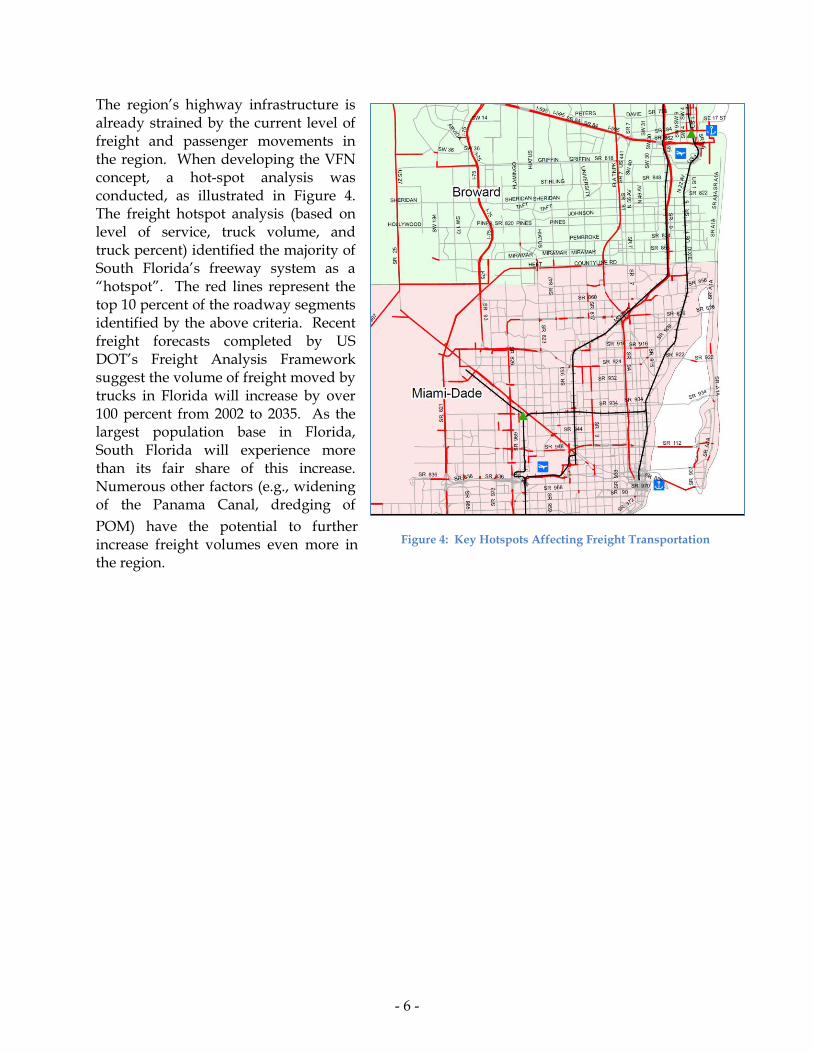
The region’s highway infrastructure is already strained by the current level of freight and passenger movements in the region. When developing the VFN concept, a hot-spot analysis was conducted, as illustrated in Figure 4. The freight hotspot analysis (based on level of service, truck volume, and truck percent) identified the majority of South Florida’s freeway system as a ―hotspot‖. The red lines represent the top 10 percent of the roadway segments identified by the above criteria. Recent freight forecasts completed by US DOT’s Freight Analysis Framework suggest the volume of freight moved by trucks in Florida will increase by over 100 percent from 2002 to 2035. As the largest population base in Florida, South Florida will experience more than its fair share of this increase. Numerous other factors (e.g., widening of the Panama Canal, dredging of
POM) have the potential to further increase freight volumes even more in the region.
Figure 4: Key Hotspots Affecting Freight Transportation
- 7 -
4. Application Description
The Virtual Freight Network (VFN) is a regional freight-focused dynamic mobility application being developed by Districts 4 and 6 (South Florida) of the Florida Department of Transportation, in conjunction with the region’s public- and private-sector freight stakeholders (e.g., Broward and Miami-Dade Metropolitan Planning Organizations (MPOs), Port of Miami, Miami International Airport, Port Everglades, Florida East Coast Railway, CSX, Florida Trucking Association).
The VFN concept is designed to augment data sharing among the region’s commercial vehicle operators, freight facilities (e.g., Port of Miami, Port Everglades, Miami International Airport, Florida East Coast Railway terminal, CSX terminal), shippers/receivers, and existing public-sector ITS infrastructure (e.g., SunGuide), in order to improve freight mobility and overall system performance in South Florida. The VFN application is being considered for deployment on the routes that serve as the key connectors to/from the region’s major intermodal facilities. Specific objectives of the VFN include:
Improve reliability of travel times on the region’s transportation system;
Reduce delay for commercial vehicles moving to/from the region’s key freight facilities;
Reduce number of empty/unproductive movements among drayage operators serving the region’s key intermodal facilities;
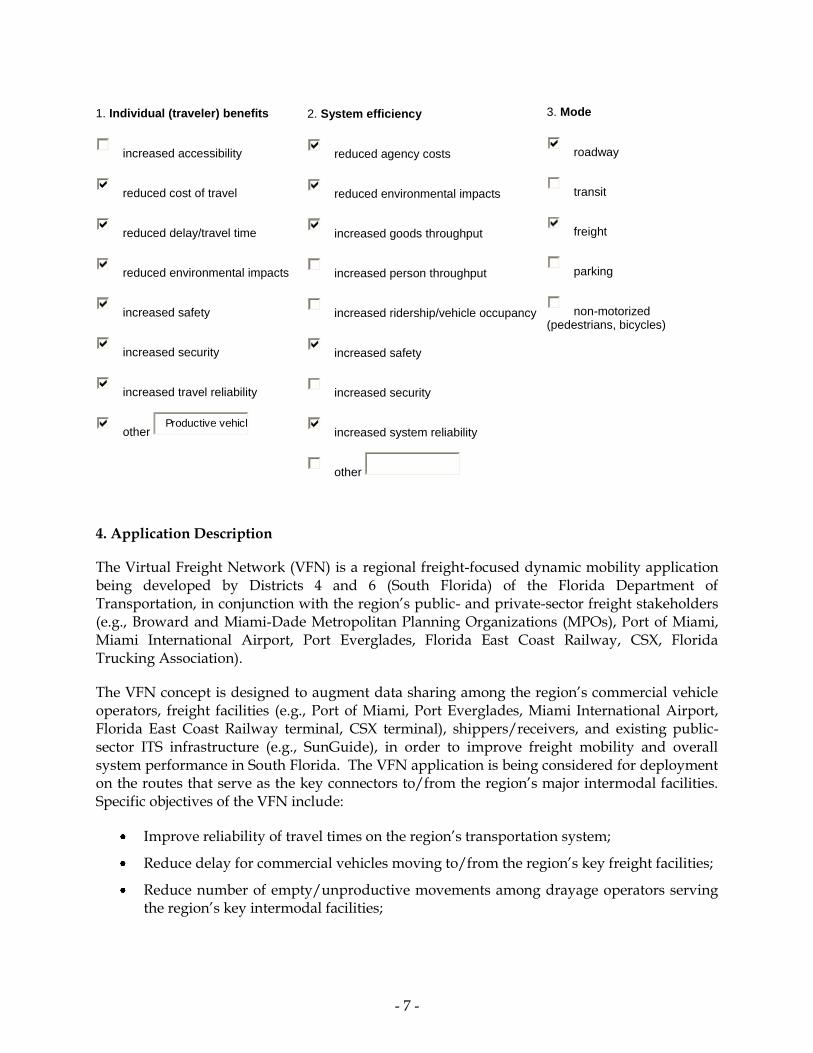
1. Individual (traveler) benefits
increased accessibility
reduced cost of travel
reduced delay/travel time
reduced environmental impacts
increased safety
increased security
increased travel reliability
other Productive vehicl
2. System efficiency
reduced agency costs
reduced environmental impacts
increased goods throughput
increased person throughput
increased ridership/vehicle occupancy
increased safety
increased security
increased system reliability
other
3. Mode
roadway
transit
freight
parking
non-motorized (pedestrians, bicycles)
- 8 -
Augment real-time monitoring of transportation system performance and improve effectiveness of mobility applications for all system users;
Improve the safety and regulatory compliance of commercial vehicles operating in the region; and
Improve environmental stewardship by reducing the number of idling commercial vehicles on the region’s highways.
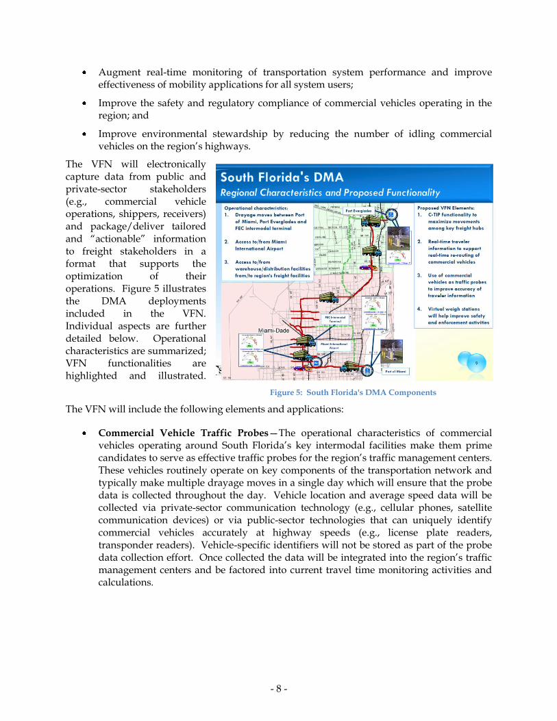
The VFN will electronically capture data from public and private-sector stakeholders (e.g., commercial vehicle operations, shippers, receivers) and package/deliver tailored and ―actionable‖ information to freight stakeholders in a format that supports the optimization of their operations. Figure 5 illustrates the DMA deployments included in the VFN. Individual aspects are further detailed below. Operational characteristics are summarized; VFN functionalities are highlighted and illustrated.
The VFN will include the following elements and applications:
Commercial Vehicle Traffic Probes—The operational characteristics of commercial vehicles operating around South Florida’s key intermodal facilities make them prime candidates to serve as effective traffic probes for the region’s traffic management centers. These vehicles routinely operate on key components of the transportation network and typically make multiple drayage moves in a single day which will ensure that the probe data is collected throughout the day. Vehicle location and average speed data will be collected via private-sector communication technology (e.g., cellular phones, satellite communication devices) or via public-sector technologies that can uniquely identify commercial vehicles accurately at highway speeds (e.g., license plate readers, transponder readers). Vehicle-specific identifiers will not be stored as part of the probe data collection effort. Once collected the data will be integrated into the region’s traffic management centers and be factored into current travel time monitoring activities and calculations.
Figure 5: South Florida's DMA Components
- 9 -
Port of Miami
MIA
SR 826
SR 836
I-395
Primary Route
Alternate Route
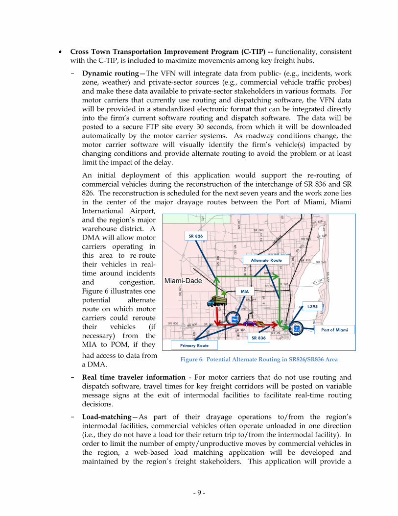
Cross Town Transportation Improvement Program (C-TIP) -- functionality, consistent with the C-TIP, is included to maximize movements among key freight hubs.
- Dynamic routing—The VFN will integrate data from public- (e.g., incidents, work zone, weather) and private-sector sources (e.g., commercial vehicle traffic probes) and make these data available to private-sector stakeholders in various formats. For motor carriers that currently use routing and dispatching software, the VFN data will be provided in a standardized electronic format that can be integrated directly into the firm’s current software routing and dispatch software. The data will be posted to a secure FTP site every 30 seconds, from which it will be downloaded automatically by the motor carrier systems. As roadway conditions change, the motor carrier software will visually identify the firm’s vehicle(s) impacted by changing conditions and provide alternate routing to avoid the problem or at least limit the impact of the delay.
An initial deployment of this application would support the re-routing of commercial vehicles during the reconstruction of the interchange of SR 836 and SR 826. The reconstruction is scheduled for the next seven years and the work zone lies in the center of the major drayage routes between the Port of Miami, Miami International Airport, and the region’s major warehouse district. A DMA will allow motor carriers operating in this area to re-route their vehicles in real-time around incidents and congestion. Figure 6 illustrates one potential alternate route on which motor carriers could reroute their vehicles (if necessary) from the MIA to POM, if they
had access to data from a DMA.
- Real time traveler information - For motor carriers that do not use routing and dispatch software, travel times for key freight corridors will be posted on variable message signs at the exit of intermodal facilities to facilitate real-time routing decisions.
- Load-matching—As part of their drayage operations to/from the region’s intermodal facilities, commercial vehicles often operate unloaded in one direction (i.e., they do not have a load for their return trip to/from the intermodal facility). In order to limit the number of empty/unproductive moves by commercial vehicles in the region, a web-based load matching application will be developed and maintained by the region’s freight stakeholders. This application will provide a
Figure 6: Potential Alternate Routing in SR826/SR836 Area

- 10 -
Port Everglades
Port of Miami
forum for shippers and receivers to post their loads in need of transport and provide an opportunity for commercial vehicles to find a load to haul on their trip back to/from an intermodal facility.
Virtual weigh stations to help improve safety and enforcement activities. In addition to these mobility-focused applications, the VFN will deploy virtual compliance stations at key locations around the region to support the real-time screening of commercial vehicles for compliance with Federal and state credential, safety, and/or size and weight regulations. In addition, these stations will be equipped to communicate with the truck drivers to provide information on vehicle weight. Initial deployment of this type of compliance application likely will occur on Eller Drive leading to the entrance/exit of the container operation at Port Everglades, and at the entrance/exist to the Port or Miami. Figure 7 illustrates these likely deployment locations.
Synchronized signal timing and truck priority. The urban nature of the South Florida region dictates that the region’s commercial vehicles transit urban streets during many moves to/from intermodal facilities. In order to expedite the movement of commercial vehicles through the urban transportation system, timing of traffic signals around the intermodal facilities will be synchronized. Giving priority to traffic queues with large numbers of commercial vehicles also is being considered. Miami Dade County is in the process of completing the installation of an Automated Traffic Signal Synchronization System across the County. Arterials with heavy freight movements can be identified for this implementation of this technology.
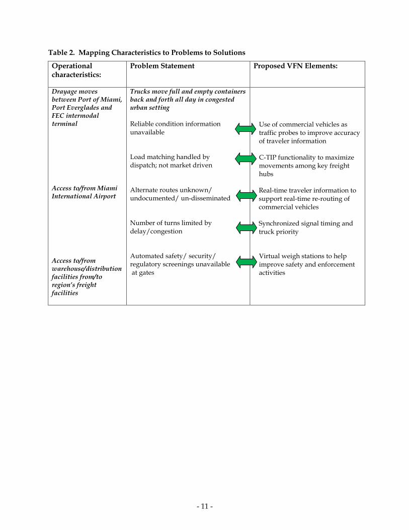
Table 2 below maps the existing problems to the proposed VFN solutions.
Figure 7: Likely Location for Virtual Compliance Stations
- 11 -
Table 2. Mapping Characteristics to Problems to Solutions
Operational characteristics:
Problem Statement Proposed VFN Elements:
Drayage moves between Port of Miami, Port Everglades and FEC intermodal terminal
Access to/from Miami International Airport
Access to/from warehouse/distribution facilities from/to region’s freight facilities
Trucks move full and empty containers back and forth all day in congested urban setting
Reliable condition information unavailable
Load matching handled by dispatch; not market driven
Alternate routes unknown/ undocumented/ un-disseminated
Number of turns limited by delay/congestion
Automated safety/ security/ regulatory screenings unavailable at gates
Use of commercial vehicles as traffic probes to improve accuracy of traveler information
C-TIP functionality to maximize movements among key freight hubs
Real-time traveler information to support real-time re-routing of commercial vehicles
Synchronized signal timing and truck priority
Virtual weigh stations to help improve safety and enforcement activities

- 12 -
5. Potential Benefits and Impacts
US DOT has defined multiple evaluation criteria to drive the selection of the demonstration projects. The VFN partners have defined system parameters that address each of the evaluation factors, as summarized in Table 3.
Table 3. How Well Have We Met Your Evaluation Criteria?
Evaluation Criteria Evaluation of South Florida’s VFN Concept Transformative Impact South Florida’s VFN proposal provides the final component in a
strategy to compete globally as an international trade hub. With major connectivity and capacity investments planned, programmed, and underway, the operational improvements provided by the VFN will allow for streamlined communications, travel time savings from improved congestion management practices, reductions in wasted or empty trips, and improved safety and security screenings. This will have a transformative effect on South Florida as the expansion of the Panama Canal is completed and Port of Miami and Port Everglades compete with other East Coast seaports to be a first port of call for the new fleet of mega-container vessels.
In addition to the local impacts, the VFN, once proven in South Florida, could be applied nationally over the longer term, transforming an industry of fragmented protocols to something more consistent or standardized, increasing overall system efficiency. The VFN could then function as an employment engine, promote new focus areas in academic programs, create a new genre of technology specialists, ultimately helping the U.S. become a world leader in freight technologies and information sharing.
Stakeholder Support/Interest The South Florida VFN proposal is supported by a diverse group of private and public stakeholders who are committed to the development of this program. The Miami-Dade MPO’s Freight Transportation Advisory Committee (FTAC) passed a resolution of support; other partners have provided letters of support, including:
- Port of Miami
- Port Everglades
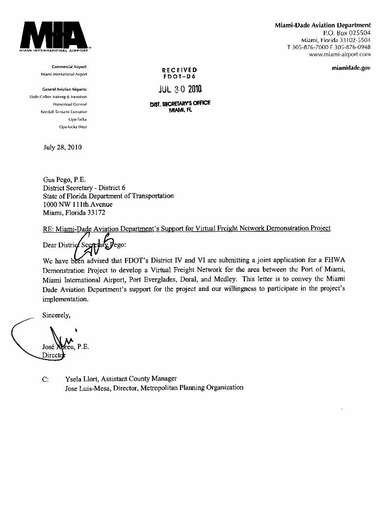
- Miami International Airport
- Florida Customs Brokers & Forwarders Association, Inc.
- Miami-Dade MPO’s Freight Transportation Advisory Committee (FTAC)
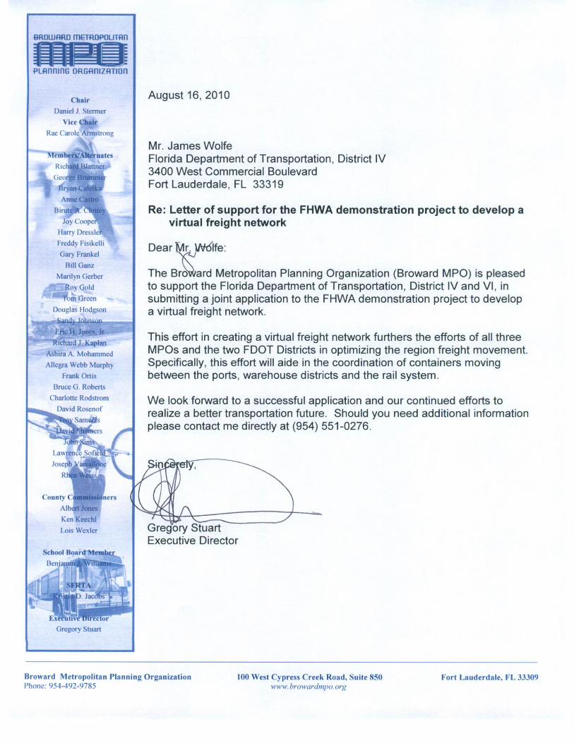
- Broward MPO
In addition to this list, other key partners have expressed a willingness to support FDOT moving forward, including the Florida Turnpike, the FDOT Office Motor Carrier Compliance, the Florida Trucking Association, and the Miami-Dade Expressway Authority.
- 13 -
Evolve Near to Long FDOT recognizes the long term goal of using demonstration projects to successfully test technologies and software to create a system that evolves over time. It is critical that operational programs, such as the VFN, amount to more than just research. With the two South Florida Traffic Management Centers (TMCs) being used as one of the key data collection and dissemination tools, the VFN will become part of a permanent, ongoing system on day one. The TMC’s are staffed with experienced operators who manage the freeway system in real time using the Intelligent Transportation System (ITS) and are prepared to take on the challenges specific to the freight and goods users.
In the near term, the VFN will build off of technologies successfully tested by other programs, such as CTIP. New software or technologies will be explored and refined as necessary to ensure a successful and sustainable VFN. The lessons learned through the initial deployment will be used to help model expansions to other major freight routes in South Florida, such as US-27. As part of this process, various public/private business models will be explored to help identify a leader to drive the program following the testing time period.
Make Use of IntelliDrive Data IntelliDrive represents the future of our transportation system. While currently a research topic of the FHWA, it includes a variety of roadside and in-vehicle technologies that will drive communication protocols in the future. The VFN meets all of these objectives and will be compatible with future IntelliDrive deployments.
FDOT already has significant deployments in place as part of its freeway incident management system. All TMCs are uploading data to State’s 511 system and the Transportation System Management and Operations (TSM&O) program is expanding ITS applications to a broader network that includes all modes using the arterial and freeway network
Open Code The VFN will be based on a variety of technologies, both hardware and software. FDOT is committed to ensuring all software developed as part of this demonstration project will be ―open code‖ and available to the system developers; FDOT also will explore other available source code from similar projects that may have some application to the VFN, such as CTIP.
Cross-Modal Impact The VFN is a cross-modal or multimodal project. It is driven by the need to better connect South Florida’s seaports with highway and rail corridors, as well as to warehouses and distribution centers. The ultimate success of this demonstration project will be improved efficiencies between modes.

- 14 -
The development of the VFN provides South Florida with an opportunity to further implement project priorities that were identified as part of the recently completed South Florida Regional Freight Plan. This initiative identified the use of technology to streamline South Florida freight operations as a top 10 priority. In addition, the VFN compliments and builds off of the regional ITS architecture, integrates technologies developed as part of other US DOT-sponsored programs, and encourages public-private partnerships. The remainder of this document describes the VFN concept in detail, as organized in the submittal form
5a. Near-term impacts
As a result of the VFN, commercial vehicles will be able to determine the optimal route to travel to/from South Florida’s key freight hubs. The VFN will support both pre-trip planning of commercial vehicle routes (e.g., consideration of work zones and special events on initial route selection), as well as real-time dynamic rerouting of commercial vehicles around non-recurring congestion (e.g., incidents, weather-related delays). By leveraging the motor carriers’ current commercial vehicle routing and dispatch software, it will be ensured that all routing designs are made with proper consideration given towards a vehicle size, weight, and configuration.
The deployment of a load matching application will maximize commercial vehicle movements in the region and reduce the number of empty/unproductive moves made by the region’s commercial vehicles. Once deployed, the application will enable drayage operators departing an intermodal facility to identify a load in need of delivery back to the facility so that the vehicle does not make the return trip empty.
General system monitoring by FDOT will be improved by VFN through the integration of probe data from commercial vehicles into the region’s current ITS architecture. These vehicles will greatly augment the real-time data available to FDOT for key elements of the region’s freight transportation network. Processes to analyze real-time data and calculate travel times will remain unchanged by the VFN. Synchronization of traffic signals will expedite the movement of commercial vehicles through urban areas.
In the near-term, the VFN will rely on existing ITS (e.g., dynamic message signs, transponder readers, license plate readers) and private-sector communication methods (e.g., cellular and satellite telephones) to support the collection of real-time system performance data. Load and traveler information that has been tailored for commercial vehicles also will be made available via existing dissemination sources (e.g., Internet, FTP site).
5b. Long-term impacts
IntelliDrive, currently a USDOT research initiative, has the potential to support the deployment and operation of the VFN concept. When the IntelliDrive architecture is deployed, it will include roadside and on-board equipment that will enable a broad range of safety, mobility, and environmental applications. Once a sufficient number of commercial vehicles in South Florida are IntelliDrive-enabled, the VFN functionality will be more seamlessly integrated into both public- and private-sector operations. With IntelliDrive-enabled commercial vehicles, traffic probe data will be automatically collected with a frequency that currently is not cost effective using current private-sector communication technology (e.g., costs associated with cellular and satellite communication) nor public-sector ITS technology (e.g., widespread

- 15 -
deployment of license plate or transponder readers). IntelliDrive-equipped vehicles also could streamline the process for calculating the number of commercial vehicles in a traffic queue and synchronize/prioritize traffic signals accordingly.
IntelliDrive also has the potential to streamline the delivery of real-time traveler information to commercial vehicle operations. IntelliDrive has the potential to deliver both real-time traveler alerts and vehicle-specific/load-sensitive re-routing instructions to commercial drivers without the need to involve a dispatcher or other off-vehicle system.
6. High-level application needs
6a. Data needs
In order to improve freight mobility in South Florida, the VFN requires the following data:
Accurate positional data for commercial vehicles;
Real-time traveler information (e.g., speed, travel time, work zone, weather, incidents) for key freight corridors in the region;
Detailed information (e.g., location, commodity, equipment required) regarding loads in need of transport to/from regional freight facilities; and
Peak times when commercial vehicles will be exiting freight facilities.
6b. Communication needs
In the short-term, the VFN will leverage existing technologies for both its data collection and data output transactions. For data collection, the VFN will use data from third-party communication providers (e.g., cellular, satellite), as well as license plate readers and 900 MHz transponders to determine the location and average speed of commercial vehicles operating on the region’s transportation network. For the purposes of probe data, no identifying information will be captured or stored for the commercial vehicles. The probe data will be integrated with the region’s current ITS architecture, in order to improve the accuracy of system performance monitoring and travel time calculations. In the long-term, the deployment of IntelliDrive infrastructure and IntelliDrive-enabled vehicles will streamline the probe data collection process and likely expand the geographic area for which and frequency with which probe data can be collected.
In the near-term, VFN traveler information will be provided to the commercial vehicle industry in two forms. As noted above, traveler information data will be provided to motor carriers via FTP site on a regular basis so that it can be integrated into the company’s routing and dispatch software. Travel time data for key freight corridors also will be provided via dynamic message signs at the exit from key intermodal facilities so that companies without routing and dispatch software can make use of the data. In the long-term, IntelliDrive will streamline the delivery of VFN data via IntelliDrive roadside equipment (RSEs) to IntelliDrive-enabled commercial vehicles where it will be displayed on an in-vehicle device or relayed to a driver in a way that does not distract him/her. Similarly, the IntelliDrive architecture also could be a means to streamline the delivery of available load information to commercial vehicle operators.
- 16 -
6c. Infrastructure needs
The deployment of transponder and/or license plate readers may be required at key interchanges, if it is determined that these means are the most effective in collecting probe data in the short term. The deployment of detection cameras also will be needed at intersection, in order to determine the queues, which should be given priority to expedite the movement of freight (i.e., determine the queues with the largest number of commercial vehicles). FDOT also will be deploying virtual compliance station technologies (e.g., weigh-in-motion scales, vehicle identification technology), as part of its VFN program. In the long-term, both data collection and data dissemination components of the VFN will use IntelliDrive infrastructure (i.e., RSEs, IntelliDrive-enabled vehicles). The virtual compliance station also will leverage IntelliDrive technology to identify, weigh, and screen commercial vehicles for safety and regulatory compliance.
7. Ongoing Research
Is the suggested application of interest a modification or enhancement of existing/ongoing research that you have conducted?
Please specify here if the application will leverage existing or ongoing research and development efforts that you are currently are involved in?
___X__ Yes
_______ No
If yes, specify. Project title and Sponsoring Organization
Project Titles:
Virtual Freight Network Support and Plan Development
FDOT Transportation System Management and Operation (TSM&O) program
Sponsoring Organization:
Florida Department of Transportation, District 4
Florida Department of Transportation, District 6 (co-sponsor)
Supporting Organizations:
1. Broward MPO (Letter of Support attached)
2. Miami-Dade MPO – Freight Transportation Advisory Committee (FTAC) (Resolution of Support attached)
3. Miami International Airport (Letter of Support attached)
4. Port Everglades (Letter of Support attached)
5. Port of Miami (Letter of Support attached)
6. Florida Customs Brokers & Forwarders Association, Inc. (Letter of Support attached)